Lullingstone

Settlement in Kent Sevenoaks

England

Lullingstone

Lullingstone Castle, near Shoreham, Kent
Lullingstone Castle, near Shoreham, Kent Credit: Becky Williamson

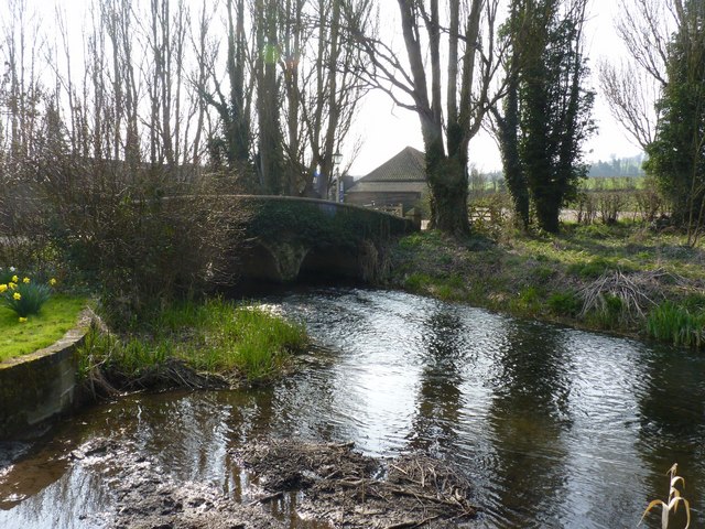
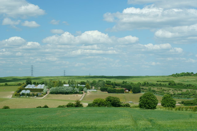
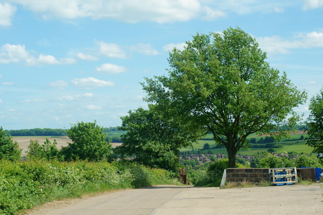
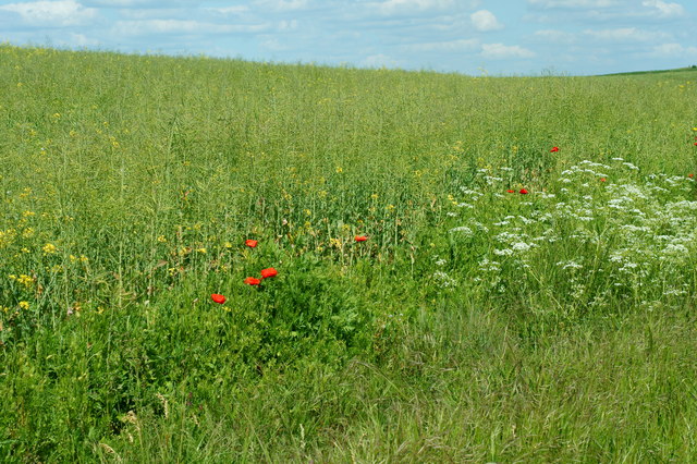
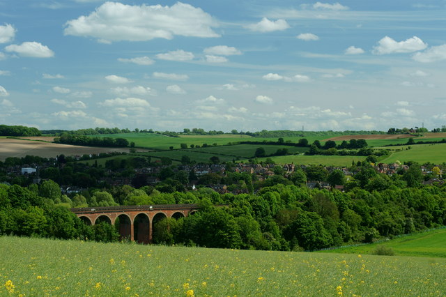
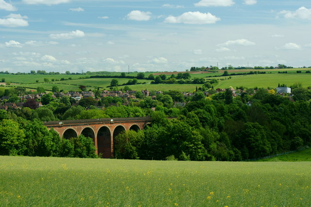
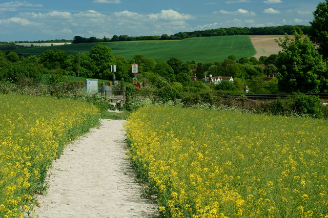
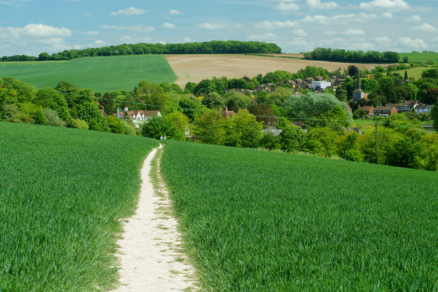
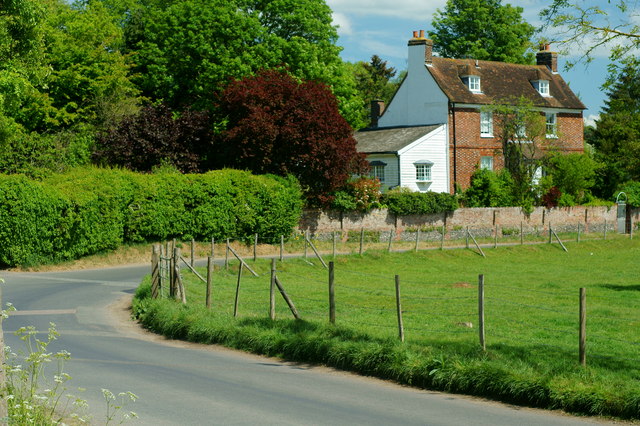
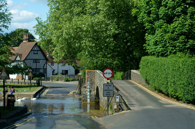
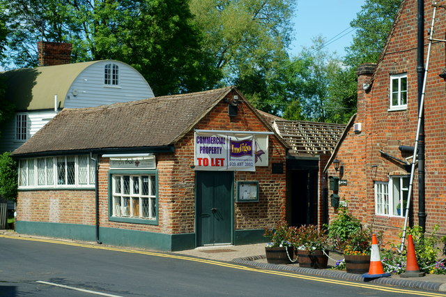
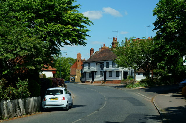
Lullingstone is a charming village located in the county of Kent, England. Situated on the outskirts of the town of Eynsford, Lullingstone is known for its picturesque beauty and historical significance. The village is nestled within the tranquil Darent Valley, surrounded by rolling hills and lush greenery, making it an idyllic countryside retreat.

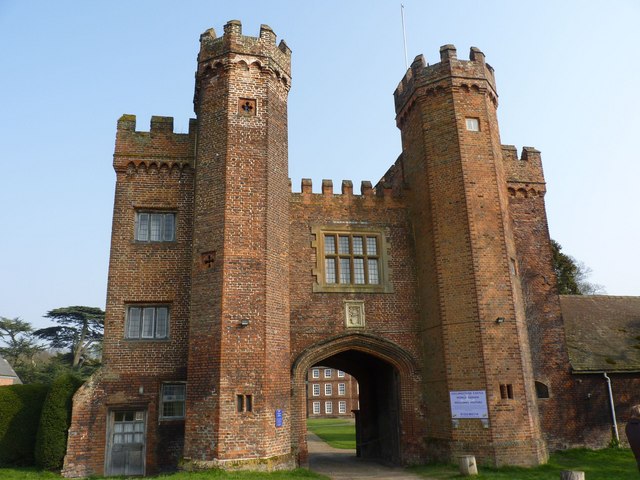
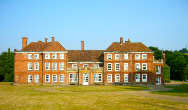
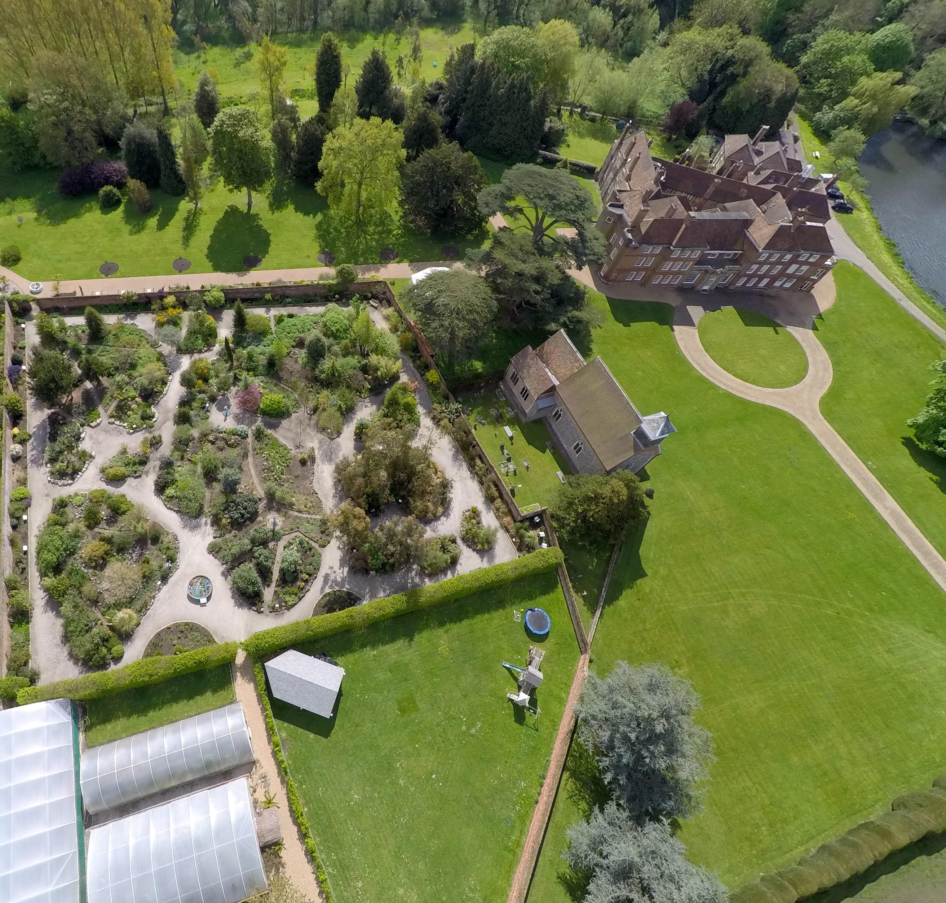
One of the highlights of Lullingstone is its stunning 15th-century manor house, Lullingstone Castle. This historic building boasts a rich history, with parts of it dating back to the 13th century. The castle is renowned for its beautiful gardens, including the World Garden, which showcases an extensive collection of plants from around the globe. Visitors can explore the grounds, admire the elegant architecture, and learn about the castle's intriguing past.

Lullingstone Roman Villa is another notable attraction in the village. This well-preserved Roman villa was built in the 1st century AD and offers a fascinating insight into life during Roman times. The site features intricate mosaics, a bathhouse, and a museum that displays Roman artifacts discovered on the grounds.

Aside from its historical sites, Lullingstone offers plenty of opportunities for outdoor activities. The Darent Valley Path, a long-distance walking trail, passes through the village, providing hikers with breathtaking views of the surrounding countryside. The nearby River Darent is popular among anglers, with its abundance of fish species.

With its quaint charm, rich history, and natural beauty, Lullingstone is a delightful destination for those seeking a peaceful retreat or an enriching cultural experience.

If you have any feedback on the listing, please let us know in the comments section below.

Lullingstone Images

Images are sourced within 2km of 51.357934/0.19626326 or Grid Reference TQ5364. Thanks to Geograph Open Source API. All images are credited.

Lullingstone Castle, near Shoreham, Kent
Bridge over River Darent at Castle Farm
Bald Eagle at Eagle Heights, Eynsford, Kent Bald eagle (Haliaeetus leucocephalus). Seen during the lunchtime flying display.
<span class="nowrap"><a title="http://www.eagleheights.co.uk/" rel="nofollow ugc noopener" href="http://www.eagleheights.co.uk/">Link</a><img style="margin-left:2px;" alt="External link" title="External link - shift click to open in new window" src="https://s1.geograph.org.uk/img/external.png" width="10" height="10"/></span>
Bald Eagle at Eagle Heights, Eynsford, Kent
Bald eagle (Haliaeetus leucocephalus). Seen during the lunchtime flying display. LinkExternal link
Cheetah at Eagle Heights, Eynsford, Kent One of three cheetahs (Acinonyx jubatus) in the enclosure.
<span class="nowrap"><a title="http://www.eagleheights.co.uk/" rel="nofollow ugc noopener" href="http://www.eagleheights.co.uk/">Link</a><img style="margin-left:2px;" alt="External link" title="External link - shift click to open in new window" src="https://s1.geograph.org.uk/img/external.png" width="10" height="10"/></span>
Cheetah at Eagle Heights, Eynsford, Kent
One of three cheetahs (Acinonyx jubatus) in the enclosure. LinkExternal link
View From Eagle Heights, Eynsford, Kent Looking in the direction of Capricorn Farm. The railway line runs between the double row of diagonal hedges, to the right of picture
View From Eagle Heights, Eynsford, Kent
Looking in the direction of Capricorn Farm. The railway line runs between the double row of diagonal hedges, to the right of picture
View From Eagle Heights, Eynsford, Kent Looking across the valley, in the direction of Eynsford.
View From Eagle Heights, Eynsford, Kent
Looking across the valley, in the direction of Eynsford.
Footpath to Eynsford, Kent Leaving the road, just below Eagle Heights; the footpath heads towards Eynsford, crossing the railway line en route. Photographed through the fading yellow of the rape crop.
Footpath to Eynsford, Kent
Leaving the road, just below Eagle Heights; the footpath heads towards Eynsford, crossing the railway line en route. Photographed through the fading yellow of the rape crop.
Crop Meets Wild Flowers At the field edge; the crop of rape finishes, and is met by poppies and cow parsley. A hedge is out of picture, to the right. Photograph taken from the footpath between Eagle Heights and Eynsford, Kent.
Crop Meets Wild Flowers
At the field edge; the crop of rape finishes, and is met by poppies and cow parsley. A hedge is out of picture, to the right. Photograph taken from the footpath between Eagle Heights and Eynsford, Kent.
View Towards Eynsford, Kent Looking across the railway viaduct, towards the village of Eynsford.
View Towards Eynsford, Kent
Looking across the railway viaduct, towards the village of Eynsford.
Eynsford Railway Viaduct, Kent Looking towards the viaduct, and village of Eynsford, from the footpath.
Eynsford Railway Viaduct, Kent
Looking towards the viaduct, and village of Eynsford, from the footpath.
Footpath to Eynsford. Kent The footpath crosses the railway line, before dropping into the Darent Valley.
Footpath to Eynsford. Kent
The footpath crosses the railway line, before dropping into the Darent Valley.
Footpath to Eynsford, Kent View from just below the railway line. Eynsford Village, and church, can be seen to the right of picture.
Footpath to Eynsford, Kent
View from just below the railway line. Eynsford Village, and church, can be seen to the right of picture.
Lullingstone Lane, Eynsford, Kent View from a bench, which must have been placed with the view in mind. This is the outskirts of Eynsford Village.
Lullingstone Lane, Eynsford, Kent
View from a bench, which must have been placed with the view in mind. This is the outskirts of Eynsford Village.
Riverside, Eynsford, Kent I'm guessing that this will be a popular location, on summer weekends. Pub to the left, River Darent to the right.
Riverside, Eynsford, Kent
I'm guessing that this will be a popular location, on summer weekends. Pub to the left, River Darent to the right.
Through the Ford Fording the River Darent, at Eynsford,  is a coach. Large vehicles are obliged to use the ford, to avoid 'grounding' on the old bridge.
Through the Ford
Fording the River Darent, at Eynsford, is a coach. Large vehicles are obliged to use the ford, to avoid 'grounding' on the old bridge.
Bridge and Ford, Eynsford, Kent Ancient bridge, and ford, in this lovely village. Just out of picture, to the right, stood a tea room; popular with cycling clubs. This closed several years ago.
Bridge and Ford, Eynsford, Kent
Ancient bridge, and ford, in this lovely village. Just out of picture, to the right, stood a tea room; popular with cycling clubs. This closed several years ago.
Former Tearoom, Eynsford, Kent This former tearoom, standing by the bridge and ford, was popular with cycling clubs. Sadly, it closed in c2003.
Former Tearoom, Eynsford, Kent
This former tearoom, standing by the bridge and ford, was popular with cycling clubs. Sadly, it closed in c2003.
High Street, Eynsford, Kent A rare traffic-free minute, in this lovely village.
High Street, Eynsford, Kent
A rare traffic-free minute, in this lovely village.
Show me another place!

Lullingstone is located at Grid Ref: TQ5364 (Lat: 51.357934, Lng: 0.19626326)

Administrative County: Kent

District: Sevenoaks

Police Authority: Kent

What 3 Words

///waddled.assist.clock. Near Eynsford, Kent

Related Wikis

St Botolph's Church, Lullingstone

St Botolph's Church is an Anglican church in the village of Lullingstone, in Kent, England, situated on the lawn of Lullingstone Castle. It dates from...

Lullingstone Castle

Lullingstone Castle is a historic manor house, set in an estate in the village of Lullingstone and the civil parish of Eynsford in the English county of...

Lullingstone

Lullingstone is a rural hamlet within the Sevenoaks District of Kent, England, located south east of Swanley. It is best known for its castle, Roman villa...

Lullingstone Roman Villa

Lullingstone Roman Villa is a villa built during the Roman occupation of Britain, situated in Lullingstone near the village of Eynsford in Kent, south...

Nearby Amenities

Located within 500m of 51.357934,0.19626326
Created By: YahooApplet 1.0
Lat/Long: 51.3551242/0.2000968
Created By: YahooApplet 1.0
Lat/Long: 51.3576031/0.1954405
Created By: YahooApplet 1.0
Lat/Long: 51.355419/0.1949041
Created By: YahooApplet 1.0
Lat/Long: 51.3549098/0.1943676
Barrier: bollard
Horse: yes
Maxwidth Physical: 1.2
Motorcycle: yes
Lat/Long: 51.3579572/0.1944956
Barrier: kissing_gate
Foot: yes
Maxwidth Physical: 0.98
Lat/Long: 51.3576596/0.1941955
Bench
Colour: brown
Material: wood
Seats: 3
Lat/Long: 51.3567343/0.1931941
Bench
Backrest: yes
Colour: brown
Material: wood
Seats: 3
Lat/Long: 51.3573377/0.1937914
Barrier: entrance
Lat/Long: 51.358959/0.1959179
Barrier: entrance
Lat/Long: 51.3591675/0.1960075
Toilets
Lat/Long: 51.3581855/0.1951185
Toilets
Lat/Long: 51.3591954/0.1952673
Shelter
Bench: yes
Bin: no
Shelter Type: picnic_shelter
Lat/Long: 51.3584235/0.1991929
Bus Stop
Castle Road
Local Ref: opp
Naptan AtcoCode: 2400A074660A
Naptan Bearing: SW
Naptan BusStopType: MKD
Naptan CommonName: Castle Road
Naptan Crossing: Castle Road
Naptan Indicator: opp
Naptan Landmark: Castle Road
Naptan NaptanCode: kntjmgdj
Naptan RevisionNumber: 2
Naptan Status: act
Naptan Street: A225 Shoreham Road
Naptan Verified: no
Public Transport: platform
Ref: kntjmgdj
Source: naptan_import
Source Date: 2018-04-24
Lat/Long: 51.3557422/0.2005392
Bus Stop
Castle Road
Local Ref: adj
Naptan AtcoCode: 2400A074650A
Naptan Bearing: N
Naptan BusStopType: MKD
Naptan CommonName: Castle Road
Naptan Crossing: Castle Road
Naptan Indicator: adj
Naptan Landmark: Castle Road
Naptan NaptanCode: kntjmgdm
Naptan RevisionNumber: 2
Naptan Status: act
Naptan Street: A225 Shoreham Road
Naptan Verified: no
Public Transport: platform
Ref: kntjmgdm
Source: naptan_import
Source Date: 2018-04-24
Lat/Long: 51.3566045/0.2005949
Bench
Backrest: yes
Colour: brown
Material: wood
Seats: 3
Lat/Long: 51.3568514/0.1933658
Defibrillator
Access: yes
Defibrillator Location: outside wall of building
Emergency: defibrillator
Lat/Long: 51.3611566/0.1958287
The data included in this document is from www.openstreetmap.org. The data is made available under ODbL.

Have you been to Lullingstone?

Leave your review of Lullingstone below (or comments, questions and feedback).