Low Fields

Settlement in Yorkshire

England

Low Fields

Stainland Road B6112 heading north towards Halifax
Stainland Road Credit: Chris Heaton

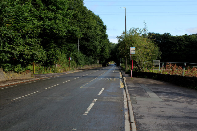
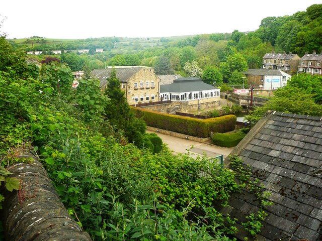
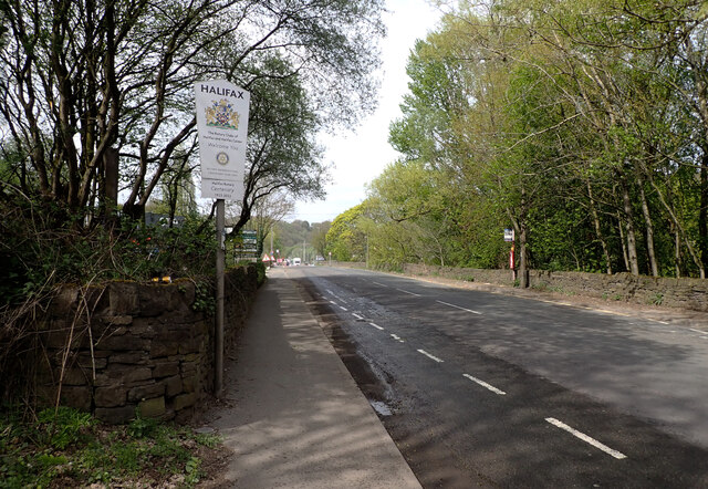
Low Fields is a charming rural area located in the county of Yorkshire, England. Situated amidst the picturesque landscapes of the Aire Valley, Low Fields is a place of natural beauty and tranquility. The area is known for its rolling hills, lush green meadows, and meandering streams that add to its idyllic charm.

The village itself is small, with a close-knit community that fosters a welcoming and friendly atmosphere. It is primarily an agricultural area, with farming being the predominant occupation of the local residents. The fields surrounding the village are used for grazing livestock and cultivating crops, contributing to the area's agricultural heritage.

The architecture in Low Fields is typical of a traditional English village, characterized by charming stone cottages and quaint farmhouses. The village is adorned with vibrant floral displays during the summer months, enhancing its visual appeal and creating a colorful oasis.

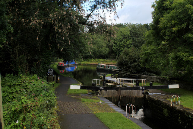
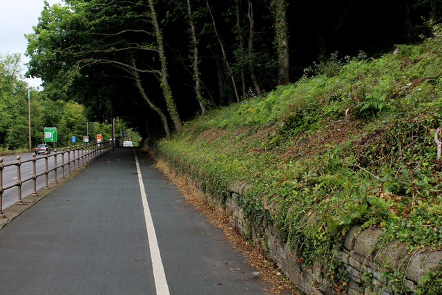
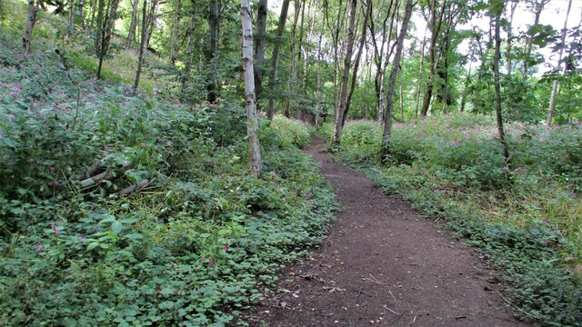
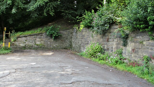
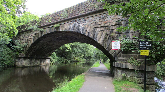
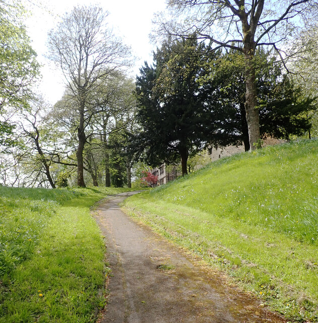
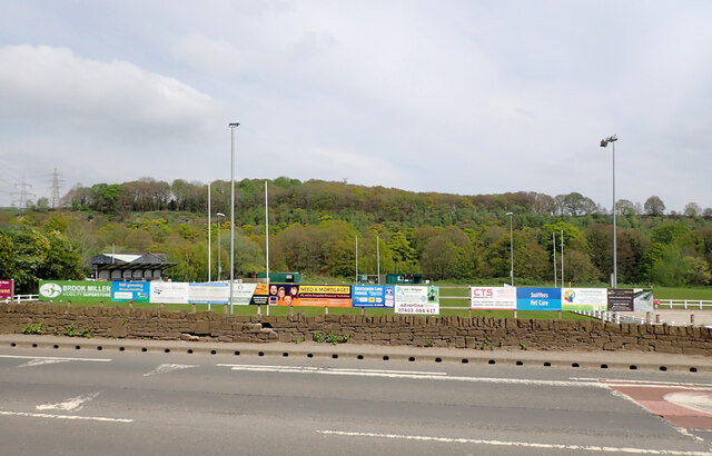
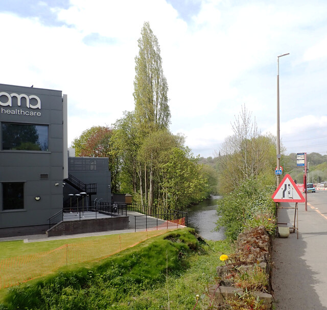
Low Fields offers ample opportunities for outdoor activities and exploration. The village is surrounded by numerous walking trails, allowing residents and visitors to immerse themselves in the beauty of the countryside. The nearby River Aire is a popular spot for fishing enthusiasts, offering a chance to catch trout or grayling.

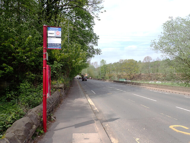
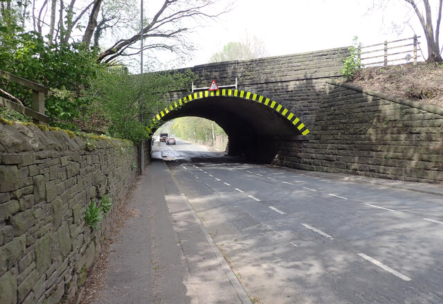
Despite its rural setting, Low Fields is well-connected to nearby towns and cities. The village has good road links, making it easily accessible by car. Additionally, the railway station in the neighboring town provides convenient connections to major cities such as Leeds and Bradford.

In summary, Low Fields is a picturesque village nestled in the heart of Yorkshire's countryside. Its natural beauty, friendly community, and agricultural heritage make it a delightful place to visit or call home.

If you have any feedback on the listing, please let us know in the comments section below.
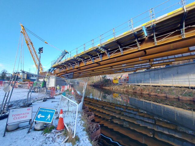
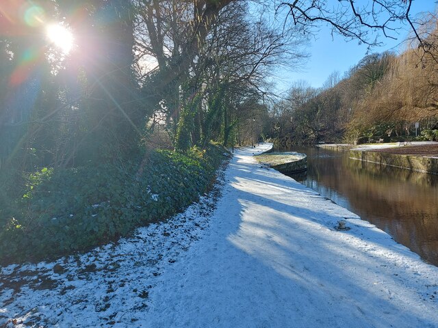
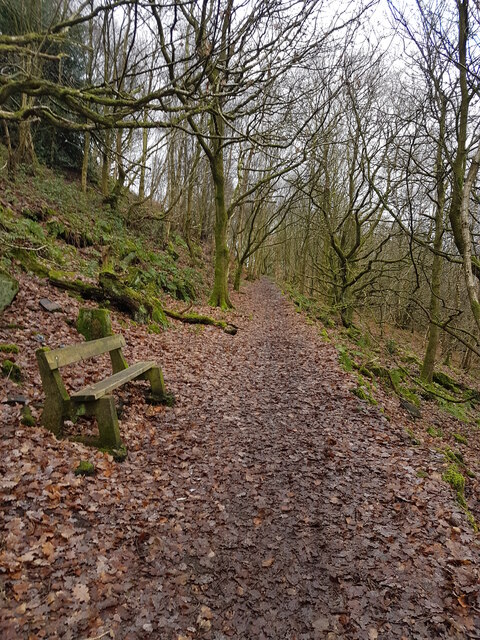
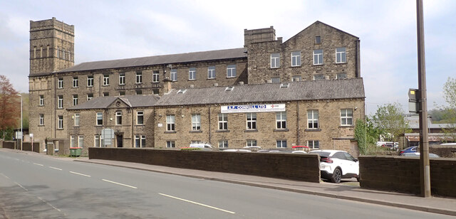
Low Fields Images

Images are sourced within 2km of 53.694454/-1.8271031 or Grid Reference SE1122. Thanks to Geograph Open Source API. All images are credited.

Stainland Road B6112 heading north towards Halifax
Stainland Road
B6112 heading north towards Halifax
Calder and Hebble Navigation at Salterhebble
Pedestrian and Cycle Path below Elland Wood The cycle and pedestrian path squeezed between Elland Woods and the A629. The Calderdale Way long distance footpath is compelled to follow this busy road for a short stretch.
Pedestrian and Cycle Path below Elland Wood
The cycle and pedestrian path squeezed between Elland Woods and the A629. The Calderdale Way long distance footpath is compelled to follow this busy road for a short stretch.
The Ground of Siddal Rugby League Club An amateur rugby league club currently playing in the National Conference, based on Exley Lane in Halifax
The Ground of Siddal Rugby League Club
An amateur rugby league club currently playing in the National Conference, based on Exley Lane in Halifax
The Watermill pub-restaurant, Halifax This view is from Bankhouse Lane. The pub is a Brewers Fayre house.
The Watermill pub-restaurant, Halifax
This view is from Bankhouse Lane. The pub is a Brewers Fayre house.
Path on the Stainland Branch Railway Trackbed In North Dean Wood now but approaching where the branch joined the main line east of the then Greetland Station
Path on the Stainland Branch Railway Trackbed
In North Dean Wood now but approaching where the branch joined the main line east of the then Greetland Station
Former Railway Coal Drops The masonry of the coal drops and coal yard on Stainland Road, now used as a car park for North Dean Wood
Former Railway Coal Drops
The masonry of the coal drops and coal yard on Stainland Road, now used as a car park for North Dean Wood
Elland Wood Railway Viaduct Crossing the Calder & Hebble Canal and the River Calder glimpsed on the extreme right of the view
Elland Wood Railway Viaduct
Crossing the Calder & Hebble Canal and the River Calder glimpsed on the extreme right of the view
New bridge construction off Elland bypass
Halifax Arm Canal Towpath
North Dean Woods
North Dean Woods
North Dean Mill, Stainland Road (B6112), West Vale, Greetland
Clayhouse Park, West Vale, Greetland
Heath Rugby Union Football Club, Stainland Road, West Vale, Greetland
Bus stop, Stainland Road (B6112), West Vale, Greetland
Railway bridge crossing Stainland Road (B6112), West Vale, Greetland
Stainland Road (B6112) entering Halifax
The River Calder seen from Stainland Road (B6112), Halifax The River Calder is a river in West Yorkshire.
The Calder rises on the eastern slopes of the Pennines flows through alternating countryside, former woollen-mill villages, and large and small towns before joining the River Aire near Castleford, 45 miles later.
The river's valley is generally known as the Calder Valley. The name Calderdale usually refers to the large urban and rural borough (centred on Halifax) through which the upper river flows. The lower reaches flow through the boroughs of Kirklees (based on Huddersfield) and Wakefield. However, the river does not flow through the centres of Halifax and Huddersfield, which are on the Calder's main tributaries, the River Hebble and River Colne respectively. The only large town centres through which the Calder flows are Brighouse, Mirfield, Dewsbury and Wakefield.
The River Calder seen from Stainland Road (B6112), Halifax
The River Calder is a river in West Yorkshire. The Calder rises on the eastern slopes of the Pennines flows through alternating countryside, former woollen-mill villages, and large and small towns before joining the River Aire near Castleford, 45 miles later. The river's valley is generally known as the Calder Valley. The name Calderdale usually refers to the large urban and rural borough (centred on Halifax) through which the upper river flows. The lower reaches flow through the boroughs of Kirklees (based on Huddersfield) and Wakefield. However, the river does not flow through the centres of Halifax and Huddersfield, which are on the Calder's main tributaries, the River Hebble and River Colne respectively. The only large town centres through which the Calder flows are Brighouse, Mirfield, Dewsbury and Wakefield.
Show me another place!

Low Fields is located at Grid Ref: SE1122 (Lat: 53.694454, Lng: -1.8271031)

Division: West Riding

Unitary Authority: Calderdale

Police Authority: West Yorkshire

What 3 Words

///thank.props.films. Near Elland, West Yorkshire

Related Wikis

Suma (co-operative)

Suma is the trading name of the Triangle Wholefoods Collective Limited, a worker co-operative wholefoods wholesaler. It was founded in Leeds in 1977 and...

Elland Power Station

Elland Power Station was a coal-fired power station situated adjacent to the Manchester to Wakefield railway line and on a loop of the River Calder, north...

Elland railway station

Elland railway station served the town of Elland in West Yorkshire, England until 1962. == History == The station was originally opened on 5 October 1840...

Church of St Mary, Elland

The Church of St Mary is a Church of England parish church in Elland, West Yorkshire. The church is a Grade I listed building. == History == Stones in...

Nearby Amenities

Located within 500m of 53.694454,-1.8271031
Park Nook Lock
Material: wood
Seamark Type: gate
Source: GPX glitch
Waterway: lock_gate
Lat/Long: 53.6955877/-1.8301582
Elland Lock
Material: wood
Seamark Type: gate
Waterway: lock_gate
Lat/Long: 53.6932834/-1.8337138
Bus Stop
Elland Road
Local Ref: 45022617
Naptan AtcoCode: 450022617
Naptan Bearing: SW
Naptan CommonName: Elland Road
Naptan Crossing: Binns Top Lane
Naptan Indicator: Stop 45022617
Naptan Landmark: W T Knowles & Son Ltd
Naptan PlusbusZoneRef: LEEDS
Naptan ShortCommonName: Rawson Arms
Naptan Street: Elland Road
Naptan Verified: no
Source: naptan_import
Lat/Long: 53.6980169/-1.8234406
Bus Stop
Elland Road
Local Ref: 45022618
Naptan AtcoCode: 450022618
Naptan Bearing: E
Naptan CommonName: Elland Road
Naptan Crossing: Nr-At Binns Top Lane
Naptan Indicator: Stop 45022618
Naptan Notes: L/C 44
Naptan PlusbusZoneRef: LEEDS
Naptan ShortCommonName: Rawson Arms
Naptan Street: Elland Road
Naptan Verified: no
Source: naptan_import
Lat/Long: 53.6981514/-1.8231825
Bus Stop
Park Wood
Local Ref: 45022619
Naptan AtcoCode: 450022619
Naptan Bearing: SW
Naptan CommonName: Park Wood
Naptan Crossing: Park Wood Crematorium
Naptan Indicator: Stop 45022619
Naptan Landmark: Collier Arms PH
Naptan PlusbusZoneRef: LEEDS
Naptan ShortCommonName: Collier Arms
Naptan Street: Park Road
Naptan Verified: no
Source: naptan_import
Lat/Long: 53.6948381/-1.8318139
Bus Stop
Park Wood
Local Ref: 45022620
Naptan AtcoCode: 450022620
Naptan Bearing: NE
Naptan CommonName: Park Wood
Naptan Crossing: Park Wood Crematorium
Naptan Indicator: Stop 45022620
Naptan Landmark: Colliers Arms PH
Naptan PlusbusZoneRef: LEEDS
Naptan ShortCommonName: Collier Arms
Naptan Street: Park Road
Naptan Verified: no
Source: naptan_import
Lat/Long: 53.6947576/-1.832102
Bus Stop
River Bank Way
Local Ref: 45025653
Naptan AtcoCode: 450025653
Naptan Bearing: NE
Naptan CommonName: River Bank Way
Naptan Crossing: Lacy Way
Naptan Indicator: Stop 45025653
Naptan Landmark: Lowfields Business Park
Naptan PlusbusZoneRef: LEEDS
Naptan ShortCommonName: River Bank Way
Naptan Street: River Bank Way
Naptan Verified: no
Shelter: no
Source: naptan_import
Lat/Long: 53.6950018/-1.8268154
Bus Stop
Low Fields Business Park
Local Ref: 45025654
Naptan AtcoCode: 450025654
Naptan Bearing: SE
Naptan CommonName: Low Fields Business Park
Naptan Crossing: Adj Warhurst Road
Naptan Indicator: Stop 45025654
Naptan Landmark: Low Fields Business Park
Naptan PlusbusZoneRef: LEEDS
Naptan ShortCommonName: Lowfields Bsn Park
Naptan Street: Lowfields Way
Naptan Verified: no
Source: naptan_import
Lat/Long: 53.6934481/-1.8215817
Bus Stop
River Bank Way
Local Ref: 45025710
Naptan AtcoCode: 450025710
Naptan Bearing: SW
Naptan CommonName: River Bank Way
Naptan Crossing: Nr-At Lacy Way
Naptan Indicator: Stop 45025710
Naptan Landmark: Lowfields Business Park
Naptan PlusbusZoneRef: LEEDS
Naptan ShortCommonName: Lacy Way
Naptan Street: River Bank Way
Naptan Verified: no
Source: naptan_import
Lat/Long: 53.6963482/-1.8255679
Bus Stop
Lacy Way
Local Ref: 45025711
Naptan AtcoCode: 450025711
Naptan Bearing: NE
Naptan CommonName: Lacy Way
Naptan Crossing: Navigation Close
Naptan Indicator: Stop 45025711
Naptan Landmark: Lowfields Business Park
Naptan PlusbusZoneRef: LEEDS
Naptan ShortCommonName: Navigation Close
Naptan Street: Lacy Way
Naptan Verified: no
Source: naptan_import
Lat/Long: 53.6930533/-1.8281864
Bus Stop
Lacy Way
Local Ref: 45025712
Naptan AtcoCode: 450025712
Naptan Bearing: SW
Naptan CommonName: Lacy Way
Naptan Crossing: Navigation Close
Naptan Indicator: Stop 45025712
Naptan Landmark: Lowfields Business Park
Naptan PlusbusZoneRef: LEEDS
Naptan ShortCommonName: Navigation Close
Naptan Street: Lacy Way
Naptan Verified: no
Source: naptan_import
Lat/Long: 53.6929184/-1.8281718
Bus Stop
Premier Way
Local Ref: 45025713
Naptan AtcoCode: 450025713
Naptan Bearing: SW
Naptan CommonName: Premiery Way
Naptan Crossing: Nr-At Savile Way
Naptan Indicator: Stop 45025713
Naptan Landmark: Lowfields Business Park
Naptan PlusbusZoneRef: LEEDS
Naptan ShortCommonName: Savile Way
Naptan Street: Premier Way
Naptan Verified: no
Source: naptan_import
Lat/Long: 53.6929243/-1.832291
Bus Stop
Lowfields Way
Local Ref: 45025714
Naptan AtcoCode: 450025714
Naptan Bearing: E
Naptan CommonName: Lowfields Way
Naptan Crossing: Warhurst Road
Naptan Indicator: Stop 45025714
Naptan Landmark: Lowfields Business Park
Naptan PlusbusZoneRef: LEEDS
Naptan ShortCommonName: Warhurst Road
Naptan Street: Lowfields Way
Naptan Verified: no
Source: naptan_import
Lat/Long: 53.6919913/-1.8272518
Bus Stop
Old Power Way
Local Ref: 45025715
Naptan AtcoCode: 450025715
Naptan Bearing: NW
Naptan CommonName: Old Power Way
Naptan Crossing: Adj Lowfields Way
Naptan Indicator: Stop 45025715
Naptan Landmark: Lowfields Business Park
Naptan PlusbusZoneRef: LEEDS
Naptan ShortCommonName: Lowfields Way
Naptan Street: Old Power Way
Naptan Verified: no
Source: naptan_import
Lat/Long: 53.6912771/-1.8306621
Bus Stop
Lowfields Way
Local Ref: 45025716
Naptan AtcoCode: 450025716
Naptan Bearing: SW
Naptan CommonName: Lowfields Way
Naptan Crossing: Old Power Way
Naptan Indicator: Stop 45025716
Naptan Landmark: Lowfields Business Park
Naptan PlusbusZoneRef: LEEDS
Naptan ShortCommonName: Old Power Way
Naptan Street: Lowfields Way
Naptan Verified: no
Source: naptan_import
Lat/Long: 53.6909711/-1.8303604
Mini Roundabout
Lat/Long: 53.6949966/-1.8198585
Mini Roundabout
Lat/Long: 53.6958869/-1.8244562
Turning Circle
Lat/Long: 53.6937396/-1.8297464
Turning Circle
Lat/Long: 53.694878/-1.8287675
Mini Roundabout
Direction: clockwise
Lat/Long: 53.6930793/-1.8314306
Barrier: block
Material: stone
Motor Vehicle: no
Lat/Long: 53.6915404/-1.8314526
Post Box
Operator: Royal Mail
Ref: HX5 156
Lat/Long: 53.6909919/-1.830315
Power: tower
Lat/Long: 53.6937773/-1.8249792
Power: tower
Lat/Long: 53.6956004/-1.8222377
Power: tower
Lat/Long: 53.696674/-1.8300297
Power: tower
Lat/Long: 53.6948636/-1.8254996
Power: tower
Lat/Long: 53.6933834/-1.8234286
Power: tower
Lat/Long: 53.6936335/-1.8232703
Power: tower
Lat/Long: 53.6956743/-1.8209129
Power: tower
Lat/Long: 53.6960268/-1.8225677
Power: tower
Lat/Long: 53.6958077/-1.8230934
Power: tower
Lat/Long: 53.6935398/-1.8237987
Power: tower
Lat/Long: 53.6954933/-1.8203604
Park Nook Lock
Material: wood
Seamark Type: gate
Waterway: lock_gate
Lat/Long: 53.6957213/-1.8299537
Elland Lock
Material: wood
Seamark Type: gate
Waterway: lock_gate
Lat/Long: 53.6934099/-1.8335013
Power: tower
Lat/Long: 53.6935997/-1.8243399
Power: tower
Lat/Long: 53.6936268/-1.8241615
Power: tower
Lat/Long: 53.6936716/-1.8238667
Power: tower
Lat/Long: 53.6937551/-1.8233179
Power: tower
Lat/Long: 53.6937907/-1.8230834
Power: tower
Lat/Long: 53.6938318/-1.822887
Power: tower
Lat/Long: 53.6938923/-1.8245745
Power: tower
Lat/Long: 53.6939399/-1.8243117
Power: tower
Lat/Long: 53.6939923/-1.8240223
Power: switch
Lat/Long: 53.694039/-1.8237642
Power: transformer
Voltage: 400000;132000
Lat/Long: 53.6940488/-1.8246246
Power: tower
Lat/Long: 53.6940865/-1.823482
Power: tower
Lat/Long: 53.6941294/-1.8232264
Power: transformer
Voltage: 400000;132000
Lat/Long: 53.6941511/-1.8241053
Power: tower
Lat/Long: 53.6941745/-1.8229579
Power: transformer
Voltage: 400000;132000
Lat/Long: 53.6942414/-1.8235833
Power: transformer
Voltage: 400000;132000
Lat/Long: 53.6943179/-1.8230705
Optcare
Addr Street: Navigation Close
Shop: medical_supply
Toilets Wheelchair: yes
Wheelchair: yes
Wheelchair Description: NHS Wheelchair Service
Lat/Long: 53.6936716/-1.8287516
Barrier: lift_gate
Lat/Long: 53.6930354/-1.8278818
Barrier: lift_gate
Lat/Long: 53.692018/-1.8270165
Location Transition: yes
Power: pole
Lat/Long: 53.6941322/-1.8331504
Location Transition: yes
Power: pole
Lat/Long: 53.6939047/-1.8324175
Power: switch
Lat/Long: 53.6937834/-1.8242366
Power: switch
Lat/Long: 53.6937134/-1.8235923
Power: switch
Lat/Long: 53.6939601/-1.8231549
Power: switch
Lat/Long: 53.6949408/-1.8229623
Generator Method: photovoltaic
Generator Output Electricity: yes
Generator Source: solar
Generator Type: solar_photovoltaic_panel
Power: generator
Lat/Long: 53.6955678/-1.8255692
Defibrillator
Access: yes
Defibrillator Location: outside Waters Edge Day Nursery, Park Road, Elland
Emergency: defibrillator
Indoor: no
Lat/Long: 53.6950956/-1.8313138
Defibrillator
Access: yes
Defibrillator Location: attached to railings outside Tetberg, Lowfields Way, Elland
Emergency: defibrillator
Indoor: no
Lat/Long: 53.6924886/-1.8243344
The data included in this document is from www.openstreetmap.org. The data is made available under ODbL.

Have you been to Low Fields?

Leave your review of Low Fields below (or comments, questions and feedback).