Longbyre

Settlement in Northumberland

England

Longbyre

Longbyre, near Greenhead
Longbyre, near Greenhead Credit: Chris Morgan

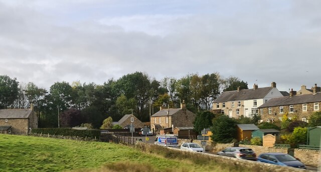
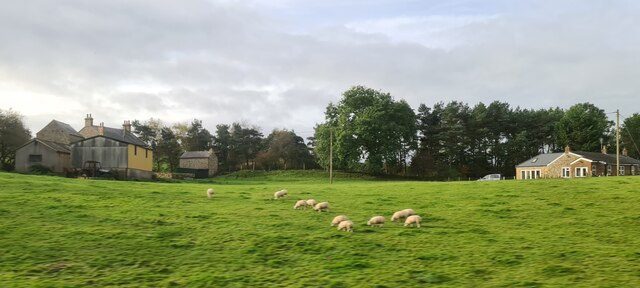
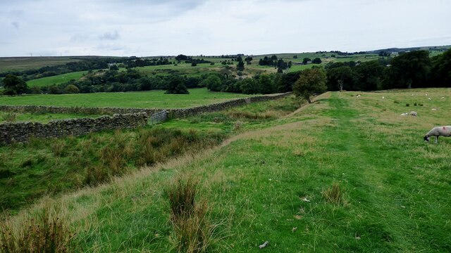
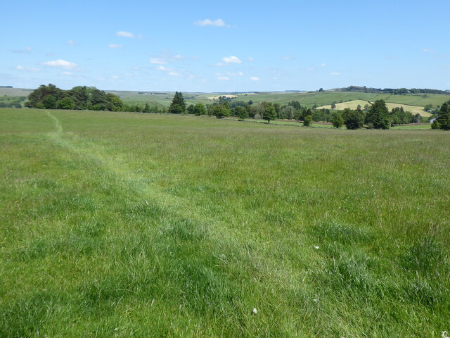
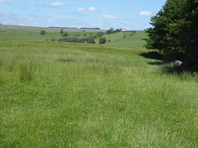
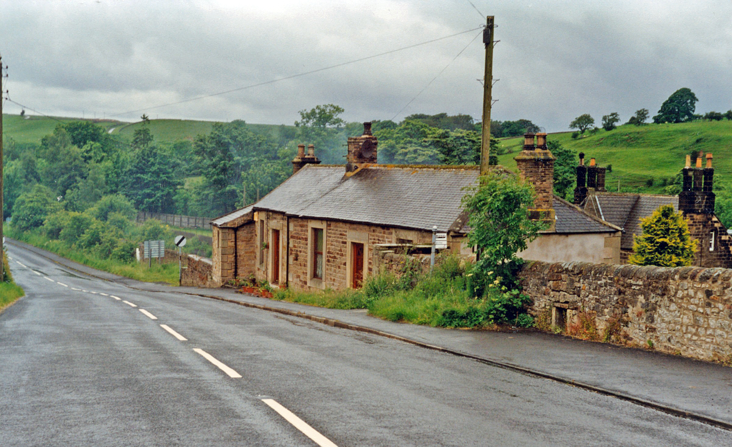
Longbyre is a charming village nestled in the picturesque region of Northumberland in northeast England. Located just eight miles northwest of the bustling market town of Hexham, this idyllic village is surrounded by rolling hills, lush green fields, and the meandering River Tyne.

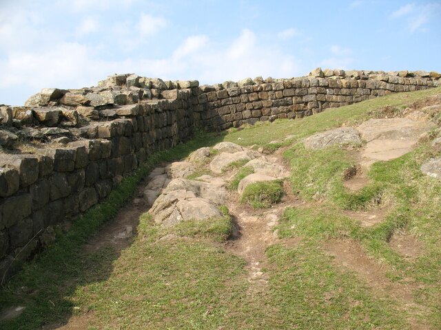
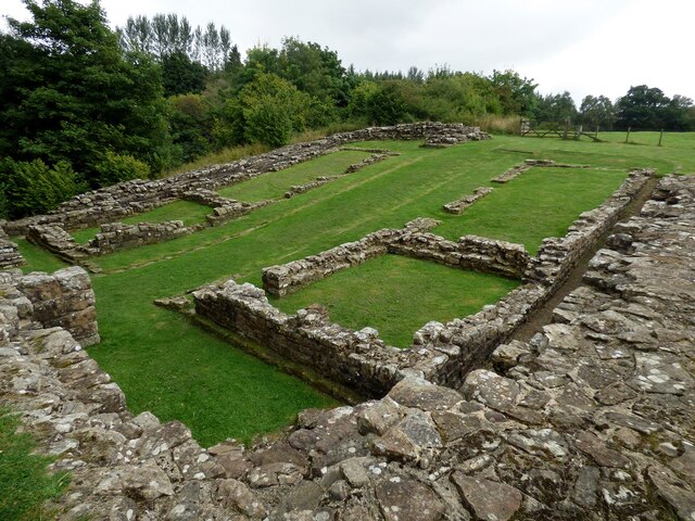
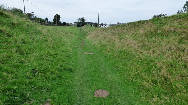
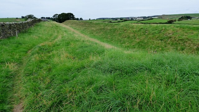
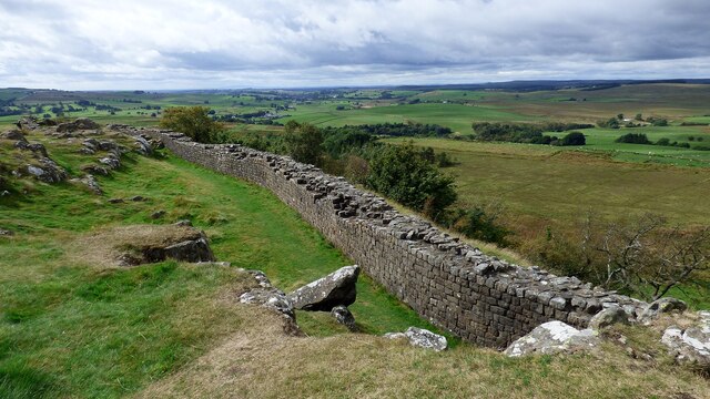
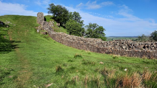
With a population of around 300 residents, Longbyre exudes a peaceful and tight-knit community atmosphere. The village boasts a rich history dating back to the Roman era, evident in the nearby remains of Hadrian's Wall, a UNESCO World Heritage Site. Visitors to Longbyre can explore this ancient structure and gain a glimpse into the area's past.

Longbyre offers a range of amenities to cater to its residents' needs. The village has a primary school, ensuring that children receive quality education close to home. Additionally, there is a local pub, The Black Bull, where locals and visitors gather to enjoy traditional pub fare and a friendly atmosphere.

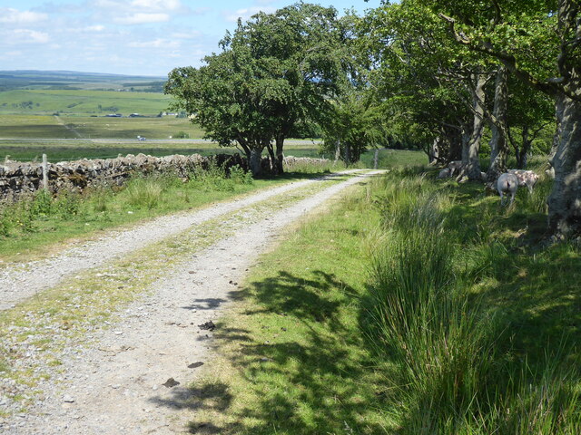
Nature enthusiasts will find Longbyre to be a paradise, as it is surrounded by stunning landscapes and provides ample opportunities for outdoor activities. The nearby Northumberland National Park offers breathtaking views, extensive walking trails, and the chance to spot rare wildlife. The village is also conveniently located close to Kielder Forest, Europe's largest man-made woodland, which boasts an observatory and an array of outdoor recreational activities.

Overall, Longbyre is a peaceful village that offers a rich history, natural beauty, and a close-knit community, making it an attractive destination for both residents and visitors seeking a tranquil escape in the heart of Northumberland.

If you have any feedback on the listing, please let us know in the comments section below.

Longbyre Images

Images are sourced within 2km of 54.989859/-2.5428833 or Grid Reference NY6566. Thanks to Geograph Open Source API. All images are credited.

Longbyre, near Greenhead
Sheep at Longbyre
Sheep at Longbyre
Hadrian's Wall on Walltown Crags Hadrian's wall or 'Vallum Aelium' is the remains of a large Roman fortification. The wall extended west from Segedunum at Wallsend on the River Tyne to the shore of the Solway Firth, ending a short but unknown distance west of the village of Bowness-on-Solway. Construction probably started sometime in AD 122 and was largely completed within six years.

The remains were made a UNESCO World Heritage Site in 1987.
Hadrian's Wall on Walltown Crags
Hadrian's wall or 'Vallum Aelium' is the remains of a large Roman fortification. The wall extended west from Segedunum at Wallsend on the River Tyne to the shore of the Solway Firth, ending a short but unknown distance west of the village of Bowness-on-Solway. Construction probably started sometime in AD 122 and was largely completed within six years. The remains were made a UNESCO World Heritage Site in 1987.
Poltross Burn Roman Milecastle Well preserved milecastle on Hadrian's Wall.
Poltross Burn Roman Milecastle
Well preserved milecastle on Hadrian's Wall.
Hadrian's Wall ditch Ditch in front of the wall which is no longer visible along this length.
Hadrian's Wall ditch
Ditch in front of the wall which is no longer visible along this length.
Hadrian's Wall ditch at Green Croft The field wall on the left is on the site of Hadrian's Wall.
Hadrian's Wall ditch at Green Croft
The field wall on the left is on the site of Hadrian's Wall.
Train crossing the Hadrian's Wall National Trail
Thirlwall Castle Almost entirely built from stone robbed from nearby Hadrian's Wall.
Thirlwall Castle
Almost entirely built from stone robbed from nearby Hadrian's Wall.
Ford and footbridge at Holmhead
Walltown Quarry Disused quarry now partly filled with water. A length of Hadrian's Wall was destroyed by this quarry.
Walltown Quarry
Disused quarry now partly filled with water. A length of Hadrian's Wall was destroyed by this quarry.
Hadrian's Wall ditch east of Holmhead The outer defensive ditch survives very well along this length. The wall itself is no longer visible but would have originally stood where the field wall now stands.
Hadrian's Wall ditch east of Holmhead
The outer defensive ditch survives very well along this length. The wall itself is no longer visible but would have originally stood where the field wall now stands.
Art installation at Walltown Country Park
Hadrian's Wall at Walltown Crags Hadrian's wall or 'Vallum Aelium' is the remains of a large Roman fortification. The wall extended west from Segedunum at Wallsend on the River Tyne to the shore of the Solway Firth, ending a short but unknown distance west of the village of Bowness-on-Solway. Construction probably started sometime in AD 122 and was largely completed within six years.

The remains were made a UNESCO World Heritage Site in 1987.
Hadrian's Wall at Walltown Crags
Hadrian's wall or 'Vallum Aelium' is the remains of a large Roman fortification. The wall extended west from Segedunum at Wallsend on the River Tyne to the shore of the Solway Firth, ending a short but unknown distance west of the village of Bowness-on-Solway. Construction probably started sometime in AD 122 and was largely completed within six years. The remains were made a UNESCO World Heritage Site in 1987.
Thirlwall Castle This medieval Grade I listed fortified tower is beside the Hadrian’s Wall Path and the Pennine Way National Trails.  It is constructed mainly from re-used stones from Hadrian’s Wall nearby and was the family seat of the Thirlwall family.
Thirlwall Castle
This medieval Grade I listed fortified tower is beside the Hadrian’s Wall Path and the Pennine Way National Trails. It is constructed mainly from re-used stones from Hadrian’s Wall nearby and was the family seat of the Thirlwall family.
Hadrian's Wall near Turret 45A
The Pennine Way approaching the A69
The Pennine Way near the A69
The Pennine Way near Haltwhistle Golf Club
Show me another place!

Longbyre is located at Grid Ref: NY6566 (Lat: 54.989859, Lng: -2.5428833)

Unitary Authority: Northumberland

Police Authority: Northumbria

What 3 Words

///costly.palm.brief. Near Greenhead, Northumberland

Nearby Locations

Thirlwall Castle Longbyre

Related Wikis

Milecastle 47

Milecastle 47 (Chapel House) was a milecastle on Hadrian's Wall (grid reference NY64906607). == Description == Milecastle 47 is about 270 metres east of...
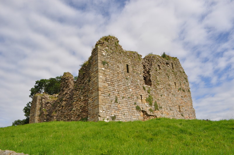
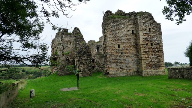
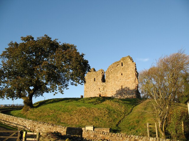
Thirlwall Castle

Thirlwall Castle is a 12th-century castle in Northumberland, England, on the bank of the River Tipalt close to the village of Greenhead and approximately...

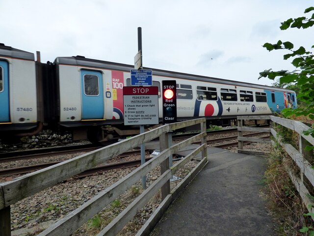
Greenhead railway station

Greenhead was a former railway station, which served the village of Greenhead, Northumberland in Northumberland between 1836 and 1967. == History == The...

Milecastle 46

Milecastle 46 (Carvoran) was a milecastle on Hadrian's Wall (grid reference NY66466601). == Description == Milecastle 46 is just west of the Vallum deviation...

Nearby Amenities

Located within 500m of 54.989859,-2.5428833
Grit Bin
Lat/Long: 54.9886654/-2.5399417
Bench
Lat/Long: 54.9891038/-2.5403052
Bench
Lat/Long: 54.9890119/-2.5405271
Bus Stop
Bench: no
Covered: no
Naptan AtcoCode: 3100Y655662
Naptan NaptanCode: nldawjma
Shelter: no
Lat/Long: 54.9897308/-2.5405427
Waste Basket
Lat/Long: 54.9896707/-2.5403516
Post Box
Collection Times: Mo-Fr 16:30; Sa 09:00
Post Box Type: lamp
Ref: CA8 50
Lat/Long: 54.9899312/-2.5415956
Power: pole
Lat/Long: 54.9915151/-2.5400411
Line Management: branch
Power: pole
Lat/Long: 54.9908436/-2.5394109
Power: pole
Lat/Long: 54.9905865/-2.537662
Power: pole
Lat/Long: 54.9909835/-2.5362726
Power: pole
Lat/Long: 54.9922636/-2.5419431
Power: pole
Lat/Long: 54.9938694/-2.5401243
Power: pole
Lat/Long: 54.9939986/-2.5412883
Power: pole
Lat/Long: 54.994131/-2.5424122
Power: pole
Lat/Long: 54.9942664/-2.5435199
Power: pole
Lat/Long: 54.9919391/-2.5435709
Power: pole
Lat/Long: 54.9918806/-2.5450435
Power: pole
Lat/Long: 54.9918329/-2.5465562
Power: pole
Lat/Long: 54.9918952/-2.5472697
Power: pole
Lat/Long: 54.9919783/-2.548643
Crossing Barrier: half
Railway: level_crossing
Lat/Long: 54.9901802/-2.539614
Crossing Barrier: half
Railway: level_crossing
Lat/Long: 54.9901554/-2.5396594
Communication Mobile Phone: yes
Man Made: mast
Lat/Long: 54.9926942/-2.5436736
Railway: crossing
Lat/Long: 54.9929932/-2.5449422
Railway: crossing
Lat/Long: 54.9929616/-2.5449729
Power: pole
Lat/Long: 54.9919968/-2.5425512
Power: pole
Lat/Long: 54.9919208/-2.5410745
Power: pole
Switch: mechanical
Lat/Long: 54.9908615/-2.5393286
Line Management: branch
Power: pole
Lat/Long: 54.9907517/-2.5393222
Material: wood
Power: pole
Switch: mechanical
Lat/Long: 54.9902828/-2.5388771
Line Management: termination
Power: pole
Transformer: distribution
Lat/Long: 54.9907433/-2.5393799
Material: wood
Power: pole
Lat/Long: 54.9890373/-2.5374453
Material: wood
Power: pole
Lat/Long: 54.9883228/-2.5365078
Material: wood
Power: pole
Lat/Long: 54.9897236/-2.538336
Defibrillator
Defibrillator Location: at bottom of Low Castle Terrace, Longbyre
Emergency: defibrillator
Indoor: no
Lat/Long: 54.9898541/-2.5410325
Phone
Emergency: phone
Lat/Long: 54.9897546/-2.5402618
Shelter
Shelter Type: public_transport
Lat/Long: 54.989333/-2.5403816
The data included in this document is from www.openstreetmap.org. The data is made available under ODbL.

Have you been to Longbyre?

Leave your review of Longbyre below (or comments, questions and feedback).