Llannewydd

Settlement in Radnorshire

Wales

Llannewydd

Newchurch Presbyterian church
Newchurch Presbyterian church Credit: Philip Halling

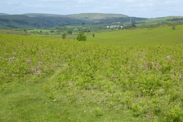
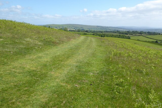
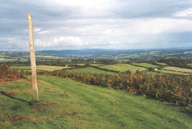
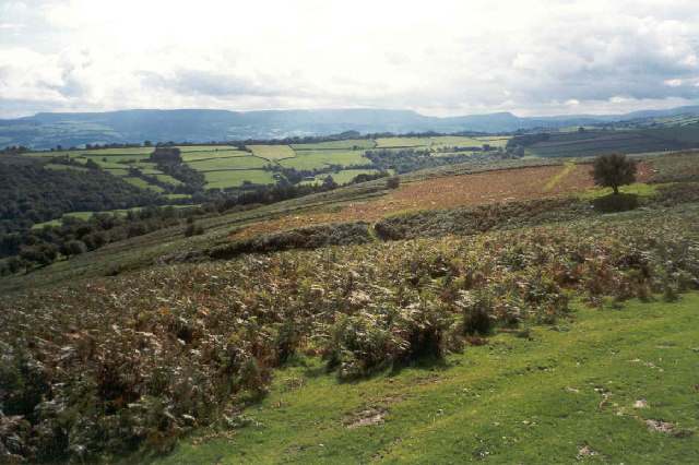
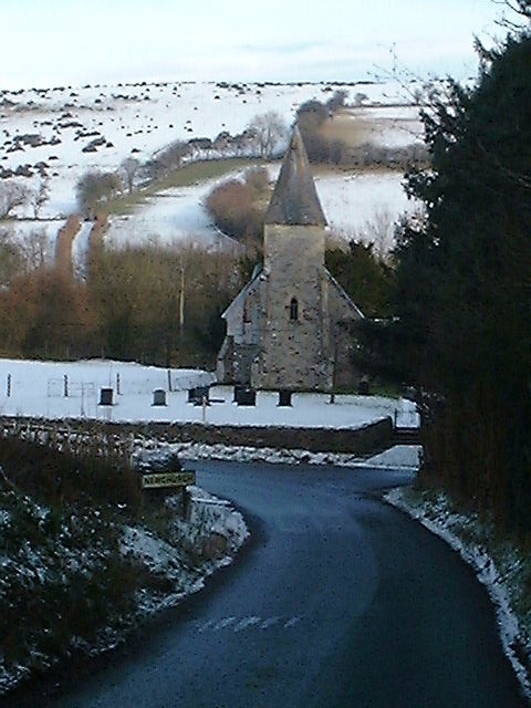
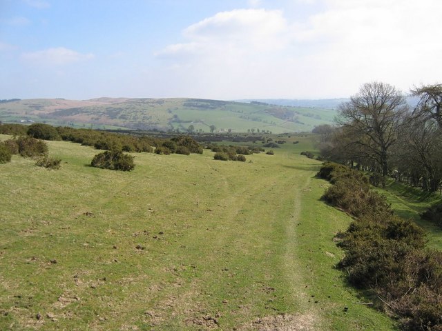
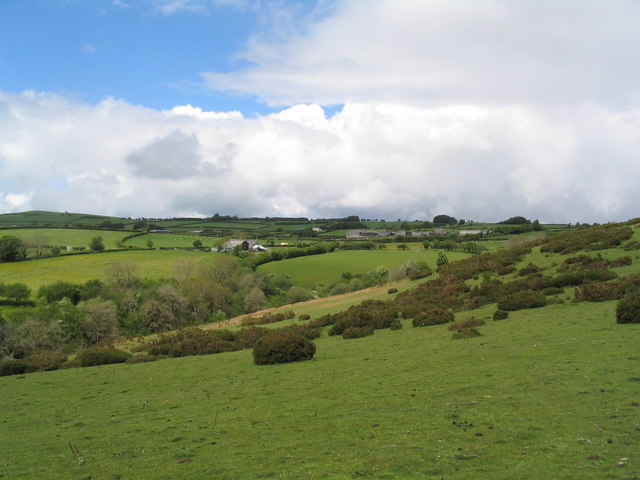
Llannewydd is a small village located in the historic county of Radnorshire, Wales. Situated in the heart of the rural countryside, it is surrounded by rolling hills and picturesque landscapes. The village is nestled in a valley, with the River Wye flowing nearby, offering stunning views and a tranquil setting.

Llannewydd boasts a rich history, with evidence of human settlement in the area dating back to prehistoric times. The village itself is steeped in Welsh culture and tradition, with a strong sense of community and a warm welcome for visitors.

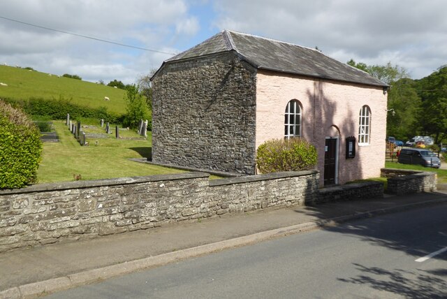
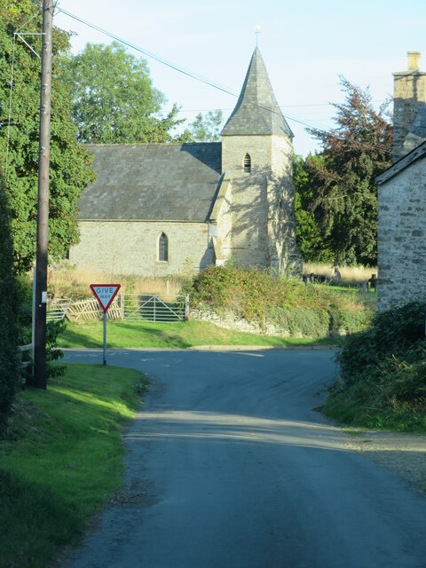
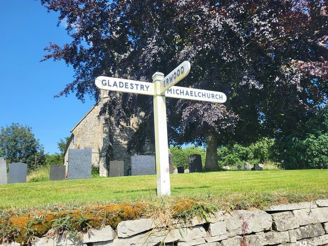
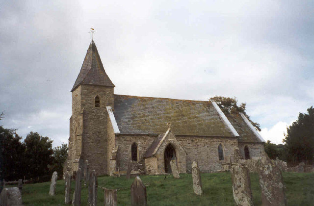
Despite its small size, Llannewydd is home to several notable landmarks and attractions. The village church, dedicated to St. Michael, is a beautiful example of medieval architecture and is a focal point for local worship. Additionally, there are several traditional Welsh cottages dotted throughout the village, adding to its charm and character.

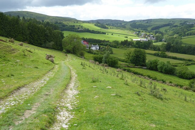
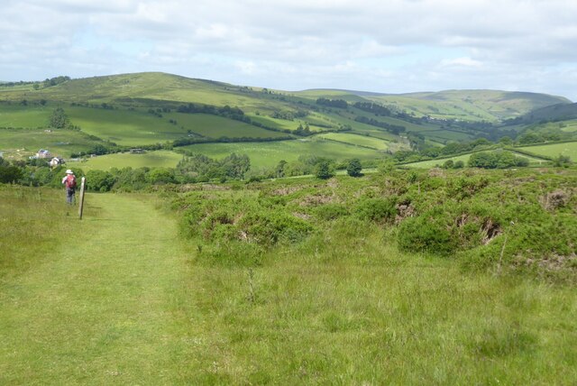
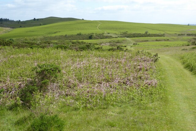
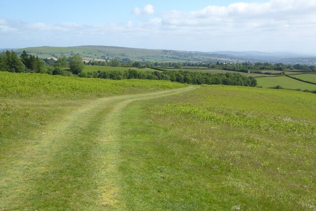
The surrounding area provides ample opportunities for outdoor activities and exploration. Llannewydd is an ideal base for hikers and nature enthusiasts, with numerous walking trails and scenic routes in the vicinity. The nearby Radnor Forest and Elan Valley are popular destinations for those seeking stunning natural beauty and wildlife encounters.

Although Llannewydd is a quiet and peaceful village, it benefits from its proximity to larger towns such as Builth Wells and Llandrindod Wells, which offer a wider range of amenities and services. Overall, Llannewydd is a hidden gem in Radnorshire, offering visitors a chance to experience the beauty and tranquility of the Welsh countryside.

If you have any feedback on the listing, please let us know in the comments section below.
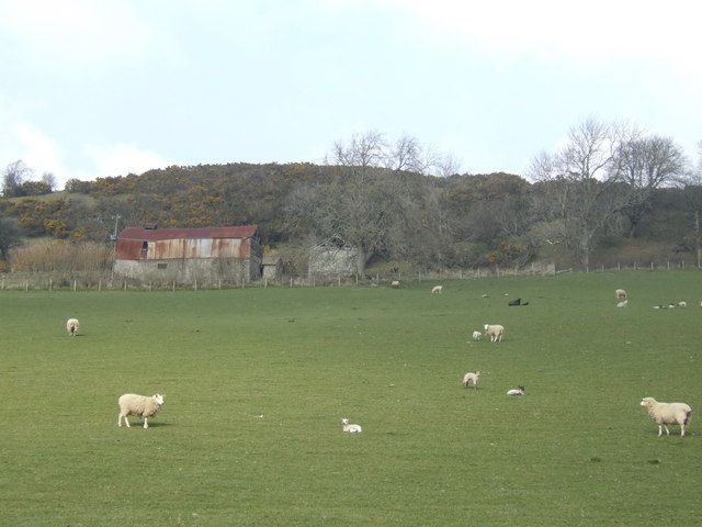
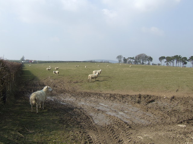
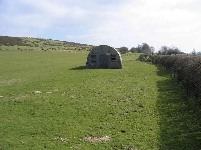
Llannewydd Images

Images are sourced within 2km of 52.149435/-3.1476308 or Grid Reference SO2150. Thanks to Geograph Open Source API. All images are credited.

Newchurch Presbyterian church
Offa's Dyke Path descending to Newchurch Gilfach-yr-heol can be seen in the near distance.
Offa's Dyke Path descending to Newchurch
Gilfach-yr-heol can be seen in the near distance.
View over the Arrow valley View over the Arrow valley from Offa's Dyke Path as it ascends Disgwylfa Hill from Newchurch.
View over the Arrow valley
View over the Arrow valley from Offa's Dyke Path as it ascends Disgwylfa Hill from Newchurch.
Disgwylfa Hill Offa's Dyke Long Distance Path crossing Disgwylfa Hill, north-east of Newchurch.
Disgwylfa Hill
Offa's Dyke Long Distance Path crossing Disgwylfa Hill, north-east of Newchurch.
View over the Arrow valley View over the Arrow valley from Offa's Dyke Path on Disgwylfa Hill
View over the Arrow valley
View over the Arrow valley from Offa's Dyke Path on Disgwylfa Hill
Offa's Dyke Path, Disgwylfa Hill Offa's Dyke Path crossing Disgwylfa Hill; Hergest Ridge can be seen in the middle distance, Titterstone Clee Hill can be seen in the far distance.
Offa's Dyke Path, Disgwylfa Hill
Offa's Dyke Path crossing Disgwylfa Hill; Hergest Ridge can be seen in the middle distance, Titterstone Clee Hill can be seen in the far distance.
Junction in Newchurch Approaching a give way sign at the junction with B4594 in Newchurch. St Mary's church in the background.
Junction in Newchurch
Approaching a give way sign at the junction with B4594 in Newchurch. St Mary's church in the background.
Offa's Dyke Path, Disgwylfa Hill View from Offa's Dyke Path on Disgwylfa Hill to Hergest Ridge which can be seen to the left of centre on the horizon.
Offa's Dyke Path, Disgwylfa Hill
View from Offa's Dyke Path on Disgwylfa Hill to Hergest Ridge which can be seen to the left of centre on the horizon.
Direction Sign – Signpost on the B4594 at Newchurch Located in the churchyard at Newchurch on the northeast side of a T junction on the B4594. Gladestry Community. 3 arms and layered finial. See also <a title="https://www.geograph.org.uk/photo/6654106" href="https://www.geograph.org.uk/photo/6654106">Link</a> and <a title="https://www.geograph.org.uk/photo/6654138" href="https://www.geograph.org.uk/photo/6654138">Link</a>.

Milestone Society National ID: RAD_SO2150
Direction Sign – Signpost on the B4594 at Newchurch
Located in the churchyard at Newchurch on the northeast side of a T junction on the B4594. Gladestry Community. 3 arms and layered finial. See also Link and Link. Milestone Society National ID: RAD_SO2150
Disgwylfa Hill Disgwylfa Hill is crossed by Offa's Dyke Path, this area of open land is just in Wales, the border runs along the eastern boundary of this common. In this view to the north-east Clee Hill in Shropshire can be seen on the horizon in the middle.
Disgwylfa Hill
Disgwylfa Hill is crossed by Offa's Dyke Path, this area of open land is just in Wales, the border runs along the eastern boundary of this common. In this view to the north-east Clee Hill in Shropshire can be seen on the horizon in the middle.
View south from Disgwylfa Hill The northern escarpment of the Black Mountains viewed from Disgwylfa Hill. The path visible through the bracken is the course of Offa's Dyke Path.
View south from Disgwylfa Hill
The northern escarpment of the Black Mountains viewed from Disgwylfa Hill. The path visible through the bracken is the course of Offa's Dyke Path.
St Mary's church, Newchurch <span class="nowrap"><a title="http://www.churchinwales.org.uk/swanbrec/s507/newchurch.html" rel="nofollow ugc noopener" href="http://www.churchinwales.org.uk/swanbrec/s507/newchurch.html">Link</a><img style="margin-left:2px;" alt="External link" title="External link - shift click to open in new window" src="https://s1.geograph.org.uk/img/external.png" width="10" height="10"/></span>
St Mary's church, Newchurch
Newchurch Church in the snow David Vaughan the Rector of this church was a colleague of Frances Kilvert the Victorian diarist and Vicar
Newchurch Church in the snow
David Vaughan the Rector of this church was a colleague of Frances Kilvert the Victorian diarist and Vicar
Hillside below Pen-y-Gwyddel Recently-born lambs in this sunny south-facing pasture.
Hillside below Pen-y-Gwyddel
Recently-born lambs in this sunny south-facing pasture.
New Barn pasture land At 1200' elevation.
New Barn pasture land
At 1200' elevation.
Nissen Hut on Newchurch Hill Old Nissen hut on unenclosed land at foot of Newchurch Hill
Nissen Hut on Newchurch Hill
Old Nissen hut on unenclosed land at foot of Newchurch Hill
View towards Newchurch View from path on Newchurch Hill towards Newchurch
View towards Newchurch
View from path on Newchurch Hill towards Newchurch
View to Lower Blaencerde View north west from the Offa's Dyke path
View to Lower Blaencerde
View north west from the Offa's Dyke path
Show me another place!

Llannewydd is located at Grid Ref: SO2150 (Lat: 52.149435, Lng: -3.1476308)

Unitary Authority: Powys

Police Authority: Dyfed Powys

Also known as: Newchurch

What 3 Words

///revisits.payer.journals. Near Clifford, Herefordshire

Related Wikis

Newchurch, Powys

Newchurch is a small rural village in Powys, Wales, centred around St Mary's Church. The village is within the community of Gladestry, about 5 miles (8...

Baynham Hall

Baynham Hall is a Grade II* listed 17th -century manor house located in Michaelchurch-On-Arrow, Gladestry, Powys, Wales. Originally built circa 1700, the...

Rhos Goch National Nature Reserve

Rhos Goch National Nature Reserve, located near Painscastle on the England/Wales border, is one of the largest raised bogs in mid and south Wales. ‘Goch...

Gladestry

Gladestry (Welsh: Llanfair Llythynwg) is a small village and community in Radnorshire, Powys, mid-Wales, close to the border with England at the end of...

Nearby Amenities

Located within 500m of 52.149435,-3.1476308
Newchurch
Is In: Powys,Wales,UK
Name Cy: Eglwys Newydd
Name En: Newchurch
Place: village
Source: npe
Wikidata: Q20601818
Lat/Long: 52.1499108/-3.1481061
Post Box
Collection Times: Mo-Fr 11:00; Sa 09:15
Operator: Royal Mail
Post Box Type: lamp
Ref: HR5 676
Royal Cypher: EIIR
Royal Cypher Wikidata: Q33102113
Source: survey
Survey Date: 2019-07-03
Lat/Long: 52.1486669/-3.1465021
Ford: yes
Lat/Long: 52.1455774/-3.1443126
Direction: 195
Generator Method: photovoltaic
Generator Output Electricity: yes
Generator Solar Modules: 16
Generator Source: solar
Generator Type: solar_photovoltaic_panel
Location: roof
Power: generator
Lat/Long: 52.1499328/-3.1478355
Drinking Water
Lat/Long: 52.1493311/-3.1469116
The data included in this document is from www.openstreetmap.org. The data is made available under ODbL.

Have you been to Llannewydd?

Leave your review of Llannewydd below (or comments, questions and feedback).