Llanelian-yn-Rhôs

Settlement in Denbighshire

Wales

Llanelian-yn-Rhôs

Rolling hills viewed from B5183 near to Glan Gors
Rolling hills viewed from B5183 near to Glan Gors Credit: Richard Hoare

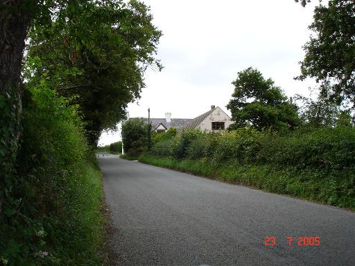
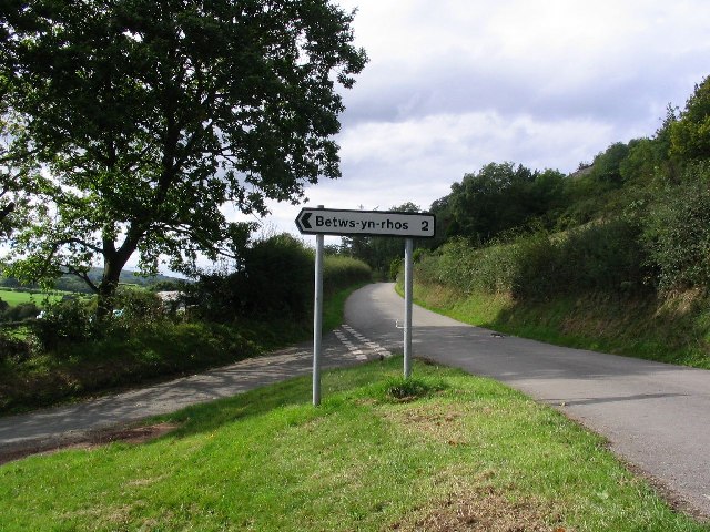
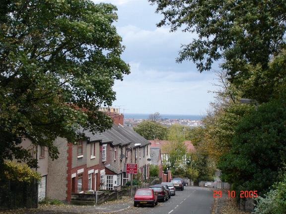
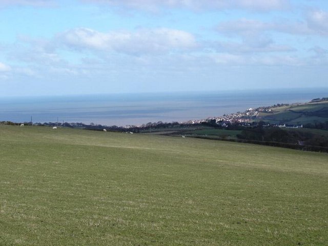
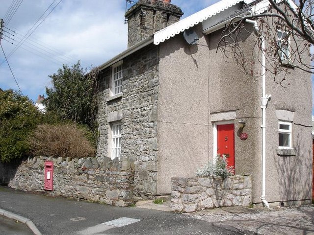
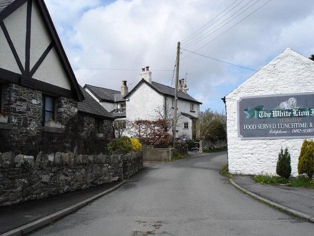
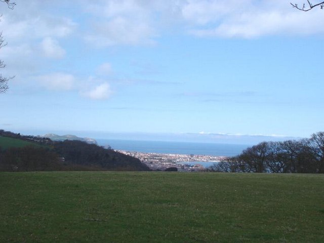
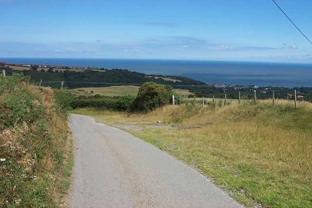
Llanelian-yn-Rhôs is a small village located in the county of Denbighshire, Wales. Situated on the northern coast of the country, the village is nestled between the towns of Colwyn Bay and Abergele. With a population of around 500 residents, Llanelian-yn-Rhôs offers a charming and tranquil rural setting.

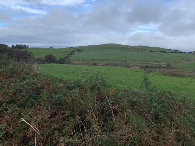
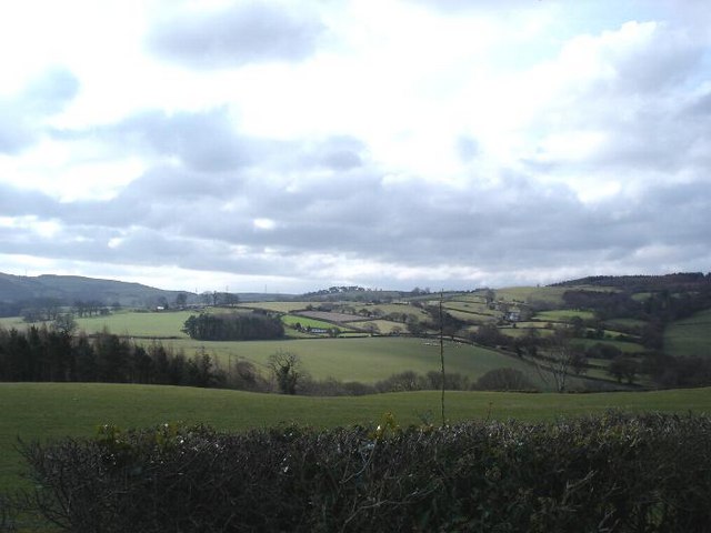
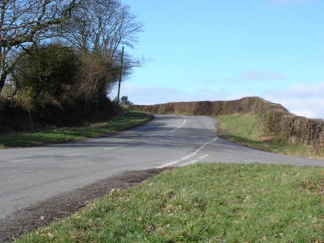
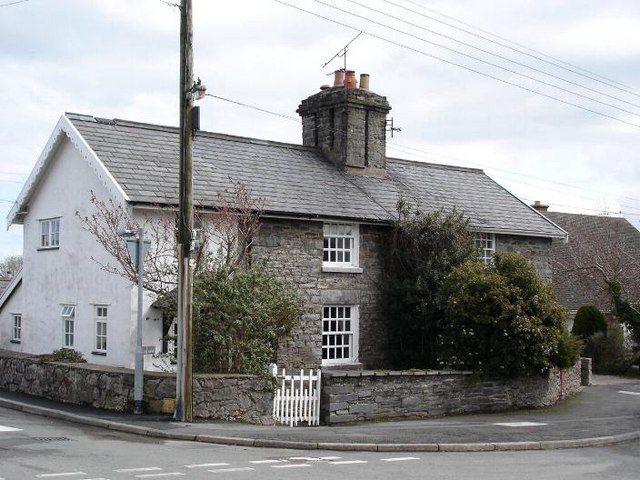
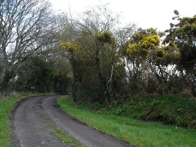
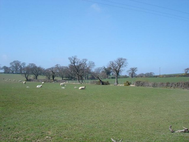
The village is known for its picturesque surroundings, surrounded by rolling hills and farmland. It is a popular destination for outdoor enthusiasts, with ample opportunities for hiking, cycling, and exploring the nearby coast. The beautiful sandy beaches of Colwyn Bay are just a short drive away, providing residents and visitors with the chance to enjoy seaside activities and water sports.

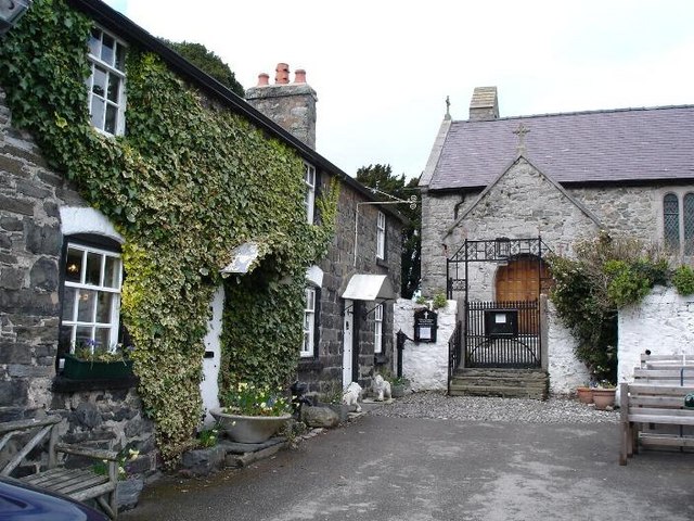
Llanelian-yn-Rhôs boasts a rich history, with evidence of human habitation dating back centuries. The village is home to the St. Elian's Church, a Grade II listed building that dates back to the 12th century. The church is an architectural gem, known for its medieval features and stunning stained glass windows.

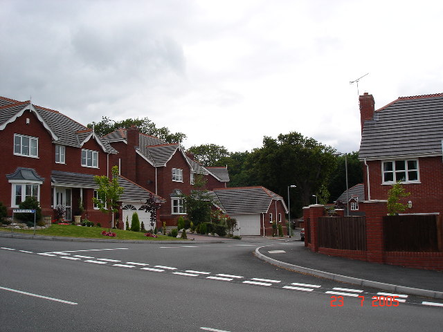
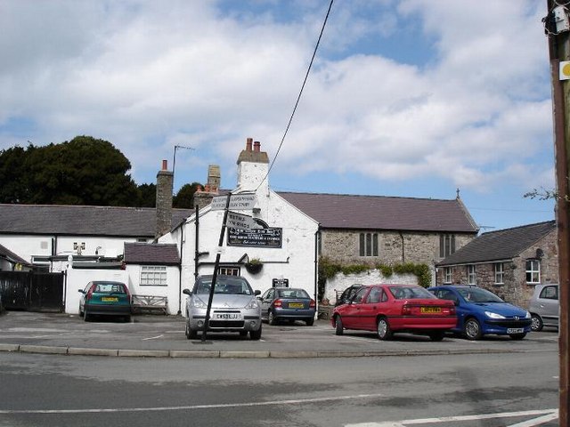
Despite its small size, Llanelian-yn-Rhôs offers a range of amenities to its residents. The village has a community center, a primary school, and a local pub, providing a sense of community and a gathering place for locals.

Overall, Llanelian-yn-Rhôs is a charming village that offers a peaceful and idyllic rural lifestyle. With its beautiful surroundings, rich history, and close proximity to the coast, it is a hidden gem in Denbighshire, attracting those seeking a slower pace of life away from the hustle and bustle of larger towns and cities.

If you have any feedback on the listing, please let us know in the comments section below.

Llanelian-yn-Rhôs Images

Images are sourced within 2km of 53.272098/-3.7057083 or Grid Reference SH8676. Thanks to Geograph Open Source API. All images are credited.

Rolling hills viewed from B5183 near to Glan Gors
Old Milestone by A547, approximately 20m west of Coed Coch Road The Milestone is located at the rear of a footway. Outside Ladbrokes shop on the South of the road.  Parish of Old Conwy (Conwy County Borough District), erected in the 19th Century. 

Inscription reads:-  
TO / ABERGELE / 5 MILES / T0 / CONWAY / 6 MILES / 6 FURLONGS  

Milestone Society National ID: DEN_AGCY05
Old Milestone by A547, approximately 20m west of Coed Coch Road
The Milestone is located at the rear of a footway. Outside Ladbrokes shop on the South of the road.  Parish of Old Conwy (Conwy County Borough District), erected in the 19th Century. Inscription reads:- TO / ABERGELE / 5 MILES / T0 / CONWAY / 6 MILES / 6 FURLONGS Milestone Society National ID: DEN_AGCY05
New houses at Old Colwyn Part of the new housing estates at Old Colwyn
New houses at Old Colwyn
Part of the new housing estates at Old Colwyn
The B5383 The B5383 heading towards Old Colwyn.
The B5383
The B5383 heading towards Old Colwyn.
Road Junction and Squirrels This picture was taken looking west along the B5381 from sh866750. If you look closely there are three squirrels also featured in this image.
Road Junction and Squirrels
This picture was taken looking west along the B5381 from sh866750. If you look closely there are three squirrels also featured in this image.
View from Glyn Glyn - high above the town of Colwyn Bay
View from Glyn
Glyn - high above the town of Colwyn Bay
Farmland near Dolwen Looking South from the B5381
Farmland near Dolwen
Looking South from the B5381
Hills to sea From the hills above Colwyn Bay looking down over the fields with the coast to the North
Hills to sea
From the hills above Colwyn Bay looking down over the fields with the coast to the North
Old Colwyn Hills One of the many lanes the criss cross the hills high above Old Colwyn
Old Colwyn Hills
One of the many lanes the criss cross the hills high above Old Colwyn
The old post office at Llanelian Now a home, the former post office keeps its red door and the post box on the wall
The old post office at Llanelian
Now a home, the former post office keeps its red door and the post box on the wall
The two 'locals' at Llanelian The village pub and church in the centre of the village
The two 'locals' at Llanelian
The village pub and church in the centre of the village
Llanelian yn Rhos church The village church with the White Lion pub to the left
Llanelian yn Rhos church
The village church with the White Lion pub to the left
Main road through Llanelian The road winds between cottages and the village pub
Main road through Llanelian
The road winds between cottages and the village pub
Llanelian cottages Stone cottages in the centre of the village
Llanelian cottages
Stone cottages in the centre of the village
Track above Colwyn Bay Farm track in the hills above Colwyn Bay
Track above Colwyn Bay
Farm track in the hills above Colwyn Bay
Dolwen farmland
Dolwen farmland
Above Colwyn Bay Fields above the town looking down to the coast
Above Colwyn Bay
Fields above the town looking down to the coast
Lane to Cilgwyn Mawr near Colwyn Bay This minor road terminates at Cilgwyn Mawr above Colwyn Bay and the photo was taken looking North from grid reference SH 84970 76544.
Lane to Cilgwyn Mawr near Colwyn Bay
This minor road terminates at Cilgwyn Mawr above Colwyn Bay and the photo was taken looking North from grid reference SH 84970 76544.
Show me another place!

Llanelian-yn-Rhôs is located at Grid Ref: SH8676 (Lat: 53.272098, Lng: -3.7057083)

Unitary Authority: Conwy

Police Authority: North Wales

What 3 Words

///perfectly.relished.repelled. Near Llysfaen, Conwy

Related Wikis

Llanelian Road

Llanelian Road (Welsh: Ffordd Llanelian) is a multi-use stadium in Old Colwyn, North Wales and also known as the 4 Crosses Construction Arena for sponsorship...

Ysgol Bryn Elian

Ysgol Bryn Elian is an 11–18 English-medium co-educational comprehensive school on Windsor Drive in Old Colwyn. Along with Eirias High School and Coleg...

Colwyn Bay Community Hospital

Colwyn Bay Community Hospital (Welsh: Ysbyty Cymuned Bae Colwyn) is a community hospital in Colwyn Bay, Wales. It is managed by the Betsi Cadwaladr University...

Llety'r Dryw

Llety'r Dryw is a house in Abergele Road, Colwyn Bay, Conwy, Wales. It is a Grade II listed building. It was built in 1893 for John Eden (uncle of Anthony...

Nearby Amenities

Located within 500m of 53.272098,-3.7057083
Barrier: stile
Lat/Long: 53.274793/-3.7045102
Barrier: stile
Historic: monument
Lat/Long: 53.2753183/-3.7073033
Llanelian yn Rhos
Place: village
Wikidata: Q13129619
Lat/Long: 53.2722139/-3.7056457
Power: pole
Lat/Long: 53.2761556/-3.703339
Power: pole
Lat/Long: 53.2761107/-3.7049483
Power: pole
Lat/Long: 53.276077/-3.7063538
Power: pole
Lat/Long: 53.2760401/-3.7078156
Power: pole
Lat/Long: 53.2753071/-3.7082528
Power: pole
Lat/Long: 53.2747554/-3.7085961
Power: pole
Lat/Long: 53.2739935/-3.7090601
Power: pole
Lat/Long: 53.2733982/-3.7094443
Power: pole
Lat/Long: 53.2727871/-3.7098488
Power: pole
Lat/Long: 53.2721939/-3.7103257
Power: pole
Lat/Long: 53.2716312/-3.7108877
Power: pole
Lat/Long: 53.2710481/-3.7115349
Power: pole
Lat/Long: 53.2704471/-3.7122204
Telephone
Defibrillator
Booth: K6
Covered: booth
Defibrillator Location: inside old red phone box, Llanelian yn Rhos - opposite White Lion pub
Emergency: defibrillator
Man Made: telephone_box
Lat/Long: 53.2722732/-3.7052742
Post Box
Post Box Type: wall
Lat/Long: 53.2720598/-3.7054914
Direction: 255
Generator Method: photovoltaic
Generator Output Electricity: yes
Generator Solar Modules: 5
Generator Source: solar
Generator Type: solar_photovoltaic_panel
Location: roof
Power: generator
Lat/Long: 53.2715542/-3.7052931
Direction: 260
Generator Method: photovoltaic
Generator Output Electricity: yes
Generator Solar Modules: 8
Generator Source: solar
Generator Type: solar_photovoltaic_panel
Location: roof
Power: generator
Lat/Long: 53.2724149/-3.706298
Direction: 255
Generator Method: photovoltaic
Generator Output Electricity: yes
Generator Solar Modules: 7
Generator Source: solar
Generator Type: solar_photovoltaic_panel
Location: roof
Power: generator
Lat/Long: 53.2715707/-3.705234
The data included in this document is from www.openstreetmap.org. The data is made available under ODbL.

Have you been to Llanelian-yn-Rhôs?

Leave your review of Llanelian-yn-Rhôs below (or comments, questions and feedback).