Layer de la Haye

Settlement in Essex Colchester

England

Layer de la Haye

Abberton Reservoir from a permissive path; Near Layer-De-La Haye This section of the path I only discovered last Saturday. I was soon to find out that it ended on a "private" section of Fields Farm Road!
Abberton Reservoir from a permissive path; Near Layer-De-La Haye Credit: Mr James D

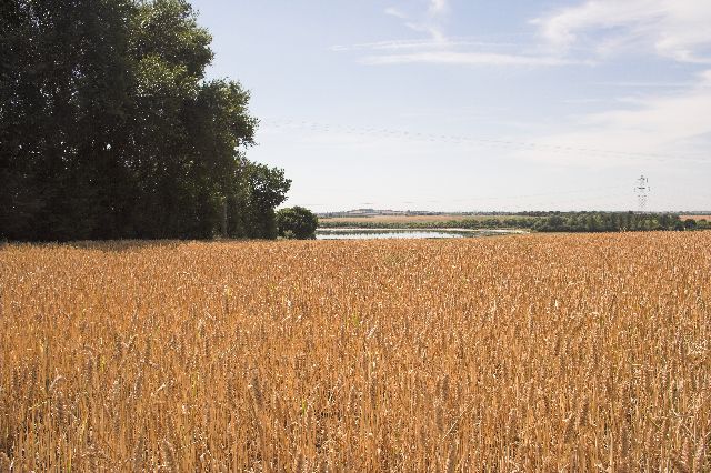
Layer de la Haye is a small village located in the county of Essex, England. It is situated just to the south of Colchester, the largest town in the area. The village is surrounded by picturesque countryside, offering residents and visitors a tranquil and scenic environment.

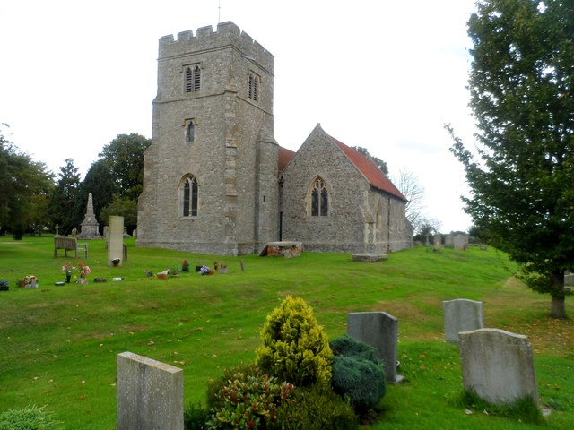
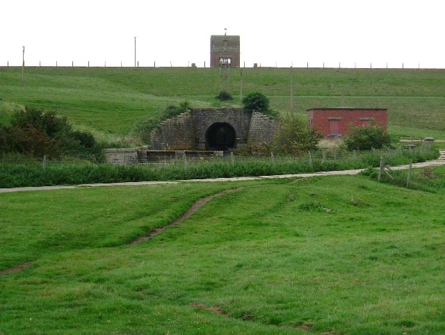
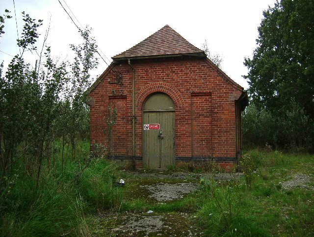
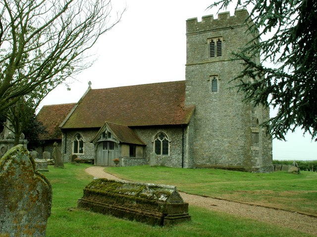
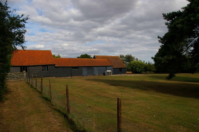
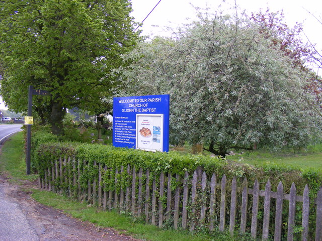
Layer de la Haye has a rich history, with evidence of human settlement in the area dating back to the Roman times. The village itself is known for its traditional architecture, with a charming mix of thatched cottages and brick houses. The local church, St. John the Baptist, is a notable landmark, dating back to the 12th century and featuring stunning architectural details.

Despite its small size, Layer de la Haye offers a range of amenities for its residents. These include a village hall, a primary school, a post office, and a local shop, providing essential services to the community. The village also has a friendly and active community, with various clubs and organizations catering to different interests.

The surrounding countryside offers plenty of opportunities for outdoor activities, such as walking, cycling, and nature exploration. Layer de la Haye is also conveniently located near Colchester, which provides additional amenities, including shopping centers, restaurants, and leisure facilities.

Overall, Layer de la Haye is a charming village with a rich history and a close-knit community. Its idyllic setting and range of amenities make it an attractive place to live for those seeking a peaceful and picturesque lifestyle.

If you have any feedback on the listing, please let us know in the comments section below.

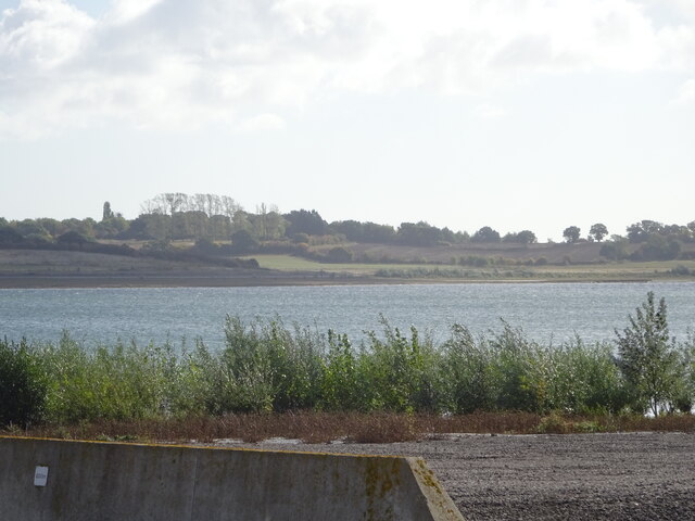
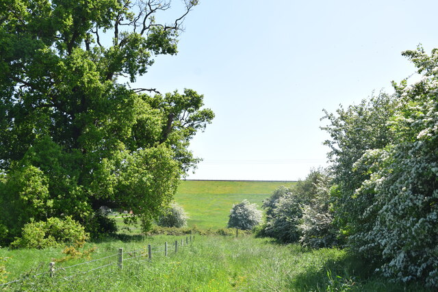
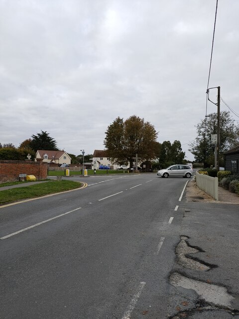
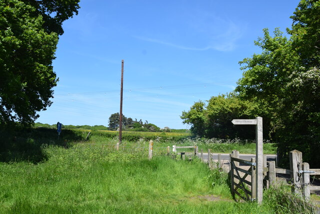
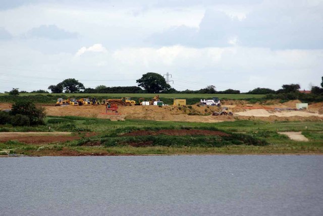
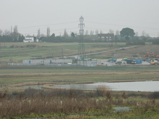
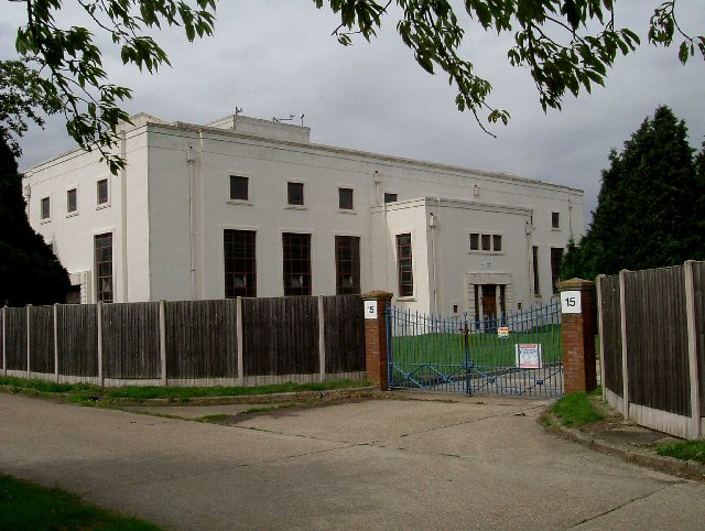
Layer de la Haye Images

Images are sourced within 2km of 51.848516/0.86052498 or Grid Reference TL9720. Thanks to Geograph Open Source API. All images are credited.

Abberton Reservoir from a permissive path; Near Layer-De-La Haye This section of the path I only discovered last Saturday. I was soon to find out that it ended on a "private" section of Fields Farm Road!
Abberton Reservoir from a permissive path; Near Layer-De-La Haye
This section of the path I only discovered last Saturday. I was soon to find out that it ended on a "private" section of Fields Farm Road!
Dam of Abberton Reservoir Ahead is the back slope of the dam of Abberton Reservoir taken from the permissive footpath which runs behind the dam.
Dam of Abberton Reservoir
Ahead is the back slope of the dam of Abberton Reservoir taken from the permissive footpath which runs behind the dam.
Morris Minor parked in Oliver's lane I took this pic in black & white to make it appear as an old fashioned photo from the 50s, and not as a modern pic from 2022. The car in question is a Morris Minor MM, which thankfully, has its original reg no (issued in 1952 in East Sussex according to "Where's It From; When was It Issued" book on UK registration numbers I have in my possession); and not one of those "age related" plates you often see on vehicles of its age (which I don't like).
Morris Minor parked in Oliver's lane
I took this pic in black & white to make it appear as an old fashioned photo from the 50s, and not as a modern pic from 2022. The car in question is a Morris Minor MM, which thankfully, has its original reg no (issued in 1952 in East Sussex according to "Where's It From; When was It Issued" book on UK registration numbers I have in my possession); and not one of those "age related" plates you often see on vehicles of its age (which I don't like).
Junction of Church Road and Birch Road Layer de la Haye
Looking across Abberton Road  Taken from the permissive footpath which runs north of the dam of Abberton Reservoir.
Looking across Abberton Road
Taken from the permissive footpath which runs north of the dam of Abberton Reservoir.
Glaciation Limit This gravel extraction pit marks the southern limit of the ice sheet during the last ice age. The gravel laid down by the retreating glacier is being extracted for building works associated with the £150m scheme to expand the capacity of Abberton Reservoir. Using locally sourced materials reduces road trips by truck and hence reduces the carbon footprint of the project as a whole. As the new gravel pit will not actually be under water in 2015 when new lake is full the tax-man has declared it is not part of the building site and so  is liable to gravel extraction tax. Essex and Suffolk Water are understandably contesting this.
Glaciation Limit
This gravel extraction pit marks the southern limit of the ice sheet during the last ice age. The gravel laid down by the retreating glacier is being extracted for building works associated with the £150m scheme to expand the capacity of Abberton Reservoir. Using locally sourced materials reduces road trips by truck and hence reduces the carbon footprint of the project as a whole. As the new gravel pit will not actually be under water in 2015 when new lake is full the tax-man has declared it is not part of the building site and so is liable to gravel extraction tax. Essex and Suffolk Water are understandably contesting this.
Preparations for Expansion: New Inlet Structure All the new buildings are being put here because Essex and Suffolk water want to enlarge the Reservoir. The Reservoir takes water from the Rivers Stour and Colne also some water is taken from the Roman River and the Denver Complex in Norfolk as well. The remains of the B1026 road will form a reef, a Tern Raft and a Osprey Platform will also be constructed.
Preparations for Expansion: New Inlet Structure
All the new buildings are being put here because Essex and Suffolk water want to enlarge the Reservoir. The Reservoir takes water from the Rivers Stour and Colne also some water is taken from the Roman River and the Denver Complex in Norfolk as well. The remains of the B1026 road will form a reef, a Tern Raft and a Osprey Platform will also be constructed.
Preparations for Expansion: Contractors site offices All the new buildings are being put here because Essex and Suffolk water want to enlarge the Reservoir. The Reservoir takes water from the Rivers Stour and Colne also some water is taken from the Roman River and the Denver Complex in Norfolk as well. The remains of the B1026 road will form a reef, a Tern Raft and a Osprey Platform will also be constructed.
Preparations for Expansion: Contractors site offices
All the new buildings are being put here because Essex and Suffolk water want to enlarge the Reservoir. The Reservoir takes water from the Rivers Stour and Colne also some water is taken from the Roman River and the Denver Complex in Norfolk as well. The remains of the B1026 road will form a reef, a Tern Raft and a Osprey Platform will also be constructed.
St John the Baptist church, Layer de la Haye C12 nave, C14 century chancel, C14 tower. Some C19 restoration.
St John the Baptist church, Layer de la Haye
C12 nave, C14 century chancel, C14 tower. Some C19 restoration.
Pumping Station A typical piece of 1930's architecture, the pump house for Abberton Reservoir.
Pumping Station
A typical piece of 1930's architecture, the pump house for Abberton Reservoir.
Abberton Dam 
This is a photo of the dam and outflow of the Abberton Reservoir. The photo was taken from the footpath that runs behind the dam.
Abberton Dam
This is a photo of the dam and outflow of the Abberton Reservoir. The photo was taken from the footpath that runs behind the dam.
Pump House at Abberton Dam This is a photo of a small pump house just to the east of the Abberton Reservoir dam.
Pump House at Abberton Dam
This is a photo of a small pump house just to the east of the Abberton Reservoir dam.
St. John the Baptist church, Layer de la Haye, Essex This church stands close to Abberton reservoir, south of the main village. It dates back to the Norman period though most of the present building is 14th century.
St. John the Baptist church, Layer de la Haye, Essex
This church stands close to Abberton reservoir, south of the main village. It dates back to the Norman period though most of the present building is 14th century.
Field leading down to Abberton Reservoir
Blind Knights The right of way turns 90 degrees to the left in front of  the gate and then passes to the north of the farm.
Blind Knights
The right of way turns 90 degrees to the left in front of the gate and then passes to the north of the farm.
A view of Wick Farm from Church Road, the B.1026
A farm building on Fields Farm Road There are so many farms along this road, it is difficult to say which farm owns this building.
A farm building on Fields Farm Road
There are so many farms along this road, it is difficult to say which farm owns this building.
Footpath sign Church Lane, Layer-de-la-Haye
Show me another place!

Layer de la Haye is located at Grid Ref: TL9720 (Lat: 51.848516, Lng: 0.86052498)

Administrative County: Essex

District: Colchester

Police Authority: Essex

Also known as: Layer-de-la-Haye

What 3 Words

///laws.calms.edge. Near Layer de la Haye, Essex

Related Wikis

Roman River Valley

Roman River Valley is a 17.8-hectare (44-acre) nature reserve north of Layer de la Haye in Essex. It is managed by the Essex Wildlife Trust.This wetland...

Layer de la Haye

Layer de la Haye (often spelled Layer-de-la-Haye; locally known just as Layer) is a village and civil parish in the City of Colchester district of Essex...

Roman River SSSI

Roman River is a 275.6-hectare (681-acre) biological Site of Special Scientific Interest (SSSI) south of Colchester in Essex. Two areas, Friday Wood and...

Colchester Zoo

Colchester Zoo is a zoological garden situated near Colchester, England. The zoo opened in 1963 and celebrated its 60th anniversary on 2 June 2023. It...

St Michael's Church, Berechurch

St Michael's Church is a redundant Anglican church in the village of Berechurch, Essex, England. It is recorded in the National Heritage List for England...

Birch, Essex

Birch is a village and civil parish in the City of Colchester district of Essex, England. It is located approximately 5 miles (8 km) south-west of Colchester...

Alderman Blaxill School

Alderman Blaxill School was a secondary school with academy status in Colchester, Essex, and was the town's smallest secondary school. It closed in 2014...

Heckfordbridge

Heckfordbridge or Heckford is a hamlet in the civil parish of Birch, in the county of Essex, England. The settlement is on the B1022 road, between Colchester...

Related Videos

Colchester Zoo Walking Tour England | United Kingdom 🏴󠁧󠁢󠁥󠁮󠁧󠁿

Hi Guys Welcome Back To Another Video Colchester Zoo Walking Tour England | United Kingdom Colchester Zoo is a ...

30 października 2023

Saturday walk in the woods #woods #natureshorts #forest #trees #naturephotographylovers #photographylife #outdoors #wood ...

Day out at Colchester zoo - family day Bank holiday Easter weekend 🥰❤️👨‍👩‍👧‍👦

Fun family day out at Colchester zoo on bank holiday Monday of the Easter half term. #colchesterzoo #familydayout #familyfun ...

Nearby Amenities

Located within 500m of 51.848516,0.86052498
Post Box
Brand: Royal Mail
Brand Wikidata: Q638098
Brand Wikipedia: en:Royal Mail
Operator: Royal Mail
Operator Wikidata: Q638098
Ref: CO2 112
Lat/Long: 51.8442053/0.8613177
Post Box
Brand: Royal Mail
Brand Wikidata: Q638098
Brand Wikipedia: en:Royal Mail
Operator: Royal Mail
Operator Wikidata: Q638098
Ref: CO2 267
Lat/Long: 51.8498312/0.8625379
Bus Stop
Les Bois
Bus: yes
Naptan AtcoCode: 150014011003
Naptan BusStopType: CUS
Naptan NaptanCode: esxdamdj
Naptan Verified: no
Public Transport: platform
Source: naptan_import
Lat/Long: 51.8483017/0.8602838
Bus Stop
New Cut
Bus: yes
Naptan AtcoCode: 150014011004
Naptan BusStopType: CUS
Naptan NaptanCode: esxdamdm
Naptan Verified: no
Public Transport: platform
Source: naptan_import
Lat/Long: 51.8467456/0.8577019
Bus Stop
The Folly
Bus: yes
Naptan AtcoCode: 150014011010
Naptan BusStopType: CUS
Naptan NaptanCode: esxgjdtm
Naptan Verified: no
Public Transport: platform
Source: naptan_import
Lat/Long: 51.8512373/0.8653061
Bus Stop
The Folly
Bus: yes
Naptan AtcoCode: 1500140110Y0
Naptan BusStopType: CUS
Naptan NaptanCode: esxgtgmj
Naptan Verified: no
Public Transport: platform
Source: naptan_import
Lat/Long: 51.8512663/0.8652208
Bus Stop
Les Bois
Bus: yes
Naptan AtcoCode: 150014011Y03
Naptan BusStopType: CUS
Naptan NaptanCode: esxjadja
Naptan Verified: no
Public Transport: platform
Source: naptan_import
Lat/Long: 51.8482696/0.860122
Bus Stop
New Cut
Bus: yes
Naptan AtcoCode: 150014011Y04
Naptan BusStopType: CUS
Naptan NaptanCode: esxjadjd
Naptan Verified: no
Public Transport: platform
Source: naptan_import
Lat/Long: 51.8467225/0.8575408
Bus Stop
Hawfinch Road
Bus: yes
Naptan AtcoCode: 1500HAWFINCH
Naptan Bearing: E
Naptan BusStopType: CUS
Naptan CommonName: Hawfinch Road
Naptan Indicator: Adj
Naptan Landmark: Hawfinch Road
Naptan NaptanCode: esxgmgdj
Naptan Street: Malting Green Road
Naptan Verified: no
Public Transport: platform
Source: naptan_import
Lat/Long: 51.8441817/0.8607098
Layer-de-la-Haye
Is In: Essex, England
Place: village
Wikidata: Q2744886
Lat/Long: 51.8467947/0.8623408
Barrier: kissing_gate
Lat/Long: 51.8475993/0.8649314
Leisure: playground
Lat/Long: 51.8461063/0.8547893
The data included in this document is from www.openstreetmap.org. The data is made available under ODbL.

Have you been to Layer de la Haye?

Leave your review of Layer de la Haye below (or comments, questions and feedback).