Laneside

Settlement in Lancashire Hyndburn

England

Laneside

Empress Garage
Empress Garage Credit: Anthony Parkes

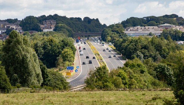
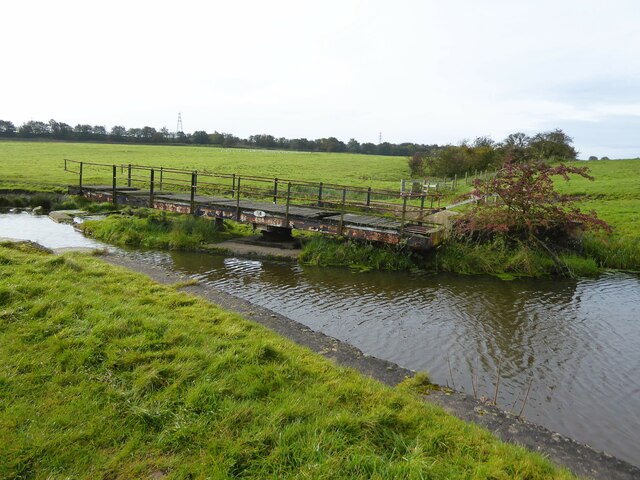
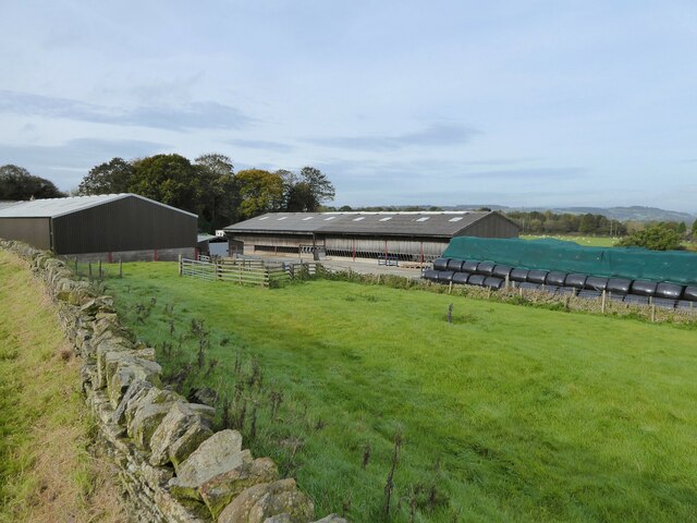
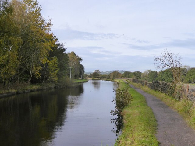
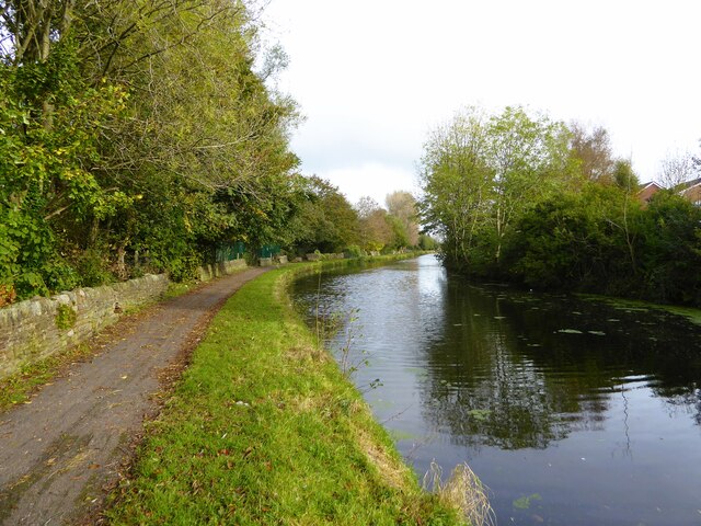
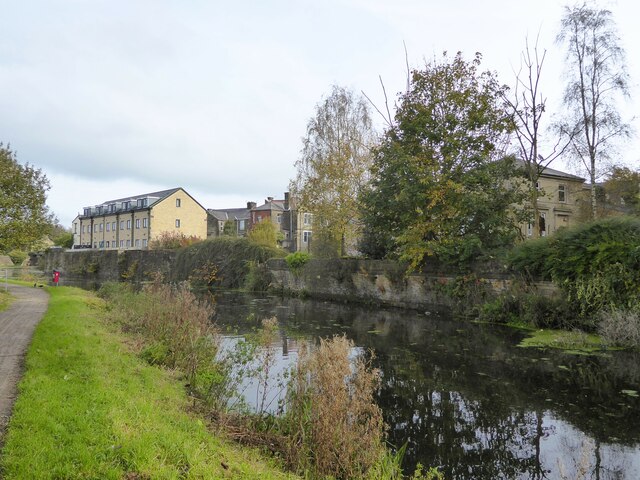
Laneside is a small village located in the county of Lancashire, in the northwest region of England. Situated in the picturesque Rossendale Valley, it is surrounded by rolling hills and lush green countryside, offering residents and visitors a tranquil and scenic environment.

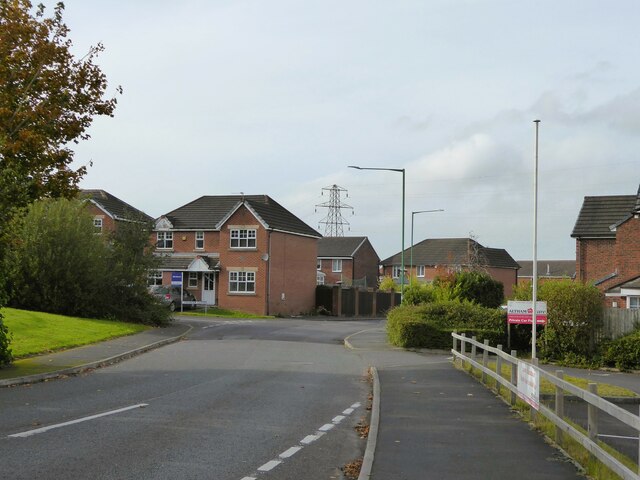
The village of Laneside is home to a close-knit community, with a population of approximately 500 residents. It boasts a peaceful and friendly atmosphere, making it an ideal place to live for those seeking a quieter lifestyle away from the hustle and bustle of larger towns and cities.

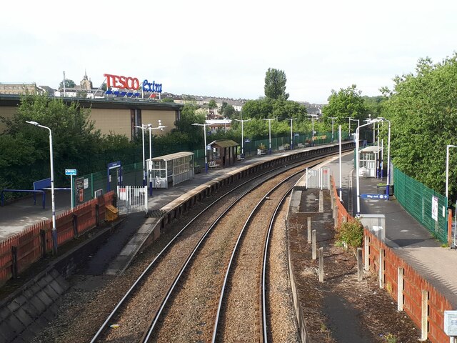
Despite its small size, Laneside offers a range of amenities to cater to the needs of its residents. These include a local convenience store, a post office, and a village pub, providing essential services and a sense of community. The village also benefits from being in close proximity to larger towns, such as Rawtenstall and Bacup, where additional amenities, shops, and leisure facilities can be found.

For outdoor enthusiasts, Laneside is a gateway to an abundance of natural beauty. The surrounding countryside offers numerous walking and hiking trails, allowing residents to explore the stunning landscapes and enjoy the fresh air. Additionally, the village is conveniently located near the popular ski resort of Ski Rossendale, providing ample opportunities for winter sports enthusiasts.

In conclusion, Laneside is a charming village nestled in the heart of Lancashire's Rossendale Valley. With its idyllic surroundings, friendly community, and access to both essential amenities and outdoor activities, it is a delightful place to call home or to visit for a peaceful retreat.

If you have any feedback on the listing, please let us know in the comments section below.
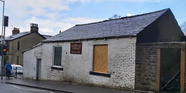
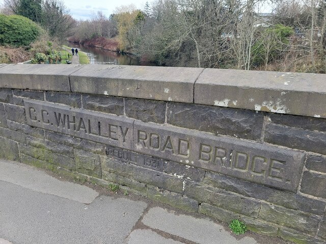
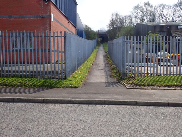
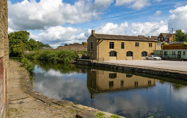
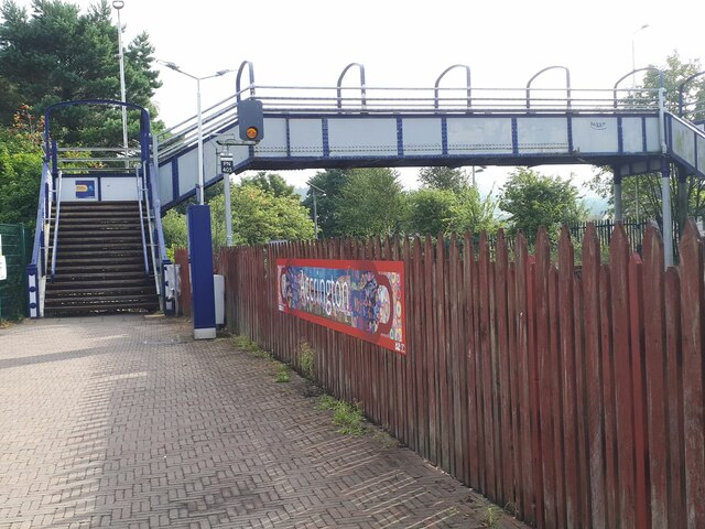
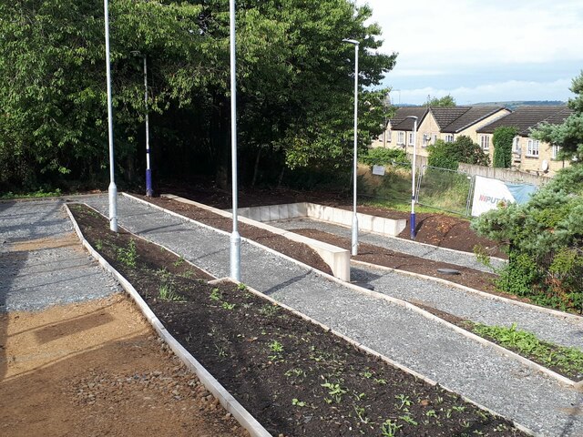
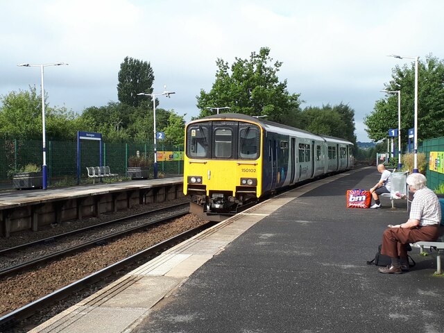
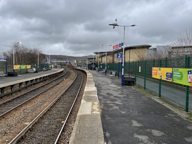
Laneside Images

Images are sourced within 2km of 53.763303/-2.3676514 or Grid Reference SD7529. Thanks to Geograph Open Source API. All images are credited.

Empress Garage
Empress Garage
Old Bridge Marker on the A680 Whalley Road Bridge Marker inscribed on two stones in the parapet of Whalley Road Bridge, Leeds and Liverpool Canal, on the east side of the A680 Whalley Road. In Clayton le Moors parish until 1974 when it was abolished.

Milestone Society National ID: LA_CLAYLM01br
Old Bridge Marker on the A680 Whalley Road
Bridge Marker inscribed on two stones in the parapet of Whalley Road Bridge, Leeds and Liverpool Canal, on the east side of the A680 Whalley Road. In Clayton le Moors parish until 1974 when it was abolished. Milestone Society National ID: LA_CLAYLM01br
Footpath from Newhouse Road Entrance for the footpath leading from Newhouse Road on Huncoat Industrial estate.
Footpath from Newhouse Road
Entrance for the footpath leading from Newhouse Road on Huncoat Industrial estate.
Leeds & Liverpool Canal The Leeds & Liverpool Canal at Enfield.
Leeds & Liverpool Canal
The Leeds & Liverpool Canal at Enfield.
M65 The M65 Motorway seen from the Leeds & Liverpool Canal.
M65
The M65 Motorway seen from the Leeds & Liverpool Canal.
Derelict swing bridge No.116 On the Leeds and Liverpool Canal at Lower Clough Bank, this bridge referred to as Smiths swing bridge, needs at least a new deck.
Derelict swing bridge No.116
On the Leeds and Liverpool Canal at Lower Clough Bank, this bridge referred to as Smiths swing bridge, needs at least a new deck.
Livestock Barn At Moorside Farm with plenty of winter feed adjacent
Livestock Barn
At Moorside Farm with plenty of winter feed adjacent
Leeds and Liverpool Canal Just after passing Pilkington Canal Bridge. The towpath now has competition from an illuminated housing estate path that follows the other bank.
Leeds and Liverpool Canal
Just after passing Pilkington Canal Bridge. The towpath now has competition from an illuminated housing estate path that follows the other bank.
Leeds and Liverpool Canal The towpath is approaching some green security fencing that comes down to the canal from the local school.
Leeds and Liverpool Canal
The towpath is approaching some green security fencing that comes down to the canal from the local school.
Leeds and Liverpool Canal Approaching Whalley Road Bridge with some old mill walling on the bank opposite the towpath
Leeds and Liverpool Canal
Approaching Whalley Road Bridge with some old mill walling on the bank opposite the towpath
Modern housing estate On Bold Venture Way near the boundary with Altham
Modern housing estate
On Bold Venture Way near the boundary with Altham
Accrington station from the footbridge In the days of the Lancashire and Yorkshire Railway, this was a triangular junction station, of which only one pair of curved platforms remains, heading west towards Blackburn and north-east towards Burnley. The southern route no longer exists between here and Stubbins. Tesco Extra is built on the site of the former goods shed and sidings.
Accrington station from the footbridge
In the days of the Lancashire and Yorkshire Railway, this was a triangular junction station, of which only one pair of curved platforms remains, heading west towards Blackburn and north-east towards Burnley. The southern route no longer exists between here and Stubbins. Tesco Extra is built on the site of the former goods shed and sidings.
Accrington station footbridge There are no ticket barriers on this station, so the bridge acts as a general public route for customers of the Tesco Extra that occupies the southern part of the original station site, as well as for rail passengers.
Accrington station footbridge
There are no ticket barriers on this station, so the bridge acts as a general public route for customers of the Tesco Extra that occupies the southern part of the original station site, as well as for rail passengers.
Accrington station access ramp Still in construction, to provide easier access from Paxton Street to the eastbound platform.
Accrington station access ramp
Still in construction, to provide easier access from Paxton Street to the eastbound platform.
Sprinter arriving at Accrington station Unit 150102 calls with the 09.34 all-stations service to Colne.
Sprinter arriving at Accrington station
Unit 150102 calls with the 09.34 all-stations service to Colne.
Infant Street, Accrington – 1971 Although taken with the bus as the main subject, the view is of interest for the inscription on the tall building in the background. This reads “God says: do not drink wine nor strong drink, thou nor thy sons with thee”. The building is shown on older OS maps as 'Hall' and was presumably a Temperance hall. The quotation, from Leviticus, is clearly aimed at total abstinence from alcohol, although the text actually continues “when ye go into the tabernacle of the congregation”, which clearly indicates a more limited abstinence than total. Also of interest is the inscription on the Accrington Provident Co-operative Society building, since demolished.

The bus is Accrington Corporation 26, a Bristol RE with East Lancs bodywork, new in 1968. Rhyddings Street is in neighbouring Oswaldtwistle.

This is one of a series of views featuring buses in the 60s, 70s, and 80s. <a title="https://www.geograph.org.uk/search.php?i=2114547&displayclass=slide" href="https://www.geograph.org.uk/search.php?i=2114547&displayclass=slide">Link</a>
Infant Street, Accrington – 1971
Although taken with the bus as the main subject, the view is of interest for the inscription on the tall building in the background. This reads “God says: do not drink wine nor strong drink, thou nor thy sons with thee”. The building is shown on older OS maps as 'Hall' and was presumably a Temperance hall. The quotation, from Leviticus, is clearly aimed at total abstinence from alcohol, although the text actually continues “when ye go into the tabernacle of the congregation”, which clearly indicates a more limited abstinence than total. Also of interest is the inscription on the Accrington Provident Co-operative Society building, since demolished. The bus is Accrington Corporation 26, a Bristol RE with East Lancs bodywork, new in 1968. Rhyddings Street is in neighbouring Oswaldtwistle. This is one of a series of views featuring buses in the 60s, 70s, and 80s. Link
Accrington railway station, Lancashire Opened in 1848 by the East Lancashire Railway, soon to become part of the Lancashire & Yorkshire Railway, this station was a major junction where the company's Burnley-Blackburn-Liverpool/Preston and Burnley-Bury-Manchester lines diverged. The latter line and platforms closed in 1966.
View north east towards Huncoat and Burnley. In former times there was a bay platform to the immediate right and a large goods shed. Platforms to Bury were in the distance, beyond the footbridge, which used to have a roof. By the 1980s, it had become a very basic station - see <a href="https://www.geograph.org.uk/photo/3204618">SD7528 : Accrington railway station, Lancashire, 1983</a> but has since received a new booking office (2012) and step free ramps from street level (2022).
For more information, see <span class="nowrap"><a title="http://www.disused-stations.org.uk/a/accrington/index.shtml" rel="nofollow ugc noopener" href="http://www.disused-stations.org.uk/a/accrington/index.shtml">Link</a><img style="margin-left:2px;" alt="External link" title="External link - shift click to open in new window" src="https://s1.geograph.org.uk/img/external.png" width="10" height="10"/></span>.
Accrington railway station, Lancashire
Opened in 1848 by the East Lancashire Railway, soon to become part of the Lancashire & Yorkshire Railway, this station was a major junction where the company's Burnley-Blackburn-Liverpool/Preston and Burnley-Bury-Manchester lines diverged. The latter line and platforms closed in 1966. View north east towards Huncoat and Burnley. In former times there was a bay platform to the immediate right and a large goods shed. Platforms to Bury were in the distance, beyond the footbridge, which used to have a roof. By the 1980s, it had become a very basic station - see SD7528 : Accrington railway station, Lancashire, 1983 but has since received a new booking office (2012) and step free ramps from street level (2022). For more information, see LinkExternal link.
The Fan Zone at the Wham Stadium The Wham Stadium is home to Accrington Stanley.
The Fan Zone at the Wham Stadium
The Wham Stadium is home to Accrington Stanley.
Show me another place!

Laneside is located at Grid Ref: SD7529 (Lat: 53.763303, Lng: -2.3676514)

Administrative County: Lancashire

District: Hyndburn

Police Authority: Lancashire

What 3 Words

///branded.latest.remit. Near Clayton le Moors, Lancashire

Related Wikis

Crown Ground

The Crown Ground is a multi-use stadium in Accrington, Lancashire, England. It is currently used mostly for football matches and is the home ground of...

Accrington Academy

Accrington Academy is a mixed 11-18 Academy in Accrington, Lancashire. It has designated specialisms in Sports and Mathematics. It is situated in the centre...

Thorneyholme Road

Thorneyholme Road is a cricket and former football ground in Accrington, England. It is the home ground of Accrington Cricket Club, and was the home ground...

Accrington F.C.

Accrington Football Club was an English football club from Accrington, Lancashire, who were one of the founder members of The Football League. == History... ==

St Christopher's Church of England High School, Accrington

St Christopher's C of E High is a Church of England High School with academy status located north of Accrington in Lancashire, north-west England. The...

Accrington power station

Accrington power station was a coal and refuse fired electricity generating station located in the centre of Accrington, Lancashire. The station supplied...

Accrington brick

Accrington bricks, or Nori, are a type of iron-hard engineering brick, produced in Altham near Accrington, Lancashire, England from 1887 to 2008 and again...

Hyndburn (UK Parliament constituency)

Hyndburn is a constituency in Lancashire represented in the House of Commons of the UK Parliament since 2019 by Sara Britcliffe of the Conservative Party...

Nearby Amenities

Located within 500m of 53.763303,-2.3676514
Traffic Signals
Lat/Long: 53.7598938/-2.3681246
Mini Roundabout
Direction: clockwise
Lat/Long: 53.7625953/-2.3706636
Hospital
Accrington Victoria Hospital
Addr City: Accrington
Addr Postcode: BB5 6AS
Addr Street: Haywood Road
Healthcare: hospital
Wheelchair: yes
Lat/Long: 53.7593834/-2.3668938
Bus Stop
Bus: yes
Naptan AtcoCode: 2500IMG2263
Naptan NaptanCode: langampg
Public Transport: platform
Wheelchair: yes
Lat/Long: 53.7599639/-2.3691495
Bus Stop
Bus: yes
Naptan AtcoCode: 250010040
Naptan NaptanCode: lanadajp
Public Transport: platform
Lat/Long: 53.7590078/-2.3678137
Bus Stop
Bus: yes
Naptan AtcoCode: 2500IMG2264
Naptan NaptanCode: langampj
Public Transport: platform
Lat/Long: 53.7593154/-2.3682965
Bus Stop
Bus: yes
Naptan AtcoCode: 2500IMG2081
Naptan NaptanCode: landwtwj
Public Transport: platform
Lat/Long: 53.7594867/-2.3680256
Turning Circle
Lat/Long: 53.7666122/-2.3690576
Turning Circle
Lat/Long: 53.7668773/-2.3714791
Turning Circle
Lat/Long: 53.7669074/-2.3703192
Turning Circle
Lat/Long: 53.7666888/-2.3691495
Turning Circle
Lat/Long: 53.766861/-2.3716751
Atm
Lat/Long: 53.7616131/-2.3698531
Post Box
Lat/Long: 53.7616543/-2.3698933
Bicycle Parking
Lat/Long: 53.7598103/-2.3692759
Post Box
Post Box Type: pillar
Lat/Long: 53.759894/-2.3652079
Turning Circle
Lat/Long: 53.7669056/-2.3705024
Pub
The Crown Inn
Addr City: Accrington
Addr Postcode: BB5 5DQ
Addr Street: Whalley Road
Opening Hours: Mo-Th 12:00-23:00; Fr-Sa 12:00-00:30; Su 09:00-22:30
Phone: +44 1254381002
Website: https://www.crownaccrington.co.uk/
Lat/Long: 53.7648187/-2.3723343
Pub
The Grey Horse Hotel
Addr City: Accrington
Addr Housenumber: 263
Addr Postcode: BB5 5AD
Addr Street: Whalley Road
Fhrs Id: 817217
Opening Hours: Mo-We 12:00-23:30; Th-Su 12:00-00:00
Phone: +44 1254232133
Lat/Long: 53.7617464/-2.3701042
Crossing
Crossing: traffic_signals
Crossing Ref: pelican
Kerb: lowered
Tactile Paving: yes
Lat/Long: 53.7620051/-2.3701185
Noexit: yes
Lat/Long: 53.7619341/-2.3604883
Noexit: yes
Lat/Long: 53.7630353/-2.3602152
The data included in this document is from www.openstreetmap.org. The data is made available under ODbL.

Have you been to Laneside?

Leave your review of Laneside below (or comments, questions and feedback).