Lamberton Shiels

Settlement in Berwickshire

Scotland

Lamberton Shiels

Ross Point I don't know if this qualifies as a geograph (this is my first posting) as it is actually taken in NT9561 looking into NT9660. However it shows the landscape features of the coastline that wouldn't really be visible from within NT9660 itself. 
The photo shows the hard coastal cliffs, vegetated sometimes down to sea level and backed by arable fields baked in the summer sun. 
In the foreground part of the small fishing settlement of Burnmouth can be seen. Several of the sea front houses are painted in different pastel shades.
Ross Point Credit: Colin Stewart

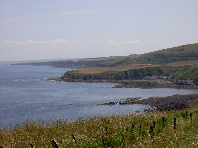
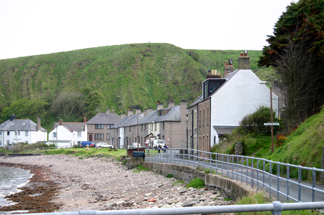
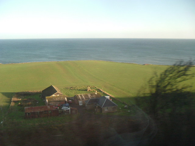
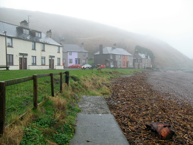
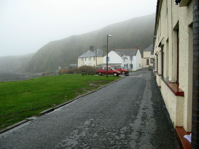
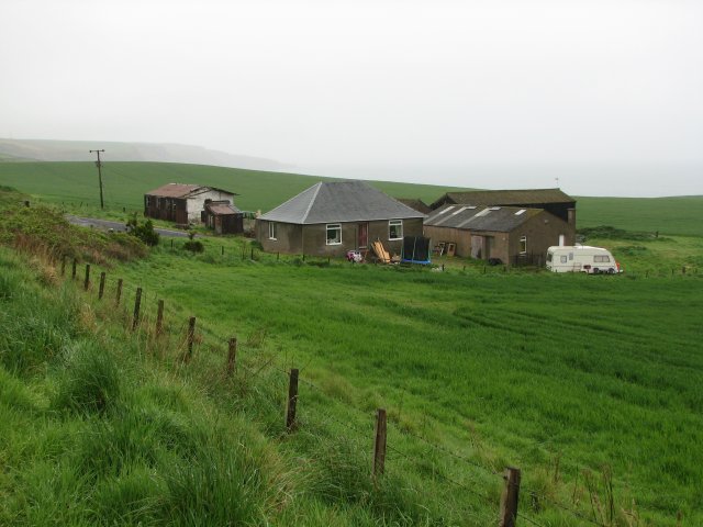
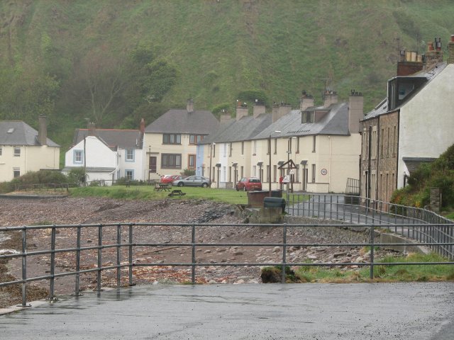
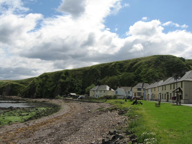
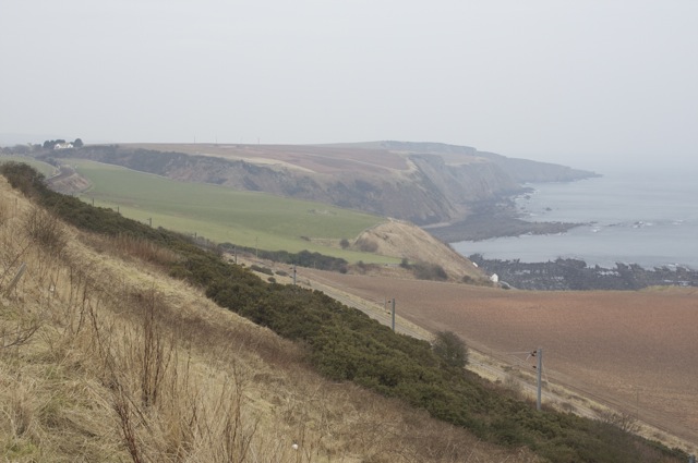
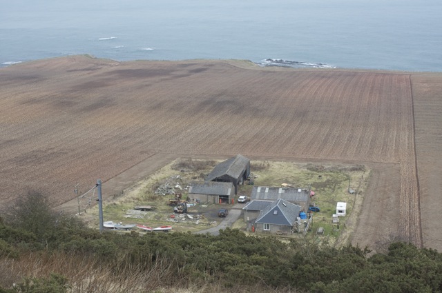
Lamberton Shiels is a small village located in the Scottish Borders region of Berwickshire. Situated near the border with England, the village is known for its picturesque countryside and historic landmarks.

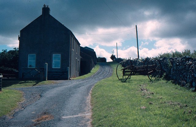
The village is home to a small population of residents who enjoy a peaceful and rural way of life. The surrounding area is characterized by rolling hills, farmland, and meandering streams, making it an ideal location for outdoor activities such as hiking, cycling, and fishing.

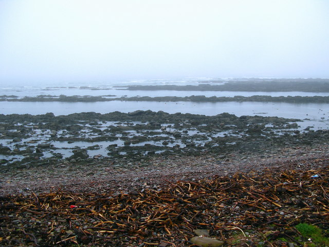
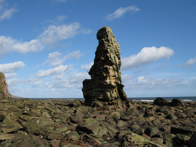
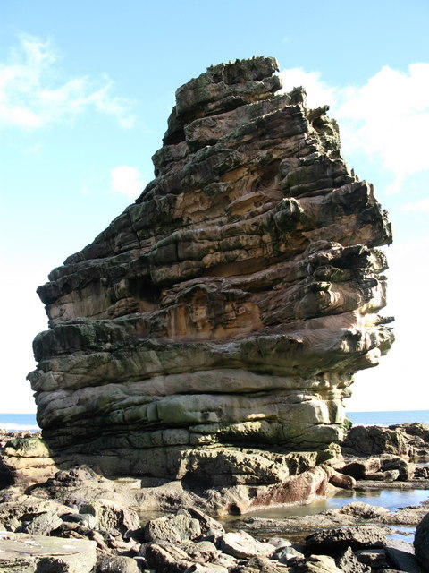
Lamberton Shiels is also known for its proximity to the North Sea coast, with picturesque beaches and cliffs just a short drive away. The village itself has a few local amenities, including a village hall, post office, and a small number of shops and businesses.

Overall, Lamberton Shiels offers a tranquil and idyllic setting for those looking to escape the hustle and bustle of city life and enjoy the beauty of the Scottish countryside.

If you have any feedback on the listing, please let us know in the comments section below.

Lamberton Shiels Images

Images are sourced within 2km of 55.823003/-2.0584222 or Grid Reference NT9658. Thanks to Geograph Open Source API. All images are credited.

Ross Point I don't know if this qualifies as a geograph (this is my first posting) as it is actually taken in NT9561 looking into NT9660. However it shows the landscape features of the coastline that wouldn't really be visible from within NT9660 itself. 
The photo shows the hard coastal cliffs, vegetated sometimes down to sea level and backed by arable fields baked in the summer sun. 
In the foreground part of the small fishing settlement of Burnmouth can be seen. Several of the sea front houses are painted in different pastel shades.
Ross Point
I don't know if this qualifies as a geograph (this is my first posting) as it is actually taken in NT9561 looking into NT9660. However it shows the landscape features of the coastline that wouldn't really be visible from within NT9660 itself. The photo shows the hard coastal cliffs, vegetated sometimes down to sea level and backed by arable fields baked in the summer sun. In the foreground part of the small fishing settlement of Burnmouth can be seen. Several of the sea front houses are painted in different pastel shades.
Cowdrait The short coast road at the bottom of Burnmouth hill leading to the isolated village.
Cowdrait
The short coast road at the bottom of Burnmouth hill leading to the isolated village.
Lamberton Holdings By the railway, near Ross Point.
Lamberton Holdings
By the railway, near Ross Point.
Cowdrait, Burnmouth Rocks of Ross Point visible from the shore at the small seaside hamlet of Cowdrait.
Cowdrait, Burnmouth
Rocks of Ross Point visible from the shore at the small seaside hamlet of Cowdrait.
Misty Afternoon at Cowdrait, Burnmouth Lower Burnmouth is split into four small communities, Lower Burnmouth, Partanhall, Cowdrait and Ross. Lower Burnmouth sits beside the harbour and Partanhall is located to the north. Cowdrait is located to the south of the harbour. And the tiny community of Ross is located just south of Cowdrait. This is a view from the seaweed clad beachfront towards Cowdrait.
Misty Afternoon at Cowdrait, Burnmouth
Lower Burnmouth is split into four small communities, Lower Burnmouth, Partanhall, Cowdrait and Ross. Lower Burnmouth sits beside the harbour and Partanhall is located to the north. Cowdrait is located to the south of the harbour. And the tiny community of Ross is located just south of Cowdrait. This is a view from the seaweed clad beachfront towards Cowdrait.
Ross and Cowdrait, Burnmouth Lower Burnmouth is split into four small communities of Lower Burnmouth, Partanhall, Cowdrait and Ross. Lower Burnmouth sits beside the harbour and Partanhall is located to the north. Cowdrait is located to the south of the harbour. This picture is taken from Cowdrait towards the tiny community of Ross Ross now consists of only four houses (those beyond the line of cars) and is considered a separate community, as it lies just across the parish boundary, in the parish of Mordington.
Ross and Cowdrait, Burnmouth
Lower Burnmouth is split into four small communities of Lower Burnmouth, Partanhall, Cowdrait and Ross. Lower Burnmouth sits beside the harbour and Partanhall is located to the north. Cowdrait is located to the south of the harbour. This picture is taken from Cowdrait towards the tiny community of Ross Ross now consists of only four houses (those beyond the line of cars) and is considered a separate community, as it lies just across the parish boundary, in the parish of Mordington.
Beach at Cowdrait Lower Burnmouth is split into the four small communities of Lower Burnmouth, Partanhall, Cowdrait and Ross. Cowdrait is located to the south of the harbour and this is a view out to the beach and rocks exposed at low tide at Cowdrait.
Beach at Cowdrait
Lower Burnmouth is split into the four small communities of Lower Burnmouth, Partanhall, Cowdrait and Ross. Cowdrait is located to the south of the harbour and this is a view out to the beach and rocks exposed at low tide at Cowdrait.
Maiden's Stone, near Ross Point, Burnmouth
Maiden's Stone, near Ross Point
Cowdrait, Burnmouth The small communities of Cowdrait and Ross (the last 4 houses on the left hand side) as seen from the Berwickshire Coastal Path that descends into Cowdrait, through the back gardens. The headland is known as Ross Point.
Cowdrait, Burnmouth
The small communities of Cowdrait and Ross (the last 4 houses on the left hand side) as seen from the Berwickshire Coastal Path that descends into Cowdrait, through the back gardens. The headland is known as Ross Point.
Ross, Burnmouth Lower Burnmouth is split into the four small communities of Lower Burnmouth, Partanhall, Cowdrait and Ross. Lower Burnmouth sits beside the harbour and Partanhall is located to the north. Cowdrait is located to the south of the harbour. This picture is of the tiny community of Ross, consisting now of only four houses. It is considered a separate community, as it lies just across the parish boundary, in the parish of Mordington.
Ross, Burnmouth
Lower Burnmouth is split into the four small communities of Lower Burnmouth, Partanhall, Cowdrait and Ross. Lower Burnmouth sits beside the harbour and Partanhall is located to the north. Cowdrait is located to the south of the harbour. This picture is of the tiny community of Ross, consisting now of only four houses. It is considered a separate community, as it lies just across the parish boundary, in the parish of Mordington.
Lamberton Holdings The access road to the north is not shown on the 1:50000 scale map.
Lamberton Holdings
The access road to the north is not shown on the 1:50000 scale map.
Cowdrait and Ross A cluster of houses with an exposed access road, hugging the coast from Burnmouth.
Cowdrait and Ross
A cluster of houses with an exposed access road, hugging the coast from Burnmouth.
Farmhouse on a narrow asphalt road
Cowdrait These houses command fantastic sea views.
Cowdrait
These houses command fantastic sea views.
T-junction on the A1
East Coast Main Line at Ross The point where the railway line leaves the coast and heads inland at Burnmouth
East Coast Main Line at Ross
The point where the railway line leaves the coast and heads inland at Burnmouth
Lamberton Holdings, Ross The fields surrounding the farm, at 35 to 40 metres above sea level, have been prepared for this year's crop.
Lamberton Holdings, Ross
The fields surrounding the farm, at 35 to 40 metres above sea level, have been prepared for this year's crop.
Show me another place!

Lamberton Shiels is located at Grid Ref: NT9658 (Lat: 55.823003, Lng: -2.0584222)

Unitary Authority: The Scottish Borders

Police Authority: The Lothians and Scottish Borders

What 3 Words

///bombshell.bikes.unzips. Near Eyemouth, Scottish Borders

Nearby Locations

Lamberton Shiels

Related Wikis

Lamberton Skerrs

Lamberton Skerrs is towards the southernmost point on the east coast of Scotland. It was the scene of a building known as the "Smuggler's Bothy" which...

Lamberton, Scottish Borders

Lamberton is a hilly, former landed estate in Berwickshire, Scotland, its eastern boundary being the North Sea. It is 4 miles (6.4 km) north of Berwick...

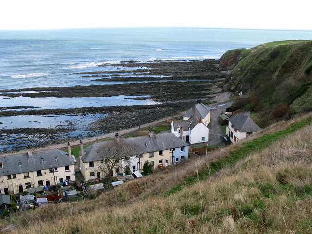
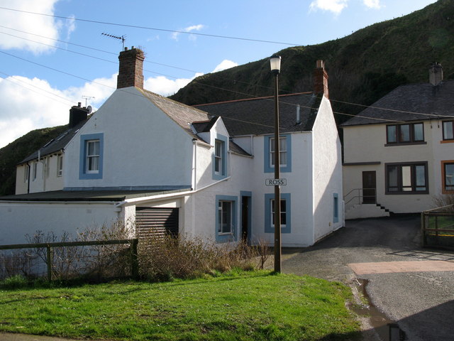
Ross, Scottish Borders

Ross is a hamlet on the coast of the Scottish Borders area of Scotland, south of Burnmouth, in the parish of Ayton, and close to the A1. Ross is one of...

Lamberton Castle

Lamberton Castle was a castle located at Lamberton, in Scottish Borders, Scotland. The castle was a stronghold of the Lindsay family. It was the caput...

Nearby Amenities

Located within 500m of 55.823003,-2.0584222
Lamberton Shields
Place: hamlet
Lat/Long: 55.8231028/-2.058292
Speed Camera
Lat/Long: 55.8254897/-2.0548962
Give Way
Direction: backward
Lat/Long: 55.8268764/-2.0559032
Power: pole
Lat/Long: 55.8188484/-2.0609943
Power: pole
Lat/Long: 55.8227288/-2.060904
Power: pole
Lat/Long: 55.8224366/-2.0617962
Power: pole
Lat/Long: 55.8223629/-2.0620584
Power: pole
Lat/Long: 55.8215827/-2.0617854
Power: pole
Lat/Long: 55.8207385/-2.0614823
Power: pole
Lat/Long: 55.819997/-2.0612974
Power: pole
Lat/Long: 55.8194982/-2.061162
Power: pole
Lat/Long: 55.8236611/-2.0585027
Power: pole
Lat/Long: 55.8242384/-2.0581866
Power: pole
Lat/Long: 55.8248156/-2.0579115
Power: pole
Lat/Long: 55.8253832/-2.0576212
Power: pole
Lat/Long: 55.8259507/-2.0573332
Power: pole
Lat/Long: 55.8262031/-2.05723
Power: pole
Lat/Long: 55.8264519/-2.0570988
Power: pole
Lat/Long: 55.8267018/-2.0568473
Power: pole
Lat/Long: 55.8271293/-2.0564518
Power: pole
Lat/Long: 55.8230132/-2.0620821
Power: pole
Lat/Long: 55.8238851/-2.062512
Power: pole
Lat/Long: 55.8244889/-2.0628173
Power: pole
Lat/Long: 55.8253475/-2.0632688
Power: pole
Lat/Long: 55.826246/-2.0637245
The data included in this document is from www.openstreetmap.org. The data is made available under ODbL.

Have you been to Lamberton Shiels?

Leave your review of Lamberton Shiels below (or comments, questions and feedback).