Lady Balk

Settlement in Yorkshire

England

Lady Balk

Pontefract castle. Steps up to the keep.
Pontefract castle. Credit: steven ruffles

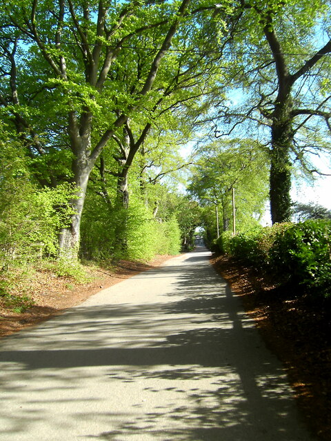
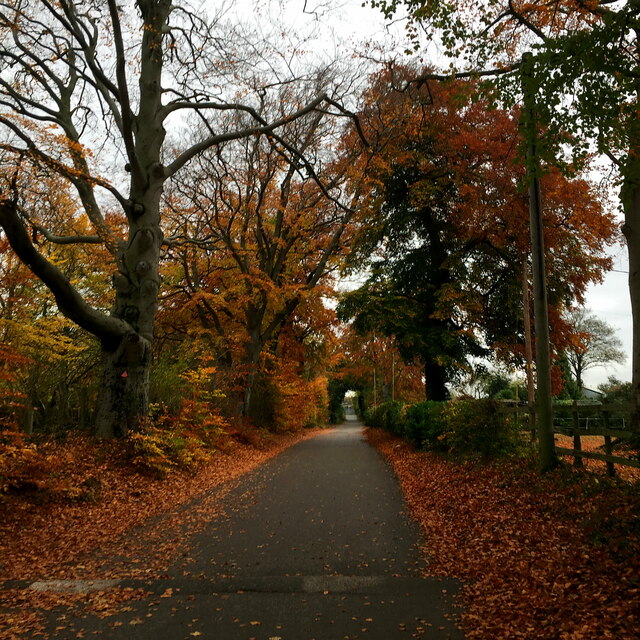
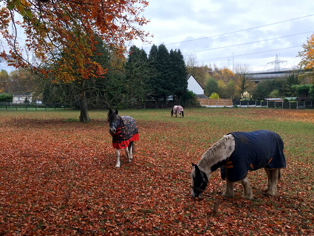
Lady Balk is a small village located in the county of Yorkshire, England. Situated in the picturesque countryside, it lies approximately 5 miles southwest of the town of Selby. The village is surrounded by rolling hills, lush green fields, and beautiful landscapes, making it an idyllic rural destination.

Lady Balk is a close-knit community with a small population. The village primarily consists of charming traditional cottages and houses, giving it a quaint and peaceful atmosphere. The architecture reflects the rich history of the region, with some buildings dating back several centuries.

Despite its small size, Lady Balk offers a range of amenities to its residents. These include a local pub, a village hall, and a primary school, providing essential services and promoting community engagement. The village hall often serves as a venue for various events and gatherings, fostering a strong sense of community spirit.

The surrounding countryside provides ample opportunities for outdoor activities and exploration. Residents and visitors can enjoy picturesque walks along the numerous footpaths that crisscross the fields and woods. The village also benefits from its proximity to the River Ouse, which offers fishing and boating opportunities.

Lady Balk enjoys a peaceful and serene atmosphere, perfect for those seeking a tranquil escape from the hustle and bustle of city life. Its rich history, natural beauty, and strong sense of community make it an appealing destination for both residents and visitors alike.

If you have any feedback on the listing, please let us know in the comments section below.
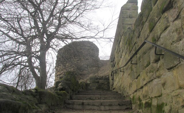
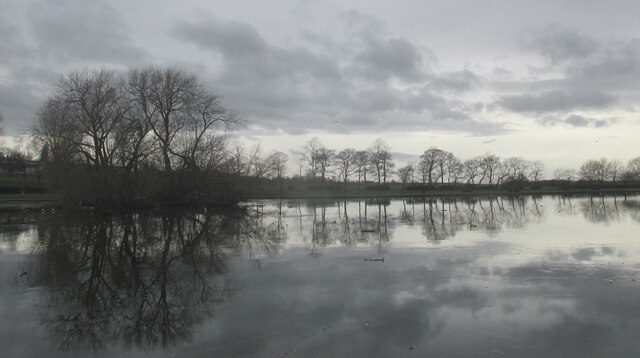
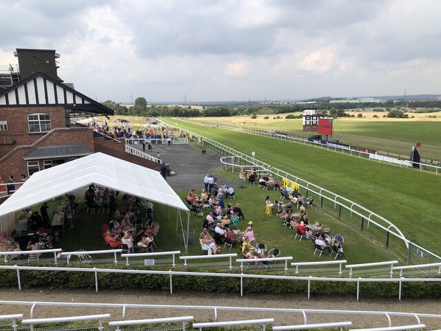
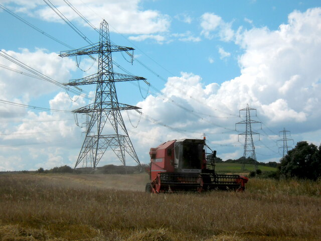
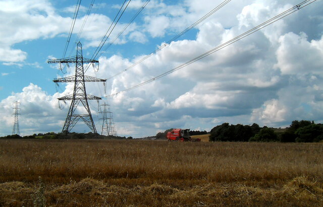
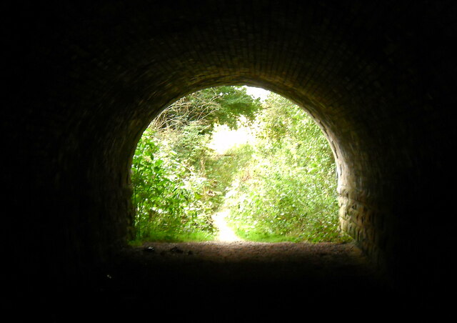
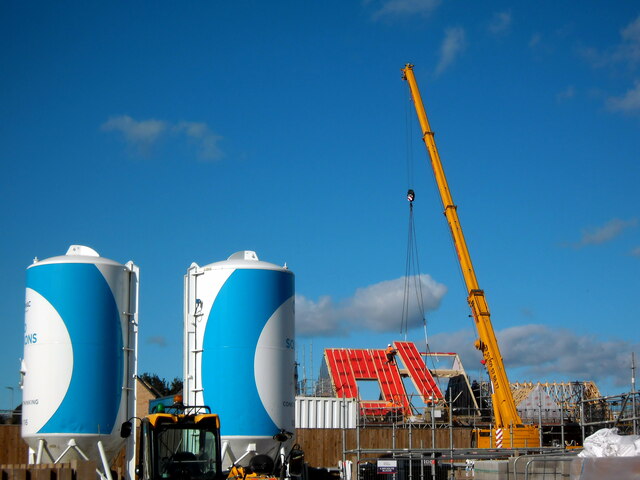
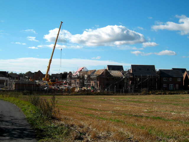
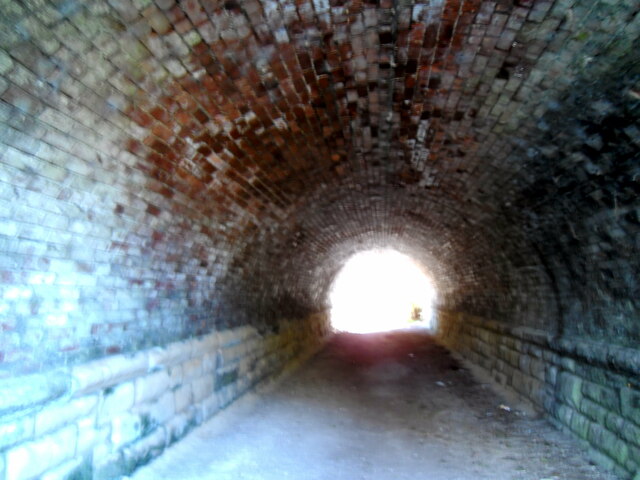
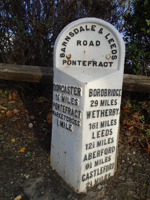
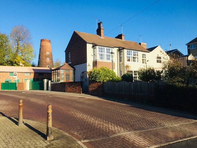
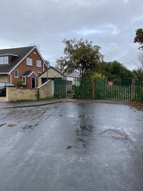
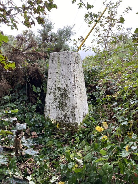
Lady Balk Images

Images are sourced within 2km of 53.702811/-1.3051416 or Grid Reference SE4523. Thanks to Geograph Open Source API. All images are credited.

Pontefract castle. Steps up to the keep.
Pontefract castle.
Steps up to the keep.
Boating lake at Pontefract park. A cold winters afternoon.
Boating lake at Pontefract park.
A cold winters afternoon.
Looking Down the Home Straight View of the grandstand and home straight at Pontefract Racecourse.
Looking Down the Home Straight
View of the grandstand and home straight at Pontefract Racecourse.
Fryston Lane
Fryston Lane
Combining at Holmfield Lane
Harvest Time
Harvest Time
The light at the end of the tunnel
Raising the roof Houses under construction off Sowgate lane Pontefract
Raising the roof
Houses under construction off Sowgate lane Pontefract
New housing at Pontefract
Tunnel under railway lines
Autumn on Fryston Lane
Autumn grazing at Holmfield Farm
Old milestone This West Riding CC milestone is on Park Road north of Pontefract, A639.  It is just north of a roundabout and behind it is a large Retail Park built on the site of the Prince of Wales Colliery. It has the maker's name on the bevel, Brayshaw & Booth, Liversedge.   It is Grade II listed, 1299786 and was last painted in 2010 by two Milestone Society members.
Old milestone
This West Riding CC milestone is on Park Road north of Pontefract, A639. It is just north of a roundabout and behind it is a large Retail Park built on the site of the Prince of Wales Colliery. It has the maker's name on the bevel, Brayshaw & Booth, Liversedge. It is Grade II listed, 1299786 and was last painted in 2010 by two Milestone Society members.
Dandy Mill Pontefract Dis-used old windmill on Water Lane Pontefract
Dandy Mill Pontefract
Dis-used old windmill on Water Lane Pontefract
Start of walk to Holywell Wood Trig Point
Holywell Wood Trig Point Flush Bracket S4200
Holmfield Trig Point Flush Bracket S4239
View from Long Bull Hill Trig Point
Show me another place!

Lady Balk is located at Grid Ref: SE4523 (Lat: 53.702811, Lng: -1.3051416)

Division: West Riding

Unitary Authority: Wakefield

Police Authority: West Yorkshire

What 3 Words

///steer.candy.chips. Near Pontefract, West Yorkshire

Related Wikis

Pontefract Priory

Pontefract Priory was a Cluniac monastery dedicated to St. John the Evangelist, founded about 1090 by Robert de Lacy, 2nd Baron of Pontefract, and located...

Pontefract Monkhill railway station

Pontefract Monkhill railway station is the busiest station in the town of Pontefract, West Yorkshire, England. The station is on the Pontefract Line managed...

Monkhill, West Yorkshire

Monkhill is an area of Pontefract, in the Wakefield district, in the English county of West Yorkshire. It was the site of the former Pontefract Priory...

All Saints' Church, Pontefract

The Church of All Saints in Pontefract, West Yorkshire, England is an active Church of England parish church in the archdeaconry of Pontefract and the...

Nearby Amenities

Located within 500m of 53.702811,-1.3051416
Post Box
Drive Through: no
Operator: Royal Mail
Operator Wikidata: Q638098
Post Box Type: wall
Ref: WF8 6
Royal Cypher: GR
Royal Cypher Wikidata: Q33102273
Lat/Long: 53.7012522/-1.3107135
Bus Stop
Monkhill Lane Lady Balk Lane
Bus: yes
Local Ref: 45013452
Naptan AtcoCode: 450013452
Naptan Bearing: NW
Naptan CommonName: Monkhill Lane Lady Balk Lane
Naptan Crossing: Lady Balk Lane
Naptan Indicator: Stop 45013452
Naptan PlusbusZoneRef: LEEDS
Naptan ShortCommonName: Lady Balk Lane
Naptan Street: Monkhill Lane
Naptan Verified: no
Public Transport: platform
Source: naptan_import
Lat/Long: 53.7023411/-1.3047212
Bus Stop
Monkhill Lane Nestfield Close
Bus: yes
Local Ref: 45013453
Naptan AtcoCode: 450013453
Naptan Bearing: SE
Naptan CommonName: Monkhill Lane Nestfield Close
Naptan Crossing: New Hall Road
Naptan Indicator: Stop 45013453
Naptan PlusbusZoneRef: LEEDS
Naptan ShortCommonName: Lady Balk Lane
Naptan Street: Monkhill Lane
Naptan Verified: no
Public Transport: platform
Source: naptan_import
Lat/Long: 53.7025924/-1.3047539
Bus Stop
Lady Balk Lane Victoria Street
Bus: yes
Local Ref: 45013461
Naptan AtcoCode: 450013461
Naptan Bearing: W
Naptan CommonName: Lady Balk Lane Victoria Street
Naptan Indicator: Stop 45013461
Naptan Landmark: Social Club
Naptan PlusbusZoneRef: LEEDS
Naptan ShortCommonName: Lady Balk Lane
Naptan Street: Lady Balk Lane
Naptan Verified: no
Public Transport: platform
Source: naptan_import
Lat/Long: 53.7014137/-1.3097828
Bus Stop
Monkhill Avenue Monkhill Mount
Bus: yes
Check Date Shelter: 2022-12-18
Local Ref: 45013468
Naptan AtcoCode: 450013468
Naptan Bearing: E
Naptan CommonName: Monkhill Avenue Monkhill Mount
Naptan Crossing: Monkhill Mount
Naptan Indicator: Stop 45013468
Naptan PlusbusZoneRef: LEEDS
Naptan ShortCommonName: Monkhill Mount
Naptan Street: Monkhill Avenue
Public Transport: platform
Shelter: yes
Source: naptan_import
Lat/Long: 53.7000679/-1.3065375
Bus Stop
Monkhill Avenue Monkhill Drive
Bench: no
Bin: no
Bus: yes
Local Ref: 45013470
Naptan AtcoCode: 450013470
Naptan Bearing: E
Naptan CommonName: Monkhill Avenue Monkhill Drive
Naptan Crossing: Monkhill Drive
Naptan Indicator: Stop 45013470
Naptan PlusbusZoneRef: LEEDS
Naptan ShortCommonName: Monkhill Drive
Naptan Street: Monkhill Avenue
Public Transport: platform
Shelter: no
Source: naptan_import
Lat/Long: 53.7004173/-1.304201
Bus Stop
Monkhill Lane Willowdene Lane
Bus: yes
Local Ref: 45024100
Naptan AtcoCode: 450024100
Naptan Bearing: SE
Naptan CommonName: Monkhill Lane Willowdene Lane
Naptan Crossing: Willowdene Lane
Naptan Indicator: Stop 45024100
Naptan PlusbusZoneRef: LEEDS
Naptan ShortCommonName: Willowdene Lane
Naptan Street: Monkhill Lane
Naptan Verified: no
Public Transport: platform
Source: naptan_import
Lat/Long: 53.7048618/-1.3070495
Bus Stop
Monkhill Lane Willowdene Lane
Bus: yes
Naptan AtcoCode: 450028533
Naptan Bearing: NW
Naptan CommonName: Monkhill Lane Willowdene Lane
Naptan Crossing: Willowdene Lane
Naptan Landmark: Unknown
Naptan PlusbusZoneRef: LEEDS
Naptan ShortCommonName: Willowdene Lane
Naptan Street: Monkhill Lane
Naptan Verified: no
Public Transport: platform
Source: naptan_import
Lat/Long: 53.704619/-1.3070232
Bus Stop
Lady Balk Lane Victoria Street
Bus: yes
Naptan AtcoCode: 450029036
Naptan Bearing: E
Naptan CommonName: Lady Balk Lane Victoria Street
Naptan Crossing: Victoria Street
Naptan Landmark: Unknown
Naptan ShortCommonName: Victoria Street
Naptan Street: Lady Balk Lane
Naptan Verified: no
Public Transport: platform
Source: naptan_import
Lat/Long: 53.7014395/-1.3099387
Turning Circle
Lat/Long: 53.7023513/-1.311837
Crossing
Crossing: unmarked
Crossing Island: no
Kerb: lowered
Tactile Paving: yes
Lat/Long: 53.69989/-1.3090437
Turning Circle
Lat/Long: 53.7026395/-1.3111
Crossing
Crossing: unmarked
Crossing Island: no
Kerb: lowered
Tactile Paving: yes
Lat/Long: 53.7003063/-1.3048225
Turning Circle
Lat/Long: 53.7028997/-1.3103971
Turning Circle
Lat/Long: 53.6995761/-1.3039014
Turning Circle
Lat/Long: 53.7035243/-1.3100432
Turning Circle
Lat/Long: 53.7032551/-1.3097309
Crossing
Crossing: unmarked
Crossing Island: no
Kerb: lowered
Tactile Paving: yes
Lat/Long: 53.7003825/-1.3041355
Mini Roundabout
Lat/Long: 53.7030248/-1.3019055
Mini Roundabout
Lat/Long: 53.7031835/-1.3041424
Mini Roundabout
Lat/Long: 53.7029578/-1.299532
Noexit: yes
Lat/Long: 53.7031926/-1.3007756
Turning Circle
Lat/Long: 53.7031775/-1.3049818
Turning Circle
Lat/Long: 53.6999925/-1.3022133
Noexit: yes
Lat/Long: 53.7027823/-1.3085914
Turning Circle
Lat/Long: 53.7040116/-1.2992132
Noexit: yes
Lat/Long: 53.7004839/-1.3076707
Crossing
Crossing: unmarked
Crossing Island: no
Surface: asphalt
Tactile Paving: no
Traffic Calming: hump
Lat/Long: 53.7003091/-1.3109613
Turning Circle
Lat/Long: 53.7025685/-1.2980679
Turning Circle
Lat/Long: 53.7042422/-1.2991468
Noexit: yes
Lat/Long: 53.7030892/-1.3059888
Turning Circle
Lat/Long: 53.7036101/-1.2992206
Noexit: yes
Lat/Long: 53.702162/-1.2982006
Noexit: yes
Lat/Long: 53.7032586/-1.3086209
Barrier: cycle_barrier
Motor Vehicle: no
Lat/Long: 53.704/-1.3110486
Crossing
Lat/Long: 53.7043974/-1.3038971
Turning Circle
Lat/Long: 53.7062037/-1.3057861
Turning Circle
Lat/Long: 53.7060954/-1.3068438
Noexit: yes
Lat/Long: 53.7033649/-1.3034955
Noexit: yes
Lat/Long: 53.7031203/-1.3031602
Noexit: yes
Lat/Long: 53.7025435/-1.3037792
Noexit: yes
Lat/Long: 53.7042524/-1.3046166
Noexit: yes
Lat/Long: 53.7028107/-1.3047212
Noexit: yes
Lat/Long: 53.7025653/-1.3028953
Noexit: yes
Lat/Long: 53.7041603/-1.3047373
Noexit: yes
Lat/Long: 53.7022963/-1.304343
Noexit: yes
Lat/Long: 53.7028869/-1.3009527
Noexit: yes
Lat/Long: 53.7022153/-1.2997484
Noexit: yes
Lat/Long: 53.703341/-1.2997404
Noexit: yes
Lat/Long: 53.7032489/-1.2995768
Noexit: yes
Lat/Long: 53.7005977/-1.3094363
Traffic Calming: hump
Lat/Long: 53.6999762/-1.3093497
Traffic Calming: hump
Lat/Long: 53.7001613/-1.3057568
Noexit: yes
Lat/Long: 53.7010368/-1.3094632
Noexit: yes
Lat/Long: 53.7004015/-1.3007919
Railway: switch
Lat/Long: 53.6990973/-1.3035292
Railway: switch
Lat/Long: 53.699067/-1.3032234
Railway: switch
Lat/Long: 53.7004703/-1.2986748
Railway: switch
Lat/Long: 53.6983755/-1.3056094
Railway: switch
Usage: main
Lat/Long: 53.6983598/-1.3055572
Post Box
Brand: Royal Mail
Brand Wikidata: Q638098
Operator: Royal Mail
Operator Wikidata: Q638098
Post Box Type: lamp
Ref: WF8 15
Lat/Long: 53.7033014/-1.301672
Noexit: yes
Lat/Long: 53.6989612/-1.3024744
Noexit: yes
Lat/Long: 53.6998413/-1.2997869
Noexit: yes
Lat/Long: 53.7052079/-1.3081898
Noexit: yes
Lat/Long: 53.7050817/-1.3080579
Direction: forward
Traffic Calming: table
Lat/Long: 53.6994989/-1.3062482
Traffic Calming: bump
Lat/Long: 53.6987248/-1.3037523
Traffic Calming: bump
Lat/Long: 53.6986026/-1.303631
Noexit: yes
Lat/Long: 53.7034725/-1.3077983
Noexit: yes
Lat/Long: 53.7040139/-1.3080544
Noexit: yes
Lat/Long: 53.7041834/-1.3081134
Noexit: yes
Lat/Long: 53.7034392/-1.3080316
Slimming World
Addr City: Pontefract
Addr Housenumber: 10
Addr Postcode: WF8 2UQ
Addr Street: Hinton Close
Fhrs Id: 1093595
Lat/Long: 53.7034789/-1.303449
Noexit: yes
Lat/Long: 53.7046726/-1.3074041
Pontefract Monkhill
Addr City: Pontefract
Addr Postcode: WF8 1JA
Naptan AtcoCode: 9100PTFTMHL
Network: National Rail
Network Website: https://www.nationalrail.co.uk/stations/pfm/
Network Wikidata: Q26334
Operator: Northern
Operator Website: https://www.northernrailway.co.uk/stations/pontefract-monkhill
Operator Wikidata: Q85789775
Public Transport: station
Railway: station
Ref Crs: PFM
Source: NPE
Train: yes
Wheelchair: no
Wikidata: Q2212501
Wikipedia: en:Pontefract Monkhill railway station
Lat/Long: 53.6988004/-1.3041376
Pontefract West Junction
Railway: junction
Lat/Long: 53.6983518/-1.3056697
Crossing
Crossing: unmarked
Tactile Paving: no
Lat/Long: 53.7003274/-1.3108083
Crossing
Lat/Long: 53.7013783/-1.3100568
Crossing
Lat/Long: 53.701197/-1.3062961
Crossing
Lat/Long: 53.701297/-1.306736
Noexit: yes
Lat/Long: 53.7019725/-1.3103889
Crossing
Lat/Long: 53.7021437/-1.3046305
Crossing
Lat/Long: 53.7020699/-1.3053726
Barrier: cycle_barrier
Motor Vehicle: no
Lat/Long: 53.7039172/-1.3118498
Generator Method: photovoltaic
Generator Output Electricity: yes
Generator Source: solar
Generator Type: solar_photovoltaic_panel
Power: generator
Lat/Long: 53.7008867/-1.3083935
Generator Method: photovoltaic
Generator Output Electricity: yes
Generator Source: solar
Generator Type: solar_photovoltaic_panel
Power: generator
Lat/Long: 53.7011468/-1.3085256
Generator Method: photovoltaic
Generator Output Electricity: yes
Generator Source: solar
Generator Type: solar_photovoltaic_panel
Power: generator
Lat/Long: 53.700667/-1.3067642
Generator Method: photovoltaic
Generator Output Electricity: yes
Generator Source: solar
Generator Type: solar_photovoltaic_panel
Power: generator
Lat/Long: 53.7006769/-1.3067239
Generator Method: photovoltaic
Generator Output Electricity: yes
Generator Source: solar
Generator Type: solar_photovoltaic_panel
Power: generator
Lat/Long: 53.7007173/-1.3072836
Generator Method: photovoltaic
Generator Output Electricity: yes
Generator Source: solar
Generator Type: solar_photovoltaic_panel
Power: generator
Lat/Long: 53.7007214/-1.3072266
Generator Method: photovoltaic
Generator Output Electricity: yes
Generator Source: solar
Generator Type: solar_photovoltaic_panel
Power: generator
Lat/Long: 53.7008885/-1.3071833
Generator Method: photovoltaic
Generator Output Electricity: yes
Generator Source: solar
Generator Type: solar_photovoltaic_panel
Power: generator
Lat/Long: 53.7009588/-1.3066477
Generator Method: photovoltaic
Generator Output Electricity: yes
Generator Source: solar
Generator Type: solar_photovoltaic_panel
Power: generator
Lat/Long: 53.7016623/-1.3067277
Generator Method: photovoltaic
Generator Output Electricity: yes
Generator Source: solar
Generator Type: solar_photovoltaic_panel
Power: generator
Lat/Long: 53.7017162/-1.3063241
Generator Method: photovoltaic
Generator Output Electricity: yes
Generator Source: solar
Generator Type: solar_photovoltaic_panel
Power: generator
Lat/Long: 53.7014373/-1.3083343
Generator Method: photovoltaic
Generator Output Electricity: yes
Generator Source: solar
Generator Type: solar_photovoltaic_panel
Power: generator
Lat/Long: 53.7014009/-1.3086093
Generator Method: photovoltaic
Generator Output Electricity: yes
Generator Source: solar
Generator Type: solar_photovoltaic_panel
Power: generator
Lat/Long: 53.7013857/-1.308727
Barrier: bollard
Bollard: fixed
Colour: Grey/white
Material: concrete
Lat/Long: 53.7013165/-1.3103727
Barrier: bollard
Bollard: fixed
Colour: Grey/white
Material: concrete
Lat/Long: 53.7013189/-1.3103552
Barrier: bollard
Bollard: fixed
Colour: Grey/white
Material: concrete
Lat/Long: 53.7013216/-1.3103362
Barrier: bollard
Bollard: fixed
Colour: Grey/white
Material: concrete
Lat/Long: 53.7013241/-1.3103178
Barrier: bollard
Bollard: fixed
Colour: Grey/white
Material: concrete
Lat/Long: 53.7013268/-1.3102989
Barrier: bollard
Bollard: fixed
Colour: Grey/white
Material: concrete
Lat/Long: 53.70133/-1.3102763
Barrier: bollard
Bollard: fixed
Colour: Grey/white
Material: concrete
Lat/Long: 53.7013331/-1.3102541
Barrier: bollard
Bollard: fixed
Colour: Grey/white
Material: concrete
Lat/Long: 53.7013353/-1.3102378
Barrier: bollard
Bollard: fixed
Colour: Grey/white
Material: concrete
Lat/Long: 53.7013373/-1.3102229
Barrier: bollard
Bollard: fixed
Colour: Grey/white
Material: concrete
Lat/Long: 53.7013425/-1.3101866
Barrier: bollard
Bollard: fixed
Colour: Grey/white
Material: concrete
Lat/Long: 53.7013468/-1.3101552
Barrier: bollard
Bollard: fixed
Colour: Grey/white
Material: concrete
Lat/Long: 53.7013406/-1.3101995
Barrier: bollard
Bollard: fixed
Colour: Grey/white
Material: concrete
Lat/Long: 53.7013441/-1.3101746
Barrier: bollard
Bollard: fixed
Colour: Grey/white
Material: concrete
Lat/Long: 53.7013756/-1.3100002
Barrier: bollard
Bollard: fixed
Colour: Grey/white
Material: concrete
Lat/Long: 53.7013785/-1.3099785
Barrier: bollard
Bollard: fixed
Colour: Grey/white
Material: concrete
Lat/Long: 53.7013811/-1.3099588
Barrier: bollard
Bollard: fixed
Colour: Grey/white
Material: concrete
Lat/Long: 53.7013832/-1.3099434
Barrier: bollard
Bollard: fixed
Colour: Grey/white
Material: concrete
Lat/Long: 53.7013848/-1.3099311
Barrier: bollard
Bollard: fixed
Colour: Grey/white
Material: concrete
Lat/Long: 53.7013881/-1.3099066
Generator Method: photovoltaic
Generator Output Electricity: yes
Generator Source: solar
Generator Type: solar_photovoltaic_panel
Power: generator
Lat/Long: 53.7019783/-1.3046649
Generator Method: photovoltaic
Generator Output Electricity: yes
Generator Source: solar
Generator Type: solar_photovoltaic_panel
Power: generator
Lat/Long: 53.7018876/-1.3049214
Generator Method: photovoltaic
Generator Output Electricity: yes
Generator Source: solar
Generator Type: solar_photovoltaic_panel
Power: generator
Lat/Long: 53.6991937/-1.309187
Crossing
Lat/Long: 53.701/-1.3075527
Crossing
Lat/Long: 53.7010697/-1.3075647
Noexit: yes
Lat/Long: 53.7008607/-1.3026047
Crossing
Crossing: unmarked
Crossing Island: no
Tactile Paving: yes
Lat/Long: 53.7009292/-1.3120049
Crossing
Lat/Long: 53.701738/-1.3122727
Crossing
Lat/Long: 53.7028006/-1.312296
Crossing
Lat/Long: 53.7008571/-1.3050157
Crossing
Lat/Long: 53.7013886/-1.3053545
Crossing
Lat/Long: 53.7040455/-1.3099188
Crossing
Lat/Long: 53.7037856/-1.3110303
Crossing
Lat/Long: 53.7037063/-1.3118302
Crossing
Lat/Long: 53.7031862/-1.3118271
Crossing
Lat/Long: 53.7028345/-1.3124726
Crossing
Lat/Long: 53.7014545/-1.3103283
Traffic Calming: bump
Lat/Long: 53.6988235/-1.3034104
Traffic Calming: bump
Lat/Long: 53.6987474/-1.3032691
Camera Type: fixed
Man Made: surveillance
Surveillance Type: camera
Lat/Long: 53.6986683/-1.3037697
Turning Circle
Lat/Long: 53.6999478/-1.3025333
Generator Method: photovoltaic
Generator Output Electricity: yes
Generator Source: solar
Generator Type: solar_photovoltaic_panel
Power: generator
Lat/Long: 53.7000658/-1.3015567
Noexit: yes
Lat/Long: 53.7030906/-1.3037848
Noexit: yes
Lat/Long: 53.6991372/-1.3017684
Crossing
Lat/Long: 53.6997695/-1.2997271
Crossing
Lat/Long: 53.6993529/-1.3007999
Crossing
Lat/Long: 53.699068/-1.3015654
Crossing
Crossing: unmarked
Crossing Island: no
Tactile Paving: yes
Lat/Long: 53.6992399/-1.3010421
Crossing
Crossing: unmarked
Crossing Island: no
Tactile Paving: yes
Lat/Long: 53.6991967/-1.3013603
Noexit: yes
Lat/Long: 53.6986602/-1.3022934
Crossing
Lat/Long: 53.6988883/-1.3032007
Barrier: cycle_barrier
Motor Vehicle: no
Lat/Long: 53.7037493/-1.3119141
Barrier: bollard
Lat/Long: 53.703672/-1.3118682
Barrier: bollard
Lat/Long: 53.7036503/-1.3118451
Barrier: bollard
Lat/Long: 53.7036264/-1.3118528
Barrier: bollard
Lat/Long: 53.7036038/-1.3118675
Barrier: bollard
Lat/Long: 53.70363/-1.3116813
Barrier: bollard
Lat/Long: 53.7036131/-1.3117119
Barrier: bollard
Lat/Long: 53.7035896/-1.3117281
Barrier: bollard
Lat/Long: 53.7035714/-1.311735
Barrier: bollard
Lat/Long: 53.7027297/-1.312707
Barrier: bollard
Lat/Long: 53.7027472/-1.312672
Barrier: bollard
Lat/Long: 53.7027718/-1.3126456
Barrier: bollard
Lat/Long: 53.7038511/-1.3110128
Barrier: bollard
Lat/Long: 53.7038795/-1.3109929
Barrier: bollard
Lat/Long: 53.703893/-1.3109542
Crossing
Lat/Long: 53.7027017/-1.3125819
Post Office
Ladybalk Post Office
Addr City: Pontefract
Addr Postcode: WF8 1JQ
Addr Street: Lady Balk Lane
Brand: Post Office
Brand Wikidata: Q1783168
Brand Wikipedia: en:Post Office Ltd
Contact Website: https://www.postoffice.co.uk/branch-finder/5653231/ladybalk
Opening Hours: Mo-Fr 08:30-17:30; Sa 08:30-13:00
Operator: Post Office
Operator Wikidata: Q1783168
Ref Pol Id: 15760
Lat/Long: 53.7012314/-1.3106685
Turning Circle
Lat/Long: 53.7062265/-1.3061407
Turning Circle
Lat/Long: 53.7060165/-1.3072481
Noexit: yes
Lat/Long: 53.7018109/-1.31082
Noexit: yes
Lat/Long: 53.7012856/-1.3040317
Noexit: yes
Lat/Long: 53.7019056/-1.3045246
Crossing
Lat/Long: 53.7020502/-1.3050172
Noexit: yes
Lat/Long: 53.7019783/-1.3051614
Noexit: yes
Lat/Long: 53.7020467/-1.3047383
Noexit: yes
Lat/Long: 53.7008835/-1.3041467
Noexit: yes
Lat/Long: 53.7011655/-1.3042494
Noexit: yes
Lat/Long: 53.7011926/-1.309046
Noexit: yes
Lat/Long: 53.7007868/-1.3088933
Noexit: yes
Lat/Long: 53.7003832/-1.3093897
Noexit: yes
Lat/Long: 53.7007855/-1.3069653
Noexit: yes
Lat/Long: 53.7006545/-1.3064899
Noexit: yes
Lat/Long: 53.7007706/-1.3056589
Noexit: yes
Lat/Long: 53.7007727/-1.3055704
Noexit: yes
Lat/Long: 53.7002381/-1.3015569
Noexit: yes
Lat/Long: 53.7000613/-1.3012563
Noexit: yes
Lat/Long: 53.7010413/-1.2998668
Noexit: yes
Lat/Long: 53.7011965/-1.2996324
Noexit: yes
Lat/Long: 53.7034457/-1.2993009
Noexit: yes
Lat/Long: 53.7049807/-1.3031218
Noexit: yes
Lat/Long: 53.7036255/-1.3058083
Noexit: yes
Lat/Long: 53.7029379/-1.3119009
Noexit: yes
Lat/Long: 53.703074/-1.3114353
Noexit: yes
Lat/Long: 53.7034147/-1.3111763
Noexit: yes
Lat/Long: 53.7030873/-1.3108738
Noexit: yes
Lat/Long: 53.7032692/-1.3092752
Noexit: yes
Lat/Long: 53.7038152/-1.3070005
Noexit: yes
Lat/Long: 53.7038226/-1.3071783
Noexit: yes
Lat/Long: 53.7037405/-1.3071685
Noexit: yes
Lat/Long: 53.7033706/-1.3068932
Noexit: yes
Lat/Long: 53.7015729/-1.3064496
Noexit: yes
Lat/Long: 53.7025835/-1.3034916
Noexit: yes
Lat/Long: 53.7027844/-1.301153
Noexit: yes
Lat/Long: 53.7029535/-1.3003599
Noexit: yes
Lat/Long: 53.7030271/-1.3000358
Noexit: yes
Lat/Long: 53.704482/-1.3033934
Barrier: cycle_barrier
Cycle Barrier: double
Cycle Barrier Installation: fixed
Lat/Long: 53.7007766/-1.3104973
Direction: both
Traffic Calming: hump
Lat/Long: 53.7019404/-1.306066
Direction: both
Traffic Calming: hump
Lat/Long: 53.7015838/-1.3087402
Crossing
Crossing: uncontrolled
Crossing Island: no
Crossing Markings: zebra;dots
Crossing Ref: zebra
Tactile Paving: yes
Lat/Long: 53.7012246/-1.3110954
Noexit: yes
Lat/Long: 53.7031997/-1.3021403
Noexit: yes
Lat/Long: 53.6998857/-1.3031643
Railway: level_crossing
Lat/Long: 53.6993049/-1.3022533
Railway: level_crossing
Lat/Long: 53.6993421/-1.3022777
Railway: level_crossing
Lat/Long: 53.6993729/-1.3023026
Parcel Locker
Amazon Hub Locker
Brand: Amazon Hub
Brand Wikidata: Q16974764
Brand Wikipedia: en:Amazon (company)
Operator: Amazon
Lat/Long: 53.6987151/-1.3042206
Recycling
Recycling Clothes: yes
Recycling Type: container
Lat/Long: 53.7013619/-1.3098801
Noexit: yes
Lat/Long: 53.6987972/-1.3043418
Noexit: yes
Lat/Long: 53.6991146/-1.3032535
Noexit: yes
Lat/Long: 53.6985863/-1.3046974
Crossing
Lat/Long: 53.6986631/-1.3038119
Crossing
Lat/Long: 53.6986392/-1.3034801
Crossing
Lat/Long: 53.6988621/-1.3032791
Crossing
Crossing: uncontrolled
Crossing Island: no
Crossing Markings: surface
Surface: paving_stones
Traffic Calming: table
Lat/Long: 53.7029961/-1.3124571
Crossing
Crossing: uncontrolled
Crossing Island: no
Crossing Markings: surface
Surface: paving_stones
Traffic Calming: table
Lat/Long: 53.7040057/-1.3104001
Noexit: yes
Lat/Long: 53.7041957/-1.3097638
Turning Circle
Lat/Long: 53.7035596/-1.30958
Noexit: yes
Lat/Long: 53.7034546/-1.3103
Crossing
Crossing: unmarked
Crossing Island: no
Tactile Paving: yes
Lat/Long: 53.7010999/-1.3119051
Give Way
Direction: backward
Lat/Long: 53.7010206/-1.3118286
Crossing
Crossing: unmarked
Crossing Island: no
Tactile Paving: yes
Lat/Long: 53.700897/-1.31167
Bus Stop
Monkhill Avenue Monkhill Drive
Bench: no
Bin: no
Bus: yes
Local Ref: 45013469
Naptan AtcoCode: 450013469
Naptan Bearing: W
Naptan CommonName: Monkhill Avenue Monkhill Drive
Naptan Crossing: Monkhill Drive
Naptan Indicator: Stop 45013469
Naptan PlusbusZoneRef: LEEDS
Naptan ShortCommonName: Monkhill Drive
Naptan Street: Monkhill Avenue
Public Transport: platform
Shelter: no
Source: naptan_import
Lat/Long: 53.7002747/-1.304787
Bus Stop
Monkhill Avenue Monkhill Mount
Bench: yes
Bin: no
Bus: yes
Local Ref: 45013467
Naptan AtcoCode: 450013467
Naptan Bearing: W
Naptan CommonName: Monkhill Avenue Monkhill Mount
Naptan Indicator: Stop 45013467
Naptan PlusbusZoneRef: LEEDS
Naptan ShortCommonName: Monkhill Drive
Naptan Street: Monkhill Avenue
Public Transport: platform
Shelter: yes
Source: naptan_import
Lat/Long: 53.6999479/-1.3069605
Bus Stop
Monkhill Avenue Skinner Lane
Bench: no
Bin: no
Bus: yes
Local Ref: 45013466
Naptan AtcoCode: 450013466
Naptan Bearing: S
Naptan CommonName: Monkhill Avenue Skinner Lane
Naptan Crossing: Skinner Lane
Naptan Indicator: Stop 45013466
Naptan PlusbusZoneRef: LEEDS
Naptan ShortCommonName: Skinner Lane
Naptan Street: Monkhill Avenue
Public Transport: platform
Shelter: no
Source: naptan_import
Lat/Long: 53.7003044/-1.3103987
Bus Stop
Monkhill Avenue Skinner Lane
Bench: no
Bin: no
Bus: yes
Naptan AtcoCode: 450028953
Naptan Bearing: W
Naptan CommonName: Monkhill Avenue Skinner Lane
Naptan Crossing: Skinner Lane
Naptan Landmark: Unknown
Naptan ShortCommonName: Monk Av Skinner Ln
Naptan Street: Monkhill Avenue
Naptan Verified: no
Public Transport: platform
Shelter: no
Source: naptan_import
Lat/Long: 53.7002286/-1.3105981
Bench
Backrest: yes
Material: metal
Seats: 4
Lat/Long: 53.6995876/-1.306518
Bench
Backrest: yes
Material: metal
Seats: 4
Lat/Long: 53.6996038/-1.3064889
Bench
Backrest: yes
Material: metal
Seats: 4
Lat/Long: 53.6998328/-1.3065864
Crossing
Crossing: unmarked
Traffic Calming: table
Lat/Long: 53.6994936/-1.3063002
Direction: backward
Traffic Calming: table
Lat/Long: 53.6994816/-1.306386
Waste Basket
Material: metal
Operator: Wakefield Council
Lat/Long: 53.6995432/-1.3063135
Waste Basket
Material: metal
Operator: Wakefield Council
Lat/Long: 53.699945/-1.3066551
Street Lamp
Direction: -10
Lamp Mount: pole
Lamp Type: led
Ref: 3
Lat/Long: 53.7000705/-1.3067157
Crossing
Crossing: unmarked
Crossing Island: no
Lat/Long: 53.6993793/-1.3088454
Crossing
Crossing: unmarked
Crossing Island: no
Kerb: lowered
Tactile Paving: yes
Lat/Long: 53.6997479/-1.3088461
Give Way
Direction: forward
Lat/Long: 53.700545/-1.3036175
Give Way
Direction: forward
Lat/Long: 53.7002955/-1.3035358
Crossing
Crossing: unmarked
Crossing Island: separate
Kerb: lowered
Tactile Paving: yes
Lat/Long: 53.7003637/-1.3037323
Crossing
Crossing: unmarked
Crossing Island: separate
Kerb: lowered
Tactile Paving: yes
Lat/Long: 53.7004643/-1.3037682
Crossing
Crossing: unmarked
Lat/Long: 53.7000914/-1.3064005
Crossing
Crossing: unmarked
Crossing Island: no
Tactile Paving: no
Lat/Long: 53.7000122/-1.3070367
Recycling
Recycling Clothes: yes
Recycling Type: container
Lat/Long: 53.7013433/-1.3098771
Crossing
Lat/Long: 53.7018677/-1.3056571
Crossing
Lat/Long: 53.7016538/-1.3075253
Crossing
Crossing: unmarked
Crossing Island: no
Kerb: lowered
Tactile Paving: yes
Lat/Long: 53.699947/-1.3088478
Crossing
Lat/Long: 53.7004031/-1.3090831
Crossing
Lat/Long: 53.7013687/-1.3092111
Crossing
Lat/Long: 53.7013221/-1.3109611
Crossing
Lat/Long: 53.70103/-1.3078836
Crossing
Lat/Long: 53.7007962/-1.3076015
Crossing
Lat/Long: 53.704174/-1.3098611
Give Way
Direction: backward
Lat/Long: 53.7009796/-1.3117621
Parcel Locker
Brand: Locker InPost
Brand Wikidata: Q3182097
Operator: InPost
Parcel Mail In: yes
Lat/Long: 53.6987078/-1.3042619
Noexit: yes
Lat/Long: 53.7019756/-1.30086
Noexit: yes
Lat/Long: 53.7027493/-1.3010078
Tactile Paving: yes
Lat/Long: 53.7012059/-1.3110792
Tactile Paving: yes
Lat/Long: 53.7012434/-1.3111116
Crossing
Crossing: unmarked
Crossing Island: no
Tactile Paving: yes
Lat/Long: 53.7010719/-1.3115742
Tactile Paving: yes
Lat/Long: 53.701049/-1.3115552
Tactile Paving: yes
Lat/Long: 53.7010947/-1.3115931
Tactile Paving: yes
Lat/Long: 53.7011123/-1.311863
Tactile Paving: yes
Lat/Long: 53.7010876/-1.3119472
Tactile Paving: yes
Lat/Long: 53.7008815/-1.3117105
Tactile Paving: yes
Lat/Long: 53.7009135/-1.3116248
Tactile Paving: yes
Lat/Long: 53.7009073/-1.3119859
Tactile Paving: yes
Lat/Long: 53.7009603/-1.3120318
Crossing
Crossing: uncontrolled
Crossing Island: no
Crossing Markings: surface
Surface: paving_stones
Traffic Calming: table
Lat/Long: 53.7034138/-1.3117757
Crossing
Crossing: uncontrolled
Crossing Island: no
Crossing Markings: surface
Surface: paving_stones
Traffic Calming: table
Lat/Long: 53.7037472/-1.3113136
Crossing
Crossing: unmarked
Crossing Island: no
Lat/Long: 53.7028279/-1.3093063
Crossing
Crossing: unmarked
Crossing Island: no
Lat/Long: 53.7025571/-1.3100177
Crossing
Crossing: unmarked
Crossing Island: no
Lat/Long: 53.702285/-1.3107767
Crossing
Crossing: unmarked
Crossing Island: no
Lat/Long: 53.7020255/-1.3115519
Noexit: yes
Lat/Long: 53.7029517/-1.3069164
Direction: backward
Traffic Sign: GB:965
Lat/Long: 53.7009045/-1.3119009
Addr City: Pontefract
Addr Postcode: WF8 1JQ
Ref GB Uprn: 63138961
Lat/Long: 53.7008324/-1.3095764
Give Way
Direction: backward
Lat/Long: 53.699801/-1.3088462
Crossing
Crossing: unmarked
Crossing Island: no
Kerb: lowered
Tactile Paving: yes
Lat/Long: 53.7002109/-1.3044604
Kerb: lowered
Tactile Paving: yes
Lat/Long: 53.7004409/-1.3037626
Kerb: lowered
Tactile Paving: yes
Lat/Long: 53.7004058/-1.3037504
Noexit: yes
Lat/Long: 53.6999634/-1.3037259
The data included in this document is from www.openstreetmap.org. The data is made available under ODbL.

Have you been to Lady Balk?

Leave your review of Lady Balk below (or comments, questions and feedback).