Kilnhurst

Settlement in Yorkshire

England

Kilnhurst

Rochdale Canal at Gauxholme View from Rochdale to Leeds railway
Rochdale Canal at Gauxholme Credit: Raymond Knapman

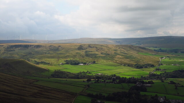
Kilnhurst is a small village located in the metropolitan borough of Rotherham, South Yorkshire, England. Situated approximately 8 miles east of the city of Sheffield, Kilnhurst is nestled in the heart of the Dearne Valley, surrounded by picturesque countryside and rolling hills.

The village has a rich industrial heritage, with its origins dating back to the 19th century. Kilnhurst was once a thriving coal mining and ironworks community, playing a significant role in the region's industrial revolution. Today, remnants of its industrial past can still be seen in the form of historical buildings and structures scattered throughout the village.

Despite its industrial roots, Kilnhurst has managed to maintain its charm and character. The village is home to a close-knit community, with a population of around 4,000 residents. The local amenities include a primary school, several shops, a post office, and a number of pubs and restaurants.

Nature lovers can enjoy the nearby Trans Pennine Trail, a popular walking and cycling route that passes through Kilnhurst. The village is also well-connected, with good transport links to surrounding towns and cities, making it an ideal location for commuters.

In conclusion, Kilnhurst is a small but vibrant village in Yorkshire, steeped in industrial history and surrounded by beautiful countryside. With its strong sense of community and convenient location, it offers a peaceful and picturesque place to live or visit.

If you have any feedback on the listing, please let us know in the comments section below.
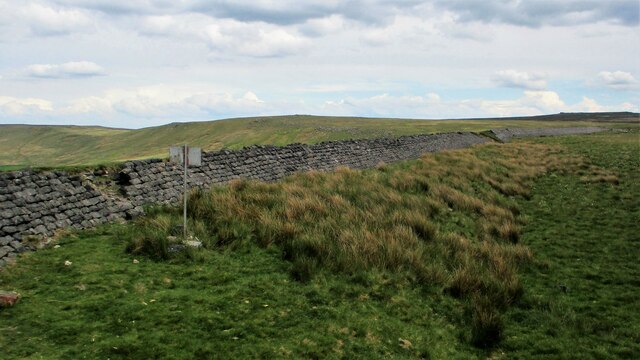
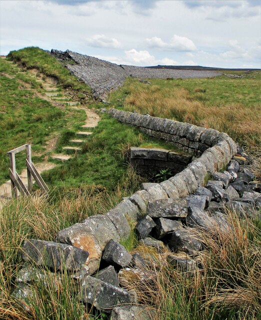
Kilnhurst Images

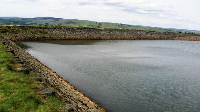
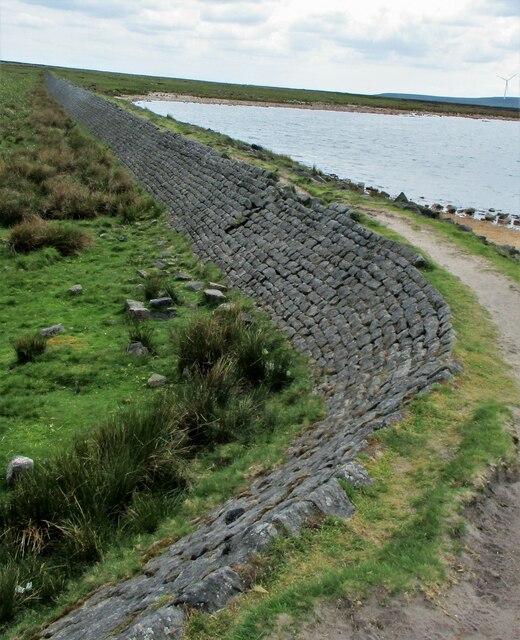
Images are sourced within 2km of 53.71335/-2.0858704 or Grid Reference SD9424. Thanks to Geograph Open Source API. All images are credited.

Rochdale Canal at Gauxholme View from Rochdale to Leeds railway
Rochdale Canal at Gauxholme
View from Rochdale to Leeds railway
Burnley Road, Todmorden View from Rochdale to Leeds railway
Burnley Road, Todmorden
View from Rochdale to Leeds railway
Rodwell End Clough View from Lobb Mill Viaduct
Rodwell End Clough
View from Lobb Mill Viaduct
Sunlight on Todmorden from ridge south of Stoodley Pike Monument
Lumbutts from Stoodley Pike Monument
Lower Knowl A work in progress
Lower Knowl
A work in progress
Swineshead Farm View from Lower Knowl
Swineshead Farm
View from Lower Knowl
Lower Knowl A farmhouse hopefully work in progress
Lower Knowl
A farmhouse hopefully work in progress
Steps at Gaddings Dam Steps at western corner of dam showing daylight through them
Steps at Gaddings Dam
Steps at western corner of dam showing daylight through them
Langfield Common Boundary Stone Stone with L on face away from camera, nothing discernible on other. Gaddings Dam steps in background
Langfield Common Boundary Stone
Stone with L on face away from camera, nothing discernible on other. Gaddings Dam steps in background
Costa del Todmordo The beach in Gaddings Dam, a very popular spot for Todmorden folk. Stoodley Pike Monument in the background
Costa del Todmordo
The beach in Gaddings Dam, a very popular spot for Todmorden folk. Stoodley Pike Monument in the background
Old Boundary Marker Estate Boundary Marker set in a stone wall on Matthew Lane, a green lane. In the former Stansfield township and parish, absorbed into Todmorden parish in 1897. Not on any township or parish boundary so is thought to mark an estate boundary.

Milestone Society National ID: YW_TOD10em
Old Boundary Marker
Estate Boundary Marker set in a stone wall on Matthew Lane, a green lane. In the former Stansfield township and parish, absorbed into Todmorden parish in 1897. Not on any township or parish boundary so is thought to mark an estate boundary. Milestone Society National ID: YW_TOD10em
Gaddings Dam The stone inner face of the dam. Gaddings is maintained by a local Group with Friends support.
Gaddings Dam
The stone inner face of the dam. Gaddings is maintained by a local Group with Friends support.
Gaddings Dam Outlet Pipe The culvert in the North West dam wall
Gaddings Dam Outlet Pipe
The culvert in the North West dam wall
Gaddings Dam Outlet Culvert Keystone 1853 datestone on outlet culvert in North West dam wall
Gaddings Dam Outlet Culvert Keystone
1853 datestone on outlet culvert in North West dam wall
Gaddings Dam (East) Wall The dam wall that separates the East & West dams. The East dam has been drained by United Utilities. The West dam is maintained by a local support group
Gaddings Dam (East) Wall
The dam wall that separates the East & West dams. The East dam has been drained by United Utilities. The West dam is maintained by a local support group
Gaddings Dam (East) The dam wall that runs along Langfield Edge
Gaddings Dam (East)
The dam wall that runs along Langfield Edge
Breach in Gaddings Dam (East) The breach in the dam wall that runs along Langfield Edge. This appears to be at the former outlet culvert which has been re-configured
Breach in Gaddings Dam (East)
The breach in the dam wall that runs along Langfield Edge. This appears to be at the former outlet culvert which has been re-configured
Show me another place!

Kilnhurst is located at Grid Ref: SD9424 (Lat: 53.71335, Lng: -2.0858704)

Division: West Riding

Unitary Authority: Calderdale

Police Authority: West Yorkshire

What 3 Words

///climbing.circling.grumbling. Near Todmorden, West Yorkshire

Related Wikis

Todmorden

Todmorden ( TOD-mər-dən; locally ) is a market town and civil parish in the Upper Calder Valley in Calderdale, West Yorkshire, England. It is 17 miles...

Todmorden Markets

Todmorden Markets consist of an indoor market held in the Public Market Hall and an outdoor open air market held to the front of the Public Market Hall...

Todmorden bus station

Todmorden bus station serves the town of Todmorden, West Yorkshire, England. The bus station is owned and managed by West Yorkshire Metro and was opened...

Todmorden Town Hall

Todmorden Town Hall is a municipal building in Halifax Road, Todmorden, West Yorkshire, England. The town hall, which is the meeting place of Todmorden...

Nearby Amenities

Located within 500m of 53.71335,-2.0858704
Traffic Signals
Traffic Signals: traffic_lights
Traffic Signals Direction: forward
Lat/Long: 53.7167085/-2.0898407
Traffic Signals
Traffic Signals: traffic_lights
Traffic Signals Direction: backward
Lat/Long: 53.7162747/-2.0892591
Barrier: yes
Lat/Long: 53.7146979/-2.0875557
Post Box
Post Box Type: lamp
Lat/Long: 53.7132447/-2.0857334
Seamark Type: gate
Waterway: lock_gate
Lat/Long: 53.7149659/-2.0798946
Seamark Type: gate
Waterway: lock_gate
Lat/Long: 53.715053/-2.0795521
Waterway: turning_point
Lat/Long: 53.7132518/-2.0880662
Bus Stop
Halifax Road Phoenix Street
Bus: yes
Local Ref: 45019846
Naptan AtcoCode: 450019846
Naptan Bearing: E
Naptan CommonName: Halifax Road Phoenix Street
Naptan Crossing: Phoenix Street
Naptan Indicator: Stop 45019846
Naptan Landmark: First Bus Depot
Naptan PlusbusZoneRef: LEEDS
Naptan ShortCommonName: Phoenix Street
Naptan Street: Halifax Road
Naptan Verified: no
Public Transport: platform
Source: naptan_import
Lat/Long: 53.7166167/-2.0824317
Bus Stop
Halifax Road Phoenix Street
Bus: yes
Local Ref: 45019847
Naptan AtcoCode: 450019847
Naptan Bearing: W
Naptan CommonName: Halifax Road Phoenix Street
Naptan Crossing: Phoenix Street
Naptan Indicator: Stop 45019847
Naptan Landmark: Todmorden Bus Depot (First)
Naptan PlusbusZoneRef: LEEDS
Naptan ShortCommonName: River Street
Naptan Street: Halifax Road
Naptan Verified: no
Public Transport: platform
Source: naptan_import
Lat/Long: 53.7164818/-2.0825375
Bus Stop
Phoenix Street Halifax Road
Bus: yes
Local Ref: 45019848
Naptan AtcoCode: 450019848
Naptan Bearing: S
Naptan CommonName: Phoenix Street Halifax Road
Naptan Crossing: Halifax Road
Naptan Indicator: Stop 45019848
Naptan Notes: OSR taken place 060106
Naptan PlusbusZoneRef: LEEDS
Naptan ShortCommonName: Halifax Road
Naptan Street: Phoenix Street
Naptan Verified: no
Public Transport: platform
Source: naptan_import
Lat/Long: 53.7169046/-2.0821141
Bus Stop
Broadstone Street
Bus: yes
Local Ref: 45019854
Naptan AtcoCode: 450019854
Naptan Bearing: E
Naptan CommonName: Broadstone Street
Naptan Crossing: Adj Phoenix Street
Naptan Indicator: Stop 45019854
Naptan PlusbusZoneRef: LEEDS
Naptan ShortCommonName: Broadstone Street
Naptan Street: Broadstone Street
Naptan Verified: no
Public Transport: platform
Source: naptan_import
Lat/Long: 53.7174247/-2.0837516
Bus Stop
Highcroft
Bus: yes
Local Ref: 45019856
Naptan AtcoCode: 450019856
Naptan Bearing: NE
Naptan CommonName: Highcroft
Naptan Crossing: Millwood Lane
Naptan Indicator: Stop 45019856
Naptan PlusbusZoneRef: LEEDS
Naptan ShortCommonName: Cross Stone Road
Naptan Street: Cross Stone Road
Naptan Verified: no
Public Transport: platform
Source: naptan_import
Lat/Long: 53.7165333/-2.0860683
Bus Stop
Halifax Road Russell Street
Bus: yes
Local Ref: 45019857
Naptan AtcoCode: 450019857
Naptan Bearing: E
Naptan CommonName: Halifax Road Russell Street
Naptan Crossing: Russell Street
Naptan Indicator: Stop 45019857
Naptan Notes: OSR taken place 211105
Naptan PlusbusZoneRef: LEEDS
Naptan ShortCommonName: Russell Street
Naptan Street: Halifax Road
Naptan Verified: no
Public Transport: platform
Source: naptan_import
Lat/Long: 53.7163633/-2.0849466
Bus Stop
Russell Street Todmorden
Bus: yes
Local Ref: 45019858
Naptan AtcoCode: 450019858
Naptan Bearing: W
Naptan CommonName: Russell Street Todmorden
Naptan Crossing: Russell Street
Naptan Indicator: Stop 45019858
Naptan PlusbusZoneRef: LEEDS
Naptan ShortCommonName: Russell Street
Naptan Street: Halifax Road
Naptan Verified: no
Public Transport: platform
Source: naptan_import
Lat/Long: 53.7161986/-2.0851775
Bus Stop
Halifax Road River Street
Bus: yes
Local Ref: 45019859
Naptan AtcoCode: 450019859
Naptan Bearing: NE
Naptan CommonName: Halifax Road River Street
Naptan Crossing: River Street
Naptan Indicator: Stop 45019859
Naptan Landmark: Garage
Naptan Notes: OSR taken place 211105ad panels fitted on 250208
Naptan PlusbusZoneRef: LEEDS
Naptan ShortCommonName: River Street
Naptan Street: Halifax Road
Naptan Verified: no
Public Transport: platform
Source: naptan_import
Lat/Long: 53.7153004/-2.0881265
Bus Stop
Hallroyd Road
Bus: yes
Local Ref: 45019860
Naptan AtcoCode: 450019860
Naptan Bearing: W
Naptan CommonName: Hallroyd Road
Naptan Crossing: Hallroyd Crescent
Naptan Indicator: Stop 45019860
Naptan PlusbusZoneRef: LEEDS
Naptan ShortCommonName: Hallroyd Crescent
Naptan Street: Hallroyd Road
Naptan Verified: no
Public Transport: platform
Shelter: yes
Source: naptan_import
Lat/Long: 53.7161631/-2.088295
Bus Stop
Hallroyd Road High Croft Road
Bus: yes
Local Ref: 45019861
Naptan AtcoCode: 450019861
Naptan Bearing: N
Naptan CommonName: Hallroyd Road High Croft Road
Naptan Crossing: High Croft Road
Naptan Indicator: Stop 45019861
Naptan PlusbusZoneRef: LEEDS
Naptan ShortCommonName: High Croft Road
Naptan Street: Hallroyd Road
Naptan Verified: no
Public Transport: platform
Source: naptan_import
Lat/Long: 53.7170876/-2.0901001
Bus Stop
Halifax Road River Street
Bus: yes
Local Ref: 45019874
Naptan AtcoCode: 450019874
Naptan Bearing: NW
Naptan CommonName: Halifax Road River Street
Naptan Crossing: River Street
Naptan Indicator: Stop 45019874
Naptan Landmark: Petrol Station
Naptan PlusbusZoneRef: LEEDS
Naptan ShortCommonName: River Street
Naptan Street: Halifax Road
Naptan Verified: no
Public Transport: platform
Source: naptan_import
Lat/Long: 53.7149767/-2.0882622
Bus Stop
Key Syke Lane
Bus: yes
Local Ref: 45019875
Naptan AtcoCode: 450019875
Naptan Bearing: NW
Naptan CommonName: Key Syke Lane
Naptan Crossing: Derdale Street
Naptan Indicator: Stop 45019875
Naptan Landmark: Unknown
Naptan PlusbusZoneRef: LEEDS
Naptan ShortCommonName: Key Syke Ln Garage
Naptan Street: Key Sike Lane
Naptan Verified: no
Public Transport: platform
Source: naptan_import
Lat/Long: 53.7142941/-2.0875486
Bus Stop
Summerfield Road
Bus: yes
Local Ref: 45019876
Naptan AtcoCode: 450019876
Naptan Bearing: NE
Naptan CommonName: Summerfield Road
Naptan Crossing: Holderness Street
Naptan Indicator: Stop 45019876
Naptan PlusbusZoneRef: LEEDS
Naptan ShortCommonName: Holderness Street
Naptan Street: Summerfield Road
Naptan Verified: no
Public Transport: platform
Source: naptan_import
Lat/Long: 53.7135767/-2.085244
Bus Stop
Summerfield Road Woodhouse Grove
Bus: yes
Local Ref: 45019877
Naptan AtcoCode: 450019877
Naptan Bearing: W
Naptan CommonName: Summerfield Road Woodhouse Grove
Naptan Crossing: Woodhouse Grove
Naptan Indicator: Stop 45019877
Naptan Notes: OSR taken place 211105
Naptan PlusbusZoneRef: LEEDS
Naptan ShortCommonName: Woodhouse Grove
Naptan Street: Summerfield Road
Naptan Verified: no
Public Transport: platform
Source: naptan_import
Lat/Long: 53.7139831/-2.0824266
Bus Stop
Halifax Road Sanworth Street
Bus: yes
Local Ref: 45019878
Naptan AtcoCode: 450019878
Naptan Bearing: W
Naptan CommonName: Halifax Road Sanworth Street
Naptan Crossing: Sanworth Street
Naptan Indicator: Stop 45019878
Naptan PlusbusZoneRef: LEEDS
Naptan ShortCommonName: Sanworth Street
Naptan Street: Halifax Road
Naptan Verified: no
Public Transport: platform
Source: naptan_import
Lat/Long: 53.7143281/-2.0902494
Bus Stop
Halifax Road Sanworth Street
Bus: yes
Local Ref: 45019879
Naptan AtcoCode: 450019879
Naptan Bearing: N
Naptan CommonName: Halifax Road Sanworth Street
Naptan Crossing: Sanworth Street
Naptan Indicator: Stop 45019879
Naptan PlusbusZoneRef: LEEDS
Naptan ShortCommonName: Sanworth Street
Naptan Street: Halifax Road
Naptan Verified: no
Public Transport: platform
Source: naptan_import
Lat/Long: 53.7143867/-2.0907448
Bus Stop
Hallroyd Road Hallroyd Crescent
Bus: yes
Local Ref: 45025812
Naptan AtcoCode: 450025812
Naptan Bearing: E
Naptan CommonName: Hallroyd Road Hallroyd Crescent
Naptan Crossing: Hallroyd Crescent
Naptan Indicator: Stop 45025812
Naptan Notes: OSR taken place 211105
Naptan PlusbusZoneRef: LEEDS
Naptan ShortCommonName: Hallroyd Crescent
Naptan Street: Hallroyd Road
Naptan Verified: no
Public Transport: platform
Source: naptan_import
Lat/Long: 53.716262/-2.0882345
Bus Stop
Hallroyd Road High Croft Road
Bus: yes
Local Ref: 45025817
Naptan AtcoCode: 450025817
Naptan Bearing: S
Naptan CommonName: Hallroyd Road High Croft Road
Naptan Crossing: High Croft Road
Naptan Indicator: Stop 45025817
Naptan Notes: OSR taken place 211105
Naptan PlusbusZoneRef: LEEDS
Naptan ShortCommonName: High Croft Road
Naptan Street: Hallroyd Road
Naptan Verified: no
Public Transport: platform
Source: naptan_import
Lat/Long: 53.7170427/-2.0899788
Bus Stop
Summerfield Road Holderness Street
Bus: yes
Local Ref: 45050869
Naptan AtcoCode: 450050869
Naptan Bearing: SW
Naptan BusStopType: CUS
Naptan CommonName: Summerfield Road Holderness Street
Naptan Indicator: Stop 45050869
Naptan PlusbusZoneRef: LEEDS
Naptan ShortCommonName: Kilnhurst Lane
Naptan Street: Summerfield Road
Naptan Verified: no
Public Transport: platform
Source: naptan_import
Lat/Long: 53.7135048/-2.0851984
Barrier: bollard
Lat/Long: 53.714535/-2.0897399
Turning Circle
Lat/Long: 53.7159202/-2.0897627
Barrier: stile
Foot: yes
Material: wood
Stile: stepover
Lat/Long: 53.7122476/-2.0787184
Turning Circle
Lat/Long: 53.7171614/-2.0874771
Turning Circle
Lat/Long: 53.7158378/-2.0857073
Railway: switch
Lat/Long: 53.7169016/-2.086161
Railway: switch
Lat/Long: 53.7169417/-2.0861718
Railway: switch
Lat/Long: 53.716624/-2.0892518
Railway: switch
Lat/Long: 53.716783/-2.0884385
Charging Station
Lidl Todmorden
Access: customers
Capacity: 1
Operator: Pod Point
Operator Wikidata: Q42888154
Lat/Long: 53.7135511/-2.0908583
Turning Circle
Lat/Long: 53.7143131/-2.0808451
Turning Circle
Lat/Long: 53.7142274/-2.0807271
Barrier: yes
Lat/Long: 53.7148928/-2.0879854
Barrier: yes
Lat/Long: 53.7147736/-2.0874727
Barrier: yes
Lat/Long: 53.7146553/-2.0872347
Hall Royd Junction
Railway: junction
Lat/Long: 53.7168751/-2.0865065
Railway: railway_crossing
Lat/Long: 53.7168535/-2.0869078
Ford: yes
Lat/Long: 53.7118238/-2.0871135
Barrier: stile
Material: wood
Stile: stepover
Lat/Long: 53.70931/-2.0890373
Barrier: yes
Lat/Long: 53.7162003/-2.0827246
Noexit: yes
Lat/Long: 53.713205/-2.0888646
Power: pole
Lat/Long: 53.7098025/-2.088832
Power: pole
Lat/Long: 53.709885/-2.0861471
Power: pole
Lat/Long: 53.7099152/-2.0851278
Power: pole
Lat/Long: 53.709947/-2.0841569
Power: pole
Lat/Long: 53.7099755/-2.0830303
Power: pole
Lat/Long: 53.7100089/-2.0821533
Power: pole
Lat/Long: 53.7119305/-2.0789923
Power: pole
Lat/Long: 53.712629/-2.0796575
Power: pole
Lat/Long: 53.7103994/-2.081008
Power: pole
Lat/Long: 53.7107217/-2.0801094
Barrier: chain
Lat/Long: 53.7130379/-2.0914191
Creative Care Ltd
Addr City: Todmorden
Addr Housename: Sandholme Sawmill
Addr Postcode: OL14 5RF
Addr Street: Key Sike Lane
Man Made: works
Product: furniture
Website: https://creativecareltd.com
Lat/Long: 53.7142037/-2.0876303
Bench
Backrest: yes
Material: wood
Lat/Long: 53.7151232/-2.0884263
Bench
Backrest: yes
Material: wood
Lat/Long: 53.7151365/-2.0884068
Barrier: bollard
Lat/Long: 53.7139401/-2.0868864
Barrier: bollard
Lat/Long: 53.7138226/-2.0867027
Cycle Factory
Addr City: Todmorden
Addr Housename: Cycle Factory
Addr Postcode: OL14 5QY
Addr Street: Der Street
Service Bicycle Clothing: yes
Service Bicycle Parts: yes
Service Bicycle Sales: yes
Shop: bicycle
Website: https://cyclefactory.co.uk/
Lat/Long: 53.7137992/-2.0894339
RS Motorcycles
Addr City: Todmorden
Addr Housename: Richmond Street Mill
Addr Street: Richmond Street
Shop: motorcycle
Website: https://en-gb.facebook.com/RSMotorcycles1/
Lat/Long: 53.714303/-2.0885636
Warburtons Funeralcare
Addr City: Todmorden
Addr Housename: Old Chapel Schoolhouse
Addr Postcode: OL14 8AL
Addr Street: Broadstone Street
Shop: funeral_directors
Lat/Long: 53.7174132/-2.0846893
Actpoint Ltd
Shop: car_repair
Lat/Long: 53.7145053/-2.0908302
Fast Food
Magic Chef
Addr City: Todmorden
Addr Housenumber: 117
Addr Postcode: OL14 5BE
Addr Street: Halifax Road
Cuisine: chinese
Delivery: yes
Takeaway: only
Website: https://www.themagicchef.co.uk
Lat/Long: 53.714452/-2.090916
Right Choice
Addr City: Todmorden
Addr Housenumber: 128-130
Addr Postcode: OL14 5QR
Addr Street: Halifax Road
Shop: doityourself
Lat/Long: 53.7143497/-2.08976
Barrier: bollard
Lat/Long: 53.7164121/-2.0845358
Hoyles of Todmorden
Addr City: Todmorden
Addr Housename: Phoenix Garage
Addr Postcode: OL14 5SG
Addr Street: Phoenix Street
Second Hand: only
Shop: car
Website: https://www.hoylesoftodmorden.co.uk
Lat/Long: 53.7172148/-2.0820178
Barrier: bollard
Lat/Long: 53.7136884/-2.0863255
Barrier: bollard
Lat/Long: 53.7138419/-2.085612
Barrier: bollard
Lat/Long: 53.7139221/-2.085361
Barrier: bollard
Lat/Long: 53.7139918/-2.0851806
Barrier: bollard
Lat/Long: 53.7142314/-2.0844712
Barrier: bollard
Lat/Long: 53.7142997/-2.0842796
Barrier: bollard
Lat/Long: 53.7144066/-2.0839536
Physio & Therapies
Addr City: Todmorden
Addr Housenumber: 61
Addr Postcode: OL14 5BB
Addr Street: Halifax Road
Healthcare: physiotherapist
Website: https://www.physiotherapies.co.uk/
Lat/Long: 53.7141833/-2.093191
Pharmacy
Todmorden Pharmaxcy
Addr City: Todmorden
Addr Housenumber: 61A
Addr Postcode: OL14 5BB
Addr Street: Halifax Road
Drive Through: no
Healthcare: pharmacy
Website: https://todmorden-pharmacy.co.uk/
Lat/Long: 53.7141914/-2.0931142
Arts Centre
The Folklore Centre
Addr City: Todmorden
Addr Housenumber: 65-67
Addr Postcode: OL14 5BB
Addr Street: Halifax Road
Website: https://www.folkloremythmagic.com/
Lat/Long: 53.7142072/-2.0929867
The data included in this document is from www.openstreetmap.org. The data is made available under ODbL.

Have you been to Kilnhurst?

Leave your review of Kilnhurst below (or comments, questions and feedback).