Kiln Farm

Settlement in Buckinghamshire

England

Kiln Farm

The A5  on a dull morning Returning to Milton Keynes after the Christmas Day park run.
The A5 on a dull morning Credit: Malcolm Neal

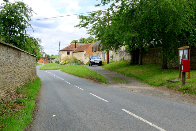
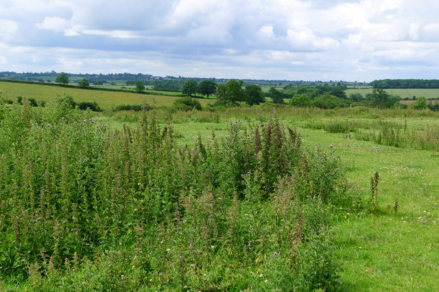
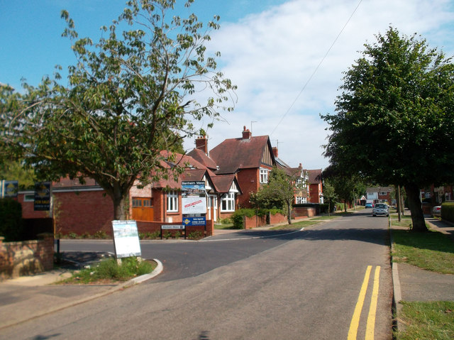
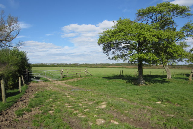
Kiln Farm is a small village located in the county of Buckinghamshire, England. Situated approximately 4 miles west of the bustling town of Milton Keynes, it is known for its picturesque countryside and peaceful atmosphere. The village is surrounded by lush green fields and farmland, offering a serene and idyllic setting for its residents.

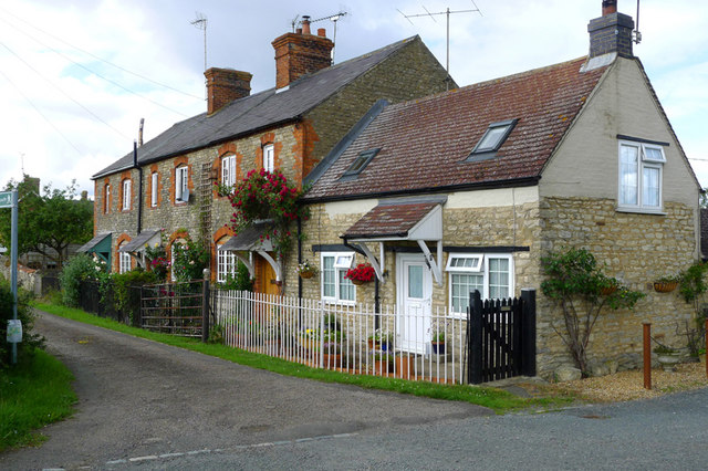
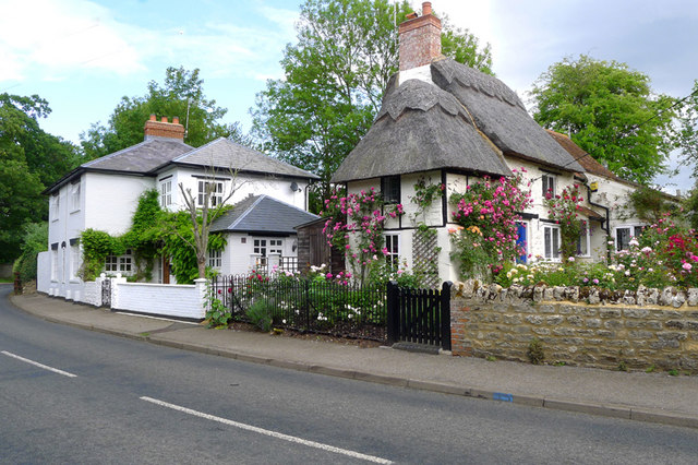
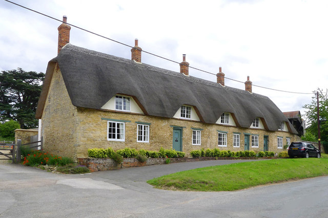
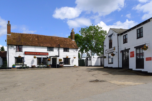
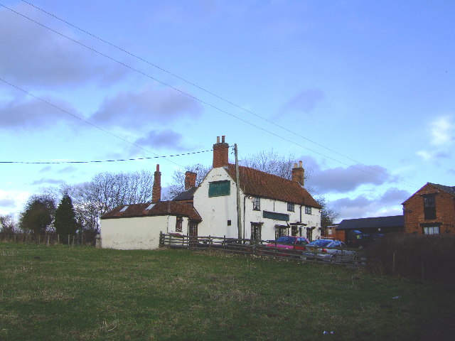
In terms of amenities, Kiln Farm primarily consists of residential properties, with a mix of modern houses and traditional cottages. The village also boasts a local pub, The Kiln, which serves a variety of traditional British dishes and beverages, creating a cozy gathering spot for locals and visitors alike.

Despite being a predominantly residential area, Kiln Farm benefits from its close proximity to Milton Keynes, providing residents with easy access to a wide range of amenities and services. The town offers numerous shopping centers, leisure facilities, and entertainment options, including cinemas, theaters, and restaurants.

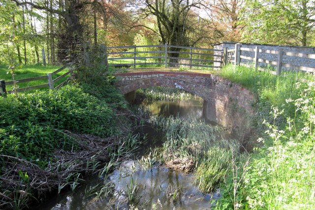
For those seeking outdoor activities, Kiln Farm is located near various parks and nature reserves, such as Loughton Valley Park and Linford Lakes Nature Reserve. These green spaces offer opportunities for walking, cycling, and wildlife spotting.

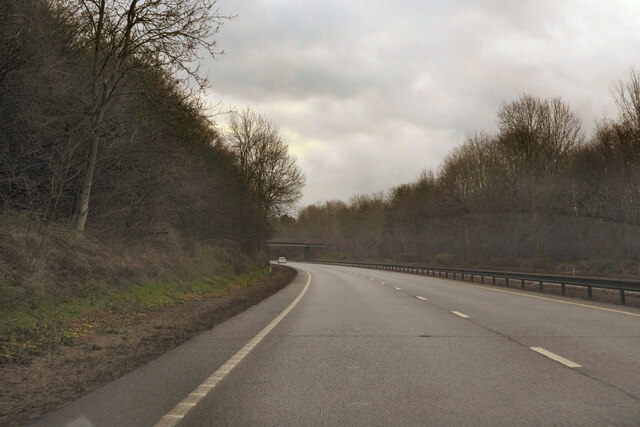
Transport links in Kiln Farm are excellent, with Milton Keynes Central Railway Station providing frequent connections to London and other major cities. The village is also well-connected by road, with the A5 and M1 motorway just a short drive away, making it easily accessible for commuters and visitors.

Overall, Kiln Farm offers a peaceful and charming rural lifestyle, while still providing convenient access to nearby urban amenities.

If you have any feedback on the listing, please let us know in the comments section below.
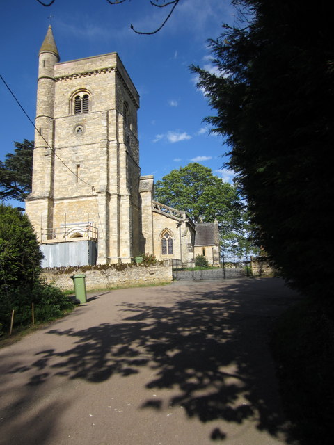
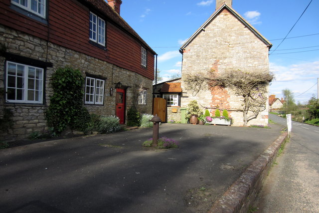
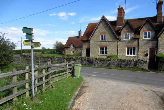
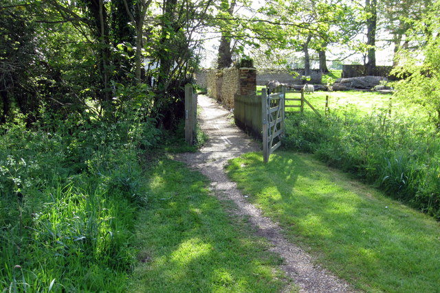
Kiln Farm Images

Images are sourced within 2km of 52.042242/-0.82335671 or Grid Reference SP8038. Thanks to Geograph Open Source API. All images are credited.

The A5  on a dull morning Returning to Milton Keynes after the Christmas Day park run.
The A5 on a dull morning
Returning to Milton Keynes after the Christmas Day park run.
Middle Weald, Calverton, Bucks
Lower Weald, Calverton, Bucks
Cottages, Lower Weald, Calverton, Bucks
Open fields around Upper Weald, Calverton
The Shoulder of Mutton, Calverton, Bucks
All Saints Church, Lower Weald, Calverton, Bucks
Blenheim Avenue, Stony Stratford An area of suburban housing dating mainly from the 1920s and 30s.
Blenheim Avenue, Stony Stratford
An area of suburban housing dating mainly from the 1920s and 30s.
Path towards Milton Keynes and stile
Wind pump on the path to Stony Stratford Well, it's marked as a wind pump on the map but it seems to have lost its vanes.
Wind pump on the path to Stony Stratford
Well, it's marked as a wind pump on the map but it seems to have lost its vanes.
Disused farm building
All Saints church tower
Row of cottages in Lower Weald With an old hydrant in front of them
Row of cottages in Lower Weald
With an old hydrant in front of them
Circular Walk and houses on the edge of Lower Weald
Footbridge on path to cottages
Footbridge on the path to Calverton Place
Shoulder of Mutton, Calverton wide range of beers plus regular live entertainment
Shoulder of Mutton, Calverton
wide range of beers plus regular live entertainment
Show me another place!

Kiln Farm is located at Grid Ref: SP8038 (Lat: 52.042242, Lng: -0.82335671)

Unitary Authority: Milton Keynes

Police Authority: Thames Valley

What 3 Words

///intersect.shocking.products. Near Calverton, Buckinghamshire

Nearby Locations

Fairfields Kiln Farm

Related Wikis

Fairfields

Fairfields is a neighbourhood and civil parish that covers a large new development area on the western flank of Milton Keynes, Buckinghamshire, England...

Abbey Hill

Abbey Hill is a civil parish that covers the Two Mile Ash, Kiln Farm, and Wymbush districts of Milton Keynes in Buckinghamshire, England. As the first...

Whitehouse, Milton Keynes

Whitehouse is a neighbourhood and civil parish that covers a large new development area on the western flank of Milton Keynes, Buckinghamshire, England...

Watling Academy

Watling Academy is a coeducational secondary school located in the Whitehouse area of Milton Keynes, in the English county of Buckinghamshire. == History... ==

Two Mile Ash

Two Mile Ash is a district of north-west Milton Keynes in Buckinghamshire, England, two miles south of Stony Stratford, just off Watling Street. The district...

Watling Valley Ecumenical Partnership

The Watling Valley Ecumenical Partnership is a Local Ecumenical Partnership (LEP) in Milton Keynes, England which belongs to the Church of England, The...

The Radcliffe School

The Radcliffe School is a comprehensive school located in Wolverton, Milton Keynes, England. The school offers General Certificates of Secondary Education...

Calverton, Buckinghamshire

Calverton is a civil parish in the unitary authority area of the City of Milton Keynes, Buckinghamshire, England and just outside the Milton Keynes urban...

Nearby Amenities

Located within 500m of 52.042242,-0.82335671
Power: tower
Lat/Long: 52.0409877/-0.8190983
Power: tower
Lat/Long: 52.0428982/-0.8162173
Bus Stop
Tilers Road
Bus: yes
Naptan AtcoCode: 049003235360
Naptan Bearing: NW
Naptan CommonName: Tilers Road
Naptan Indicator: o/s
Naptan Landmark: Kiln Farm Sports Ground
Naptan NaptanCode: mltdgdj
Naptan PlusbusZoneRef: MKNSCEN
Naptan Street: Pitfield
Naptan Verified: no
Public Transport: platform
Shelter: yes
Source: naptan_import
Lat/Long: 52.0443709/-0.8214152
Bus Stop
Tilers Road
Bus: yes
Naptan AtcoCode: 049003235372
Naptan Bearing: SE
Naptan CommonName: Tilers Road
Naptan Indicator: opp
Naptan Landmark: Kiln Farm Sports Ground
Naptan NaptanCode: mltdgdt
Naptan PlusbusZoneRef: MKNSCEN
Naptan Street: Pitfield
Naptan Verified: no
Public Transport: platform
Source: naptan_import
Lat/Long: 52.0444061/-0.8212552
Bus Stop
Brick Close
Bus: yes
Naptan AtcoCode: 049003235607
Naptan Bearing: NW
Naptan CommonName: Brick Close
Naptan Indicator: northbound
Naptan Landmark: N
Naptan NaptanCode: mltdgdw
Naptan PlusbusZoneRef: MKNSCEN
Naptan Street: Pitfield
Naptan Verified: no
Public Transport: platform
Source: naptan_import
Lat/Long: 52.0426239/-0.8179353
Bus Stop
Brick Close
Bus: yes
Naptan AtcoCode: 049003235608
Naptan Bearing: SE
Naptan CommonName: Brick Close
Naptan Indicator: southbound
Naptan Landmark: N
Naptan NaptanCode: mltagpdg
Naptan PlusbusZoneRef: MKNSCEN
Naptan Street: Pitfield
Naptan Verified: no
Public Transport: platform
Source: naptan_import
Lat/Long: 52.0426123/-0.8176731
Bus Stop
Abbey Hill Golf Course
Bus: yes
Naptan AtcoCode: 049003245697
Naptan Bearing: NE
Naptan CommonName: Abbey Hill Golf Course
Naptan Indicator: opp
Naptan Landmark: Abbey Hill Golf Course
Naptan NaptanCode: mltdgja
Naptan PlusbusZoneRef: MKNSCEN
Naptan Street: Monks Way H3
Naptan Verified: no
Public Transport: platform
Shelter: yes
Source: naptan_import
Lat/Long: 52.0427191/-0.8162617
Bus Stop
Abbey Hill Golf Course
Bus: yes
Naptan AtcoCode: 049003245698
Naptan Bearing: SW
Naptan CommonName: Abbey Hill Golf Course
Naptan Indicator: o/s
Naptan Landmark: Abbey Hill Golf Course
Naptan NaptanCode: mltdgjd
Naptan PlusbusZoneRef: MKNSCEN
Naptan Street: Monks Way H3
Naptan Verified: no
Public Transport: platform
Shelter: yes
Source: naptan_import
Lat/Long: 52.0426042/-0.8161948
Bus Stop
Fairways Roundabout south
Bus: yes
Naptan AtcoCode: 049003925544
Naptan Bearing: NW
Naptan CommonName: Fairways Roundabout south
Naptan Indicator: northbound
Naptan Landmark: Two Mile Ash Farm
Naptan NaptanCode: mltdptm
Naptan PlusbusZoneRef: MKNSCEN
Naptan Street: Watling Street V4
Naptan Verified: no
Public Transport: platform
Source: naptan_import
Lat/Long: 52.0397267/-0.8174924
Power: tower
Lat/Long: 52.039811/-0.827922
Power: tower
Lat/Long: 52.04067/-0.8250056
Power: tower
Lat/Long: 52.0408431/-0.8217134
Power: pole
Lat/Long: 52.043234/-0.829732
Power: pole
Lat/Long: 52.0438345/-0.828698
Power: pole
Lat/Long: 52.0394211/-0.8222093
Power: pole
Lat/Long: 52.0387727/-0.8230207
Power: pole
Lat/Long: 52.0382216/-0.8237301
Post Box
Brand: Royal Mail
Brand Wikidata: Q638098
Brand Wikipedia: en:Royal Mail
Collection Times: Mo-Fr 18:30
Operator: Royal Mail
Operator Wikidata: Q638098
Ref: MK11 615
Royal Cypher: EIIR
Royal Cypher Wikidata: Q33102113
Source: survey
Lat/Long: 52.0454189/-0.8226451
Post Box
Brand: Royal Mail
Brand Wikidata: Q638098
Brand Wikipedia: en:Royal Mail
Collection Times: Mo-Fr 18:30; Sa 12:00
Operator: Royal Mail
Operator Wikidata: Q638098
Post Box Type: pillar
Ref: MK11 339
Royal Cypher: EIIR
Royal Cypher Wikidata: Q33102113
Source: survey
Lat/Long: 52.0465837/-0.8233283
Telephone
Booth: KX300
Covered: booth
Source: survey
Lat/Long: 52.0466042/-0.823375
Ramgarhia Sabha Lunch Club
Addr City: Milton Keynes
Addr Country: GB
Addr Postcode: MK11 3LH
Addr Street: Keller Close
Addr Suburb: Kiln Farm
Club: social
Fhrs Authority: Milton Keynes
Fhrs Id: 139795
Fhrs Local Authority Id: 75670
Lat/Long: 52.0432942/-0.8239666
Bicycle Parking
Bicycle Parking: stands
Capacity: 10
Covered: yes
Cyclestreets Id: 111481
Lat/Long: 52.0436967/-0.8183325
Direction: 220
Generator Method: photovoltaic
Generator Output Electricity: yes
Generator Solar Modules: 12
Generator Source: solar
Generator Type: solar_photovoltaic_panel
Location: roof
Power: generator
Lat/Long: 52.0414189/-0.8165102
Direction: 220
Generator Method: photovoltaic
Generator Output Electricity: yes
Generator Solar Modules: 14
Generator Source: solar
Generator Type: solar_photovoltaic_panel
Location: roof
Power: generator
Lat/Long: 52.0416213/-0.8162155
Pharmacy
Hot Chemist (online)
Addr City: Milton Keynes
Addr Housenumber: 39
Addr Postcode: MK11 3HL
Addr Street: Carters Lane
Contact Website: https://www.hotchemist.co.uk/
Dispensing: yes
Drive Through: no
Healthcare: pharmacy
Note: internet orders only
Operator: Hot Chemist
Phone: +441908803499
Lat/Long: 52.0453941/-0.828014
Inscription: BUN-BLS
Marker: post
Utility: oil
Lat/Long: 52.0377773/-0.8240678
Inscription: BLS-BUN
Marker: post
Utility: oil
Lat/Long: 52.0378035/-0.8240268
Inscription: BUN-BLS
Marker: post
Utility: oil
Lat/Long: 52.0378837/-0.8241534
Inscription: BLS-BUN
Marker: post
Utility: oil
Lat/Long: 52.0379098/-0.8241123
Turning Circle
Turning Circle: knuckle
Lat/Long: 52.0438372/-0.8298795
The data included in this document is from www.openstreetmap.org. The data is made available under ODbL.

Have you been to Kiln Farm?

Leave your review of Kiln Farm below (or comments, questions and feedback).