Keppel's Column

Settlement in Yorkshire

England

Keppel's Column

Old milestone In the contract between the West Riding County Council and Gill & Frank Stead, stonemasons, of Mirfield, six of these milestones were to be erected from this one on the A629, Wortley Road, in Kimberworth to where the route meets the Sheffield to Penistone road, A61.   Rotherham 3 & 4 are now missing with 5, 6 and 7 still in situ.   They were set up in 1893/94.
Old milestone Credit: Chris Minto

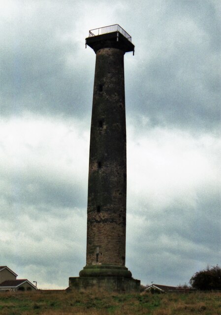
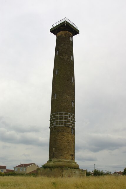
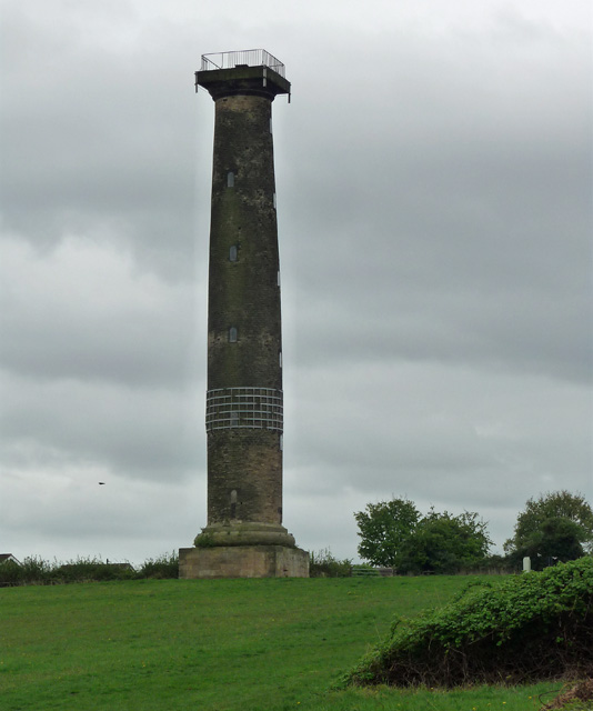
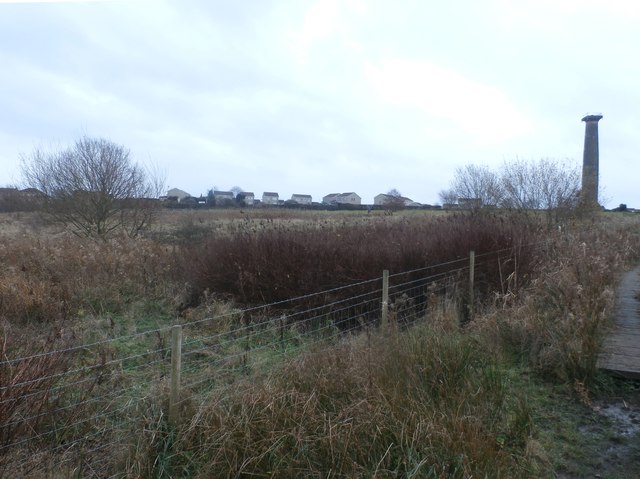
Keppel's Column is a prominent monument located in the village of Keppel in the East Riding of Yorkshire, England. Standing at an impressive height of 130 feet (40 meters), the column is a Grade II listed structure and is considered one of the tallest monuments in the county.

The column was constructed in 1793 as a tribute to Admiral Augustus Keppel, the first Viscount Keppel and a distinguished naval officer. Keppel played a crucial role in the British Navy during the American Revolutionary War. The monument was funded by public subscription and designed by architect William Lindley, with the purpose of commemorating Keppel's achievements and celebrating his naval victories.

The structure itself is made of ashlar sandstone and features a Doric column design. At the top of the column, there is a statue of Admiral Keppel in naval attire, holding a telescope and surrounded by naval symbols such as anchors and cannons. The statue was crafted by renowned sculptor John Bacon.

Keppel's Column offers stunning panoramic views of the surrounding countryside, including the nearby village of Keppel and the Humber Estuary. It has become a popular tourist attraction, drawing visitors who are interested in history and architecture. The monument is also a testament to the local community's admiration for Admiral Keppel's military achievements.

If you have any feedback on the listing, please let us know in the comments section below.

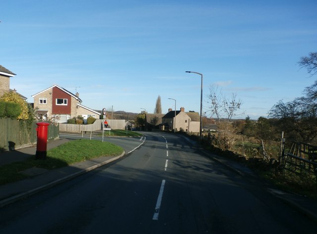
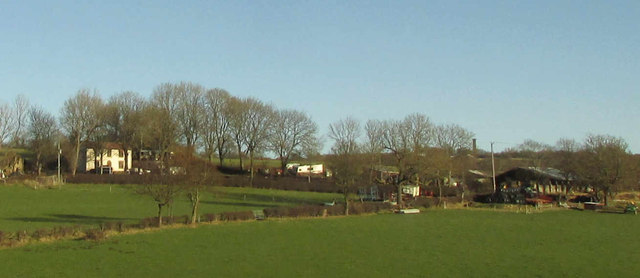
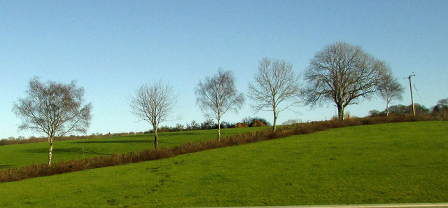
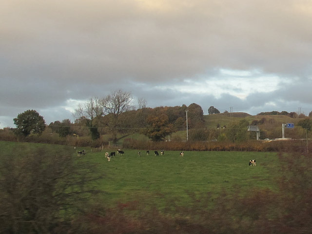
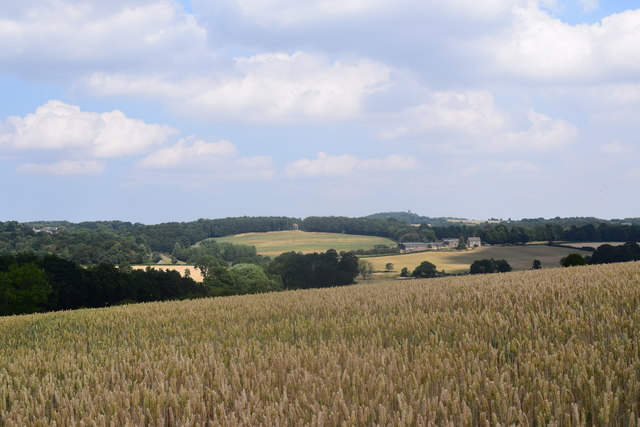
Keppel's Column Images

Images are sourced within 2km of 53.447982/-1.4184688 or Grid Reference SK3894. Thanks to Geograph Open Source API. All images are credited.

Old milestone In the contract between the West Riding County Council and Gill & Frank Stead, stonemasons, of Mirfield, six of these milestones were to be erected from this one on the A629, Wortley Road, in Kimberworth to where the route meets the Sheffield to Penistone road, A61.   Rotherham 3 & 4 are now missing with 5, 6 and 7 still in situ.   They were set up in 1893/94.
Old milestone
In the contract between the West Riding County Council and Gill & Frank Stead, stonemasons, of Mirfield, six of these milestones were to be erected from this one on the A629, Wortley Road, in Kimberworth to where the route meets the Sheffield to Penistone road, A61. Rotherham 3 & 4 are now missing with 5, 6 and 7 still in situ. They were set up in 1893/94.
Keppel's Column in 1999 The column before the steel reinforcing bands were applied
Keppel's Column in 1999
The column before the steel reinforcing bands were applied
Keppel's Column A folly for Wentworth Woodhouse, now with strengthening metal 'girdle'
Keppel's Column
A folly for Wentworth Woodhouse, now with strengthening metal 'girdle'
Millmoor Juniors Football Club, Rotherham
Wentworth Road in Thorpe Hesley
M1, North of Tinsley The M1 is a north–south motorway connecting London to Leeds, where it joins the A1(M) near Aberford. It was the first motorway to be completed in the United Kingdom.
The motorway is 193 miles long and was constructed in four phases. Most of the motorway was opened between 1959 and 1968 but the southern end was extended in 1977 and the northern end was extended in 1999.
M1, North of Tinsley
The M1 is a north–south motorway connecting London to Leeds, where it joins the A1(M) near Aberford. It was the first motorway to be completed in the United Kingdom. The motorway is 193 miles long and was constructed in four phases. Most of the motorway was opened between 1959 and 1968 but the southern end was extended in 1977 and the northern end was extended in 1999.
M1 near Thundercliffe Grange The M1 is a north–south motorway connecting London to Leeds, where it joins the A1(M) near Aberford. It was the first motorway to be completed in the United Kingdom.
The motorway is 193 miles long and was constructed in four phases. Most of the motorway was opened between 1959 and 1968 but the southern end was extended in 1977 and the northern end was extended in 1999.
M1 near Thundercliffe Grange
The M1 is a north–south motorway connecting London to Leeds, where it joins the A1(M) near Aberford. It was the first motorway to be completed in the United Kingdom. The motorway is 193 miles long and was constructed in four phases. Most of the motorway was opened between 1959 and 1968 but the southern end was extended in 1977 and the northern end was extended in 1999.
Northbound M1, Grange Park The M1 is a north–south motorway connecting London to Leeds, where it joins the A1(M) near Aberford. It was the first motorway to be completed in the United Kingdom.
The motorway is 193 miles long and was constructed in four phases. Most of the motorway was opened between 1959 and 1968 but the southern end was extended in 1977 and the northern end was extended in 1999.
Northbound M1, Grange Park
The M1 is a north–south motorway connecting London to Leeds, where it joins the A1(M) near Aberford. It was the first motorway to be completed in the United Kingdom. The motorway is 193 miles long and was constructed in four phases. Most of the motorway was opened between 1959 and 1968 but the southern end was extended in 1977 and the northern end was extended in 1999.
Northbound M1, Jumble Lane Bridge The M1 is a north–south motorway connecting London to Leeds, where it joins the A1(M) near Aberford. It was the first motorway to be completed in the United Kingdom.
The motorway is 193 miles long and was constructed in four phases. Most of the motorway was opened between 1959 and 1968 but the southern end was extended in 1977 and the northern end was extended in 1999.
Northbound M1, Jumble Lane Bridge
The M1 is a north–south motorway connecting London to Leeds, where it joins the A1(M) near Aberford. It was the first motorway to be completed in the United Kingdom. The motorway is 193 miles long and was constructed in four phases. Most of the motorway was opened between 1959 and 1968 but the southern end was extended in 1977 and the northern end was extended in 1999.
Northbound M1, Bridges at Junction 35 The M1 is a north–south motorway connecting London to Leeds, where it joins the A1(M) near Aberford. It was the first motorway to be completed in the United Kingdom.
The motorway is 193 miles long and was constructed in four phases. Most of the motorway was opened between 1959 and 1968 but the southern end was extended in 1977 and the northern end was extended in 1999.
Northbound M1, Bridges at Junction 35
The M1 is a north–south motorway connecting London to Leeds, where it joins the A1(M) near Aberford. It was the first motorway to be completed in the United Kingdom. The motorway is 193 miles long and was constructed in four phases. Most of the motorway was opened between 1959 and 1968 but the southern end was extended in 1977 and the northern end was extended in 1999.
Keppel's Column near Thorpe Hesley One of the umpteen Wentworth monuments. By John Carr, 1778, "in memory of the acquittal at his court martial of Lord Rockingham's friend Admiral Keppel". For an account of the pronounced entasis, see here: <a href="https://www.geograph.org.uk/photo/2713386">SK3894 : Keppel's Column</a>. Grade II* listed.
Keppel's Column near Thorpe Hesley
One of the umpteen Wentworth monuments. By John Carr, 1778, "in memory of the acquittal at his court martial of Lord Rockingham's friend Admiral Keppel". For an account of the pronounced entasis, see here: SK3894 : Keppel's Column. Grade II* listed.
Common Land near Kimberworth Park View from the bridleway to Scholes Coppice which cuts across the north western corner of this square. Keppel's Column on the right of picture is situated in SK3894.
Common Land near Kimberworth Park
View from the bridleway to Scholes Coppice which cuts across the north western corner of this square. Keppel's Column on the right of picture is situated in SK3894.
Upper Wortley Road in Rotherham Pictured as Storm Barbara was moving into the area. This turned out to be a fairly benign pre-xmas weather system.
Upper Wortley Road in Rotherham
Pictured as Storm Barbara was moving into the area. This turned out to be a fairly benign pre-xmas weather system.
Rainstorth House And outbuildings, seen from the M1.
Rainstorth House
And outbuildings, seen from the M1.
Trees near Rainstorth House Trees along a field boundary, seen from the M1.
Trees near Rainstorth House
Trees along a field boundary, seen from the M1.
Cows near the motorway Seen from a passing train.
Cows near the motorway
Seen from a passing train.
Arable farmland on Low Common Along the Rotherham Roundwalk.
Arable farmland on Low Common
Along the Rotherham Roundwalk.
M1 southbound nearing Jumble Lane overbridge
Show me another place!

Keppel's Column is located at Grid Ref: SK3894 (Lat: 53.447982, Lng: -1.4184688)

Division: West Riding

Unitary Authority: Rotherham

Police Authority: South Yorkshire

What 3 Words

///verbs.bind.error. Near Wentworth, South Yorkshire

Related Wikis

Keppel's Column

Keppel's Column is a 115-foot (35 m) tower Grade II* listed building between Wentworth and Kimberworth in Rotherham, South Yorkshire, England. Keppel's...
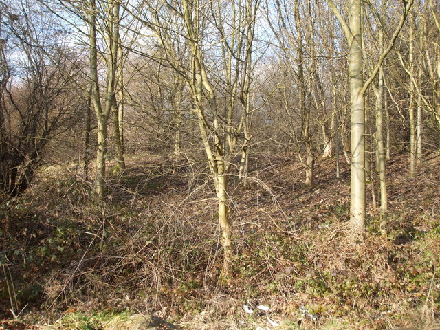
Scholes Coppice

Scholes Coppice (also called Scholes Wood) in an area of ancient woodland located to the north-west of Kimberworth in the Metropolitan Borough of Rotherham...

Scholes, South Yorkshire

Scholes is a small village in the Rotherham borough of South Yorkshire, England, near the southern boundary of Wentworth Woodhouse, formerly the family...
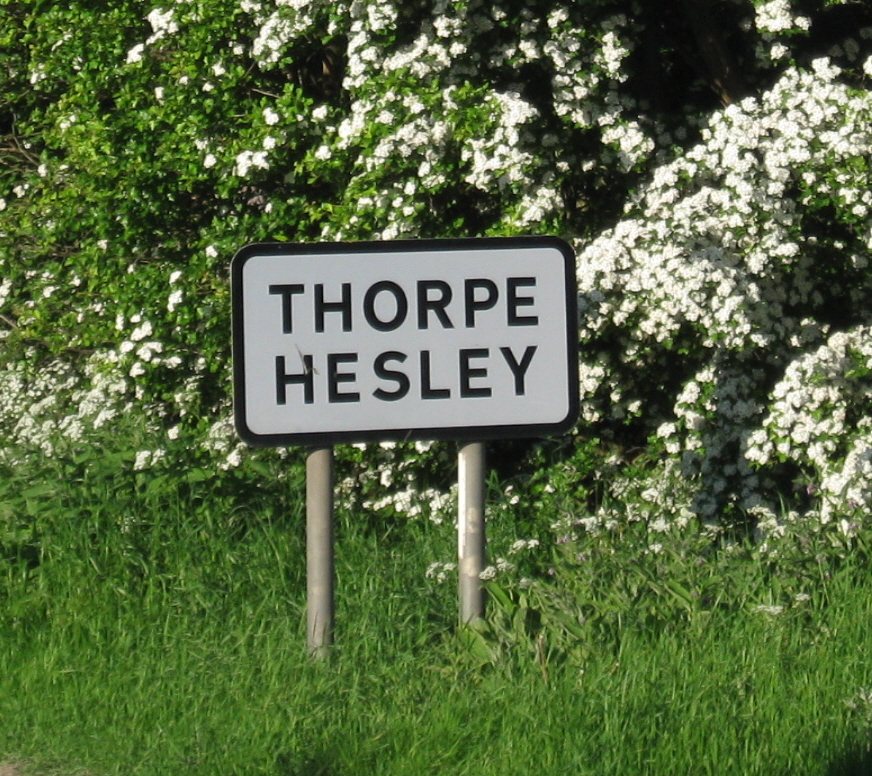
Thorpe Hesley

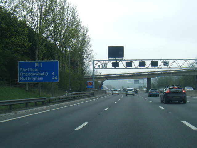
Thorpe Hesley is a village in the Metropolitan Borough of Rotherham, South Yorkshire, England, lying east of the M1 motorway at junction 35. The village...

Abbey School, Rotherham

Abbey School is a mixed special school for children with moderate and complex learning difficulties. It is located in Kimberworth, South Yorkshire, England...

Grange Lane railway station (South Yorkshire)

Grange Lane railway station was a railway station located on the South Yorkshire Railway line between Sheffield and Barnsley in South Yorkshire, England...

Old Hall Comprehensive School

Old Hall Comprehensive School was a comprehensive school located in Kimberworth, Rotherham, South Yorkshire, England. It merged with Kimberworth Comprehensive...

Winterhill School

Winterhill School is a mixed secondary school located in Kimberworth, Rotherham, South Yorkshire, England. The school was formed in 2004 by the merger...

Nearby Amenities

Located within 500m of 53.447982,-1.4184688
Bus Stop
Upper Wortley Road/Hesley Grange
Alt Name: Upper Wortley Road/Hesley Grange
Bus: yes
Naptan AltCommonName: Upper Wortley Road/Hesley Grange
Naptan AtcoCode: 370030884
Naptan Bearing: SE
Naptan CommonName: Upper Wortley Road/Hesley Grange
Naptan Indicator: 30884
Naptan Landmark: Keppels Column
Naptan PlusbusZoneRef: ROTHCEN
Naptan Street: Upper Wortley Road
Naptan Verified: no
Public Transport: platform
Source: naptan_import
Lat/Long: 53.4465111/-1.4153342
Bus Stop
Upper Wortley Road/Admirals Crest
Bus: yes
Naptan AtcoCode: 370030339
Naptan Bearing: NW
Naptan CommonName: Upper Wortley Road/Admirals Crest
Naptan Indicator: 30339
Naptan Landmark: Opposite Hesley House
Naptan PlusbusZoneRef: ROTHCEN
Naptan Street: Upper Wortley Road
Naptan Verified: no
Public Transport: platform
Source: naptan_import
Lat/Long: 53.4461337/-1.4148536
Bus Stop
Upper Wortley Road/Kirkstead Abbey Mews
Alt Name: Upper Wortley Road/Kirkstead Abbey Mews
Bus: yes
Naptan AltCommonName: Upper Wortley Road/Kirkstead Abbey Mews
Naptan AtcoCode: 370035064
Naptan Bearing: NW
Naptan CommonName: Upper Wortley Road/Kirkstead Abbey Mews
Naptan Indicator: 35064
Naptan Landmark: KIRKSTEAD ABBEY MEWS
Naptan PlusbusZoneRef: ROTHCEN
Naptan Street: Upper Wortley Road
Naptan Verified: no
Public Transport: platform
Source: naptan_import
Lat/Long: 53.450583/-1.4245692
Bus Stop
Upper Wortley Road/Keppel Road
Bus: yes
Naptan AtcoCode: 370035066
Naptan Bearing: N
Naptan CommonName: Upper Wortley Road/Keppel Road
Naptan Indicator: 35066
Naptan Landmark: Keppels Column
Naptan PlusbusZoneRef: ROTHCEN
Naptan Street: Upper Wortley Road
Naptan Verified: no
Public Transport: platform
Source: naptan_import
Lat/Long: 53.4480844/-1.4190619
Bus Stop
Upper Wortley Road/Louden Close
Bus: yes
Naptan AtcoCode: 370035068
Naptan Bearing: N
Naptan CommonName: Upper Wortley Road/Louden Close
Naptan Indicator: 35068
Naptan Landmark: 35068
Naptan PlusbusZoneRef: ROTHCEN
Naptan Street: Upper Wortley Road
Naptan Verified: no
Public Transport: platform
Source: naptan_import
Lat/Long: 53.4488211/-1.4198789
Turning Circle
Keppel Drive
Lat/Long: 53.4488022/-1.4183882
Post Box
Collection Times: Mo-Fr 09:00; Sa 07:00
Post Box Type: lamp
Ref: S61 161
Royal Cypher: EIIR
Royal Cypher Wikidata: Q33102113
Lat/Long: 53.4484298/-1.4193253
Information: board
Tourism: information
Lat/Long: 53.4478729/-1.4154047
Barrier: stile
Lat/Long: 53.4522034/-1.4167982
Tourism: viewpoint
Lat/Long: 53.447974/-1.4152908
Power: pole
Lat/Long: 53.4511618/-1.4212873
Upper Wortley Road/Kirkstead Abbey Mews
Bus: yes
Public Transport: stop_position
Lat/Long: 53.450639/-1.4245432
Upper Wortley Road/Louden Close
Bus: yes
Public Transport: stop_position
Lat/Long: 53.4487901/-1.4199409
Upper Wortley Road/Keppel Road
Bus: yes
Public Transport: stop_position
Lat/Long: 53.4481189/-1.4190205
Upper Wortley Road/Hesley Grange
Bus: yes
Public Transport: stop_position
Lat/Long: 53.4464431/-1.4154158
Upper Wortley Road/Admirals Crest
Bus: yes
Public Transport: stop_position
Lat/Long: 53.4461899/-1.4148168
Power: pole
Lat/Long: 53.4485552/-1.4252582
Power: pole
Lat/Long: 53.4501749/-1.422739
Power: pole
Lat/Long: 53.4493288/-1.424055
Power: pole
Lat/Long: 53.4521462/-1.4196537
Keppel's Column
Place: suburb
Lat/Long: 53.4481546/-1.4184384
The data included in this document is from www.openstreetmap.org. The data is made available under ODbL.

Have you been to Keppel's Column?

Leave your review of Keppel's Column below (or comments, questions and feedback).