Keeper's Corner

Settlement in Surrey Tandridge

England

Keeper's Corner

St Bartholomew Church, Burstow, Surrey A delightful half timbered 11th century Church of England church in this tranquil village (other than all of Gatwick airports air traffic that thunders a few hundred metres overhead!). Restored 184-95.
More info at <span class="nowrap"><a title="http://www.achurchnearyou.com/page.php?V=565&P=207" rel="nofollow ugc noopener" href="http://www.achurchnearyou.com/page.php?V=565&P=207">Link</a><img style="margin-left:2px;" alt="External link" title="External link - shift click to open in new window" src="https://s1.geograph.org.uk/img/external.png" width="10" height="10"/></span>
St Bartholomew Church, Burstow, Surrey Credit: Pete Chapman

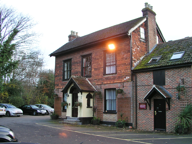
Keeper's Corner is a small village located in the county of Surrey, England. Situated approximately 25 miles south-west of London, it is nestled within the picturesque Surrey Hills Area of Outstanding Natural Beauty. The village is known for its charming countryside scenery and tranquil surroundings, making it a popular destination for nature lovers and those seeking a peaceful retreat.

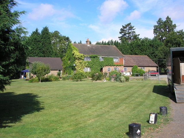
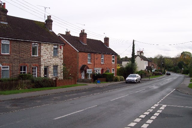
The community of Keeper's Corner is comprised mainly of residential properties, with a mix of traditional cottages and modern houses. The village has a close-knit community, with a small population that values its rural identity. The local residents take pride in maintaining the village's charm and preserving its natural environment.

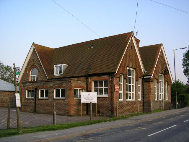
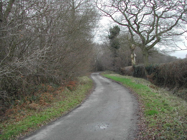
Despite its small size, Keeper's Corner offers a range of amenities and services to its residents. These include a local convenience store, a post office, and a village hall that serves as a hub for community events and gatherings. The village also has a primary school, providing education for the younger population. For recreational activities, there are several walking trails and cycling routes in the surrounding countryside, allowing residents and visitors to explore the beautiful landscapes.

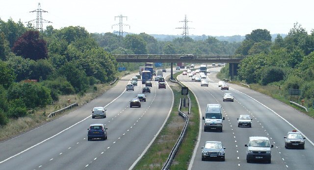
The location of Keeper's Corner is also advantageous for those looking to explore the wider area. The nearby town of Guildford offers a wider range of amenities, including shopping centers, restaurants, and entertainment options. Additionally, the village benefits from excellent transport links, with easy access to major roads and railway connections, allowing for convenient travel to surrounding towns and cities.

Overall, Keeper's Corner offers a tranquil and idyllic setting for those seeking a peaceful lifestyle amidst beautiful natural surroundings, while still providing access to necessary amenities and nearby urban areas.

If you have any feedback on the listing, please let us know in the comments section below.

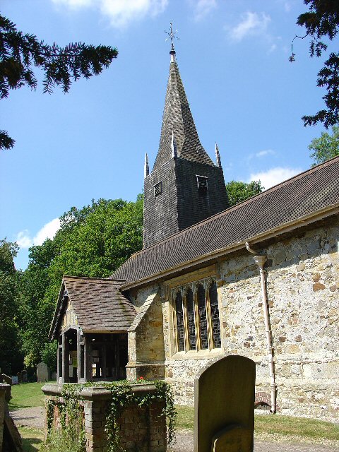
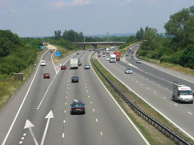
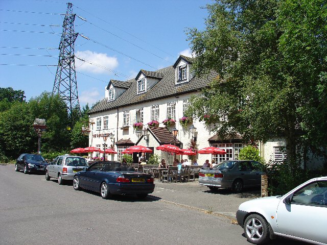
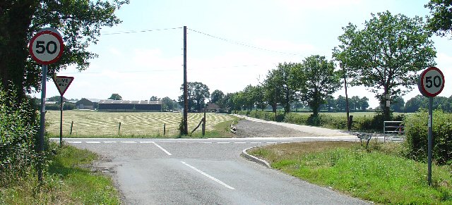
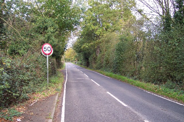
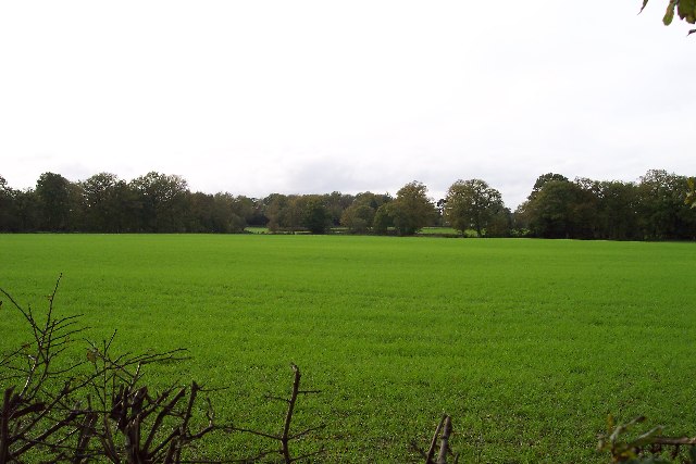
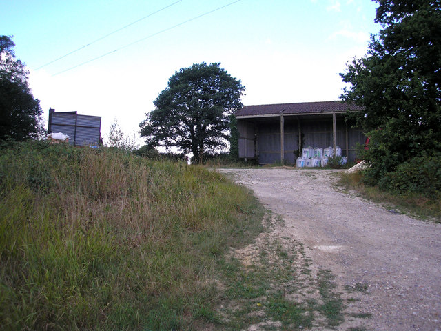
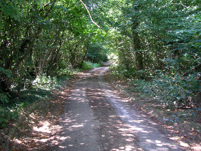
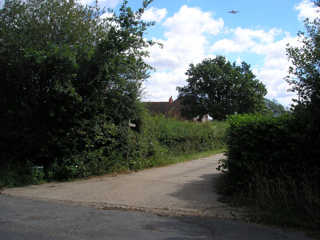
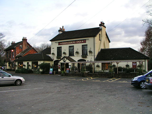
Keeper's Corner Images

Images are sourced within 2km of 51.152672/-0.11004449 or Grid Reference TQ3240. Thanks to Geograph Open Source API. All images are credited.

St Bartholomew Church, Burstow, Surrey A delightful half timbered 11th century Church of England church in this tranquil village (other than all of Gatwick airports air traffic that thunders a few hundred metres overhead!). Restored 184-95.
More info at <span class="nowrap"><a title="http://www.achurchnearyou.com/page.php?V=565&P=207" rel="nofollow ugc noopener" href="http://www.achurchnearyou.com/page.php?V=565&P=207">Link</a><img style="margin-left:2px;" alt="External link" title="External link - shift click to open in new window" src="https://s1.geograph.org.uk/img/external.png" width="10" height="10"/></span>
St Bartholomew Church, Burstow, Surrey
A delightful half timbered 11th century Church of England church in this tranquil village (other than all of Gatwick airports air traffic that thunders a few hundred metres overhead!). Restored 184-95. More info at LinkExternal link
M23 Junction 9 - Gatwick Airport Spur Road, West Sussex Viewed from a bridleway bridge just to the south, looking N.
M23 Junction 9 - Gatwick Airport Spur Road, West Sussex
Viewed from a bridleway bridge just to the south, looking N.
The Shipley Bridge Pub, Shipley Bridge, Surrey A country pub with a large pub garden. View taken from E looking W. Popular on this Friday lunchtime.
The Shipley Bridge Pub, Shipley Bridge, Surrey
A country pub with a large pub garden. View taken from E looking W. Popular on this Friday lunchtime.
Road Junction of B2037 with minor road to Burstow. Newhouse Farm in the Background A junction with a busy road. Most of this square is farmland, with the B road cutting across from E-W. Newhouse Farm dominates the view in the distance. View taken from Burstow road, looking SSE.
Road Junction of B2037 with minor road to Burstow. Newhouse Farm in the Background
A junction with a busy road. Most of this square is farmland, with the B road cutting across from E-W. Newhouse Farm dominates the view in the distance. View taken from Burstow road, looking SSE.
Motorway Bridge of B2037 over M23, Shipley Bridge, Surrey View taken from Bridleway bridge to the N, looking S. The Shipley Bridge Pub is very close to this bridge.
Motorway Bridge of B2037 over M23, Shipley Bridge, Surrey
View taken from Bridleway bridge to the N, looking S. The Shipley Bridge Pub is very close to this bridge.
Telephone Mast near M23 Junction 9, Near Burstow, Surrey. This is situated in a field just N of a bridleway leading to Burstow. View taken looking N from the bridleway.
Telephone Mast near M23 Junction 9, Near Burstow, Surrey.
This is situated in a field just N of a bridleway leading to Burstow. View taken looking N from the bridleway.
The John Flamsteed Hall, Burstow Church, Burstow, Surrey Just over the road from the church. A plaque over the door states that the building was erected in 1859.
The John Flamsteed Hall, Burstow Church, Burstow, Surrey
Just over the road from the church. A plaque over the door states that the building was erected in 1859.
Turf Farming Perry Farm is flat and ideal for producing turves.
Turf Farming
Perry Farm is flat and ideal for producing turves.
Road in a rural area Taken from TQ322400 looking almost north shows the smaller of two roads in the square, which is very rural.
Road in a rural area
Taken from TQ322400 looking almost north shows the smaller of two roads in the square, which is very rural.
A very rural square Taken from the b.o.a.t. at TQ327405 looking west. A very rural square.
A very rural square
Taken from the b.o.a.t. at TQ327405 looking west. A very rural square.
Redehall Preparatory School in Redehall Road, Smallfield. Occupying the buildings of the former village school - <span class="nowrap"><a title="http://www.redehall.surrey.sch.uk/" rel="nofollow ugc noopener" href="http://www.redehall.surrey.sch.uk/">Link</a><img style="margin-left:2px;" alt="External link" title="External link - shift click to open in new window" src="https://s1.geograph.org.uk/img/external.png" width="10" height="10"/></span>
Redehall Preparatory School
in Redehall Road, Smallfield. Occupying the buildings of the former village school - LinkExternal link
Sheridan Farm, West Park Road, Surrey Sheridan Farm lies just south of the B2028 near Domewood.  The breeding and rearing of racehorses is an important activity here.
Sheridan Farm, West Park Road, Surrey
Sheridan Farm lies just south of the B2028 near Domewood. The breeding and rearing of racehorses is an important activity here.
Open barns, Chithurst Farm, Surrey Chithurst Farm is reached by a long and narrow lane leading southwards from Croydonbarns Lane
Open barns, Chithurst Farm, Surrey
Chithurst Farm is reached by a long and narrow lane leading southwards from Croydonbarns Lane
Chithurst Lane, Surrey The status of this lane south of Chithurst Farm is not known to me.  There are no public footpath or bridleway markings on the OS map, where it is just shown as a 'white' road.  Whether it actually emerges anywhere at the southern end I do not know.  As can be seen from the photograph, it is barely motorable.
Chithurst Lane, Surrey
The status of this lane south of Chithurst Farm is not known to me. There are no public footpath or bridleway markings on the OS map, where it is just shown as a 'white' road. Whether it actually emerges anywhere at the southern end I do not know. As can be seen from the photograph, it is barely motorable.
Dowlands Farm, Dowlands Lane, Surrey Dowlands Farm drowses in the late morning sun, while high above an airliner begins its landing approach to Gatwick Airport.
Dowlands Farm, Dowlands Lane, Surrey
Dowlands Farm drowses in the late morning sun, while high above an airliner begins its landing approach to Gatwick Airport.
The Hedgehog Inn, Copthorne Formerly the Effingham Arms the Hedgehog is now a restaurant pub and has acquired the adjacent house (in the left of shot) to provide guest rooms. In a sense it's assumed the function of the old-fashioned inn. The exterior has hardly changed since the 1950s <span class="nowrap"><a title="http://www.francisfrith.com/search/england/west+sussex/copthorne/photos/copthorne_C422005.htm" rel="nofollow ugc noopener" href="http://www.francisfrith.com/search/england/west+sussex/copthorne/photos/copthorne_C422005.htm">Link</a><img style="margin-left:2px;" alt="External link" title="External link - shift click to open in new window" src="https://s1.geograph.org.uk/img/external.png" width="10" height="10"/></span>.

It's the occasional meeting place for local members of the Guinea Pig Club <span class="nowrap"><a title="http://en.wikipedia.org/wiki/Guinea_Pig_Club" rel="nofollow ugc noopener" href="http://en.wikipedia.org/wiki/Guinea_Pig_Club">Link</a><img style="margin-left:2px;" alt="External link" title="External link - shift click to open in new window" src="https://s1.geograph.org.uk/img/external.png" width="10" height="10"/></span> who will have witnessed the changes over the years.
The Hedgehog Inn, Copthorne
Formerly the Effingham Arms the Hedgehog is now a restaurant pub and has acquired the adjacent house (in the left of shot) to provide guest rooms. In a sense it's assumed the function of the old-fashioned inn. The exterior has hardly changed since the 1950s LinkExternal link. It's the occasional meeting place for local members of the Guinea Pig Club LinkExternal link who will have witnessed the changes over the years.
Accommodation for the Hedgehog House converted into guest rooms to provide accommodation for <a href="https://www.geograph.org.uk/photo/620618">TQ3340 : The Hedgehog Inn, Copthorne</a>. The structure built on to the right of the house looks new but may simply have been repointed as it appears on a photograph from the 1950s <span class="nowrap"><a title="http://www.francisfrith.com/search/england/west+sussex/copthorne/photos/copthorne_C422005.htm" rel="nofollow ugc noopener" href="http://www.francisfrith.com/search/england/west+sussex/copthorne/photos/copthorne_C422005.htm">Link</a><img style="margin-left:2px;" alt="External link" title="External link - shift click to open in new window" src="https://s1.geograph.org.uk/img/external.png" width="10" height="10"/></span>.
Accommodation for the Hedgehog
House converted into guest rooms to provide accommodation for TQ3340 : The Hedgehog Inn, Copthorne. The structure built on to the right of the house looks new but may simply have been repointed as it appears on a photograph from the 1950s LinkExternal link.
Chithurst Lane The lane is a no-through road for motor vehicles, but still maintained by the county council as far as Brick Barns Farm, useable if you don't mind the odd pothole (see also <a href="https://www.geograph.org.uk/photo/212606">TQ3341 : Chithurst Lane, Surrey</a>). Beyond Brick Barns Farm is a bridleway which connects with West Park Road (B2028), although the entire route was perhaps once a through road. For a minor country lane, it cuts a remarkably wide swathe through the fields: nearly 30m between the field boundaries on either side.
Chithurst Lane
The lane is a no-through road for motor vehicles, but still maintained by the county council as far as Brick Barns Farm, useable if you don't mind the odd pothole (see also TQ3341 : Chithurst Lane, Surrey). Beyond Brick Barns Farm is a bridleway which connects with West Park Road (B2028), although the entire route was perhaps once a through road. For a minor country lane, it cuts a remarkably wide swathe through the fields: nearly 30m between the field boundaries on either side.
Show me another place!

Keeper's Corner is located at Grid Ref: TQ3240 (Lat: 51.152672, Lng: -0.11004449)

Administrative County: Surrey

District: Tandridge

Police Authority: Surrey

What 3 Words

///native.cheat.suffice. Near Copthorne, West Sussex

Nearby Locations

Keeper's Corner

Related Wikis

Copthorne, West Sussex

Copthorne is a village in the Mid Sussex district of West Sussex, England. It lies close to Gatwick Airport, 25.5 miles (41 km) south of London, 21.5 miles...

Burstow

Burstow is a village and civil parish in the Tandridge district of Surrey, England. Its largest settlement is Smallfield. Smallfield is 2.5 miles (4.0...

Fernhill, West Sussex

Fernhill is a hamlet close to Gatwick Airport in West Sussex, England. Its fields and farmhouses formerly straddled the county boundary between Surrey...

Ariana Afghan Airlines Flight 701

Ariana Afghan Airlines Flight 701 was the flight involved in a fatal air accident on 5 January 1969, when a Boeing 727 with 62 people on board crashed...

A264 road

The A264 is an east–west road in southern England that runs from Pembury in west Kent to Five Oaks in West Sussex. == History == There have been a number...

Crawley Down Monastery

The Monastery of the Holy Trinity, Crawley Down is an Anglican monastery located at Crawley Down in West Sussex, England. The monastery belongs to the...

Hedgecourt

Hedgecourt is a 33.6-hectare (83-acre) biological Site of Special Scientific Interest (SSSI) north of Felbridge in Surrey. An area of 5 ha (12 acres) is...

Tinsley Green

Tinsley Green is an area in the Borough of Crawley, one of seven local government districts in the English county of West Sussex. Originally a hamlet...

Related Videos

Rubytues walking on the pavement

This is Rubytues, a gorgeous rescue staffie who is currently at Rescue Remedies Dog Rescue. If you want to find out more about ...

Rokita walking beautifully on the lead

Rokita is a rescue dog. You can find out more about her here: ...

Nearby Amenities

Located within 500m of 51.152672,-0.11004449
Traffic Signals
Lat/Long: 51.1530461/-0.1109514
Man Made: survey_point
Source: npe
Lat/Long: 51.1547859/-0.1052439
Post Box
Ref: RH6 212
Lat/Long: 51.1537006/-0.1108135
Bus Stop
Bonwicke Cottages
Bus: yes
Naptan AtcoCode: 40004410010A
Naptan Bearing: N
Naptan CommonName: Bonwicke Cottages
Naptan Indicator: Just Before
Naptan Landmark: Bonwicke Cottages
Naptan NaptanCode: surdmgma
Naptan Street: Copthorne Bank
Naptan Verified: yes
Public Transport: platform
Source: naptan_import
Wheelchair: no
Lat/Long: 51.1488507/-0.1105342
Bus Stop
Bonwicke Cottages
Bus: yes
Naptan AtcoCode: 40004410010B
Naptan Bearing: S
Naptan BusStopType: CUS
Naptan CommonName: Bonwicke Cottages
Naptan Indicator: Just after
Naptan Landmark: Bonwicke Cottages
Naptan NaptanCode: surgpawm
Naptan Street: Copthorne Bank
Naptan Verified: no
Physically Present: no
Public Transport: platform
Source: naptan_import
Wheelchair: no
Lat/Long: 51.1492605/-0.1104271
Bus Stop
Keepers Corner
Bus: yes
Naptan AtcoCode: 40004410011A
Naptan Bearing: S
Naptan CommonName: Keepers Corner
Naptan Indicator: Just Before
Naptan Landmark: Keepers Corner
Naptan NaptanCode: surdmgmd
Naptan Street: Redehall Road
Naptan Verified: yes
Public Transport: platform
Source: naptan_import
Wheelchair: limited
Lat/Long: 51.1538648/-0.1109359
Barrier: stile
Lat/Long: 51.1494205/-0.1088146
Barrier: stile
Lat/Long: 51.1507376/-0.1067644
Barrier: stile
Lat/Long: 51.1491513/-0.1104101
Barrier: stile
Lat/Long: 51.1501781/-0.1069878
First Burstow Scouts
Brand: The Scout Association
Brand Wikidata: Q849740
Club: scout
Name En: 1st Burstow Scouts
Lat/Long: 51.1555403/-0.1122681
Bus Stop
Keepers Corner
Bus: yes
Naptan AtcoCode: 40004410011B
Naptan Bearing: N
Naptan CommonName: Keepers Corner
Naptan Indicator: Just after
Naptan Landmark: Keepers Corner
Naptan NaptanCode: surdmgmg
Naptan Street: Redehall Road
Naptan Verified: yes
Public Transport: platform
Source: naptan_import
Wheelchair: limited
Lat/Long: 51.1535342/-0.111057
Access: no
Barrier: block
Lat/Long: 51.1552986/-0.1119198
The data included in this document is from www.openstreetmap.org. The data is made available under ODbL.

Have you been to Keeper's Corner?

Leave your review of Keeper's Corner below (or comments, questions and feedback).