Ingliston

Settlement in Midlothian

Scotland

Ingliston

Edinburgh Airport Looking east from the newest stands towards car parks, airport vehicle park and private maintenance hangars.
Edinburgh Airport Credit: M J Richardson

Ingliston is a small village located in the county of Midlothian, Scotland. Situated approximately 7 miles west of the capital city of Edinburgh, it falls within the boundaries of the City of Edinburgh Council. The village is surrounded by picturesque countryside and offers a tranquil retreat from the bustling city life.

Ingliston is primarily known for its proximity to the Royal Highland Centre, which is a large exhibition venue and home to the Royal Highland Show, Scotland's largest agricultural event. The Royal Highland Centre attracts a wide range of events and exhibitions throughout the year, including trade shows, concerts, and sporting events.

In addition to the Royal Highland Centre, Ingliston is also home to a number of equestrian facilities. The Scottish National Equestrian Centre, located within the village, hosts various equestrian events and competitions, drawing participants and spectators from all over the country.

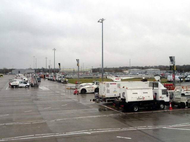
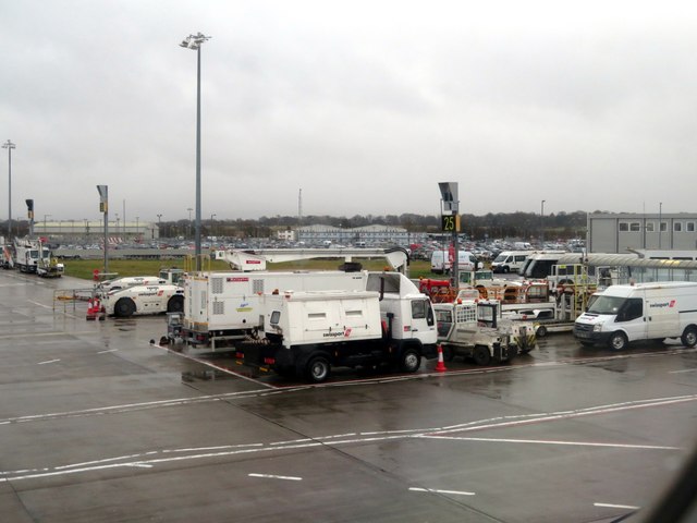
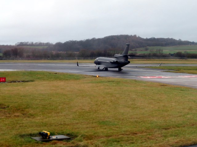
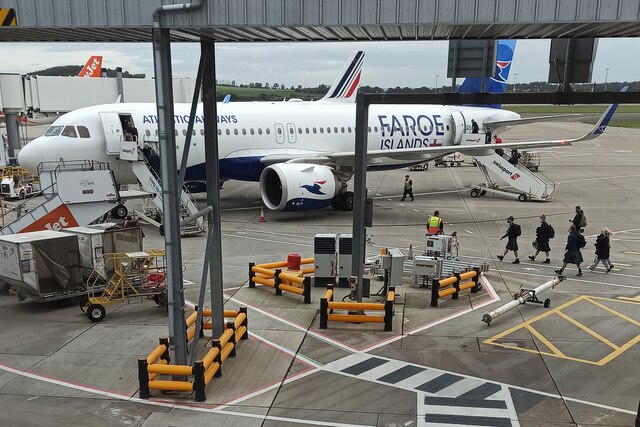
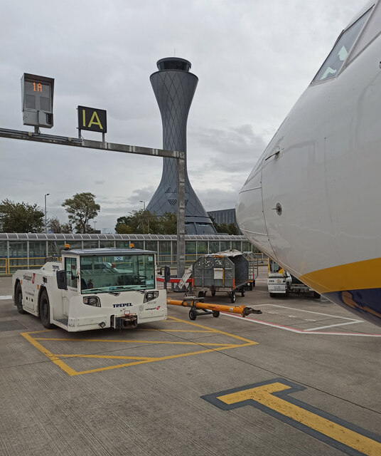
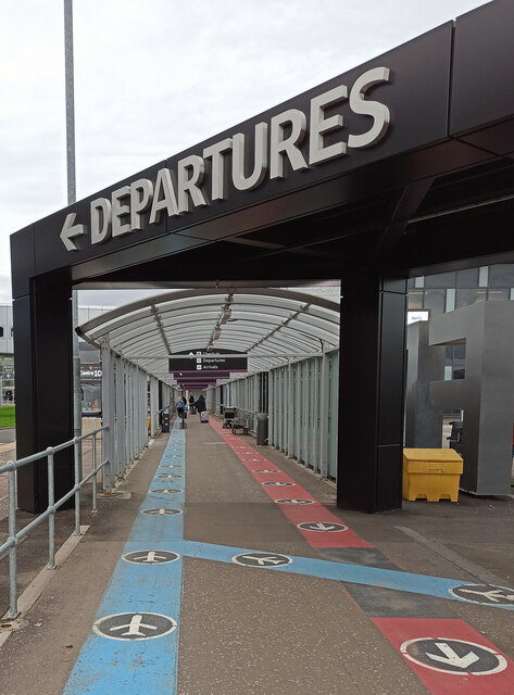
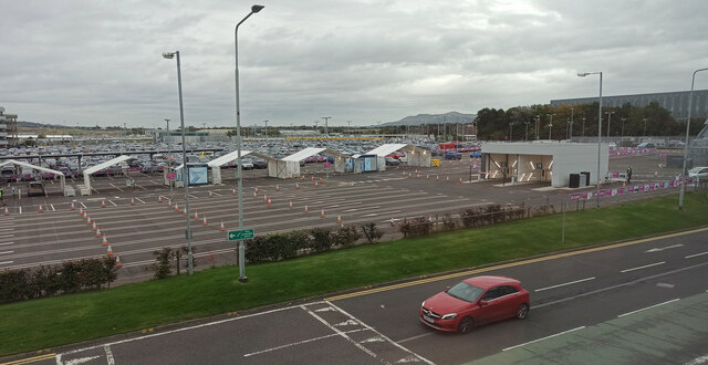
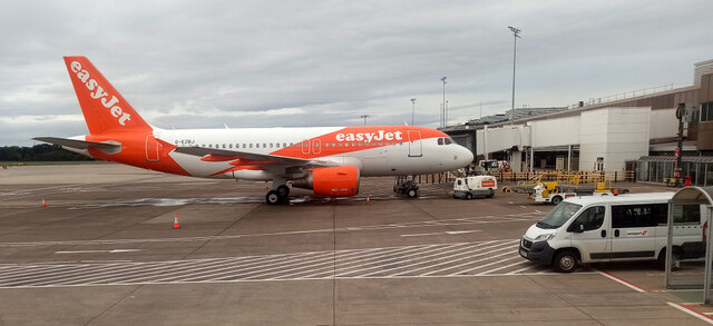
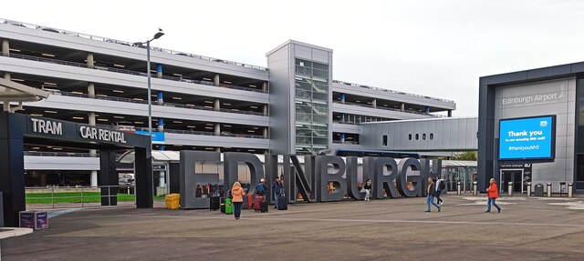
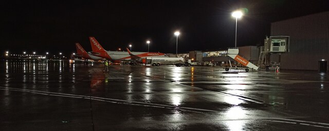
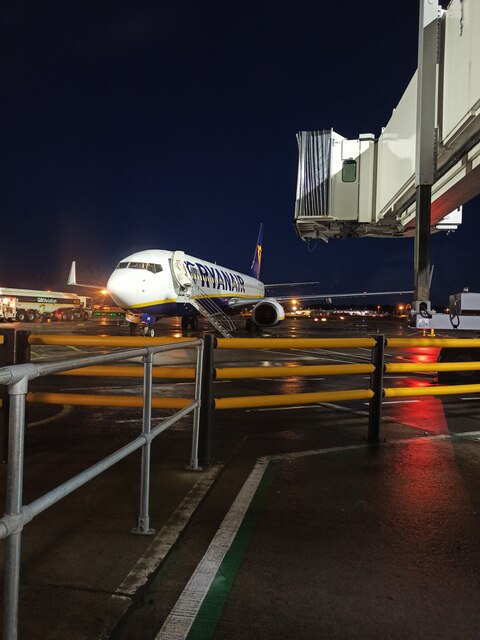
The village itself is relatively small, with a population of around 200 people. It offers a range of amenities, including a local pub and a hotel. The nearby Edinburgh Airport, just a short distance from Ingliston, provides convenient transportation options for residents and visitors alike.

Overall, Ingliston is a charming village in Midlothian, renowned for its close proximity to the Royal Highland Centre and equestrian facilities. With its peaceful surroundings and easy access to both the countryside and the city, it offers a unique blend of rural tranquility and urban convenience.

If you have any feedback on the listing, please let us know in the comments section below.

Ingliston Images

Images are sourced within 2km of 55.942907/-3.3695377 or Grid Reference NT1473. Thanks to Geograph Open Source API. All images are credited.

Edinburgh Airport Looking east from the newest stands towards car parks, airport vehicle park and private maintenance hangars.
Edinburgh Airport
Looking east from the newest stands towards car parks, airport vehicle park and private maintenance hangars.
Edinburgh Airport Looking southeast from the newest stands towards car parks, airport vehicle park and private maintenance hangars.
Edinburgh Airport
Looking southeast from the newest stands towards car parks, airport vehicle park and private maintenance hangars.
Dassault Falcon 7X at Edinburgh Airport Accelerating for take-off on Runway 06-24.
Dassault Falcon 7X at Edinburgh Airport
Accelerating for take-off on Runway 06-24.
Tartan Army at Edinburgh Airport Some of the many Scotland football fans boarding a flight to the Faroe Islands for tomorrow's World Cup qualifier match.
Tartan Army at Edinburgh Airport
Some of the many Scotland football fans boarding a flight to the Faroe Islands for tomorrow's World Cup qualifier match.
Airside at Edinburgh Airport The Ryanair flight to Prague is about to depart from Gate 1A. The distinctive NATS tower is in the background.

Compare with the same view in July 2018 <a href="https://www.geograph.org.uk/photo/5834942">NT1473 : Airside at Edinburgh Airport</a>.
Airside at Edinburgh Airport
The Ryanair flight to Prague is about to depart from Gate 1A. The distinctive NATS tower is in the background. Compare with the same view in July 2018 NT1473 : Airside at Edinburgh Airport.
Bike path at Edinburgh Airport This section leads from the long stay car parks to the hotels and car rental area. It crosses the Gogar Burn and the tram lines in quick succession.
Bike path at Edinburgh Airport
This section leads from the long stay car parks to the hotels and car rental area. It crosses the Gogar Burn and the tram lines in quick succession.
The Gogar Burn The burn runs in a channel at this point, near the long stay car parks at Edinburgh Airport.
The Gogar Burn
The burn runs in a channel at this point, near the long stay car parks at Edinburgh Airport.
Tram level crossing at Edinburgh Airport A bike path crosses the line at this point
Tram level crossing at Edinburgh Airport
A bike path crosses the line at this point
Covered walkway at Edinburgh Airport Red and blue lines on the floor in an attempt to keep passengers socially distanced from each other while the Coronavirus (Covid-19) persists.
Covered walkway at Edinburgh Airport
Red and blue lines on the floor in an attempt to keep passengers socially distanced from each other while the Coronavirus (Covid-19) persists.
Drive-through Covid-19 test centre at Edinburgh Airport Part of the surface car park nearest the departures area has been converted to a drive-through test area.
Drive-through Covid-19 test centre at Edinburgh Airport
Part of the surface car park nearest the departures area has been converted to a drive-through test area.
Easyjet aircraft at Edinburgh Airport The Airbus A319-111 aircraft G-EZBJ arrived from Stansted earlier in the day.
Easyjet aircraft at Edinburgh Airport
The Airbus A319-111 aircraft G-EZBJ arrived from Stansted earlier in the day.
Edinburgh Airport The large Edinburgh sign is popular with locals and tourists alike.
Edinburgh Airport
The large Edinburgh sign is popular with locals and tourists alike.
Night scene at Edinburgh Airport Easyjet and Loganair aircraft and a Pentland Aviation fuel tanker, airside at the east side of the airport.
Night scene at Edinburgh Airport
Easyjet and Loganair aircraft and a Pentland Aviation fuel tanker, airside at the east side of the airport.
Old milestone A view of the milestone 7 miles from Edinburgh on Boathouse Bridge Road west of the River Almond.   Boathouse Bridge over the river is now known as 'the bridge to nowhere' after the B9080 was cut by the airport runway.  It is on the route of the Northern Route turnpike from Edinburgh-Linlithgow-Falkirk-Glasgow
Old milestone
A view of the milestone 7 miles from Edinburgh on Boathouse Bridge Road west of the River Almond. Boathouse Bridge over the river is now known as 'the bridge to nowhere' after the B9080 was cut by the airport runway. It is on the route of the Northern Route turnpike from Edinburgh-Linlithgow-Falkirk-Glasgow
Old milestone A close-up of the top of the 7 mile stone on Boathouse Bridge Road.   A very faint EDIN can be made out just above the clearer 7.
Old milestone
A close-up of the top of the 7 mile stone on Boathouse Bridge Road. A very faint EDIN can be made out just above the clearer 7.
Airside at Edinburgh Airport Ryanair Boeing 737 with registration number EI-DHF at Gate 16 is preparing to depart for Prague.
Airside at Edinburgh Airport
Ryanair Boeing 737 with registration number EI-DHF at Gate 16 is preparing to depart for Prague.
Airside at Edinburgh Airport A Christmas tree and floor markings to remind passengers to keep a safe distance from others during the coronavirus (Covid-19) pandemic, Omicron wave.
Airside at Edinburgh Airport
A Christmas tree and floor markings to remind passengers to keep a safe distance from others during the coronavirus (Covid-19) pandemic, Omicron wave.
Travelodge at Ratho Station near Edinburgh Airport
Show me another place!

Ingliston is located at Grid Ref: NT1473 (Lat: 55.942907, Lng: -3.3695377)

Unitary Authority: City of Edinburgh

Police Authority: Edinburgh

What 3 Words

///serve.bunks.simple. Near Ratho Station, Edinburgh

Nearby Locations

Ingliston

Related Wikis

Royal Highland Centre

The Royal Highland Centre (RHC), originally the Royal Highland Showground, is an exhibition centre and showground located at Ingliston in the western outskirts...

Royal Highland Show

The Royal Highland Show is Scotland's biggest annual Agricultural show. The show is organised by the Royal Highland and Agricultural Society of Scotland...

Ingliston

Ingliston (; Scots: Inglistoun) is an area in the west of Edinburgh, near Maybury, South Gyle and Newbridge. It is home to Edinburgh Airport and The Royal...

Ingliston Racing Circuit

Ingliston Racing Circuit is 1.030 mi (1.658 km) motor racing circuit that was built at the Royal Highland Showground at Ingliston, Edinburgh. The circuit...

RAF Turnhouse

Royal Air Force Turnhouse, or more simply RAF Turnhouse, is a former Royal Air Force Sector Station located in Edinburgh, Scotland. It is now Edinburgh...
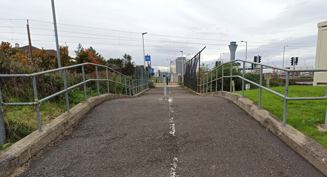
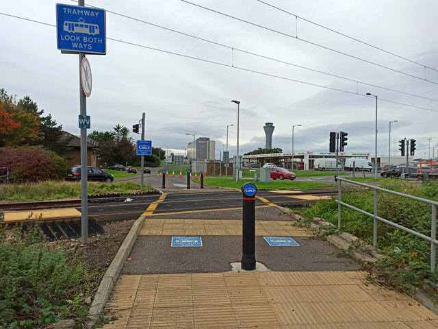
Edinburgh Airport

Edinburgh Airport (Scottish Gaelic: Port-adhair Dhùn Èideann) (IATA: EDI, ICAO: EGPH) is an airport located in the Ingliston area of Edinburgh, Scotland...

Ratho rail crash

The Ratho Rail crash occurred on 3 January 1917 and killed 12 people. It occurred near Ratho Station in Scotland when an express collided with a light...

Edinburgh Airport Rail Link

The Edinburgh Airport Rail Link (EARL) was a proposed rail link to Edinburgh Airport, Scotland. The project was passed by the Scottish Parliament in 2007...

Nearby Amenities

Located within 500m of 55.942907,-3.3695377
Mini Roundabout
Lat/Long: 55.9407851/-3.3703448
Bus Stop
Royal Highland Showground
Naptan AtcoCode: 6200247602
Naptan Bearing: S
Naptan CommonName: Royal Highland Showground
Naptan Indicator: Car Park Bus Stop
Naptan Landmark: Ingliston Showground
Naptan NaptanCode: 36245832
Naptan PlusbusZoneRef: EDINBUR
Naptan Street: NA
Naptan Verified: no
Public Transport: platform
Source: naptan_import
Lat/Long: 55.9410783/-3.3688003
Access: customers
Barrier: lift_gate
Lat/Long: 55.9445603/-3.3709901
Power: pole
Lat/Long: 55.9434307/-3.3768296
Charging Station
Edinburgh Supercharger
Access: customers
Bicycle: no
Brand: Tesla, Inc.
Brand Wikidata: Q478214
Capacity: 2
Fee: yes
Motorcar: yes
Opening Hours: 24/7
Operator: Tesla, Inc.
Operator Wikidata: Q478214
Short Name: Tesla
Socket Tesla Supercharger: 2
Socket Tesla Supercharger Output: 150 kW
Socket Tesla Supercharger Ccs: 2
Socket Tesla Supercharger Ccs Output: 150 kW
Tesla Ref: edinburghsupercharger
Website: https://www.tesla.com/findus/location/supercharger/edinburghsupercharger
Lat/Long: 55.9453713/-3.3667292
Aeroway: gate
Ref: 1K
Lat/Long: 55.9467381/-3.3657292
Turning Circle
Lat/Long: 55.9461599/-3.3653543
Access: foot
Barrier: block
Lat/Long: 55.9452378/-3.3736853
Secure Airparks - Airport Parking Edinburgh
Description: Edinburgh Airport Parking
Lat/Long: 55.9453278/-3.371735
603 'City of Edinburgh' Squadron Spitfire Memorial
Aircraft Type: military
Artwork Type: installation
Historic: aircraft
Tourism: artwork
Lat/Long: 55.9448685/-3.3629298
Aeroway: parking_position
Ref: 1B
Lat/Long: 55.945723/-3.3660253
Aeroway: parking_position
Ref: 1A
Lat/Long: 55.9461297/-3.3660301
Aeroway: parking_position
Ref: 1
Lat/Long: 55.9465841/-3.3659082
Aeroway: gate
Ref: 99
Lat/Long: 55.9459417/-3.3684924
Aeroway: gate
Ref: 100
Lat/Long: 55.9460674/-3.3686467
Aeroway: gate
Ref: 101
Lat/Long: 55.9461928/-3.3684874
Aeroway: gate
Ref: 102
Lat/Long: 55.9465302/-3.368796
Aeroway: gate
Ref: 103
Lat/Long: 55.9470382/-3.3688166
Animal Breeding
Ingliston Cattery and Kennels
Addr Postcode: EH28 8NB
Addr Street: Ingliston Road
Animal Breeding: dog;cat
Opening Hours: Mo-Su 08:30-16:30
Lat/Long: 55.9400448/-3.36644
Car Rental
gold car
Lat/Long: 55.9440897/-3.3724169
Man Made: mast
Lat/Long: 55.9407297/-3.3627395
Entrance: main
Lat/Long: 55.9428075/-3.3705012
Give Way
Direction: backward
Lat/Long: 55.9452077/-3.3655452
Barrier: lift_gate
Lat/Long: 55.9453429/-3.3652381
Barrier: lift_gate
Lat/Long: 55.9453527/-3.3653849
DSS F
Gas Insulated: yes
Location: indoor
Power: substation
Substation: minor_distribution
Voltage: 11000
Lat/Long: 55.9453339/-3.3668442
Entrance: main
Lat/Long: 55.9449719/-3.3667221
Royal Highland Ingilston
Location: indoor
Operator: SP Energy Networks
Operator Wikidata: Q116022116
Power: substation
Substation: minor_distribution
Lat/Long: 55.943168/-3.3700608
Location: indoor
Power: substation
Substation: minor_distribution
Voltage: 11000
Lat/Long: 55.944171/-3.3704216
MARSHALL'S F VIEW PF ISTON
Location: indoor
Operator: SP Energy Networks
Power: substation
Substation: minor_distribution
Voltage: 11000
Lat/Long: 55.9440885/-3.3704219
Location: outdoor
Power: transformer
Lat/Long: 55.9441492/-3.3704907
Entrance: main
Lat/Long: 55.9436083/-3.3751534
Bicycle Parking
Bicycle Parking: stands
Capacity: 8
Lat/Long: 55.9440211/-3.3713409
Entrance: exit
Lat/Long: 55.9423194/-3.3704222
Communication Mobile Phone: yes
Man Made: mast
Operator: O2
Tower Construction: lattice
Tower Type: communication
Lat/Long: 55.9432791/-3.3701299
Entrance: yes
Lat/Long: 55.9438591/-3.3619356
Leisure: picnic_table
Lat/Long: 55.9437951/-3.3624186
Leisure: picnic_table
Lat/Long: 55.9437906/-3.3624856
Leisure: picnic_table
Lat/Long: 55.9437553/-3.3624655
Leisure: picnic_table
Lat/Long: 55.9437553/-3.3623998
Bicycle Parking
Access: yes
Bicycle Parking: stands
Capacity: 20
Covered: no
Lit: yes
Lat/Long: 55.9435713/-3.3619559
Moxy Hotel Unit A&B
Gas Insulated: yes
Location: indoor
Operator: SP Energy Networks
Power: substation
Substation: minor_distribution
Lat/Long: 55.9434391/-3.3632601
Car Rental
Green Motion
Building: yes
Fixme: Exact position and shape when on an aerial image
Source: survey;bing
Lat/Long: 55.9457154/-3.3723334
Bench
Lat/Long: 55.9428874/-3.3704248
Toilets
Access: customers
Level: 1
Wheelchair: yes
Lat/Long: 55.9465114/-3.3655098
Aeroway: gate
Ref: 1F
Lat/Long: 55.9465129/-3.3653516
Aeroway: gate
Ref: 1A
Lat/Long: 55.9465189/-3.3652255
Barrier: bollard
Bollard: fixed
Material: plastic
Lat/Long: 55.9436092/-3.3758941
The data included in this document is from www.openstreetmap.org. The data is made available under ODbL.

Have you been to Ingliston?

Leave your review of Ingliston below (or comments, questions and feedback).