Hoften's Cross

Settlement in Staffordshire Staffordshire Moorlands

England

Hoften's Cross

View from Ellastone Road at Windy Harbour Looking north east with the low buildings of Moorend Farm in the centre ahead. A plume of smoke is coming from the cement works at Cauldon with its enormous limestone quarry eating up Cauldon Low - the high area to the right of the shot. On the left emerging from behind a tree is the row of cottages on Stony Lane, Moorend which are also seen in <a href="https://www.geograph.org.uk/photo/2966784">SK0648 : Terraced houses at Stony Lane, Moorend</a> and <a href="https://www.geograph.org.uk/photo/4458833">SK0648 : Terraced houses on Stony Lane</a>
View from Ellastone Road at Windy Harbour Credit: Trevor Harris

Hoften's Cross is a small village located in the county of Staffordshire, England. Situated in the West Midlands region, it is nestled in the picturesque countryside, surrounded by rolling hills and fields. The village is part of the Staffordshire Moorlands district and falls within the Staffordshire Moorlands parliamentary constituency.

Hoften's Cross is a quintessential English village with a population of around 500 residents. It is known for its idyllic charm and peaceful atmosphere, making it a popular destination for those seeking a retreat from the bustle of city life. The village is characterized by its traditional architecture, featuring quaint cottages and historic buildings that reflect its rich heritage.

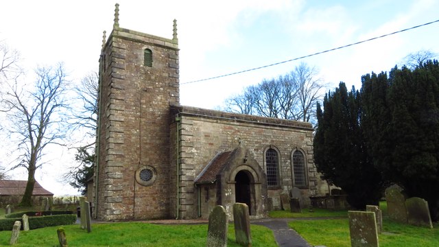
One of the notable landmarks in Hoften's Cross is the village church, St. Mary's, which dates back several centuries. This beautiful place of worship stands as a testament to the village's long-standing religious traditions.

Despite its small size, Hoften's Cross boasts a close-knit community that actively participates in village events and activities. The village hosts various social gatherings throughout the year, including fairs, festivals, and fundraisers, which bring residents together and foster a strong sense of community spirit.

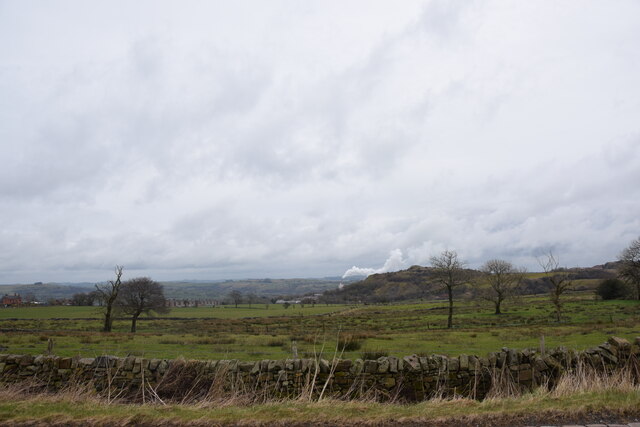
Surrounded by captivating natural beauty, Hoften's Cross offers ample opportunities for outdoor enthusiasts. The nearby countryside provides scenic walking trails and cycling routes, allowing residents and visitors to explore the stunning landscapes that Staffordshire has to offer.

In summary, Hoften's Cross is a charming village in Staffordshire, England, with a rich history, stunning countryside, and a close-knit community. It is an ideal destination for those seeking a tranquil retreat amidst picturesque surroundings.

If you have any feedback on the listing, please let us know in the comments section below.

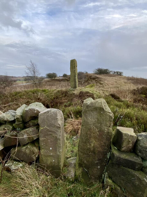
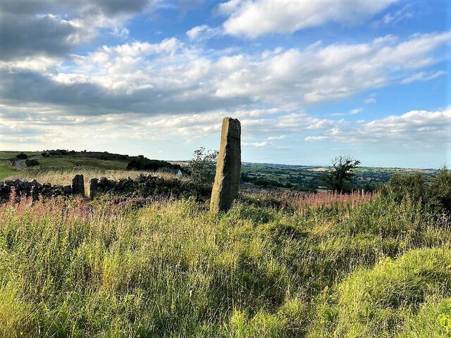
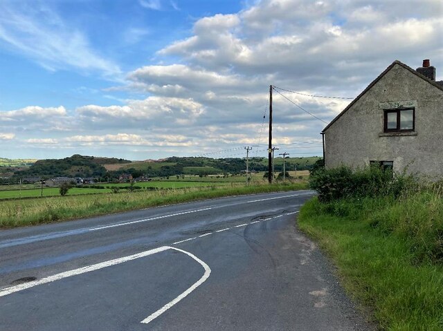
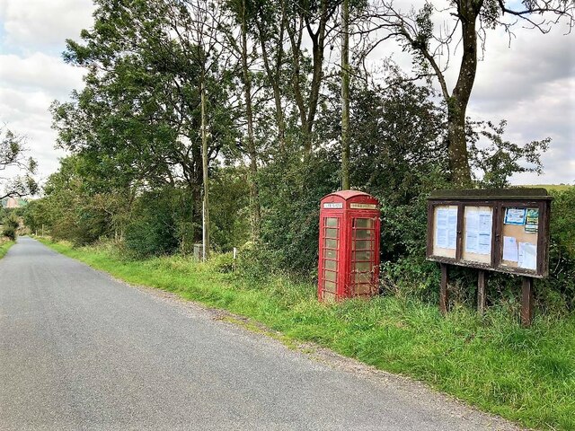
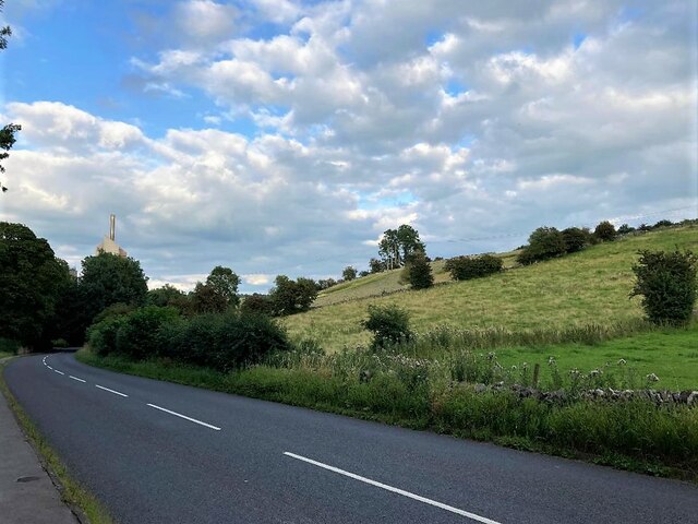
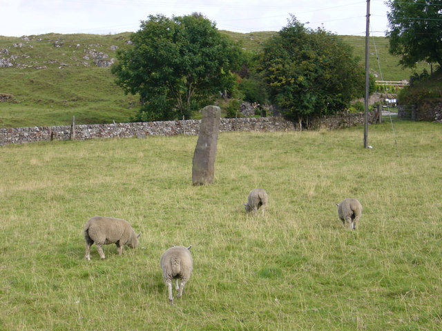
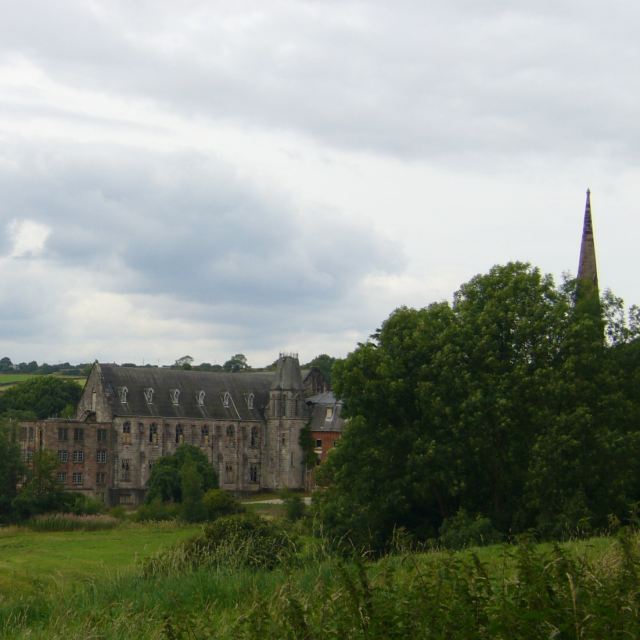
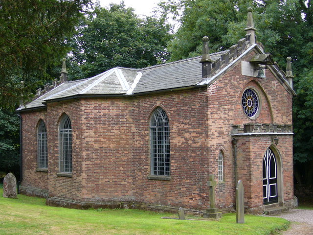
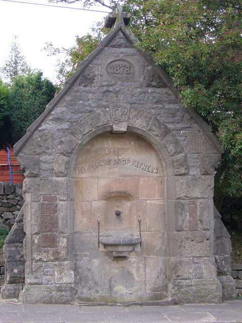
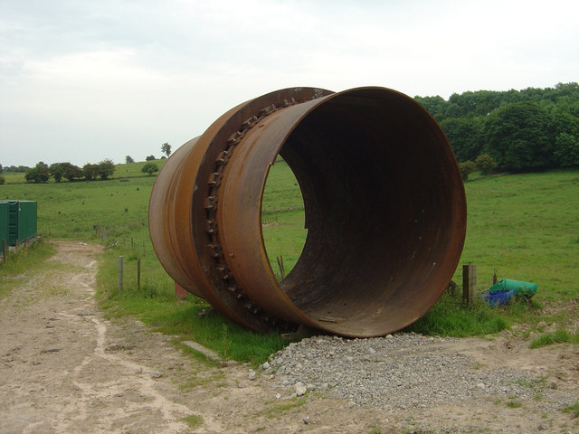
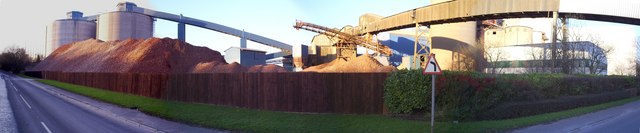
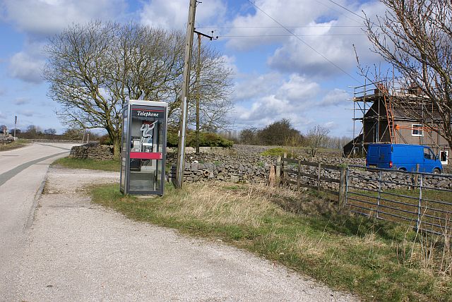
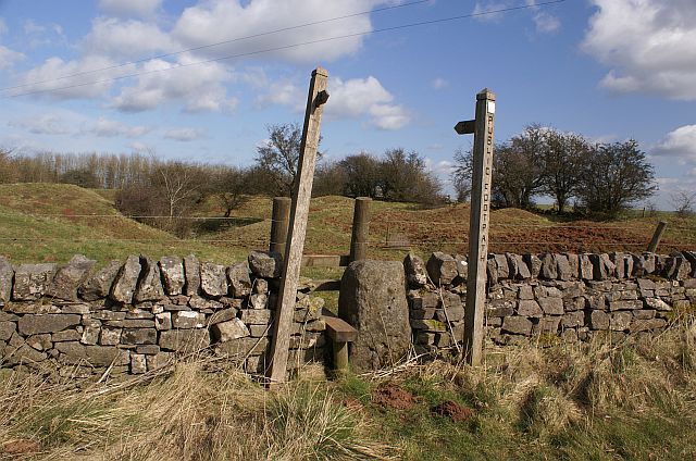
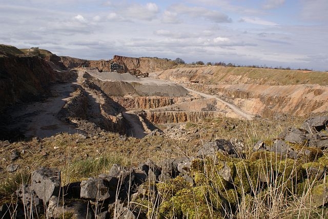
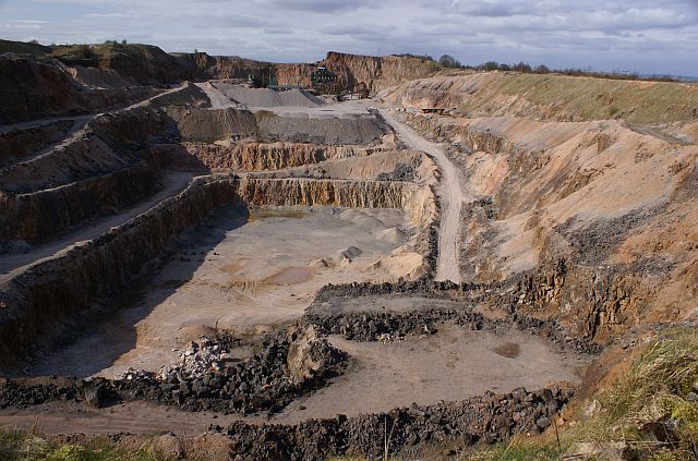
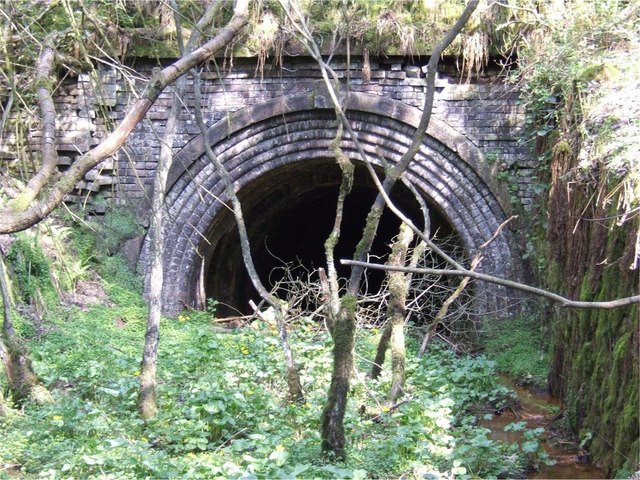
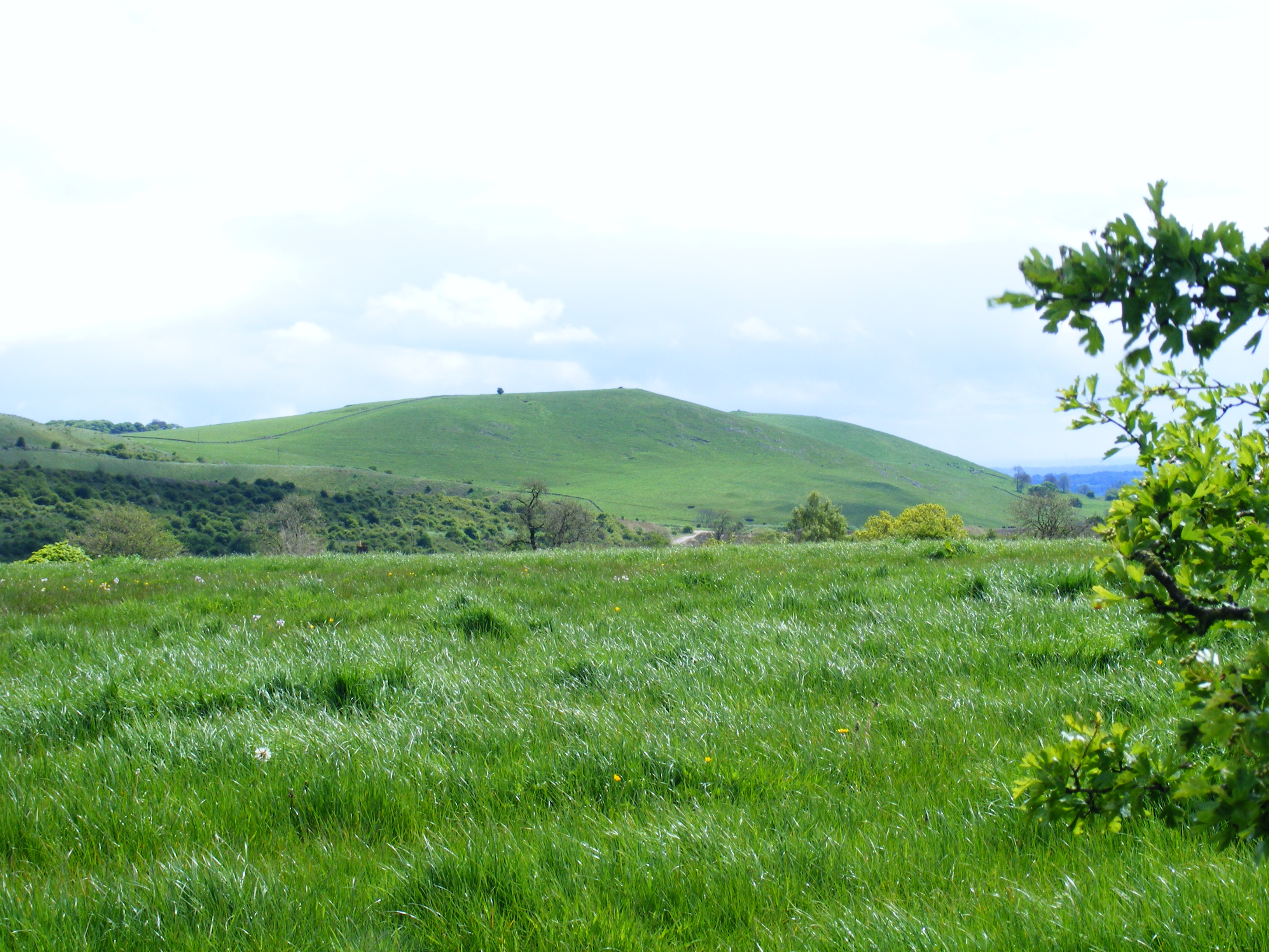
Hoften's Cross Images

Images are sourced within 2km of 53.027404/-1.8930853 or Grid Reference SK0747. Thanks to Geograph Open Source API. All images are credited.

View from Ellastone Road at Windy Harbour Looking north east with the low buildings of Moorend Farm in the centre ahead. A plume of smoke is coming from the cement works at Cauldon with its enormous limestone quarry eating up Cauldon Low - the high area to the right of the shot. On the left emerging from behind a tree is the row of cottages on Stony Lane, Moorend which are also seen in <a href="https://www.geograph.org.uk/photo/2966784">SK0648 : Terraced houses at Stony Lane, Moorend</a> and <a href="https://www.geograph.org.uk/photo/4458833">SK0648 : Terraced houses on Stony Lane</a>
View from Ellastone Road at Windy Harbour
Looking north east with the low buildings of Moorend Farm in the centre ahead. A plume of smoke is coming from the cement works at Cauldon with its enormous limestone quarry eating up Cauldon Low - the high area to the right of the shot. On the left emerging from behind a tree is the row of cottages on Stony Lane, Moorend which are also seen in SK0648 : Terraced houses at Stony Lane, Moorend and SK0648 : Terraced houses on Stony Lane
Waymarker Stone and Stile at Windyway Cross On Staffordshire footpath Cotton 32 looking SE, the view NW is <a href="https://www.geograph.org.uk/photo/2966886">SK0548 : Footpath junction near the standing / guide stone</a>. The Stone was used as a guide to the packhorse route over dryer ground, explained in <span class="nowrap"><a title="https://churnet-valley.guide/heritage/windyway-cross?fbclid=IwAR0E02aCH-ARG-sH6i2Y7BAZwZqp3X6NmC6uE-vPdJT660MHIvJJ8O8xUjE" rel="nofollow ugc noopener" href="https://churnet-valley.guide/heritage/windyway-cross?fbclid=IwAR0E02aCH-ARG-sH6i2Y7BAZwZqp3X6NmC6uE-vPdJT660MHIvJJ8O8xUjE">Link</a><img style="margin-left:2px;" alt="External link" title="External link - shift click to open in new window" src="https://s1.geograph.org.uk/img/external.png" width="10" height="10"/></span> .
Copper was transported from Ecton to the smelting works at Whiston <span class="nowrap"><a title="https://maps.nls.uk/geo/explore/#zoom=17.0&lat=53.02201&lon=-1.94133&layers=168&b=1&marker=53.022080313486065,-1.941266188458469" rel="nofollow ugc noopener" href="https://maps.nls.uk/geo/explore/#zoom=17.0&lat=53.02201&lon=-1.94133&layers=168&b=1&marker=53.022080313486065,-1.941266188458469">Link</a><img style="margin-left:2px;" alt="External link" title="External link - shift click to open in new window" src="https://s1.geograph.org.uk/img/external.png" width="10" height="10"/></span> which became disused around 1880/98.

Milestone Society National ID: ST_XIPS
Waymarker Stone and Stile at Windyway Cross
On Staffordshire footpath Cotton 32 looking SE, the view NW is SK0548 : Footpath junction near the standing / guide stone. The Stone was used as a guide to the packhorse route over dryer ground, explained in LinkExternal link . Copper was transported from Ecton to the smelting works at Whiston LinkExternal link which became disused around 1880/98. Milestone Society National ID: ST_XIPS
Waymarker Stone at Windywaycross This impressive stone stands at 8 feet high and was originally used to guide pack horse trains over drier ground from the copper mines at Ecton to the smelting works at Whiston.  It was more cost effective to bring the copper ore to Whiston, where coal for smelting was available from the Foxt and Kingsley coalfields than to transport coal to the Ecton Copper Mine, as it took about four tons of coal to smelt one ton of copper ore. The white gable end of Windywaycross House can be deciphered in the distance to the left of the stone.
Waymarker Stone at Windywaycross
This impressive stone stands at 8 feet high and was originally used to guide pack horse trains over drier ground from the copper mines at Ecton to the smelting works at Whiston. It was more cost effective to bring the copper ore to Whiston, where coal for smelting was available from the Foxt and Kingsley coalfields than to transport coal to the Ecton Copper Mine, as it took about four tons of coal to smelt one ton of copper ore. The white gable end of Windywaycross House can be deciphered in the distance to the left of the stone.
Road Junction Overlooking Cauldon The Casey is seen joining Ellastone Road here with Cauldon Low on the horizon. The dwelling on the right is Moorland Cottage.
Road Junction Overlooking Cauldon
The Casey is seen joining Ellastone Road here with Cauldon Low on the horizon. The dwelling on the right is Moorland Cottage.
Telephone Box and Notice Board at Moorend Located on Stoney Lane at the western edge of the grid square.
Telephone Box and Notice Board at Moorend
Located on Stoney Lane at the western edge of the grid square.
Main Road near Cauldon Looking east with one of the chimneys associated with the cement works visible.
Main Road near Cauldon
Looking east with one of the chimneys associated with the cement works visible.
Cauldon - St Mary & St Laurence Church
Standing stone and sheep opposite The Cross public house at Hoften's Cross near Cauldon. Not marked on the map but the stone may well be Bronze Age or thereabouts.
Standing stone and sheep
opposite The Cross public house at Hoften's Cross near Cauldon. Not marked on the map but the stone may well be Bronze Age or thereabouts.
Cotton College Cotton Lane, Cotton, Staffordshire. This Roman Catholic boarding school <span class="nowrap"><a title="http://www.cottoncollege.co.uk/" rel="nofollow ugc noopener" href="http://www.cottoncollege.co.uk/">Link</a><img style="margin-left:2px;" alt="External link" title="External link - shift click to open in new window" src="https://s1.geograph.org.uk/img/external.png" width="10" height="10"/></span> closed in 1987. The buildings are derelict. The spire on the right is St Wilfred's Roman Catholic Church which is still in use.
Cotton College
Cotton Lane, Cotton, Staffordshire. This Roman Catholic boarding school LinkExternal link closed in 1987. The buildings are derelict. The spire on the right is St Wilfred's Roman Catholic Church which is still in use.
Church of St John the Baptist Cotton Lane, Cotton, Staffordshire. <span class="nowrap"><a title="http://www.genuki.org.uk/big/eng/STS/Cotton/index.html" rel="nofollow ugc noopener" href="http://www.genuki.org.uk/big/eng/STS/Cotton/index.html">Link</a><img style="margin-left:2px;" alt="External link" title="External link - shift click to open in new window" src="https://s1.geograph.org.uk/img/external.png" width="10" height="10"/></span> This charming little church built in 1795 is tucked into a corner and virtually surrounded by St Wilfred's Roman Catholic Church and <a href="https://www.geograph.org.uk/photo/224492">SK0646 : Cotton College</a>.
Church of St John the Baptist
Cotton Lane, Cotton, Staffordshire. LinkExternal link This charming little church built in 1795 is tucked into a corner and virtually surrounded by St Wilfred's Roman Catholic Church and SK0646 : Cotton College.
Drinking fountain a rather urban looking drinking fountain beside the main road through Cauldon, Staffordshire. Inscriptions are: "1878", "CB" monogram - presumably the benefactor and "thy clouds drop fatness" - Psalm 65 v 12 in the 1662 Book of Common Prayer version.
Drinking fountain
a rather urban looking drinking fountain beside the main road through Cauldon, Staffordshire. Inscriptions are: "1878", "CB" monogram - presumably the benefactor and "thy clouds drop fatness" - Psalm 65 v 12 in the 1662 Book of Common Prayer version.
Rotary Kiln section This section of a rotary kiln from the Lafarge/Blue Circle works at Cauldon has been dumped on farmland close to the works. It is approximately 4 metres high. It could well be the section of the current kiln which was replaced during early 2005.
Rotary Kiln section
This section of a rotary kiln from the Lafarge/Blue Circle works at Cauldon has been dumped on farmland close to the works. It is approximately 4 metres high. It could well be the section of the current kiln which was replaced during early 2005.
Lafarge Cement Works At Cauldon Panorama made up of four images.
Lafarge Cement Works At Cauldon
Panorama made up of four images.
Telephone box on the road to Wardlow Quarry Looking in the direction of the A52 with Red House to the right.
Telephone box on the road to Wardlow Quarry
Looking in the direction of the A52 with Red House to the right.
Footpath north of the A52 This footpath leads off north from the A52 towards the massive Caldonlow Quarries. In the other direction, the footpath crosses the A52 to follow a lane down to Wardlow Quarry.
Footpath north of the A52
This footpath leads off north from the A52 towards the massive Caldonlow Quarries. In the other direction, the footpath crosses the A52 to follow a lane down to Wardlow Quarry.
Southeastern edge of Wardlow Quarry This limestone quarry spans several squares. The larger,northern section of the quarry is hidden from view.
Southeastern edge of Wardlow Quarry
This limestone quarry spans several squares. The larger,northern section of the quarry is hidden from view.
Southeastern end of Wardlow quarry A better view of the southeastern end of Wardlow quarry, which intrudes into four grid squares.
Southeastern end of Wardlow quarry
A better view of the southeastern end of Wardlow quarry, which intrudes into four grid squares.
Entrance to Trubshaw's Tunnel Trubshaw's Tunnel was dug for the 1847 Caldon Low railway. The railway was a self-acting inclined plane, where empty wagons travelling upward were attached by a cable via a brake drum at the top of the plane to wagons loaded with limestone travelling downwards.
Entrance to Trubshaw's Tunnel
Trubshaw's Tunnel was dug for the 1847 Caldon Low railway. The railway was a self-acting inclined plane, where empty wagons travelling upward were attached by a cable via a brake drum at the top of the plane to wagons loaded with limestone travelling downwards.
Show me another place!

Hoften's Cross is located at Grid Ref: SK0747 (Lat: 53.027404, Lng: -1.8930853)

Administrative County: Staffordshire

District: Staffordshire Moorlands

Police Authority: Staffordshire

What 3 Words

///prefect.copy.crawler. Near Cheadle, Staffordshire

Nearby Locations

Moorside Hoften's Cross

Related Wikis

Broomyshaw

Broomyshaw is a village in Staffordshire, England. Population details for the 2011 census can be found under Waterhouses, Staffordshire

Cotton College

Cotton College was a Roman Catholic boarding school in Cotton, Staffordshire, United Kingdom. It was also known as Saint Wilfrid's College. The school...

Cotton, Staffordshire

Cotton is a village and civil parish in Staffordshire, England. It is about 5 miles (8.0 km) north-east of Cheadle. Cotton Hall, originally built in the...

Caldon Low Halt railway station

Caldon Low Halt railway station was a railway station near the hamlet of Cauldon, Staffordshire. It was opened by the North Staffordshire Railway (NSR...

Cauldon

Cauldon or Caldon is a village and former civil parish, 19 miles (31 km) north east of Stafford, now in the parish of Waterhouses, in the Staffordshire...

Cotton Dell

Cotton Dell is a nature reserve of the Staffordshire Wildlife Trust. It is a wooded valley area near the village of Cotton and about 0.5 miles (0.8 km...

Weaver Hills

The Weaver Hills are a small range of hills in north east Staffordshire, England.The Weaver Hills are about 15 miles (24 km) east of Stoke-on-Trent and...

Back o'th' Brook

Back o'th' Brook is a village in Staffordshire, England. The population for the 2011 census can be found under Waterhouses

Nearby Amenities

Located within 500m of 53.027404,-1.8930853
Pub
The Cross Inn
Lat/Long: 53.0305553/-1.8942727
Post Office
Lat/Long: 53.0297387/-1.8937278
Bus Stop
Westfields
Naptan AtcoCode: 3800C800800
Naptan Bearing: N
Naptan CommonName: Westfields
Naptan Indicator: Adj
Naptan Landmark: Westfields
Naptan Street: Bangor Terrace
Naptan Verified: no
Source: naptan_import
Lat/Long: 53.0275204/-1.8931528
Bus Stop
Cross Inn PH
Naptan AtcoCode: 3800C804300
Naptan Bearing: NE
Naptan BusStopType: CUS
Naptan CommonName: Cross Inn PH
Naptan Indicator: Adj
Naptan Landmark: Cross Inn PH
Naptan Street: Main Rd
Naptan Verified: no
Source: naptan_import
Lat/Long: 53.0302807/-1.8938021
Turning Circle
Lat/Long: 53.0293099/-1.8944662
Bus Stop
Hoftens Cross
Naptan AtcoCode: 3800C837501
Naptan Bearing: S
Naptan CommonName: Hoftens Cross
Naptan Indicator: Opp
Naptan Landmark: Hoftens Cross
Naptan Street: Main Rd
Naptan Verified: no
Source: naptan_import
Lat/Long: 53.02953/-1.8935617
Removed Amenity: telephone
Lat/Long: 53.03044/-1.8927279
Barrier: yes
Lat/Long: 53.0256644/-1.8970288
Ele: 363
Natural: peak
Lat/Long: 53.0270719/-1.8877752
Hoften's Cross
Place: village
Lat/Long: 53.0263999/-1.8938199
Bench
Lat/Long: 53.0296775/-1.8936034
Man Made: flagpole
Lat/Long: 53.0296329/-1.8935694
Historic: beacon
Man Made: beacon
Lat/Long: 53.0296082/-1.8935551
Historic: memorial
Memorial: war_memorial
Lat/Long: 53.0296238/-1.8937554
Shelter
Shelter Type: public_transport
Lat/Long: 53.029748/-1.8939029
Post Box
Post Box Type: lamp
Royal Cypher: EIIR
Lat/Long: 53.0297297/-1.8938797
The data included in this document is from www.openstreetmap.org. The data is made available under ODbL.

Have you been to Hoften's Cross?

Leave your review of Hoften's Cross below (or comments, questions and feedback).