Hoddomcross

Settlement in Dumfriesshire

Scotland

Hoddomcross

Start of track to Woodcock Air
Start of track to Woodcock Air Credit: thejackrustles

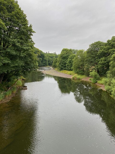
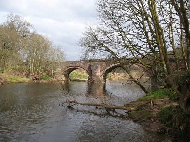
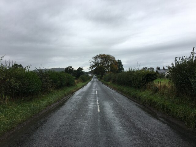
Hoddomcross is a small village located in the region of Dumfriesshire, Scotland. Nestled in the picturesque Annandale Valley, this rural settlement is known for its stunning natural beauty and historical significance. The village sits on the banks of the River Annan, offering breathtaking views of the surrounding countryside.

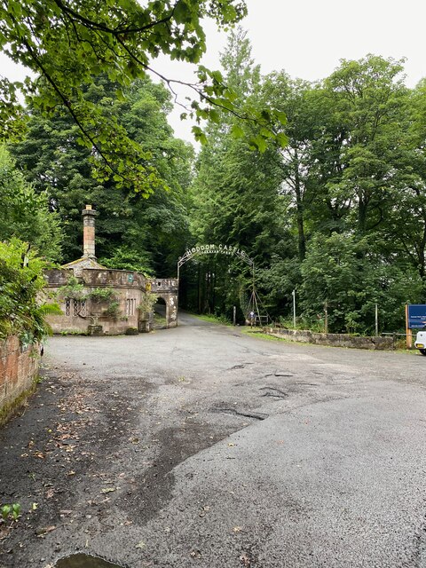
One of the notable landmarks of Hoddomcross is the ruins of Hoddom Castle, a medieval fortress that dates back to the 15th century. Despite being partially in ruins, the castle still retains its majestic charm and attracts tourists who are interested in Scotland's rich history. Nearby, visitors can explore the tranquil Hoddom Castle Caravan Park, which offers camping facilities and a chance to relax amidst nature.

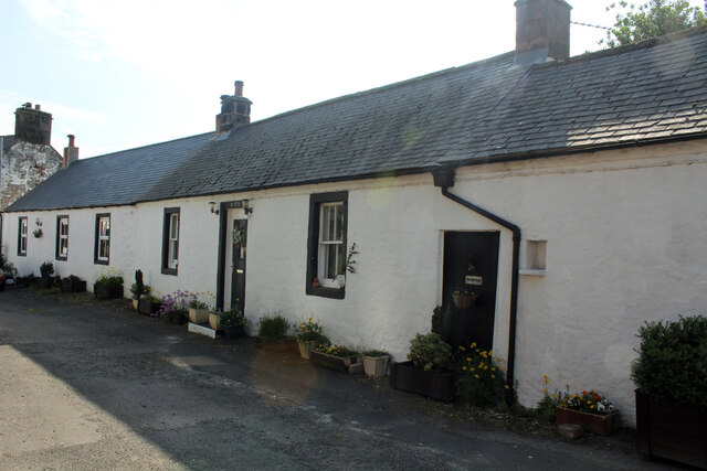
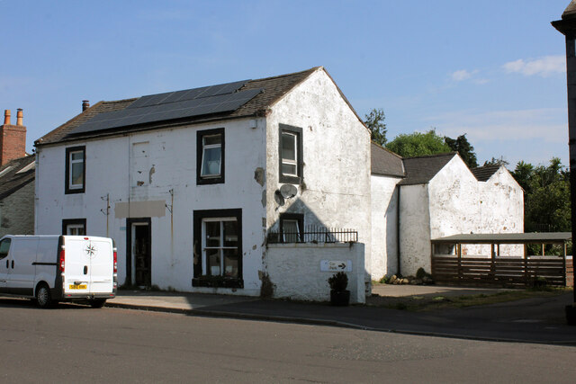
The village is also home to a small community of residents, who enjoy the peace and tranquility that rural life offers. Hoddomcross has limited amenities, with a local pub and a few shops catering to the needs of the village and nearby areas.

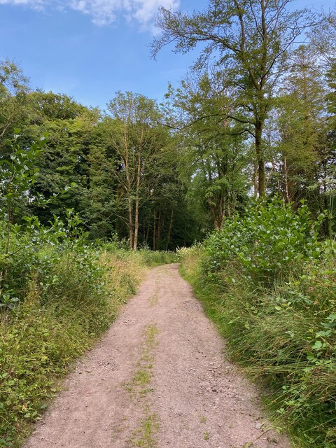
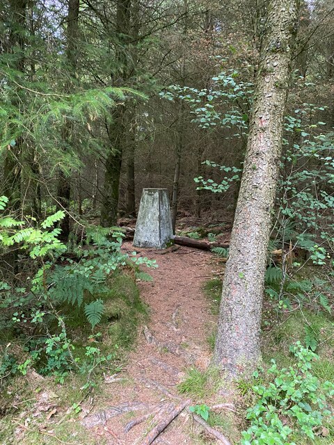
For outdoor enthusiasts, Hoddomcross offers ample opportunities for exploring nature. The nearby Hoddom and Kinmount Estates provide scenic walking trails, where visitors can admire the vibrant flora and fauna of the region. The area is also known for its fishing spots, with the River Annan being a popular destination for anglers.

In summary, Hoddomcross is a charming village in Dumfriesshire, Scotland, that combines historical landmarks, natural beauty, and a close-knit community. It is a haven for those seeking a peaceful retreat amidst Scotland's stunning countryside.

If you have any feedback on the listing, please let us know in the comments section below.
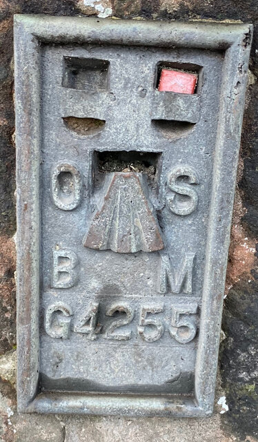
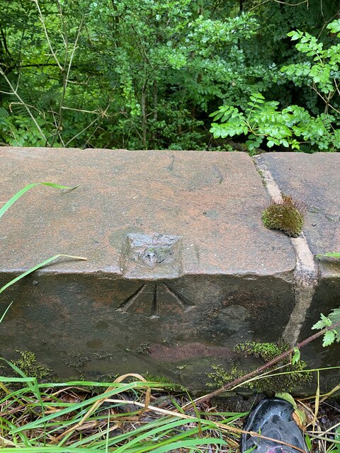
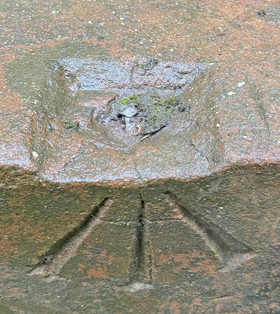
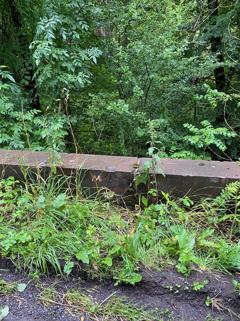
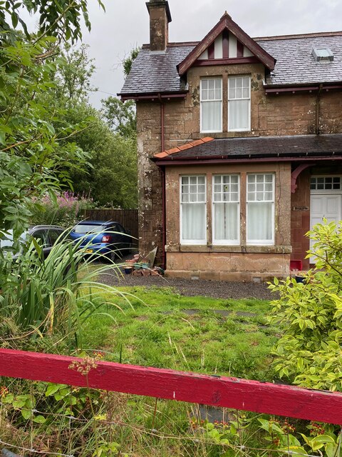
Hoddomcross Images

Images are sourced within 2km of 55.049141/-3.289147 or Grid Reference NY1773. Thanks to Geograph Open Source API. All images are credited.

Start of track to Woodcock Air
Woodcock Air Hill Trig Point Flush Bracket S9842
Entrance to Hoddom Castle
View from Hoddum Bridge
OS Flush Bracket G4255 Hoddom Bridge <span class="nowrap"><a title="https://www.bench-marks.org.uk/bm445" rel="nofollow ugc noopener" href="https://www.bench-marks.org.uk/bm445">Link</a><img style="margin-left:2px;" alt="External link" title="External link - shift click to open in new window" src="https://s1.geograph.org.uk/img/external.png" width="10" height="10"/></span>
OS Flush Bracket G4255 Hoddom Bridge
OS Rivet - Hoddom, Bridge <span class="nowrap"><a title="https://www.bench-marks.org.uk/bm136250" rel="nofollow ugc noopener" href="https://www.bench-marks.org.uk/bm136250">Link</a><img style="margin-left:2px;" alt="External link" title="External link - shift click to open in new window" src="https://s1.geograph.org.uk/img/external.png" width="10" height="10"/></span>
OS Rivet - Hoddom, Bridge
Close up of OS Rivet Bridge, Hoddom <span class="nowrap"><a title="https://www.bench-marks.org.uk/bm136250" rel="nofollow ugc noopener" href="https://www.bench-marks.org.uk/bm136250">Link</a><img style="margin-left:2px;" alt="External link" title="External link - shift click to open in new window" src="https://s1.geograph.org.uk/img/external.png" width="10" height="10"/></span>
Close up of OS Rivet Bridge, Hoddom
West parapet of bridge Hoddom
Section of bridge parapet with OS Rivet
Braeside, Hoddom
Braeside, Hoddom
Section of Braeside, Hoddom
Hoddom Bridge The eighteenth century Hoddom Bridge is Category A listed and carries the B723 road across the River Annan.
The Annandale Way long distance path crosses the bridge.
Hoddom Bridge
The eighteenth century Hoddom Bridge is Category A listed and carries the B723 road across the River Annan. The Annandale Way long distance path crosses the bridge.
B725 towards Dalton
B725 towards Dalton
2 Church Street, Ecclefechan Category B Listed cottage with lintel marked 'JH 1778'. The property has been extended both to the north and south. The extension to the north was previously a derelict commercial garage (possibly a former barn) and was converted to living accommodation in September 2020. The southern extension is of much earlier date.
2 Church Street, Ecclefechan
Category B Listed cottage with lintel marked 'JH 1778'. The property has been extended both to the north and south. The extension to the north was previously a derelict commercial garage (possibly a former barn) and was converted to living accommodation in September 2020. The southern extension is of much earlier date.
Hoddom Court, sheltered housing, Academy Street, Ecclefechan The 1875 tower is the remaining part of a Category C Listed, earlier 19th century, L-plan school now enclosed by modern sheltered housing. Hoddom Court comprises 11 flats built in 1988.
Hoddom Court, sheltered housing, Academy Street, Ecclefechan
The 1875 tower is the remaining part of a Category C Listed, earlier 19th century, L-plan school now enclosed by modern sheltered housing. Hoddom Court comprises 11 flats built in 1988.
Johnstone United Presbyterian Church, B7076, Ecclefechan Category B Listed former church built in 1864-6; the architect was James Barbour (1834-1912). It became the parish church following destruction by fire of old parish church in 1975. Now a private 4 bedroom dwelling known as Church House and attached Caretakers House, planning approved conversion in 2018. The United Presbyterian Church was established in Ecclefechan in 1748 and after conducting services in the open air, a thatch-covered church was opened in 1766 (off Hall Road) and used until this church opened.
Johnstone United Presbyterian Church, B7076, Ecclefechan
Category B Listed former church built in 1864-6; the architect was James Barbour (1834-1912). It became the parish church following destruction by fire of old parish church in 1975. Now a private 4 bedroom dwelling known as Church House and attached Caretakers House, planning approved conversion in 2018. The United Presbyterian Church was established in Ecclefechan in 1748 and after conducting services in the open air, a thatch-covered church was opened in 1766 (off Hall Road) and used until this church opened.
Ecclefechan Hotel, High Street, Ecclefechan Category C Listed late 18th century inn, altered in the late 19th century. The hotel's website claims the building dates to the 1730s. Refurbished in 2005 the hotel seems to have closed recently and looks to have been on the market for a couple of years. A search of my few directories suggests the hotel may have been called the Bush Hotel, here are the results; 1825 no inn/pub names given; 1837 only vintners listed are Bush Inn, Globe Inn, Ewe & Lamb, Blue Bell; 1861 only vintners listed are Commercial & Globe; 1878-1886 only vintners listed are Bush, Commercial & Globe; 1903 establishments listed are Bush Hotel & Commercial Hotel.
Ecclefechan Hotel, High Street, Ecclefechan
Category C Listed late 18th century inn, altered in the late 19th century. The hotel's website claims the building dates to the 1730s. Refurbished in 2005 the hotel seems to have closed recently and looks to have been on the market for a couple of years. A search of my few directories suggests the hotel may have been called the Bush Hotel, here are the results; 1825 no inn/pub names given; 1837 only vintners listed are Bush Inn, Globe Inn, Ewe & Lamb, Blue Bell; 1861 only vintners listed are Commercial & Globe; 1878-1886 only vintners listed are Bush, Commercial & Globe; 1903 establishments listed are Bush Hotel & Commercial Hotel.
Globe House, High Street, Ecclefechan Category C Listed early 19th century former inn, described in the listing as including Watson's shop. The Globe Inn is listed in my directories in 1837, 1861, 1878 and 1886 but my 1903 directory doesn't include it. The front and middle sections are stone built suggesting the original footprint of the inn, with the rear brick sections a later addition. Between at least 1995 and 2006 the building was vacant and in 2005 planning had been granted for change of use to the former shop (Watson's?) and store to form a flat. In 2010 there appears to have been 3 flats here with a hairdressers in the ground floor shop and in the August, retrospective planning was approved for a shop and 3 flats. The shop seems currently unoccupied.
Globe House, High Street, Ecclefechan
Category C Listed early 19th century former inn, described in the listing as including Watson's shop. The Globe Inn is listed in my directories in 1837, 1861, 1878 and 1886 but my 1903 directory doesn't include it. The front and middle sections are stone built suggesting the original footprint of the inn, with the rear brick sections a later addition. Between at least 1995 and 2006 the building was vacant and in 2005 planning had been granted for change of use to the former shop (Watson's?) and store to form a flat. In 2010 there appears to have been 3 flats here with a hairdressers in the ground floor shop and in the August, retrospective planning was approved for a shop and 3 flats. The shop seems currently unoccupied.
Show me another place!

Hoddomcross is located at Grid Ref: NY1773 (Lat: 55.049141, Lng: -3.289147)

Unitary Authority: Dumfries and Galloway

Police Authority: Dumfries and Galloway

What 3 Words

///prone.haircuts.permanent. Near Annan, Dumfries & Galloway

Nearby Locations

Hoddomcross

Related Wikis

Hoddom

Hoddom is a small settlement and civil parish in Dumfries and Galloway, Scotland, dating back to the 8th century. == Location == Hoddom is 13 miles by...

Thomas Carlyle's Birthplace

Thomas Carlyle's Birthplace is a house in Ecclefechan, Dumfries and Galloway, Scotland, UK, in which Thomas Carlyle, who was to become a pre-eminent man...

Ecclefechan railway station

Ecclefechan railway station was a station which served the rural area around Ecclefechan, south of Lockerbie in Applegarth parish, Scottish county of Dumfries...

Ecclefechan

Ecclefechan (Scottish Gaelic: Eaglais Fheichein) is a small village located in Dumfries and Galloway in the south of Scotland. The village is famous for...

Nearby Amenities

Located within 500m of 55.049141,-3.289147
Hoddom Cross
Naptan AtcoCode: 680000236111
Naptan Bearing: SW
Naptan BusStopType: CUS
Naptan CommonName: Hoddom Cross
Naptan Indicator: opp Smithy
Naptan Landmark: Smithy
Naptan NaptanCode: 34237435
Naptan Notes: none
Naptan Street: B725
Naptan Verified: no
Source: naptan_import
Lat/Long: 55.0493783/-3.29027
Hoddom Cross
Naptan AtcoCode: 680000236222
Naptan Bearing: NE
Naptan BusStopType: CUS
Naptan CommonName: Hoddom Cross
Naptan Indicator: Smithy
Naptan Landmark: Smithy
Naptan NaptanCode: 34237436
Naptan Notes: none
Naptan Street: B725
Naptan Verified: no
Source: naptan_import
Lat/Long: 55.0494256/-3.2900524
Hoddom Church
Historic: ruins
Lat/Long: 55.0493651/-3.2875904
Power: pole
Lat/Long: 55.0480618/-3.2917876
Power: pole
Lat/Long: 55.0482529/-3.2904777
Power: pole
Lat/Long: 55.0484463/-3.2892
Power: pole
Lat/Long: 55.048647/-3.2878708
Power: pole
Lat/Long: 55.0488772/-3.2872655
Power: pole
Lat/Long: 55.0492948/-3.286181
Power: pole
Lat/Long: 55.0498585/-3.2847771
Power: pole
Lat/Long: 55.0503957/-3.2833938
Power: pole
Lat/Long: 55.0509475/-3.2819848
Power: pole
Lat/Long: 55.0497493/-3.2898311
Power: pole
Lat/Long: 55.0490454/-3.2875102
Power: pole
Lat/Long: 55.0494734/-3.2881671
The data included in this document is from www.openstreetmap.org. The data is made available under ODbL.

Have you been to Hoddomcross?

Leave your review of Hoddomcross below (or comments, questions and feedback).