Hockering Estate

Settlement in Surrey Woking

England

Hockering Estate

Basingstoke Canal and towpath at Sheerwater
Basingstoke Canal and towpath at Sheerwater Credit: David Martin

Hockering Estate is a picturesque residential area situated in Surrey, England. Located approximately 30 miles southwest of London, it offers a peaceful countryside setting while still being within close proximity to major urban centers.

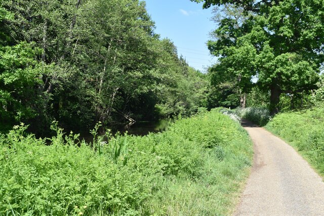
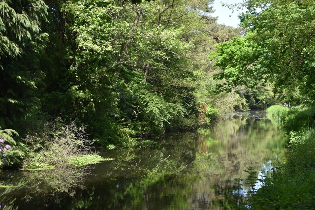
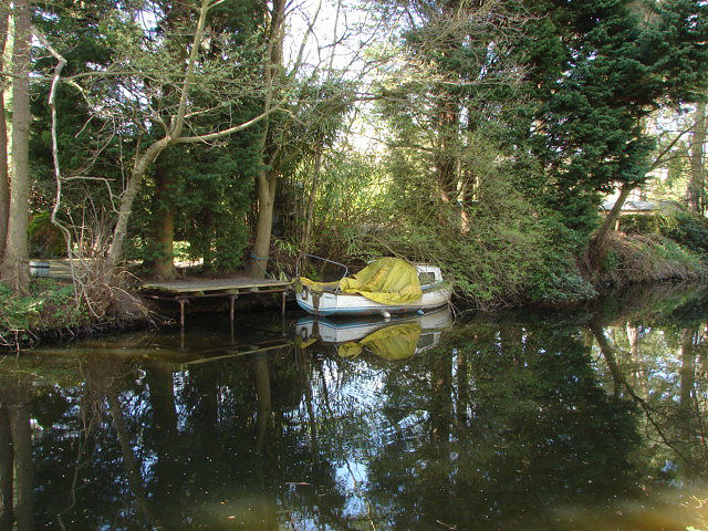
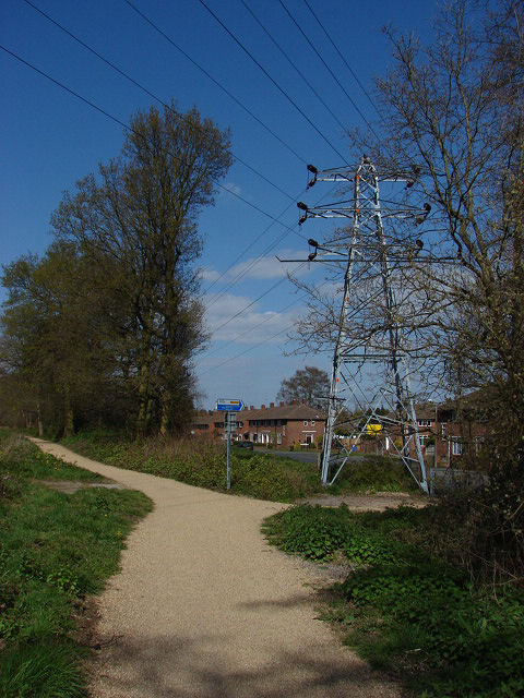
The estate is known for its expansive green spaces and breathtaking natural beauty. Lush meadows, rolling hills, and dense woodlands surround the area, creating a tranquil environment ideal for outdoor activities and relaxation. It is a popular destination for nature enthusiasts, offering plenty of opportunities for hiking, cycling, and wildlife spotting.

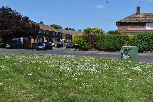
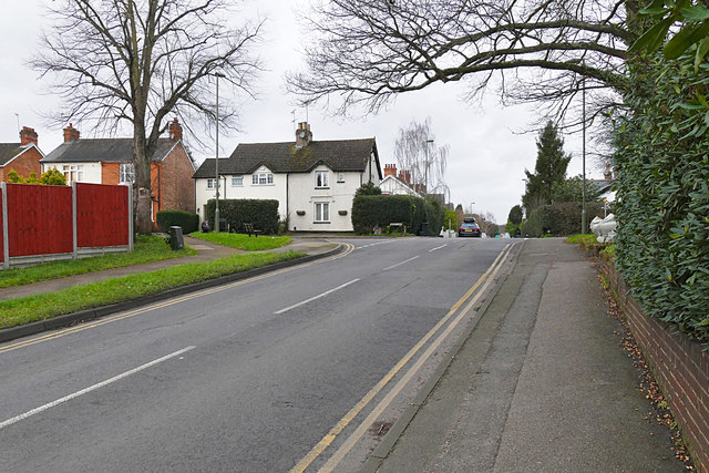
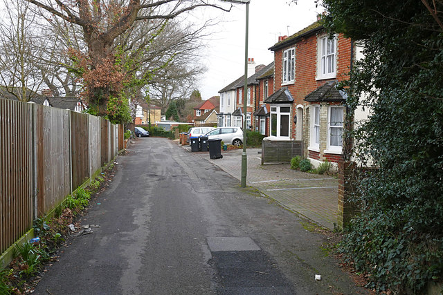
Hockering Estate is primarily a residential area, characterized by a mix of traditional and modern architecture. The houses in the area range from charming cottages to contemporary family homes, catering to a diverse range of preferences. The neighborhood is well-maintained, with pristine gardens and manicured lawns enhancing the overall aesthetic appeal.

Residents of Hockering Estate enjoy a close-knit community atmosphere, with various amenities and facilities available to cater to their needs. These include local shops, schools, and recreational spaces. The area is also well-connected, with excellent transport links to nearby towns and cities, ensuring easy access to employment opportunities, shopping centers, and entertainment venues.

Overall, Hockering Estate offers a delightful blend of rural tranquility and convenient living. With its natural beauty, high-quality housing, and strong sense of community, it is a highly sought-after location for individuals and families looking to enjoy the best of both worlds.

If you have any feedback on the listing, please let us know in the comments section below.

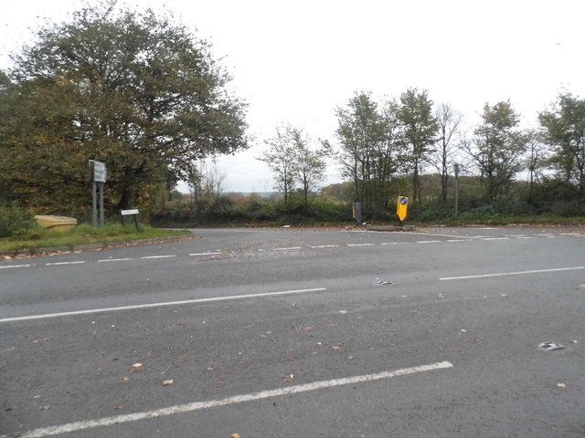
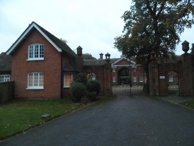
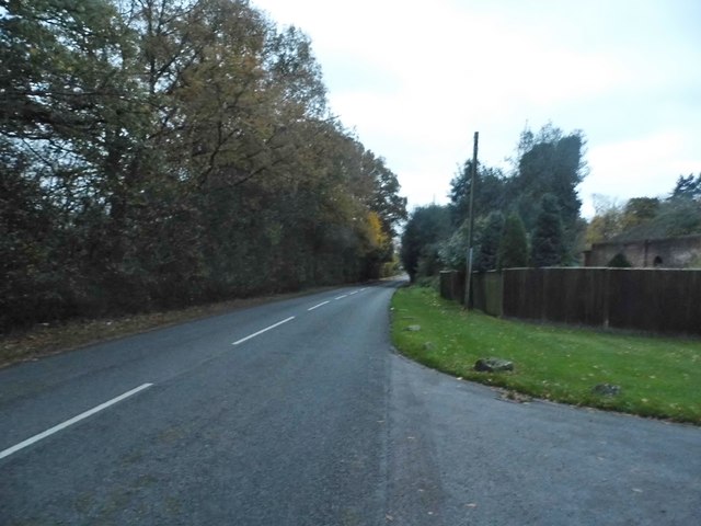
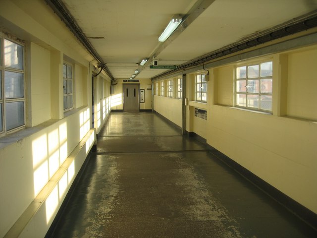
Hockering Estate Images

Images are sourced within 2km of 51.314916/-0.53811593 or Grid Reference TQ0158. Thanks to Geograph Open Source API. All images are credited.

Basingstoke Canal and towpath at Sheerwater
Basingstoke Canal, adjacent to Blackmore Crescent
View across verge at north end of Bentham Avenue
Basingstoke Canal Old boat moored on the Woodham Hall Estate bank of the Basingstoke Canal
Basingstoke Canal
Old boat moored on the Woodham Hall Estate bank of the Basingstoke Canal
Basingstoke Canal Electricity pylon on the eastern bank of the canal by the exit to Blackmore Crescent, Sheerwater.
Basingstoke Canal
Electricity pylon on the eastern bank of the canal by the exit to Blackmore Crescent, Sheerwater.
Octimum Business Park, Sheerwater Another industrial estate with a contrived, gobbledegook name. This is one of several adjoining estates in north-east Woking and includes the West Horsley Dairy - though West Horsley village is some 10 kilometres away to the south-east.
Octimum Business Park, Sheerwater
Another industrial estate with a contrived, gobbledegook name. This is one of several adjoining estates in north-east Woking and includes the West Horsley Dairy - though West Horsley village is some 10 kilometres away to the south-east.
West Horsley Dairy Not in West Horsley, but warehousing on a modern industrial estate in Sheerwater, Woking - some 10 kilometres north-west of West Horsley village.
<span class="nowrap"><a title="www.westhorsleydairy.co.uk" rel="nofollow ugc noopener" href="http://www.westhorsleydairy.co.uk">Link</a><img style="margin-left:2px;" alt="External link" title="External link - shift click to open in new window" src="https://s1.geograph.org.uk/img/external.png" width="10" height="10"/></span>
West Horsley Dairy
Not in West Horsley, but warehousing on a modern industrial estate in Sheerwater, Woking - some 10 kilometres north-west of West Horsley village. LinkExternal link
Octimum Business Park, Sheerwater Modern industrial estate, beside several others, in north-east Woking. This one has a more gobbledook name than most.
Octimum Business Park, Sheerwater
Modern industrial estate, beside several others, in north-east Woking. This one has a more gobbledook name than most.
Shah Jahan Mosque: early September 2015 It is a long time since I submitted a mosque. This one has quite a history <span class="nowrap"><a title="https://en.wikipedia.org/wiki/Shah_Jahan_Mosque,_Woking" rel="nofollow ugc noopener" href="https://en.wikipedia.org/wiki/Shah_Jahan_Mosque,_Woking">Link</a><img style="margin-left:2px;" alt="External link" title="External link - shift click to open in new window" src="https://s1.geograph.org.uk/img/external.png" width="10" height="10"/></span>
Shah Jahan Mosque: early September 2015
It is a long time since I submitted a mosque. This one has quite a history LinkExternal link
St Paul, Maybury: early September 2015
Looking from St Paul's across Oriental Road towards  Lion Shopping Park
Looking from St Paul's across Oriental Road towards Lion Shopping Park
Footbridge at Woking Station Accessed by lifts.
Footbridge at Woking Station
Accessed by lifts.
Pyrford Common Lane at the junction of Upshot Lane
The entrance to Pyrford Court
Pyrford Common Road by the entrance to Pyrford Court
Footbridge at Woking Station
East Hill, Woking The northwest end of East Hill in Maybury looking towards the junction with Sandy Lane. Over the brow of the hill the road is named College Road.
East Hill, Woking
The northwest end of East Hill in Maybury looking towards the junction with Sandy Lane. Over the brow of the hill the road is named College Road.
Frailey Hill, Woking Frailey Hill in the Maybury Estate.
Frailey Hill, Woking
Frailey Hill in the Maybury Estate.
Show me another place!

Hockering Estate is located at Grid Ref: TQ0158 (Lat: 51.314916, Lng: -0.53811593)

Administrative County: Surrey

District: Woking

Police Authority: Surrey

What 3 Words

///august.solve.clouds. Near Woking, Surrey

Nearby Locations

Maybury Hockering Estate

Related Wikis

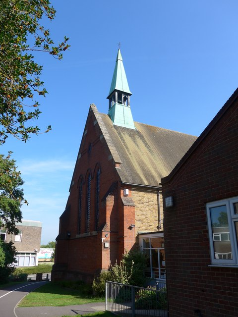
St Dunstan's Church, Woking

St Dunstan's Church is a Roman Catholic Parish church in Woking, Surrey. At first it was built in 1899, replaced by a larger church in 1923 and its final...

Hoe Bridge School

Hoe Bridge School is an independent co-educational, pre-prep and prep school in Woking, England. At its last full inspection in 2023 it was rated excellent...

White Rose Lane

White Rose Lane is a 3.4-hectare (8.4-acre) Local Nature Reserve in Woking in Surrey. It is owned and managed by Woking Borough Council.This site is damp...

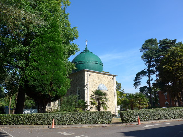
Shah Jahan Mosque, Woking

The Shah Jahan Mosque (also known as Woking Mosque) in Oriental Road, Woking, England, is the first purpose-built mosque in the United Kingdom. Built in...

St John the Baptist School, Woking

St John the Baptist School is a coeducational Catholic secondary school and sixth form in Woking, Surrey, England. The school was one of the first 100...

Old Woking

Old Woking is a ward and the original settlement of the town and borough of Woking, Surrey, about 1.3 miles (2.1 km) southeast of the modern town centre...

Woking College

Woking College is a sixth form college in Woking, Surrey, with over 1,500 16-19-year-olds studying A Levels and advanced vocational courses. It was the...

Woking power station

Woking power station supplied electricity to the Borough of Woking and the surrounding area from 1890 to 1960. The power station was operated by the Woking...

Nearby Amenities

Located within 500m of 51.314916,-0.53811593
Post Box
Collection Times: Mo-Fr 09:00; Sa 07:00
Operator: Royal Mail
Post Box Type: pillar
Postal Code: GU22
Ref: GU22 109D
Royal Cypher: GVIR
Royal Cypher Wikidata: Q33102169
Lat/Long: 51.3156177/-0.5382823
Entrance: yes
Lat/Long: 51.3151238/-0.5380639
Bus Stop
Shey Copse
Naptan AtcoCode: 40004404030A
Naptan Bearing: SW
Naptan CommonName: Shey Copse
Naptan Indicator: Just Before
Naptan Landmark: Shey Copse Riding Centre
Naptan NaptanCode: surgdgpm
Naptan PlusbusZoneRef: WOKING
Naptan Street: Old Woking Road
Naptan Verified: no
Public Transport: platform
Source: naptan_import
Lat/Long: 51.3181144/-0.5341767
Shey Copse
Naptan AtcoCode: 40004404030B
Naptan Bearing: NE
Naptan BusStopType: CUS
Naptan CommonName: Shey Copse
Naptan Indicator: Just after
Naptan Landmark: Shey Copse
Naptan NaptanCode: surgpgwm
Naptan Street: Old Woking Road
Naptan Verified: no
Source: naptan_import
Lat/Long: 51.3182049/-0.5342169
Bus Stop
Maybury Inn
Naptan AtcoCode: 40004404031A
Naptan Bearing: NW
Naptan CommonName: Maybury Inn
Naptan Indicator: Just after
Naptan Landmark: Maybury Inn
Naptan NaptanCode: surgdgpt
Naptan PlusbusZoneRef: WOKING
Naptan Street: Maybury Hill
Naptan Verified: no
Public Transport: platform
Shelter: no
Source: naptan_import
Lat/Long: 51.3155048/-0.5383966
Bus Stop
Shaftesbury Road
Naptan AtcoCode: 40004404032A
Naptan Bearing: NW
Naptan CommonName: Shaftesbury Road
Naptan Indicator: Just Before
Naptan Landmark: Shaftesbury Road
Naptan NaptanCode: surgdgta
Naptan PlusbusZoneRef: WOKING
Naptan Street: Maybury Hill
Naptan Verified: no
Public Transport: platform
Shelter: no
Source: naptan_import
Lat/Long: 51.3174679/-0.5390979
Bus Stop
Shaftesbury Road
Naptan AtcoCode: 40004404032B
Naptan Bearing: SE
Naptan CommonName: Shaftesbury Road
Naptan Indicator: Just after
Naptan Landmark: Shaftesbury Road
Naptan NaptanCode: surgdgtd
Naptan PlusbusZoneRef: WOKING
Naptan Street: Maybury Hill
Naptan Verified: no
Public Transport: platform
Shelter: no
Source: naptan_import
Lat/Long: 51.3172204/-0.5388393
Turning Circle
Lat/Long: 51.3158751/-0.5426506
Entrance: yes
Lat/Long: 51.3151046/-0.5385159
Crossing
Crossing: unmarked
Kerb: lowered
Sloped Curb: yes
Lat/Long: 51.3150443/-0.5381533
Crossing
Crossing Island: yes
Kerb: lowered
Sloped Curb: yes
Source: Surrey-Air_Survey
Lat/Long: 51.3148463/-0.5380634
Crossing
Crossing Island: yes
Kerb: lowered
Sloped Curb: yes
Source: Surrey-Air_Survey
Lat/Long: 51.3149151/-0.5379876
Addr City: Woking
Addr Housenumber: 53
Addr Street: Sandy Lane
Lat/Long: 51.3188186/-0.5372489
Addr City: Woking
Addr Housenumber: 59
Addr Street: Sandy Lane
Lat/Long: 51.3187205/-0.5372341
Bus Stop
Maybury Inn
Naptan AtcoCode: 40004404031B
Naptan Bearing: SE
Naptan CommonName: Maybury Inn
Naptan Indicator: O/s
Naptan Landmark: Maybury Inn
Naptan NaptanCode: surgdgpw
Naptan PlusbusZoneRef: WOKING
Naptan Street: Maybury Hill
Naptan Verified: no
Public Transport: platform
Shelter: no
Source: naptan_import
Lat/Long: 51.3152766/-0.5381628
The data included in this document is from www.openstreetmap.org. The data is made available under ODbL.

Have you been to Hockering Estate?

Leave your review of Hockering Estate below (or comments, questions and feedback).