Hillbrae

Settlement in Aberdeenshire
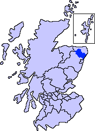
Scotland

Hillbrae

Cottage at Collynie Looking west from the B9170 to a cottage at Collynie Farm.
Cottage at Collynie Credit: Scott Cormie

Hillbrae is a small village located in Aberdeenshire, Scotland. Situated on the eastern coast of the country, it is nestled between the larger towns of Peterhead and Fraserburgh. With a population of around 500 residents, Hillbrae boasts a close-knit community that takes pride in its rural charm.

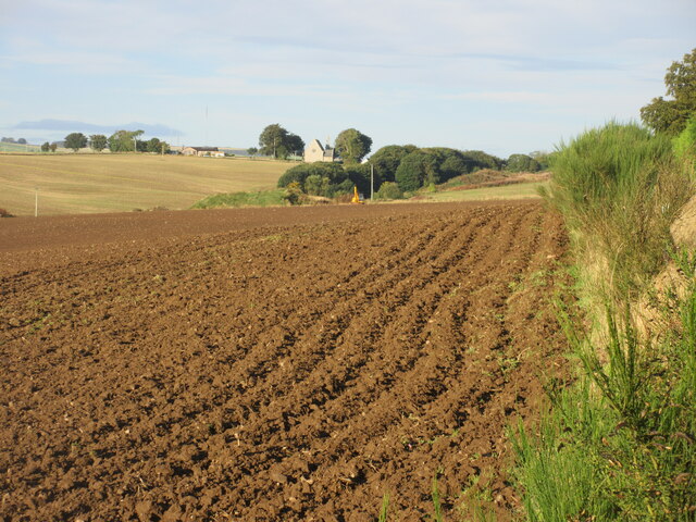
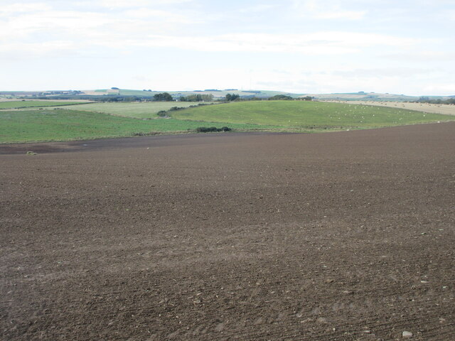
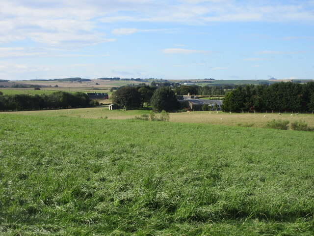
The village is known for its picturesque surrounding landscapes, which include rolling hills, lush green fields, and stunning sea views. It offers a peaceful retreat from the bustling city life, making it an ideal place for those seeking tranquility and a slower pace of living.

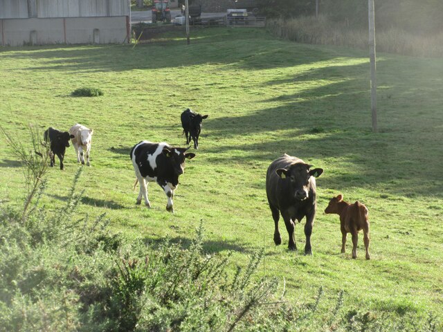
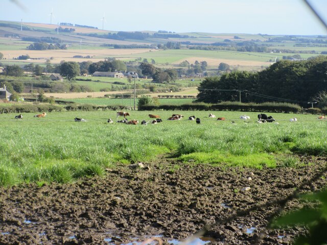
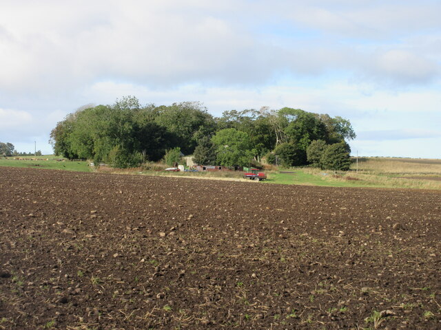
Hillbrae is primarily an agricultural community, with farming being the main occupation for many of its residents. The fertile soil and favorable climate make it perfect for cultivating crops and rearing livestock. Visitors to the village can often spot fields filled with grazing cows and sheep, adding to the picturesque countryside scenery.

Despite its small size, Hillbrae has a strong sense of community, with various social and recreational activities taking place throughout the year. The village hosts an annual summer fair, where locals and visitors come together to enjoy live music, traditional food stalls, and fun fair rides. Additionally, Hillbrae boasts a vibrant local pub, which serves as a hub for residents to gather and socialize.

In summary, Hillbrae is a charming village in Aberdeenshire, Scotland, known for its rural beauty, agricultural heritage, and strong community spirit. It offers a peaceful escape for those seeking a slower pace of life amidst picturesque surroundings.

If you have any feedback on the listing, please let us know in the comments section below.
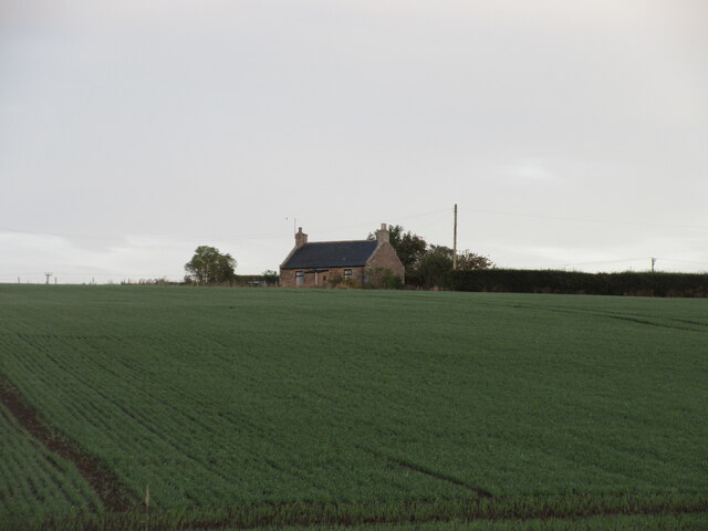
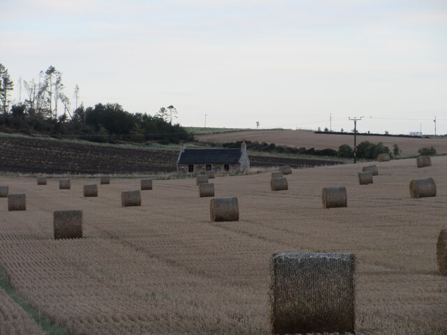
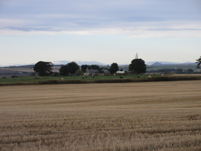
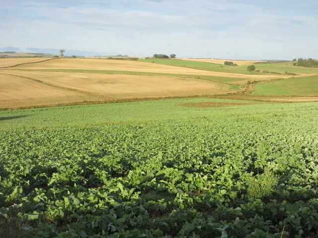
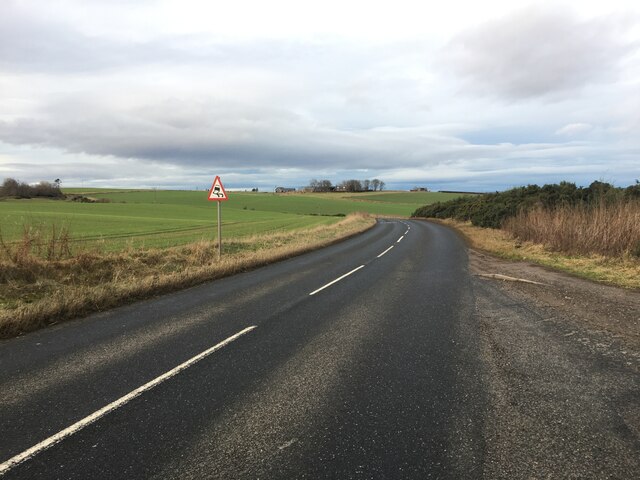
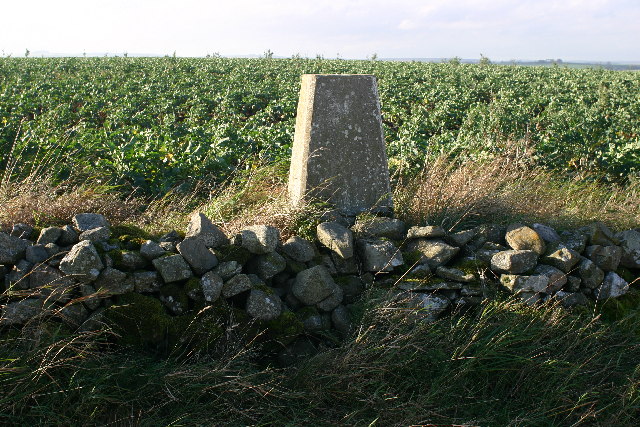
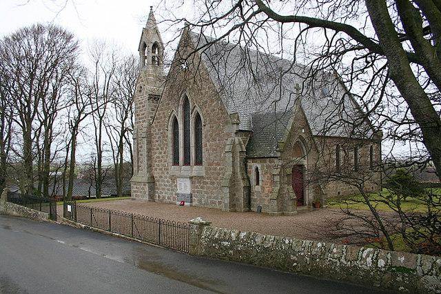
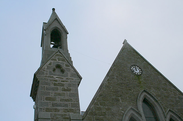
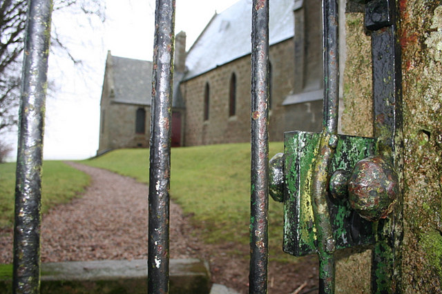
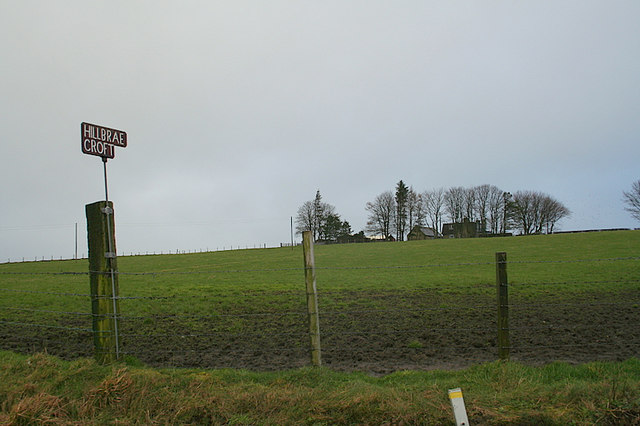
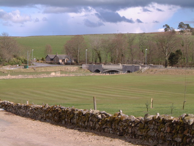
Hillbrae Images

Images are sourced within 2km of 57.405659/-2.2827743 or Grid Reference NJ8335. Thanks to Geograph Open Source API. All images are credited.

Cottage at Collynie Looking west from the B9170 to a cottage at Collynie Farm.
Cottage at Collynie
Looking west from the B9170 to a cottage at Collynie Farm.
Old cottage near Andet Looking over a field of bales to a derelict stone cottage.
Old cottage near Andet
Looking over a field of bales to a derelict stone cottage.
Hillbrae Croft A distant view of Hillbrae Croft from the north-east, with Mither Tap of Bennachie visible on the horizon to the right.
Hillbrae Croft
A distant view of Hillbrae Croft from the north-east, with Mither Tap of Bennachie visible on the horizon to the right.
Turnip field north of Hillbrae Looking westwards down a field of turnips to the north of Hillbrae.
Turnip field north of Hillbrae
Looking westwards down a field of turnips to the north of Hillbrae.
Cattle near Earlsford Frisky cattle in a field west of Earlsford.
Cattle near Earlsford
Frisky cattle in a field west of Earlsford.
Ploughed field near Hardford Looking westwards over a newly ploughed field near Hardford, with Barthol Chapel in the distance.
Ploughed field near Hardford
Looking westwards over a newly ploughed field near Hardford, with Barthol Chapel in the distance.
Barthol Chapel Cemetery Looking westwards from within the cemetery at Barthol Chapel.
Barthol Chapel Cemetery
Looking westwards from within the cemetery at Barthol Chapel.
Large field near South Blackstocks Large field of soil to the west of South Blackstocks.
Large field near South Blackstocks
Large field of soil to the west of South Blackstocks.
Woodland at Throopmuir Looking south-west from the Crossroads at Braikley to woodland at Throopmuir.
Woodland at Throopmuir
Looking south-west from the Crossroads at Braikley to woodland at Throopmuir.
Cattle at Braikley Looking eastwards to cattle in a field at Braikley.
Cattle at Braikley
Looking eastwards to cattle in a field at Braikley.
Copse at Greenmyre Copse surrounding Greenmyre Farm, viewed from the south-east.
Copse at Greenmyre
Copse surrounding Greenmyre Farm, viewed from the south-east.
Barthol Chapel Geocaching is a type of global treasure hunt of people looking for caches, or hidden stashes of objects. Geocaching may also be described as a series of hide-and-seek games, where hiders provide online clues for seekers. Seekers use global positioning system (GPS) devices to find hidden caches
Barthol Chapel
Geocaching is a type of global treasure hunt of people looking for caches, or hidden stashes of objects. Geocaching may also be described as a series of hide-and-seek games, where hiders provide online clues for seekers. Seekers use global positioning system (GPS) devices to find hidden caches
B9170 towards Methlick
Courtstone trig Looking W
Courtstone trig
Looking W
The Church of Scotland at Barthol Chapel.
Church tower  and clock at Barthol Chapel church.
Church tower and clock at Barthol Chapel church.
Births, Marriages, and Deaths. Imagine the emotions that spurred the hands that turned the knob that opened this gate over the years!!
Births, Marriages, and Deaths.
Imagine the emotions that spurred the hands that turned the knob that opened this gate over the years!!
Hillbrae Croft by name and nature.
Show me another place!

Hillbrae is located at Grid Ref: NJ8335 (Lat: 57.405659, Lng: -2.2827743)

Unitary Authority: Aberdeenshire

Police Authority: North East

What 3 Words

///reseller.incomes.trudges. Near Oldmeldrum, Aberdeenshire

Nearby Locations

Hillbrae

Related Wikis

Formartine

Formartine (Scottish Gaelic: Fearann MhĂ rtainn meaning "Martin's land") is a committee area in Aberdeenshire, Scotland. This district extends north from...

Barthol Chapel

Barthol Chapel is a small village in the Formartine area of Aberdeenshire, Scotland, named after the Catholic saint, St Bartholomew. Barthol Chapel has...

Methlick

Methlick (Gaelic: Maothulach) is a village in the Formartine area of Aberdeenshire, Scotland, situated on the River Ythan 11.2 kilometres (7.0 mi) north...

Haddo House

Haddo House is a Scottish stately home located near Tarves in Aberdeenshire, approximately 20 miles (32 km) north of Aberdeen (grid reference NJ868347...

Nearby Amenities

Located within 500m of 57.405659,-2.2827743
Power: pole
Lat/Long: 57.4068303/-2.2903786
Power: pole
Lat/Long: 57.4072099/-2.2895412
Power: pole
Lat/Long: 57.4076352/-2.2886017
Power: pole
Lat/Long: 57.4079656/-2.2878644
Power: pole
Lat/Long: 57.4085056/-2.286666
Power: pole
Lat/Long: 57.4089403/-2.2856851
Power: pole
Lat/Long: 57.4090117/-2.2848477
Power: pole
Lat/Long: 57.4091107/-2.2835656
Power: pole
Lat/Long: 57.4092162/-2.2822498
Power: pole
Lat/Long: 57.4093204/-2.2809296
Power: pole
Lat/Long: 57.4094259/-2.2796703
Power: pole
Lat/Long: 57.4094967/-2.2850435
Power: pole
Lat/Long: 57.4084846/-2.2846455
Power: pole
Lat/Long: 57.4079937/-2.284465
Power: pole
Lat/Long: 57.4075087/-2.2840865
Power: pole
Lat/Long: 57.4070225/-2.283732
Power: pole
Lat/Long: 57.4068174/-2.2837146
Power: pole
Lat/Long: 57.4058005/-2.2851435
Power: pole
Lat/Long: 57.4061461/-2.2846498
Power: pole
Lat/Long: 57.4064847/-2.2841844
Power: pole
Lat/Long: 57.4068538/-2.2830621
Power: pole
Lat/Long: 57.4068924/-2.2823618
Power: pole
Lat/Long: 57.4069276/-2.2816223
Power: pole
Lat/Long: 57.4069733/-2.2808741
Generator Method: wind_turbine
Generator Output Electricity: yes
Generator Source: wind
Generator Type: horizontal_axis
Power: generator
Lat/Long: 57.4079557/-2.2866127
The data included in this document is from www.openstreetmap.org. The data is made available under ODbL.

Have you been to Hillbrae?

Leave your review of Hillbrae below (or comments, questions and feedback).