High Skyreholme

Settlement in Yorkshire Craven

England

High Skyreholme

Sheep dip below Howgill Lane The facility is variously referred to on maps as 'sheep dip' or 'sheep wash'; the water presumably comes from the stream causing the boggy surface in the foreground.
Sheep dip below Howgill Lane Credit: Stephen Craven

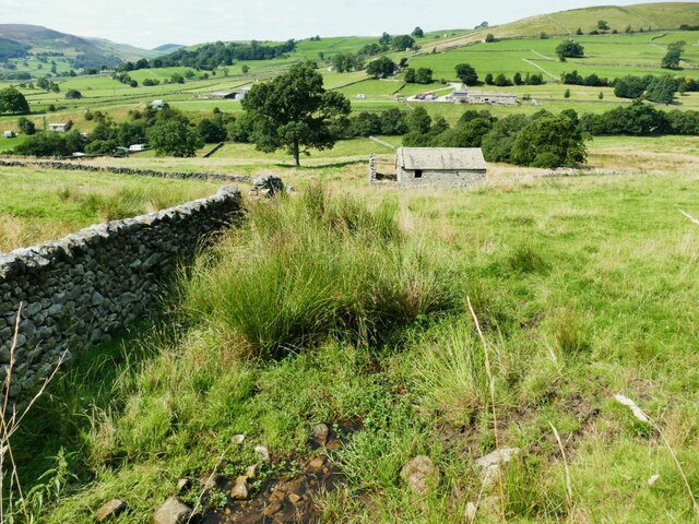
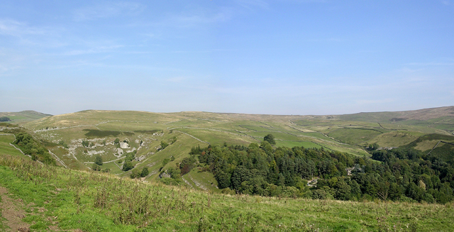
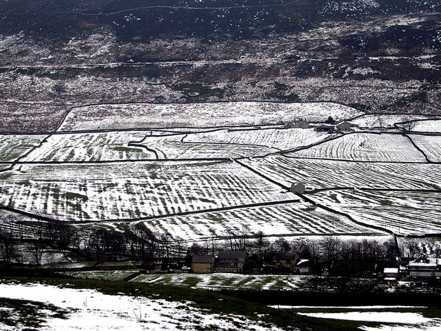
High Skyreholme is a small village located in the Craven district of North Yorkshire, England. Situated in the heart of the Yorkshire Dales National Park, it is surrounded by stunning natural beauty and offers a tranquil escape from the hustle and bustle of city life.

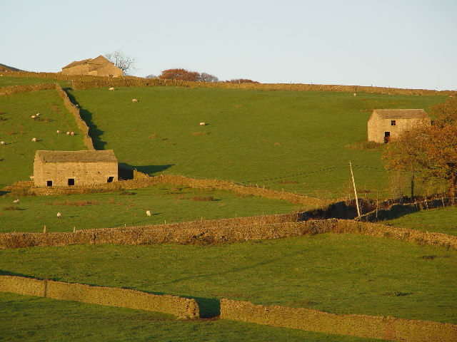
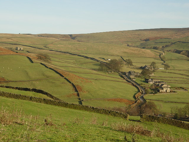
The village is characterized by its picturesque countryside, with rolling hills, meandering rivers, and lush green fields. It is nestled in a valley, bordered by the River Wharfe to the east and the River Skirfare to the west. This idyllic setting makes High Skyreholme a popular destination for outdoor enthusiasts, particularly hikers, cyclists, and nature lovers.

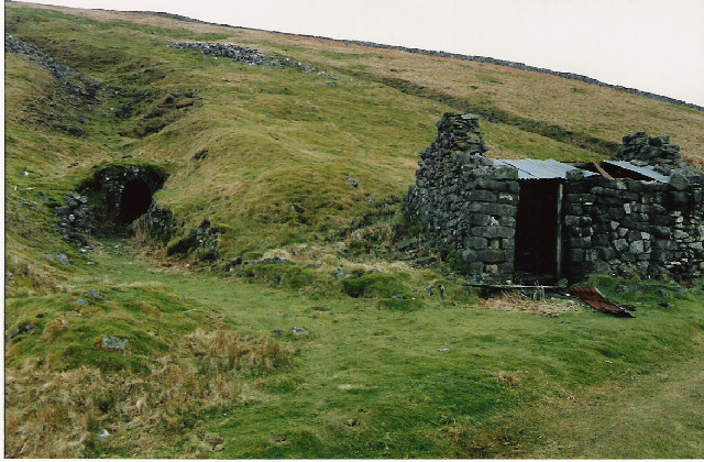
Despite its small size, the village boasts a rich history. It dates back to medieval times and was once a thriving agricultural community. Today, it retains much of its traditional charm, with stone-built cottages, a quaint village church, and a friendly, close-knit community.

While High Skyreholme may lack the amenities of larger towns, it is in close proximity to several nearby villages that offer a range of services and facilities, such as shops, pubs, and restaurants. The village is also conveniently located near popular tourist attractions, including the Bolton Abbey estate and the historic market town of Skipton.

Overall, High Skyreholme is a hidden gem in the Yorkshire Dales, offering a peaceful and picturesque setting for those seeking a rural retreat or an outdoor adventure.

If you have any feedback on the listing, please let us know in the comments section below.

High Skyreholme Images

Images are sourced within 2km of 54.04384/-1.8894159 or Grid Reference SE0760. Thanks to Geograph Open Source API. All images are credited.

Sheep dip below Howgill Lane The facility is variously referred to on maps as 'sheep dip' or 'sheep wash'; the water presumably comes from the stream causing the boggy surface in the foreground.
Sheep dip below Howgill Lane
The facility is variously referred to on maps as 'sheep dip' or 'sheep wash'; the water presumably comes from the stream causing the boggy surface in the foreground.
Howgill Barn Now holiday accommodation.
Howgill Barn
Now holiday accommodation.
Howgill Lodge Holiday accommodation with adjacent caravan and camp site.
Howgill Lodge
Holiday accommodation with adjacent caravan and camp site.
Simon's Seat
Simon's Seat
Simon's Seat from Parcevall Hall A view from just over a mile away across the valley.
Simon's Seat from Parcevall Hall
A view from just over a mile away across the valley.
Troller's Ghyll Looking North, up the Ghyll which is an old dried up river gorge left over from the last ice age.
Troller's Ghyll
Looking North, up the Ghyll which is an old dried up river gorge left over from the last ice age.
Above Trollers Ghyll Looking north, the valley which will become Trollers Ghyll is beginning to form.
Above Trollers Ghyll
Looking north, the valley which will become Trollers Ghyll is beginning to form.
Skyreholme Beck This limestone gorge was thought to be the home of trolls and monsters!
Skyreholme Beck
This limestone gorge was thought to be the home of trolls and monsters!
Panorama near Parcevall Hall Parcevall Hall is in trees centre right.
Panorama near Parcevall Hall
Parcevall Hall is in trees centre right.
Hopewell Level (Lead)
Mineworkings on Burhill
Farm Buildings and Fields, Appletreewick
Appletreewick The church is St John the Baptist - it was made from 2 cottages, rather than being built specifically as a church.
Appletreewick
The church is St John the Baptist - it was made from 2 cottages, rather than being built specifically as a church.
Middle & High Skyreholme
Forest Road This road leads from Wharfedale over Pockstones Moor and comes out at the head of Thruscross reservoir. The building on the skyline is No 3 Shaft, the southern end of the three and a half mile long aqueduct tunnel that runs under Greenhow.
Forest Road
This road leads from Wharfedale over Pockstones Moor and comes out at the head of Thruscross reservoir. The building on the skyline is No 3 Shaft, the southern end of the three and a half mile long aqueduct tunnel that runs under Greenhow.
Skyreholme Bank Leads up to a junction with Forest Road <a href="https://www.geograph.org.uk/gridref/SE0861">SE0861</a> going to the east and Blachill Road to the north, both are very rough tracks. The houses on the right are Middle & High Skyreholme <a href="https://www.geograph.org.uk/gridref/SE0760">SE0760</a> and the small building on the skyline to the left is No 3 Shaft <a href="https://www.geograph.org.uk/gridref/SE0861">SE0861</a>
Skyreholme Bank
Leads up to a junction with Forest Road SE0861 going to the east and Blachill Road to the north, both are very rough tracks. The houses on the right are Middle & High Skyreholme SE0760 and the small building on the skyline to the left is No 3 Shaft SE0861
Mediaeval field patterns near Parceval Hall, Appletreewick Ancient strips show clearly under a covering of snow.
Mediaeval field patterns near Parceval Hall, Appletreewick
Ancient strips show clearly under a covering of snow.
The fool's dam This dam across Skyreholme Beck was built to store water for a mill.  The builder was obviously not a skilled engineer because he failed to realise that a dam built on porous limestone will not work! It has apparently been deliberately breached at some time.
The fool's dam
This dam across Skyreholme Beck was built to store water for a mill. The builder was obviously not a skilled engineer because he failed to realise that a dam built on porous limestone will not work! It has apparently been deliberately breached at some time.
Show me another place!

High Skyreholme is located at Grid Ref: SE0760 (Lat: 54.04384, Lng: -1.8894159)

Division: West Riding

Administrative County: North Yorkshire

District: Craven

Police Authority: North Yorkshire

What 3 Words

///troubles.cashiers.sometime. Near Grassington, North Yorkshire

Related Wikis

Parcevall Hall

Parcevall Hall -- also known as Parceval Hall -- and its gardens are located at Skyreholme near Appletreewick village, Wharfedale, North Yorkshire, England...
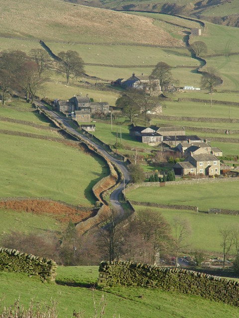
Skyreholme

Skyreholme is a hamlet in Wharfedale in the Yorkshire Dales, North Yorkshire, England. It lies 1-mile (1.6 km) east of Appletreewick, in the small side...
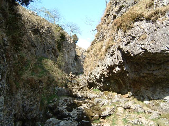
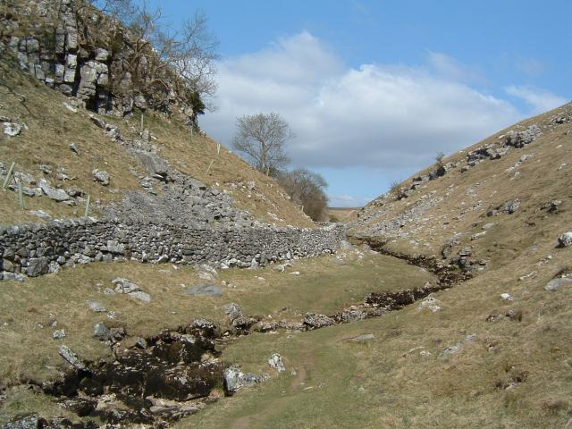
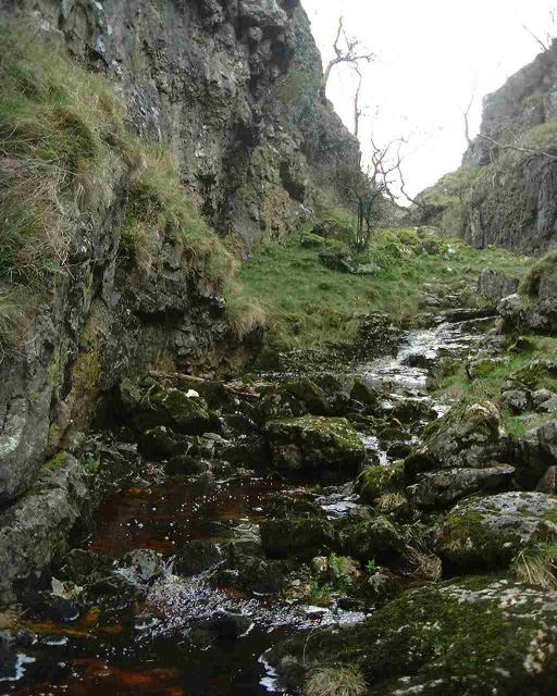
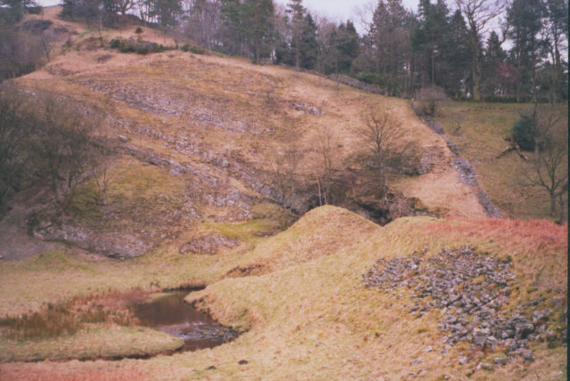
Trollers Gill

Trollers Gill is a limestone gill or gorge in North Yorkshire, England, close to the village of Skyreholme and 4.7 miles (7.5 km) south-east of Grassington...
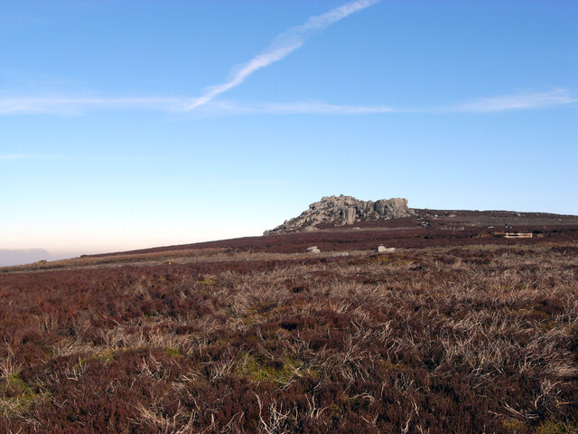
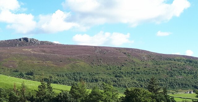
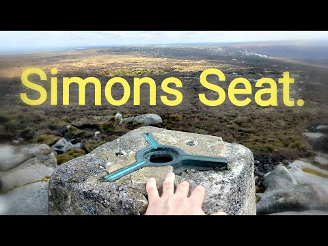
Simon's Seat

Simon's Seat is a peak in the Yorkshire Dales in northern England. It is a prominent outcrop of millstone grit on the eastern side of Wharfedale. Although...
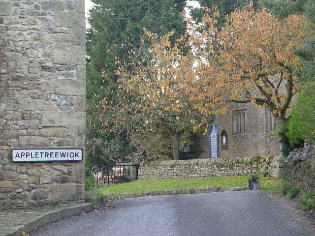
Appletreewick

Appletreewick is a village and civil parish in the Craven district of North Yorkshire, England, 6.5 miles (10.5 km) north-east of Skipton, 7 miles (11...

Stump Cross Caverns

Stump Cross Caverns is a limestone cave system between Wharfedale and Nidderdale in North Yorkshire, England. == Geography == The caverns at Stump Cross...

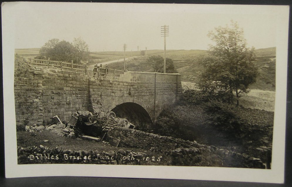
1925 Dibbles Bridge coach crash

On 10 June 1925, a coach crashed at the bottom of a steep hill at Dibbles Bridge, near Hebden in North Yorkshire, England. Seven people were killed and...

1975 Dibbles Bridge coach crash

On 27 May 1975, a coach carrying elderly passengers crashed at the bottom of a steep hill at Dibble's Bridge, near Hebden in North Yorkshire, England....

Related Videos

Synovial Sarcoma: Walking with Sarcoma - Simon’s Seat

My walk up Simon's Seat in the Yorkshire dales, UK. I'm doing this to keep positive on the lead up to my surgery at the end of ...

Around Appletreewick in Wharfedale North Yorkshire August 2023.

I think they seem to encourage barking gogs there judging by the sounds on this short video lol.

Simons Seat, Yorkshire Dale's.

Here we are starting this walk of at Barden Bridge and heading upto Simons Seat in yorkshire. Simons Seat is a peak in the ...

Nearby Amenities

Located within 500m of 54.04384,-1.8894159
High Skyreholme
Is In: UK, England, North Yorkshire, Wharfedale, Yorkshire Dales
Place: hamlet
Lat/Long: 54.0432339/-1.8903646
old level
Historic: mine_adit
Note: exact location uncertain
Source: OS 1:25k
Lat/Long: 54.047497/-1.8892642
Information: map
Tourism: information
Lat/Long: 54.0395287/-1.8880724
Barrier: stile
Lat/Long: 54.0407914/-1.8898596
Ele: 267
Ele Ft: 875
Natural: peak
Source: OS sheet 134,publ.1853
Lat/Long: 54.046533/-1.8890482
The data included in this document is from www.openstreetmap.org. The data is made available under ODbL.

Have you been to High Skyreholme?

Leave your review of High Skyreholme below (or comments, questions and feedback).