Heigham Grove

Settlement in Norfolk Norwich

England

Heigham Grove

The Last Bar & Restaurant, Norwich
The Last Bar & Restaurant, Norwich Credit: JThomas

Heigham Grove is a small village located in the county of Norfolk, England. Situated in the East Anglia region, it lies approximately 6 miles northwest of the city of Norwich. The village is part of the Broadland district and falls within the parliamentary constituency of Norwich South.

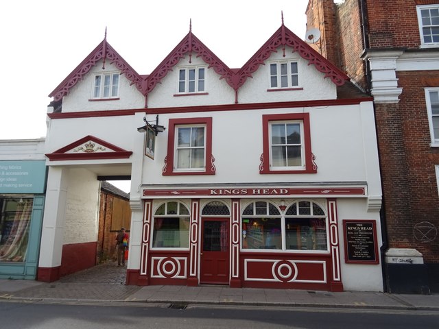
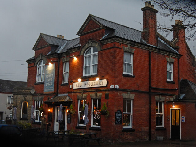
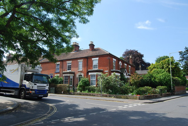
Heigham Grove boasts a charming rural setting with picturesque landscapes and a tranquil atmosphere. Surrounded by lush green fields and woodland, it offers a peaceful retreat for residents and visitors alike. The village is characterized by its traditional architecture, with many period houses and cottages lining its streets.

Although it is a small village, Heigham Grove benefits from a strong community spirit. It has a village hall that serves as a hub for various social events and gatherings, fostering a sense of togetherness among its residents. Additionally, the village is home to a local church, which plays a central role in community life.

In terms of amenities, Heigham Grove is well-connected to nearby towns and cities. The city of Norwich is easily accessible by road, providing residents with access to a wide range of services, including shopping centers, schools, and healthcare facilities.

Overall, Heigham Grove offers a peaceful and idyllic countryside living experience while still providing convenient access to larger urban areas. Its natural beauty and close-knit community make it an attractive place to reside for those seeking a quieter lifestyle in Norfolk.

If you have any feedback on the listing, please let us know in the comments section below.

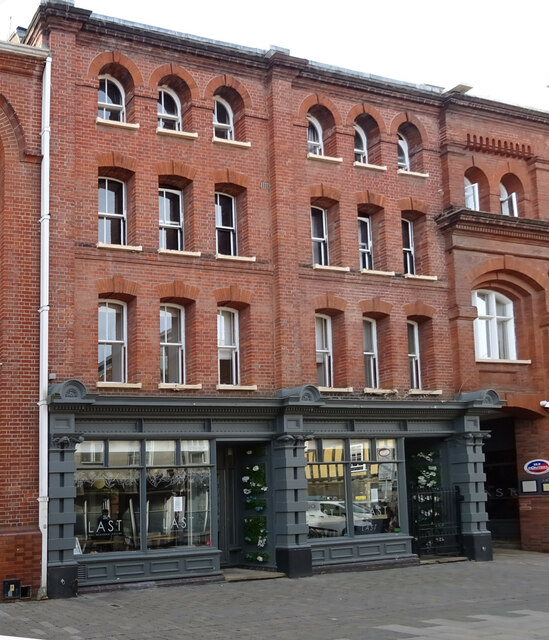
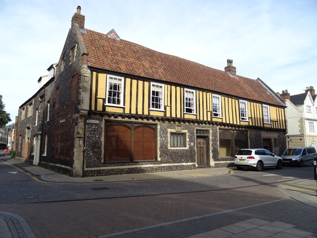
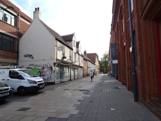
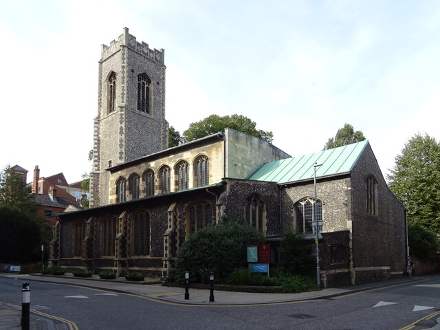
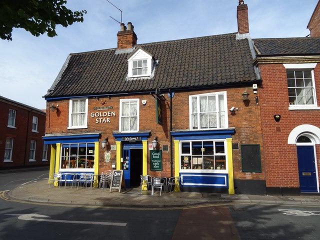
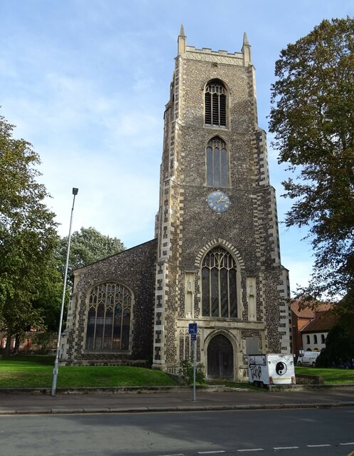
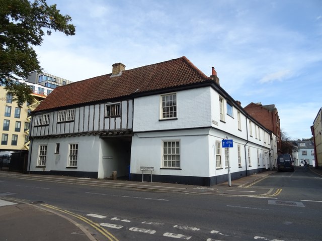
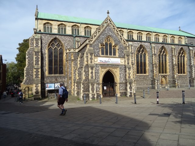
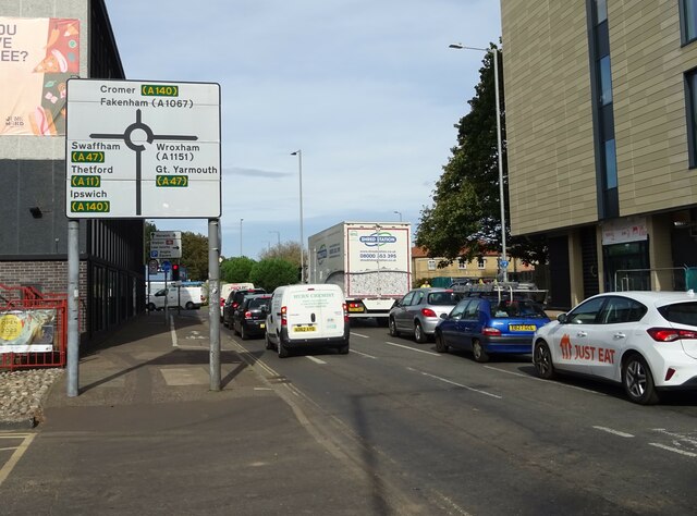
Heigham Grove Images

Images are sourced within 2km of 52.630519/1.2808231 or Grid Reference TG2208. Thanks to Geograph Open Source API. All images are credited.

The Last Bar & Restaurant, Norwich
Sign for the Last Bar & Restaurant, Norwich
Old building on Colegate
St Georges Street, Norwich
The Church of St George, Colegate
The Golden Star, Norwich
Sign for the Golden Star, Norwich
Colegate, Norwich
Colegate, Norwich
Premier Inn Norwich City Centre
National Cycle Route 1, Norwich
The Oak Circus Centre St Michael Coslany, Grade I listed medieval church.
The Oak Circus Centre
St Michael Coslany, Grade I listed medieval church.
Old house on Duke Street Behind is the Whip & Nag Yard.
Old house on Duke Street
Behind is the Whip & Nag Yard.
Norwich Central Baptist Church
St Andrew's Hall, Norwich
Duke Street, Norwich
The Kings Head, Norwich
Sign for the Kings Head, Norwich
The Rosebery, New Catton Light is rapidly fading on this December afternoon but the fine old Victorian pub looks inviting. It was formerly known as the Lord Rosebery, named after Archibald Primrose who was Liberal Prime Minister between 1894 and 1895.
The Rosebery, New Catton
Light is rapidly fading on this December afternoon but the fine old Victorian pub looks inviting. It was formerly known as the Lord Rosebery, named after Archibald Primrose who was Liberal Prime Minister between 1894 and 1895.
Show me another place!

Heigham Grove is located at Grid Ref: TG2208 (Lat: 52.630519, Lng: 1.2808231)

Administrative County: Norfolk

District: Norwich

Police Authority: Norfolk

What 3 Words

///scarf.cried.bottle. Near Norwich, Norfolk

Related Wikis

Plantation Garden, Norwich

The Plantation Garden is a restored Victorian town garden located off Earlham Road, Norwich, Norfolk. As of 2021, visitors are asked to pay £2 to visit...

St John the Baptist Cathedral, Norwich

The Cathedral Church of St John the Baptist is the Roman Catholic cathedral of the Diocese of East Anglia and is located in Norwich, Norfolk, England....

Earlham Road

Earlham Road (the B1108) is a road in Norwich, England, linking the city centre to the area of Earlham to the west of the city and the Norwich southern...

Golden Triangle (Norwich)

The Golden Triangle is a wedge-shaped area within the south western suburbs of Norwich, United Kingdom. The base of the Triangle is at the Colman Road...

St Benedict's Church, Norwich

St Benedict's Church, Norwich is a Grade I listed Anglican former parish church in Norwich, Norfolk, England. The church is medieval and probably dates...

Chapel Field Road drill hall, Norwich

The Chapel Field Road drill hall was a military installation in Norwich, Norfolk. == History == The building, which was designed by James Benest in the...

St Giles' Church, Norwich

St Giles' Church, Norwich is a Grade I listed parish church in the Church of England in Norwich. == History == The church is medieval and is noted in the...

Norwich Arts Centre

Norwich Arts Centre is a live music venue, theatre and art gallery located in St Benedict's Street in Norwich, Norfolk, England. It has a capacity of 300...

Related Videos

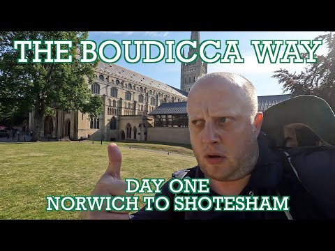
Boudicca Way - Day One - Norwich to Shotesham | Cool Dudes Walking Club

The first day of a 37-mile walk from Norwich to Diss, taking in Norwich Cathedral and the Roman ruins at Caistor St. Edmund.

Haven Holidays Caravan Tour | Norwich UK | Hopton on Sea | Hopton Holiday Village | Norfolk Beach |

Haven holidays caravan tour Norfolk Norwich UK. Hopton on sea. Great Yarmouth.

City of Stories - A Walking Tour of Norwich (4K)

Join me on a walking tour of the medieval city of Norwich guided by a group of students from UEA. The walk starts on St Andrew's ...

Norwich Norfolk | Norwich City afternoon Walk on a busy Bank Holiday weekend (May 6, 2023)

Norwich City afternoon Walk on a busy bank Holiday weekend . Please Don't Forget to Like and Subscribe so you don't miss any ...

Nearby Amenities

Located within 500m of 52.630519,1.2808231
Traffic Signals
Lat/Long: 52.6336124/1.2787295
Traffic Signals
Lat/Long: 52.6282175/1.2831611
Traffic Calming: hump
Lat/Long: 52.627245/1.2763887
Traffic Calming: hump
Lat/Long: 52.6280174/1.2760647
Traffic Calming: hump
Lat/Long: 52.6287161/1.2758322
Check Date: 2022-10-16
Traffic Calming: hump
Lat/Long: 52.6299446/1.2753953
Crossing
Bicycle: yes
Crossing: uncontrolled
Crossing Island: no
Crossing Ref: zebra
Tactile Paving: yes
Lat/Long: 52.6307547/1.2783884
Barrier: bollard
Lat/Long: 52.6324469/1.2813015
Crossing
Bicycle: yes
Button Operated: yes
Check Date Crossing: 2021-08-09
Crossing: traffic_signals
Crossing Ref: toucan
Tactile Paving: yes
Lat/Long: 52.6279685/1.2857766
Traffic Signals
Lat/Long: 52.628469/1.2837197
Crossing
Crossing: unmarked
Lat/Long: 52.6277117/1.2796078
Traffic Signals
Lat/Long: 52.6282004/1.283323
Traffic Signals
Lat/Long: 52.6283682/1.2836138
Post Box
Collection Times: Mo-Fr 09:00; Sa 07:00
Drive Through: no
Operator: Royal Mail
Post Box Type: pillar
Ref: NR2 216D
Royal Cypher: GR
Royal Cypher Wikidata: Q33102273
Lat/Long: 52.6272992/1.2810954
Post Box
Collection Times: Mo-Fr 09:00; Sa 07:00
Operator: Royal Mail
Post Box Type: pillar
Ref: NR2 219D
Royal Cypher: GR
Royal Cypher Wikidata: Q33102273
Lat/Long: 52.630815/1.2789046
Post Box
Collection Times: Mo-Fr 09:00; Sa 07:00
Operator: Royal Mail
Post Box Design: type_g
Post Box Type: pillar
Ref: NR2 224D
Royal Cypher: EIIR
Royal Cypher Wikidata: Q33102113
Lat/Long: 52.6304609/1.2752751
Post Box
Collection Times: Mo-Fr 18:55; Sa 11:00
Operator: Royal Mail
Post Box Type: lamp
Postal Code: NR2
Ref: NR2 232
Lat/Long: 52.6318121/1.28153
Post Box
Collection Times: Mo-Fr 18:00; Sa 11:45
Operator: Royal Mail
Post Box Apertures: 2
Post Box Design: type_c
Post Box Type: pillar
Ref: NR2 220;NR2 226
Royal Cypher: EIIR
Royal Cypher Wikidata: Q33102113
Lat/Long: 52.6328302/1.2816575
Post Box
Collection Times: Mo-Fr 18:00
Opening Hours: Mo-Fr 12:30-18:00
Operator: Royal Mail
Post Box Type: meter
Ref: NR2 265
Lat/Long: 52.6328237/1.2816924
Post Office
Dereham Road Post Office
Addr City: Norwich
Addr Country: GB
Addr Housenumber: 58-62
Addr Postcode: NR2 4BT
Addr Street: Dereham Road
Brand: Post Office
Brand Wikidata: Q1783168
Indoor: yes
Opening Hours: Mo-Sa 08:00-22:00; Su 10:00-16:00
Ref Pol Id: 24569
Source Addr Postcode: pol_branch_list_2018-01
Source Opening Hours: pol_branch_list_2018-01
Website: https://www.postoffice.co.uk/branch-finder/1101366/dereham-road
Wheelchair: yes
Lat/Long: 52.6328111/1.2810766
Post Box
Collection Times: Mo-Fr 19:00; Sa 12:15
Note: Within service station building wall
Operator: Royal Mail
Post Box Design: off_street_box
Post Box Type: pillar
Postal Code: NR2
Ref: NR2 238
Lat/Long: 52.6326111/1.2843711
Post Box
Collection Times: Mo-Fr 16:30; Sa 11:45
Operator: Royal Mail
Post Box Type: pillar
Ref: NR2 235
Royal Cypher: GVIR
Royal Cypher Wikidata: Q33102169
Lat/Long: 52.6314933/1.2867603
Post Box
Collection Times: Mo-Fr 16:30; Sa 11:30
Note: Inside shop window
Operator: Royal Mail
Post Box Type: wall
Ref: NR2 205
Royal Cypher: VR
Royal Cypher Wikidata: Q33102356
Lat/Long: 52.6293977/1.2860714
Crossing
Bicycle: yes
Button Operated: yes
Check Date Crossing: 2021-08-09
Crossing: traffic_signals
Crossing Ref: toucan
Tactile Paving: yes
Lat/Long: 52.6279231/1.2856109
Crossing
Crossing: traffic_signals
Crossing Ref: puffin
Tactile Paving: yes
Lat/Long: 52.6328902/1.2819289
Barrier: bollard
Lat/Long: 52.6326639/1.2856606
Barrier: bollard
Bicycle: yes
Foot: yes
Lat/Long: 52.6345826/1.2836252
Waste Basket
Colour: green
Material: plastic
Lat/Long: 52.6304551/1.2753555
Crossing
Crossing: uncontrolled
Crossing Island: no
Crossing Ref: zebra
Tactile Paving: yes
Lat/Long: 52.6304589/1.2755073
Waste Basket
Colour: green
Material: plastic
Lat/Long: 52.6306399/1.2768234
Waste Basket
Colour: green
Material: plastic
Lat/Long: 52.6318579/1.2782819
Waste Basket
Lat/Long: 52.6314618/1.2875462
Waste Basket
Lat/Long: 52.6341348/1.2817569
Waste Basket
Lat/Long: 52.6335456/1.2813641
Waste Basket
Colour: green
Material: plastic
Lat/Long: 52.6334184/1.2814207
Waste Basket
Colour: green
Material: plastic
Lat/Long: 52.6333527/1.2815969
Waste Basket
Colour: green
Material: plastic
Lat/Long: 52.6331319/1.2822007
Waste Basket
Lat/Long: 52.6332286/1.281833
Waste Basket
Colour: green
Material: plastic
Lat/Long: 52.6334589/1.282982
Waste Basket
Colour: green
Material: plastic
Lat/Long: 52.6325088/1.2830063
Waste Basket
Lat/Long: 52.6325356/1.2833799
Recycling
Mini-Recycling
Operator: Norwich City Council
Recycling Aerosol Cans: yes
Recycling Aluminium Cans: yes
Recycling Aluminium Tins: yes
Recycling Cardboard: yes
Recycling Glass Bottles: yes
Recycling Paper: yes
Recycling Plastic Bottles: yes
Recycling Steel Cans: yes
Recycling Steel Tins: yes
Lat/Long: 52.6292287/1.2854289
Bench
Lat/Long: 52.6292133/1.2854295
Give Way
Lat/Long: 52.6292374/1.2874873
Give Way
Lat/Long: 52.6301632/1.2870969
Crossing
Crossing: traffic_signals
Crossing Ref: puffin
Tactile Paving: yes
Lat/Long: 52.629082/1.2870305
Give Way
Lat/Long: 52.6291731/1.2871484
Give Way
Direction: backward
Lat/Long: 52.6320252/1.287269
Crossing
Crossing: uncontrolled
Tactile Paving: yes
Lat/Long: 52.6316917/1.2854816
Crossing
Crossing: unmarked
Crossing Island: no
Tactile Paving: no
Lat/Long: 52.631567/1.2864882
Crossing
Crossing: unmarked
Crossing Island: yes
Tactile Paving: yes
Lat/Long: 52.6285757/1.2862267
Crossing
Crossing: unmarked
Crossing Island: no
Tactile Paving: no
Lat/Long: 52.6316054/1.2865147
Crossing
Bicycle: designated
Crossing: unmarked
Lat/Long: 52.631638/1.286387
Barrier: bollard
Bicycle: yes
Colour: red
Foot: yes
Lat/Long: 52.6307209/1.2861741
Recycling
Garden House PH, Pembroke Road
Recycling Cans: yes
Recycling Glass Bottles: yes
Url: http://www.norwich.gov.uk/intranet_docs/A-Z/Recycling/Recycling_Centres.pdf
Lat/Long: 52.6282384/1.2751914
Recycling
Vauxhall Centre
Recycling Cans: yes
Recycling Paper: yes
Recycling Shoes: yes
Recycling Type: container
Url: http://www.norwich.gov.uk/intranet_docs/A-Z/Recycling/Recycling_Centres.pdf
Lat/Long: 52.6277958/1.2850329
The Newsagent And Off Licence
Addr City: Norwich
Addr Housenumber: 2
Addr Postcode: NR2 3ED
Addr Street: Alexandra Road
Brand: Premier
Brand Wikidata: Q7240340
Fhrs Id: 1371920
Shop: convenience
Source Addr: FHRS Open Data
Lat/Long: 52.6309512/1.2757234
Bus Stop
Earlham Road / St John Cathedral
Bench: yes
Bin: yes
Bus: yes
Lit: yes
Naptan AtcoCode: 2900N12377
Naptan Bearing: W
Naptan CommonName: Roman Catholic Cathedral
Naptan Indicator: adj
Naptan Landmark: Roman Catholic Cathedral
Naptan Latitude: 52.6295205
Naptan Locality: Norwich
Naptan Longitude: 1.2837544
Naptan NaptanCode: nfodjpjm
Naptan PlusbusZoneRef: NRCH
Naptan Street: Earlham Road
Note: Bearing should be NW
Operator: First Eastern Counties;H. Semmence & Co;Konectbus
Public Transport: platform
Shelter: yes
Source: naptan_import;survey
Tactile Paving: yes
Lat/Long: 52.6295906/1.2834865
Bus Stop
Earlham Road / West Parade
Bench: no
Bin: yes
Bus: yes
Lit: no
Naptan AtcoCode: 2900N12380
Naptan Bearing: E
Naptan CommonName: Gladstone Street
Naptan Indicator: adj
Naptan Landmark: Gladstone Street
Naptan Latitude: 52.6307382
Naptan Locality: Norwich
Naptan Longitude: 1.2774601
Naptan NaptanCode: nfodjpma
Naptan PlusbusZoneRef: NRCH
Naptan Street: Earlham Road
Operator: H. Semmence & Co;Konectbus
Public Transport: platform
Shelter: no
Source: naptan_import;survey
Tactile Paving: yes
Lat/Long: 52.6306437/1.27685
Bus Stop
Edinburgh Road, adj
Bench: yes
Bin: yes
Bus: yes
Naptan AtcoCode: 2900N12382
Naptan Bearing: E
Naptan CommonName: Edinburgh Road
Naptan Indicator: adj
Naptan Landmark: No. 125
Naptan Locality: Norwich
Naptan NaptanCode: nfodjpmg
Naptan PlusbusZoneRef: NRCH
Naptan Street: Earlham Road
Naptan Verified: no
Operator: First Eastern Counties;H. Semmence & Co;Konectbus
Public Transport: platform
Shelter: yes
Source: naptan_import
Tactile Paving: yes
Lat/Long: 52.6302557/1.2734479
Bus Stop
Park Lane
Bench: no
Bin: yes
Bus: yes
Lit: yes
Naptan AtcoCode: 290067
Naptan Bearing: NE
Naptan CommonName: Somerleyton Road
Naptan Indicator: adj
Naptan Landmark: Somerleyton Road
Naptan Locality: Norwich
Naptan NaptanCode: nfogpjtj
Naptan PlusbusZoneRef: NRCH
Naptan Street: Unthank Road
Note: NaPTAN codes don't match (see Neville Street)
Public Transport: platform
Ref: NFODJTAT
Shelter: no
Source: naptan_import;survey
Tactile Paving: no
Lat/Long: 52.6264166/1.2797679
Bus Stop
CitySightseeing / Norwich Tour
Bus: yes
Naptan AtcoCode: 2900N12290
Naptan Bearing: NE
Naptan CommonName: Cleveland Road
Naptan Indicator: adj
Naptan Landmark: shelter in layby
Naptan Locality: Norwich
Naptan NaptanCode: nfogmdta
Naptan PlusbusZoneRef: NRCH
Naptan Street: Cleveland Road
Note: Landmark should be capitalised
Operator: Awayadays
Public Transport: platform
Shelter: yes
Source: naptan_import;survey
Lat/Long: 52.6288588/1.2863037
Bus Stop
Charles Square
Bus: yes
Naptan AtcoCode: 2900N12291
Naptan Bearing: NW
Naptan CommonName: Charles Square
Naptan Indicator: adj
Naptan Landmark: Charles Square
Naptan Locality: Norwich
Naptan NaptanCode: nfodjgpt
Naptan PlusbusZoneRef: NRCH
Naptan Street: Dereham Road
Operator: Norfolk County Council
Public Transport: platform
Route Ref: 19;20;21;22;5
Shelter: yes
Source: naptan_import;survey
Lat/Long: 52.6325174/1.2829855
Bus Stop
Co-Op, opp
Bus: yes
Naptan AtcoCode: 2900N12292
Naptan Bearing: SE
Naptan CommonName: Co-Op
Naptan Indicator: opp
Naptan Locality: Norwich
Naptan NaptanCode: nfodjgpw
Naptan PlusbusZoneRef: NRCH
Naptan Street: Dereham Road
Naptan Verified: no
Operator: Norfolk County Council
Public Transport: platform
Route Ref: 19;20;21;22;5
Shelter: yes
Source: naptan_import
Lat/Long: 52.6333201/1.2806836
Bus Stop
Dereham Road / Adelaide Street
Bench: yes
Bin: yes
Bus: yes
Check Date Shelter: 2023-08-14
Naptan AtcoCode: 2900N12293
Naptan Bearing: NW
Naptan CommonName: Adelaide Street
Naptan Indicator: opp
Naptan Landmark: Belvior Street
Naptan Latitude: 52.6337645
Naptan Locality: Norwich
Naptan Longitude: 1.2773022
Naptan NaptanCode: nfodjgta
Naptan PlusbusZoneRef: NRCH
Naptan Street: Dereham Road
Operator: Norfolk County Council
Public Transport: platform
Route Ref: 19;20;21;22;16;5
Shelter: yes
Source: naptan_import;survey
Tactile Paving: yes
Lat/Long: 52.6337399/1.2771383
Bus Stop
Dereham Road / Adelaide Street
Bench: yes
Bin: yes
Bus: yes
Check Date Shelter: 2023-08-14
Naptan AtcoCode: 2900N12296
Naptan Bearing: SE
Naptan CommonName: Adelaide Street
Naptan Indicator: adj
Naptan Landmark: Adelaide Street
Naptan Locality: Norwich
Naptan NaptanCode: nfodjgtj
Naptan PlusbusZoneRef: NRCH
Naptan Street: Dereham Road
Operator: Norfolk County Council
Public Transport: platform
Route Ref: 19;20;21;22;16;5
Shelter: yes
Source: naptan_import;survey
Tactile Paving: yes
Lat/Long: 52.6338928/1.2768669
Bus Stop
Norwich / R.C. Cathedral
Bench: yes
Bin: yes
Bus: yes
Lit: yes
Naptan AtcoCode: 2900N12378
Naptan Bearing: E
Naptan CommonName: Roman Catholic Cathedral
Naptan Indicator: opp
Naptan Landmark: Paragon Place
Naptan Latitude: 52.6297061
Naptan Locality: Norwich
Naptan Longitude: 1.2835466
Naptan NaptanCode: nfodjpjp
Naptan PlusbusZoneRef: NRCH
Naptan Street: Earlham Road
Note: Bearing should be SE
Operator: First Eastern Counties;H. Semmence & Co;Konectbus
Public Transport: platform
Shelter: yes
Source: naptan_import;survey
Tactile Paving: yes
Lat/Long: 52.630024/1.2825491
Bus Stop
Earlham Road / West Parade
Bench: no
Bin: no
Bus: yes
Lit: no
Naptan AtcoCode: 2900N12379
Naptan Bearing: W
Naptan CommonName: Gladstone Street
Naptan Indicator: opp
Naptan Landmark: Gladstone Road
Naptan Locality: Norwich
Naptan NaptanCode: nfodjpjt
Naptan PlusbusZoneRef: NRCH
Naptan Street: Earlham Road
Operator: H. Semmence & Co;Konectbus
Public Transport: platform
Ref: NFODJPJT
Shelter: no
Source: naptan_import;survey
Tactile Paving: yes
Lat/Long: 52.6305107/1.2764262
Bus Stop
Neville Street
Bench: no
Bin: no
Bus: yes
Lit: no
Naptan AtcoCode: 2900N12405
Naptan Bearing: SW
Naptan BusStopType: CUS
Naptan CommonName: Neville Street
Naptan Indicator: opp
Naptan Landmark: Clarendon Road
Naptan Latitude: 52.6276346
Naptan Locality: Norwich
Naptan Longitude: 1.2820316
Naptan NaptanCode: nfodjtap
Naptan PlusbusZoneRef: NRCH
Naptan Street: Unthank Road
Public Transport: platform
Shelter: no
Source: naptan_import;survey
Tactile Paving: no
Lat/Long: 52.6278318/1.2825108
Bus Stop
Neville Street
Bus: yes
Naptan AtcoCode: 2900N12406
Naptan Bearing: NE
Naptan BusStopType: CUS
Naptan CommonName: Neville Street
Naptan Indicator: adj
Naptan Landmark: Neville Street
Naptan Locality: Norwich
Naptan NaptanCode: nfodjtat
Naptan PlusbusZoneRef: NRCH
Naptan Street: Unthank Road
Note: Sign missing NaPTAN code. Might be NFOGPJTJ (Park Lane NE)
Public Transport: platform
Shelter: no
Source: naptan_import;survey
Lat/Long: 52.6271741/1.2809041
Bus Stop
Park Lane
Bench: no
Bin: no
Bus: yes
Lit: no
Naptan AtcoCode: 2900N12407
Naptan Bearing: SW
Naptan BusStopType: CUS
Naptan CommonName: Somerleyton Street
Naptan Indicator: adj
Naptan Landmark: Somerleyton Street
Naptan Latitude: 52.6260681
Naptan Locality: Norwich
Naptan Longitude: 1.2794904
Naptan NaptanCode: nfodjtaw
Naptan PlusbusZoneRef: NRCH
Naptan Street: Unthank Road
Public Transport: platform
Shelter: no
Source: naptan_import;survey
Tactile Paving: no
Lat/Long: 52.6263373/1.2798767
Unthank Road CCTV Camera
Man Made: surveillance
Note: Demountable CCTV camera. Operated by a microwave link to and from the Grapes Hill Fixed CCTV Camera.
Surveillance: public
Website: https://sites.google.com/site/norwichpolicecctv/
Lat/Long: 52.628159/1.283212
Grapes Hill CCTV Camera
Man Made: surveillance
Note: Permanent CCTV camera. Microwave base station for Unthank Road demountable camera.
Surveillance: public
Url: http://sites.google.com/site/norwichpolicecctv/
Lat/Long: 52.629246/1.284999
Chapelfield Gardens CCTV Camera
Man Made: surveillance
Note: Permanent CCTV camera. Forward Vision MIC1-400 with Dual Infrared Illuminators.
Surveillance: public
Url: http://sites.google.com/site/norwichpolicecctv/
Lat/Long: 52.6279668/1.286282
Waste Basket
Colour: green
Material: plastic
Lat/Long: 52.6296093/1.283431
Bench
Backrest: yes
Lat/Long: 52.6301657/1.2822669
Crossing
Crossing: traffic_signals
Crossing Island: no
Note: Traffic sensors only
Tactile Paving: yes
Lat/Long: 52.6339551/1.2762084
Traffic Signals
Lat/Long: 52.6318215/1.2850628
Crossing
Crossing: traffic_signals
Crossing Island: yes
Tactile Paving: yes
Lat/Long: 52.6318238/1.2852234
Crossing
Crossing: traffic_signals
Crossing Island: yes
Tactile Paving: yes
Lat/Long: 52.6319006/1.2854942
Crossing
Crossing: uncontrolled
Tactile Paving: yes
Lat/Long: 52.6319853/1.2849526
Traffic Signals
Enforcement: traffic_signals
Enforcement Direction: S
Enforcement Installation: static
Lat/Long: 52.6320532/1.2854153
Crossing
Crossing: traffic_signals
Crossing Island: yes
Tactile Paving: yes
Lat/Long: 52.6318867/1.2850894
Crossing
Crossing: traffic_signals
Tactile Paving: yes
Lat/Long: 52.6321084/1.2852745
Crossing
Crossing: uncontrolled
Tactile Paving: yes
Lat/Long: 52.6320556/1.285014
Crossing
Crossing: traffic_signals
Tactile Paving: yes
Lat/Long: 52.631835/1.2854193
Crossing
Crossing: traffic_signals
Crossing Island: yes
Tactile Paving: yes
Lat/Long: 52.6319151/1.2849622
Traffic Signals
Lat/Long: 52.6318411/1.2849777
Crossing
Crossing: uncontrolled
Tactile Paving: yes
Lat/Long: 52.6319575/1.2849305
Crossing
Crossing: traffic_signals
Tactile Paving: yes
Lat/Long: 52.6320213/1.2853908
Traffic Signals
Enforcement: traffic_signals
Enforcement Direction: N
Enforcement Installation: static
Lat/Long: 52.6320795/1.2849162
Bicycle Parking
Capacity: 8
Covered: no
Operator: Norwich City Council
Lat/Long: 52.6292402/1.287172
Bicycle Parking
Capacity: 16
Covered: no
Operator: Norwich City Council
Lat/Long: 52.6314435/1.2875411
Bicycle Parking
Capacity: 8
Covered: no
Operator: Norwich City Council
Lat/Long: 52.6280835/1.2866005
Crossing
Button Operated: yes
Crossing: traffic_signals
Crossing Island: no
Crossing Ref: puffin
Tactile Paving: yes
Traffic Signals Sound: yes
Lat/Long: 52.6295207/1.2838303
Crossing
Crossing Island: yes
Tactile Paving: no
Lat/Long: 52.6324111/1.2836437
Crossing
Button Operated: yes
Crossing: traffic_signals
Crossing Ref: pelican
Supervised: no
Tactile Paving: yes
Lat/Long: 52.6336488/1.2784634
Crossing
Crossing Island: yes
Tactile Paving: no
Lat/Long: 52.6331998/1.2807205
Crossing
Button Operated: yes
Crossing: traffic_signals
Crossing Ref: pelican
Supervised: no
Tactile Paving: yes
Lat/Long: 52.6335085/1.2788023
Crossing
Button Operated: yes
Crossing: traffic_signals
Crossing Ref: pelican
Supervised: no
Tactile Paving: yes
Lat/Long: 52.6337053/1.2786227
Crossing
Button Operated: yes
Crossing: traffic_signals
Crossing Ref: pelican
Supervised: no
Tactile Paving: yes
Lat/Long: 52.6335544/1.2790952
Recycling
Mini-Recycling
Operator: Norwich City Council
Recycling Aerosol Cans: yes
Recycling Aluminium Cans: yes
Recycling Aluminium Tins: yes
Recycling Cardboard: yes
Recycling Glass Bottles: yes
Recycling Paper: yes
Recycling Plastic Bottles: yes
Recycling Steel Cans: yes
Recycling Steel Tins: yes
Lat/Long: 52.6289544/1.2864346
Entrance: yes
Lat/Long: 52.6311557/1.2860947
Vending Machine
Vending: parking_tickets
Lat/Long: 52.6313207/1.2877379
Check Date: 2022-10-16
Traffic Calming: hump
Lat/Long: 52.6292795/1.2756189
Crossing
Bicycle: no
Crossing: uncontrolled
Crossing Island: no
Crossing Ref: zebra
Tactile Paving: yes
Lat/Long: 52.6308209/1.2781671
Vending Machine
Vending: parking_tickets
Lat/Long: 52.6303128/1.2871666
Vending Machine
Vending: parking_tickets
Lat/Long: 52.6293496/1.2864216
Vending Machine
Vending: parking_tickets
Lat/Long: 52.6294034/1.2856625
Telephone
Booth: KX100
Covered: booth
Operator: BT
Lat/Long: 52.6327792/1.2817425
Barrier: bollard
Lat/Long: 52.6332282/1.2811516
Bicycle Parking
Capacity: 4
Covered: no
Lat/Long: 52.6331535/1.2811059
Bicycle Parking
Capacity: 8
Check Date: 2023-08-14
Covered: no
Lat/Long: 52.6321886/1.2839207
Parking
Lat/Long: 52.6324187/1.2825225
Atm
Lat/Long: 52.6327939/1.2813652
Bicycle Parking
Capacity: 4
Covered: no
Lat/Long: 52.6329668/1.2817831
Bicycle Parking
Bicycle Parking: stands
Capacity: 8
Covered: no
Lat/Long: 52.632985/1.2779275
Barrier: bollard
Lat/Long: 52.6331798/1.2819321
Entrance: yes
Lat/Long: 52.6313218/1.287463
Bicycle Parking
Capacity: 4
Covered: no
Operator: Norwich City Council
Source: Norwich City Council
Lat/Long: 52.6292721/1.2877591
Bicycle Parking
Capacity: 4
Covered: no
Operator: Norwich City Council
Lat/Long: 52.6293633/1.2862684
Heigham Grove
Place: suburb
Source: OS_OpenData _StreetView
Lat/Long: 52.6313583/1.2815564
Bicycle Parking
Bicycle Parking: stands
Capacity: 4
Covered: no
Lat/Long: 52.6339036/1.2783897
Waste Basket
Lat/Long: 52.6339062/1.2783445
Access: yes
Entrance: main
Wheelchair: yes
Lat/Long: 52.6339117/1.2783249
Grit Bin
Lat/Long: 52.6339697/1.2784336
Atm
Operator: RBS
Lat/Long: 52.6339254/1.2782234
Bicycle Parking
Bicycle Parking: stands
Capacity: 8
Covered: no
Lat/Long: 52.6339385/1.2784423
Waste Basket
Lat/Long: 52.6324777/1.2816971
Bicycle Parking
Bicycle Parking: stands
Capacity: 12
Covered: no
Lat/Long: 52.6326466/1.2816528
Bicycle Parking
Bicycle Parking: stands
Capacity: 12
Covered: no
Lat/Long: 52.6329304/1.281321
Barrier: cycle_barrier
Foot: yes
Lat/Long: 52.6314717/1.2812591
Barrier: cycle_barrier
Foot: yes
Lat/Long: 52.6318195/1.2813395
Entrance: yes
Lat/Long: 52.6312178/1.2809654
Entrance: yes
Lat/Long: 52.6312558/1.2805366
Entrance: yes
Lat/Long: 52.6312656/1.2810221
Barrier: bollard
Bicycle: no
Foot: yes
Lat/Long: 52.6319934/1.2818483
Barrier: bollard
Bicycle: no
Foot: yes
Lat/Long: 52.6322526/1.2819599
Barrier: cycle_barrier
Bicycle: no
Foot: yes
Lat/Long: 52.6314847/1.2831443
Entrance: yes
Lat/Long: 52.6309557/1.2838042
Entrance: yes
Lat/Long: 52.6309788/1.2835651
Entrance: yes
Lat/Long: 52.6308724/1.2843355
Entrance: yes
Lat/Long: 52.630905/1.2840986
Entrance: yes
Lat/Long: 52.6309793/1.2822077
Entrance: yes
Lat/Long: 52.6306779/1.2832765
Entrance: yes
Lat/Long: 52.6308901/1.2830756
Entrance: yes
Lat/Long: 52.630914/1.2828352
Entrance: yes
Lat/Long: 52.6300832/1.2830167
Entrance: yes
Lat/Long: 52.630369/1.2831593
Entrance: yes
Lat/Long: 52.6302255/1.2830862
Entrance: yes
Lat/Long: 52.6313355/1.2800982
Entrance: yes
Lat/Long: 52.6321846/1.2804442
Entrance: yes
Lat/Long: 52.6323367/1.2804617
Entrance: yes
Lat/Long: 52.6320683/1.2802369
Entrance: yes
Lat/Long: 52.6320721/1.2800853
Entrance: yes
Lat/Long: 52.632308/1.2806562
Barrier: bollard
Bicycle: no
Foot: yes
Lat/Long: 52.6306708/1.2803558
Street Lamp
Lit: no
Operator: Norfolk County Council
Ref: 5274
Lat/Long: 52.626807/1.2804057
Traffic Signals
Lat/Long: 52.6318554/1.2853356
Street Lamp
Lit: no
Operator: Norfolk County Council
Ref: 1877
Lat/Long: 52.6316704/1.2852293
Street Lamp
Lit: no
Operator: Norfolk County Council
Ref: 2610
Lat/Long: 52.6317205/1.2854384
Street Lamp
Lit: 24/7
Operator: Norfolk County Council
Ref: 1967
Lat/Long: 52.6335386/1.2784643
Street Lamp
Lit: 24/7
Operator: Norfolk County Council
Ref: 1876
Lat/Long: 52.6317398/1.2848973
Bar
Addr City: Norwich
Addr Housename: Norwich Arts Centre
Addr Parentstreet: St Benedicts Street
Addr Postcode: NR2 4PG
Addr Street: Reeves Yard
Fhrs Id: 68606
Note: Position is inexact
Phone: +44 1603 630479
Real Ale: 1
Real Cider: no
Lat/Long: 52.631587/1.2880034
Bench
Backrest: yes
Material: wood
Seats: 4
Lat/Long: 52.631447/1.2812015
Barrier: bollard
Bicycle: yes
Bollard: fixed
Foot: yes
Lat/Long: 52.6279938/1.2858923
Crossing
Crossing: unmarked
Crossing Island: no
Tactile Paving: yes
Traffic Calming: table
Lat/Long: 52.6317135/1.2863548
Crossing
Bicycle: yes
Crossing: uncontrolled
Crossing Island: no
Crossing Ref: zebra
Segregated: yes
Tactile Paving: yes
Lat/Long: 52.6317717/1.2861732
Entrance: yes
Lat/Long: 52.6296882/1.2803062
Entrance: yes
Lat/Long: 52.6296937/1.2804673
Entrance: yes
Lat/Long: 52.6298106/1.2801711
Entrance: yes
Lat/Long: 52.6299061/1.2802171
Noexit: yes
Lat/Long: 52.6299562/1.2800884
Fountain
Lat/Long: 52.6290839/1.2821736
Bench
Backrest: yes
Material: wood
Seats: 3
Lat/Long: 52.6290948/1.2820329
Bench
Backrest: yes
Material: wood
Seats: 3
Lat/Long: 52.6292067/1.2823148
Bench
Backrest: yes
Material: wood
Seats: 3
Lat/Long: 52.6292648/1.2820271
Bench
Backrest: yes
Material: wood
Seats: 3
Lat/Long: 52.6293048/1.2820828
Bench
Backrest: yes
Material: wood
Seats: 4
Lat/Long: 52.629356/1.2821935
Traffic Signals
Traffic Signals: signal
Lat/Long: 52.628563/1.2863332
Crossing
Crossing: unmarked
Crossing Island: yes
Tactile Paving: yes
Lat/Long: 52.6286177/1.286245
Traffic Signals
Traffic Signals: signal
Lat/Long: 52.6286407/1.2860404
Crossing
Crossing: unmarked
Crossing Island: no
Tactile Paving: yes
Lat/Long: 52.6286956/1.2860526
Crossing
Crossing: unmarked
Crossing Island: no
Tactile Paving: yes
Lat/Long: 52.6286731/1.2861779
Bench
Backrest: yes
Material: wood
Lat/Long: 52.6283247/1.2870916
Bicycle Parking
Capacity: 2
Covered: no
Lat/Long: 52.6292752/1.2854481
Cityscape tile mural
Artist Name: Melanie Strank (1988)
Artwork Type: Ceramic_tile_mural
Note: Ceramic tile mural in underpass, showing buildings of Norwich
Tourism: artwork
Lat/Long: 52.6276421/1.2859256
Entrance: yes
Lat/Long: 52.6312858/1.2809897
Entrance: yes
Lat/Long: 52.6313244/1.2805954
Entrance: yes
Lat/Long: 52.6313286/1.2805583
Entrance: yes
Lat/Long: 52.631387/1.2801162
Bench
Lat/Long: 52.6310535/1.2858713
Entrance: main
Lat/Long: 52.6291636/1.283185
Entrance: yes
Lat/Long: 52.632251/1.2781676
Access: yes
Entrance: main
Wheelchair: yes
Lat/Long: 52.6310446/1.280941
Entrance: yes
Lat/Long: 52.6289146/1.2841978
Entrance: yes
Lat/Long: 52.629237/1.2838829
Entrance: yes
Lat/Long: 52.6293102/1.28328
Entrance: yes
Lat/Long: 52.6294009/1.2834988
Entrance: yes
Lat/Long: 52.629132/1.284369
Entrance: yes
Lat/Long: 52.6288168/1.2836443
Saint Philip
Demolished Amenity: place_of_worship
Denomination: anglican
Description: Demolished in 1977 having become redundant
Historic: church
Religion: christian
Website: http://www.heritage.norfolk.gov.uk/record-details?MNF42519
Lat/Long: 52.6321627/1.2787351
Entrance: main
Lat/Long: 52.6297553/1.2837837
Entrance: yes
Lat/Long: 52.629766/1.2837009
Entrance: yes
Lat/Long: 52.6295459/1.2869467
Entrance: yes
Lat/Long: 52.6294359/1.2874657
Entrance: main
Lat/Long: 52.6294144/1.2870686
Barrier: bollard
Lat/Long: 52.6314377/1.2874885
Entrance: main
Lat/Long: 52.6314977/1.2878245
Entrance: main
Lat/Long: 52.6297616/1.2880429
Entrance: yes
Lat/Long: 52.6338528/1.2796964
Entrance: yes
Lat/Long: 52.6336113/1.2795384
Entrance: yes
Lat/Long: 52.6336089/1.2796182
Entrance: yes
Lat/Long: 52.6335987/1.2796558
Entrance: yes
Lat/Long: 52.6336035/1.2794943
Entrance: yes
Lat/Long: 52.6339552/1.2778366
Entrance: yes
Lat/Long: 52.6339413/1.2780152
Entrance: main
Lat/Long: 52.6339493/1.277912
Entrance: main
Lat/Long: 52.6277919/1.2762666
Traffic Calming: table
Lat/Long: 52.6302906/1.2752975
Stop
Lat/Long: 52.6303347/1.2752882
Give Way
Direction: forward
Lat/Long: 52.628382/1.2758974
Crossing
Crossing: unmarked
Crossing Markings: no
Tactile Paving: yes
Lat/Long: 52.6282576/1.2832442
Entrance: main
Lat/Long: 52.6284952/1.2832044
Give Way
Lat/Long: 52.632201/1.2774163
Give Way
Lat/Long: 52.6322605/1.2774262
Give Way
Lat/Long: 52.6323125/1.27569
Give Way
Lat/Long: 52.6323809/1.2756968
Give Way
Lat/Long: 52.6324299/1.2745338
Give Way
Lat/Long: 52.632423/1.274643
Give Way
Lat/Long: 52.6322604/1.2765065
Give Way
Lat/Long: 52.6323197/1.2765127
Entrance: yes
Lat/Long: 52.6317985/1.2815338
Traffic Calming: cushion
Lat/Long: 52.6328936/1.2869448
A&W Cushion Limited
Shop: trade
Trade: timber
Lat/Long: 52.6331834/1.2854969
Grit Bin
Lat/Long: 52.6286038/1.2848972
Restaurant
The Tipsy Vegan
Addr City: Norwich
Addr Housenumber: 68-70
Addr Postcode: NR2 4AR
Addr Street: Saint Benedicts Street
Check Date: 2023-07-16
Contact Facebook: https://www.facebook.com/thetipsyvegan/
Contact Instagram: https://www.instagram.com/thetipsyveganbar
Contact Website: https://thetipsyvegan.co.uk/norwich/
Diet Vegan: only
Diet Vegetarian: only
Fhrs Id: 1681170
Internet Access: wlan
Old Name: Trattoria;Umberto's Ristorante
Opening Hours: Mo-Th 11:00-21:00; Fr-Sa 11:00-22:00; Su 11:00-18:00
Source Addr Postcode: FHRS Open Data
Wheelchair: yes
Lat/Long: 52.6312418/1.2877468
Give Way
Lat/Long: 52.6306715/1.2861992
Grit Bin
Lat/Long: 52.6316434/1.2854232
Entrance: yes
Lat/Long: 52.6274309/1.2830883
Entrance: main
Lat/Long: 52.6275631/1.2829287
Barrier: lift_gate
Foot: yes
Motor Vehicle: private
Lat/Long: 52.6277826/1.2824315
Clinic
Sk:n Clinic
Healthcare: clinic
Url: https://www.sknclinics.co.uk/clinics/the-midlands/norwich-unthank-road
Lat/Long: 52.6278632/1.2818791
Entrance: main
Wheelchair: yes
Lat/Long: 52.6329117/1.2814509
AMDeX Solutions
Company: software
Email: enquiry@amdex.co.uk
Level: 1
Office: company
Phone: +44 1420 568211
Short Name: amdex
Website: http://www.amdexsolutions.com/
Lat/Long: 52.6275325/1.2831443
Give Way
Lat/Long: 52.6310768/1.27557
Give Way
Lat/Long: 52.6310994/1.2744064
Traffic Calming: bump
Lat/Long: 52.6331476/1.2843755
Traffic Calming: bump
Lat/Long: 52.6332827/1.2844677
Traffic Calming: bump
Lat/Long: 52.6334535/1.2848907
Power: transformer
Transformer: distribution
Lat/Long: 52.6315607/1.2859783
Parking Space
Access: customers
Capacity: 1
Fee: no
Parking: surface
Parking Space: disabled
Surface: asphalt
Lat/Long: 52.6339012/1.2782986
Access: delivery
Entrance: yes
Lat/Long: 52.6341113/1.2784388
Entrance: main
Lat/Long: 52.6329055/1.2823191
Entrance: main
Lat/Long: 52.6281929/1.286689
Toilets
Changing Places, Vauxhall Community Hub
Access: yes
Addr Housename: Johnson Place
Addr Street: Vauxhall Street
Changing Table: no
Contact Phone: +44 1603 626 014
Fee: no
Opening Hours: 24/7
Operator: Vauxhall Community Hub
Unisex: yes
Wheelchair: yes
Wheelchair Description: Adult changing bench - Height Adjustable, Adult Sized. Peninsular Toilet, Emergency Alarm, Privacy Screen
Lat/Long: 52.6276597/1.2851698
Social Facility
Belvedere Community Centre Luncheon Club
Addr City: Norwich
Addr Housename: Belvedere Community Centre
Addr Postcode: NR2 3AZ
Addr Street: Belvoir Street
Fee: yes
Fhrs Id: 4892
Opening Hours: We 12:15-13:30
Social Facility: soup_kitchen
Source Addr: FHRS Open Data
Website: http://www.thebelvedere.co.uk/luncheon-club/
Lat/Long: 52.6328974/1.2780301
Traffic Signals
Traffic Signals: signal
Lat/Long: 52.6287355/1.2862754
Give Way
Lat/Long: 52.6281253/1.2854058
Sarah Ann Glover Plaque
Historic: memorial
Inscription: Plaque commemorating Sarah Ann Glover, who developed the Tonic Sol-fa method of teaching music.
Material: metal
Memorial: plaque
Lat/Long: 52.6304969/1.2875881
Barrier: bollard
Bicycle: yes
Foot: yes
Lat/Long: 52.6310505/1.2821834
Bench
Backrest: yes
Seats: 3
Lat/Long: 52.6307972/1.2783408
Barrier: bollard
Foot: no
Lat/Long: 52.6307972/1.2783053
Barrier: bollard
Foot: no
Lat/Long: 52.630809/1.2782642
Barrier: bollard
Foot: no
Lat/Long: 52.6308286/1.2782322
Waste Basket
Lat/Long: 52.626362/1.2796873
Pub
The X Bells
Addr City: Norwich
Addr Country: GB
Addr Housenumber: 74-78
Addr Postcode: NR2 4AR
Addr Street: Saint Benedicts Street
Contact Facebook: https://www.facebook.com/people/The-Ten-Bells-Norwich/100067596811906/
Fhrs Id: 1287904;1522488
Note: Part whisky bar
Opening Hours: Mo-Th 12:00-01:00; Fr-Sa 12:00-01:30; Su 12:00-00:30
Phone: +44 1603 920292
Real Ale: 4
Real Cider: no
Lat/Long: 52.6313009/1.2875003
Addr Street: Saint Benedicts Street
Entrance: yes
Lat/Long: 52.6313133/1.287507
Addr City: Norwich
Addr Housenumber: 78
Addr Postcode: NR2 4AR
Addr Street: Saint Benedicts Street
Entrance: yes
Source Addr Postcode: code-point_open
Lat/Long: 52.6313074/1.2875378
Bench
Lat/Long: 52.6292528/1.2878345
Bicycle Rental
Douro Place/Dereham Road
Capacity: 4
Email: support@beryl.cc
Fee: yes
Name Signed: no
Network: Beryl - Norwich
Official Name: Douro Place/Dereham Road
Operator: Beryl
Operator Wikidata: Q106575369
Payment App: yes
Payment App Android: cc.beryl.basis
Payment App Ios: 1386768364
Payment Cash: no
Payment Credit Cards: no
Payment Cryptocurrencies: no
Payment Debit Cards: no
Payment Electronic Purses: no
Phone: +44 20 3003 5044
Ref Gbfs: beryl_norwich:1833
Rental: city_bike;ebike;escooter
Website: https://beryl.cc/scheme/norwich
Lat/Long: 52.6332474/1.281179
Bicycle Rental
West Pottergate
Bicycle Rental: dropoff_point
Capacity: 6
Email: support@beryl.cc
Fee: yes
Name Signed: no
Network: Beryl - Norwich
Official Name: West Pottergate
Operator: Beryl
Operator Wikidata: Q106575369
Payment App: yes
Payment App Android: cc.beryl.basis
Payment App Ios: 1386768364
Payment Cash: no
Payment Credit Cards: no
Payment Cryptocurrencies: no
Payment Debit Cards: no
Payment Electronic Purses: no
Phone: +44 20 3003 5044
Ref Gbfs: beryl_norwich:1960
Rental: city_bike;ebike;escooter
Website: https://beryl.cc/scheme/norwich
Lat/Long: 52.6309319/1.278246
Bicycle Rental
St Swithins Street
Capacity: 8
Email: support@beryl.cc
Fee: yes
Name Signed: no
Network: Beryl - Norwich
Official Name: St Swithins Street
Operator: Beryl
Operator Wikidata: Q106575369
Payment App: yes
Payment App Android: cc.beryl.basis
Payment App Ios: 1386768364
Payment Cash: no
Payment Credit Cards: no
Payment Cryptocurrencies: no
Payment Debit Cards: no
Payment Electronic Purses: no
Phone: +44 20 3003 5044
Ref Gbfs: beryl_norwich:2033
Rental: city_bike;ebike;escooter
Website: https://beryl.cc/scheme/norwich
Lat/Long: 52.6317673/1.2865191
Charging Station
Access: customers
Amperage: 32
Authentication None: yes
Capacity: 4
Fee: no
Opening Hours: 24/7
Operator: evopen
Socket Type2: 4
Voltage: 230
Lat/Long: 52.6278717/1.2827665
Charging Station
Access: customers
Amperage: 32
Authentication None: yes
Capacity: 4
Fee: no
Opening Hours: 24/7
Operator: evopen
Socket Type2: 4
Voltage: 230
Lat/Long: 52.6278985/1.2828255
Cafe
Kofra
Addr City: Norwich
Addr Housenumber: 81
Addr Postcode: NR2 1AB
Addr Street: Upper Saint Giles Street
Check Date: 2023-07-16
Cuisine: coffee_shop
Fhrs Id: 1222731
Internet Access: no
Opening Hours: Mo-Sa 08:00-17:00, Su 09:00-17:00
Outdoor Seating: yes
Takeaway: yes
Website: https://www.kofra.co.uk/upper-st-giles
Lat/Long: 52.6293989/1.2863582
Access: no
Barrier: bollard
Bicycle: yes
Bollard: fixed
Foot: yes
Lat/Long: 52.6269429/1.2817683
Little shop of Vegans
Addr City: Norwich
Addr Housenumber: 49
Addr Postcode: NR2 4PG
Addr Street: Saint Benedicts Street
Fhrs Id: 1228356
Shop: convenience
Source Addr Postcode: FHRS Open Data
Lat/Long: 52.6313712/1.2878783
Addr City: Norwich
Addr Housenumber: 86
Addr Postcode: NR2 4AB
Addr Street: Saint Benedicts Street
Disused Shop: yes
Source Addr Postcode: FHRS Open Data
Lat/Long: 52.6314109/1.2869438
Crossing
Lat/Long: 52.6283235/1.2844295
Crossing
Crossing: uncontrolled
Crossing Island: no
Crossing Ref: toucan
Tactile Paving: yes
Lat/Long: 52.6283145/1.2846997
Crossing
Crossing: uncontrolled
Crossing Island: no
Crossing Ref: toucan
Tactile Paving: yes
Lat/Long: 52.6282342/1.2846589
Crossing
Bicycle: designated
Crossing: uncontrolled
Foot: designated
Tactile Paving: no
Lat/Long: 52.6281202/1.2831497
Cycleway: asl
Lat/Long: 52.6282393/1.2832062
Crossing
Crossing: unmarked
Crossing Island: no
Crossing Markings: no
Tactile Paving: yes
Lat/Long: 52.6281181/1.2833152
Cycleway: asl
Lat/Long: 52.6283641/1.2848556
Waste Basket
Colour: green
Material: plastic
Lat/Long: 52.6319537/1.2797395
Waste Basket
Lat/Long: 52.6280019/1.27864
Waste Basket
Colour: green
Material: plastic
Lat/Long: 52.6335915/1.2777247
Waste Basket
Colour: green
Material: plastic
Lat/Long: 52.6312584/1.2796988
Waste Basket
Colour: green
Material: plastic
Lat/Long: 52.6318305/1.2818966
Waste Basket
Colour: black
Material: metal
Lat/Long: 52.6293704/1.2853664
Waste Basket
Colour: green
Material: plastic
Lat/Long: 52.6331427/1.2811894
Waste Basket
Lat/Long: 52.6305474/1.2790894
Waste Basket
Lat/Long: 52.6338603/1.2816629
Waste Basket
Lat/Long: 52.6330453/1.277809
Waste Basket
Colour: green
Material: plastic
Lat/Long: 52.6275716/1.2855034
Waste Basket
Lat/Long: 52.6279712/1.2863397
Waste Basket
Colour: green
Material: plastic
Lat/Long: 52.6332239/1.2834744
Waste Basket
Colour: green
Material: plastic
Lat/Long: 52.6281537/1.282939
Waste Basket
Lat/Long: 52.6322186/1.2799286
Waste Basket
Colour: green
Material: plastic
Lat/Long: 52.6337003/1.2772768
Waste Basket
Colour: green
Material: plastic
Lat/Long: 52.6322037/1.2822929
Waste Basket
Colour: green
Material: plastic
Lat/Long: 52.6280561/1.278511
Waste Basket
Colour: green
Material: plastic
Lat/Long: 52.6265664/1.2842224
Waste Basket
Colour: green
Material: plastic
Lat/Long: 52.6336253/1.2790217
Waste Basket
Lat/Long: 52.6284976/1.2862929
Waste Basket
Colour: green
Material: plastic
Lat/Long: 52.628295/1.2754072
Waste Basket
Colour: green
Material: plastic
Lat/Long: 52.6308364/1.2836657
Waste Basket
Colour: green
Material: plastic
Lat/Long: 52.6318925/1.2815323
Waste Basket
Colour: green
Material: plastic
Lat/Long: 52.633194/1.2808567
Waste Basket
Colour: green
Material: plastic
Lat/Long: 52.6316347/1.2832857
Waste Basket
Colour: black
Material: metal
Lat/Long: 52.6292712/1.2870717
Waste Basket
Colour: green
Material: plastic
Lat/Long: 52.6281396/1.2843559
Waste Basket
Colour: green
Material: plastic
Lat/Long: 52.6296156/1.2791297
Waste Basket
Colour: green
Material: plastic
Lat/Long: 52.6336477/1.2776287
Waste Basket
Colour: green
Material: plastic
Lat/Long: 52.6280077/1.2834834
Waste Basket
Lat/Long: 52.6282932/1.2871235
Waste Basket
Colour: green
Material: plastic
Lat/Long: 52.6338472/1.2772995
Waste Basket
Colour: green
Material: plastic
Lat/Long: 52.632716/1.2823208
Waste Basket
Lat/Long: 52.6282441/1.2862994
Waste Basket
Lat/Long: 52.6330282/1.2775398
Give Way
Lat/Long: 52.6313056/1.287402
Give Way
Lat/Long: 52.6313351/1.2874179
Last Level Games
Addr City: Norwich
Addr Housenumber: 64
Addr Postcode: NR2 4AR
Addr Street: Saint Benedicts Street
Old Name: & Books
Shop: video_games
Website: https://www.lastlevelgames.net/
Lat/Long: 52.631221/1.2878974
Bar
The Corkscrew
Addr City: Norwich
Addr Housenumber: 60-62
Addr Postcode: NR2 4AR
Addr Street: Saint Benedicts Street
Fhrs Id: 1229971
Old Name: Unknown Coffee
Website: https://thecorkscrew-benedictstreet.co.uk/
Lat/Long: 52.6312055/1.2879768
Give Way
Direction: forward
Lat/Long: 52.6283208/1.2754615
Barrier: bollard
Bollard: fixed
Colour: black
Material: metal
Lat/Long: 52.6282192/1.275882
Give Way
Lat/Long: 52.6268882/1.2764745
Give Way
Lat/Long: 52.627354/1.2762823
Give Way
Lat/Long: 52.6278384/1.2787589
Barrier: bollard
Bollard: fixed
Material: wood
Lat/Long: 52.626715/1.2818241
Kerb: raised
Lat/Long: 52.6278505/1.2848979
Give Way
Lat/Long: 52.6274984/1.2844388
Barrier: lift_gate
Lat/Long: 52.6274773/1.284357
Give Way
Lat/Long: 52.6272201/1.2848996
Give Way
Lat/Long: 52.6266197/1.280217
Give Way
Lat/Long: 52.6263356/1.2812664
Kerb: yes
Lat/Long: 52.6320477/1.2831972
Barrier: bollard
Bollard: fixed
Material: concrete
Lat/Long: 52.6307948/1.2836026
Barrier: bollard
Bicycle: designated
Bollard: removable
Material: metal
Lat/Long: 52.6308375/1.2836248
Give Way
Lat/Long: 52.6317153/1.2859808
Give Way
Lat/Long: 52.6316731/1.2861545
Give Way
Lat/Long: 52.6317105/1.2861662
Give Way
Lat/Long: 52.6317343/1.2860353
Crossing
Bicycle: designated
Crossing: unmarked
Lat/Long: 52.6317271/1.2860087
Crossing
Bicycle: designated
Crossing: unmarked
Lat/Long: 52.6316896/1.2861638
Give Way
Lat/Long: 52.6316226/1.2863888
Give Way
Lat/Long: 52.6317545/1.2863385
Give Way
Lat/Long: 52.6281037/1.2837468
Traffic Signals
Traffic Signals: signal
Lat/Long: 52.6285506/1.2858486
Traffic Signals
Traffic Signals: signal
Lat/Long: 52.6283678/1.2850437
Give Way
Lat/Long: 52.6286264/1.2863077
Give Way
Lat/Long: 52.6285861/1.286301
Cycleway: asl
Lat/Long: 52.628571/1.2862672
Cycleway: asl
Lat/Long: 52.6287064/1.2862265
Bicycle Rental
Upper St. Giles
Capacity: 8
Email: support@beryl.cc
Fee: yes
Network: Beryl - Norwich
Operator: Beryl
Operator Wikidata: Q106575369
Payment App: yes
Payment Cash: no
Payment Credit Cards: no
Payment Cryptocurrencies: no
Payment Debit Cards: no
Payment Electronic Purses: no
Phone: +44 20 3003 5044
Ref Gbfs: beryl_norwich:1953
Rental: city_bike;ebike;escooter
Website: https://beryl.cc/scheme/norwich
Lat/Long: 52.6293481/1.2863896
Motorcycle Parking
Barn Road Car Park
Capacity: 147
Covered: yes
Fee: no
Note: Shared with cars. Motorcycles free.
Source: https://www.norwich.gov.uk/info/20008/parking/1565/motorcycle_parking;https://www.norwich.gov.uk/directory_record/851/barn_road_car_park_nr2_4sz
Lat/Long: 52.6320594/1.2861173
Give Way
Lat/Long: 52.6324204/1.283804
Cycleway: asl
Lat/Long: 52.6320656/1.284973
Cafe
The Feed
Addr City: Norwich
Addr Country: GB
Addr Housename: Churchman House
Addr Housenumber: 71
Addr Postcode: NR2 1NR
Addr Street: Bethel Street
Fhrs Id: 1557648
Opening Hours: Mo-Su 09:30-15:30
Social Facility: outreach
Lat/Long: 52.6290817/1.2875207
Social Facility
REST
Addr City: Norwich
Addr Country: GB
Addr Housename: Churchman House
Addr Housenumber: 71
Addr Postcode: NR2 1NR
Addr Street: Bethel Street
Opening Hours: Mo-Su 09:30-15:30
Social Facility: outreach
Lat/Long: 52.6290768/1.2874523
Addr City: Norwich
Addr Housenumber: 77a
Addr Postcode: NR2 1AB
Addr Street: Upper Saint Giles Street
Source Addr Postcode: code-point_open
Lat/Long: 52.6293715/1.2865551
Studio Art Gallery
Addr City: Norwich
Addr Postcode: NR2 1AB
Addr Street: Upper Saint Giles Street
Shop: art
Source Addr Postcode: code-point_open
Website: http://studioartgallery.weebly.com/
Lat/Long: 52.6293646/1.2866188
Norwich Art Shop
Addr City: Norwich
Addr Housenumber: 75
Addr Postcode: NR2 1AB
Addr Street: Upper Saint Giles Street
Shop: art
Website: https://norwichartshop.co.uk/
Lat/Long: 52.6293585/1.2866711
Pebbles Tanning Nails and Beauty
Addr City: Norwich
Addr Housenumber: 95
Addr Postcode: NR2 1AB
Addr Street: Upper Saint Giles Street
Beauty: tanning
Shop: beauty
Website: https://www.pebbles-beauty.co.uk/
Lat/Long: 52.6294391/1.2856183
The Post Room
Addr City: Norwich
Addr Postcode: NR2 1AB
Addr Street: Upper Saint Giles Street
Shop: gift
Source Addr Postcode: code-point_open
Lat/Long: 52.6294297/1.2861179
Scrivens
Addr City: Norwich
Addr Postcode: NR2 1AB
Addr Street: Upper Saint Giles Street
Brand: Scrivens
Brand Wikidata: Q79424133
Shop: optician
Source Addr Postcode: code-point_open
Website: https://scrivens.com/branch/norwich-10/
Lat/Long: 52.6294342/1.2860582
Stiffkey Bathrooms
Addr City: Norwich
Addr Housenumber: 89
Addr Postcode: NR2 1AB
Addr Street: Upper Saint Giles Street
Shop: bathroom
Website: https://www.stiffkeybathrooms.com/
Lat/Long: 52.6294395/1.2859911
Ninety-One
Addr City: Norwich
Addr Housenumber: 91
Addr Postcode: NR2 1AB
Addr Street: Upper Saint Giles Street
Disused Amenity: cafe
Lat/Long: 52.6294448/1.285906
KA's
Addr City: Norwich
Addr Housenumber: 85
Addr Postcode: NR2 1AB
Addr Street: Upper Saint Giles Street
Shop: beauty
Website: http://www.ka-s.co.uk/
Lat/Long: 52.6294167/1.2861836
Cupcake & Co
Addr City: Norwich
Addr Housenumber: 83
Addr Postcode: NR2 1AB
Addr Street: Upper Saint Giles Street
Fhrs Id: 903861
Shop: pastry
Source Addr Postcode: code-point_open
Website: https://cupcakeand.co/
Lat/Long: 52.629413/1.286246
Restaurant
Roger Hickman's Restaurant
Addr City: Norwich
Addr Housenumber: 79
Addr Postcode: NR2 1AB
Addr Street: Upper Saint Giles Street
Fhrs Id: 33454
Source Addr Postcode: code-point_open
Website: https://www.rogerhickmansrestaurant.com/
Lat/Long: 52.6293854/1.286476
Cafe
Bread Source
Addr City: Norwich
Addr Housenumber: 93
Addr Postcode: NR2 1AB
Addr Street: Upper Saint Giles Street
Cuisine: english
Fhrs Id: 910273
Source Addr Postcode: FHRS Open Data
Website: https://www.bread-source.co.uk/
Lat/Long: 52.6294444/1.2858088
St Giles Pantry
Addr City: Norwich
Addr Housenumber: 95A
Addr Postcode: NR2 1AB
Addr Street: Upper Saint Giles Street
Fhrs Id: 1275816
Shop: deli
Website: https://stgilespantry.com/
Lat/Long: 52.6294403/1.2857031
Fabulous Frames
Addr City: Norwich
Addr Housenumber: 97
Addr Postcode: NR2 1AB
Addr Street: Upper Saint Giles Street
Opening Hours: Mo-Sa 10:00-18:00
Shop: frame
Website: https://fabulousframes.co.uk/
Lat/Long: 52.6294411/1.2855037
Book Exchange
Lat/Long: 52.6292784/1.2860493
Restaurant
Lord's
Addr City: Norwich
Addr Country: GB
Addr Housenumber: 82
Addr Postcode: NR2 1LT
Addr Street: Upper Saint Giles Street
Cuisine: seafood
Fhrs Id: 1376261
Website: https://www.lordsnorwich.co.uk/
Lat/Long: 52.6292535/1.2862996
Training
Norwich Institute for Language Education (NILE)
Addr City: Norwich
Addr Housenumber: 78-80
Addr Postcode: NR2 1LT
Addr Street: Upper Saint Giles Street
Website: https://www.nile-elt.com/
Lat/Long: 52.629216/1.2864773
Hoskins Hair
Addr City: Norwich
Addr Housenumber: 76
Addr Postcode: NR2 1LT
Addr Street: Upper Saint Giles Street
Shop: hairdresser
Source Addr Postcode: code-point_open
Website: https://www.hoskinshair.co.uk/
Lat/Long: 52.6292299/1.2866288
Bench
Backrest: yes
Material: wood
Seats: 4
Lat/Long: 52.6290931/1.2819405
Bench
Backrest: yes
Colour: black
Material: wood+metal
Seats: 3
Lat/Long: 52.6287142/1.2818431
Board Type: history
Description: The Creation of the Plantation Garden
Information: board
Tourism: information
Lat/Long: 52.6283916/1.2816402
Bench
Backrest: yes
Colour: black
Material: wood+metal
Seats: 3
Lat/Long: 52.6287361/1.2818533
Bench
Backrest: yes
Colour: black
Material: wood+metal
Seats: 3
Lat/Long: 52.6287886/1.2818947
Bench
Backrest: yes
Material: wood
Seats: 3
Lat/Long: 52.6291573/1.2819616
Waste Basket
Waste: trash
Lat/Long: 52.6284307/1.2814857
Waste Basket
Waste: trash
Lat/Long: 52.6286395/1.281791
Board Type: nature
Description: Tree-mendous Trees
Information: board
Tourism: information
Lat/Long: 52.6283829/1.2816667
Bench
Backrest: yes
Colour: black
Material: wood+metal
Seats: 3
Lat/Long: 52.628687/1.28183
Bench
Backrest: yes
Material: wood
Seats: 3
Lat/Long: 52.6293494/1.2823411
Bench
Backrest: yes
Colour: black
Material: wood+metal
Seats: 3
Lat/Long: 52.6287232/1.2819619
Board Type: history
Description: The Glasshouse
Information: board
Tourism: information
Lat/Long: 52.6293552/1.2822253
Board Type: history
Description: History of the site
Information: board
Tourism: information
Lat/Long: 52.6290394/1.2821925
Communication Mobile Phone: yes
Layer: 1
Man Made: mast
Material: metal
Operator: O2-UK;Vodafone UK;EE
Tower Construction: freestanding
Tower Type: communication
Lat/Long: 52.6290948/1.28396
Communication Mobile Phone: yes
Layer: 1
Man Made: mast
Material: metal
Operator: EE
Tower Construction: guyed_tube
Tower Type: communication
Lat/Long: 52.6270955/1.2836583
Cycleway: asl
Lat/Long: 52.6284291/1.2837217
Crossing
Crossing: unmarked
Crossing Markings: no
Lat/Long: 52.6283892/1.2849067
Traffic Signals
Traffic Signals: signal
Lat/Long: 52.6283406/1.2847963
Defibrillator
Access: yes
Defibrillator Location: On the side of the Garden House pub, facing Pembroke Road
Emergency: defibrillator
Indoor: no
Operator: Heart 2
Ref GB The Circuit: DA54CEA3-0CCF-45BB-B50A-AE01009A0B86
Lat/Long: 52.6281761/1.2753765
The data included in this document is from www.openstreetmap.org. The data is made available under ODbL.

Have you been to Heigham Grove?

Leave your review of Heigham Grove below (or comments, questions and feedback).