Hatton

Settlement in Warwickshire Warwick

England

Hatton

Bridge at Hatton Locks Over the Grand Union Canal.
Bridge at Hatton Locks Credit: David Howard

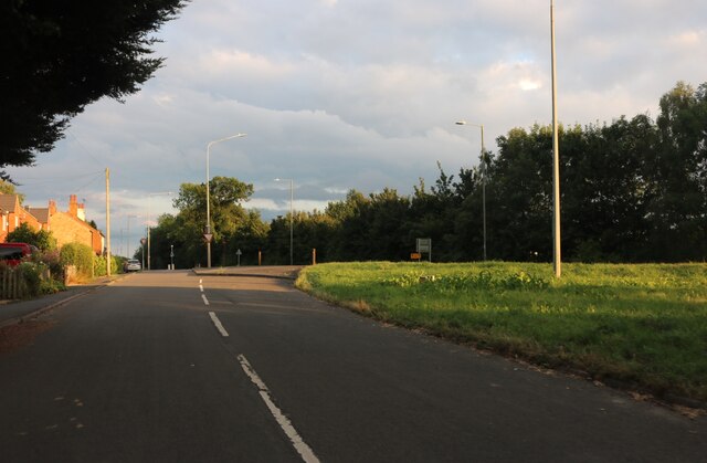
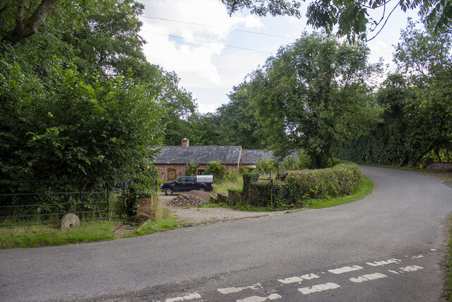
Hatton is a small village located in the county of Warwickshire, England. Situated approximately 5 miles southeast of Warwick, Hatton is nestled in the heart of the picturesque Warwickshire countryside. The village is part of the Warwick district and falls within the Hatton and Haseley parish.

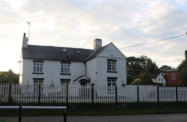
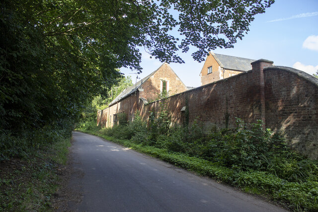
Despite its small size, Hatton boasts a rich history that dates back centuries. The village is home to several historic buildings, including St. Peter's Church, which dates back to the 12th century and is a Grade II listed building. The church's stunning architecture and beautiful stained glass windows attract visitors from near and far.

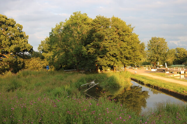
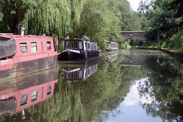
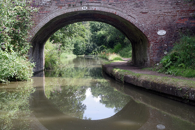
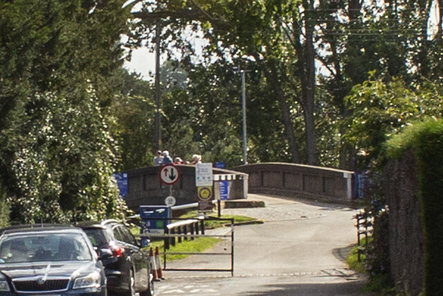
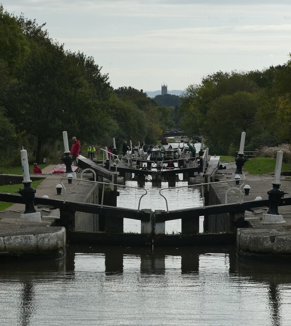
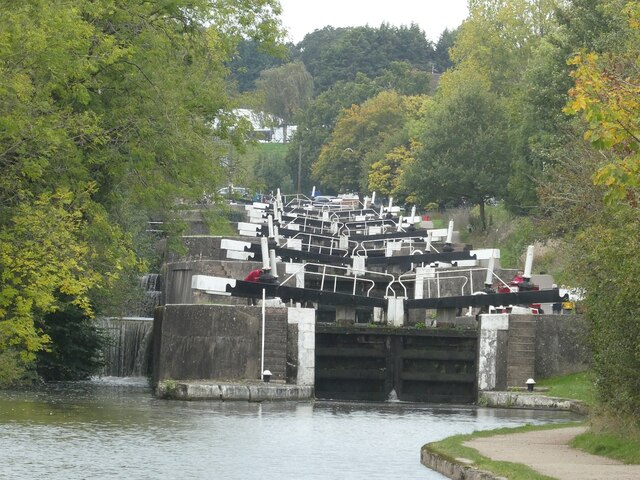
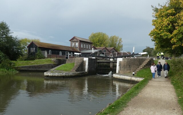
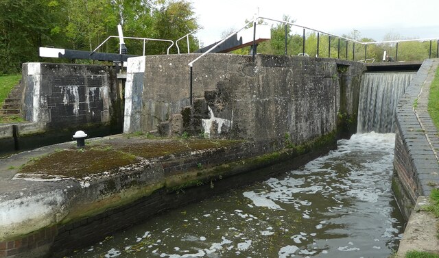
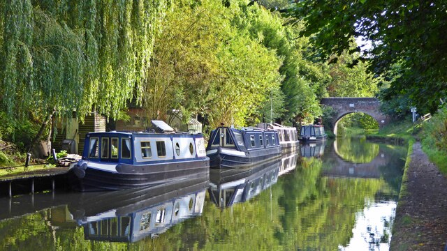
Hatton is also renowned for its charming canal system, which passes through the village. The Hatton Locks, a flight of 21 locks on the Grand Union Canal, is a popular attraction for boating enthusiasts and tourists alike. The locks provide a picturesque setting for leisurely walks and offer breathtaking views of the surrounding countryside.

In addition to its historical and natural attractions, Hatton is known for its warm and welcoming community. The village is home to a range of amenities, including a primary school, a village hall, and a selection of local shops and businesses. The village also hosts various community events throughout the year, fostering a strong sense of community spirit.

Overall, Hatton exudes a quaint and idyllic charm, making it a delightful destination for those seeking a peaceful retreat in the heart of Warwickshire's stunning countryside.

If you have any feedback on the listing, please let us know in the comments section below.

Hatton Images

Images are sourced within 2km of 52.300554/-1.6391345 or Grid Reference SP2466. Thanks to Geograph Open Source API. All images are credited.

Bridge at Hatton Locks Over the Grand Union Canal.
Bridge at Hatton Locks
Over the Grand Union Canal.
Pond by Hatton Locks The locks can be seen on the right
Pond by Hatton Locks
The locks can be seen on the right
House by Hatton Locks Possibly the lock keepers cottage
House by Hatton Locks
Possibly the lock keepers cottage
Brownley Green, Hatton
Grand Union Canal, Hatton Green Ahead is no 55, St John's Bridge, the last before boaters face the marathon of Hatton Locks.
Grand Union Canal, Hatton Green
Ahead is no 55, St John's Bridge, the last before boaters face the marathon of Hatton Locks.
St John's Bridge, Grand Union Canal Everything looks peaceful in this scene at bridge 55 but about half a mile ahead is the top of Hatton's 21 Locks which take the canal down to Warwick.
St John's Bridge, Grand Union Canal
Everything looks peaceful in this scene at bridge 55 but about half a mile ahead is the top of Hatton's 21 Locks which take the canal down to Warwick.
Haseley Mill
Haseley Mill
Kingstanding Farm Converted field barn opposite Kingstanding Farm, Kites Nest Lane
Kingstanding Farm
Converted field barn opposite Kingstanding Farm, Kites Nest Lane
Lower Farm Converted vernacular farm buildings at Lower Farm
Lower Farm
Converted vernacular farm buildings at Lower Farm
Canal bridge
Canal bridge
Shell petrol forecourt on Birmingham Road, Hatton
Birmingham Road, Haseley
Brownley Green, Hatton
Hatton locks - looking down the flight Looking down part of the flight of Hatton locks with the tower of St Mary's, Warwick directly ahead. See <a href="https://www.geograph.org.uk/photo/7006505">SP2466 : Hatton locks - looking up the flight</a> for the view up the flight.
Hatton locks - looking down the flight
Looking down part of the flight of Hatton locks with the tower of St Mary's, Warwick directly ahead. See SP2466 : Hatton locks - looking up the flight for the view up the flight.
Hatton locks - looking up the flight Looking up part of the flight of Hatton Locks. See <a href="https://www.geograph.org.uk/photo/7006504">SP2466 : Hatton locks - looking down the flight</a> for the view down the flight.
Hatton locks - looking up the flight
Looking up part of the flight of Hatton Locks. See SP2466 : Hatton locks - looking down the flight for the view down the flight.
Hatton locks - Canalside buildings and lock The buildings on the far side of this lock - one of the 21 locks that make up the Hatton flight - were almost certainly originally associated with the canal itself, but on modern maps are simply described as a 'depot'.
See shared description below.
Hatton locks - Canalside buildings and lock
The buildings on the far side of this lock - one of the 21 locks that make up the Hatton flight - were almost certainly originally associated with the canal itself, but on modern maps are simply described as a 'depot'. See shared description below.
Hatton locks - Middle Lock and side channel This photo was taken from under the 'Middle Lock Lane' bridge over the Grand Union Canal at Hatton, so presumably the lock seen on the left here is the middle (11th) of the flight of 21. To the lock's right, and nearer the camera, is the weir-like side channel. Water rushes over this man-made waterfall when excess water enters the pound above it, but the flow generally lasts only a few moments - a minute or two at most.
See shared descriptions below.
Hatton locks - Middle Lock and side channel
This photo was taken from under the 'Middle Lock Lane' bridge over the Grand Union Canal at Hatton, so presumably the lock seen on the left here is the middle (11th) of the flight of 21. To the lock's right, and nearer the camera, is the weir-like side channel. Water rushes over this man-made waterfall when excess water enters the pound above it, but the flow generally lasts only a few moments - a minute or two at most. See shared descriptions below.
Grand Union Canal near John's Bridge no 55
Show me another place!

Hatton is located at Grid Ref: SP2466 (Lat: 52.300554, Lng: -1.6391345)

Administrative County: Warwickshire

District: Warwick

Police Authority: Warwickshire

What 3 Words

///furnish.sued.untruth. Near Hatton, Warwickshire

Nearby Locations

Hatton

Related Wikis

Central Hospital, Hatton

Central Hospital was a psychiatric hospital located in Hatton, Warwickshire, England. == History == Building began in 1846 on a 42-acre (17 ha) site purchased...

Hatton Locks

The Hatton Locks or Hatton Flight are a flight of 21 locks on the Grand Union Canal in Hatton, Warwickshire, England. The flight spans less than 2 miles...

Hatton, Warwickshire

Hatton is a village and civil parish about 4 miles (6 km) west-northwest of Warwick, in the Warwick District of Warwickshire in England. The parish had...

Haseley

Haseley is a small village and former civil parish in Warwickshire, England. It is four miles north-west of the county town of Warwick and nine miles...

Budbrooke

Budbrooke is a village and civil parish in the Warwick district of Warwickshire, England. It is 3 miles west of Warwick and according to the 2001 census...

Budbrooke Barracks

Budbrooke Barracks was a military installation near Budbrooke in Warwickshire, England. == History == The barracks were built on agricultural land in 1877...

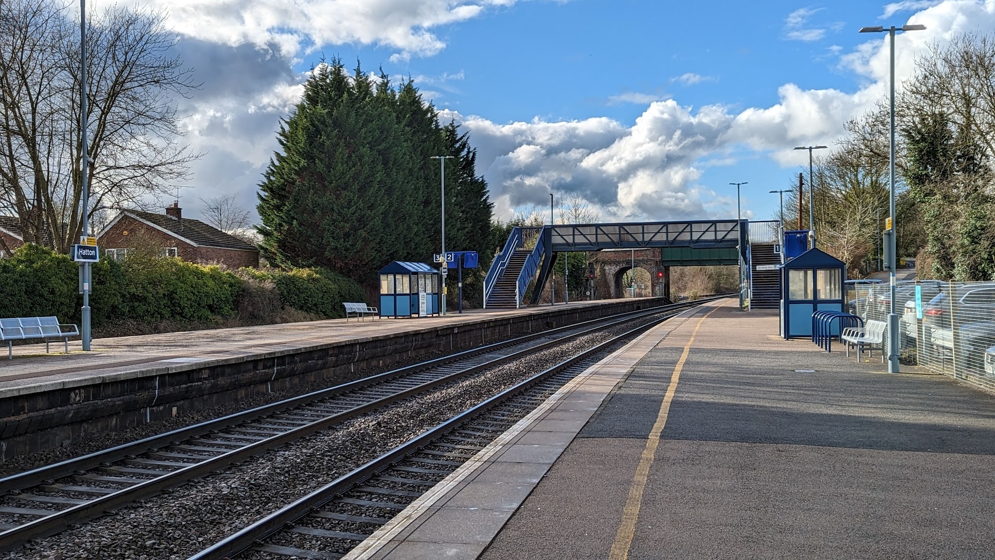
Hatton railway station (England)

Hatton railway station takes the name of the village of Hatton in Warwickshire, England, although it is about 1 mile (1.6 km) from the village. It is situated...

Warwick Parkway railway station

Warwick Parkway is a railway station with park and ride facilities on the western outskirts of Warwick in Warwickshire, England. It also serves the village...

Nearby Amenities

Located within 500m of 52.300554,-1.6391345
Bus Stop
Mollington Grove
Bus: yes
Covered: no
Naptan AtcoCode: 4200F027000
Naptan Bearing: NW
Naptan CommonName: Mollington Grove
Naptan Crossing: Mollington Grove
Naptan Indicator: Opp
Naptan Landmark: Hatton Park
Naptan NaptanCode: wardgmtj
Naptan Street: Barcheston Drive
Naptan Verified: no
Passenger Information Display: no
Public Transport: platform
Source: naptan_import
Lat/Long: 52.2988002/-1.6344759
Bus Stop
Village Hall
Bus: yes
Covered: no
Layby: yes
Naptan AtcoCode: 4200F126470
Naptan Bearing: E
Naptan CommonName: Village Hall
Naptan Indicator: Adj
Naptan Landmark: Hatton Park
Naptan NaptanCode: waradmda
Naptan Street: Barcheston Drive
Passenger Information Display: no
Public Transport: platform
Source: naptan_import
Lat/Long: 52.3028255/-1.6342124
Bus Stop
Mollington Grove
Bus: yes
Covered: no
Naptan AtcoCode: 4200F148130
Naptan Bearing: N
Naptan CommonName: Mollington Grove
Naptan Indicator: Opp
Naptan Landmark: Hatton Park
Naptan NaptanCode: wardjapm
Naptan Street: Barcheston Drive
Naptan Verified: no
Passenger Information Display: no
Public Transport: platform
Source: naptan_import
Lat/Long: 52.3015211/-1.6366032
Seamark Type: gate
Waterway: lock_gate
Lat/Long: 52.2968816/-1.6364532
Bus Stop
Winderton Avenue
Bus: yes
Naptan AtcoCode: 4200F027100
Naptan Bearing: NW
Naptan BusStopType: CUS
Naptan CommonName: Winderton Avenue
Naptan Indicator: Opp
Naptan NaptanCode: wardgmtm
Naptan Street: Birmingham Road
Naptan Verified: no
Public Transport: platform
Shelter: no
Source: naptan_import
Lat/Long: 52.2991288/-1.63733
Hatton Locks
Place: locality
Lat/Long: 52.2991589/-1.6446914
Barrier: kissing_gate
Foot: yes
Lat/Long: 52.2992378/-1.6457974
Crossing
Crossing Island: yes
Source: Warwicks CC Aeriaal Imagery 2013
Lat/Long: 52.299354/-1.6356265
Crossing
Crossing Island: yes
Source: Warwicks CC Aerial Imagery 2013
Lat/Long: 52.300559/-1.6368686
Give Way
Direction: forward
Lat/Long: 52.3005876/-1.6401003
Crossing: unmarked
Traffic Calming: choker
Lat/Long: 52.302133/-1.6357698
Seamark Type: gate
Waterway: lock_gate
Lat/Long: 52.2967729/-1.6360842
Hatton Park
Is In: Warwickshire
Place: village
Website: https://www.hattonpark.net/
Lat/Long: 52.2996033/-1.6341953
Post Box
Brand: Royal Mail
Brand Wikidata: Q638098
Brand Wikipedia: en:Royal Mail
Collection Times: Mo-Fr 09:00; Sa 07:00
Operator: Royal Mail
Operator Wikidata: Q638098
Post Box Type: lamp
Ref: CV35 33D
Royal Cypher: EIIR
Royal Cypher Wikidata: Q33102113
Source: survey
Lat/Long: 52.3005339/-1.6388194
Waste Disposal
Hatton Locks Rubbish Disposal
Access: permissive
Operator: Canal and River Trust
Waste: trash
Waterway: waste_disposal
Lat/Long: 52.2993133/-1.6448473
Seamark Type: gate
Waterway: lock_gate
Lat/Long: 52.2995656/-1.6462624
Seamark Type: gate
Waterway: lock_gate
Lat/Long: 52.2995743/-1.6458491
Seamark Type: gate
Waterway: lock_gate
Lat/Long: 52.2993738/-1.6442625
Seamark Type: gate
Waterway: lock_gate
Lat/Long: 52.2994589/-1.6446422
Seamark Type: gate
Waterway: lock_gate
Lat/Long: 52.2990717/-1.6431372
Seamark Type: gate
Waterway: lock_gate
Lat/Long: 52.2991808/-1.6434977
Seamark Type: gate
Waterway: lock_gate
Lat/Long: 52.2987362/-1.6420647
Seamark Type: gate
Waterway: lock_gate
Lat/Long: 52.2988476/-1.6424196
Seamark Type: gate
Waterway: lock_gate
Lat/Long: 52.2984141/-1.6410097
Seamark Type: gate
Waterway: lock_gate
Lat/Long: 52.2985292/-1.641372
Seamark Type: gate
Waterway: lock_gate
Lat/Long: 52.2980782/-1.6399351
Seamark Type: gate
Waterway: lock_gate
Lat/Long: 52.2981927/-1.6403034
Seamark Type: gate
Waterway: lock_gate
Lat/Long: 52.2977318/-1.6387826
Seamark Type: gate
Waterway: lock_gate
Lat/Long: 52.2978456/-1.6391472
Hatton
Is In: Warwickshire
Place: village
Wikidata: Q2218712
Lat/Long: 52.3007251/-1.6432606
Post Box
Brand: Royal Mail
Brand Wikidata: Q638098
Brand Wikipedia: en:Royal Mail
Collection Times: Mo-Fr 16:45; Sa 09:00
Operator: Royal Mail
Operator Wikidata: Q638098
Post Box Type: pillar
Ref: CV35 16
Royal Cypher: EIIR
Royal Cypher Wikidata: Q33102113
Source: survey
Lat/Long: 52.2991291/-1.6352938
Crossing
Crossing Island: yes
Source: Warwicks CC Aeriaal Imagery 2013
Lat/Long: 52.2987726/-1.634326
Crossing
Crossing Island: yes
Source: Warwicks CC Aeriaal Imagery 2013
Lat/Long: 52.2996515/-1.6362351
Give Way
Direction: backward
Lat/Long: 52.3002233/-1.634738
Give Way
Direction: forward
Source: Warwicks CC Aeriaal Imagery 2013
Lat/Long: 52.2992459/-1.6372727
Give Way
Direction: backward
Source: Warwicks CC Aeriaal Imagery 2013
Lat/Long: 52.2997217/-1.6364365
Public Transport: stop_position
Lat/Long: 52.2992617/-1.6373886
Give Way
Direction: backward
Source: Warwicks CC Aeriaal Imagery 2013
Lat/Long: 52.3002897/-1.6368855
Give Way
Direction: backward
Source: Warwicks CC Aeriaal Imagery 2013
Lat/Long: 52.301128/-1.6367565
Give Way
Direction: backward
Source: Warwicks CC Aeriaal Imagery 2013
Lat/Long: 52.302009/-1.6360596
Give Way
Direction: backward
Source: Warwicks CC Aeriaal Imagery 2013
Lat/Long: 52.302611/-1.6327978
Crossing
Crossing Island: yes
Source: Warwicks CC Aerial Imagery 2013
Lat/Long: 52.3027725/-1.6333285
Give Way
Direction: backward
Source: Warwicks CC Aerial Imagery 2013
Lat/Long: 52.3008079/-1.6367642
Give Way
Source: Warwicks CC Aerial Imagery 2013
Lat/Long: 52.302197/-1.6356171
Fire Hydrant
Emergency: fire_hydrant
Fire Hydrant Position: green
Fire Hydrant Type: underground
Note: on grass near phone box
Lat/Long: 52.3005144/-1.6388887
Give Way
Direction: forward
Lat/Long: 52.2997079/-1.6379273
Barrier: bollard
Lat/Long: 52.3018909/-1.6380892
Barrier: cycle_barrier
Lat/Long: 52.3019377/-1.6382246
Generator Method: photovoltaic
Generator Output Electricity: yes
Generator Source: solar
Generator Type: solar_photovoltaic_panel
Location: roof
Power: generator
Lat/Long: 52.2993548/-1.6330348
Generator Method: photovoltaic
Generator Output Electricity: yes
Generator Source: solar
Generator Type: solar_photovoltaic_panel
Location: roof
Power: generator
Lat/Long: 52.2998608/-1.6320129
Seamark Type: gate
Waterway: lock_gate
Lat/Long: 52.2997727/-1.646268
Defibrillator
Defibrillator Location: Front of building, to left of door
Emergency: defibrillator
Indoor: no
Ref: 4160
Ref GB The Circuit: B5A2FBC6-D0FC-4417-927D-F8BF344EA5EE
Source: survey
Lat/Long: 52.3029623/-1.634064
Communication Mobile Phone: yes
Man Made: tower
Tower Construction: pole
Tower Type: communication
Lat/Long: 52.3004981/-1.6402446
Noexit: yes
Lat/Long: 52.3026746/-1.6333573
Brand: National Grid
Brand Wikidata: Q1465461
Material: wood
Operator: National Grid Electricity Distribution
Operator Old: Western Power Distribution
Operator Wikidata: Q7988183
Owner: National Grid Electricity Distribution (East Midlands) Plc
Owner Wikidata: Q114348127
Power: pole
Lat/Long: 52.2966792/-1.6363484
Brand: National Grid
Brand Wikidata: Q1465461
Material: wood
Operator: National Grid Electricity Distribution
Operator Old: Western Power Distribution
Operator Wikidata: Q7988183
Owner: National Grid Electricity Distribution (East Midlands) Plc
Owner Wikidata: Q114348127
Power: pole
Lat/Long: 52.2976766/-1.636873
Brand: National Grid
Brand Wikidata: Q1465461
Material: wood
Operator: National Grid Electricity Distribution
Operator Old: Western Power Distribution
Operator Wikidata: Q7988183
Owner: National Grid Electricity Distribution (East Midlands) Plc
Owner Wikidata: Q114348127
Power: pole
Lat/Long: 52.2970135/-1.6374553
Give Way
Direction: backward
Source: bing
Lat/Long: 52.2995926/-1.6360213
Material: wood
Operator: National Grid Electricity Distribution
Operator Wikidata: Q7988183
Power: pole
Source: bing
Lat/Long: 52.3008908/-1.644697
Material: wood
Operator: National Grid Electricity Distribution
Operator Wikidata: Q7988183
Power: pole
Source: bing
Lat/Long: 52.3012771/-1.6437355
Material: wood
Operator: National Grid Electricity Distribution
Operator Wikidata: Q7988183
Power: pole
Source: bing
Lat/Long: 52.3016609/-1.6427417
Material: wood
Operator: National Grid Electricity Distribution
Operator Wikidata: Q7988183
Power: pole
Source: bing
Lat/Long: 52.3020734/-1.6416755
Material: wood
Operator: National Grid Electricity Distribution
Operator Wikidata: Q7988183
Power: pole
Source: bing
Lat/Long: 52.3024703/-1.6406563
Material: wood
Operator: National Grid Electricity Distribution
Operator Wikidata: Q7988183
Power: pole
Source: bing
Lat/Long: 52.3029985/-1.6391677
Material: wood
Operator: National Grid Electricity Distribution
Operator Wikidata: Q7988183
Power: pole
Source: bing
Lat/Long: 52.3039875/-1.6389316
Material: wood
Operator: National Grid Electricity Distribution
Operator Wikidata: Q7988183
Power: pole
Source: bing
Lat/Long: 52.3048985/-1.6386285
Street Lamp
Lat/Long: 52.3003742/-1.6394239
Street Lamp
Lat/Long: 52.2996499/-1.6380714
Street Lamp
Lat/Long: 52.3003373/-1.640059
Street Lamp
Lat/Long: 52.3000264/-1.6388081
Street Lamp
Lat/Long: 52.3005051/-1.6404144
Street Lamp
Lat/Long: 52.3000547/-1.6384766
Street Lamp
Lat/Long: 52.2998252/-1.638093
Street Lamp
Lat/Long: 52.3001833/-1.6392791
Street Lamp
Lat/Long: 52.2996075/-1.6377416
Street Lamp
Lat/Long: 52.2998435/-1.6384145
Street Lamp
Lat/Long: 52.3004345/-1.6397731
Street Lamp
Lat/Long: 52.300541/-1.6410855
Street Lamp
Lat/Long: 52.3004206/-1.6408026
Street Lamp
Lat/Long: 52.2972301/-1.6343453
Street Lamp
Lat/Long: 52.2973755/-1.6346692
Street Lamp
Lat/Long: 52.2975342/-1.6350066
Street Lamp
Lat/Long: 52.2978003/-1.6354594
Street Lamp
Lat/Long: 52.2980911/-1.6356645
Street Lamp
Lat/Long: 52.2983742/-1.6360462
Street Lamp
Lat/Long: 52.2986599/-1.6364421
Street Lamp
Lat/Long: 52.2989361/-1.6368289
Street Lamp
Lat/Long: 52.299146/-1.6370964
Street Lamp
Lat/Long: 52.2993732/-1.6374083
Street Lamp
Lat/Long: 52.3005642/-1.6415847
Street Lamp
Lat/Long: 52.3005911/-1.6422391
Street Lamp
Lat/Long: 52.3006205/-1.6428332
Street Lamp
Lat/Long: 52.3006449/-1.6434325
Street Lamp
Lat/Long: 52.3006963/-1.6446196
Street Lamp
Lat/Long: 52.3006712/-1.6440153
Street Lamp
Lat/Long: 52.3007223/-1.645143
Street Lamp
Lat/Long: 52.3006608/-1.6457117
Street Lamp
Lat/Long: 52.3006752/-1.6462123
Street Lamp
Lat/Long: 52.2985518/-1.6345839
Street Lamp
Lat/Long: 52.2980299/-1.6352217
Street Lamp
Lat/Long: 52.2983147/-1.6348665
Street Lamp
Lat/Long: 52.2994809/-1.6334137
Street Lamp
Lat/Long: 52.2988936/-1.6341312
Street Lamp
Lat/Long: 52.2992935/-1.6336376
Street Lamp
Lat/Long: 52.2990981/-1.6338741
Street Lamp
Lat/Long: 52.2996672/-1.6331829
Street Lamp
Lat/Long: 52.2992632/-1.6371052
Street Lamp
Lat/Long: 52.2995139/-1.636901
Street Lamp
Lat/Long: 52.2996861/-1.6366047
Street Lamp
Lat/Long: 52.2982683/-1.6329843
Street Lamp
Lat/Long: 52.2982532/-1.6332064
Street Lamp
Lat/Long: 52.2984026/-1.6334279
Street Lamp
Lat/Long: 52.2983916/-1.6336655
Street Lamp
Lat/Long: 52.2985515/-1.6337228
Street Lamp
Lat/Long: 52.2986084/-1.6340169
Street Lamp
Lat/Long: 52.298627/-1.6342245
Street Lamp
Lat/Long: 52.2987165/-1.6340491
Street Lamp
Lat/Long: 52.2987374/-1.6345092
Street Lamp
Lat/Long: 52.2987609/-1.6343051
Street Lamp
Lat/Long: 52.2988825/-1.6343889
Street Lamp
Lat/Long: 52.2990398/-1.6346855
Street Lamp
Lat/Long: 52.2988749/-1.6348604
Street Lamp
Lat/Long: 52.2990755/-1.6350375
Street Lamp
Lat/Long: 52.2989774/-1.635149
Street Lamp
Lat/Long: 52.299272/-1.6352969
Street Lamp
Lat/Long: 52.2990835/-1.6354164
Street Lamp
Lat/Long: 52.2993203/-1.6356998
Street Lamp
Lat/Long: 52.2992149/-1.6357743
Street Lamp
Lat/Long: 52.2993613/-1.6361308
Street Lamp
Lat/Long: 52.299523/-1.6361205
Street Lamp
Lat/Long: 52.2995372/-1.6358815
Street Lamp
Lat/Long: 52.2996407/-1.6362028
Street Lamp
Lat/Long: 52.2997028/-1.6359525
Street Lamp
Lat/Long: 52.2996306/-1.6363222
Street Lamp
Lat/Long: 52.299548/-1.6364229
Street Lamp
Lat/Long: 52.2997848/-1.6363274
Street Lamp
Lat/Long: 52.2998301/-1.6365968
Street Lamp
Lat/Long: 52.2999885/-1.6367422
Street Lamp
Lat/Long: 52.3000132/-1.6366725
Street Lamp
Lat/Long: 52.2998974/-1.6361183
Street Lamp
Lat/Long: 52.2981289/-1.6330467
Street Lamp
Lat/Long: 52.2980737/-1.6333412
Street Lamp
Lat/Long: 52.2979871/-1.6334226
Street Lamp
Lat/Long: 52.297716/-1.6336395
Street Lamp
Lat/Long: 52.2974904/-1.6338121
Street Lamp
Lat/Long: 52.2973505/-1.63402
Street Lamp
Lat/Long: 52.2985112/-1.6334617
Street Lamp
Lat/Long: 52.2987198/-1.6333223
Street Lamp
Lat/Long: 52.2988873/-1.6328806
Street Lamp
Lat/Long: 52.2987273/-1.6326719
Street Lamp
Lat/Long: 52.2987934/-1.6323948
Street Lamp
Lat/Long: 52.2990071/-1.6323615
Street Lamp
Lat/Long: 52.2993707/-1.6322353
Street Lamp
Lat/Long: 52.2995185/-1.6326449
Street Lamp
Lat/Long: 52.2996979/-1.6328349
Street Lamp
Lat/Long: 52.299537/-1.6320716
Street Lamp
Lat/Long: 52.2997386/-1.6320391
Street Lamp
Lat/Long: 52.2983897/-1.6326897
Street Lamp
Lat/Long: 52.2990228/-1.6331742
Street Lamp
Lat/Long: 52.2991932/-1.6335178
Direction: forward
Maxspeed: 40 mph
Traffic Sign: maxspeed
Traffic Sign Direction: forward
Lat/Long: 52.2993516/-1.6370805
Give Way
Direction: backward
Lat/Long: 52.3004536/-1.6400377
Direction: forward
Maxspeed: 40 mph
Traffic Sign: maxspeed
Traffic Sign Direction: forward
Lat/Long: 52.3006977/-1.6391778
Direction: backward
Maxspeed: 40 mph
Traffic Sign: maxspeed
Traffic Sign Direction: backward
Lat/Long: 52.3003975/-1.6448257
Street Lamp
Lat/Long: 52.3023179/-1.632394
Street Lamp
Lat/Long: 52.3025467/-1.6326418
Street Lamp
Lat/Long: 52.3025615/-1.632862
Street Lamp
Lat/Long: 52.3027284/-1.6330838
Street Lamp
Lat/Long: 52.302779/-1.6333449
Street Lamp
Lat/Long: 52.3028651/-1.6338468
Street Lamp
Lat/Long: 52.3028408/-1.6342309
Street Lamp
Lat/Long: 52.3026138/-1.6345193
Street Lamp
Lat/Long: 52.3025395/-1.634866
Street Lamp
Lat/Long: 52.3025674/-1.634699
Street Lamp
Lat/Long: 52.3024411/-1.6351169
Street Lamp
Lat/Long: 52.3022837/-1.635288
Street Lamp
Lat/Long: 52.3021651/-1.6355862
Street Lamp
Lat/Long: 52.3020869/-1.6359572
Street Lamp
Lat/Long: 52.3019713/-1.6359765
Street Lamp
Lat/Long: 52.3018936/-1.6362469
Street Lamp
Lat/Long: 52.3016567/-1.63646
Street Lamp
Lat/Long: 52.3014538/-1.6366362
Street Lamp
Lat/Long: 52.3012461/-1.6367136
Street Lamp
Lat/Long: 52.3011187/-1.6366491
Street Lamp
Lat/Long: 52.3010092/-1.6368158
Street Lamp
Lat/Long: 52.300828/-1.6368739
Street Lamp
Lat/Long: 52.3006997/-1.6367775
Street Lamp
Lat/Long: 52.3005549/-1.6369596
Street Lamp
Lat/Long: 52.3003018/-1.6367711
Street Lamp
Lat/Long: 52.3001627/-1.6368519
Street Lamp
Lat/Long: 52.3003993/-1.636932
Street Lamp
Lat/Long: 52.3014297/-1.6319237
Street Lamp
Lat/Long: 52.3016352/-1.6322472
Street Lamp
Lat/Long: 52.3017795/-1.6326691
Street Lamp
Lat/Long: 52.3019538/-1.632411
Street Lamp
Lat/Long: 52.302072/-1.6328047
Street Lamp
Lat/Long: 52.3023142/-1.633154
Street Lamp
Lat/Long: 52.3023288/-1.6335173
Street Lamp
Lat/Long: 52.3024845/-1.6337251
Street Lamp
Lat/Long: 52.3027057/-1.6327754
Street Lamp
Lat/Long: 52.3023902/-1.6359956
Street Lamp
Lat/Long: 52.3022391/-1.636455
Street Lamp
Lat/Long: 52.3022297/-1.6367319
Street Lamp
Lat/Long: 52.3027147/-1.6345751
Street Lamp
Lat/Long: 52.3026194/-1.6348286
Street Lamp
Lat/Long: 52.302671/-1.6347055
Street Lamp
Lat/Long: 52.3028012/-1.6347485
Street Lamp
Lat/Long: 52.3027739/-1.6349336
Street Lamp
Lat/Long: 52.3026421/-1.6353839
Street Lamp
Lat/Long: 52.3011142/-1.6368779
Street Lamp
Lat/Long: 52.3011375/-1.6371737
Street Lamp
Lat/Long: 52.3012826/-1.6374323
Street Lamp
Lat/Long: 52.3012991/-1.6377225
Street Lamp
Lat/Long: 52.3010494/-1.6381919
Street Lamp
Lat/Long: 52.3009609/-1.6379551
Street Lamp
Lat/Long: 52.3013382/-1.6380322
Street Lamp
Lat/Long: 52.301509/-1.6380575
Street Lamp
Lat/Long: 52.3016752/-1.6380638
Street Lamp
Lat/Long: 52.3018411/-1.6380092
Street Lamp
Lat/Long: 52.3018996/-1.6376496
Street Lamp
Lat/Long: 52.3018433/-1.637354
Street Lamp
Lat/Long: 52.3017199/-1.6371122
Street Lamp
Lat/Long: 52.3003099/-1.6370411
Street Lamp
Lat/Long: 52.3002031/-1.6372668
Street Lamp
Lat/Long: 52.3002064/-1.6375116
Street Lamp
Lat/Long: 52.3004908/-1.6378177
Street Lamp
Lat/Long: 52.3005587/-1.6376797
Street Lamp
Lat/Long: 52.3006844/-1.6378484
Street Lamp
Lat/Long: 52.3008338/-1.6365279
Street Lamp
Lat/Long: 52.300661/-1.6364318
Street Lamp
Lat/Long: 52.3004885/-1.6362422
Street Lamp
Lat/Long: 52.3003696/-1.6359397
Street Lamp
Lat/Long: 52.3023106/-1.6349105
Street Lamp
Lat/Long: 52.3021683/-1.6347415
Street Lamp
Lat/Long: 52.3019891/-1.6345297
Street Lamp
Lat/Long: 52.3019337/-1.6343007
Street Lamp
Lat/Long: 52.3018254/-1.6345885
Street Lamp
Lat/Long: 52.3017894/-1.6343319
Street Lamp
Lat/Long: 52.3017452/-1.6347933
Street Lamp
Lat/Long: 52.30174/-1.6345736
Street Lamp
Lat/Long: 52.3019428/-1.6348926
Street Lamp
Lat/Long: 52.3020178/-1.6349727
Street Lamp
Lat/Long: 52.3016746/-1.6351541
Street Lamp
Lat/Long: 52.3017361/-1.6350237
Street Lamp
Lat/Long: 52.3016316/-1.6346842
Street Lamp
Lat/Long: 52.3013685/-1.6353612
Street Lamp
Lat/Long: 52.3015486/-1.6354433
Street Lamp
Lat/Long: 52.3015097/-1.6350332
Street Lamp
Lat/Long: 52.3021024/-1.6351068
Street Lamp
Lat/Long: 52.3022217/-1.6352399
Street Lamp
Lat/Long: 52.3018954/-1.6352839
Street Lamp
Lat/Long: 52.2998537/-1.6356209
Street Lamp
Lat/Long: 52.3000215/-1.6358413
Street Lamp
Lat/Long: 52.3001064/-1.635555
Street Lamp
Lat/Long: 52.2999656/-1.6353005
Street Lamp
Lat/Long: 52.3001884/-1.6352254
Street Lamp
Lat/Long: 52.3000839/-1.6347917
Street Lamp
Lat/Long: 52.3002238/-1.6345331
Street Lamp
Lat/Long: 52.3004444/-1.6342036
Street Lamp
Lat/Long: 52.3003556/-1.6348805
Street Lamp
Lat/Long: 52.3006855/-1.6341202
Street Lamp
Lat/Long: 52.3007996/-1.6336574
Street Lamp
Lat/Long: 52.3008455/-1.6341784
Street Lamp
Lat/Long: 52.3011769/-1.6337865
Street Lamp
Lat/Long: 52.30112/-1.6338027
Street Lamp
Lat/Long: 52.3010591/-1.634354
Street Lamp
Lat/Long: 52.3009625/-1.6345605
Street Lamp
Lat/Long: 52.3010625/-1.6346823
Street Lamp
Lat/Long: 52.3011737/-1.6348281
Street Lamp
Lat/Long: 52.3011522/-1.6345759
Street Lamp
Lat/Long: 52.301199/-1.6342887
Street Lamp
Lat/Long: 52.301255/-1.6341513
Street Lamp
Lat/Long: 52.3013152/-1.6340198
Street Lamp
Lat/Long: 52.3014436/-1.633808
Street Lamp
Lat/Long: 52.3014924/-1.6339406
Street Lamp
Lat/Long: 52.3012172/-1.6333608
Street Lamp
Lat/Long: 52.3013335/-1.6336565
Street Lamp
Lat/Long: 52.3015309/-1.6335947
Street Lamp
Lat/Long: 52.3016166/-1.6336899
Street Lamp
Lat/Long: 52.3005508/-1.6352832
Street Lamp
Lat/Long: 52.3007288/-1.6354758
Street Lamp
Lat/Long: 52.3009934/-1.6356481
Street Lamp
Lat/Long: 52.3011565/-1.6357878
Street Lamp
Lat/Long: 52.3011655/-1.63542
Street Lamp
Lat/Long: 52.3013608/-1.6355189
Street Lamp
Lat/Long: 52.3013868/-1.6362696
Street Lamp
Lat/Long: 52.3014598/-1.6358199
Street Lamp
Lat/Long: 52.3016742/-1.635827
Street Lamp
Lat/Long: 52.301814/-1.6357495
Give Way
Direction: backward
Lat/Long: 52.3023801/-1.6350714
Give Way
Direction: backward
Lat/Long: 52.2984483/-1.6336244
Give Way
Direction: backward
Lat/Long: 52.2988799/-1.6330743
Give Way
Direction: backward
Lat/Long: 52.298723/-1.6325118
Give Way
Direction: backward
Lat/Long: 52.2990742/-1.6322278
Give Way
Direction: backward
Lat/Long: 52.2994311/-1.632224
Give Way
Direction: backward
Lat/Long: 52.3021284/-1.6348304
Give Way
Direction: backward
Lat/Long: 52.2982074/-1.633023
Give Way
Direction: backward
Lat/Long: 52.298081/-1.6332374
Give Way
Direction: backward
Lat/Long: 52.2978912/-1.6354
Give Way
Direction: forward
Lat/Long: 52.301032/-1.6338137
Give Way
Direction: backward
Lat/Long: 52.3010874/-1.6357615
Give Way
Direction: forward
Lat/Long: 52.3006097/-1.6391934
The data included in this document is from www.openstreetmap.org. The data is made available under ODbL.

Have you been to Hatton?

Leave your review of Hatton below (or comments, questions and feedback).