Hamm Moor

Settlement in Surrey Runnymede

England

Hamm Moor

Shepperton Lock
Shepperton Lock Credit: Alex McGregor

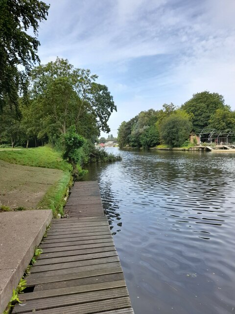
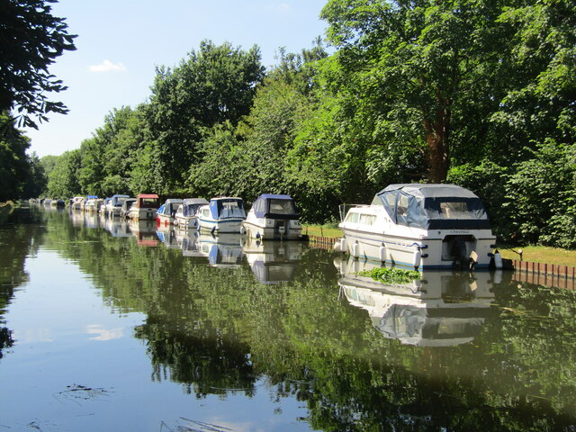
Hamm Moor is a picturesque nature reserve located in Surrey, England. Spanning an area of approximately 70 acres, it is a haven for wildlife and a popular destination for nature enthusiasts and walkers alike.

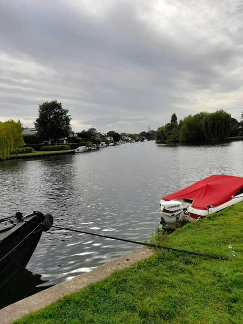
The moor is characterized by its diverse landscape, which includes open grasslands, wetlands, ponds, and woodlands. This variety of habitats provides a home to a rich and unique assortment of flora and fauna. Rare and endangered species such as the marsh orchid and the great crested newt can be found here, making it an important conservation area.

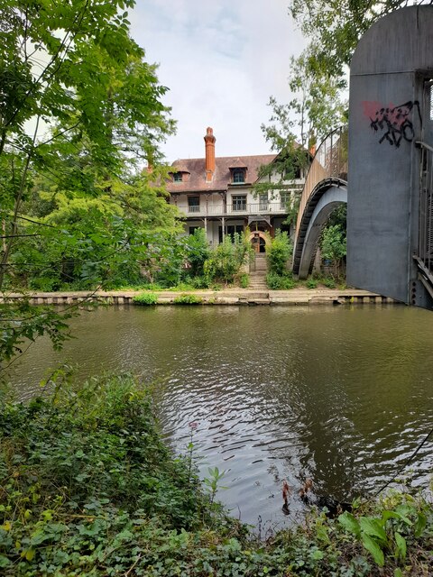
Visitors to Hamm Moor can enjoy a network of well-maintained footpaths and boardwalks that allow for easy exploration of the reserve. These paths lead visitors through the different habitats, providing opportunities for birdwatching, photography, and peaceful contemplation of nature. The reserve is particularly known for its birdlife, with over 100 species having been recorded in the area, including kingfishers, herons, and warblers.

Hamm Moor is well-equipped with facilities to enhance visitors' experiences. It offers ample parking, picnic areas, and informative signage that educates visitors about the reserve's wildlife and conservation efforts. The reserve is managed by the Surrey Wildlife Trust, which works to preserve and protect the area's natural beauty and biodiversity.

Overall, Hamm Moor is a hidden gem in Surrey, offering a tranquil escape from the hustle and bustle of city life. Its diverse habitats, abundant wildlife, and well-maintained facilities make it a must-visit destination for nature lovers and those seeking a peaceful retreat in the heart of the countryside.

If you have any feedback on the listing, please let us know in the comments section below.
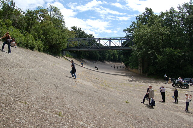
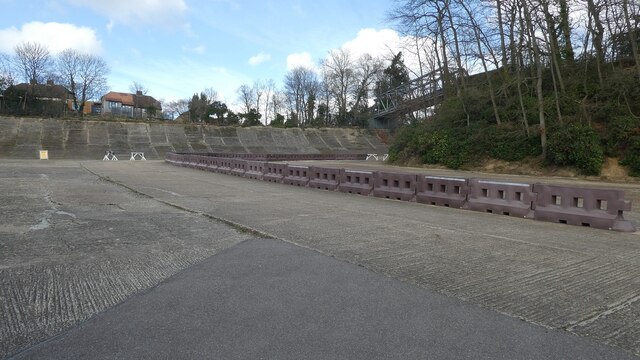
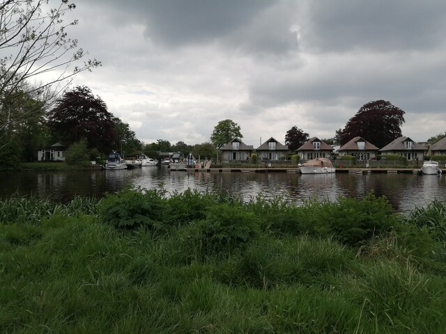
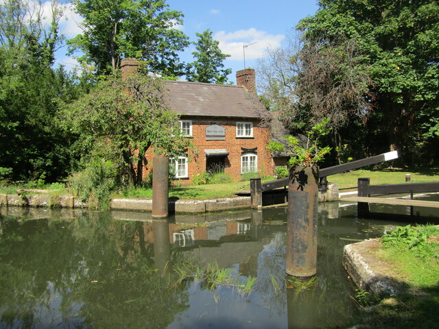
Hamm Moor Images

Images are sourced within 2km of 51.372205/-0.47520333 or Grid Reference TQ0664. Thanks to Geograph Open Source API. All images are credited.

Shepperton Lock
Shepperton Lock
Convent Lane
Convent Lane
Convent Lane
Convent Lane
Elmbridge Canoe Club
River Thames
River Thames
D'Oyly Carte
D'Oyly Carte
The Thames Court
The Thames Court
River Thames
River Thames
Shepperton Lock
Shepperton Lock
Shepperton Lock
Shepperton Lock
Coxes Lock Mills The converted Mills at Coxes Lock, Weybridge.
Coxes Lock Mills
The converted Mills at Coxes Lock, Weybridge.
Campbell Road in Weybridge
Weybridge station from Brooklands Road
Brooklands Race Track Looking along the banked racetrack at Brooklands towards the bridge.
Brooklands Race Track
Looking along the banked racetrack at Brooklands towards the bridge.
Brooklands - Finishing straight, banking and Member's Bridge Not a great deal of the famous old Brooklands motor racing circuit survives, but some of what does can be seen in this photo. The flat concrete seen nearest the camera is the finishing straight; beyond can be seen some of the banked section of the track with - on the far right - the girder-constructed Member's Bridge.
The finishing straight was effectively saved by having an extension to the Vickers  factory built over it during the war. Some years ago this hangar-like building was disassembled and reassembled some yards to the west, revealing this historic bit of concrete.
The main part of the old circuit was a banked oval - as the cars went faster they climbed up the banking. The problem with this was that if they went too fast or lost control they could flip over the top edge of the banking - which would almost certainly be fatal for the driver.
A lap of this oval was 2.75 miles (4.43 km). It opened in 1907 and was the world's first purpose-built banked motor racing circuit, with its last race taking place in August 1939 immediately prior the outbreak of WWII.
Brooklands - Finishing straight, banking and Member's Bridge
Not a great deal of the famous old Brooklands motor racing circuit survives, but some of what does can be seen in this photo. The flat concrete seen nearest the camera is the finishing straight; beyond can be seen some of the banked section of the track with - on the far right - the girder-constructed Member's Bridge. The finishing straight was effectively saved by having an extension to the Vickers factory built over it during the war. Some years ago this hangar-like building was disassembled and reassembled some yards to the west, revealing this historic bit of concrete. The main part of the old circuit was a banked oval - as the cars went faster they climbed up the banking. The problem with this was that if they went too fast or lost control they could flip over the top edge of the banking - which would almost certainly be fatal for the driver. A lap of this oval was 2.75 miles (4.43 km). It opened in 1907 and was the world's first purpose-built banked motor racing circuit, with its last race taking place in August 1939 immediately prior the outbreak of WWII.
Entrance to Bates Wharf The entrance to Bates Wharf Marina, looking across the River Thames from a convenient bench
Entrance to Bates Wharf
The entrance to Bates Wharf Marina, looking across the River Thames from a convenient bench
New Haw - Lock Keeper's Cottage Historic house on the River Wey Navigation, probably early 19th century building.
New Haw - Lock Keeper's Cottage
Historic house on the River Wey Navigation, probably early 19th century building.
New Haw - River Wey Navigation A line of pleasure boats moored south of New Haw Lock.
New Haw - River Wey Navigation
A line of pleasure boats moored south of New Haw Lock.
Show me another place!

Hamm Moor is located at Grid Ref: TQ0664 (Lat: 51.372205, Lng: -0.47520333)

Administrative County: Surrey

District: Runnymede

Police Authority: Surrey

What 3 Words

///sends.rival.yoga. Near Addlestone, Surrey

Related Wikis

St George's College, Weybridge

St George's Weybridge is an independent mixed Roman Catholic co-educational Josephite day school in Surrey, taking pupils from 3 to 18. St George's Weybridge...

Addlestone railway station

Addlestone railway station serves the town of Addlestone in the Runnymede District of Surrey, England. It is located on the Chertsey Branch Line and is...
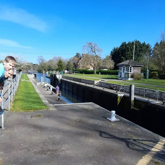
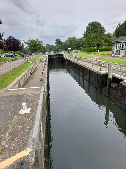
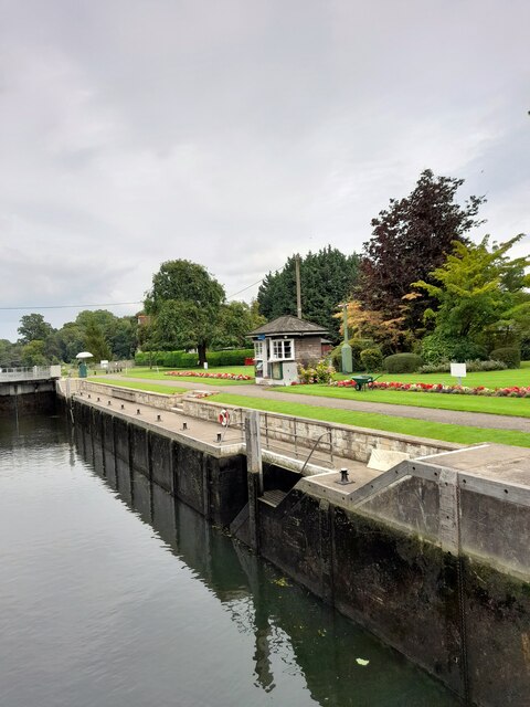
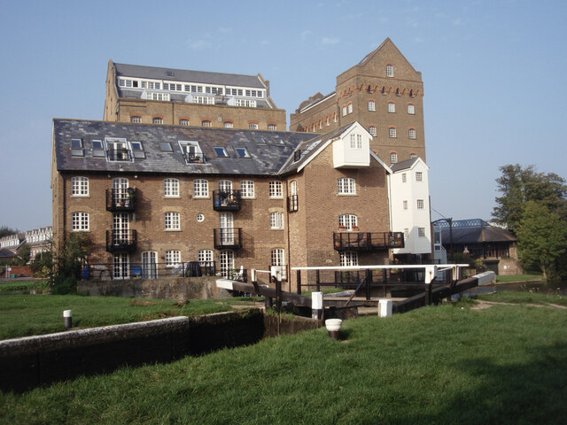
Coxes Lock

Coxes Lock is towards the northern end of the Wey Navigation parallel to the River Wey in Addlestone, Surrey, Most parts of the navigation are canal sections...

Martin Hotine

Brigadier Martin Hotine CMG CBE (17 June 1898 – 12 November 1968) was the head of the Trigonometrical and Levelling Division of the Ordnance Survey responsible...

River Bourne, Chertsey

The River Bourne or the Chertsey Bourne is in Berkshire and Surrey; it runs from sources in Windsor Great Park and Swinley Forest through to the River...

River Bourne, Addlestone

The River Bourne is the name given to a Thames tributary in northwest Surrey, England which has a longer tributary, the Windle Brook, that rises nears...

Addlestone

Addlestone ( or ) is a town in Surrey, England. It is located approximately 18.6 mi (29.9 km) southwest of London. The town is the administrative centre...

Heathside School

Heathside School is a co-educational secondary school for students aged 11–18 situated in Brooklands Lane, Weybridge, Surrey, England. The Executive Principal...

Nearby Amenities

Located within 500m of 51.372205,-0.47520333
Traffic Signals
Source: Local Knowledge
Traffic Signals Direction: forward
Lat/Long: 51.3733606/-0.4747328
Crossing
Bicycle: yes
Crossing: unmarked
Crossing Island: no
Kerb: lowered
Tactile Paving: yes
Lat/Long: 51.3723877/-0.4684201
Turning Circle
Source: Bing
Lat/Long: 51.3698546/-0.4800472
Turning Circle
Source: Bing
Lat/Long: 51.3692249/-0.4793943
Turning Circle
Source: Bing
Lat/Long: 51.3687578/-0.478866
Turning Circle
Source: Bing
Lat/Long: 51.3704544/-0.4810072
Created By: Potlatch 0.7b
Power: tower
Lat/Long: 51.369841/-0.4710812
Power: tower
Lat/Long: 51.3697338/-0.4705662
Power: tower
Lat/Long: 51.3735685/-0.4688882
Power: tower
Lat/Long: 51.3755861/-0.4713695
Post Box
Operator: Royal Mail
Post Box Type: lamp
Ref: KT15 142D
Lat/Long: 51.3693382/-0.4805033
Bus Stop
Meadow Park
Naptan AtcoCode: 40004401084A
Naptan Bearing: SE
Naptan CommonName: Meadow Park
Naptan Indicator: adj
Naptan Landmark: Meadow Park
Naptan NaptanCode: suramdpa
Naptan Street: Weybridge Road
Naptan Verified: no
Public Transport: platform
Source: naptan_import
Lat/Long: 51.3732448/-0.4738491
Bus Stop
Meadow Park
Bench: yes
Naptan AtcoCode: 40004401084B
Naptan Bearing: NW
Naptan CommonName: Meadow Park
Naptan Indicator: Opp
Naptan Landmark: Meadow Park
Naptan NaptanCode: suramdpd
Naptan Street: Weybridge Road
Naptan Verified: no
Public Transport: platform
Shelter: yes
Source: naptan_import
Tactile Paving: no
Lat/Long: 51.3730495/-0.4739507
Bus Stop
St Georges College
Bench: yes
Bus: yes
Naptan AtcoCode: 40004401085A
Naptan Bearing: SE
Naptan CommonName: St Georges College
Naptan Indicator: Just after
Naptan Landmark: St Georges College
Naptan NaptanCode: suramdpw
Naptan Street: Weybridge Road
Public Transport: platform
Shelter: yes
Source: naptan_import
Tactile Paving: no
Lat/Long: 51.3744791/-0.4781673
Bus Stop
St Georges College
Bus: yes
Naptan AtcoCode: 40004401085B
Naptan Bearing: NW
Naptan BusStopType: CUS
Naptan CommonName: St Georges College
Naptan Indicator: Just Before
Naptan Landmark: St Georges College
Naptan NaptanCode: surgpagp
Naptan Street: Weybridge Road
Naptan Verified: no
Public Transport: platform
Shelter: no
Source: naptan_import
Lat/Long: 51.3744/-0.4784972
Power: tower
Source: bing
Lat/Long: 51.3717652/-0.469455
Power: tower
Source: bing
Lat/Long: 51.3718795/-0.4700287
Power: tower
Source: bing
Lat/Long: 51.369655/-0.4700455
Power: tower
Source: bing
Lat/Long: 51.3716907/-0.4689549
Crossing
Bicycle: yes
Crossing: traffic_signals
Crossing Ref: toucan
Kerb: lowered
Sloped Curb: yes
Lat/Long: 51.3754396/-0.4801399
Crossing
Bicycle: yes
Crossing: unmarked
Kerb: lowered
Sloped Curb: yes
Lat/Long: 51.3736789/-0.4761146
Crossing
Crossing: unmarked
Crossing Island: yes
Kerb: lowered
Sloped Curb: yes
Tactile Paving: yes
Lat/Long: 51.3749685/-0.47945
Turning Circle
Lat/Long: 51.3688283/-0.4772555
Barrier: bollard
Lat/Long: 51.371752/-0.4810463
Barrier: block
Lat/Long: 51.3719996/-0.4732213
Crossing
Crossing Island: yes
Kerb: lowered
Sloped Curb: yes
Lat/Long: 51.3721823/-0.4753101
Turning Circle
Lat/Long: 51.3722163/-0.4788112
Crossing
Crossing Island: yes
Kerb: lowered
Sloped Curb: yes
Lat/Long: 51.3722209/-0.4753112
Crossing
Crossing: unmarked
Kerb: lowered
Sloped Curb: yes
Source: Surrey-Air_Survey
Lat/Long: 51.372739/-0.4750623
Crossing
Crossing: unmarked
Kerb: lowered
Sloped Curb: yes
Lat/Long: 51.3730855/-0.4748935
Traffic Signals
Source: Local Knowledge
Traffic Signals Direction: forward
Lat/Long: 51.3733393/-0.4750177
Turning Circle
Lat/Long: 51.3735274/-0.4804877
Power: tower
Lat/Long: 51.3733762/-0.470082
Power: tower
Lat/Long: 51.3737081/-0.469605
Crossing
Crossing: uncontrolled
Crossing Island: yes
Kerb: lowered
Sloped Curb: yes
Lat/Long: 51.3750335/-0.479855
Crossing
Crossing: unmarked
Crossing Island: yes
Kerb: lowered
Sloped Curb: yes
Tactile Paving: yes
Lat/Long: 51.3750422/-0.4793255
Crossing
Bicycle: yes
Crossing: uncontrolled
Crossing Island: yes
Kerb: lowered
Sloped Curb: yes
Lat/Long: 51.3752445/-0.4793651
Crossing
Bicycle: yes
Crossing: uncontrolled
Crossing Island: yes
Kerb: lowered
Sloped Curb: yes
Lat/Long: 51.3753057/-0.4794309
Barrier: cycle_barrier
Source: survey
Lat/Long: 51.3693703/-0.4763608
Traffic Signals
Source: Local Knowledge
Traffic Signals Direction: forward
Lat/Long: 51.3731994/-0.4746203
Post Box
Operator: Royal Mail
Post Box Type: pillar
Ref: KT15 10
Royal Cypher: GR
Royal Cypher Wikidata: Q33102273
Lat/Long: 51.3711036/-0.4754867
Jewson
Addr City: Addlestone
Addr Housenumber: 2
Addr Street: Hamm Moor Lane
Brand: Jewson
Brand Wikidata: Q6190226
Shop: trade
Lat/Long: 51.3695874/-0.4760157
Screwfix
Addr City: Addlestone
Addr Housenumber: Unit 5 Waterside
Addr Postcode: KT15 2SN
Addr Street: Hamm Moor Lane
Brand: Screwfix
Brand Wikidata: Q7439115
Brand Wikipedia: en:Screwfix
Shop: doityourself
Website: https://www.screwfix.com/stores/UT2/weybridge
Lat/Long: 51.3698376/-0.4746806
Toolstation
Addr Housenumber: 4
Addr Street: Hamm Moor Lane
Brand: Toolstation
Brand Wikidata: Q7824103
Brand Wikipedia: en:Toolstation
Contact Website: https://www.toolstation.com/branches/weybridge
Shop: doityourself
Lat/Long: 51.3698572/-0.4759561
Leisure: playground
Lat/Long: 51.3701524/-0.4769722
Capital Tyres
Shop: tyres
Lat/Long: 51.3709379/-0.4755486
Green Jackets Roofing
Addr City: Addlestone
Addr Housenumber: 3
Addr Street: Hamm Moor Lane
Shop: trade
Lat/Long: 51.3697091/-0.476
Howdens Joinery
Addr City: Addlestone
Addr Housenumber: 1
Addr Street: Hamm Moor Lane
Brand: Howdens Joinery
Brand Wikidata: Q5921438
Shop: trade
Website: https://www.howdens.com/find-a-depot/weybridge
Lat/Long: 51.3694514/-0.4760322
Bench
Lat/Long: 51.3727146/-0.4706775
Post Box
Operator: Royal Mail
Post Box Type: pillar
Ref: KT15 198D
Royal Cypher: GR
Royal Cypher Wikidata: Q33102273
Lat/Long: 51.3733278/-0.4741757
City Heating Spares
Addr City: Addlestone
Addr Housenumber: 5
Addr Street: Hamm Moor Lane
Contact Website: http://www.cityheatingspares.co.uk
Operator: Travis Perkins
Shop: trade
Lat/Long: 51.3699813/-0.475943
City Plumbing
Addr City: Addlestone
Addr Housenumber: 5
Addr Street: Hamm Moor Lane
Contact Website: http://www.cityplumbing.co.uk
Operator: Travis Perkins
Shop: trade
Lat/Long: 51.370025/-0.4759318
Crossing
Bicycle: yes
Crossing: unmarked
Kerb: lowered
Sloped Curb: yes
Lat/Long: 51.3750001/-0.4804641
Traffic Signals
Source: Local Knowledge
Traffic Signals Direction: forward
Lat/Long: 51.3731394/-0.4746463
Crossing
Crossing: traffic_signals
Crossing Ref: pelican
Kerb: lowered
Sloped Curb: yes
Tactile Paving: yes
Lat/Long: 51.373143/-0.4746816
Crossing
Crossing: traffic_signals
Crossing Ref: pelican
Kerb: lowered
Sloped Curb: yes
Tactile Paving: yes
Lat/Long: 51.3733513/-0.4746915
Crossing
Crossing: unmarked
Crossing Island: yes
Crossing Markings: no
Kerb: lowered
Tactile Paving: yes
Lat/Long: 51.3745204/-0.4785903
Crossing
Crossing: unmarked
Crossing Island: yes
Kerb: lowered
Sloped Curb: yes
Lat/Long: 51.3745848/-0.4785046
Crossing
Crossing: traffic_signals
Crossing Ref: pelican
Kerb: lowered
Sloped Curb: yes
Tactile Paving: yes
Lat/Long: 51.3732067/-0.4746533
Crossing
Crossing: uncontrolled
Crossing Island: yes
Kerb: lowered
Sloped Curb: yes
Lat/Long: 51.3750844/-0.4799325
Barrier: stile
Lat/Long: 51.3752707/-0.4726994
Barrier: stile
Lat/Long: 51.3758539/-0.4726429
Hiking: yes
Information: guidepost
Source: GPS survey
Tourism: information
Lat/Long: 51.375137/-0.4725523
Hiking: yes
Information: route_marker
Source: GPS survey
Tourism: information
Lat/Long: 51.375165/-0.4716575
Hiking: yes
Information: guidepost
Source: GPS survey
Tourism: information
Lat/Long: 51.3752045/-0.4699827
Premier Express
Brand: Premier Express
Brand Wikidata: Q7240340
Shop: convenience
Source: Local Knowledge
Lat/Long: 51.3743409/-0.4813212
Motor Mate
Shop: car_parts
Source: Local Knowledge
Lat/Long: 51.3742862/-0.4814279
Crossing
Crossing Island: yes
Kerb: lowered
Sloped Curb: yes
Lat/Long: 51.3720163/-0.4750786
Crossing
Crossing Island: yes
Kerb: lowered
Sloped Curb: yes
Lat/Long: 51.3724137/-0.4750153
Crossing
Crossing Island: yes
Kerb: lowered
Sloped Curb: yes
Lat/Long: 51.3724044/-0.4750965
Crossing
Crossing Island: yes
Kerb: lowered
Sloped Curb: yes
Lat/Long: 51.3721858/-0.474694
Crossing
Crossing Island: yes
Kerb: lowered
Sloped Curb: yes
Lat/Long: 51.3721277/-0.4747353
Crossing
Crossing Island: yes
Kerb: lowered
Sloped Curb: yes
Lat/Long: 51.3720126/-0.4750182
Turning Circle
Lat/Long: 51.3717142/-0.4809662
Power: transformer
Lat/Long: 51.3684089/-0.4758083
Power: transformer
Lat/Long: 51.3712439/-0.4730038
Power: pole
Lat/Long: 51.3689383/-0.4753005
Power: pole
Lat/Long: 51.3691113/-0.4743845
Power: pole
Lat/Long: 51.3708934/-0.4728873
Power: pole
Lat/Long: 51.3712344/-0.4729853
Shopmobility
Shop: yes
Lat/Long: 51.3742361/-0.4814876
Anglian Home Improvements
Addr City: Addlestone
Addr Housenumber: Unit 3 Waterside
Addr Postcode: KT15 2SN
Addr Street: Hamm Moor Lane
Shop: yes
Lat/Long: 51.37014/-0.4743634
Benchmarx
Addr City: Addlestone
Addr Housename: Waterside
Addr Postcode: KT15 2SN
Addr Street: Hamm Moor Lane
Addr Unit: Unit 4
Brand: Benchmarx
Brand Wikidata: Q102181127
Shop: kitchen
Website: https://www.benchmarxkitchens.co.uk/branches/weybridge
Lat/Long: 51.3699422/-0.4745642
Cane Adam
Addr City: Addlestone
Addr Housenumber: Unit 9 Waterside
Addr Postcode: KT15 2SN
Addr Street: Hamm Moor Lane
Shop: yes
Lat/Long: 51.3694476/-0.4749748
HSS Hire
Addr City: Addlestone
Addr Housenumber: Unit 8 Waterside
Addr Postcode: KT15 2SN
Addr Street: Hamm Moor Lane
Brand: HSS Hire
Brand Wikidata: Q5636000
Brand Wikipedia: en:HSS Hire
Shop: tool_hire
Lat/Long: 51.36952/-0.4749324
Interior Fabrics
Addr City: Addlestone
Addr Housenumber: Unit 10 Waterside
Addr Postcode: KT15 2SN
Addr Street: Hamm Moor Lane
Shop: interior_decoration
Lat/Long: 51.3704103/-0.4750663
Wilson Electrical Limited
Addr City: Addlestone
Addr Housenumber: Unit 6 Waterside
Addr Postcode: KT15 2SN
Addr Street: Hamm Moor Lane
Shop: yes
Lat/Long: 51.3697248/-0.4747673
Woodford Tools
Addr City: Addlestone
Addr Housenumber: Unit 7 Waterside
Addr Postcode: KT15 2SN
Addr Street: Hamm Moor Lane
Shop: hardware
Lat/Long: 51.3696134/-0.4748588
Crossing
Crossing: unmarked
Kerb: lowered
Sloped Curb: yes
Source: SAS
Lat/Long: 51.374585/-0.4811498
Barrier: lift_gate
Lat/Long: 51.3721165/-0.4732011
Power: pole
Lat/Long: 51.3697653/-0.4738192
Power: pole
Transformer: distribution
Lat/Long: 51.3703524/-0.4732069
Power: pole
Lat/Long: 51.368329/-0.4736172
Power: pole
Lat/Long: 51.3714353/-0.4719998
Power: pole
Transformer: distribution
Lat/Long: 51.3714809/-0.4718831
Give Way
Source: Bing
Lat/Long: 51.3706344/-0.4792035
Barrier: kerb
Kerb: lowered
Tactile Paving: no
Lat/Long: 51.3753452/-0.4794734
Crossing
Crossing: unmarked
Kerb: lowered
Sloped Curb: yes
Source: Surrey-Air_Survey
Lat/Long: 51.3727349/-0.4752012
Barrier: kerb
Lat/Long: 51.3717884/-0.4719596
Barrier: kerb
Kerb: lowered
Tactile Paving: yes
Lat/Long: 51.3744772/-0.4786563
Hiking: yes
Information: route_marker
Source: GPS survey
Tourism: information
Lat/Long: 51.3755359/-0.472514
Traffic Signals
Source: survey
Traffic Signals Direction: forward
Lat/Long: 51.3754161/-0.4801111
Give Way
Source: Bing
Lat/Long: 51.372033/-0.478362
Hiking: yes
Information: guidepost
Source: GPS
Tourism: information
Lat/Long: 51.3678135/-0.4755074
Travis Perkins
Brand: Travis Perkins
Brand Wikidata: Q2450664
Brand Wikipedia: en:Travis Perkins
Shop: doityourself
Website: https://www.travisperkins.co.uk/branch-locator/0175
Lat/Long: 51.3710466/-0.4763746
Halfords Autocentre
Brand: Halfords Autocentre
Brand Wikidata: Q5641894
Brand Wikipedia: en:Halfords Autocentre
Shop: car_repair
Website: https://www.halfords.com/locations/weybridge-autocentre/
Lat/Long: 51.370269/-0.4748981
Entrance: main
Lat/Long: 51.3727197/-0.4779005
Entrance: main
Lat/Long: 51.372635/-0.4770574
Crossing
Lat/Long: 51.3733777/-0.4771625
Crossing
Lat/Long: 51.3732061/-0.4772427
Crossing
Lat/Long: 51.3730757/-0.4773037
Crossing
Lat/Long: 51.3727589/-0.475891
Crossing
Crossing: unmarked
Crossing Markings: no
Lat/Long: 51.3735057/-0.4763828
Barrier: kerb
Kerb: lowered
Tactile Paving: no
Lat/Long: 51.3735043/-0.4764187
Give Way
Lat/Long: 51.37356/-0.476406
The data included in this document is from www.openstreetmap.org. The data is made available under ODbL.

Have you been to Hamm Moor?

Leave your review of Hamm Moor below (or comments, questions and feedback).