H M Naval Base
Settlement in Fife
Scotland
H M Naval Base
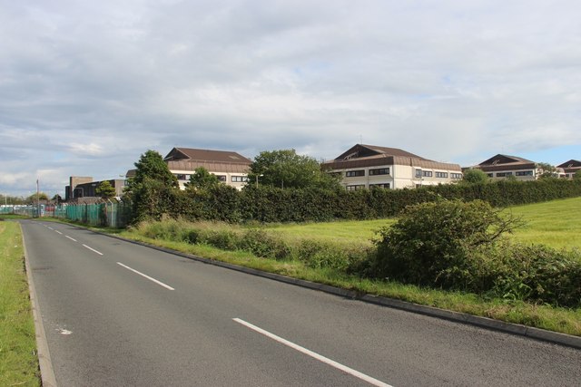
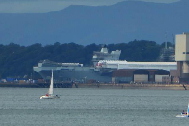
H M Naval Base, located in Fife, Scotland, is a Royal Navy base that serves as a key strategic facility for the United Kingdom's defense and maritime operations. Situated on the northern shore of the Firth of Forth, the base has been operational since the early 20th century and continues to play a vital role in the country's naval defense capabilities.
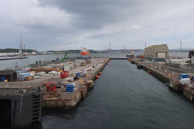
The base covers a vast area and comprises a number of different facilities, including numerous docks, jetties, and berths for various types of naval vessels. These range from frigates and destroyers to submarines and aircraft carriers. The base also houses a number of support buildings, workshops, and warehouses that cater to the maintenance, repair, and supply needs of the naval fleet.
H M Naval Base, Fife, boasts state-of-the-art infrastructure and facilities, including dry docks capable of accommodating large warships and submarines. The base also features a comprehensive array of security measures to ensure the protection of its assets and personnel.
Beyond its operational importance, the base serves as a significant employer in the region, providing jobs and supporting the local economy. It also plays an integral role in fostering partnerships and collaborations between the Royal Navy and allied forces from around the world.
In summary, H M Naval Base, Fife, is a strategically significant facility for the Royal Navy, providing a home and support infrastructure for a wide range of naval vessels. With its rich history and modern capabilities, the base remains a crucial element of the United Kingdom's maritime defense strategy.
If you have any feedback on the listing, please let us know in the comments section below.
H M Naval Base Images
Images are sourced within 2km of 56.033839/-3.4515749 or Grid Reference NT0983. Thanks to Geograph Open Source API. All images are credited.

H M Naval Base is located at Grid Ref: NT0983 (Lat: 56.033839, Lng: -3.4515749)
Unitary Authority: Fife
Police Authority: Fife
What 3 Words
///weeds.blame.massaging. Near Rosyth, Fife
Nearby Locations
Related Wikis
HMS Scotia (shore establishment)
HMS Scotia is one of the newest Royal Naval Reserve units, formed in 1958, and currently recruiting from the east of Scotland. The unit inhabits spacious...

HMS Caledonia (base)
His Majesty’s Ship Caledonia (HMS Caledonia) is a military establishment of the Royal Navy based next to the former Royal Naval Dockyard, Rosyth in Scotland...
Pattiesmuir
Pattiesmuir (formerly Pettimuir, Pettymuir and also known as Patiemuir, Patiesmuir and Peattie Muir) is a small, dormitory hamlet located in the west of...

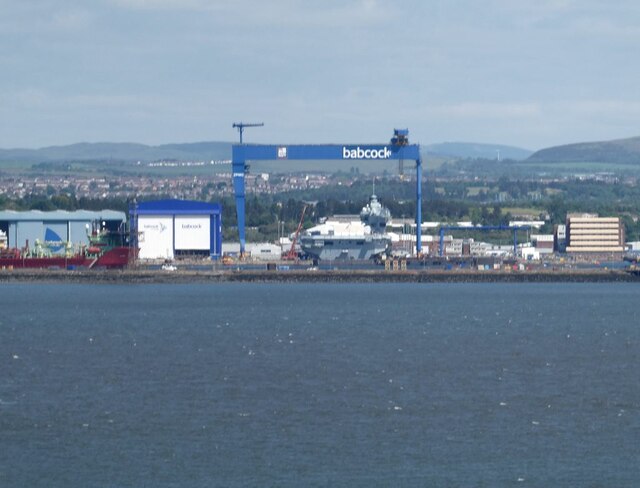
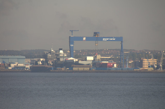
Goliath (Rosyth)
Goliath is a crane in Rosyth Dockyard, Scotland, with a lift capacity of 1,000 tonnes (980 long tons; 1,100 short tons), the largest in Britain. ��2�...

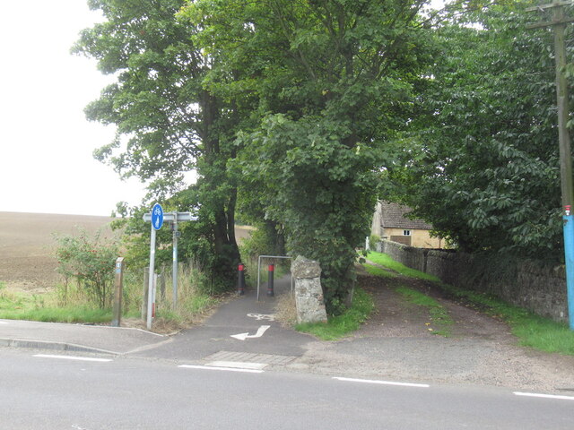
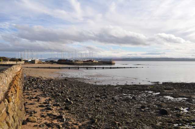
Rosyth
Rosyth (Scottish Gaelic: Ros Fhìobh, "headland of Fife") is a town on the Firth of Forth, three miles (five kilometres) south of the centre of Dunfermline...

Rosyth Dockyard
Rosyth Dockyard is a large naval dockyard on the Firth of Forth at Rosyth, Fife, Scotland, owned by Babcock Marine, which formerly undertook refitting...
Rosyth Castle
Rosyth Castle is a fifteenth-century ruined tower house on the perimeter of Rosyth Naval Dockyard, Fife, Scotland. It originally stood on a small island...
Limekilns
Limekilns is a village in Fife, Scotland. It lies on the shore of the Firth of Forth, around 3 miles (5 km) south of Dunfermline. == History and economy... ==
Related Videos
![Fife Walking Trail - Limekilns and Charlestown [Outlander Film Set]](https://i.ytimg.com/vi/31LnYpSIFbM/hqdefault.jpg)
Fife Walking Trail - Limekilns and Charlestown [Outlander Film Set]
This walking trail in Fife starts at a free car park in Limekilns harbour. We follow the coastal path past the remains of Rosyth ...

Fred Olsen Balmoral - a walking tour of the ship
Each cruise ship has its own mix of the familiar and the unexpected. Whether you are a seasoned passenger or new to cruising ...

The Inn at Charlestown, Dunfermline
Amazing hotel in a quiet little place close to the sea. It was a five minute walk to some incredible views... Food here was VERY ...

Nearby Amenities
Located within 500m of 56.033839,-3.4515749Have you been to H M Naval Base?
Leave your review of H M Naval Base below (or comments, questions and feedback).