Griseornais

Settlement in Inverness-shire

Scotland

Griseornais

Loch Greshornish
Loch Greshornish Credit: thejackrustles

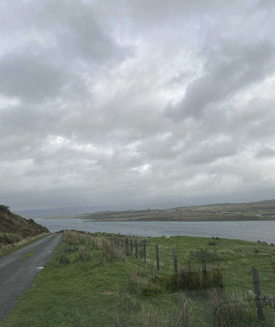
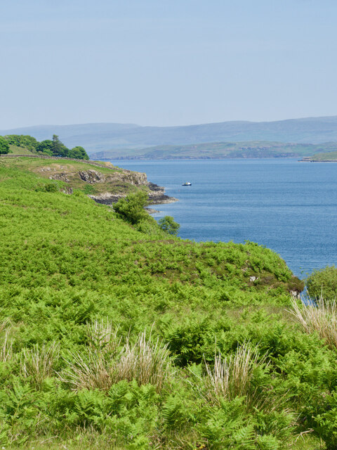
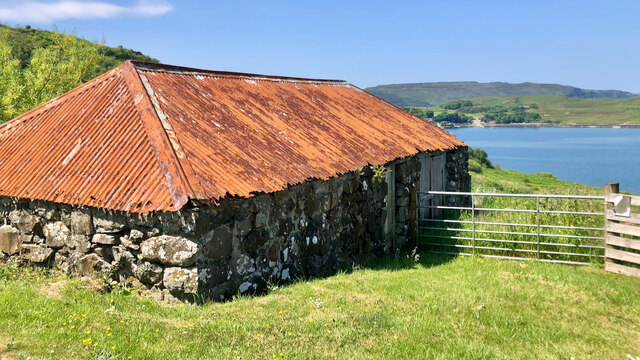
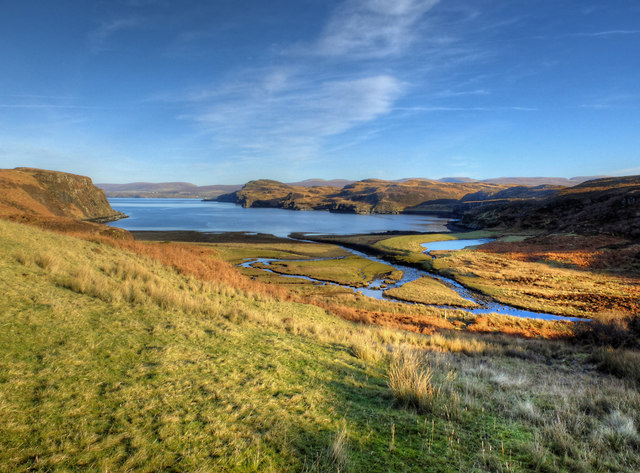
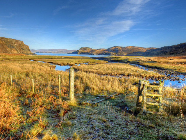
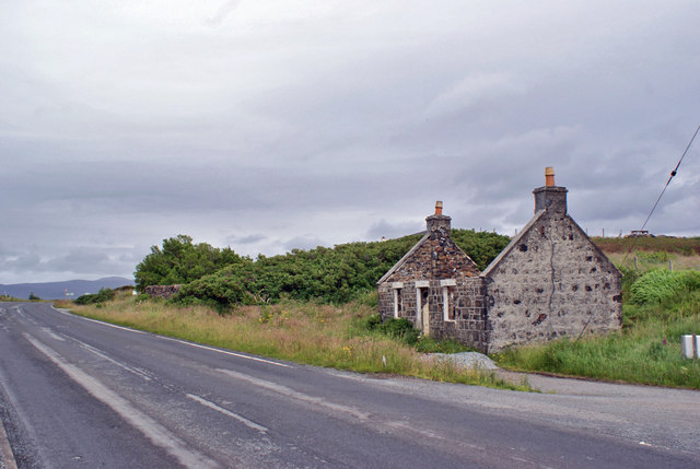
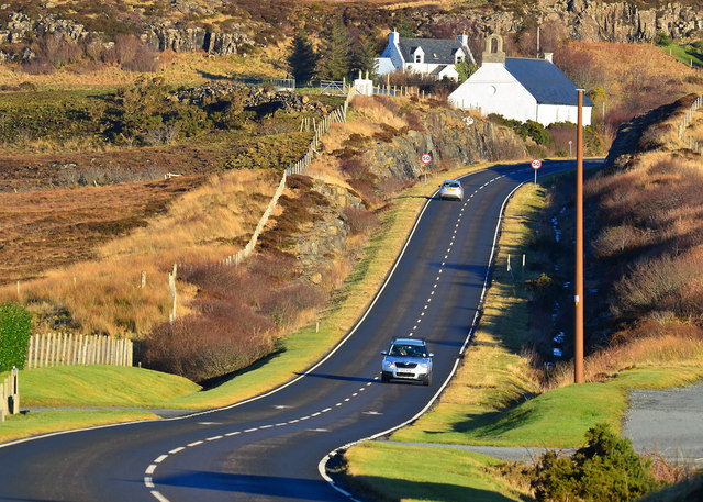
Griseornais is a small rural village located in the county of Inverness-shire in the Scottish Highlands. Situated near the banks of Loch Ness, Griseornais is known for its stunning natural beauty and picturesque surroundings. The village is surrounded by rolling hills, lush forests, and crystal-clear streams, making it a popular destination for outdoor enthusiasts and nature lovers.

Griseornais is home to a tight-knit community of residents who take pride in their village and its heritage. The village has a few local amenities, including a small convenience store, a pub, and a community center. Residents often gather for social events and celebrations, fostering a sense of community spirit.

The village is also a popular starting point for outdoor activities such as hiking, fishing, and birdwatching. The nearby Loch Ness offers opportunities for boat tours and water sports, while the surrounding countryside is dotted with walking trails and cycling routes.

Overall, Griseornais is a charming village that offers a peaceful retreat from the hustle and bustle of city life, with its stunning scenery and welcoming community making it a hidden gem in the Scottish Highlands.

If you have any feedback on the listing, please let us know in the comments section below.
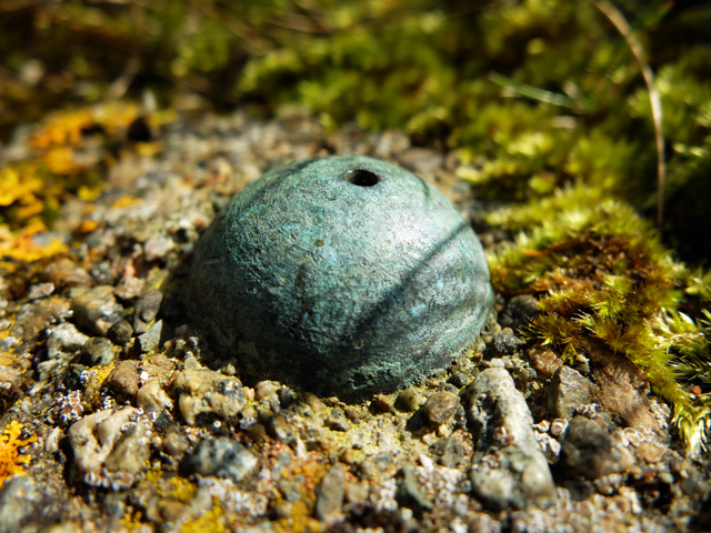
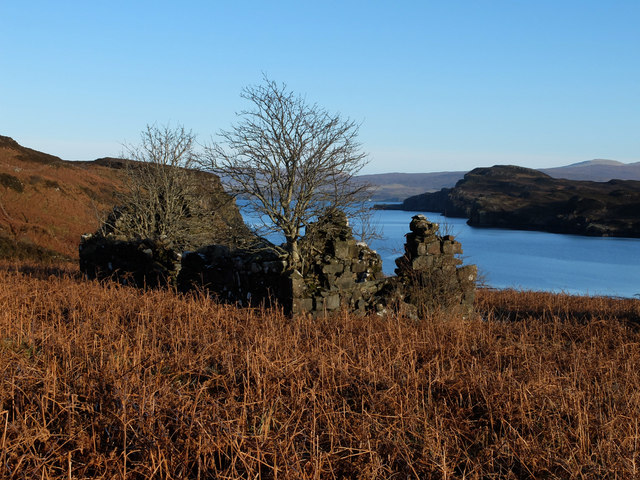
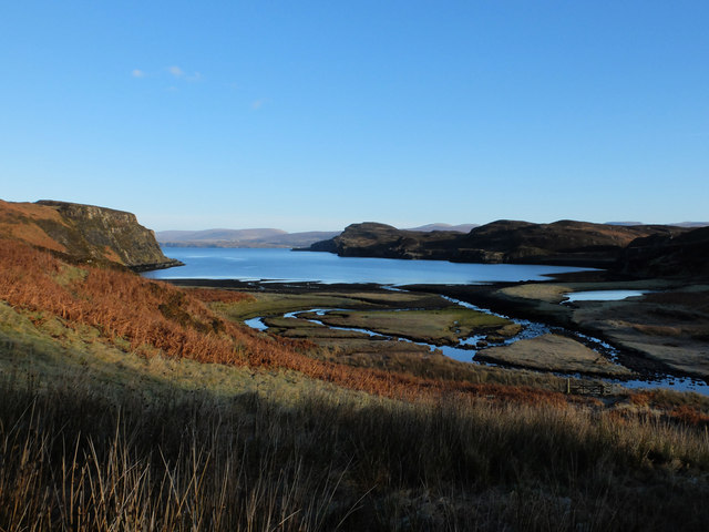
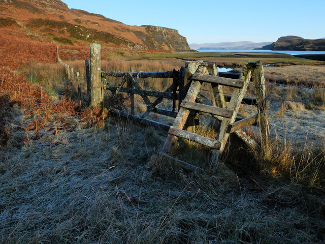
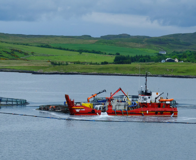
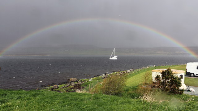
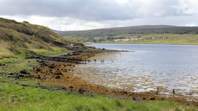
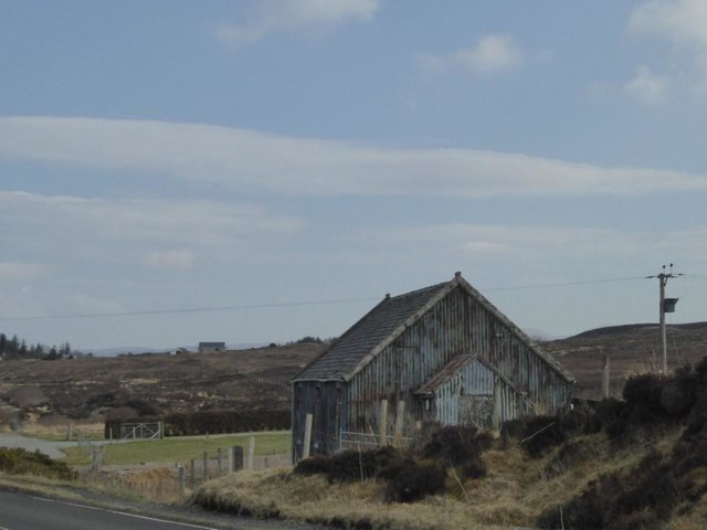
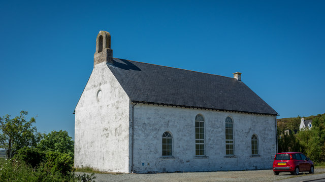
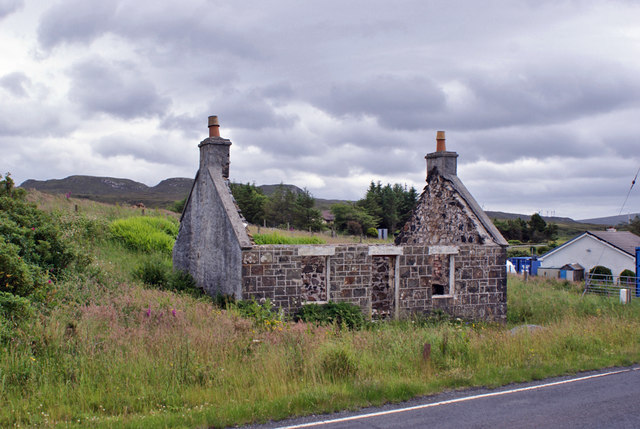
Griseornais Images

Images are sourced within 2km of 57.498962/-6.4400719 or Grid Reference NG3454. Thanks to Geograph Open Source API. All images are credited.
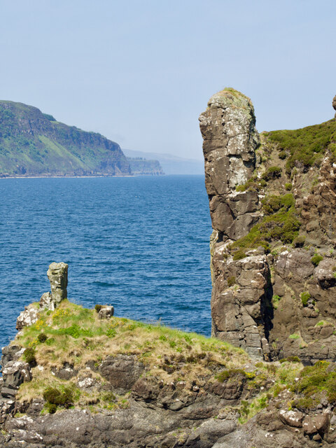
Loch Greshornish
Loch Greshornish
The magnificent bracken-infested coastline of Loch Greshornish
Boc na Caillich—“The old woman’s pimple” First stop after the day’s exertions was to the Ordnance Survey’s website, which has a lovely little page detailing the Gaelic origins of place names. ‘Boc’ turns out to be a buck or a ‘he-goat,’ likely referring to a billy goat. Therefore, Boc na Caillich, I suppose, can be interpreted as ‘the old woman’s billy goat.’

But …

The Scottish Government’s website ScotlandsPlaces has scans of the original surveyors’ notebooks used by the Ordnance Survey. For Boc na Caillich, the surveyor had written:—

<<This name applies to a Small Standing rock, and Signifies “The old woman’s pimple”:, Situated about 3/4 of a mile from “Dunbeg”>>

Mulling this over, it amuses me to entertain the notion that those mischievous Dunbeg crofters were having a jolly good laugh at the befuddlement of those Government officials. I can just picture their impish grins as they spun a yarn, convincingly claiming that "Boc na Caillich" actually pertains to a completely different region of a woman's anatomy altogether. And as for that hilariously prim and proper Victorian surveying brigade, it's no wonder they rendered it as "Pimple" in their records, utterly scandalised by the mere thought of anything remotely risque. Oh, the prudishness of those bygone days!

Adapted from my blog post <span class="nowrap"><a title="http://www.fhithich.uk/?p=32333" rel="nofollow ugc noopener" href="http://www.fhithich.uk/?p=32333">Link</a><img style="margin-left:2px;" alt="External link" title="External link - shift click to open in new window" src="https://s1.geograph.org.uk/img/external.png" width="10" height="10"/></span> which contains relevant sources.
Boc na Caillich—“The old woman’s pimple”
First stop after the day’s exertions was to the Ordnance Survey’s website, which has a lovely little page detailing the Gaelic origins of place names. ‘Boc’ turns out to be a buck or a ‘he-goat,’ likely referring to a billy goat. Therefore, Boc na Caillich, I suppose, can be interpreted as ‘the old woman’s billy goat.’ But … The Scottish Government’s website ScotlandsPlaces has scans of the original surveyors’ notebooks used by the Ordnance Survey. For Boc na Caillich, the surveyor had written:— <<This name applies to a Small Standing rock, and Signifies “The old woman’s pimple”:, Situated about 3/4 of a mile from “Dunbeg”>> Mulling this over, it amuses me to entertain the notion that those mischievous Dunbeg crofters were having a jolly good laugh at the befuddlement of those Government officials. I can just picture their impish grins as they spun a yarn, convincingly claiming that "Boc na Caillich" actually pertains to a completely different region of a woman's anatomy altogether. And as for that hilariously prim and proper Victorian surveying brigade, it's no wonder they rendered it as "Pimple" in their records, utterly scandalised by the mere thought of anything remotely risque. Oh, the prudishness of those bygone days! Adapted from my blog post LinkExternal link which contains relevant sources.
Stacdachan The Victorian surveyor&amp;#039;s notebook contains the following notes:

&amp;lt;&amp;lt;This name spplies to a high Standing rock, Signifying &amp;quot;The Pinnacle&amp;quot; Situated on the Coast 3/4 of a mile north west from Greshornish House.&amp;gt;&amp;gt;

Source: ‘OS1/16/7/111 | ScotlandsPlaces’. 2019. Scotlandsplaces.gov.uk &amp;lt;&lt;span class=&quot;nowrap&quot;&gt;&lt;a title=&quot;https://scotlandsplaces.gov.uk/digital-volumes/ordnance-survey-name-books/inverness-shire-os-name-books-1876-1878/inverness-shire-skye-volume-07/111&quot; rel=&quot;nofollow ugc noopener&quot; href=&quot;https://scotlandsplaces.gov.uk/digital-volumes/ordnance-survey-name-books/inverness-shire-os-name-books-1876-1878/inverness-shire-skye-volume-07/111&quot;&gt;Link&lt;/a&gt;&lt;img style=&quot;margin-left:2px;&quot; alt=&quot;External link&quot; title=&quot;External link - shift click to open in new window&quot; src=&quot;https://s1.geograph.org.uk/img/external.png&quot; width=&quot;10&quot; height=&quot;10&quot;/&gt;&lt;/span&gt; &amp;gt; [accessed 17 July 2023]
Stacdachan
The Victorian surveyor's notebook contains the following notes: <<This name spplies to a high Standing rock, Signifying "The Pinnacle" Situated on the Coast 3/4 of a mile north west from Greshornish House.>> Source: ‘OS1/16/7/111 | ScotlandsPlaces’. 2019. Scotlandsplaces.gov.uk <LinkExternal link > [accessed 17 July 2023]
A charming rust-roofed barn near Kildonan, with Loch Greshornish in the distance
OS Bolt on the summit of Maol na h-Àirde I&amp;#039;ve been on this summit many times without noticing the bolt. It is a fourth order trig point, set in concrete close to the small cairn, and somewhat overgrown by grass. See &lt;a title=&quot;https://www.geograph.org.uk/photo/2870990&quot; href=&quot;https://www.geograph.org.uk/photo/2870990&quot;&gt;Link&lt;/a&gt; for context.
OS Bolt on the summit of Maol na h-Àirde
I've been on this summit many times without noticing the bolt. It is a fourth order trig point, set in concrete close to the small cairn, and somewhat overgrown by grass. See Link for context.
Ruin at Diubaig The most complete of several ruined houses in the long uninhabited village of Diubaig.
The view is across Loch Diubaig to the peninsula of Greshornish.
Ruin at Diubaig
The most complete of several ruined houses in the long uninhabited village of Diubaig. The view is across Loch Diubaig to the peninsula of Greshornish.
Loch Diubaig The sea loch, an inlet of Loch Snizort, seen from the site of the derelict village of Diubaig.
Loch Diubaig
The sea loch, an inlet of Loch Snizort, seen from the site of the derelict village of Diubaig.
Gate and stile, Diubaig Covered with lichens and, today, with frost. The gate is beyond use without risking terminal damage to it, but the stile still bears weight.
Gate and stile, Diubaig
Covered with lichens and, today, with frost. The gate is beyond use without risking terminal damage to it, but the stile still bears weight.
Leslie Anne in Loch Greshornish The Leslie Anne, a multipurpose workboat, landing craft and support vessel based in Kishorn, is seen working at a Marine Harvest fish farm in Loch Greshornish.
Leslie Anne in Loch Greshornish
The Leslie Anne, a multipurpose workboat, landing craft and support vessel based in Kishorn, is seen working at a Marine Harvest fish farm in Loch Greshornish.
Rainbow over Loch Greshornish  
The photograph was taken from the shore of the Loch from a caravan and camping site at Borve.

See also this rainbow photograph by Norrie Adamson:- &lt;a href=&quot;https://www.geograph.org.uk/photo/109341&quot;&gt;NG3452 : Loch Greshornish, Skye&lt;/a&gt;.
Rainbow over Loch Greshornish
  The photograph was taken from the shore of the Loch from a caravan and camping site at Borve. See also this rainbow photograph by Norrie Adamson:- NG3452 : Loch Greshornish, Skye.
Old walls and fence at Loch Greshornish  
The photograph was taken from the eastern shore of the loch on the southern edge of a caravan and camping site at Borve.

The hamlet in the distance is Coishletter and the summit above the trees beyond is Mullach Ben Sca.

The wind turbines are part of Edinbane Wind Farm.
Old walls and fence at Loch Greshornish
  The photograph was taken from the eastern shore of the loch on the southern edge of a caravan and camping site at Borve. The hamlet in the distance is Coishletter and the summit above the trees beyond is Mullach Ben Sca. The wind turbines are part of Edinbane Wind Farm.
Mission Church at Borve, Arnisort When I lived at the nearby Borve Cottage in the early 1990s, this tin clad meeting house was in regular use.    It now appears to be disused and in disrepair.
Mission Church at Borve, Arnisort
When I lived at the nearby Borve Cottage in the early 1990s, this tin clad meeting house was in regular use. It now appears to be disused and in disrepair.
Arnisort Kirk
Arnisort Kirk
Loch Diubaig from the old settlement A view from beside the ruins of the old settlement of Diubaig, looking over the outflow of the Allt Diubaig and Loch Diubaig towards the outer reaches of Loch Snizort. The lumpy ground to the right of the loch is Greshornish Point.
Loch Diubaig from the old settlement
A view from beside the ruins of the old settlement of Diubaig, looking over the outflow of the Allt Diubaig and Loch Diubaig towards the outer reaches of Loch Snizort. The lumpy ground to the right of the loch is Greshornish Point.
Gate by the distributaries of the Allt Diubaig The very attractive old lichen covered wooden gate &lt;a href=&quot;https://www.geograph.org.uk/photo/4787214&quot;&gt;NG3254 : Gate and stile, Diubaig&lt;/a&gt; is fallen and broken. Sad to see it gone. The stile is now redundant, so may last a bit longer.
The view over the distributaries is to Loch Diubaig, where the river reaches the sea.
Gate by the distributaries of the Allt Diubaig
The very attractive old lichen covered wooden gate NG3254 : Gate and stile, Diubaig is fallen and broken. Sad to see it gone. The stile is now redundant, so may last a bit longer. The view over the distributaries is to Loch Diubaig, where the river reaches the sea.
Derelict cottage in Flashader Until recently, this long-uninhabited roadside cottage was roofed and had windows and door. When builders turned up, I had thought that restoration was underway, but it now looks like the cottage is to be left derelict.
Other views: &lt;a href=&quot;https://www.geograph.org.uk/photo/6199938&quot;&gt;NG3553 : Derelict cottage, Flashader&lt;/a&gt;, &lt;a href=&quot;https://www.geograph.org.uk/photo/6199944&quot;&gt;NG3553 : Cooking range in derelict cottage&lt;/a&gt;.
Derelict cottage in Flashader
Until recently, this long-uninhabited roadside cottage was roofed and had windows and door. When builders turned up, I had thought that restoration was underway, but it now looks like the cottage is to be left derelict. Other views: NG3553 : Derelict cottage, Flashader, NG3553 : Cooking range in derelict cottage.
Derelict cottage, Flashader Another view of the small and now roofless cottage in Flashader.
The road is the A850.
See also: &lt;a href=&quot;https://www.geograph.org.uk/photo/6199935&quot;&gt;NG3553 : Derelict cottage in Flashader&lt;/a&gt; and &lt;a href=&quot;https://www.geograph.org.uk/photo/6199944&quot;&gt;NG3553 : Cooking range in derelict cottage&lt;/a&gt;.
Derelict cottage, Flashader
Another view of the small and now roofless cottage in Flashader. The road is the A850. See also: NG3553 : Derelict cottage in Flashader and NG3553 : Cooking range in derelict cottage.
Show me another place!

Griseornais is located at Grid Ref: NG3454 (Lat: 57.498962, Lng: -6.4400719)

Unitary Authority: Highland

Police Authority: Highlands and Islands

Also known as: Greshornish

What 3 Words

///sizing.kitchen.increment. Near Dunvegan, Highland

Related Wikis

Flashader

Flashader (Scottish Gaelic: Flaiseader) is a small crofting township close to the east coast of the sea loch Loch Greshornish on the Isle of Skye. It is...

A850 road

The A850 road is a road in the Scottish Isles, off the west coast of mainland Scotland. == Road function == It is one of the principal roads of the Isle...

Edinbane

Edinbane (Scottish Gaelic: An t-Aodann Bàn the fair hill-face) is a small village on the island of Skye, Scotland. == Location == Edinbane lies on the...

Suladale

Suladale or Suledale (Scottish Gaelic: Sùladal) is a small mixed crofting hamlet of fewer than a dozen houses, located near Edinbane, on the north of...

Nearby Amenities

Located within 500m of 57.498962,-6.4400719
Created By: dmgroom_coastlines
Source: PGS
Lat/Long: 57.49472/-6.43959
Created By: dmgroom_coastlines
Source: PGS
Lat/Long: 57.49573/-6.43905
Source: PGS
Lat/Long: 57.4962282/-6.4389363
Source: PGS
Lat/Long: 57.4967922/-6.4378252
Created By: dmgroom_coastlines
Source: PGS
Lat/Long: 57.49724/-6.43751
Created By: dmgroom_coastlines
Source: PGS
Lat/Long: 57.49774/-6.437
Created By: dmgroom_coastlines
Source: PGS
Lat/Long: 57.49824/-6.43649
Source: PGS
Lat/Long: 57.4995349/-6.4364403
Source: PGS
Lat/Long: 57.4995759/-6.4365133
Source: PGS
Lat/Long: 57.4996101/-6.4369753
Source: PGS
Lat/Long: 57.5000405/-6.4373718
Created By: dmgroom_coastlines
Source: PGS
Lat/Long: 57.50055/-6.4368
Created By: dmgroom_coastlines
Source: PGS
Lat/Long: 57.50068/-6.43656
Created By: dmgroom_coastlines
Source: PGS
Lat/Long: 57.5008/-6.43631
Created By: dmgroom_coastlines
Source: PGS
Lat/Long: 57.50092/-6.43606
Created By: dmgroom_coastlines
Source: PGS
Lat/Long: 57.50106/-6.43583
Created By: dmgroom_coastlines
Source: PGS
Lat/Long: 57.50117/-6.43557
Created By: dmgroom_coastlines
Source: PGS
Lat/Long: 57.50116/-6.43509
Created By: dmgroom_coastlines
Source: PGS
Lat/Long: 57.50102/-6.43463
Created By: dmgroom_coastlines
Source: PGS
Lat/Long: 57.50153/-6.43436
Created By: dmgroom_coastlines
Source: PGS
Lat/Long: 57.50165/-6.43411
Created By: dmgroom_coastlines
Source: PGS
Lat/Long: 57.50179/-6.43386
Power: pole
Lat/Long: 57.5008224/-6.4422688
Power: pole
Lat/Long: 57.5004612/-6.4420192
Power: pole
Lat/Long: 57.4998685/-6.4417495
Power: pole
Lat/Long: 57.4992433/-6.4414838
Power: pole
Lat/Long: 57.4986322/-6.4411738
Power: pole
Lat/Long: 57.4978534/-6.441826
Power: pole
Lat/Long: 57.497172/-6.4424258
Power: pole
Lat/Long: 57.4962872/-6.4431827
Power: pole
Lat/Long: 57.4958069/-6.4436014
Power: pole
Lat/Long: 57.4951644/-6.4441368
Barrier: cattle_grid
Lat/Long: 57.4979735/-6.4402358
The data included in this document is from www.openstreetmap.org. The data is made available under ODbL.

Have you been to Griseornais?

Leave your review of Griseornais below (or comments, questions and feedback).