Green Bank

Settlement in Lancashire

England

Green Bank

Leeds & Liverpool Canal The Leeds & Liverpool Canal at Whitebirk.
Leeds & Liverpool Canal Credit: Peter McDermott

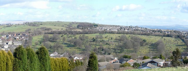
Green Bank is a small village located in the county of Lancashire, England. Situated in the borough of Ribble Valley, it is nestled in the picturesque countryside, surrounded by lush green fields and rolling hills. The village is part of the civil parish of Bowland Forest High and is located approximately 5 miles north of Clitheroe, a larger market town in the region.

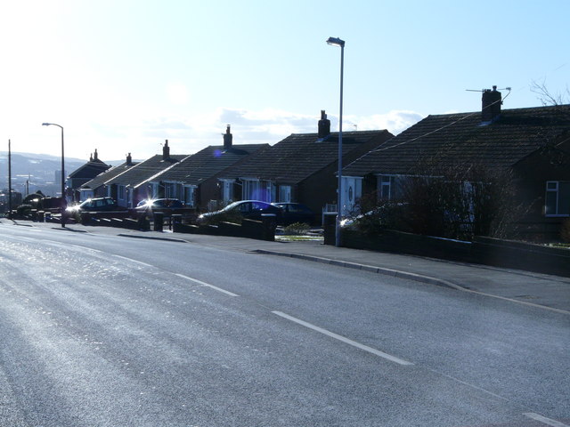
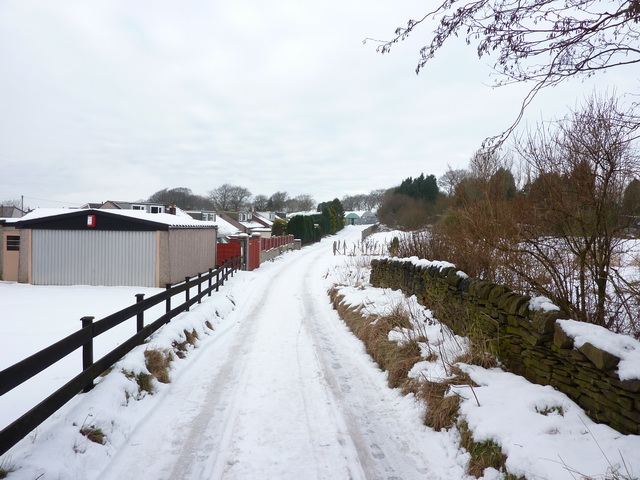
Green Bank is known for its peaceful and tranquil atmosphere, making it a popular destination for those seeking a break from the bustling city life. The village is characterized by its charming cottages and traditional stone houses, which add to its quaint and idyllic charm. Surrounded by a network of footpaths and bridleways, it offers ample opportunities for outdoor activities such as hiking, cycling, and horse riding.

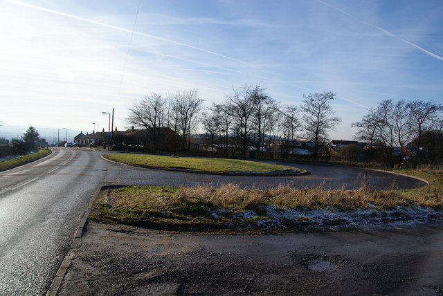
Despite its small size, Green Bank is well-connected to nearby towns and cities. The A59 road runs close by, providing easy access to Clitheroe and beyond. The village also benefits from a regular bus service, allowing residents and visitors to travel conveniently to other parts of Lancashire.

A notable landmark in Green Bank is St. Mary's Church, a lovely 19th-century building that serves as a focal point for the community. The church hosts various events and services throughout the year, bringing people together.

Although primarily residential, Green Bank is within close proximity to amenities such as schools, shops, and healthcare facilities, ensuring the needs of its residents are well catered to. With its scenic surroundings and friendly community, Green Bank offers a tranquil retreat for those seeking a slice of rural life in Lancashire.

If you have any feedback on the listing, please let us know in the comments section below.
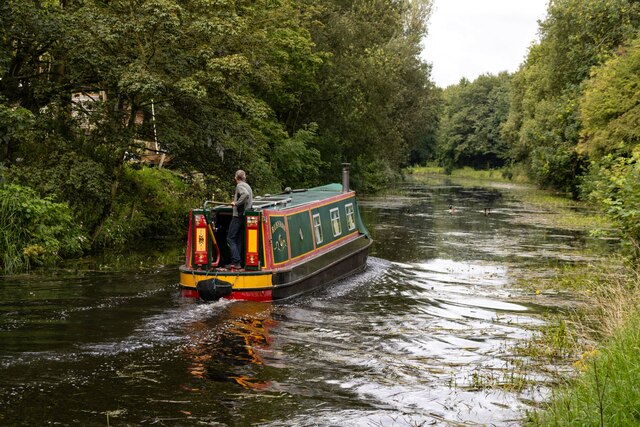
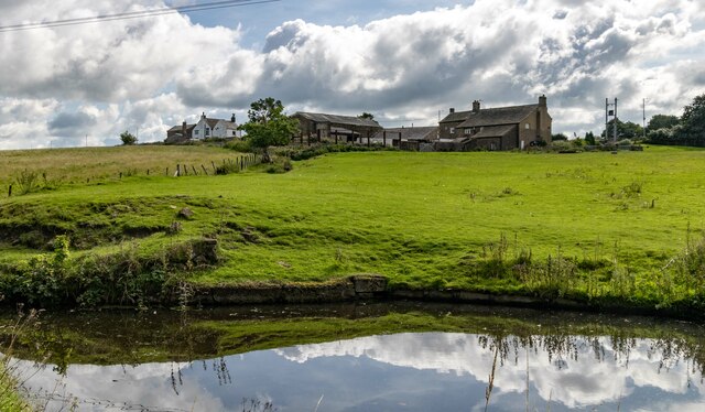
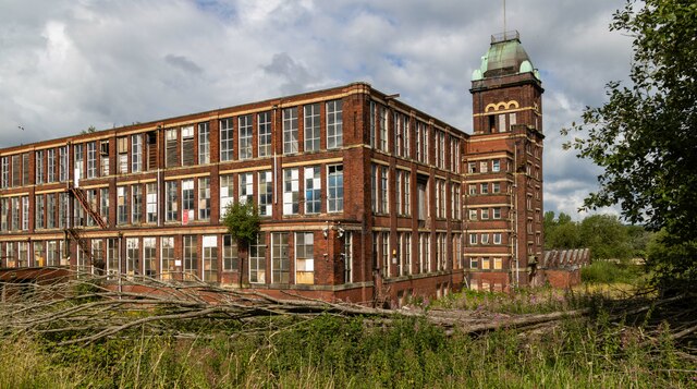
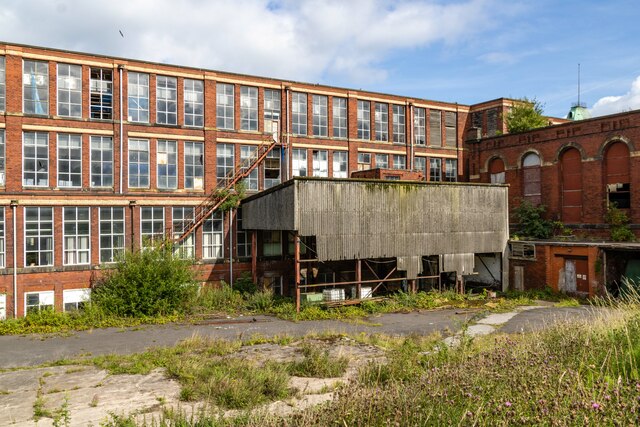
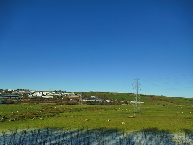
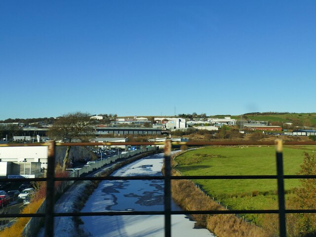
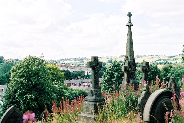
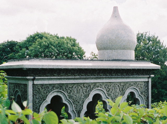
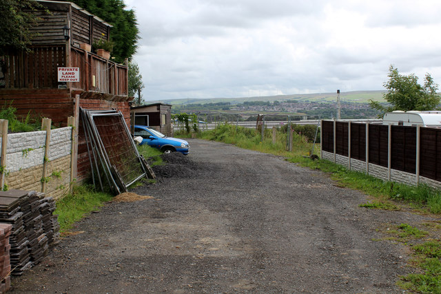
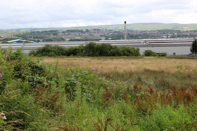
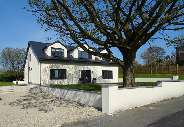
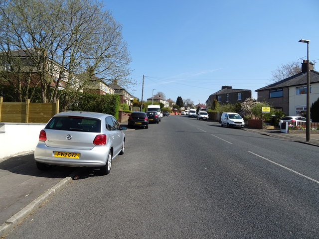
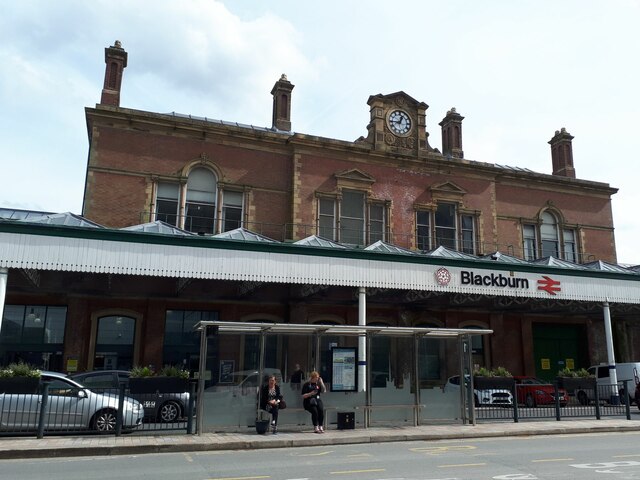
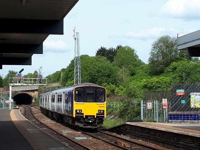
Green Bank Images

Images are sourced within 2km of 53.752603/-2.4574894 or Grid Reference SD6928. Thanks to Geograph Open Source API. All images are credited.

Leeds & Liverpool Canal The Leeds & Liverpool Canal at Whitebirk.
Leeds & Liverpool Canal
The Leeds & Liverpool Canal at Whitebirk.
Whitebirk Moss Farm Whitebirk Moss Farm alongside the Leeds & Liverpool Canal.
Whitebirk Moss Farm
Whitebirk Moss Farm alongside the Leeds & Liverpool Canal.
Imperial Mill Imperial Mill seen from the Leeds & Liverpool Canal.

See also <a href="https://www.geograph.org.uk/photo/7558847">SD7028 : Imperial Mill</a> and <a href="https://www.geograph.org.uk/photo/7558832">SD6928 : Imperial Mill</a>.
Imperial Mill
Imperial Mill seen from the Leeds & Liverpool Canal. See also SD7028 : Imperial Mill and SD6928 : Imperial Mill.
Imperial Mill Imperial Mill seen from the Leeds & Liverpool Canal.

See also <a href="https://www.geograph.org.uk/photo/7558843">SD7028 : Imperial Mill</a> and <a href="https://www.geograph.org.uk/photo/7558832">SD6928 : Imperial Mill</a>.
Imperial Mill
Imperial Mill seen from the Leeds & Liverpool Canal. See also SD7028 : Imperial Mill and SD6928 : Imperial Mill.
Field east of the canal at Whitebirk The Leeds and Liverpool canal passes in front of the buildings in the distance, and at this point acts as the boundary between Blackburn unitary authority in which the buildings lie, and Lancashire county this side.
Field east of the canal at Whitebirk
The Leeds and Liverpool canal passes in front of the buildings in the distance, and at this point acts as the boundary between Blackburn unitary authority in which the buildings lie, and Lancashire county this side.
Leeds and Liverpool Canal near Trident Way The canal was partly frozen. For a similar view from towpath level, see <a href="https://www.geograph.org.uk/photo/4435100">SD7029 : A View Along The Canal</a>.
Leeds and Liverpool Canal near Trident Way
The canal was partly frozen. For a similar view from towpath level, see SD7029 : A View Along The Canal.
Blackburn Cemetery Overgrown Victoriana
Blackburn Cemetery
Overgrown Victoriana
Blackburn Cemetery - Tomb in the Moorish style. Knotweed abundant. Grave of William Whewell. "not a lot is known about this grave" - <span class="nowrap"><a title="www.cottontown.org" rel="nofollow ugc noopener" href="http://www.cottontown.org">Link</a><img style="margin-left:2px;" alt="External link" title="External link - shift click to open in new window" src="https://s1.geograph.org.uk/img/external.png" width="10" height="10"/></span> . Can anyone help?
Blackburn Cemetery - Tomb in the Moorish style. Knotweed abundant.
Grave of William Whewell. "not a lot is known about this grave" - LinkExternal link . Can anyone help?
Dead centre of Blackburn! Blackburn Cemetery viewed from Royshaw Hill.
Dead centre of Blackburn!
Blackburn Cemetery viewed from Royshaw Hill.
Bungalows-Whalley Old Road Row of bungalows in an area known as Sunny Bower.
Bungalows-Whalley Old Road
Row of bungalows in an area known as Sunny Bower.
Snow bound road to Stone Hill Nurseries
Bus turning-circle at the top of Bank Hey This is the edge of the Blackburn conurbation.
Bus turning-circle at the top of Bank Hey
This is the edge of the Blackburn conurbation.
Access Track opposite Bank Hey Lane South As seen from Whalley Old Road.
Access Track opposite Bank Hey Lane South
As seen from Whalley Old Road.
View towards the Whitebirk Industrial Estate View across waste ground from Whalley Old Road
View towards the Whitebirk Industrial Estate
View across waste ground from Whalley Old Road
House on Whalley Old Road
Whalley Old Road Looking north east.
Whalley Old Road
Looking north east.
Entrance to Blackburn station The station building, erected c.1886-8 and still bearing the logo of the Lancashire and Yorkshire Railway above the clock dial, is grade II listed (list entry 1261389).
Entrance to Blackburn station
The station building, erected c.1886-8 and still bearing the logo of the Lancashire and Yorkshire Railway above the clock dial, is grade II listed (list entry 1261389).
Sprinter entering Blackburn station One of the earliest 'second generation' diesel units of the 1980s, 150005, enters Blackburn from the east, on the 15.25 Clitheroe to Rochdale service.  There are now two ways to get directly from here to Rochdale, either via Manchester Victoria (this service), or via Todmorden (a shorter route, departing in the opposite direction).
Sprinter entering Blackburn station
One of the earliest 'second generation' diesel units of the 1980s, 150005, enters Blackburn from the east, on the 15.25 Clitheroe to Rochdale service. There are now two ways to get directly from here to Rochdale, either via Manchester Victoria (this service), or via Todmorden (a shorter route, departing in the opposite direction).
Show me another place!

Green Bank is located at Grid Ref: SD6928 (Lat: 53.752603, Lng: -2.4574894)

Unitary Authority: Blackburn with Darwen

Police Authority: Lancashire

What 3 Words

///tape.stands.blame. Near Blackburn, Lancashire

Nearby Locations

Daisyfield Green Bank

Related Wikis

Imperial Mill, Blackburn

Imperial Mill, Blackburn is a cotton spinning mill at Wallace and Gorse Street in Greenbank, Blackburn, Lancashire, England. It was designed by P.S. Stott...

Jamiatul Ilm Wal Huda

Jamiatul Ilm Wal Huda, also known as Darul Uloom Blackburn, is an 11–25 private, Islamic, boarding and day school for boys in Blackburn, Lancashire, England...

Whitebirk

Whitebirk is a suburb in the east of Blackburn, in Lancashire, England. Most of the suburb is in the borough of Blackburn with Darwen, with the east of...

Daisyfield railway station

Daisyfield railway station was a railway station that served the Daisyfield area of Blackburn, Lancashire. == History == The station was opened by the...

Nearby Amenities

Located within 500m of 53.752603,-2.4574894
Fuel
Tesco
Brand: Tesco
Brand Wikidata: Q487494
Brand Wikipedia: en:Tesco
Source: estimated from landsat, survey and local knowledge
Website: https://www.tesco.com/store-locator/blackburn/hill-street/petrol-filling-station
Lat/Long: 53.7513868/-2.4568157
Bus Stop
Tesco
Bus: yes
Naptan AtcoCode: 2580BLA0121
Naptan NaptanCode: bladpjw
Public Transport: platform
Shelter: yes
Lat/Long: 53.7496556/-2.4592725
Fuel
Shell
Addr City: Blackburn
Addr Postcode: BB1 3HQ
Brand: Shell
Brand Wikidata: Q110716465
Opening Hours: 24/7
Operator: Motor Fuel Group
Operator Website: https://www.motorfuelgroup.com/locations/furthergate-fs961/
Operator Wikidata: Q107271358
Phone: +44 1254 260581
Ref Navads: NVDS353_11234848
Website: https://find.shell.com/gb/fuel/11234848-mfg-furthergate
Lat/Long: 53.7496228/-2.4612216
Bus Stop
Bentley Street
Bus: yes
Public Transport: platform
Lat/Long: 53.7486776/-2.4552291
Place Of Worship
Building: mosque
Religion: muslim
Lat/Long: 53.7549874/-2.463417
Traffic Signals
Lat/Long: 53.7494652/-2.4602144
Crossing
Crossing: uncontrolled
Crossing Ref: zebra
Lat/Long: 53.7510256/-2.4570757
Tesco
Bus: yes
Public Transport: stop_position
Lat/Long: 53.7493532/-2.4616134
Noexit: yes
Lat/Long: 53.7509624/-2.4556793
Crossing
Lat/Long: 53.7498798/-2.4579868
Crossing
Lat/Long: 53.7505268/-2.456815
Turning Circle
Source: Bing
Lat/Long: 53.7515719/-2.4516492
Bus Stop
Bus: yes
Public Transport: platform
Shelter: yes
Lat/Long: 53.7510233/-2.4558863
Bus Stop
Bus: yes
Public Transport: platform
Lat/Long: 53.7514671/-2.4560062
Post Office
Lat/Long: 53.7496179/-2.4610738
Traffic Signals
Tag: highway=traffic_signals
Lat/Long: 53.749559/-2.4584095
Post Box
Post Box Type: meter
Ref: BB1 86
Lat/Long: 53.7526536/-2.4619622
Post Box
Post Box Design: type_k
Post Box Type: pillar
Ref: BB1 85
Royal Cypher: EIIR
Royal Cypher Wikidata: Q33102113
Lat/Long: 53.7526299/-2.4619542
Atm
Lat/Long: 53.7509682/-2.4591206
Atm
Lat/Long: 53.7496747/-2.4611442
Toilets
Lat/Long: 53.7510628/-2.4588414
Addr Street: Accrington Road
Shop: convenience
Lat/Long: 53.7486739/-2.4556969
Bus Stop
Gloucester Road
Bus: yes
Public Transport: platform
Lat/Long: 53.7524306/-2.4501998
Bus Stop
Hereford Road
Bus: yes
Public Transport: platform
Lat/Long: 53.7515477/-2.4534468
Bus Stop
Hereford Road
Bus: yes
Naptan AtcoCode: 2580HHO0003
Naptan NaptanCode: blagpdm
Public Transport: platform
Lat/Long: 53.7513338/-2.4536793
Traffic Signals
Traffic Signals: signal
Lat/Long: 53.7513684/-2.4553329
Generator Method: photovoltaic
Generator Output Electricity: yes
Generator Source: solar
Generator Type: solar_photovoltaic_panel
Location: roof
Power: generator
Lat/Long: 53.7516802/-2.4504965
Generator Method: photovoltaic
Generator Output Electricity: yes
Generator Source: solar
Generator Type: solar_photovoltaic_panel
Location: roof
Power: generator
Lat/Long: 53.7519371/-2.4500808
Generator Method: photovoltaic
Generator Output Electricity: yes
Generator Source: solar
Generator Type: solar_photovoltaic_panel
Location: roof
Power: generator
Lat/Long: 53.7514629/-2.4519395
Generator Method: photovoltaic
Generator Output Electricity: yes
Generator Source: solar
Generator Type: solar_photovoltaic_panel
Location: roof
Power: generator
Lat/Long: 53.7514153/-2.4518671
Generator Method: photovoltaic
Generator Output Electricity: yes
Generator Source: solar
Generator Type: solar_photovoltaic_panel
Location: roof
Power: generator
Lat/Long: 53.7513757/-2.451725
Generator Method: photovoltaic
Generator Output Electricity: yes
Generator Source: solar
Generator Type: solar_photovoltaic_panel
Location: roof
Power: generator
Lat/Long: 53.7513297/-2.4516472
Generator Method: photovoltaic
Generator Output Electricity: yes
Generator Source: solar
Generator Type: solar_photovoltaic_panel
Location: roof
Power: generator
Lat/Long: 53.7512868/-2.451497
Generator Method: photovoltaic
Generator Output Electricity: yes
Generator Source: solar
Generator Type: solar_photovoltaic_panel
Location: roof
Power: generator
Lat/Long: 53.7510267/-2.4516794
Generator Method: photovoltaic
Generator Output Electricity: yes
Generator Source: solar
Generator Type: solar_photovoltaic_panel
Location: roof
Power: generator
Lat/Long: 53.7510045/-2.4515775
Generator Method: photovoltaic
Generator Output Electricity: yes
Generator Source: solar
Generator Type: solar_photovoltaic_panel
Location: roof
Power: generator
Lat/Long: 53.7508174/-2.4520549
Generator Method: photovoltaic
Generator Output Electricity: yes
Generator Source: solar
Generator Type: solar_photovoltaic_panel
Location: roof
Power: generator
Lat/Long: 53.7507857/-2.4519369
Generator Method: photovoltaic
Generator Output Electricity: yes
Generator Source: solar
Generator Type: solar_photovoltaic_panel
Location: roof
Power: generator
Lat/Long: 53.750754/-2.451784
Generator Method: photovoltaic
Generator Output Electricity: yes
Generator Source: solar
Generator Type: solar_photovoltaic_panel
Location: roof
Power: generator
Lat/Long: 53.7507159/-2.4516955
Generator Method: photovoltaic
Generator Output Electricity: yes
Generator Source: solar
Generator Type: solar_photovoltaic_panel
Location: roof
Power: generator
Lat/Long: 53.7506905/-2.4516043
Generator Method: photovoltaic
Generator Output Electricity: yes
Generator Source: solar
Generator Type: solar_photovoltaic_panel
Location: roof
Power: generator
Lat/Long: 53.7508015/-2.450577
Generator Method: photovoltaic
Generator Output Electricity: yes
Generator Source: solar
Generator Type: solar_photovoltaic_panel
Location: roof
Power: generator
Lat/Long: 53.7505335/-2.4508023
Generator Method: photovoltaic
Generator Output Electricity: yes
Generator Source: solar
Generator Type: solar_photovoltaic_panel
Location: roof
Power: generator
Lat/Long: 53.7505383/-2.4508828
Generator Method: photovoltaic
Generator Output Electricity: yes
Generator Source: solar
Generator Type: solar_photovoltaic_panel
Location: roof
Power: generator
Lat/Long: 53.750405/-2.4519476
Generator Method: photovoltaic
Generator Output Electricity: yes
Generator Source: solar
Generator Type: solar_photovoltaic_panel
Location: roof
Power: generator
Lat/Long: 53.7505668/-2.4523258
Generator Method: photovoltaic
Generator Output Electricity: yes
Generator Source: solar
Generator Type: solar_photovoltaic_panel
Location: roof
Power: generator
Lat/Long: 53.750524/-2.4522319
Generator Method: photovoltaic
Generator Output Electricity: yes
Generator Source: solar
Generator Type: solar_photovoltaic_panel
Location: roof
Power: generator
Lat/Long: 53.7503828/-2.4518618
Generator Method: photovoltaic
Generator Output Electricity: yes
Generator Source: solar
Generator Type: solar_photovoltaic_panel
Location: roof
Power: generator
Lat/Long: 53.7511647/-2.4536307
Generator Method: photovoltaic
Generator Output Electricity: yes
Generator Source: solar
Generator Type: solar_photovoltaic_panel
Location: roof
Power: generator
Lat/Long: 53.7512599/-2.4513884
Parking Space
Capacity: 1
Parking Space: disabled
Lat/Long: 53.7503081/-2.4609857
Parking Space
Capacity: 1
Parking Space: disabled
Lat/Long: 53.7498532/-2.458821
Parking Space
Capacity: 1
Parking Space: disabled
Lat/Long: 53.7498609/-2.4587682
Parking Space
Capacity: 1
Parking Space: disabled
Lat/Long: 53.74982/-2.4590111
Parking Space
Capacity: 1
Parking Space: disabled
Lat/Long: 53.7498105/-2.4590594
Parking Space
Capacity: 1
Parking Space: disabled
Lat/Long: 53.7498002/-2.4591118
Parking Space
Capacity: 1
Parking Space: disabled
Lat/Long: 53.7507715/-2.4589487
Parking Space
Capacity: 1
Parking Space: disabled
Lat/Long: 53.750803/-2.4589529
Parking Space
Capacity: 1
Parking Space: disabled
Lat/Long: 53.7507902/-2.459035
Parking Space
Capacity: 1
Parking Space: disabled
Lat/Long: 53.750714/-2.4589187
Parking Space
Capacity: 1
Parking Space: disabled
Lat/Long: 53.7507083/-2.4589942
Bus Stop
Tesco
Bus: yes
Naptan AtcoCode: 2580BLA0122
Naptan NaptanCode: bladpma
Note: FIXME - check ref - may have changed to Blackburn with Darwen code
Public Transport: platform
Ref: 2500IMG1531
Shelter: yes
Lat/Long: 53.7492255/-2.4614766
Crossing
Crossing: marked
Crossing Markings: yes
Lat/Long: 53.7488773/-2.4606385
Crossing
Crossing: marked
Crossing Markings: yes
Lat/Long: 53.7489379/-2.4606011
Crossing
Crossing: marked
Crossing Markings: yes
Lat/Long: 53.7489874/-2.4601017
Crossing
Crossing: marked
Crossing Markings: yes
Lat/Long: 53.7491407/-2.4601487
The data included in this document is from www.openstreetmap.org. The data is made available under ODbL.

Have you been to Green Bank?

Leave your review of Green Bank below (or comments, questions and feedback).