Goosewell

Settlement in Cornwall

England

Goosewell

Derestriction signs on west of Stoke Climsland
Derestriction signs on west of Stoke Climsland Credit: David Smith

Goosewell is a charming village located in Cornwall, England. Situated on the southern coast, it is nestled between the popular seaside towns of Plymouth and Torquay. With a population of around 2,500 residents, Goosewell offers a tranquil and picturesque setting.

The village is renowned for its natural beauty and stunning landscapes. Surrounded by rolling hills and picturesque countryside, it provides ample opportunities for outdoor activities such as hiking, cycling, and horse riding. The nearby coastline offers breathtaking views, with sandy beaches and rugged cliffs, making it a popular destination for beach lovers and water sports enthusiasts.

Goosewell boasts a close-knit community, with several historic buildings and landmarks. The village center is home to a range of amenities, including shops, cafes, and traditional pubs, where locals and visitors can enjoy a warm and welcoming atmosphere. The annual Goosewell Fair is a highlight for residents, showcasing the village's rich history and traditions.

The village is well-connected to larger towns and cities in the region. Its proximity to Plymouth provides easy access to a wider range of amenities, including shopping centers, theaters, and museums. Additionally, the A38 road and nearby railway stations make it convenient for commuters and tourists to explore other parts of Cornwall and beyond.

In summary, Goosewell offers a peaceful and idyllic setting, with stunning natural surroundings and a strong sense of community. Whether for a quiet getaway or as a base to explore the region, this quaint village has much to offer.

If you have any feedback on the listing, please let us know in the comments section below.
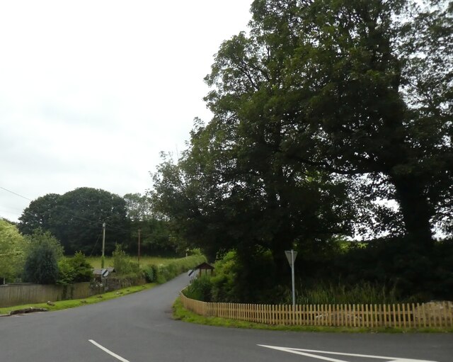
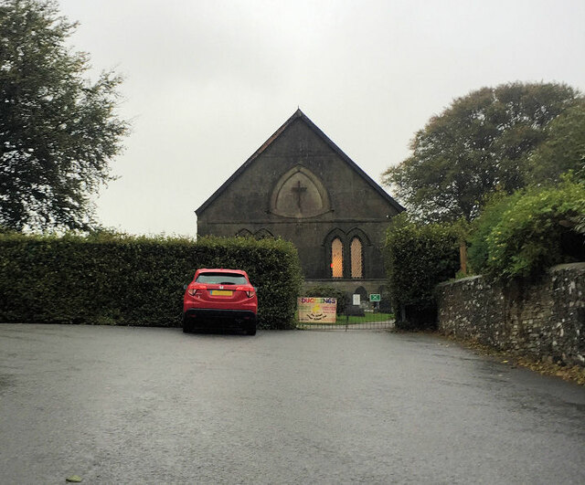
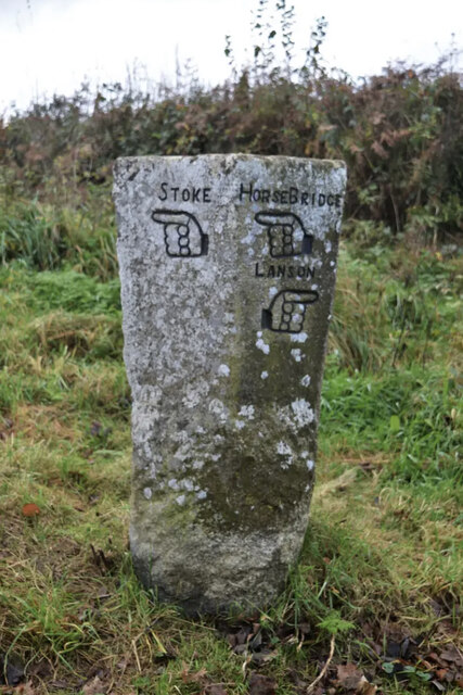
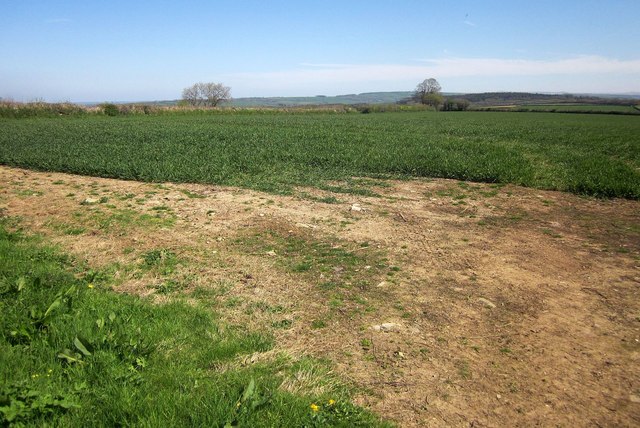
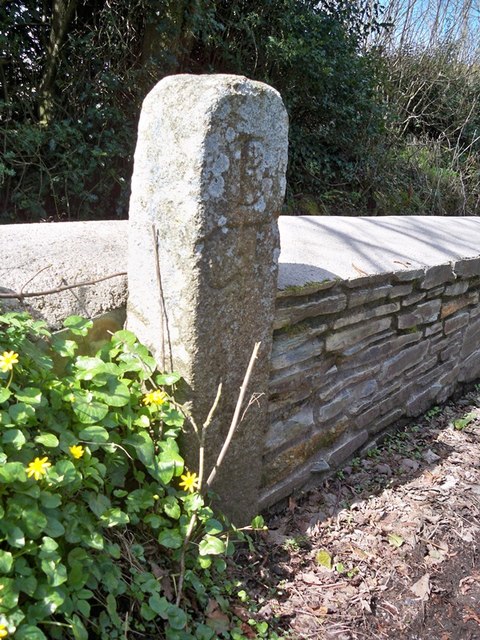
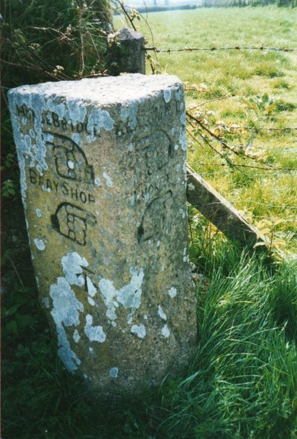
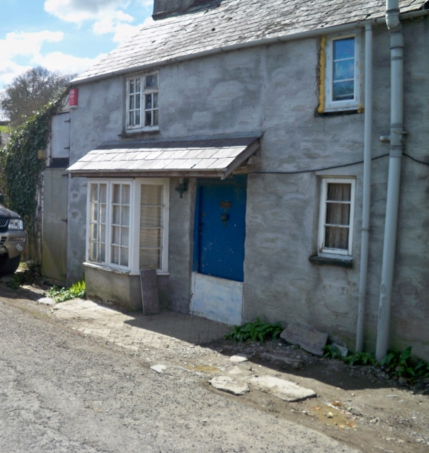
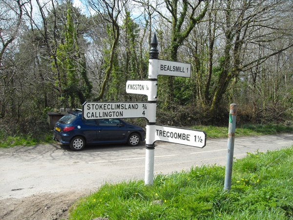
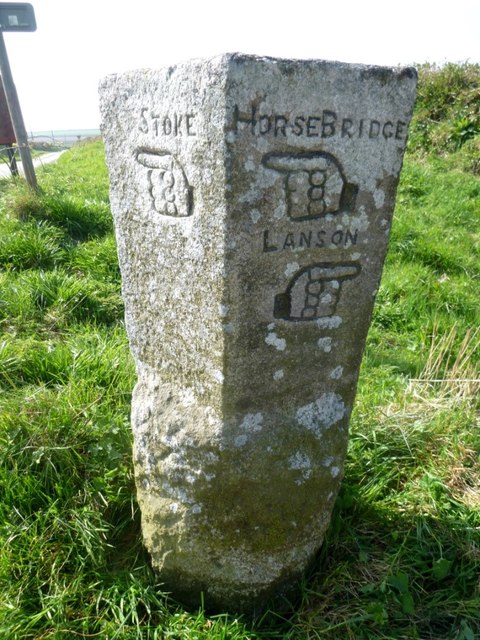
Goosewell Images

Images are sourced within 2km of 50.563652/-4.3031321 or Grid Reference SX3676. Thanks to Geograph Open Source API. All images are credited.

Derestriction signs on west of Stoke Climsland
Stoke Climsland Methodist Church
Old Guide Stone by Goosewell crossroads, Stoke Climsland Stone fingerpost by the UC road, in parish of Stoke Climsland (North Cornwall District), Goosewell, crossroads, by the road. An earlier photograph can be found here: <a title="https://www.geograph.org.uk/photo/6038677" href="https://www.geograph.org.uk/photo/6038677">Link</a>

Inscription reads:
STOKE / {pointing hand} : : HORSEBRIDGE / {pointing hand} / LANSON / {pointing hand} 

Grade II listed. List Entry Number: 1220136 <span class="nowrap"><a title="https://historicengland.org.uk/listing/the-list/list-entry/1220136" rel="nofollow ugc noopener" href="https://historicengland.org.uk/listing/the-list/list-entry/1220136">Link</a><img style="margin-left:2px;" alt="External link" title="External link - shift click to open in new window" src="https://s1.geograph.org.uk/img/external.png" width="10" height="10"/></span>

Milestone Society National ID: CW_XSTOK3.
Old Guide Stone by Goosewell crossroads, Stoke Climsland
Stone fingerpost by the UC road, in parish of Stoke Climsland (North Cornwall District), Goosewell, crossroads, by the road. An earlier photograph can be found here: Link Inscription reads: STOKE / {pointing hand} : : HORSEBRIDGE / {pointing hand} / LANSON / {pointing hand} Grade II listed. List Entry Number: 1220136 LinkExternal link Milestone Society National ID: CW_XSTOK3.
Crop north-west of Venterdon From the south-west corner of the left-hand of the fields shown in <a href="https://www.geograph.org.uk/photo/4438965">SX3575 : Two fields north of Venterdon</a>.
Crop north-west of Venterdon
From the south-west corner of the left-hand of the fields shown in SX3575 : Two fields north of Venterdon.
Old Milestone north of Kingston Carved stone post by the UC road, in parish of STOKECLIMSLAND (NORTH CORNWALL District), North of Kingston, in bank, on West side of road. Callington C gravestone, erected by the Callington turnpike trust in the 18th century. 

Inscription reads:-
IV
+
C 

Grade II Listed. List Entry Number: 1220242
<span class="nowrap"><a title="https://historicengland.org.uk/listing/the-list/list-entry/1220242" rel="nofollow ugc noopener" href="https://historicengland.org.uk/listing/the-list/list-entry/1220242">Link</a><img style="margin-left:2px;" alt="External link" title="External link - shift click to open in new window" src="https://s1.geograph.org.uk/img/external.png" width="10" height="10"/></span>

Milestone Society National ID: CW_CLBM04.
Old Milestone north of Kingston
Carved stone post by the UC road, in parish of STOKECLIMSLAND (NORTH CORNWALL District), North of Kingston, in bank, on West side of road. Callington C gravestone, erected by the Callington turnpike trust in the 18th century. Inscription reads:- IV + C Grade II Listed. List Entry Number: 1220242 LinkExternal link Milestone Society National ID: CW_CLBM04.
Old Direction Sign - Signpost south west of Tutwell Raised finial - G; by the UC road, in parish of Stoke Climsland (Caradon District), Tutwell T junction, on bank.

Surveyed

Milestone Society National ID: CW_SX3875.
Old Direction Sign - Signpost south west of Tutwell
Raised finial - G; by the UC road, in parish of Stoke Climsland (Caradon District), Tutwell T junction, on bank. Surveyed Milestone Society National ID: CW_SX3875.
Old Guide Stone by Goosewell crossroads, Stoke Climsland Stone fingerpost by the UC road, in parish of Stoke Climsland (North Cornwall District), Goosewell, crossroads, by the road.

Inscription reads:
: STOKE / {pointing hand} : : HORSEBRIDGE / {pointing hand} / LANSON / {pointing hand} :

Grade II listed. List Entry Number: 1220136
<span class="nowrap"><a title="https://historicengland.org.uk/listing/the-list/list-entry/1220136" rel="nofollow ugc noopener" href="https://historicengland.org.uk/listing/the-list/list-entry/1220136">Link</a><img style="margin-left:2px;" alt="External link" title="External link - shift click to open in new window" src="https://s1.geograph.org.uk/img/external.png" width="10" height="10"/></span>

Surveyed

Milestone Society National ID: CW_XSTOK3.
Old Guide Stone by Goosewell crossroads, Stoke Climsland
Stone fingerpost by the UC road, in parish of Stoke Climsland (North Cornwall District), Goosewell, crossroads, by the road. Inscription reads: : STOKE / {pointing hand} : : HORSEBRIDGE / {pointing hand} / LANSON / {pointing hand} : Grade II listed. List Entry Number: 1220136 LinkExternal link Surveyed Milestone Society National ID: CW_XSTOK3.
Old Direction Sign - Signpost north west of Lidwell, Stokeclimsland Parish Raised finial - G; by the UC road, in parish of Stokeclimsland (Caradon District), at crossroads North West of Lidwell, behind Cornish hedge. Post is in field with just arms showing.

To be surveyed

Milestone Society National ID: CW_SX3774
Old Direction Sign - Signpost north west of Lidwell, Stokeclimsland Parish
Raised finial - G; by the UC road, in parish of Stokeclimsland (Caradon District), at crossroads North West of Lidwell, behind Cornish hedge. Post is in field with just arms showing. To be surveyed Milestone Society National ID: CW_SX3774
Old Boundary Marker south of Beals Mill Bridge, Stokeclimsland parish Turnpike Terminus Marker by the UC road, in parish of Stokeclimsland (North Cornwall District), Beals Mill Bridge, against stone wall.

Grade II listed.
List Entry Number: 1220308 <span class="nowrap"><a title="https://historicengland.org.uk/listing/the-list/list-entry/1220308" rel="nofollow ugc noopener" href="https://historicengland.org.uk/listing/the-list/list-entry/1220308">Link</a><img style="margin-left:2px;" alt="External link" title="External link - shift click to open in new window" src="https://s1.geograph.org.uk/img/external.png" width="10" height="10"/></span>

Surveyed

Milestone Society National ID: CW_CLBM05t
Old Boundary Marker south of Beals Mill Bridge, Stokeclimsland parish
Turnpike Terminus Marker by the UC road, in parish of Stokeclimsland (North Cornwall District), Beals Mill Bridge, against stone wall. Grade II listed. List Entry Number: 1220308 LinkExternal link Surveyed Milestone Society National ID: CW_CLBM05t
Old Guide Stone east of Lockington, Stokeclimsland parish Carved stone fingerpost by the UC road, in parish of Stokeclimsland (North Cornwall District), Lockington, crossroads on Horsebridge road, by the road.

Inscription reads:-

Left face:
HORSEBRIDGE
{<-hand}
BRAY SHOP
{hand->}
Carved bench mark.

Right face:
BEALSHILL
{<-hand}
LUCKETT
{hand->}

Grade II listed.
List Entry Number: 1291115 <span class="nowrap"><a title="https://historicengland.org.uk/listing/the-list/list-entry/1291115" rel="nofollow ugc noopener" href="https://historicengland.org.uk/listing/the-list/list-entry/1291115">Link</a><img style="margin-left:2px;" alt="External link" title="External link - shift click to open in new window" src="https://s1.geograph.org.uk/img/external.png" width="10" height="10"/></span>

Surveyed

Milestone Society National ID: CW_XSTOK1
Old Guide Stone east of Lockington, Stokeclimsland parish
Carved stone fingerpost by the UC road, in parish of Stokeclimsland (North Cornwall District), Lockington, crossroads on Horsebridge road, by the road. Inscription reads:- Left face: HORSEBRIDGE {<-hand} BRAY SHOP {hand->} Carved bench mark. Right face: BEALSHILL {<-hand} LUCKETT {hand->} Grade II listed. List Entry Number: 1291115 LinkExternal link Surveyed Milestone Society National ID: CW_XSTOK1
Tollhouse in Bealsmill, Stokeclimsland Tollhouse by the unclassified road, in the parish of Stokeclimsland (North Cornwall District), Toll Cottage, Bealsmill, PL17 8LR.

Cornwall &amp;amp; Scilly HER.
HER Number: MCO55426 &lt;span class=&quot;nowrap&quot;&gt;&lt;a title=&quot;https://www.heritagegateway.org.uk/Gateway/Results_Single.aspx?uid=MCO55426&amp;amp;resourceID=1020&quot; rel=&quot;nofollow ugc noopener&quot; href=&quot;https://www.heritagegateway.org.uk/Gateway/Results_Single.aspx?uid=MCO55426&amp;amp;resourceID=1020&quot;&gt;Link&lt;/a&gt;&lt;img style=&quot;margin-left:2px;&quot; alt=&quot;External link&quot; title=&quot;External link - shift click to open in new window&quot; src=&quot;https://s1.geograph.org.uk/img/external.png&quot; width=&quot;10&quot; height=&quot;10&quot;/&gt;&lt;/span&gt;

To be surveyed

Milestone Society National ID: CW.STO
Tollhouse in Bealsmill, Stokeclimsland
Tollhouse by the unclassified road, in the parish of Stokeclimsland (North Cornwall District), Toll Cottage, Bealsmill, PL17 8LR. Cornwall & Scilly HER. HER Number: MCO55426 LinkExternal link To be surveyed Milestone Society National ID: CW.STO
Old Direction Sign - Signpost by Kingston crossroads Cone finial - G type; by the UC road, in parish of Stokeclimsland (Caradon District), Kingston crossroads, on grass verge.

To be surveyed

Milestone Society National ID: CW_SX3675
Old Direction Sign - Signpost by Kingston crossroads
Cone finial - G type; by the UC road, in parish of Stokeclimsland (Caradon District), Kingston crossroads, on grass verge. To be surveyed Milestone Society National ID: CW_SX3675
Old Guide Stone south of Goosewell Carved stone fingerpost by the UC road, in parish of Stokeclimsland (North Cornwall District), Goosewell, crossroads, by the road.

Inscription reads:-
: BEALS MILL / {hand-&amp;gt;} / CALSTOCK / {&amp;lt;-hand} : : BRAY SHOP / {hand-&amp;gt;} / STOKE :
Carved bench mark on lower &amp;#039;Calstock&amp;#039; face.

Grade II listed.
List Entry Number: 1220135 &lt;span class=&quot;nowrap&quot;&gt;&lt;a title=&quot;https://historicengland.org.uk/listing/the-list/list-entry/1220135&quot; rel=&quot;nofollow ugc noopener&quot; href=&quot;https://historicengland.org.uk/listing/the-list/list-entry/1220135&quot;&gt;Link&lt;/a&gt;&lt;img style=&quot;margin-left:2px;&quot; alt=&quot;External link&quot; title=&quot;External link - shift click to open in new window&quot; src=&quot;https://s1.geograph.org.uk/img/external.png&quot; width=&quot;10&quot; height=&quot;10&quot;/&gt;&lt;/span&gt;

Milestone Society National ID: CW_XSTOK2
Old Guide Stone south of Goosewell
Carved stone fingerpost by the UC road, in parish of Stokeclimsland (North Cornwall District), Goosewell, crossroads, by the road. Inscription reads:- : BEALS MILL / {hand->} / CALSTOCK / {<-hand} : : BRAY SHOP / {hand->} / STOKE : Carved bench mark on lower 'Calstock' face. Grade II listed. List Entry Number: 1220135 LinkExternal link Milestone Society National ID: CW_XSTOK2
Old Guide Stone south of Goosewell Carved stone fingerpost by the UC road, in parish of Stokeclimsland (North Cornwall District), Goosewell, crossroads, by the road.

Inscription reads:-
Left face:
BEALS MILL
{hand-&amp;gt;}
CALSTOCK
{&amp;lt;-hand}
Carved bench mark below &amp;#039;Calstock&amp;#039;.

Right face:
BRAY SHOP
{hand-&amp;gt;}
STOKE :

Grade II listed.
List Entry Number: 1220135 &lt;span class=&quot;nowrap&quot;&gt;&lt;a title=&quot;https://historicengland.org.uk/listing/the-list/list-entry/1220135&quot; rel=&quot;nofollow ugc noopener&quot; href=&quot;https://historicengland.org.uk/listing/the-list/list-entry/1220135&quot;&gt;Link&lt;/a&gt;&lt;img style=&quot;margin-left:2px;&quot; alt=&quot;External link&quot; title=&quot;External link - shift click to open in new window&quot; src=&quot;https://s1.geograph.org.uk/img/external.png&quot; width=&quot;10&quot; height=&quot;10&quot;/&gt;&lt;/span&gt;

Surveyed

Milestone Society National ID: CW_XSTOK2
Old Guide Stone south of Goosewell
Carved stone fingerpost by the UC road, in parish of Stokeclimsland (North Cornwall District), Goosewell, crossroads, by the road. Inscription reads:- Left face: BEALS MILL {hand->} CALSTOCK {<-hand} Carved bench mark below 'Calstock'. Right face: BRAY SHOP {hand->} STOKE : Grade II listed. List Entry Number: 1220135 LinkExternal link Surveyed Milestone Society National ID: CW_XSTOK2
Old Milestone north of Kingston Carved stone post by the UC road, in parish of STOKECLIMSLAND (NORTH CORNWALL District), North of Kingston, in bank, on West side of road. Callington &amp;#039;C&amp;#039; gravestone, erected by the Callington turnpike trust in the 18th century. 

Inscription reads:-
IV
+
C 

Grade II listed. 
List Entry Number: 1220242 &lt;span class=&quot;nowrap&quot;&gt;&lt;a title=&quot;https://historicengland.org.uk/listing/the-list/list-entry/1220242&quot; rel=&quot;nofollow ugc noopener&quot; href=&quot;https://historicengland.org.uk/listing/the-list/list-entry/1220242&quot;&gt;Link&lt;/a&gt;&lt;img style=&quot;margin-left:2px;&quot; alt=&quot;External link&quot; title=&quot;External link - shift click to open in new window&quot; src=&quot;https://s1.geograph.org.uk/img/external.png&quot; width=&quot;10&quot; height=&quot;10&quot;/&gt;&lt;/span&gt;

Milestone Society National ID: CW_CLBM04.
Old Milestone north of Kingston
Carved stone post by the UC road, in parish of STOKECLIMSLAND (NORTH CORNWALL District), North of Kingston, in bank, on West side of road. Callington 'C' gravestone, erected by the Callington turnpike trust in the 18th century. Inscription reads:- IV + C Grade II listed. List Entry Number: 1220242 LinkExternal link Milestone Society National ID: CW_CLBM04.
Old Guide Stone east of Lockington, Stokeclimsland parish Carved stone fingerpost by the UC road, in parish of Stokeclimsland (North Cornwall District), Lockington, crossroads on Horsebridge road, by the road.

Inscription reads:-

Left face:
HORSEBRIDGE
{&amp;lt;-hand}
BRAY SHOP
{hand-&amp;gt;}
Carved bench mark.

Right face:
BEALSHILL
{&amp;lt;-hand}
LUCKETT
{hand-&amp;gt;}

Grade II listed.
List Entry Number: 1291115 &lt;span class=&quot;nowrap&quot;&gt;&lt;a title=&quot;https://historicengland.org.uk/listing/the-list/list-entry/1291115&quot; rel=&quot;nofollow ugc noopener&quot; href=&quot;https://historicengland.org.uk/listing/the-list/list-entry/1291115&quot;&gt;Link&lt;/a&gt;&lt;img style=&quot;margin-left:2px;&quot; alt=&quot;External link&quot; title=&quot;External link - shift click to open in new window&quot; src=&quot;https://s1.geograph.org.uk/img/external.png&quot; width=&quot;10&quot; height=&quot;10&quot;/&gt;&lt;/span&gt;

Surveyed

Milestone Society National ID: CW_XSTOK1
Old Guide Stone east of Lockington, Stokeclimsland parish
Carved stone fingerpost by the UC road, in parish of Stokeclimsland (North Cornwall District), Lockington, crossroads on Horsebridge road, by the road. Inscription reads:- Left face: HORSEBRIDGE {<-hand} BRAY SHOP {hand->} Carved bench mark. Right face: BEALSHILL {<-hand} LUCKETT {hand->} Grade II listed. List Entry Number: 1291115 LinkExternal link Surveyed Milestone Society National ID: CW_XSTOK1
Old Guide Stone southeast of Goosewell Carved stone fingerpost by the UC road, in parish of Stoke Climsland (North Cornwall District), Goosewell, crossroads, by the road.

Inscription reads:-
: STOKE / {&amp;lt;-hand} : : HORSEBRIDGE / {&amp;lt;-hand} / LANSON / {hand-&amp;gt;} :

Grade II listed.
List Entry Number: 1220136 &lt;span class=&quot;nowrap&quot;&gt;&lt;a title=&quot;https://historicengland.org.uk/listing/the-list/list-entry/1220136&quot; rel=&quot;nofollow ugc noopener&quot; href=&quot;https://historicengland.org.uk/listing/the-list/list-entry/1220136&quot;&gt;Link&lt;/a&gt;&lt;img style=&quot;margin-left:2px;&quot; alt=&quot;External link&quot; title=&quot;External link - shift click to open in new window&quot; src=&quot;https://s1.geograph.org.uk/img/external.png&quot; width=&quot;10&quot; height=&quot;10&quot;/&gt;&lt;/span&gt;

Surveyed

Milestone Society National ID: CW_XSTOK3.
Old Guide Stone southeast of Goosewell
Carved stone fingerpost by the UC road, in parish of Stoke Climsland (North Cornwall District), Goosewell, crossroads, by the road. Inscription reads:- : STOKE / {<-hand} : : HORSEBRIDGE / {<-hand} / LANSON / {hand->} : Grade II listed. List Entry Number: 1220136 LinkExternal link Surveyed Milestone Society National ID: CW_XSTOK3.
Old Boundary Marker County Bridge Marker on the southwest side of the road 100 metres north of Bealsmill Bridge, River Inny. Lezant parish. Inscribed C. The stone marks the extent of roadway adjoining the bridge that the County was obliged to maintain.

Milestone Society National ID: CW_LEZ02br
Old Boundary Marker
County Bridge Marker on the southwest side of the road 100 metres north of Bealsmill Bridge, River Inny. Lezant parish. Inscribed C. The stone marks the extent of roadway adjoining the bridge that the County was obliged to maintain. Milestone Society National ID: CW_LEZ02br
Show me another place!

Goosewell is located at Grid Ref: SX3676 (Lat: 50.563652, Lng: -4.3031321)

Unitary Authority: Cornwall

Police Authority: Devon and Cornwall

What 3 Words

///call.wove.additives. Near South Hill, Cornwall

Nearby Locations

Goosewell

Related Wikis

Bealsmill

Bealsmill (Cornish: Melin Bila) is a hamlet in east Cornwall, England, UK. It is in the valley of the River Inny and is five miles (8 km) south-southeast...

Pempwell

Pempwell is a hamlet near Stoke Climsland in Cornwall, England, UK. == References ==

Carthamartha

Carthamartha is a hamlet in the Tamar valley 1 mile (1.6 km) east of Treburley and 5 miles (8.0 km) south of Launceston in Cornwall, England, UK. It is...

Rezare

Rezare is a hamlet in east Cornwall, England. It is one mile east of Treburley on a minor road from Lewannick to Stoke Climsland. == References ==

Nearby Amenities

Located within 500m of 50.563652,-4.3031321
The data included in this document is from www.openstreetmap.org. The data is made available under ODbL.

Have you been to Goosewell?

Leave your review of Goosewell below (or comments, questions and feedback).