Glen More

Settlement in Inverness-shire

Scotland

Glen More

Sign showing Glenelg is twinned with Glenelg
Sign showing Glenelg is twinned with Glenelg Credit: Steven Brown

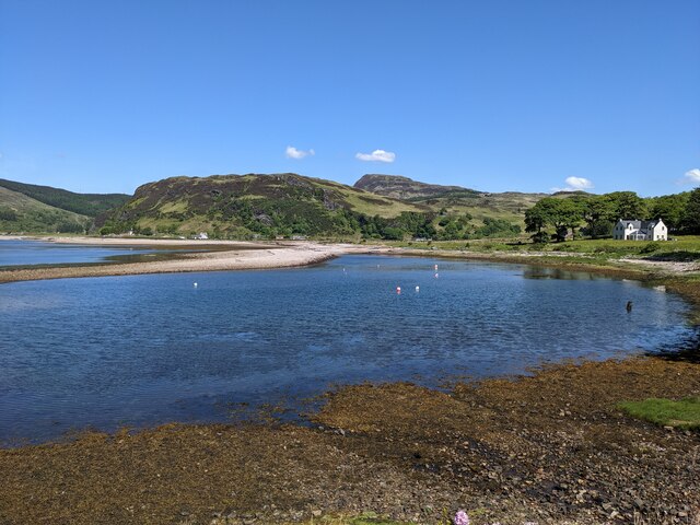
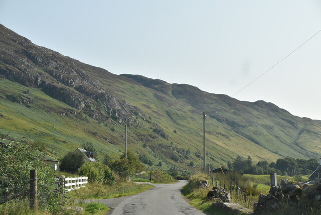
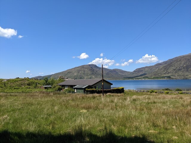
Glen More is a picturesque valley located in Inverness-shire, a historic county in the Scottish Highlands. Situated about 15 miles southwest of Inverness, Glen More is known for its breathtaking natural beauty and diverse landscapes.

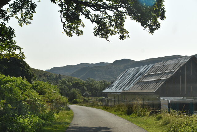
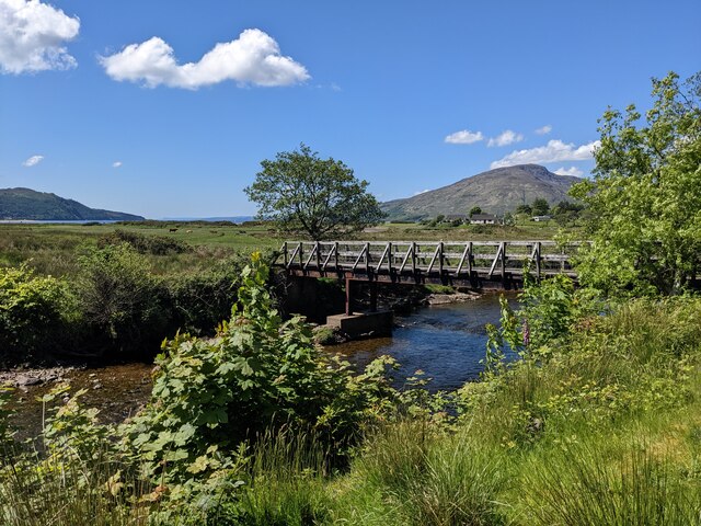
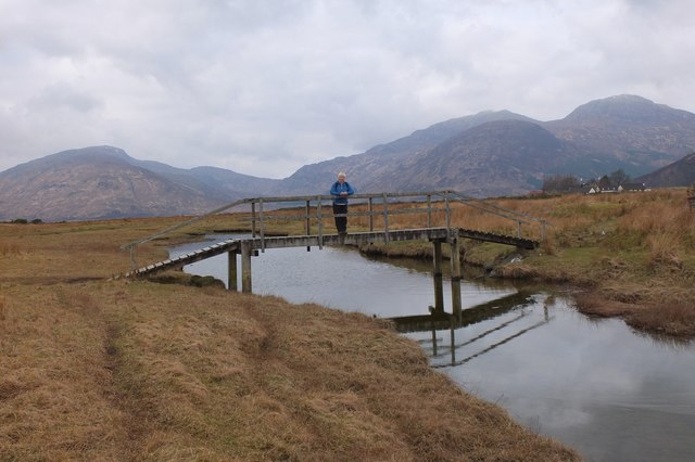
The glen stretches for approximately 10 miles, encompassing rolling hills, dense forests, and meandering rivers. It is surrounded by towering mountains, including the famous Cairngorms, and offers stunning views of rugged peaks and serene lochs. The area is a paradise for nature enthusiasts and outdoor adventurers, providing numerous opportunities for hiking, mountain biking, fishing, and wildlife spotting.

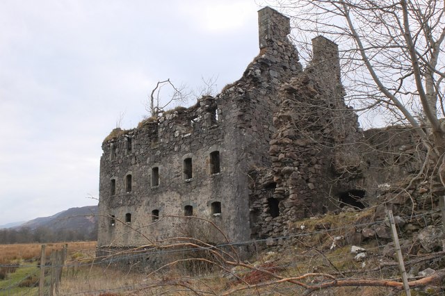
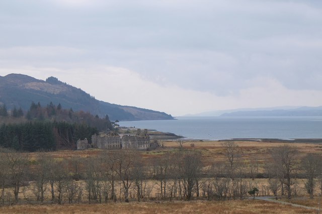
Glen More is also steeped in history and boasts a rich cultural heritage. The region is dotted with ancient ruins, including several well-preserved castles that date back to the medieval period. The nearby Culloden Battlefield, where the historic Battle of Culloden took place in 1746, is a significant historical site.

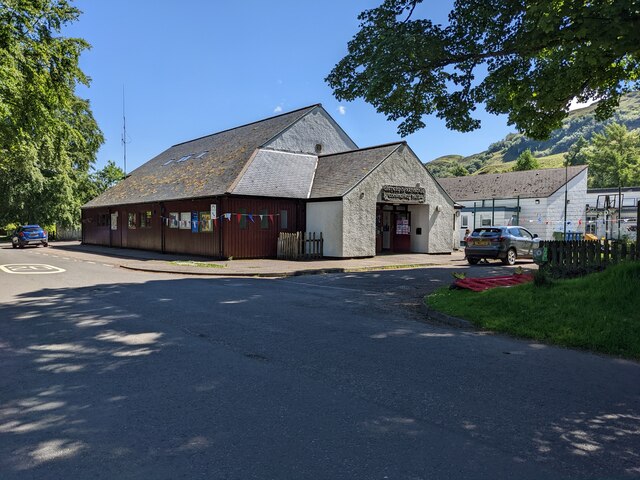
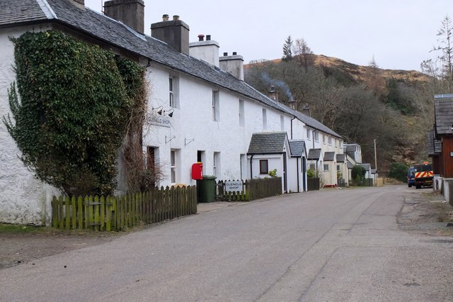
Despite its natural beauty and historical significance, Glen More remains relatively untouched by mass tourism, preserving its tranquility and authenticity. The local community is small but friendly, and visitors can expect a warm welcome from the locals. There are a few quaint villages and hamlets scattered throughout the glen, offering charming accommodations, traditional pubs, and local shops.

In summary, Glen More is a hidden gem in Inverness-shire, offering visitors a chance to immerse themselves in Scotland's stunning natural landscapes and rich cultural heritage. Whether seeking outdoor adventures or a peaceful retreat, Glen More is a destination that promises an unforgettable experience.

If you have any feedback on the listing, please let us know in the comments section below.
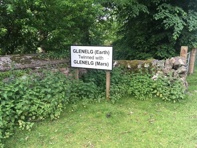
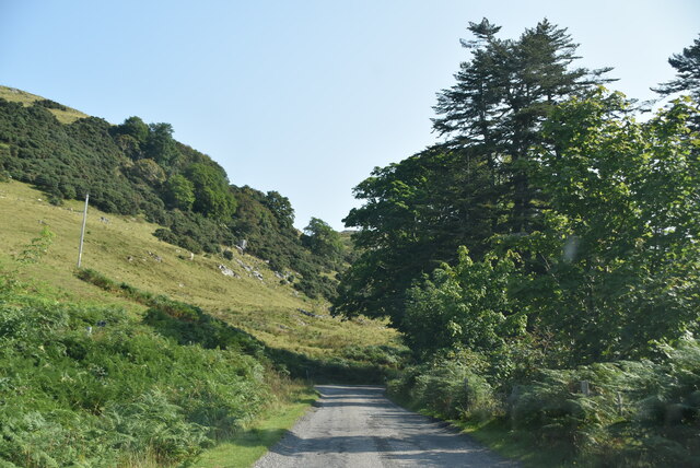
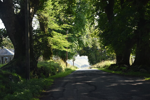
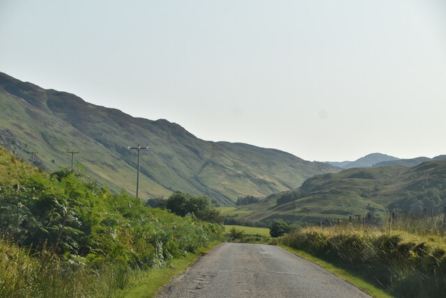
Glen More Images

Images are sourced within 2km of 57.216929/-5.5992775 or Grid Reference NG8219. Thanks to Geograph Open Source API. All images are credited.

Sign showing Glenelg is twinned with Glenelg
Old military road
Old military road
Shaded old military road
Old military road
Old military road
Tidal pool at Glenelg
The village hall at Glenelg
Approaching the junction
Road at Galltair
Road at Galltair
Old military road, Beolary
A house at Beach-haven
Footbridge over the Glenmore River
Glenelg Village Hall - twinned with Glenelg, Mars A village hall with a difference: the plaque by the side of the open door records an unveiling ceremony on 20th October 2012 to celebrate the 'twinning' of Glenelg with an area on Mars given the same name. The geology of the Martian site investigated by the NASA Curiosity Rover resembled that of Glenelg in Yellowknife, Canada - see <span class="nowrap"><a title="https://en.wikipedia.org/wiki/Glenelg,_Mars" rel="nofollow ugc noopener" href="https://en.wikipedia.org/wiki/Glenelg,_Mars">Link</a><img style="margin-left:2px;" alt="External link" title="External link - shift click to open in new window" src="https://s1.geograph.org.uk/img/external.png" width="10" height="10"/></span> .

The plaque was unveiled by Dr Bonnie J Dunbar, former astronaut and Space Shuttle commander, along with Professor John C Brown, 10th Astronomer Royal for Scotland, and Doug McCuistion, Director of NASA's Mars Exploration Programme.
Glenelg Village Hall - twinned with Glenelg, Mars
A village hall with a difference: the plaque by the side of the open door records an unveiling ceremony on 20th October 2012 to celebrate the 'twinning' of Glenelg with an area on Mars given the same name. The geology of the Martian site investigated by the NASA Curiosity Rover resembled that of Glenelg in Yellowknife, Canada - see LinkExternal link . The plaque was unveiled by Dr Bonnie J Dunbar, former astronaut and Space Shuttle commander, along with Professor John C Brown, 10th Astronomer Royal for Scotland, and Doug McCuistion, Director of NASA's Mars Exploration Programme.
Bernera Barracks, Glenelg The remains of the 18th century barracks built to house government troops, seen from the NW.
Bernera Barracks, Glenelg
The remains of the 18th century barracks built to house government troops, seen from the NW.
Footbridge, Glenelg On the path crossing the marshy area at Bernera. Some Skye hills are in the background: L to R, Ben Aslak, Sgurr na Coinnich and Beinn na Caillich.
Footbridge, Glenelg
On the path crossing the marshy area at Bernera. Some Skye hills are in the background: L to R, Ben Aslak, Sgurr na Coinnich and Beinn na Caillich.
Bernera Barracks, Glenelg Seen from near Upper Galtair to the NE.
Bernera Barracks, Glenelg
Seen from near Upper Galtair to the NE.
Glenelg village Note the village shop on the left.
Glenelg village
Note the village shop on the left.
Glenelg twinned with Mars An eye-catching sign on the road approaching Glenelg. The Mars Curiosity rover has explored an area in which features have been given names related to a geologically similar area in Yellowknife, Canada. Glenelg in Canada took its name from here, and the village was officially twinned with Mars in October 2012 - see the village hall shown in <a href="https://www.geograph.org.uk/photo/4877426">NG8119 : Glenelg Village Hall - twinned with Glenelg, Mars</a>. 

More details can be found at the Wikipedia page <span class="nowrap"><a title="https://en.wikipedia.org/wiki/Glenelg,_Mars" rel="nofollow ugc noopener" href="https://en.wikipedia.org/wiki/Glenelg,_Mars">Link</a><img style="margin-left:2px;" alt="External link" title="External link - shift click to open in new window" src="https://s1.geograph.org.uk/img/external.png" width="10" height="10"/></span>.
Glenelg twinned with Mars
An eye-catching sign on the road approaching Glenelg. The Mars Curiosity rover has explored an area in which features have been given names related to a geologically similar area in Yellowknife, Canada. Glenelg in Canada took its name from here, and the village was officially twinned with Mars in October 2012 - see the village hall shown in NG8119 : Glenelg Village Hall - twinned with Glenelg, Mars. More details can be found at the Wikipedia page LinkExternal link.
Old Milestone east of cemetery, Glenelg parish Highland granite by the UC road, in parish of Glenelg (District), East of cemetery, on verge in grass near metal gate.

Inscription once read:-
: (KYLERHEA FERRY 2½) : : (SHIEL HOTEL / 8½) :   
  
Surveyed

Milestone Society National ID: HI_SBKR08
Old Milestone east of cemetery, Glenelg parish
Highland granite by the UC road, in parish of Glenelg (District), East of cemetery, on verge in grass near metal gate. Inscription once read:- : (KYLERHEA FERRY 2½) : : (SHIEL HOTEL / 8½) : Surveyed Milestone Society National ID: HI_SBKR08
Show me another place!

Glen More is located at Grid Ref: NG8219 (Lat: 57.216929, Lng: -5.5992775)

Unitary Authority: Highland

Police Authority: Highlands and Islands

What 3 Words

///exacted.doctors.fortnight. Near Glenelg, Highland

Related Wikis

Bernera Barracks

Bernera Barracks is in Glenelg in the West Highlands of Scotland. The barracks were constructed between 1717 and 1723 as part of a campaign by the British...

Glenelg Inn

Glenelg Inn is a public house and inn in the village of Glenelg in the Highlands of Scotland. The current building dates to the second half of the 20th...
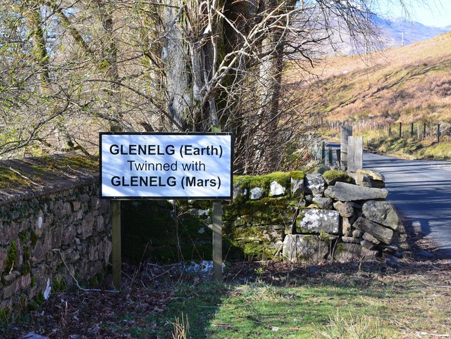
Glenelg, Highland

Glenelg (Scottish Gaelic: Glinn Eilg, also Gleann Eilg) is a scattered community area and civil parish in the Lochalsh area of Highland in western Scotland...

Glenelg Church

Glenelg Church is a Category B listed building in Glenelg, Highland, Scotland. Of Church of Scotland denomination, the church dates to the 18th century...
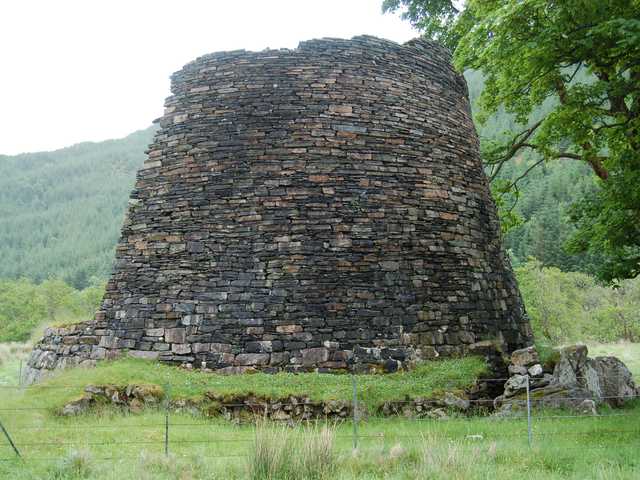
Dun Telve

Dun Telve (Scottish Gaelic: Dùn Teilbh) is an iron-age broch located about four kilometres (2.5 mi) southeast of the village of Glenelg, Inverness-shire...

Dun Troddan

Dun Troddan (Scottish Gaelic: Dùn Trodan) is an iron-age broch located about 5 kilometres (3.1 mi) southeast of the village of Glenelg, Highland, in Scotland...

Kylerhea

Kylerhea (Scottish Gaelic: Caol Reatha) is a village on the east coast of the Isle of Skye, in the Scottish Highlands, overlooking Kyle Rhea, a strait...

Beinn a' Chapuill

Beinn a' Chapuill (759 m) is a mountain in the Northwest Highlands of Scotland. It is located in Ross and Cromarty, close to the community of Glenelg....

Nearby Amenities

Located within 500m of 57.216929,-5.5992775
Passing Place
Lat/Long: 57.2163327/-5.6013855
Passing Place
Lat/Long: 57.2176733/-5.5918209
Passing Place
Lat/Long: 57.2163568/-5.6030457
Passing Place
Lat/Long: 57.2169551/-5.5991474
Passing Place
Lat/Long: 57.2167091/-5.6056725
Power: pole
Lat/Long: 57.2171208/-5.6025226
Power: pole
Lat/Long: 57.2170458/-5.6033823
Power: pole
Lat/Long: 57.2171005/-5.6046109
Power: pole
Lat/Long: 57.217189/-5.6053609
Power: pole
Lat/Long: 57.2172413/-5.6058356
Power: pole
Lat/Long: 57.2177648/-5.6059894
Power: pole
Lat/Long: 57.2171097/-5.6012434
Power: pole
Lat/Long: 57.2171036/-5.6001047
Power: pole
Lat/Long: 57.2172952/-5.5992225
Power: pole
Lat/Long: 57.2176583/-5.5976362
Power: pole
Lat/Long: 57.2177526/-5.596932
Power: pole
Lat/Long: 57.2178408/-5.5961435
Power: pole
Lat/Long: 57.2179574/-5.5951639
Power: pole
Lat/Long: 57.2179524/-5.5923639
Power: pole
Lat/Long: 57.2180071/-5.5933116
Power: pole
Lat/Long: 57.2180548/-5.5944054
The data included in this document is from www.openstreetmap.org. The data is made available under ODbL.

Have you been to Glen More?

Leave your review of Glen More below (or comments, questions and feedback).