Gannochy

Settlement in Angus

Scotland

Gannochy

Falls on the North Esk river At this point the North Esk plunges down a series of small falls, the river being confined between rocks of the Gannochy Conglomerate Formation of the Devonian period. This would indicate that the Highland Boundary fault has not yet been reached as one follows the river upstream, as here we are still on sedimentary rocks rather than metamorphic. Standing here I was lucky enough to see a salmon trying to leap the falls, but wasn't quick enough with the camera.
Falls on the North Esk river Credit: Gordon Hatton

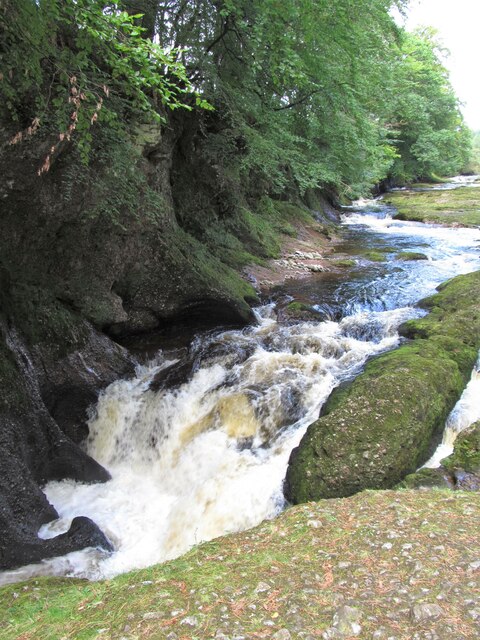
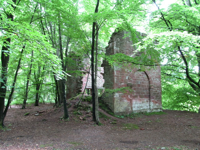
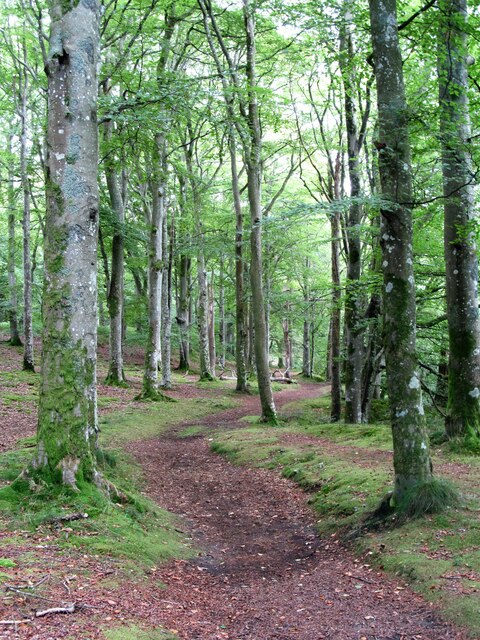
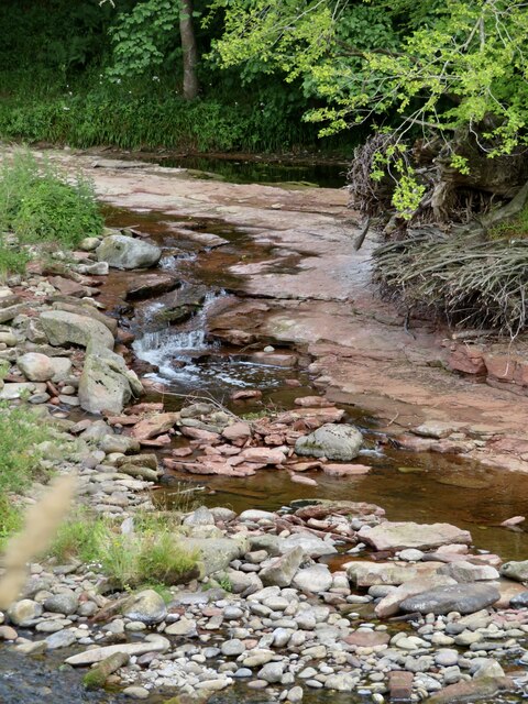
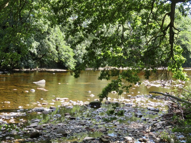
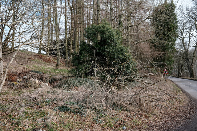
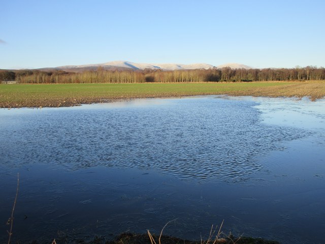
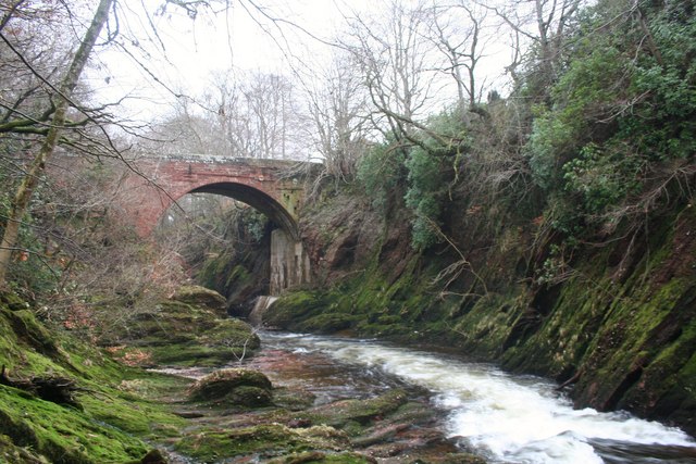
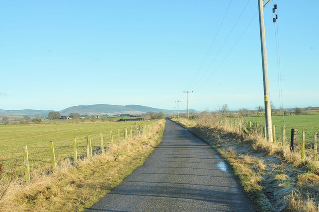
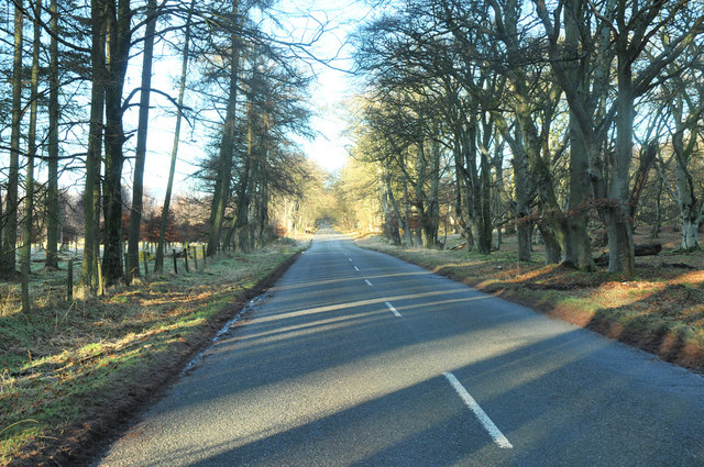
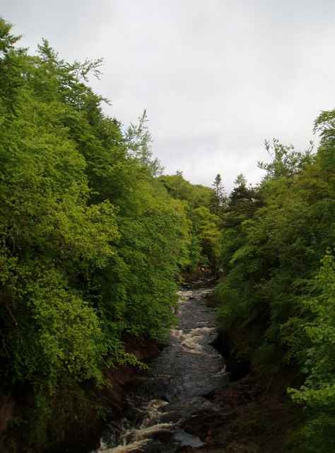
Gannochy is a small village located in the county of Angus, Scotland. It lies approximately 5 miles southwest of the town of Brechin and is nestled within a picturesque rural setting. The village is situated on the banks of the River South Esk and is surrounded by rolling hills and farmland, offering stunning views of the Angus countryside.

Historically, Gannochy was an agricultural community, with farming being the primary occupation of its residents. However, in recent years, the village has seen an increase in residential development and has become a popular destination for those seeking a quiet and peaceful lifestyle in a rural setting.

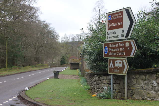
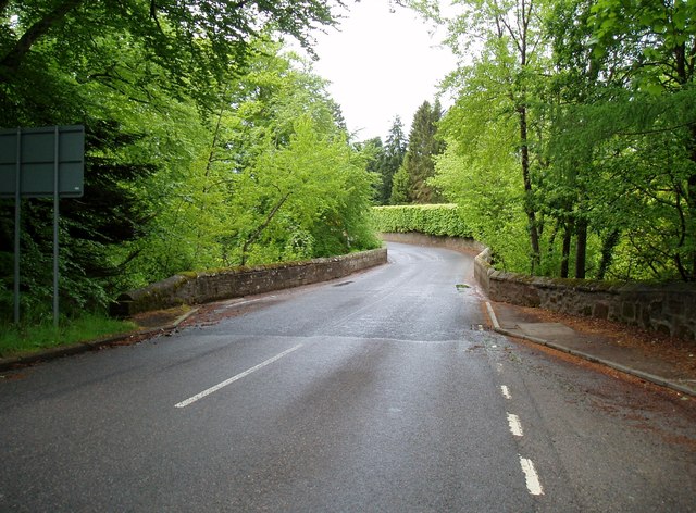
Gannochy is a close-knit community, with a small number of houses, a local pub, and a village hall serving as the focal point for social activities. The village is well-connected to the surrounding areas, with good road links to Brechin and the nearby towns of Montrose and Forfar.

Nature enthusiasts will find plenty to explore in the area surrounding Gannochy. The nearby River South Esk offers excellent opportunities for fishing, while the surrounding hills and countryside provide ample space for walking, hiking, and wildlife spotting.

Overall, Gannochy is a charming village that offers a tranquil and idyllic lifestyle for its residents, with its stunning natural surroundings and close-knit community spirit.

If you have any feedback on the listing, please let us know in the comments section below.

Gannochy Images

Images are sourced within 2km of 56.825646/-2.6576091 or Grid Reference NO5970. Thanks to Geograph Open Source API. All images are credited.

Falls on the North Esk river At this point the North Esk plunges down a series of small falls, the river being confined between rocks of the Gannochy Conglomerate Formation of the Devonian period. This would indicate that the Highland Boundary fault has not yet been reached as one follows the river upstream, as here we are still on sedimentary rocks rather than metamorphic. Standing here I was lucky enough to see a salmon trying to leap the falls, but wasn't quick enough with the camera.
Falls on the North Esk river
At this point the North Esk plunges down a series of small falls, the river being confined between rocks of the Gannochy Conglomerate Formation of the Devonian period. This would indicate that the Highland Boundary fault has not yet been reached as one follows the river upstream, as here we are still on sedimentary rocks rather than metamorphic. Standing here I was lucky enough to see a salmon trying to leap the falls, but wasn't quick enough with the camera.
Remains of old footbridge over the North Esk Not much remains of this old bridge apart from some rather rusty old framework, the decking having disappeared long ago. I'm sure in decades past I must have crossed Highland bridges in a similar state to this! The sandstone central pier stands on a local conglomerate rock of the Devonian period.
Remains of old footbridge over the North Esk
Not much remains of this old bridge apart from some rather rusty old framework, the decking having disappeared long ago. I'm sure in decades past I must have crossed Highland bridges in a similar state to this! The sandstone central pier stands on a local conglomerate rock of the Devonian period.
Lake at Glenesk Caravan Site
Arnhall Quarry Extensive area of shallow quarrying near Gannochy. Extracting sands and gravels from glacial deposits at the end of Glen Esk.
Arnhall Quarry
Extensive area of shallow quarrying near Gannochy. Extracting sands and gravels from glacial deposits at the end of Glen Esk.
Gannochy Tower An 18th century folly in woodland above the River North Esk. Grade 'C' listed. Not sure if it was built as a romantic ruin, or whether it fell apart.
Gannochy Tower
An 18th century folly in woodland above the River North Esk. Grade 'C' listed. Not sure if it was built as a romantic ruin, or whether it fell apart.
Woodland path near Gannochy Bridge This path follows the left bank of the River North Esk and begins as a very pleasant woodland route. Further on towards Edzell the path is narrow and close by a fence before dropping suddenly and very steeply down a 15m bank to the waterside. Don't say I didn't warn you. The path on the right bank of the river is excellent all the way.
Woodland path near Gannochy Bridge
This path follows the left bank of the River North Esk and begins as a very pleasant woodland route. Further on towards Edzell the path is narrow and close by a fence before dropping suddenly and very steeply down a 15m bank to the waterside. Don't say I didn't warn you. The path on the right bank of the river is excellent all the way.
River Esk Beautiful river walk, such a devastation of fallen trees with some magnificent tree specimens felled by ferocious winds.
River Esk
Beautiful river walk, such a devastation of fallen trees with some magnificent tree specimens felled by ferocious winds.
River Esk Reminiscing of lazy days of picnics, happy times with children splashing in the cool shaded pools while parents relax in the sunshine.
River Esk
Reminiscing of lazy days of picnics, happy times with children splashing in the cool shaded pools while parents relax in the sunshine.
Old ruins by the road Difficult to see but there are a few old buildings at this layby
Old ruins by the road
Difficult to see but there are a few old buildings at this layby
Gannochy Tower Remains of a folly tower, built in the later 18th century. It is now a shell, has tall storeys with a high keyblocked arch at the east and a blind arch at the west, and is constructed from courses with slate cherry cocking.
<span class="nowrap"><a title="https://online.aberdeenshire.gov.uk/smrpub/master/detail.aspx?Authority=ASH&refno=NO67SW0116" rel="nofollow ugc noopener" href="https://online.aberdeenshire.gov.uk/smrpub/master/detail.aspx?Authority=ASH&refno=NO67SW0116">Link</a><img style="margin-left:2px;" alt="External link" title="External link - shift click to open in new window" src="https://s1.geograph.org.uk/img/external.png" width="10" height="10"/></span>
Gannochy Tower
Remains of a folly tower, built in the later 18th century. It is now a shell, has tall storeys with a high keyblocked arch at the east and a blind arch at the west, and is constructed from courses with slate cherry cocking. LinkExternal link
Flooded field near Bogside Partly flooded field next to the roadside near Bogside.
Flooded field near Bogside
Partly flooded field next to the roadside near Bogside.
Victorian fountain, Edzell The fountain stands at the SE corner of the open parkland at the north end of the village.
Victorian fountain, Edzell
The fountain stands at the SE corner of the open parkland at the north end of the village.
Gannochy Bridge Ganochy Bridge from the bed of the North Esk.
Gannochy Bridge
Ganochy Bridge from the bed of the North Esk.
Glen Esk road junction near Edzell
Minor road near Arnhall
Road past Saltire Wood
The North Esk at Gannochy
Gannochy Bridge On the border of Aberdeenshire (at this point previously Kincardineshire) and Angus.
Gannochy Bridge
On the border of Aberdeenshire (at this point previously Kincardineshire) and Angus.
Show me another place!

Gannochy is located at Grid Ref: NO5970 (Lat: 56.825646, Lng: -2.6576091)

Unitary Authority: Angus

Police Authority: Tayside

What 3 Words

///stopwatch.brushing.testing. Near Brechin, Angus

Nearby Locations

Gannochy

Related Wikis

Edzell

Edzell (; Scots: Aigle; Scottish Gaelic: Eigill) is a village in Angus, Scotland. It is 5 miles (8 km) north of Brechin, by the River North Esk. Edzell...

Inglis Memorial Hall

The Inglis Memorial Hall is a municipal structure in the High Street in Edzell, Angus, Scotland, which for much of the 20th century served as Edzell Parish...

Edzell railway station

Edzell railway station served the village of Edzell, Angus, Scotland from 1896 to 1964 on the Brechin and Edzell District Railway. == History == The station...
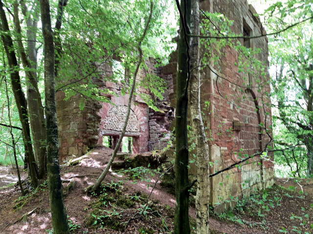
Edzell Castle

Edzell Castle is a ruined 16th-century castle, with an early-17th-century walled garden. It is located close to Edzell, and is around 5 miles (8 km) north...

Edzell Woods

Edzell Woods is a village in the Kincardine and Mearns area of Aberdeenshire, Scotland. It is 4 miles (6.4 km) from Edzell by road, but only one mile...

RAF Edzell

Royal Air Force Edzell or more simply RAF Edzell is a former Royal Air Force satellite station located in Aberdeenshire, one mile east of Edzell in Angus...

Stracathro railway station

Stracathro railway station served the sparsely populated rural area around the villages of Stracathro and Inchbare as well as Dunlappie and other estates...

Fettercairn distillery

Fettercairn distillery is a whisky distillery in Fettercairn. Situated under the Grampian foothills in the Howe of Mearns, Fettercairn town’s name is...

Nearby Amenities

Located within 500m of 56.825646,-2.6576091
Parking
Lat/Long: 56.8283023/-2.6560693
Post Box
Collection Times: Mo-Sa 13:00
Operator: Royal Mail
Post Box Type: wall
Ref: DD9 53
Royal Cypher: EVIIR
Royal Cypher Wikidata: Q33102324
Lat/Long: 56.8255767/-2.657664
Cave Pool
Lat/Long: 56.8284187/-2.6575257
Bench
Backrest: yes
Material: wood
Lat/Long: 56.8291075/-2.6573946
Big Gannochy
Lat/Long: 56.8252792/-2.6536408
Gannochy
Place: hamlet
Lat/Long: 56.8271006/-2.6578976
Power: pole
Lat/Long: 56.8262749/-2.6648034
Power: pole
Lat/Long: 56.8265923/-2.6636731
Power: pole
Lat/Long: 56.8269186/-2.6625498
Power: pole
Lat/Long: 56.8272461/-2.6614425
Power: pole
Lat/Long: 56.8273053/-2.6613619
Power: pole
Lat/Long: 56.8276982/-2.6610304
Power: pole
Lat/Long: 56.8238879/-2.6579918
Power: pole
Lat/Long: 56.8246197/-2.6587215
Power: pole
Lat/Long: 56.8253579/-2.659495
Power: pole
Lat/Long: 56.8260784/-2.6602316
Power: pole
Lat/Long: 56.8266629/-2.6608163
The data included in this document is from www.openstreetmap.org. The data is made available under ODbL.

Have you been to Gannochy?

Leave your review of Gannochy below (or comments, questions and feedback).