Flush

Settlement in Yorkshire

England

Flush

Holme Street, Millbridge, Liversedge
Holme Street, Millbridge, Liversedge Credit: habiloid

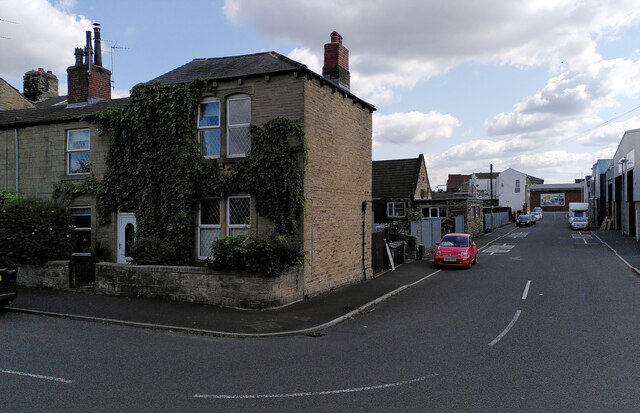
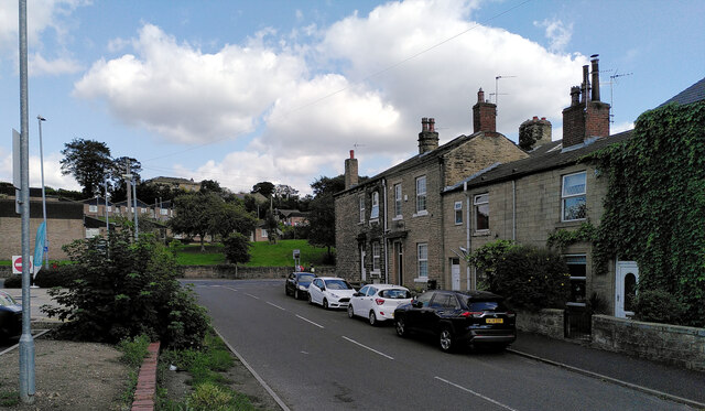
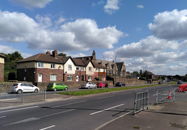
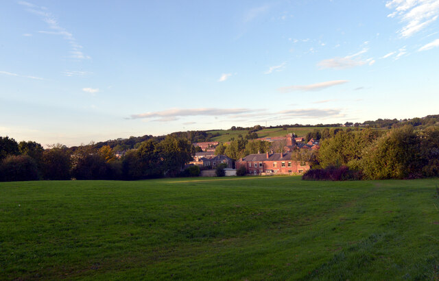
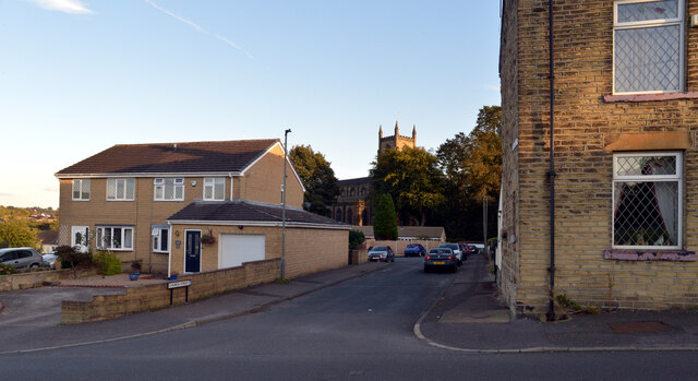
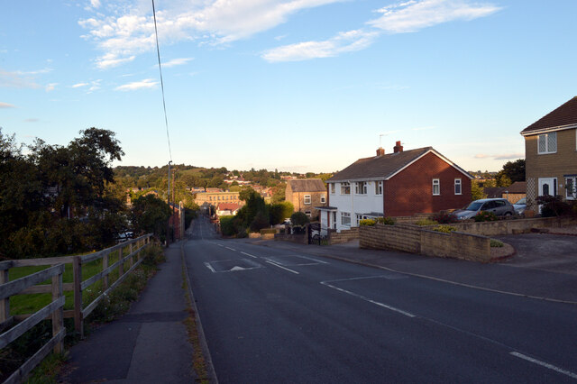
Flush is a small village located in the county of Yorkshire, England. Situated in the scenic countryside, Flush is surrounded by lush green fields and rolling hills, offering a serene and picturesque atmosphere. With a population of around 500 residents, Flush maintains a close-knit community that cherishes its rural charm.

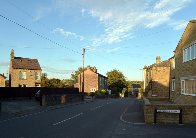
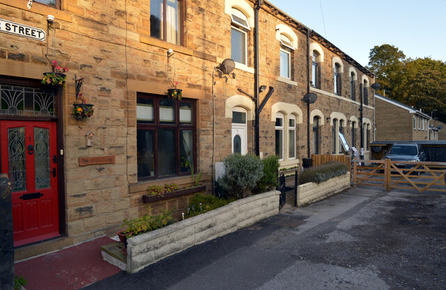
The village is known for its traditional stone-built houses, which add to its timeless appeal. The architecture reflects the region's rich history and showcases the enduring beauty of the area. Flush is also home to a quaint village church, St. Mary's, which dates back to the 12th century. This historic landmark serves as a gathering place for religious services and community events.

Nature lovers will appreciate the abundance of outdoor activities in Flush. The nearby Yorkshire Dales National Park offers stunning landscapes, including rugged moorlands, picturesque valleys, and cascading waterfalls. Visitors can explore the park through numerous walking trails, cycling routes, and even horseback riding.

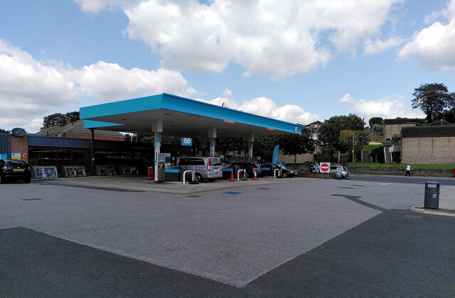
While Flush is a quiet village, it boasts a few amenities for its residents and visitors. A local pub, The Green Man, provides a cozy place to enjoy a drink or a meal, offering a warm and friendly atmosphere. The village also has a small convenience store, providing essential goods for daily needs.

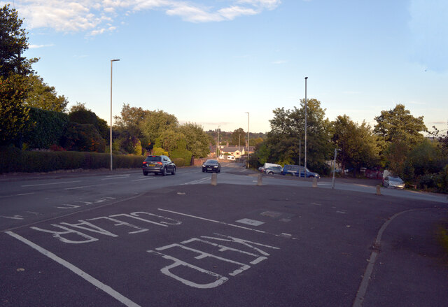
Flush is easily accessible by road, with good connections to nearby towns and cities. Its tranquil setting and charming character make it an ideal destination for those seeking a peaceful retreat or a glimpse into the idyllic countryside of Yorkshire.

If you have any feedback on the listing, please let us know in the comments section below.
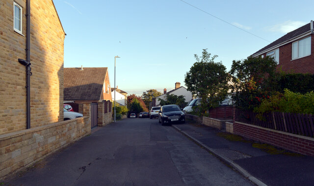
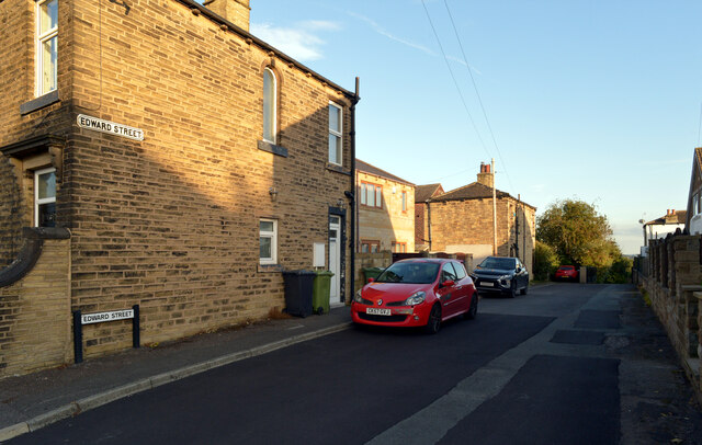
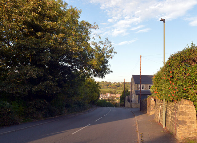
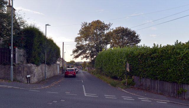
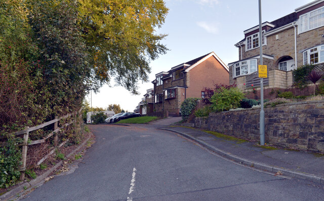
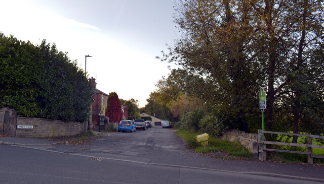
Flush Images

Images are sourced within 2km of 53.707782/-1.6816453 or Grid Reference SE2123. Thanks to Geograph Open Source API. All images are credited.

Holme Street, Millbridge, Liversedge
Co-Op petrol station and convenience store, Millbridge, Liversedge
Spen Valley Leisure Centre nearing completion, Bradford Road (A638), Liversedge
Bradford Road (A638), Littletown, Liversedge Littletown Junior and Infant School is behind the terrace of houses.
Bradford Road (A638), Littletown, Liversedge
Littletown Junior and Infant School is behind the terrace of houses.
Junction of Halifax Road (A649) and Headlands Road, Liversedge The A649 runs 8.7km between Hipperholme and Heckmondwike in West Yorkshire.
Junction of Halifax Road (A649) and Headlands Road, Liversedge
The A649 runs 8.7km between Hipperholme and Heckmondwike in West Yorkshire.
Luddite Memorial, Sparrow Park, Liversedge
Knowler Hill, Liversedge
Alexandra Street, Liversedge
Edward Street, Liversedge
Knowler Hill, Liversedge
Fair View, Liversedge
Kirklands, Liversedge
Rock Edge, Liversedge
Vicar Street, Liversedge
A view from Knowler Hill, Liversedge
Church Street, Liversedge
Knowler Hill, Liversedge
Show me another place!

Flush is located at Grid Ref: SE2123 (Lat: 53.707782, Lng: -1.6816453)

Division: West Riding

Unitary Authority: Kirklees

Police Authority: West Yorkshire

What 3 Words

///ditched.waltzed.awakes. Near Heckmondwike, West Yorkshire

Nearby Locations

Flush

Related Wikis

Heckmondwike bus station

Heckmondwike bus station (also known as Heckmondwike Hub) is a bus station in Heckmondwike, England. == History == Plans to build a bus station in Heckmondwike...

Healds Hall

Healds Hall is a house in Liversedge, Yorkshire, now a hotel. It is listed at Grade II on the English Heritage Register. It was built in 1764 and was...

Liversedge

Liversedge is a town and former parish of Birstall, in the Metropolitan Borough of Kirklees, West Yorkshire, England. Historically part of the West Riding...

Heckmondwike Spen railway station

Heckmondwike Spen was a railway station opened by the London & North Western Railway (LNWR) in Heckmondwike, West Yorkshire, England. The station was one...

Nearby Amenities

Located within 500m of 53.707782,-1.6816453
Traffic Signals
Lat/Long: 53.7102727/-1.686398
Traffic Signals
Lat/Long: 53.7071316/-1.6743833
Heckmondwike
Place: town
Population: 11219
Lat/Long: 53.7074371/-1.6754499
Traffic Signals
Lat/Long: 53.7091543/-1.6874881
Heckmondwike Central
End Date: 1965
Historic Railway: station
Railway: site
Start Date: 1888
Wikidata: Q106311106
Wikipedia: en:Heckmondwike railway station
Lat/Long: 53.7045168/-1.6766428
Traffic Signals
Crossing: traffic_signals
Crossing Ref: puffin
Kerb: flush
Tactile Paving: yes
Lat/Long: 53.7079205/-1.6775238
Mini Roundabout
Direction: clockwise
Lat/Long: 53.7069998/-1.6783222
Barrier: bollard
Lat/Long: 53.7053913/-1.684156
Crossing
Crossing: uncontrolled
Crossing Ref: zebra
Lat/Long: 53.7096001/-1.6843599
Telephone
Booth: K6
Covered: booth
Listed Status: Grade II
Man Made: telephone_box
Old Phone: +44 1924 403825
Tourism: gallery
Lat/Long: 53.7073705/-1.6749451
Telephone
Booth: K6
Covered: booth
Listed Status: Grade II
Man Made: telephone_box
Mapillary: 3102025910024937
Old Phone: +44 1924 403458
Survey Date: 2021-04-11
Tourism: gallery
Lat/Long: 53.707377/-1.6749675
Post Box
Operator: Royal Mail
Post Box Type: lamp
Ref: WF16 155
Lat/Long: 53.708886/-1.6804785
Bus Stop
Flush / Rhodes Street
Kerb: raised
Local Ref: 45015018
Naptan AtcoCode: 450015018
Naptan Bearing: W
Naptan CommonName: Flush Rhodes Street
Naptan Crossing: Rhodes Street
Naptan Indicator: Stop 45015018
Naptan Landmark: Filling Station
Naptan PlusbusZoneRef: LEEDS
Naptan ShortCommonName: Rhodes Street
Naptan Street: Flush
Shelter: yes
Source: naptan_import; survey
Towards: Birkenshaw, Bradford, Cleckheaton, Halifax
Lat/Long: 53.7091901/-1.6832188
Bus Stop
Bradford Road / Huddersfield Road
Check Date Shelter: 2023-06-16
Local Ref: 45015014
Naptan AtcoCode: 450015014
Naptan Bearing: NW
Naptan CommonName: Bradford Road Huddersfield Road
Naptan Crossing: Huddersfield Road
Naptan Indicator: Stop 45015014
Naptan Landmark: The Swan PH
Naptan PlusbusZoneRef: LEEDS
Naptan ShortCommonName: Huddersfield Road
Naptan Street: Bradford Road
Naptan Verified: yes
Ref: 45015014
Shelter: yes
Source: naptan_import
Towards: Bradford, Cleckheaton
Wheelchair: yes
Lat/Long: 53.710603/-1.6872006
Bus Stop
Halifax Road / Liversedge
Local Ref: 45015029
Naptan AtcoCode: 450015029
Naptan Bearing: SE
Naptan CommonName: Halifax Road Bennett Street
Naptan Crossing: Bennett Street
Naptan Indicator: Stop 45015029
Naptan Notes: OSR taken place 121005
Naptan PlusbusZoneRef: LEEDS
Naptan ShortCommonName: Barker Street
Naptan Street: Halifax Road
Naptan Verified: yes
Ref: 45015029
Shelter: no
Source: naptan_import
Timetable: yes
Towards: Dewsbury
Lat/Long: 53.7095477/-1.6883392
Bus Stop
Halifax Road / Huddersfield Road
Local Ref: 45015030
Naptan AtcoCode: 450015030
Naptan Bearing: NW
Naptan CommonName: Halifax Road Huddersfield Road
Naptan Crossing: Huddersfield Road
Naptan Indicator: Stop 45015030
Naptan Landmark: Working Mens Club
Naptan PlusbusZoneRef: LEEDS
Naptan ShortCommonName: Huddersfield Road
Naptan Street: Halifax Road
Naptan Verified: yes
Ref: 45015030
Shelter: no
Source: naptan_import
Timetable: yes
Towards: Birkenshaw, Cleckheaton, Leeds
Lat/Long: 53.7093261/-1.6880415
BFC
Shop: car
Lat/Long: 53.7099664/-1.6855661
Bus Stop
Westgate, Boundary Street
Local Ref: 45015019
Naptan AtcoCode: 450015019
Naptan Bearing: E
Naptan CommonName: Westgate Boundary Street
Naptan Crossing: Boundary Street
Naptan Indicator: Stop 45015019
Naptan Landmark: Mill Complex
Naptan PlusbusZoneRef: LEEDS
Naptan ShortCommonName: Boundary Street
Naptan Street: Westgate
Naptan Verified: yes
Ref: 45015019
Shelter: no
Source: naptan_import
Towards: Alighting Only
Lat/Long: 53.7088568/-1.6803325
Fast Food
Pizza Hut Delivery
Brand: Pizza Hut Delivery
Brand Wikidata: Q107293079
Cuisine: pizza
Lat/Long: 53.7078363/-1.6777606
The Cotler Practice
Phone: +44 1924 409660
Shop: optician
Lat/Long: 53.7073608/-1.6747526
Bus Stop
Leeds Road Thornleigh Drive
Local Ref: 45011838
Naptan AtcoCode: 450011838
Naptan Bearing: NE
Naptan CommonName: Leeds Road Thornleigh Drive
Naptan Crossing: Thornleigh Drive
Naptan Indicator: Stop 45011838
Naptan Landmark: Lillibets PH & Restaurant
Naptan PlusbusZoneRef: LEEDS
Naptan ShortCommonName: Thornleigh Drive
Naptan Street: Leeds Road
Naptan Verified: no
Source: naptan_import
Lat/Long: 53.7119315/-1.6838393
Bus Stop
Leeds Road Frost Hill
Local Ref: 45011839
Naptan AtcoCode: 450011839
Naptan Bearing: SW
Naptan CommonName: Leeds Road Frost Hill
Naptan Crossing: Frost Hill
Naptan Indicator: Stop 45011839
Naptan PlusbusZoneRef: LEEDS
Naptan ShortCommonName: Frost Hill
Naptan Street: Leeds Road
Naptan Verified: no
Shelter: no
Source: naptan_import
Timetable: yes
Lat/Long: 53.7105613/-1.6857434
Bus Stop
Leeds Road Bradford Road
Local Ref: 45015015
Naptan AtcoCode: 450015015
Naptan Bearing: NE
Naptan CommonName: Leeds Road Bradford Road
Naptan Crossing: Bradford Road
Naptan Indicator: Stop 45015015
Naptan PlusbusZoneRef: LEEDS
Naptan ShortCommonName: Bradford Road
Naptan Street: Leeds Road
Naptan Verified: no
Shelter: no
Source: naptan_import
Timetable: yes
Lat/Long: 53.710723/-1.6857119
Bus Stop
Wakefield Road Leeds Road
Local Ref: 45015016
Naptan AtcoCode: 450015016
Naptan Bearing: SW
Naptan CommonName: Wakefield Road Leeds Road
Naptan Crossing: Leeds Road
Naptan Indicator: Stop 45015016
Naptan Notes: OSR taken place 190106
Naptan PlusbusZoneRef: LEEDS
Naptan ShortCommonName: Leeds Road
Naptan Street: Wakefield Road
Naptan Verified: no
Source: naptan_import
Lat/Long: 53.7093496/-1.6864039
Bus Stop
Flush / Vernon Road
Kerb: raised
Local Ref: 45015017
Naptan AtcoCode: 450015017
Naptan Bearing: SE
Naptan CommonName: Flush Vernon Road
Naptan Crossing: Vernon Road
Naptan Indicator: Stop 45015017
Naptan PlusbusZoneRef: LEEDS
Naptan ShortCommonName: Vernon Road
Naptan Street: Flush
Naptan Verified: yes
Shelter: no
Source: naptan_import
Timetable: yes
Towards: Birstall, Dewsbury, Dewsbury District Hospital, Huddersfield, Leeds, Mirfield
Wheelchair: yes
Lat/Long: 53.7094326/-1.6837823
Bus Stop
H9 Westgate
Local Ref: 45015020
Naptan AtcoCode: 450015020
Naptan Bearing: W
Naptan CommonName: H9 Westgate
Naptan Crossing: Greenside
Naptan Indicator: Stop 45015020
Naptan Landmark: Charwood PH
Naptan PlusbusZoneRef: LEEDS
Naptan ShortCommonName: Heckmondwike Gn H9
Naptan Street: Westgate
Naptan Verified: yes
Ref: 45015020
Shelter: yes
Source: naptan_import
Towards: Birstall, Birkenshaw, Cleckheaton, Leeds
Lat/Long: 53.7080489/-1.6782928
Bus Stop
H10 Westgate
Local Ref: 45015022
Naptan AtcoCode: 450015022
Naptan Bearing: NW
Naptan CommonName: H10 Westgate
Naptan Crossing: Omar Street
Naptan Indicator: Stop 45015022
Naptan Landmark: Algernon Pavilion Park
Naptan PlusbusZoneRef: LEEDS
Naptan ShortCommonName: Heckmondwike Grn 10
Naptan Street: Westgate
Naptan Verified: yes
Ref: 45015022
Shelter: yes
Source: naptan_import
Towards: Bradford, Cleckheaton, Odsal
Lat/Long: 53.7081857/-1.6788022
Bus Stop
H7 Regent Street
Local Ref: 45015643
Naptan AtcoCode: 450015643
Naptan Bearing: SW
Naptan CommonName: H7 Regent Street
Naptan Crossing: Westgate
Naptan Indicator: Stop 45015643
Naptan Landmark: Comrades Club
Naptan PlusbusZoneRef: LEEDS
Naptan ShortCommonName: Heckmondwike Grn H7
Naptan Street: Regent Street
Shelter: yes
Source: naptan_import
Lat/Long: 53.707148/-1.676467
Bus Stop
Union Street / Parker Street
Local Ref: 45015644
Naptan AtcoCode: 450015644
Naptan Bearing: W
Naptan CommonName: Union Street Parker Street
Naptan Crossing: Parker Street
Naptan Indicator: Stop 45015644
Naptan PlusbusZoneRef: LEEDS
Naptan ShortCommonName: Parker Street
Naptan Street: Union Street
Naptan Verified: no
Shelter: no
Source: naptan_import
Towards: Hartshead, Hudderfield
Lat/Long: 53.7059227/-1.6821119
Bus Stop
Union Street / Parker Street
Local Ref: 45015645
Naptan AtcoCode: 450015645
Naptan Bearing: E
Naptan CommonName: Union Street Parker Street
Naptan Crossing: Parker Street
Naptan Indicator: Stop 45015645
Naptan Notes: OSR taken place 061005
Naptan PlusbusZoneRef: LEEDS
Naptan ShortCommonName: Parker Street
Naptan Street: Union Street
Naptan Verified: no
Source: naptan_import
Lat/Long: 53.706004/-1.6822779
Bus Stop
Granville Street Heckmondwike
Local Ref: 45015646
Naptan AtcoCode: 450015646
Naptan Bearing: W
Naptan CommonName: Union Street Granville Street
Naptan Crossing: Granville Way
Naptan Indicator: Stop 45015646
Naptan PlusbusZoneRef: LEEDS
Naptan ShortCommonName: Granville Street
Naptan Street: Union Road
Oposite: yes
Shelter: no
Source: naptan_import
Lat/Long: 53.7061187/-1.6848676
Bus Stop
Bridge Street Centre Street
Naptan AtcoCode: 450028985
Naptan Bearing: NW
Naptan CommonName: Bridge Street Centre Street
Naptan Crossing: Centre Street
Naptan ShortCommonName: Centre Street
Naptan Street: Bridge Street
Naptan Verified: no
Source: naptan_import
Lat/Long: 53.71067/-1.67594
Granville Street
Local Ref: 45050326
Naptan AtcoCode: 450050326
Naptan Bearing: E
Naptan BusStopType: CUS
Naptan CommonName: Granville Street
Naptan Indicator: Stop 45050326
Naptan PlusbusZoneRef: LEEDS
Naptan ShortCommonName: Granville Street
Naptan Street: Union Road
Naptan Verified: no
Source: naptan_import
Lat/Long: 53.7062265/-1.6848365
Addr Housenumber: 10
Lat/Long: 53.7088422/-1.6881567
Addr Housenumber: 12
Lat/Long: 53.708779/-1.6883015
The New Charnwood
Lat/Long: 53.7083288/-1.6781978
Grit Bin
Lat/Long: 53.7103497/-1.6861647
Entrance: main
Lat/Long: 53.7073104/-1.6755194
Abandoned Amenity: bank
Old Name: Halifax
Lat/Long: 53.7075144/-1.6762712
Park View House
Brand: The Co-operative funeralcare
Operator: The co-operative
Phone: +44 1924 401143
Shop: funeral_directors
Lat/Long: 53.7082849/-1.6778797
Pharmacy
Rowlands Pharmacy
Dispensing: yes
Lat/Long: 53.7069487/-1.6786842
Post Box
Operator: Royal Mail
Post Box Type: pillar
Ref: WF16 156
Royal Cypher: VR
Royal Cypher Wikidata: Q33102356
Lat/Long: 53.7080824/-1.6774046
Post Box
Operator: Royal Mail
Post Box Type: pillar
Ref: WF16 153
Lat/Long: 53.7059265/-1.6823038
Entrance: yes
Lat/Long: 53.7062612/-1.6766687
Crossing
Crossing: uncontrolled
Crossing Ref: zebra
Lat/Long: 53.7063779/-1.6769257
Crossing
Crossing: uncontrolled
Crossing Ref: zebra
Lat/Long: 53.7064572/-1.6770859
Crossing
Crossing: uncontrolled
Crossing Ref: zebra
Lat/Long: 53.7065485/-1.6772703
Crossing
Crossing: uncontrolled
Crossing Ref: zebra
Lat/Long: 53.7066372/-1.6774493
Total Travel
Shop: travel_agency
Source: survey
Lat/Long: 53.7080916/-1.6759079
Maughans
Addr City: Heckmondwike
Addr Country: GB
Addr Housenumber: 1
Addr Postcode: WF16 0HE
Addr Street: Westgate
Fhrs Id: 1003597
Shop: bakery
Source Addr: FHRS Open Data
Lat/Long: 53.7074909/-1.6761562
Entrance: yes
Lat/Long: 53.7064564/-1.6764832
Traffic Signals
Check Date Tactile Paving: 2024-03-29
Crossing: traffic_signals
Crossing Ref: pelican
Kerb: flush
Tactile Paving: yes
Lat/Long: 53.7074853/-1.6760844
Traffic Signals
Crossing: traffic_signals
Crossing Ref: pelican
Kerb: flush
Tactile Paving: yes
Lat/Long: 53.7074977/-1.6758332
Entrance: main
Lat/Long: 53.7075048/-1.6761117
Traffic Signals
Crossing: traffic_signals
Crossing Ref: pelican
Kerb: flush
Tactile Paving: yes
Lat/Long: 53.7076116/-1.6763148
Traffic Signals
Check Date Tactile Paving: 2024-03-29
Crossing: traffic_signals
Crossing Ref: pelican
Kerb: flush
Tactile Paving: yes
Lat/Long: 53.7076507/-1.6759768
Barrier: bollard
Bollard: removable
Lat/Long: 53.7077279/-1.6762081
Waste Basket
Lat/Long: 53.7077412/-1.6762931
Bench
Backrest: yes
Lat/Long: 53.7077569/-1.6763138
Waste Basket
Lat/Long: 53.7077669/-1.676243
Bench
Backrest: yes
Lat/Long: 53.7077826/-1.6762638
Waste Basket
Lat/Long: 53.707919/-1.6758422
Post Box
Operator: Royal Mail
Post Box Design: type_k
Post Box Type: pillar
Ref: WF16 1
Lat/Long: 53.7078864/-1.6759122
Historic: memorial
Lat/Long: 53.7078777/-1.6765116
Barrier: bollard
Lat/Long: 53.7081607/-1.6754038
Barrier: bollard
Foot: yes
Lat/Long: 53.7070545/-1.6747889
Clock
Display: analog
Layer: 1
Support: tower
Visibility: street
Lat/Long: 53.7070594/-1.6745964
Fountain
Lat/Long: 53.7070609/-1.6745971
Social Club
Millbridge W.M.C
Alcohol: yes
Lat/Long: 53.7090405/-1.6880903
Barrier: bollard
Lat/Long: 53.7109233/-1.6767937
Barrier: bollard
Lat/Long: 53.7110647/-1.6766795
Noexit: yes
Lat/Long: 53.7106447/-1.6835927
Barrier: bollard
Lat/Long: 53.7095452/-1.6851677
Recycling
Recycling Glass: yes
Recycling Type: container
Lat/Long: 53.7057352/-1.6765574
Crossing
Crossing: uncontrolled
Crossing Ref: zebra
Lat/Long: 53.7065509/-1.676325
Atm
Lat/Long: 53.7064539/-1.6763581
Pharmacy
Brand: co-operative
Dispensing: yes
Lat/Long: 53.7064917/-1.6762328
Barrier: fence
Lat/Long: 53.7074857/-1.6756258
Pharmacy
Well Pharmacy
Brand: co-operative
Dispensing: yes
Healthcare: pharmacy
Lat/Long: 53.7081208/-1.6759909
Card Factory
Brand: Card Factory
Brand Wikidata: Q5038192
Shop: gift
Lat/Long: 53.708158/-1.6760634
Le Soleil
Leisure: tanning_salon
Lat/Long: 53.7065217/-1.6761897
Peacocks
Shop: clothes
Lat/Long: 53.7083754/-1.6762534
Fast Food
Pizza Rustica
Cuisine: pizza
Delivery: yes
Phone: +44 1924 401644
Lat/Long: 53.7078114/-1.6776932
Crossing
Crossing: traffic_signals
Crossing Ref: pelican
Lat/Long: 53.7078667/-1.6773299
Greenpark Carpets
Addr City: Heckmondwike
Addr Country: GB
Addr Housename: Northgate Centre
Addr Housenumber: 6B
Addr Postcode: WF16 9RL
Addr Street: Northgate
Shop: carpet
Lat/Long: 53.7082291/-1.6761744
Taxi
Oakwell & Rex Taxis
Taxi: office
Lat/Long: 53.7073499/-1.6780226
Give Way
Lat/Long: 53.7085471/-1.6767922
Bench
Backrest: yes
Lat/Long: 53.7077222/-1.6757846
Zanko
Shop: hairdresser
Lat/Long: 53.7072159/-1.6741802
Crossing
Crossing: traffic_signals
Crossing Ref: pelican
Kerb: flush
Tactile Paving: yes
Lat/Long: 53.7070593/-1.6742213
Crossing
Crossing: traffic_signals
Crossing Island: no
Crossing Ref: pelican
Kerb: flush
Tactile Paving: yes
Lat/Long: 53.7070816/-1.6743841
Crossing
Crossing: traffic_signals
Crossing Island: no
Crossing Ref: pelican
Kerb: flush
Tactile Paving: yes
Lat/Long: 53.707127/-1.674281
Bus Stop
Heckmondwike Hub H1
Bench: yes
Bin: yes
Ref: 45029321
Shelter: yes
Tactile Paving: no
Lat/Long: 53.7077356/-1.6754421
Bus Stop
Heckmondwike Hub H4
Bench: yes
Bin: yes
Ref: 45029323
Shelter: yes
Tactile Paving: no
Lat/Long: 53.7079406/-1.6758257
Bus Stop
Heckmondwike Hub H2
Bench: yes
Bin: yes
Ref: 45029322
Shelter: yes
Tactile Paving: no
Lat/Long: 53.7079154/-1.6752663
Bus Stop
Heckmondwike Hub H3
Bench: yes
Bin: yes
Ref: 45029324
Shelter: yes
Tactile Paving: no
Lat/Long: 53.7080329/-1.6755526
Flush
Place: village
Lat/Long: 53.708993/-1.6819085
Power: transformer
Lat/Long: 53.7112058/-1.6799292
Power: transformer
Lat/Long: 53.7114662/-1.6799051
Noexit: yes
Lat/Long: 53.7110646/-1.6801652
Noexit: yes
Lat/Long: 53.7118075/-1.6800767
Barrier: yes
Lat/Long: 53.7081852/-1.6830815
Ncn Milepost: mills
Sustrans Ref: MP1111
Lat/Long: 53.7116618/-1.6788279
Generator Method: photovoltaic
Generator Output Electricity: yes
Generator Source: solar
Generator Type: solar_photovoltaic_panel
Location: roof
Power: generator
Lat/Long: 53.7037243/-1.6820165
Generator Method: photovoltaic
Generator Output Electricity: yes
Generator Source: solar
Generator Type: solar_photovoltaic_panel
Location: roof
Power: generator
Lat/Long: 53.7035989/-1.6823572
Generator Method: photovoltaic
Generator Output Electricity: yes
Generator Source: solar
Generator Type: solar_photovoltaic_panel
Location: roof
Power: generator
Lat/Long: 53.7034941/-1.68262
Generator Method: photovoltaic
Generator Output Electricity: yes
Generator Source: solar
Generator Type: solar_photovoltaic_panel
Location: roof
Power: generator
Lat/Long: 53.7035115/-1.681582
Generator Method: photovoltaic
Generator Output Electricity: yes
Generator Source: solar
Generator Type: solar_photovoltaic_panel
Location: roof
Power: generator
Lat/Long: 53.7033988/-1.6814372
Generator Method: photovoltaic
Generator Output Electricity: yes
Generator Source: solar
Generator Type: solar_photovoltaic_panel
Location: roof
Power: generator
Lat/Long: 53.7045944/-1.6798252
Generator Method: photovoltaic
Generator Output Electricity: yes
Generator Source: solar
Generator Type: solar_photovoltaic_panel
Location: roof
Power: generator
Lat/Long: 53.7045849/-1.6799324
Traffic Signals
Crossing: traffic_signals
Crossing Ref: puffin
Kerb: flush
Tactile Paving: yes
Lat/Long: 53.7078996/-1.6760262
Bench
Backrest: yes
Lat/Long: 53.7074936/-1.6752884
Bench
Backrest: yes
Lat/Long: 53.7075055/-1.6753273
Traffic Signals
Crossing: traffic_signals
Crossing Ref: puffin
Kerb: flush
Tactile Paving: yes
Lat/Long: 53.7079181/-1.6761516
Information: map
Tourism: information
Lat/Long: 53.7076958/-1.6757116
Bicycle Parking
Bicycle Parking: stands
Capacity: 10
Covered: yes
Lat/Long: 53.7078141/-1.6758255
Place Of Worship
The Salvation Army - Heckmondwike
Addr City: Heckmondwike
Addr Country: GB
Addr Postcode: WF16 0EJ
Addr Street: Barracks Street
Denomination: salvation_army
Email: heckmondwike@salvationarmy.org.uk
Phone: 01924 408714
Religion: christian
Website: https://www.salvationarmy.org.uk/heckmondwike
Lat/Long: 53.708742/-1.6782072
The data included in this document is from www.openstreetmap.org. The data is made available under ODbL.

Have you been to Flush?

Leave your review of Flush below (or comments, questions and feedback).