Fawsley
Settlement in Northamptonshire
England
Fawsley
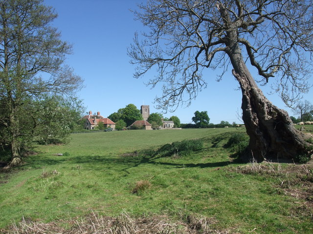
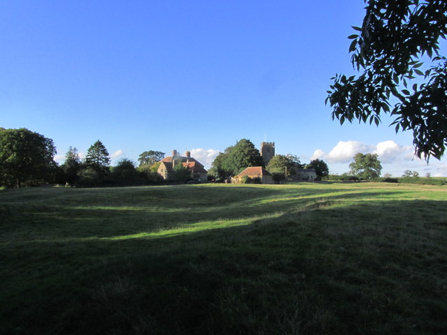
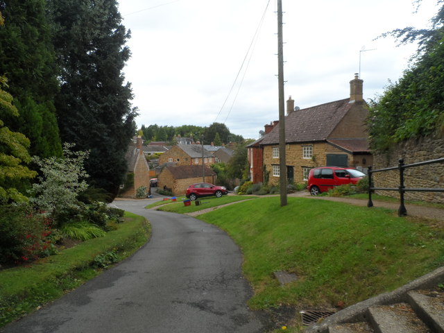
Fawsley is a small village located in the county of Northamptonshire, England. Situated approximately 12 miles northwest of the town of Northampton, Fawsley is known for its picturesque rural setting and historical significance.
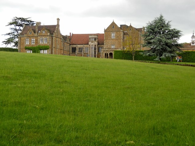
The village is primarily known for Fawsley Hall, a grand country house that dates back to the 16th century. The hall, now functioning as a luxury hotel, is surrounded by beautifully landscaped gardens and parkland. It has been a prominent residence for several notable families throughout its history, including the Knightley and the Knightley Baronet families.
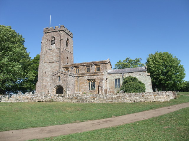
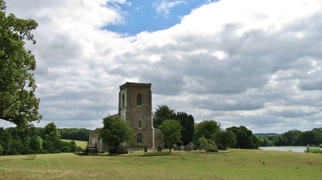
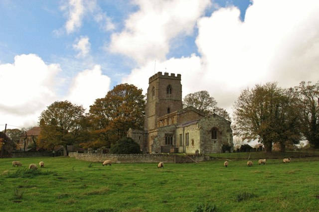
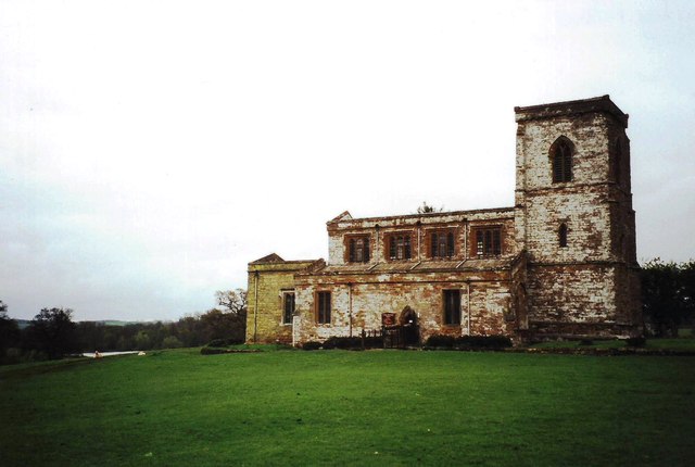
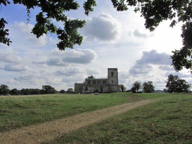
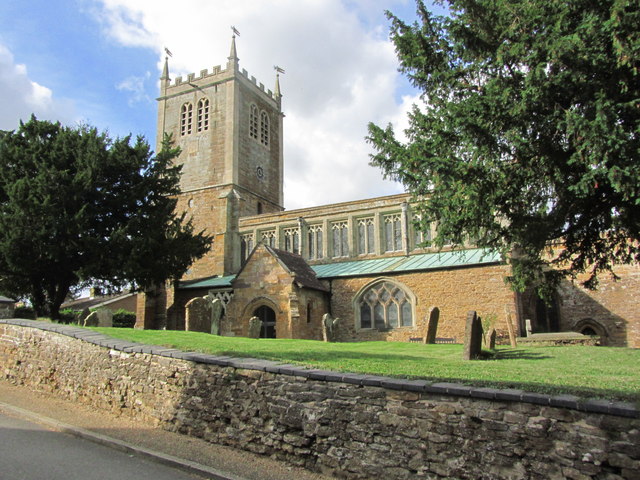
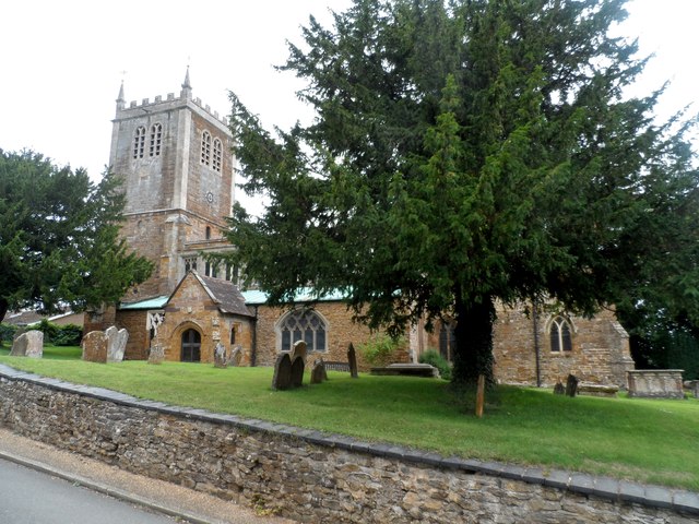
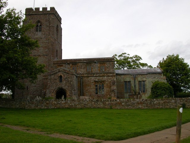
In addition to the hall, Fawsley boasts a charming village church, St. Mary the Virgin, which dates back to the 12th century. The church features stunning architectural details and houses a collection of medieval wall paintings.
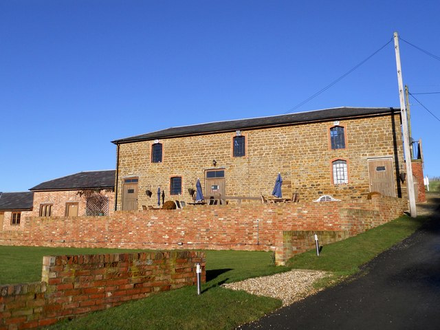
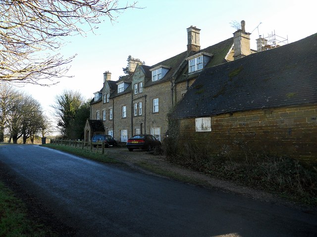
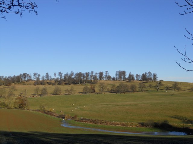
The village is also home to a number of traditional stone cottages and historic farmhouses, adding to its rustic charm. The surrounding countryside offers ample opportunities for outdoor activities such as walking, horse riding, and cycling.
Fawsley holds a significant place in English history, with connections to prominent figures such as Queen Elizabeth I and Sir Francis Drake. The village has managed to preserve its rich heritage while adapting to modern times, making it an attractive destination for history enthusiasts and nature lovers alike.
If you have any feedback on the listing, please let us know in the comments section below.
Fawsley Images
Images are sourced within 2km of 52.207954/-1.1857706 or Grid Reference SP5556. Thanks to Geograph Open Source API. All images are credited.

Fawsley is located at Grid Ref: SP5556 (Lat: 52.207954, Lng: -1.1857706)
Unitary Authority: West Northamptonshire
Police Authority: Northamptonshire
What 3 Words
///widen.straw.taxed. Near Hinton, Northamptonshire
Nearby Locations
Related Wikis

Fawsley
Fawsley is a hamlet and civil parish in West Northamptonshire, England. The population at the 2001 census was 32. At the 2011 census the population remained...

Church of St Mary the Virgin, Fawsley
The Church of St Mary the Virgin is a Church of England parish church in Fawsley, Northamptonshire, England. It serves the parish of Fawsley under the...
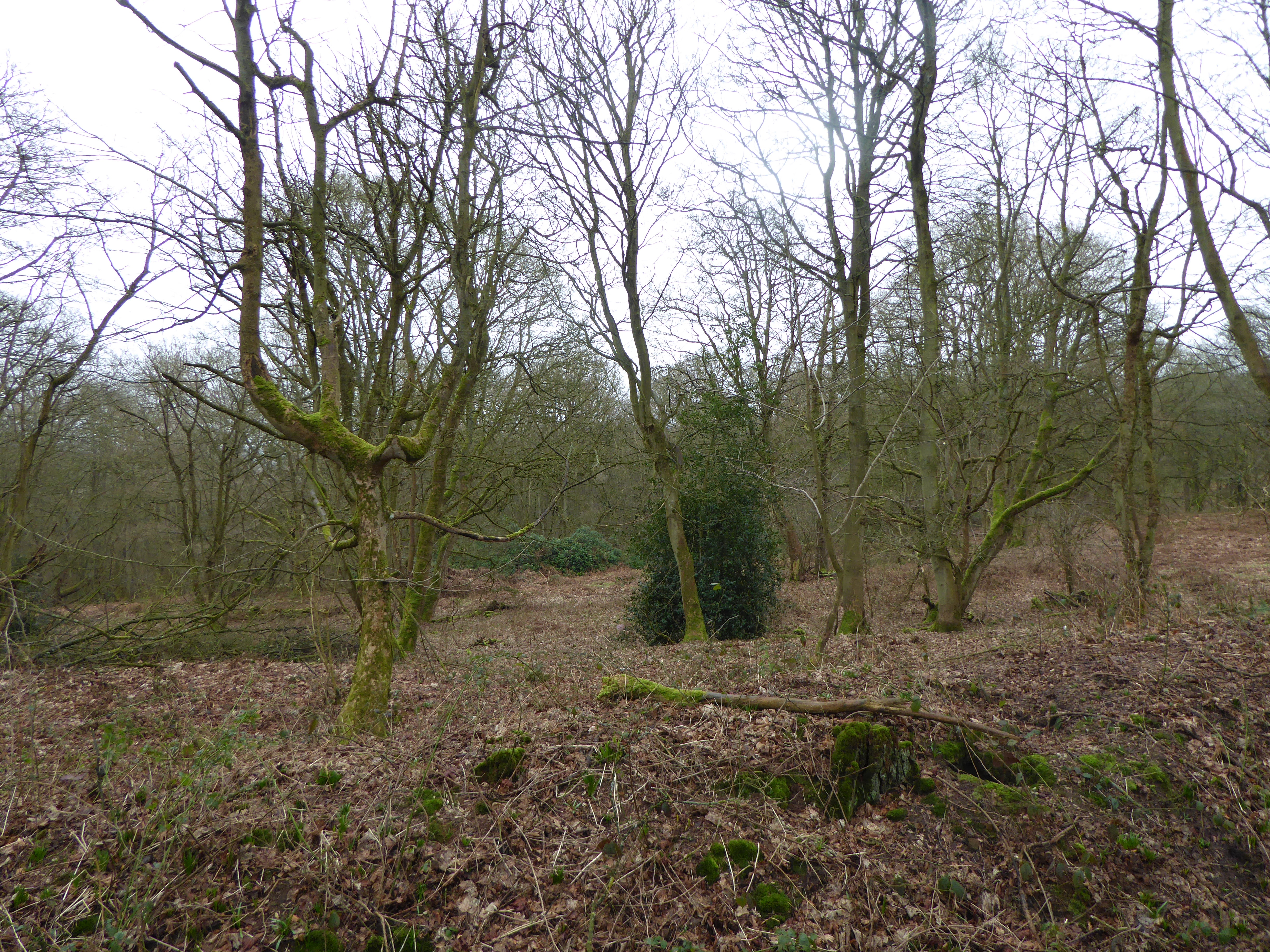
Badby Wood
Badby Wood is a 47.2-hectare (117-acre) biological Site of Special Scientific Interest (SSSI) south of Badby in Northamptonshire.This is ancient semi-natural...
Church Charwelton (lost settlement)
The lost village of Church Charwelton lies south-east of the village of Charwelton in the English county of Northamptonshire. Its site is on the north...
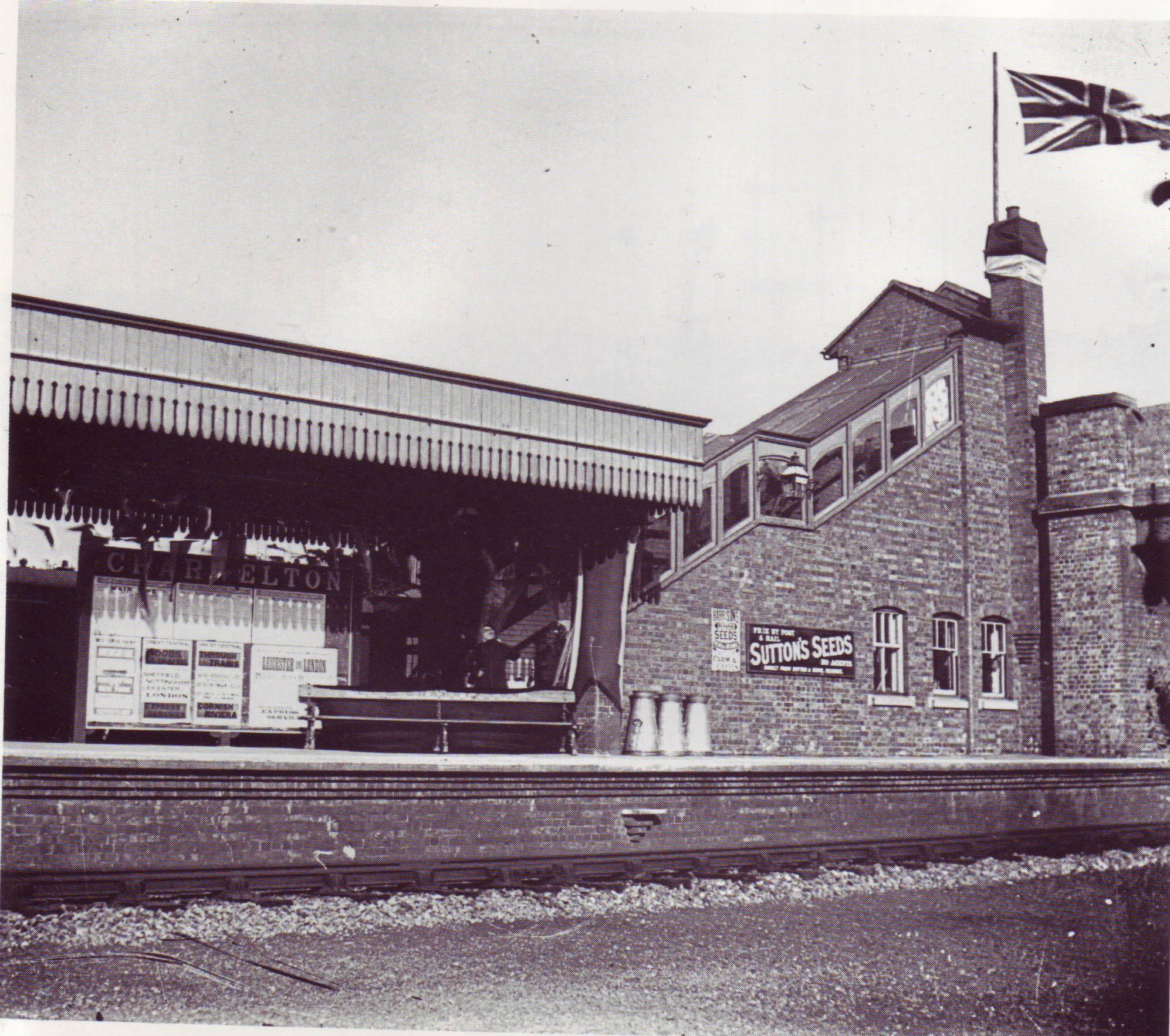
Charwelton railway station
Charwelton railway station was a station at Charwelton in Northamptonshire on the former Great Central Railway main line, the last main line to be built...

Arbury Hill
Arbury Hill, at 225 m (738 ft), is the joint highest point in the English county of Northamptonshire. It is 9 km (5.6 mi) southwest of the town of Daventry...

Badby
Badby is a village and a rural parish of about 2,020 acres (820 ha) in West Northamptonshire, England. == Location == Badby is about 2 miles (3 km) south...
Charwelton
Charwelton is a village and civil parish about 5 miles (8 km) south of Daventry in Northamptonshire, England. The 2011 Census recorded the parish's population...
Related Videos

Walking Adventures in the Cotswolds
A great first full day with Walking Adventures as we visit the Cotswolds and our first walk starting in the little village of Badby.

The Knightley Way - Badby to Farthingstone
The Knightley Way is a short walking trail in the heart of rural Northamptonshire. This 12 mile path takes you across the lands ...

Back in the woods - Badby Woods
A first chance to visit a woodland with records from around the 10th century. Privately owned but with public access. Thanks to my ...

E-MTB ride to Fawsley Hall 2021
This film is about a e-bike ride to Fawsley Hall, featuring a Cow shed with a few Bulls. Brendan Rigby & Lea Francis e-bike's ...
Nearby Amenities
Located within 500m of 52.207954,-1.1857706Have you been to Fawsley?
Leave your review of Fawsley below (or comments, questions and feedback).