Farleigh Meadows

Settlement in Devon Mid Devon

England

Farleigh Meadows

Tiverton : Westexe South Looking south on the road where there has been an accident.
Tiverton : Westexe South Credit: Lewis Clarke

Farleigh Meadows is a picturesque village located in the county of Devon, England. Situated amidst rolling hills and lush green landscapes, this idyllic village offers a peaceful retreat for residents and visitors alike. With a population of around 500, Farleigh Meadows exudes a close-knit community feel, where neighbors are friendly and amenities are easily accessible.

The village boasts a range of housing options, from charming cottages to modern family homes, all blending seamlessly into the natural surroundings. Many properties offer stunning views of the nearby river and countryside, adding to the overall appeal of the area.

Nature enthusiasts will find themselves captivated by the beauty of Farleigh Meadows. The village is surrounded by expansive meadows, woodland areas, and nature reserves, providing ample opportunities for walking, hiking, and wildlife spotting. The nearby river is a haven for anglers, attracting fishing enthusiasts from far and wide.

Farleigh Meadows is well-equipped with essential amenities, including a village shop, post office, and a traditional pub, where locals gather for hearty meals and friendly conversations. The village also has a primary school, making it an ideal place for families with young children.

Despite its tranquil ambiance, Farleigh Meadows is conveniently located within reach of larger towns and cities. The bustling market town of Exeter is just a short drive away, offering a wider range of shopping, dining, and entertainment options.

In conclusion, Farleigh Meadows is a hidden gem in the heart of Devon. Its natural beauty, sense of community, and convenient location make it an ideal place to call home or to simply visit and enjoy a peaceful getaway.

If you have any feedback on the listing, please let us know in the comments section below.

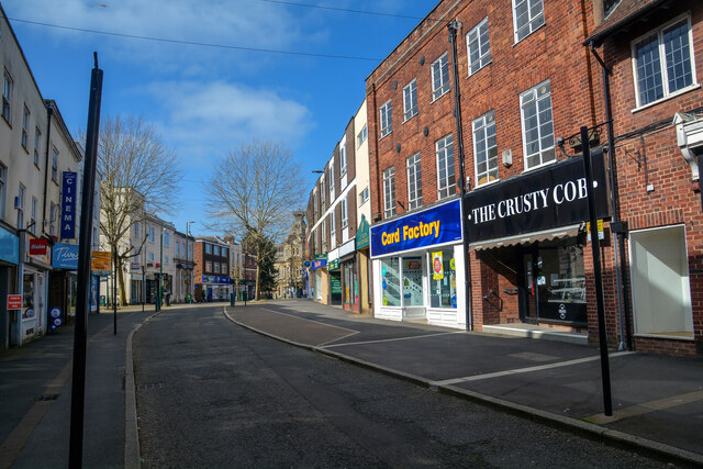
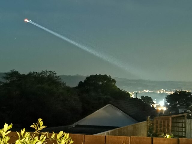
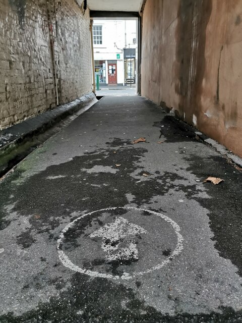
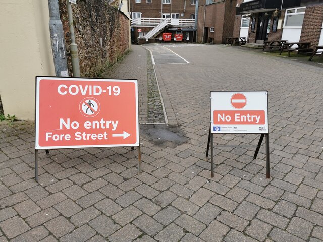
Farleigh Meadows Images

Images are sourced within 2km of 50.913176/-3.5018216 or Grid Reference SS9413. Thanks to Geograph Open Source API. All images are credited.

Tiverton : Westexe South Looking south on the road where there has been an accident.
Tiverton : Westexe South
Looking south on the road where there has been an accident.
Tiverton : Westexe South Looking along Westexe South where there seems to have been a collision.
Tiverton : Westexe South
Looking along Westexe South where there seems to have been a collision.
Tiverton : Christmas Illuminations A snow scene at a house on Longmeadow.
Tiverton : Christmas Illuminations
A snow scene at a house on Longmeadow.
Tiverton : Fore Street Fore Street in Tiverton town centre.
Tiverton : Fore Street
Fore Street in Tiverton town centre.
Tiverton : Morrisons At the petrol station and car wash in Tiverton.
Tiverton : Morrisons
At the petrol station and car wash in Tiverton.
Washfield : The A361 Looking along the A361 heading into Tiverton.
Washfield : The A361
Looking along the A361 heading into Tiverton.
Tiverton : A386 Police incident on the A396. I believe a child had been involved in a minor car accident.
Tiverton : A386
Police incident on the A396. I believe a child had been involved in a minor car accident.
Tiverton : Great Western Way A396 Police incident on the A396 involving somebody's welfare.
Tiverton : Great Western Way A396
Police incident on the A396 involving somebody's welfare.
Tiverton : Town Scenery The Devon Air Ambulance in the sky looking for a place to land.
Tiverton : Town Scenery
The Devon Air Ambulance in the sky looking for a place to land.
Tiverton : Alleyway An alley to Fore Street and a one way notice.
Tiverton : Alleyway
An alley to Fore Street and a one way notice.
Tiverton : Alleyway An alleyway heading to the town centre from the market car park.
Tiverton : Alleyway
An alleyway heading to the town centre from the market car park.
Tiverton : Public Space A one-way system in place between the town centre and Tiverton Pannier Market due to Covid-19.
Tiverton : Public Space
A one-way system in place between the town centre and Tiverton Pannier Market due to Covid-19.
Tiverton : Cosway Road Garden A bumble bee keeping busy on a sunflower in a garden on Cosway Road.
Tiverton : Cosway Road Garden
A bumble bee keeping busy on a sunflower in a garden on Cosway Road.
Tiverton : Cosway Road Garden Bumble bees keeping busy on a sunflower in a garden on Cosway Road.
Tiverton : Cosway Road Garden
Bumble bees keeping busy on a sunflower in a garden on Cosway Road.
Tiverton : Cosway Road Garden A bumble bee keeping busy on a sunflower in a garden on Cosway Road.
Tiverton : Cosway Road Garden
A bumble bee keeping busy on a sunflower in a garden on Cosway Road.
Tiverton : Cosway Road Garden Bees keeping busy on a sunflower in a garden on Cosway Road.
Tiverton : Cosway Road Garden
Bees keeping busy on a sunflower in a garden on Cosway Road.
Tiverton : Angel Hill Members of the Royal British Legion prepare to mark 100 years of the service.
Tiverton : Angel Hill
Members of the Royal British Legion prepare to mark 100 years of the service.
Tiverton : War Memorial Building Doc Savage lays a wreath on the building housing the town's war memorial to commemorate 100 years of the Royal British Legion.
Tiverton : War Memorial Building
Doc Savage lays a wreath on the building housing the town's war memorial to commemorate 100 years of the Royal British Legion.
Show me another place!

Farleigh Meadows is located at Grid Ref: SS9413 (Lat: 50.913176, Lng: -3.5018216)

Administrative County: Devon

District: Mid Devon

Police Authority: Devon and Cornwall

What 3 Words

///holiday.dignitary.allies. Near Tiverton, Devon

Nearby Locations

Farleigh Meadows

Related Wikis

Tiverton High School

Tiverton High School is a state secondary school located in Tiverton, Devon, England. It is located on the outskirts of the town, and has a close working...

Tiverton and District Hospital

Tiverton and District Hospital is a health facility based in Kennedy Way, Tiverton, Devon, England. It is managed by Royal Devon and Exeter NHS Foundation...

Bolham, Devon

Bolham is a village in the parish of Tiverton in Devon, England. It was the object of much attention in December 2011 when a Stags head, said to resemble...

Tiverton Town F.C.

Tiverton Town Football Club are an English football club based in Tiverton, Devon. The club are currently members of the Southern League Premier Division...

Siege of Tiverton (1645)

The Siege of Tiverton took place in October 1645 during the First English Civil War, when a Royalist garrison surrendered to a detachment of the New Model...
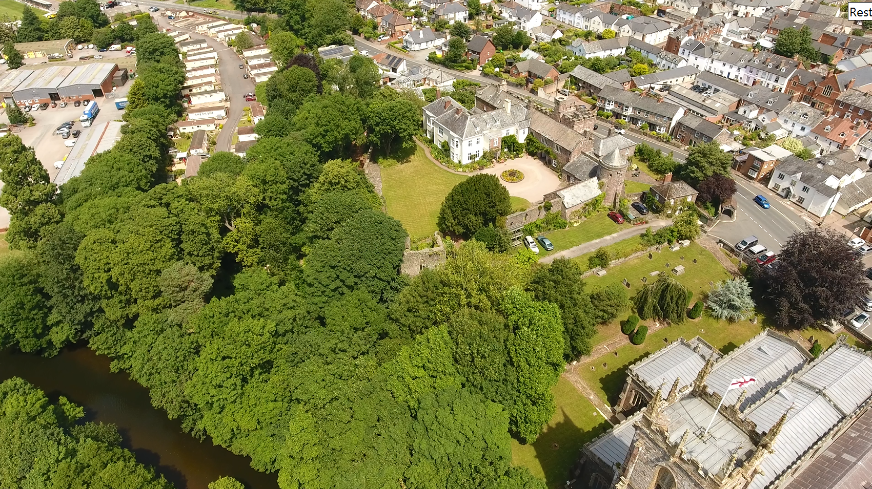
Tiverton Castle

Tiverton Castle is the remains of a medieval castle dismantled after the Civil War and thereafter converted in the 17th century into a country house. It...
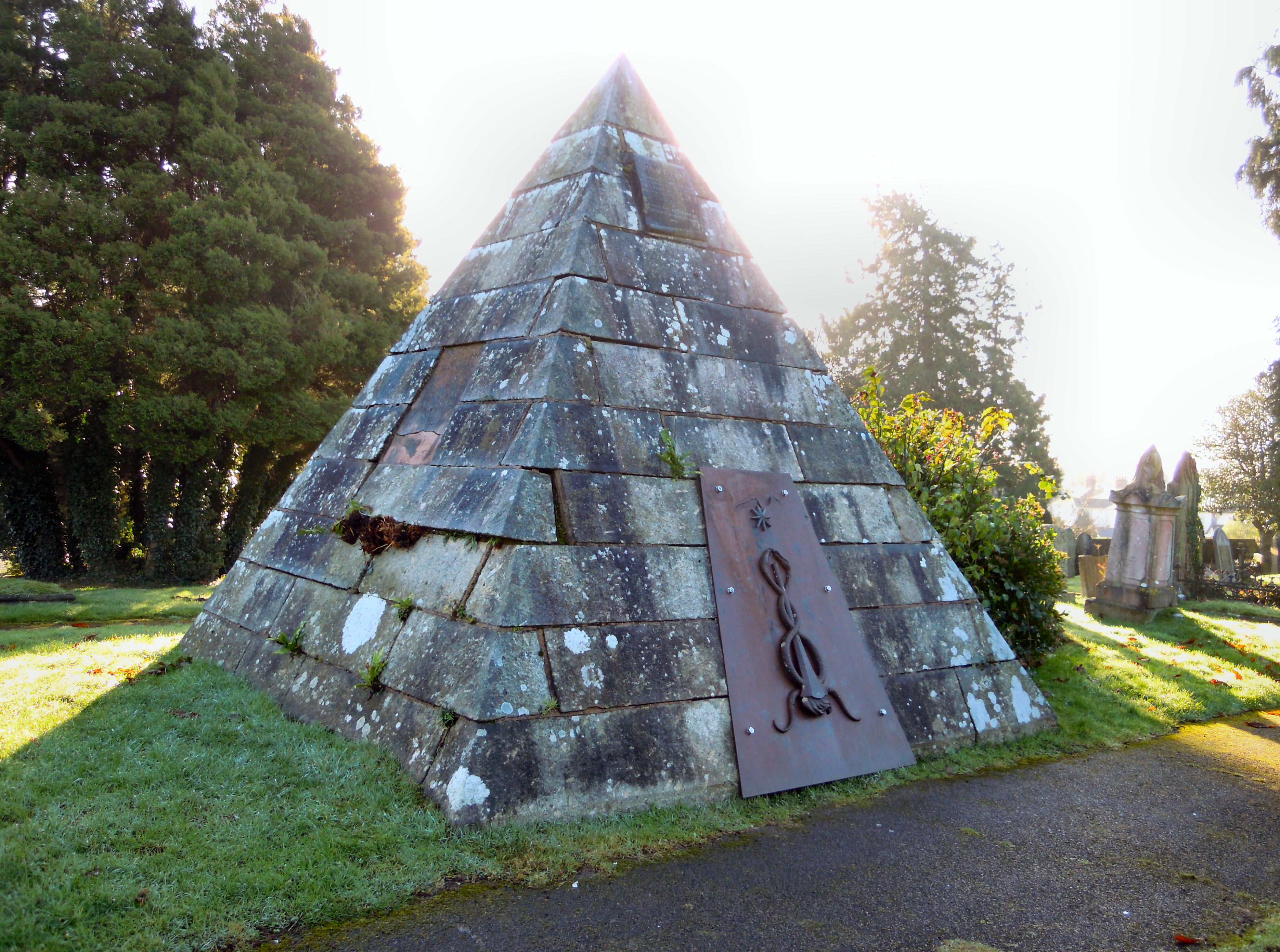
Tiverton Cemetery

Tiverton Cemetery is the burial ground for the town of Tiverton in Devon. The cemetery covers eight acres and is owned and maintained by Mid Devon Council...

St Peter's Church, Tiverton

St Peter's Church, Tiverton is a Grade I listed parish church in the Church of England in Tiverton, Devon. == History == The church dates from 1073. Several...

Nearby Amenities

Located within 500m of 50.913176,-3.5018216
Give Way
Direction: backward
Lat/Long: 50.9089742/-3.4992726
Barrier: stile
Lat/Long: 50.9103512/-3.4983616
Bus Stop
Farley Meadow
Bus: yes
Naptan AtcoCode: 1100DEA59015
Naptan Bearing: N
Naptan BusStopType: CUS
Naptan Indicator: N-bound
Naptan LocalityName: Washfield
Naptan NaptanCode: dvngtjwj
Naptan NptgLocality: E0045340
Naptan Status: act
Naptan StopType: BCT
Naptan TimingStatus: OTH
Public Transport: platform
Source: naptan
Lat/Long: 50.9118954/-3.5036153
Bus Stop
Farleigh Meadows
Bus: yes
Naptan AtcoCode: 1100DEA57039
Naptan Bearing: NW
Naptan BusStopType: CUS
Naptan Indicator: NW-bound
Naptan LocalityName: Bolham
Naptan NaptanCode: dvngpdta
Naptan NptgLocality: E0007759
Naptan Status: act
Naptan StopType: BCT
Naptan Street: Farleigh Meadows
Naptan TimingStatus: OTH
Public Transport: platform
Source: naptan
Lat/Long: 50.9132764/-3.5032189
Direction: 175
Generator Method: photovoltaic
Generator Output Electricity: yes
Generator Solar Modules: 8
Generator Source: solar
Generator Type: solar_photovoltaic_panel
Location: roof
Power: generator
Lat/Long: 50.9123901/-3.502674
Direction: 235
Generator Method: photovoltaic
Generator Output Electricity: yes
Generator Solar Modules: 16
Generator Source: solar
Generator Type: solar_photovoltaic_panel
Location: roof
Power: generator
Lat/Long: 50.9125609/-3.5031621
Direction: 235
Generator Method: photovoltaic
Generator Output Electricity: yes
Generator Solar Modules: 12
Generator Source: solar
Generator Type: solar_photovoltaic_panel
Location: roof
Power: generator
Lat/Long: 50.913794/-3.5037777
Direction: 235
Generator Method: photovoltaic
Generator Output Electricity: yes
Generator Solar Modules: 12
Generator Source: solar
Generator Type: solar_photovoltaic_panel
Location: roof
Power: generator
Lat/Long: 50.9139462/-3.5039923
Direction: 75
Generator Method: photovoltaic
Generator Output Electricity: yes
Generator Solar Modules: 20
Generator Source: solar
Generator Type: solar_photovoltaic_panel
Location: roof
Power: generator
Lat/Long: 50.9140443/-3.5048372
Direction: 255
Generator Method: photovoltaic
Generator Output Electricity: yes
Generator Solar Modules: 20
Generator Source: solar
Generator Type: solar_photovoltaic_panel
Location: roof
Power: generator
Lat/Long: 50.9140274/-3.5049069
Direction: ENE
Generator Method: photovoltaic
Generator Output Electricity: yes
Generator Solar Modules: 6
Generator Source: solar
Generator Type: solar_photovoltaic_panel
Location: roof
Power: generator
Lat/Long: 50.9112844/-3.4995398
Direction: WSW
Generator Method: photovoltaic
Generator Output Electricity: yes
Generator Solar Modules: 6
Generator Source: solar
Generator Type: solar_photovoltaic_panel
Location: roof
Power: generator
Lat/Long: 50.9112827/-3.499564
Power: pole
Source: bing
Lat/Long: 50.9147399/-3.503315
Power: pole
Source: bing
Lat/Long: 50.9143526/-3.5039534
Power: pole
Source: bing
Lat/Long: 50.9139831/-3.5045582
Power: pole
Source: bing
Lat/Long: 50.9134462/-3.5054232
Power: pole
Source: bing
Lat/Long: 50.9132069/-3.5065444
Power: pole
Source: bing
Lat/Long: 50.9129/-3.5080263
Give Way
Direction: backward
Lat/Long: 50.9122345/-3.5032533
Give Way
Direction: backward
Lat/Long: 50.9119605/-3.5036969
Give Way
Direction: backward
Lat/Long: 50.9127647/-3.5047272
Ford: yes
Lat/Long: 50.9148531/-3.504796
Ford: yes
Lat/Long: 50.9146572/-3.5045968
Post Box
Lat/Long: 50.9127987/-3.5045906
The data included in this document is from www.openstreetmap.org. The data is made available under ODbL.

Have you been to Farleigh Meadows?

Leave your review of Farleigh Meadows below (or comments, questions and feedback).