Dunterlie

Settlement in Renfrewshire

Scotland

Dunterlie

Dry-stone wall and fence The space between the wall and fence is more worn than the surrounding moorland because, as shown on the map, the route between them is part of a footpath. For a good summary of that path, see <a href="https://www.geograph.org.uk/photo/369064">NS4859 : Paisley - Brownside Braes - Harelaw  Reservoir</a>.

The same fence and wall are shown in <a href="https://www.geograph.org.uk/photo/2308667">NS4860 : Dry-stone wall and fence</a>, which was taken at a point about 270 metres further along the same path.
Dry-stone wall and fence Credit: Lairich Rig

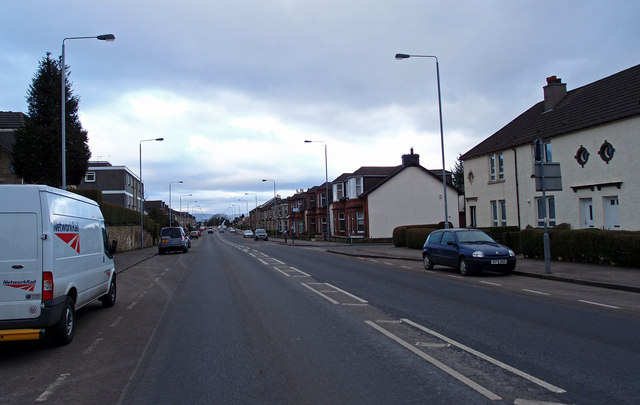
Dunterlie is a small residential area located in Renfrewshire, Scotland. Situated on the outskirts of the town of Barrhead, it is part of the larger Glasgow metropolitan area. The community is primarily made up of council housing, providing affordable accommodation for local residents.

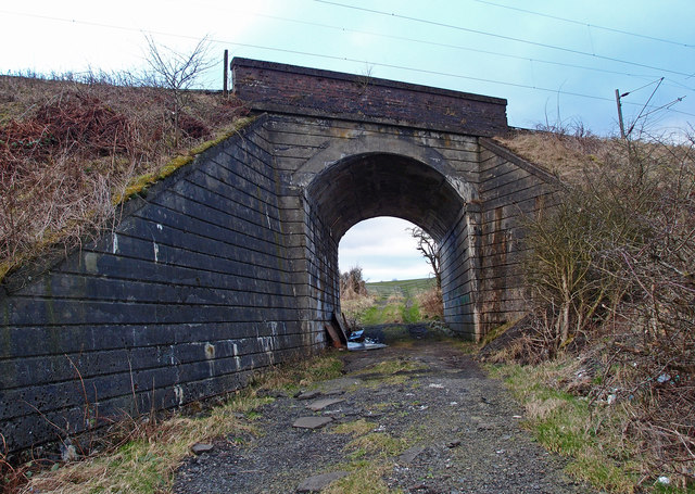
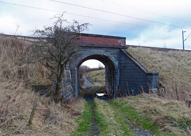
Dunterlie is well-connected to the surrounding areas by road and public transport links. The nearby Barrhead railway station offers regular services to Glasgow city center, making it convenient for commuters. Additionally, the M77 motorway is easily accessible, providing quick access to Glasgow and other nearby towns.

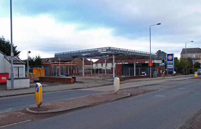
Although Dunterlie is primarily a residential area, it benefits from its proximity to a range of amenities and services. The town of Barrhead, located just a short distance away, offers a variety of shops, supermarkets, and leisure facilities, including a swimming pool and a library. There are also several primary and secondary schools in the area, providing education for the local community.

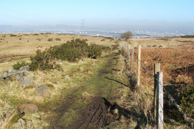
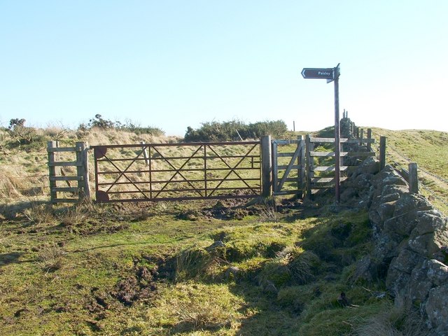
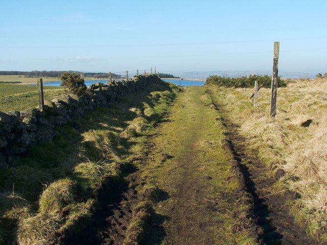
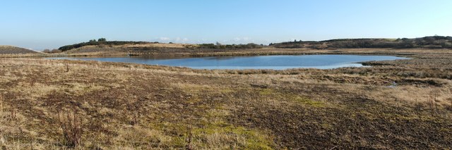
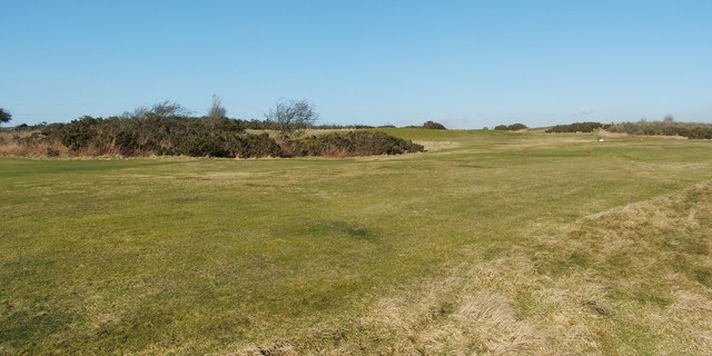
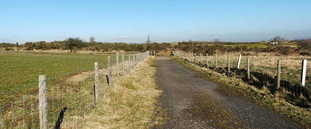
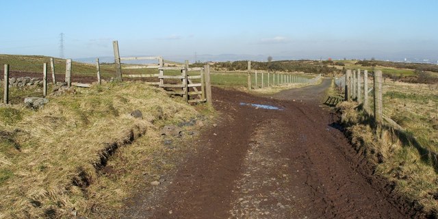
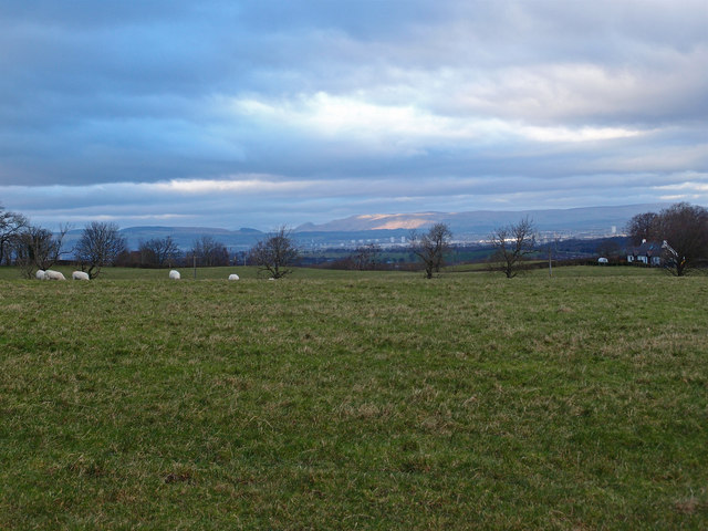
Nature enthusiasts can enjoy the nearby countryside, with attractions such as the Barrhead Dams offering picturesque walking trails and wildlife spotting opportunities. The area also benefits from several parks and green spaces, providing recreational areas for residents to enjoy.

Overall, Dunterlie offers an affordable and convenient place to live, with good transport links, access to amenities, and nearby natural attractions.

If you have any feedback on the listing, please let us know in the comments section below.
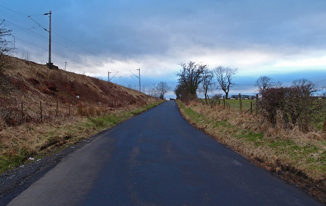
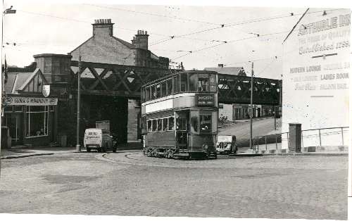
Dunterlie Images

Images are sourced within 2km of 55.803702/-4.3947429 or Grid Reference NS4959. Thanks to Geograph Open Source API. All images are credited.

Dry-stone wall and fence The space between the wall and fence is more worn than the surrounding moorland because, as shown on the map, the route between them is part of a footpath. For a good summary of that path, see <a href="https://www.geograph.org.uk/photo/369064">NS4859 : Paisley - Brownside Braes - Harelaw  Reservoir</a>.

The same fence and wall are shown in <a href="https://www.geograph.org.uk/photo/2308667">NS4860 : Dry-stone wall and fence</a>, which was taken at a point about 270 metres further along the same path.
Dry-stone wall and fence
The space between the wall and fence is more worn than the surrounding moorland because, as shown on the map, the route between them is part of a footpath. For a good summary of that path, see NS4859 : Paisley - Brownside Braes - Harelaw Reservoir. The same fence and wall are shown in NS4860 : Dry-stone wall and fence, which was taken at a point about 270 metres further along the same path.
Signpost at footpath junction The signpost is located at a three-way junction of paths.

The sign pointing to the left says "Paisley", and points along the route shown in <a href="https://www.geograph.org.uk/photo/2308698">NS4859 : Dry-stone wall and fence</a> and <a href="https://www.geograph.org.uk/photo/2308667">NS4860 : Dry-stone wall and fence</a>.

Another, pointing towards the photographer's position, reads "Killoch Glen via Glenburn Resr"; for that route, see <a href="https://www.geograph.org.uk/photo/2309088">NS4859 : Path to Glenburn Reservoir</a>.

The third, pointing in the opposite direction, reads "Barrhead / Killoch Glen via Harelaw Resr"; for a view back along that route, see <a href="https://www.geograph.org.uk/photo/2309100">NS4859 : Path from Killoch Glen</a>.
Signpost at footpath junction
The signpost is located at a three-way junction of paths. The sign pointing to the left says "Paisley", and points along the route shown in NS4859 : Dry-stone wall and fence and NS4860 : Dry-stone wall and fence. Another, pointing towards the photographer's position, reads "Killoch Glen via Glenburn Resr"; for that route, see NS4859 : Path to Glenburn Reservoir. The third, pointing in the opposite direction, reads "Barrhead / Killoch Glen via Harelaw Resr"; for a view back along that route, see NS4859 : Path from Killoch Glen.
Path from Killoch Glen For the previous part of the route, see <a href="https://www.geograph.org.uk/photo/2310031">NS4859 : Path from Killoch Glen</a>. That path makes a sharp turn near <a href="https://www.geograph.org.uk/photo/2309150">NS4859 : Harelaw Reservoir</a>. The present photograph shows the part of the route beyond that corner; it leads towards the signpost that is shown in <a href="https://www.geograph.org.uk/photo/2309070">NS4859 : Signpost at footpath junction</a>.

The top of that signpost is just visible in this photograph; it can be seen straight ahead on the path, with <a href="https://www.geograph.org.uk/photo/2308500">NS4760 : Glenburn Reservoir</a> visible behind it.
Path from Killoch Glen
For the previous part of the route, see NS4859 : Path from Killoch Glen. That path makes a sharp turn near NS4859 : Harelaw Reservoir. The present photograph shows the part of the route beyond that corner; it leads towards the signpost that is shown in NS4859 : Signpost at footpath junction. The top of that signpost is just visible in this photograph; it can be seen straight ahead on the path, with NS4760 : Glenburn Reservoir visible behind it.
Harelaw Reservoir Unlike nearby <a href="https://www.geograph.org.uk/photo/2308500">NS4760 : Glenburn Reservoir</a>, Harelaw Reservoir appears on the first-edition OS map, which was surveyed in 1858.

The water level has been lowered considerably in recent years. Relative to the OS map that was current when this picture was taken, the photographer's position would be in the water of the reservoir, although not very far from the edge. The changes being made here are part of a Local Biodiversity Action Plan; this body of water will be de-classified as a reservoir.

For other pictures, see <a href="https://www.geograph.org.uk/photo/369064">NS4859 : Paisley - Brownside Braes - Harelaw  Reservoir</a>, <a href="https://www.geograph.org.uk/photo/441217">NS4859 : Harelaw Reservoir</a>, and <a href="https://www.geograph.org.uk/photo/441118">NS4859 : Grazing on Fereneze Hills and Harelaw Reservoir</a>.
Harelaw Reservoir
Unlike nearby NS4760 : Glenburn Reservoir, Harelaw Reservoir appears on the first-edition OS map, which was surveyed in 1858. The water level has been lowered considerably in recent years. Relative to the OS map that was current when this picture was taken, the photographer's position would be in the water of the reservoir, although not very far from the edge. The changes being made here are part of a Local Biodiversity Action Plan; this body of water will be de-classified as a reservoir. For other pictures, see NS4859 : Paisley - Brownside Braes - Harelaw Reservoir, NS4859 : Harelaw Reservoir, and NS4859 : Grazing on Fereneze Hills and Harelaw Reservoir.
Fereneze Golf Course This is part of the course of Fereneze Golf Club. The picture was taken from near what used to be the edge of <a href="https://www.geograph.org.uk/photo/2309150">NS4859 : Harelaw Reservoir</a>.

See also <a href="https://www.geograph.org.uk/photo/369064">NS4859 : Paisley - Brownside Braes - Harelaw  Reservoir</a>.
Fereneze Golf Course
This is part of the course of Fereneze Golf Club. The picture was taken from near what used to be the edge of NS4859 : Harelaw Reservoir. See also NS4859 : Paisley - Brownside Braes - Harelaw Reservoir.
Path from Killoch Glen For the previous part of the route, see <a href="https://www.geograph.org.uk/photo/2310037">NS4859 : Path from Killoch Glen</a>.

The present photograph was taken from about 100 metres further along the path. About 50 metres ahead, the route turns sharply to the left; the section beyond that corner is shown in <a href="https://www.geograph.org.uk/photo/2309100">NS4859 : Path from Killoch Glen</a>.
Path from Killoch Glen
For the previous part of the route, see NS4859 : Path from Killoch Glen. The present photograph was taken from about 100 metres further along the path. About 50 metres ahead, the route turns sharply to the left; the section beyond that corner is shown in NS4859 : Path from Killoch Glen.
Path from Killoch Glen The footpath continues straight ahead; the gate on the left leads into a field instead.

For a view from a point further along this path, see <a href="https://www.geograph.org.uk/photo/2310031">NS4859 : Path from Killoch Glen</a>. Visible in the background, on the right, is part of a <a href="https://www.geograph.org.uk/photo/2310006">NS4859 : Fereneze Golf Course</a>.
Path from Killoch Glen
The footpath continues straight ahead; the gate on the left leads into a field instead. For a view from a point further along this path, see NS4859 : Path from Killoch Glen. Visible in the background, on the right, is part of a NS4859 : Fereneze Golf Course.
B771, Paisley Road Dunterlie area of Barrhead.
B771, Paisley Road
Dunterlie area of Barrhead.
United Services Club Building Paisley Road, Dunterlie
United Services Club Building
Paisley Road, Dunterlie
Masonic Lodge, Barrhead Sits on Cochrane Street. Upper floor looks to be residential.
Masonic Lodge, Barrhead
Sits on Cochrane Street. Upper floor looks to be residential.
Bourock Parish Church, Barrhead War Memorial stands in front of church.
Bourock Parish Church, Barrhead
War Memorial stands in front of church.
Bourock Parish Church Hall, Barrhead War Memorial stands in front of church.
Bourock Parish Church Hall, Barrhead
War Memorial stands in front of church.
Sheep Grazing near Neilston Sun on the distant Campsie Fells over Glasgow. Newhouse Cottages on the right.
Sheep Grazing near Neilston
Sun on the distant Campsie Fells over Glasgow. Newhouse Cottages on the right.
Disused Petrol Station B771, Paisley Road, Dunterlie area of Barrhead.
Disused Petrol Station
B771, Paisley Road, Dunterlie area of Barrhead.
Bourock Parish Church, Barrhead Church of Scotland <span class="nowrap"><a title="http://www.portaltothepast.co.uk/heritage/heritage_building/heritage_churches/heritage-churches-barrhead.htm" rel="nofollow ugc noopener" href="http://www.portaltothepast.co.uk/heritage/heritage_building/heritage_churches/heritage-churches-barrhead.htm">Link</a><img style="margin-left:2px;" alt="External link" title="External link - shift click to open in new window" src="https://s1.geograph.org.uk/img/external.png" width="10" height="10"/></span>
Bourock Parish Church, Barrhead
Church of Scotland LinkExternal link
Railway Bridge, Neilston Allowing field access under the Neilston/Rutherglen branch line.
Railway Bridge, Neilston
Allowing field access under the Neilston/Rutherglen branch line.
Railway Bridge, Neilston Allowing field access under the Neilston/Rutherglen branch line. Looking through to Springfield Road from farmland.
Railway Bridge, Neilston
Allowing field access under the Neilston/Rutherglen branch line. Looking through to Springfield Road from farmland.
Springfield Road, Minor Road Neilston Railway branch line to the left.
Springfield Road, Minor Road
Neilston Railway branch line to the left.
Show me another place!

Dunterlie is located at Grid Ref: NS4959 (Lat: 55.803702, Lng: -4.3947429)

Unitary Authority: East Renfrewshire

Police Authority: Greater Glasgow

What 3 Words

///nobody.lined.undulation. Near Barrhead, East Renfrewshire

Related Wikis

Dunterlie Park

Dunterlie Park is a football ground in Barrhead, Scotland. The third stadium to bear the name, it is the home ground of Arthurlie. == History == Arthurlie...

Barrhead railway station

Barrhead railway station is a railway station in the town of Barrhead, East Renfrewshire, Greater Glasgow, Scotland. The station is managed by ScotRail...

Barrhead Central railway station

Barrhead Central railway station was a railway station serving the town of Barrhead, Renfrewshire, Scotland. The station was on the Glasgow and South...

Barrhead (New) railway station

Barrhead (New) was one of four railway stations in Barrhead, Renfrewshire, Scotland. == History == The station was originally part of the Paisley and Barrhead...
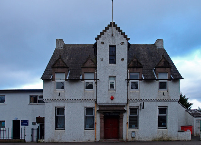
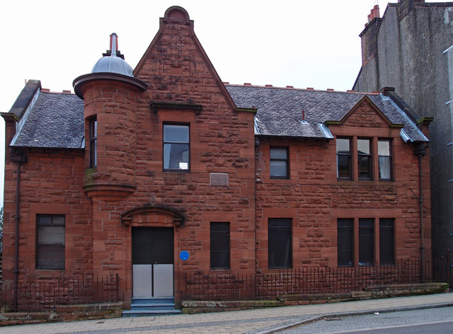
Barrhead Burgh Hall

Barrhead Burgh Hall, also known as Barrhead Burgh Court Hall and Burgh Chambers and as the James McGuire Building, is a municipal complex in Main Street...

Barrhead

Barrhead (Scots: Baurheid, Scottish Gaelic: Ceann a' Bharra) is a town in East Renfrewshire, Scotland, thirteen kilometres (8 mi) southwest of Glasgow...

Dunterlie Park (1906–1919)

Dunterlie Park was a football ground in Barrhead, Scotland. It was the home ground of Arthurlie between 1906 and 1919, and was the second of three grounds...

Dunterlie Park (1882–1906)

Dunterlie Park was a football ground in Barrhead, Scotland. It was the home ground of Arthurlie between 1882 and 1906, and was the first of three grounds...

Nearby Amenities

Located within 500m of 55.803702,-4.3947429
Barrhead
Naptan AtcoCode: 9100BRHD
Network: National Rail
Public Transport: stop_position
Railway: stop
Source: npe/landsat
Train: yes
Lat/Long: 55.8038585/-4.3974322
Railway: switch
Lat/Long: 55.802238/-4.4012119
Traffic Signals
Lat/Long: 55.7997273/-4.3927312
Crossing
Crossing: traffic_signals
Crossing Ref: pelican
Lat/Long: 55.8003145/-4.3973412
Crossing
Crossing: uncontrolled
Crossing Ref: zebra
Lat/Long: 55.8037297/-4.3904778
Traffic Signals
Lat/Long: 55.8034634/-4.3979499
Traffic Signals
Lat/Long: 55.7996255/-4.3926748
Barrhead
Alt Name Gd: Cnoc a' Bharra
Is In: Glasgow
Is In Municipality: East Renfrewshire
Name Gd: Ceann a' Bhàirr
Name Sco: Baurheid
Place: town
Population: 17268
Wikidata: Q2598252
Wikipedia: en:Barrhead
Lat/Long: 55.8011027/-4.3899826
Mini Roundabout
Direction: clockwise
Lat/Long: 55.8021713/-4.3937867
Crossing
Crossing: traffic_signals
Crossing Ref: pelican
Lat/Long: 55.8012424/-4.3887213
Bus Stop
Bus: yes
Public Transport: platform
Shelter: yes
Lat/Long: 55.8073768/-4.3992512
Bus Stop
Bus: yes
Public Transport: platform
Lat/Long: 55.805535/-4.3984871
Bus Stop
Bus: yes
Nat Ref: 62013?
Public Transport: platform
Lat/Long: 55.8040268/-4.3979365
Bus Stop
Bus: yes
Naptan AtcoCode: 612015
Naptan NaptanCode: 37323473
Public Transport: platform
Lat/Long: 55.8014497/-4.3977797
Bus Stop
Bus: yes
Nat Ref: 62018
Public Transport: platform
Lat/Long: 55.8001036/-4.3975308
Barrier: bollard
Lat/Long: 55.8024566/-4.4009125
Mini Roundabout
Direction: clockwise
Lat/Long: 55.8071009/-4.3942039
Recycling
Barrhead Recycling Centre
Addr City: Barrhead
Addr Postcode: G78 1AA
Addr Street: Carlibar Road
Owner: East Renfrewshire Council
Ownership: municipal
Recycling Type: centre
Website: https://www.eastrenfrewshire.gov.uk/barrhead-recycling-centre
Wikidata: Q106085719
Lat/Long: 55.8050761/-4.3936657
Speed Camera
Direction: 60
Maxspeed: 30 mph
Lat/Long: 55.8001831/-4.3916058
Fast Food
Kadir's
Cuisine: fish_and_chips
Lat/Long: 55.8004043/-4.3902007
Iceland
Addr Housenumber: 158
Addr Postcode: G78 1SL
Addr Street: Main Street
Brand: Iceland
Brand Wikidata: Q721810
Brand Wikipedia: en:Iceland (supermarket)
Contact Website: https://www.iceland.co.uk/store-finder/store?StoreID=78&StoreName=BARRHEAD
Fhrs Id: 7461
Shop: frozen_food
Source Addr: FHRS Open Data
Lat/Long: 55.8008073/-4.3889303
Pharmacy
Rowlands Pharmacy
Addr Housenumber: 176
Addr Postcode: G78 1SL
Addr Street: Main Street
Brand: Rowlands Pharmacy
Brand Wikidata: Q62663235
Healthcare: pharmacy
Source Addr: FHRS Open Data
Website: https://rowlandspharmacy.co.uk/find-local-pharmacy#!/l/glasgow/182-184-main-street/1726
Lat/Long: 55.8011355/-4.3883197
Bank
RBS
Atm: yes
Brand: RBS
Brand Wikidata: Q160126
Brand Wikipedia: en:Royal Bank of Scotland
Official Name: Royal Bank of Scotland
Operator: Royal Bank of Scotland
Lat/Long: 55.7996305/-4.3979012
Cafe
Central Cafe
Addr Housenumber: 70
Addr Postcode: G78 1RP
Addr Street: Cross Arthurlie Street
Fhrs Id: 7859
Source Addr: FHRS Open Data
Lat/Long: 55.8008041/-4.3972905
Cafe
Alpinos
Addr Housenumber: 63-65
Addr Postcode: G78 1RR
Addr Street: Cross Arthurlie Street
Fhrs Id: 1173137
Source Addr: FHRS Open Data
Lat/Long: 55.8007924/-4.3976572
Fast Food
Ming's Cuisine
Cuisine: chinese
Lat/Long: 55.8007483/-4.3972352
Post Office
Barrhead Post Office
Addr Housenumber: 77
Addr Postcode: G78 1RS
Addr Street: Cross Arthurlie Street
Brand: Post Office
Brand Wikidata: Q1783168
Check Date: 2023-09-27
Fhrs Id: 82574
Ref Pol Id: 9640
Source Addr: FHRS Open Data
Lat/Long: 55.8012079/-4.3979672
Pub
The Brigg Inn
Addr Housenumber: 141
Addr Postcode: G78 1EX
Addr Street: Cross Arthulie Street
Fhrs Id: 7854
Source Addr: FHRS Open Data
Lat/Long: 55.8032416/-4.398208
Place Of Worship
Barrhead Evangelical Church
Denomination: evangelical
Religion: christian
Lat/Long: 55.7999375/-4.3973615
Fast Food
L'Arco
Addr Housenumber: 47
Addr Postcode: G78 1QU
Addr Street: Cross Arthurlie Street
Cuisine: fish_and_chips
Fhrs Id: 1062829
Source Addr: FHRS Open Data
Lat/Long: 55.8000395/-4.3976834
Restaurant
Red Fort
Addr Housenumber: 46
Addr Postcode: G78 1QU
Addr Street: Cross Arthurlie Street
Cuisine: indian
Fhrs Id: 7849
Source Addr: FHRS Open Data
Lat/Long: 55.8002105/-4.3972562
Bicycle Parking
Bicycle Parking: stands
Capacity: 2
Covered: no
Lat/Long: 55.8037805/-4.3973134
Bicycle Parking
Bicycle Parking: lockers
Capacity: 2
Lat/Long: 55.8037928/-4.3972903
Crossing
Crossing: traffic_signals
Crossing Ref: pelican
Lat/Long: 55.801179/-4.3886435
Waste Basket
Lat/Long: 55.7994126/-4.3929166
Pub
Fereneze Inn
Addr City: Barrhead
Lat/Long: 55.8031505/-4.3923001
Historic: monument
Lat/Long: 55.8004198/-4.3966472
Post Box
Collection Times: Mo-Fr 16:30; Sa 11:45
Operator: Royal Mail
Ref: G78 715
Lat/Long: 55.8038185/-4.3904299
Barrier: cycle_barrier
Bicycle: yes
Foot: yes
Lat/Long: 55.8016041/-4.3923807
Source: GPS
Lat/Long: 55.8020485/-4.3908499
Fuel
Asda
Brand: Asda
Brand Wikidata: Q297410
Brand Wikipedia: en:Asda
Contact Facebook: https://www.facebook.com/asda/
Contact Twitter: asda
Contact Website: https://storelocator.asda.com/scotland/barrhead/4-church-road
Operator: Asda Stores Ltd
Lat/Long: 55.8011418/-4.3919423
Barrhead
Naptan AtcoCode: 9100BRHD
Network: National Rail
Public Transport: stop_position
Railway: stop
Source: npe/landsat
Train: yes
Lat/Long: 55.8038352/-4.3973917
Railway: buffer_stop
Lat/Long: 55.8020483/-4.4015891
Railway: switch
Lat/Long: 55.8025329/-4.4004141
Railway: switch
Lat/Long: 55.8046479/-4.3957085
Railway: switch
Lat/Long: 55.8049511/-4.3952026
Railway: switch
Lat/Long: 55.8053731/-4.3944089
Railway: switch
Lat/Long: 55.8055774/-4.3939613
Traffic Signals
Lat/Long: 55.8038328/-4.3979573
Barrhead Central
Historic Railway: station
Railway: site
Wikidata: Q4863465
Wikipedia: en:Barrhead Central railway station
Lat/Long: 55.8011577/-4.3960549
Dunterlie
Place: suburb
Lat/Long: 55.8034026/-4.3962559
Carlibar
Place: suburb
Lat/Long: 55.8038478/-4.388629
Railway: buffer_stop
Lat/Long: 55.8040733/-4.3971754
Railway: switch
Lat/Long: 55.8052212/-4.3946841
Bench
Backrest: yes
Lat/Long: 55.8027266/-4.3882382
Generator Method: photovoltaic
Generator Output Electricity: yes
Generator Source: solar
Generator Type: solar_photovoltaic_panel
Power: generator
Lat/Long: 55.8037569/-4.3959975
Addr City: Barrhead
Lat/Long: 55.8031779/-4.3932196
Addr City: Barrhead
Lat/Long: 55.8032339/-4.3927856
Generator Method: photovoltaic
Generator Output Electricity: yes
Generator Source: solar
Generator Type: solar_photovoltaic_panel
Power: generator
Lat/Long: 55.8038866/-4.3886604
Crossing
Crossing: traffic_signals
Tactile Paving: yes
Lat/Long: 55.7993687/-4.3954963
Crossing
Crossing: traffic_signals
Tactile Paving: yes
Lat/Long: 55.7992988/-4.3953113
Barrhead (New)
Historic Railway: station
Railway: site
Wikidata: Q4863463
Wikipedia: en:Barrhead (New) railway station
Lat/Long: 55.7998172/-4.3969758
Barrhead
Naptan AtcoCode: 9100BRHD
Network: National Rail
Network Website: https://www.nationalrail.co.uk/stations/brr/
Network Wikidata: Q26334
Operator: ScotRail
Operator Website: https://www.scotrail.co.uk/plan-your-journey/stations-and-facilities/brr
Operator Wikidata: Q18356161
Public Transport: station
Railway: station
Ref Crs: BRR
Source: npe/landsat
Train: yes
Wikidata: Q1808222
Wikipedia: en:Barrhead railway station
Lat/Long: 55.8038509/-4.3974133
Fast Food
Domino's
Brand: Domino's
Brand Wikidata: Q839466
Cuisine: pizza
Survey Date: 2022-06-02
Takeaway: yes
Lat/Long: 55.8007556/-4.3893184
Access: yes
Door: hinged
Entrance: main
Lat/Long: 55.8037/-4.3973096
Bus Stop
Bus: yes
Public Transport: platform
Lat/Long: 55.8036894/-4.3972941
Entrance: yes
Lat/Long: 55.8037466/-4.3972741
Fixme: continue
Lat/Long: 55.8039834/-4.3965932
Bus Stop
Bus: yes
Naptan AtcoCode: 612013
Naptan NaptanCode: 37323628
Public Transport: platform
Lat/Long: 55.8038673/-4.3978004
Fixme: continue
Lat/Long: 55.8040176/-4.3978653
Entrance: yes
Lat/Long: 55.8038757/-4.3975982
Fixme: continue
Lat/Long: 55.8036071/-4.3971922
Barrier: bollard
Bicycle: yes
Foot: yes
Motor Vehicle: no
Lat/Long: 55.8029169/-4.3997877
Bank
Bank of Scotland
Brand: Bank of Scotland
Brand Wikidata: Q627381
Lat/Long: 55.7998925/-4.3914655
The data included in this document is from www.openstreetmap.org. The data is made available under ODbL.

Have you been to Dunterlie?

Leave your review of Dunterlie below (or comments, questions and feedback).