Delph Hill

Settlement in Lancashire

England

Delph Hill

Middlebrook Valley Way, Lady Bridge Lane Combined cycle and pedestrian path and river, Middle Brook, at road bridge; the bridge continues to the left over the railway line. In 1978 the path was not named or designted as a cycle route.
Middlebrook Valley Way, Lady Bridge Lane Credit: M J Roscoe

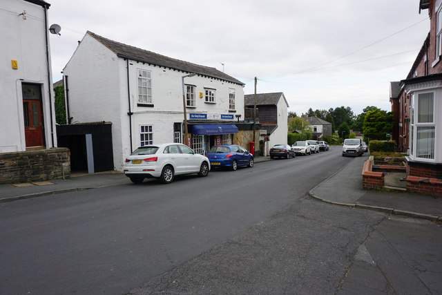
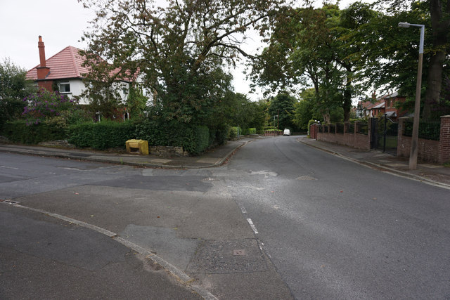
Delph Hill is a small village located in the county of Lancashire, in the North West of England. Situated approximately 4 miles north of Bolton and 10 miles northwest of Manchester, Delph Hill is part of the Metropolitan Borough of Bolton. The village is nestled amidst the picturesque countryside, offering residents and visitors a serene and tranquil environment.

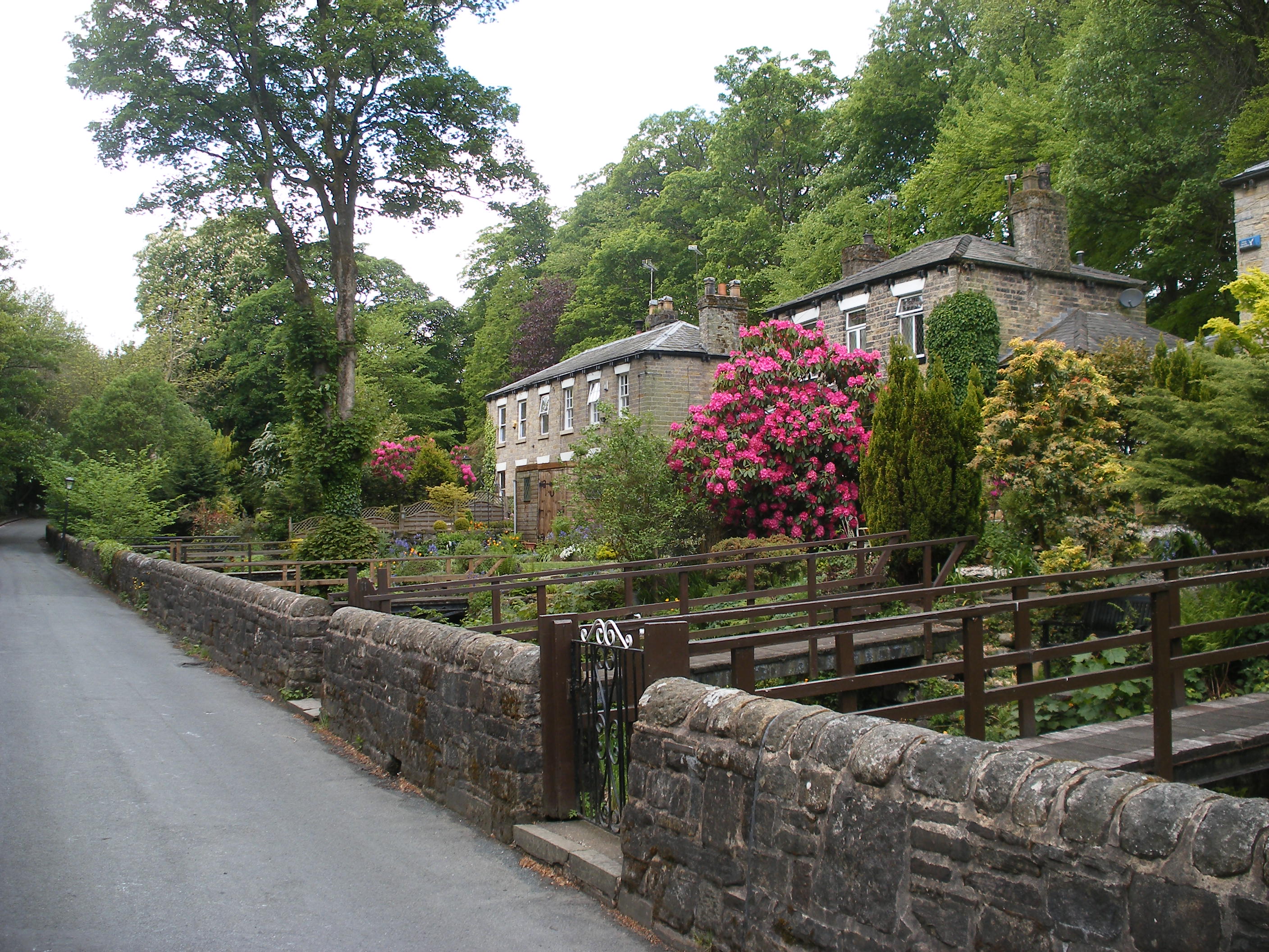
Delph Hill is primarily a residential area, with a population of around 2,000 residents. The village boasts a mixture of housing, including detached and semi-detached properties, as well as a few apartment complexes. The architecture in Delph Hill varies, with a blend of traditional and modern designs.

The village has limited amenities, but residents have convenient access to nearby towns for shopping, entertainment, and other services. Delph Hill benefits from its proximity to Bolton, which offers a wider range of facilities such as supermarkets, schools, healthcare centers, and recreational venues.

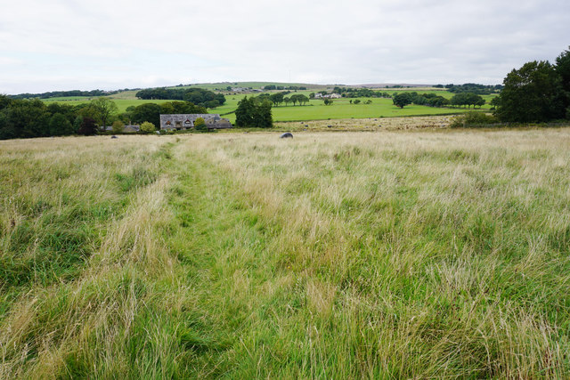
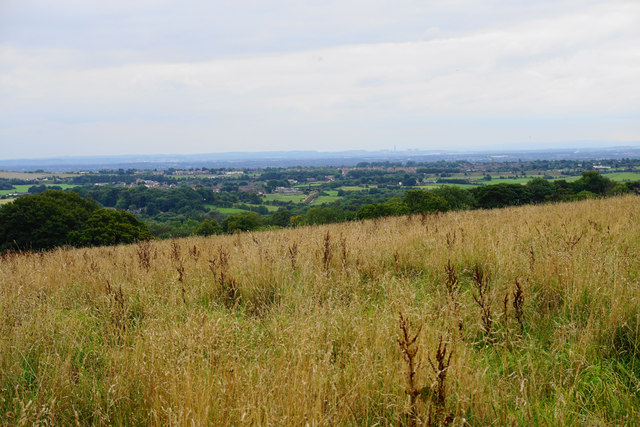
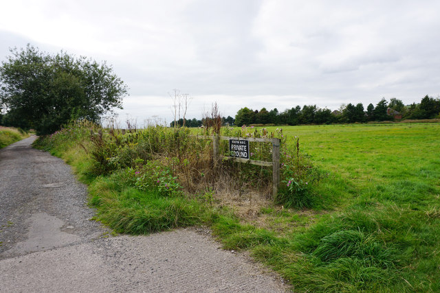
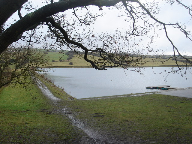
Surrounded by beautiful green fields and rolling hills, Delph Hill offers a peaceful setting for nature enthusiasts and walkers. The village is close to several parks and nature reserves, providing opportunities for outdoor activities and exploration.

Transport links in Delph Hill are well-connected. The village is easily accessible by road, with the M61 motorway located just a short drive away. Public transportation options include regular bus services, connecting Delph Hill to neighboring towns and cities.

Overall, Delph Hill is a charming village, ideal for those seeking a quiet and idyllic countryside lifestyle, while still having access to urban amenities.

If you have any feedback on the listing, please let us know in the comments section below.
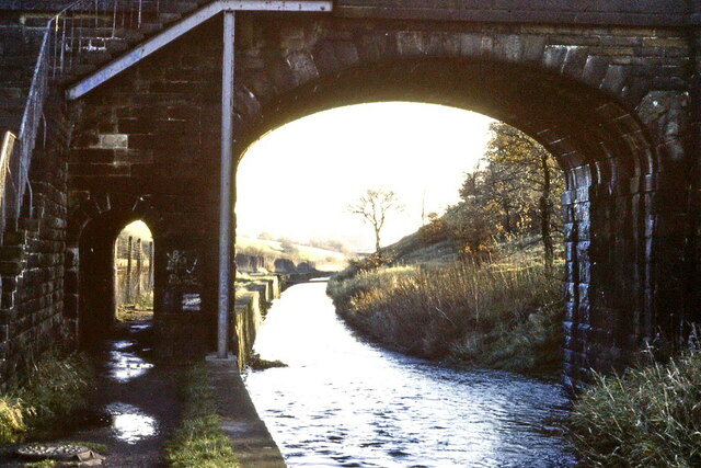
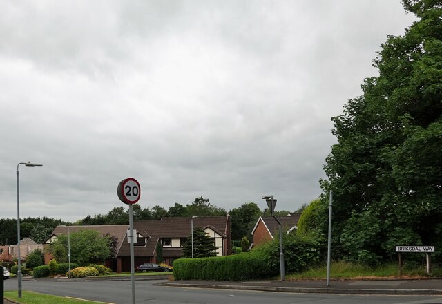
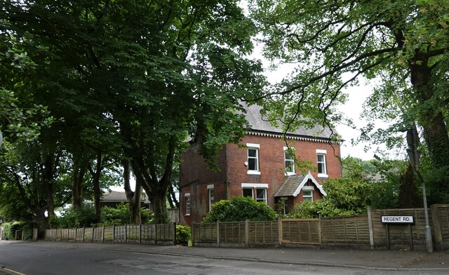
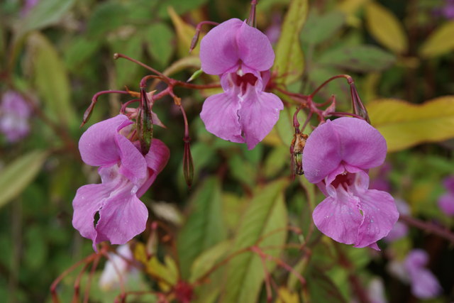
Delph Hill Images

Images are sourced within 2km of 53.591881/-2.4813132 or Grid Reference SD6810. Thanks to Geograph Open Source API. All images are credited.

Middlebrook Valley Way, Lady Bridge Lane Combined cycle and pedestrian path and river, Middle Brook, at road bridge; the bridge continues to the left over the railway line. In 1978 the path was not named or designted as a cycle route.
Middlebrook Valley Way, Lady Bridge Lane
Combined cycle and pedestrian path and river, Middle Brook, at road bridge; the bridge continues to the left over the railway line. In 1978 the path was not named or designted as a cycle route.
Briksdal Way A residential development off Chorley New Road.
Briksdal Way
A residential development off Chorley New Road.
Regent Road A residential road in Lostock.
Regent Road
A residential road in Lostock.
Bolton Steam Museum This centrifugal governor has appeared on display since my last visit here. It is the speed control governor from a 2500 horsepower horizontal tandem compound extraction engine built by John Musgrave of Bolton in 1923/4 for the east Lancs Paper Mill, Radcliffe. The engine also had an extraction governor to maintain pressure in the pass-out process main. The Museum also has this engine's barring engine. The governor is seen with the cover raised to show the weights and springs within.
Bolton Steam Museum
This centrifugal governor has appeared on display since my last visit here. It is the speed control governor from a 2500 horsepower horizontal tandem compound extraction engine built by John Musgrave of Bolton in 1923/4 for the east Lancs Paper Mill, Radcliffe. The engine also had an extraction governor to maintain pressure in the pass-out process main. The Museum also has this engine's barring engine. The governor is seen with the cover raised to show the weights and springs within.
Bolton Steam Museum - Corliss valve gear These components are the Corliss steam (inlet) valve trip gears from the low pressure cylinder of a horizontal tandem compound engine that was at Primrose Mill, Harle Syke. The engine was by Pollit & Wigzell of Sowerby Bridge and produced 700 horsepower. The intention is to reassemble these and drive them by an electric motor to demonstrate the trip gear in action. The green and red item behind is a barring engine from another site.
Bolton Steam Museum - Corliss valve gear
These components are the Corliss steam (inlet) valve trip gears from the low pressure cylinder of a horizontal tandem compound engine that was at Primrose Mill, Harle Syke. The engine was by Pollit & Wigzell of Sowerby Bridge and produced 700 horsepower. The intention is to reassemble these and drive them by an electric motor to demonstrate the trip gear in action. The green and red item behind is a barring engine from another site.
Bolton Steam Museum - Robey cross compound engine Seen running at about normal working speed of 120 rpm. Built by Robey of Lincoln in 1935 as a teaching engine for the Manchester College of Technology. The engine was removed in 1947 and stored for 40 years for possible resale. One of the society's members bought it and loaned it in 1987.
Bolton Steam Museum - Robey cross compound engine
Seen running at about normal working speed of 120 rpm. Built by Robey of Lincoln in 1935 as a teaching engine for the Manchester College of Technology. The engine was removed in 1947 and stored for 40 years for possible resale. One of the society's members bought it and loaned it in 1987.
Bolton Steam Museum - main entrance  This is the museum of the Northern Mill Engine Society and contains one of the best collections of stationary steam engines in the country.
Bolton Steam Museum - main entrance
This is the museum of the Northern Mill Engine Society and contains one of the best collections of stationary steam engines in the country.
Bolton Steam Museum - 'Elsie' The audience are admiring 'Elsie' during a run on live steam. The engine is a J & W McNaught of Rochdale horizontal tandem compound from Wasp Mill, Wardle. 
Bolton steam Museum is the country's finest collection of textile mill type engines and they can all be demonstrated in steam.
Bolton Steam Museum - 'Elsie'
The audience are admiring 'Elsie' during a run on live steam. The engine is a J & W McNaught of Rochdale horizontal tandem compound from Wasp Mill, Wardle. Bolton steam Museum is the country's finest collection of textile mill type engines and they can all be demonstrated in steam.
Bolton Steam Museum - Robey uniflow engine I have a real soft spot for this 'modern' design of reciprocating steam engine. This design has the efficiency of a much more complicated triple expansion engine in a much smaller footprint. This is because wasteful condensation is reduced by ensuring the steam flows in one direction only from the hot cylinder heads to the cooler exhaust ports in the centre of the cylinder. Because of the temperature gradient and differential expansion the cylinders were bored in a barrel shape with a wider bore in the cool centre. At operating temperature the bore became parallel. Another special feature was the need to provide compression relief when the engine was running without a good vacuum produced by condensing the steam. Many uniflows had manually operated valves on the sides of the cylinder that opened auxiliary clearance spaces. This engine has automatic auxiliary exhaust valves. These operate all the time in the Museum because there is no condensing plant in operation. This engine was built in 1926 and supplied to the Baltic Sawmills, Ammanford. From 1938 it was used as a test engine in the laboratories of the Manchester College of Technology. It was removed by a local machinery merchant in 1947 and stored until acquired by the Northern Mill Engine Society in 1987. The cylinder is 13.5" bore by 16" stroke and it ran at 200 revolutions per minute on superheated steam at 200 pounds per square inch.
Bolton Steam Museum - Robey uniflow engine
I have a real soft spot for this 'modern' design of reciprocating steam engine. This design has the efficiency of a much more complicated triple expansion engine in a much smaller footprint. This is because wasteful condensation is reduced by ensuring the steam flows in one direction only from the hot cylinder heads to the cooler exhaust ports in the centre of the cylinder. Because of the temperature gradient and differential expansion the cylinders were bored in a barrel shape with a wider bore in the cool centre. At operating temperature the bore became parallel. Another special feature was the need to provide compression relief when the engine was running without a good vacuum produced by condensing the steam. Many uniflows had manually operated valves on the sides of the cylinder that opened auxiliary clearance spaces. This engine has automatic auxiliary exhaust valves. These operate all the time in the Museum because there is no condensing plant in operation. This engine was built in 1926 and supplied to the Baltic Sawmills, Ammanford. From 1938 it was used as a test engine in the laboratories of the Manchester College of Technology. It was removed by a local machinery merchant in 1947 and stored until acquired by the Northern Mill Engine Society in 1987. The cylinder is 13.5" bore by 16" stroke and it ran at 200 revolutions per minute on superheated steam at 200 pounds per square inch.
Closure of Lady Bridge Lane The bridge over the railway has been closed due to electrification work on the line. The diversion is a long way round.
Closure of Lady Bridge Lane
The bridge over the railway has been closed due to electrification work on the line. The diversion is a long way round.
Woodland by Deane Golf Club Viewed from one of the paths giving access round the course.
Woodland by Deane Golf Club
Viewed from one of the paths giving access round the course.
Newsagent on Markland Hill
Junction of Towncroft Lane and Verdure Avenue Quite a desirable part of town.
Junction of Towncroft Lane and Verdure Avenue
Quite a desirable part of town.
Path down to Old Hall Old Hall is in the dip, and now comprises a number of residences.
Path down to Old Hall
Old Hall is in the dip, and now comprises a number of residences.
Grassland on Dob Hill From here there is a good view over the Cheshire Plain, and the Clwyd Hills can be seen far right.
Grassland on Dob Hill
From here there is a good view over the Cheshire Plain, and the Clwyd Hills can be seen far right.
Mobile phone mast on Dob Hill There is also a large phalanx of Himalayan balsam.
Mobile phone mast on Dob Hill
There is also a large phalanx of Himalayan balsam.
Himalayan balsam Very attractive!
Himalayan balsam
Very attractive!
Private ground on the edge of Bolton It is private as stated by Bolton MBC, but they haven't done much to keep it private.
Private ground on the edge of Bolton
It is private as stated by Bolton MBC, but they haven't done much to keep it private.
Show me another place!

Delph Hill is located at Grid Ref: SD6810 (Lat: 53.591881, Lng: -2.4813132)

Unitary Authority: Bolton

Police Authority: Greater Manchester

What 3 Words

///entry.pools.shrimp. Near Bolton, Manchester

Related Wikis

Doffcocker

Doffcocker is a mostly residential district of Bolton, Greater Manchester, lying about 3½ miles from the town centre on the northwest edge of the suburbs...

Markland Hill

Markland Hill is a mostly residential district of Bolton, Greater Manchester, England. Historically within Lancashire, it is about 2.5 miles to the north...

Moss Bank Park, Bolton

Moss Bank Park is a 34.25 hectares (84.6 acres) park in Bolton, Greater Manchester, England. It consists of open space, woodland, gardens and other facilities...

Barrow Bridge, Bolton

Barrow Bridge is a model village in the north-west outskirts of Bolton in Greater Manchester, England. It was created in the Industrial Revolution but...

High Rid Reservoir

High Rid Reservoir is a small, stone-sided reservoir close to Lostock Junction. It lies three miles to the west of Bolton town centre, Greater Manchester...

Heaton, Greater Manchester

Heaton is mostly a residential district of Bolton, Greater Manchester, England. It lies about 2 miles (3 km) north west of Bolton town centre. It is bounded...

St Margaret's Church, Halliwell

St Margaret's Church is in Lonsdale Road, Halliwell, Bolton, Greater Manchester, England. It is an active Anglican parish church in the deanery of Bolton...

Smithills

Smithills is a mainly residential suburb of Bolton in Greater Manchester, England. It is 3.1 miles (5 km) northwest of Bolton, 14.5 miles (23 km) south...

Nearby Amenities

Located within 500m of 53.591881,-2.4813132
Bus Stop
Moss Bank Way/Boot Lane
Bus: yes
Naptan AtcoCode: 1800WA14151
Naptan Bearing: NE
Naptan CommonName: Moss Bank Way/Boot Lane
Naptan Indicator: Grassland
Naptan Landmark: GRASSLAND
Naptan NaptanCode: manpamdj
Naptan PlusbusZoneRef: MNCRPIC
Naptan ShortCommonName: Boot Lane
Naptan Street: MOSS BANK WAY
Naptan Verified: no
Network: TfGM
Public Transport: platform
Source: naptan_import
Lat/Long: 53.5899978/-2.4798328
Bus Stop
Moss Bank Way/Boot Lane
Bus: yes
Naptan AtcoCode: 1800WA14161
Naptan Bearing: SW
Naptan CommonName: Moss Bank Way/Boot Lane
Naptan Indicator: Nr House 879
Naptan Landmark: NR HOUSE 879
Naptan NaptanCode: manpamdm
Naptan PlusbusZoneRef: MNCRPIC
Naptan ShortCommonName: Boot Lane
Naptan Street: MOSS BANK WAY
Naptan Verified: no
Network: TfGM
Public Transport: platform
Source: naptan_import
Lat/Long: 53.589963/-2.4795453
Bus Stop
Chorley Old Road/The Colliers Arms
Bus: yes
Naptan AtcoCode: 1800WA14171
Naptan Bearing: SE
Naptan CommonName: Chorley Old Road/The Colliers Arms
Naptan Indicator: O/s House 1052
Naptan Landmark: HOUSE 1052
Naptan NaptanCode: manpamdp
Naptan PlusbusZoneRef: MNCRPIC
Naptan ShortCommonName: The Colliers Arms
Naptan Street: Chorley Old Road
Naptan Verified: no
Network: TfGM
Public Transport: platform
Source: naptan_import
Lat/Long: 53.5916486/-2.4805918
Bus Stop
Chorley Old Road/Montserrat Road
Bus: yes
Naptan AtcoCode: 1800WA14181
Naptan Bearing: NW
Naptan CommonName: Chorley Old Road/Montserrat Road
Naptan Indicator: Opp Tempest Arms
Naptan Landmark: Tempest Arms
Naptan NaptanCode: manpamdt
Naptan Notes: NAME AMENDED
Naptan PlusbusZoneRef: MNCRPIC
Naptan ShortCommonName: Montserrat Road
Naptan Street: Chorley Old Road
Naptan Verified: no
Network: TfGM
Public Transport: platform
Source: naptan_import
Lat/Long: 53.5924043/-2.4826853
Bus Stop
Chorley Old Road/Montserrat Road
Bus: yes
Naptan AtcoCode: 1800WA14191
Naptan Bearing: SE
Naptan CommonName: Chorley Old Road/Montserrat Road
Naptan Indicator: Sportsman Arms
Naptan Landmark: SPORTSMAN ARMS
Naptan NaptanCode: manpamdw
Naptan PlusbusZoneRef: MNCRPIC
Naptan ShortCommonName: Montserrat Road
Naptan Street: Chorley Old Road
Naptan Verified: no
Network: TfGM
Public Transport: platform
Source: naptan_import
Lat/Long: 53.5928512/-2.4833099
Bus Stop
Montserrat Road/Chorley Old Road
Bus: yes
Naptan AtcoCode: 1800WA14921
Naptan Bearing: E
Naptan CommonName: Montserrat Road/Chorley Old Road
Naptan Indicator: Opp House 30
Naptan Landmark: HOUSE 30
Naptan NaptanCode: manpapjd
Naptan PlusbusZoneRef: MNCRPIC
Naptan ShortCommonName: Chorley Old Road
Naptan Street: MONTSERRAT ROAD
Naptan Verified: no
Network: TfGM
Public Transport: platform
Source: naptan_import
Lat/Long: 53.5933305/-2.482575
Bus Stop
Montserrat Road/Tattersall Avenue
Bus: yes
Naptan AtcoCode: 1800WA14931
Naptan Bearing: W
Naptan CommonName: Montserrat Road/Tattersall Avenue
Naptan Indicator: O/s House 60
Naptan Landmark: HOUSE 60
Naptan NaptanCode: manpapjg
Naptan PlusbusZoneRef: MNCRPIC
Naptan ShortCommonName: Tattersall Avenue
Naptan Street: MONTSERRAT ROAD
Naptan Verified: no
Network: TfGM
Public Transport: platform
Source: naptan_import
Lat/Long: 53.5934909/-2.4807033
Bus Stop
Montserrat Road/Chorley Old Road
Bus: yes
Naptan AtcoCode: 1800WA14941
Naptan Bearing: E
Naptan CommonName: Montserrat Road/Chorley Old Road
Naptan Indicator: Nr House 57
Naptan Landmark: HOUSE 57
Naptan NaptanCode: manpapjm
Naptan PlusbusZoneRef: MNCRPIC
Naptan ShortCommonName: Chorley Old Road
Naptan Street: MONTSERRAT ROAD
Naptan Verified: no
Network: TfGM
Public Transport: platform
Source: naptan_import
Lat/Long: 53.5935907/-2.4804627
Bus Stop
Montserrat Road/Gisburn Avenue
Bus: yes
Naptan AtcoCode: 1800WA14951
Naptan Bearing: SW
Naptan CommonName: Montserrat Road/Gisburn Avenue
Naptan Indicator: Grass Verge
Naptan Landmark: HOUSE 104
Naptan NaptanCode: manpapjp
Naptan PlusbusZoneRef: MNCRPIC
Naptan ShortCommonName: Gisburn Avenue
Naptan Street: MONTSERRAT ROAD
Naptan Verified: no
Network: TfGM
Public Transport: platform
Source: naptan_import
Lat/Long: 53.5941233/-2.4776585
Bus Stop
Lightbounds Road/Hollin Hey Road
Bus: yes
Naptan AtcoCode: 1800WA14961
Naptan Bearing: NE
Naptan CommonName: Lightbounds Road/Hollin Hey Road
Naptan Indicator: The Schooner
Naptan Landmark: HOUSE 7
Naptan NaptanCode: manpapjt
Naptan PlusbusZoneRef: MNCRPIC
Naptan ShortCommonName: Hollin Hey Road
Naptan Street: Lightbounds Road
Naptan Verified: no
Network: TfGM
Public Transport: platform
Source: naptan_import
Lat/Long: 53.594927/-2.4767307
Bus Stop
Moss Bank Way/Knott Lane
Bus: yes
Naptan AtcoCode: 1800WA05611
Naptan Bearing: NE
Naptan CommonName: Moss Bank Way/Knott Lane
Naptan Indicator: O/s House 826
Naptan Landmark: HOUSE 826
Naptan NaptanCode: manjwjaw
Naptan PlusbusZoneRef: MNCRPIC
Naptan ShortCommonName: Knott Lane
Naptan Street: MOSS BANK WAY
Naptan Verified: no
Network: TfGM
Public Transport: platform
Source: naptan_import
Lat/Long: 53.592625/-2.4767344
Bus Stop
Moss Bank Way/Chorley Old Road
Bus: yes
Naptan AtcoCode: 1800WA05621
Naptan Bearing: SW
Naptan CommonName: Moss Bank Way/Chorley Old Road
Naptan Indicator: O/s House 855
Naptan Landmark: HOUSE 855
Naptan NaptanCode: manjwjda
Naptan PlusbusZoneRef: MNCRPIC
Naptan ShortCommonName: Chorley Old Road
Naptan Street: MOSS BANK WAY
Naptan Verified: no
Network: TfGM
Public Transport: platform
Source: naptan_import
Lat/Long: 53.5914261/-2.4777942
Bus Stop
Chorley Old Road/New Church Road
Bus: yes
Naptan AtcoCode: 1800WA20071
Naptan Bearing: E
Naptan CommonName: Chorley Old Road/New Church Road
Naptan Indicator: Church
Naptan Landmark: CHURCH
Naptan NaptanCode: manpdtma
Naptan PlusbusZoneRef: MNCRPIC
Naptan ShortCommonName: New Church Road
Naptan Street: Chorley Old Road
Naptan Verified: no
Network: TfGM
Public Transport: platform
Source: naptan_import
Lat/Long: 53.5902713/-2.4743668
Bus Stop
Chorley Old Road/New Church Road
Bus: yes
Naptan AtcoCode: 1800WA20081
Naptan Bearing: W
Naptan CommonName: Chorley Old Road/New Church Road
Naptan Indicator: Chip Shop
Naptan Landmark: SURGERY
Naptan NaptanCode: manpdtmd
Naptan PlusbusZoneRef: MNCRPIC
Naptan ShortCommonName: New Church Road
Naptan Street: Chorley Old Road
Naptan Verified: no
Network: TfGM
Public Transport: platform
Source: naptan_import
Lat/Long: 53.5904154/-2.4764801
Bus Stop
New Church Road/Chorley Old Road
Bus: yes
Naptan AtcoCode: 1800WA20121
Naptan Bearing: E
Naptan CommonName: New Church Road/Chorley Old Road
Naptan Indicator: Church
Naptan Landmark: CHURCH
Naptan NaptanCode: manpdtmt
Naptan PlusbusZoneRef: MNCRPIC
Naptan ShortCommonName: Chorley Old Road
Naptan Street: NEW CHURCH ROAD
Naptan Verified: no
Network: TfGM
Public Transport: platform
Source: naptan_import
Lat/Long: 53.5904869/-2.4743995
Bus Stop
New Church Road/Chorley Old Road
Bus: yes
Naptan AtcoCode: 1800WA20131
Naptan Bearing: W
Naptan CommonName: New Church Road/Chorley Old Road
Naptan Indicator: Opp Church
Naptan Landmark: HOUSE 64
Naptan NaptanCode: manpdtmw
Naptan PlusbusZoneRef: MNCRPIC
Naptan ShortCommonName: Chorley Old Road
Naptan Street: NEW CHURCH ROAD
Naptan Verified: no
Network: TfGM
Public Transport: platform
Source: naptan_import
Lat/Long: 53.5905866/-2.474174
Bus Stop
Chorley Old Road/Moss Bank Way
Bus: yes
Naptan AtcoCode: 1800WA11521
Naptan Bearing: E
Naptan CommonName: Chorley Old Road/Moss Bank Way
Naptan Indicator: Os House 992
Naptan Landmark: HOUSE 992
Naptan NaptanCode: manjwtgp
Naptan PlusbusZoneRef: MNCRPIC
Naptan ShortCommonName: Moss Bank Way
Naptan Street: Chorley Old Road
Naptan Verified: no
Network: TfGM
Public Transport: platform
Source: naptan_import
Lat/Long: 53.5905439/-2.476339
Bus Stop
Chorley Old Road/Moss Bank Way
Bus: yes
Naptan AtcoCode: 1800WA11531
Naptan Bearing: E
Naptan CommonName: Chorley Old Road/Moss Bank Way
Naptan Indicator: Os House 1000
Naptan Landmark: HOUSE 1000
Naptan NaptanCode: manjwtgt
Naptan PlusbusZoneRef: MNCRPIC
Naptan ShortCommonName: Moss Bank Way
Naptan Street: Chorley Old Road
Naptan Verified: no
Network: TfGM
Public Transport: platform
Source: naptan_import
Lat/Long: 53.590534/-2.4767267
Turning Circle
Lat/Long: 53.5929444/-2.4816277
Traffic Calming: table
Lat/Long: 53.5904932/-2.4745512
Turning Circle
Lat/Long: 53.5925042/-2.4810403
Turning Circle
Lat/Long: 53.5939681/-2.4820869
Crossing
Crossing: traffic_signals
Crossing Ref: puffin
Kerb: lowered
Tactile Paving: yes
Lat/Long: 53.5917565/-2.4775306
Barrier: bollard
Lat/Long: 53.5940609/-2.4842067
Waste Basket
Lat/Long: 53.5933428/-2.4767879
Post Box
Lat/Long: 53.594274/-2.4767261
Post Box
Lat/Long: 53.591936/-2.4771848
Johnson Fold
Place: neighbourhood
Lat/Long: 53.5938642/-2.4748329
Barrier: bollard
Lat/Long: 53.5905694/-2.4790137
Traffic Signals
Traffic Signals: signal
Traffic Signals Direction: backward
Lat/Long: 53.5904709/-2.4747852
Traffic Signals
Traffic Signals: signal
Traffic Signals Direction: forward
Lat/Long: 53.5903674/-2.4752967
Traffic Signals
Traffic Signals: signal
Traffic Signals Direction: backward
Lat/Long: 53.5902644/-2.4746646
Waste Basket
Lat/Long: 53.5903497/-2.4758622
Post Box
Lat/Long: 53.5906134/-2.4741105
The data included in this document is from www.openstreetmap.org. The data is made available under ODbL.

Have you been to Delph Hill?

Leave your review of Delph Hill below (or comments, questions and feedback).