County Oak

Settlement in Sussex Crawley

England

County Oak

Gatwick Beehive Original 1930s Circular Airport Terminal. The airport was re-built approximately 1/2 mile to the north in the 1950s. The "Beehive" is now used as offices
Gatwick Beehive Credit: Michael of Crawley

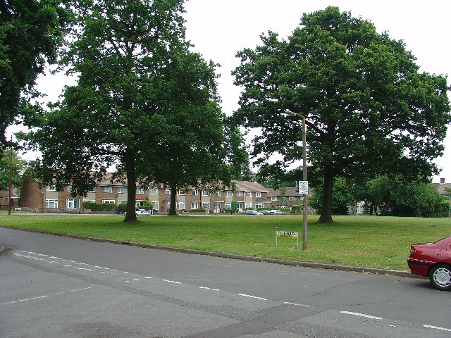
County Oak is a suburb located in the county of West Sussex, England. Situated just north of Crawley, it forms part of the larger neighborhood of Crawley Down. The area is primarily residential, offering a peaceful and family-friendly environment.

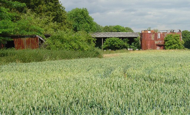
One of the notable features of County Oak is its abundance of green spaces and parks. The neighborhood is surrounded by picturesque landscapes, including the nearby Tilgate Park and Buchan Country Park, which provide ample opportunities for outdoor activities and nature walks. Additionally, the proximity to the South Downs National Park offers residents easy access to stunning countryside views and hiking trails.

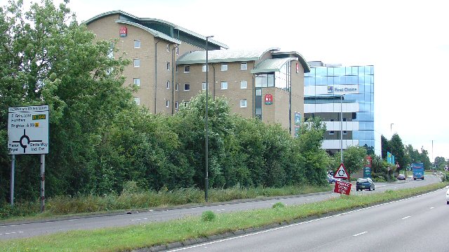
The area is well-connected, with the A23 road running close by, providing easy access to neighboring towns and cities. Gatwick Airport is conveniently located just a short drive away, making County Oak an attractive location for frequent travelers.

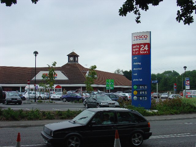
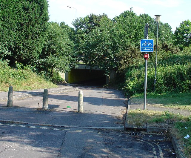
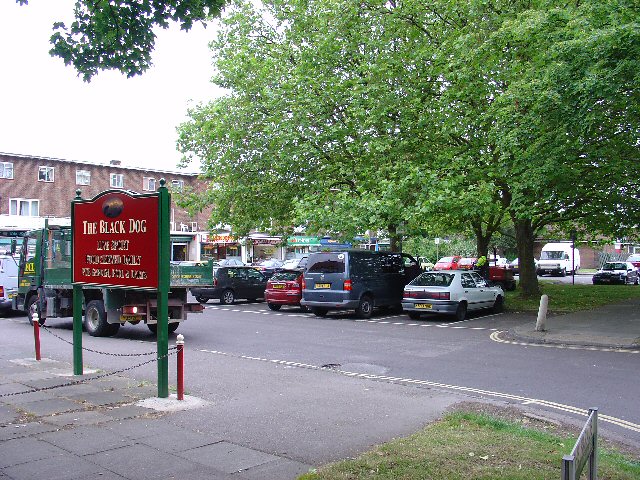
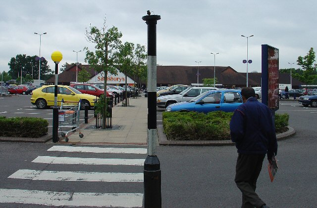
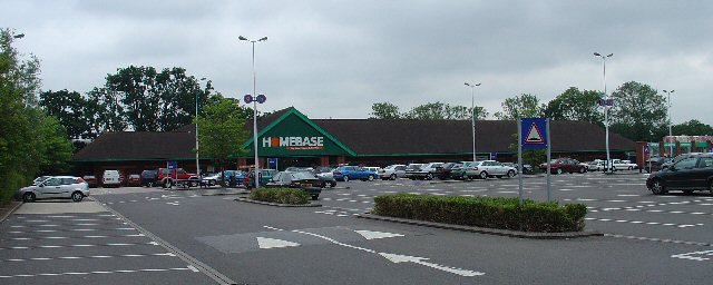
County Oak also boasts a range of amenities and facilities. The local County Oak Retail Park offers a variety of shopping options, including major supermarkets, electronics stores, and home improvement centers. The neighborhood is also home to several schools, contributing to its appeal for families.

In summary, County Oak in Sussex offers a tranquil living environment with its green spaces and parks, while still providing convenient access to nearby towns and cities. The presence of amenities and its proximity to Gatwick Airport make it an attractive place to call home.

If you have any feedback on the listing, please let us know in the comments section below.
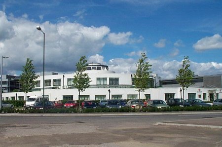
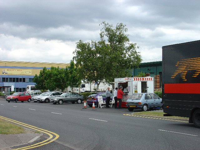
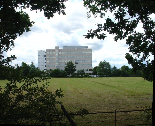
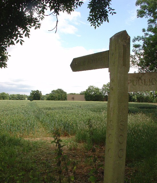
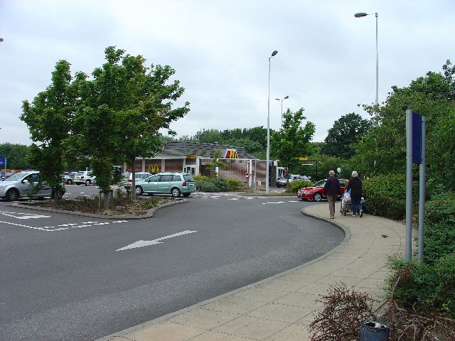
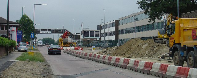
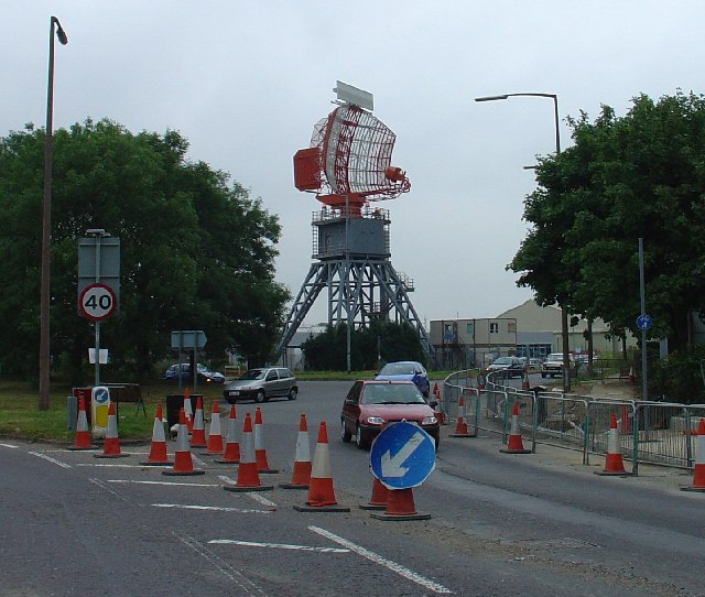
County Oak Images

Images are sourced within 2km of 51.134796/-0.18508797 or Grid Reference TQ2738. Thanks to Geograph Open Source API. All images are credited.

Gatwick Beehive Original 1930s Circular Airport Terminal. The airport was re-built approximately 1/2 mile to the north in the 1950s. The "Beehive" is now used as offices
Gatwick Beehive
Original 1930s Circular Airport Terminal. The airport was re-built approximately 1/2 mile to the north in the 1950s. The "Beehive" is now used as offices
Manor Royal Industrial Estate, Crawley, West Sussex - Lunch Time Manor Royal Industrial Estate dominates Grid square TQ2738. The industries are varied and include various types of light to medium weight engineering, pharmaceuticals, administrative head offices, storage, etc. The view here shows one of the many snack bars that are found at strategic points round the estate. Most of the larger premises include on-site catering for employees, but there are many small companies who don't.
Manor Royal Industrial Estate, Crawley, West Sussex - Lunch Time
Manor Royal Industrial Estate dominates Grid square TQ2738. The industries are varied and include various types of light to medium weight engineering, pharmaceuticals, administrative head offices, storage, etc. The view here shows one of the many snack bars that are found at strategic points round the estate. Most of the larger premises include on-site catering for employees, but there are many small companies who don't.
County Oak Retail Park, Crawley, West Sussex The largest of several small retail parks in Crawley that are situated away from the town centre. Carpets, Furniture, Consumer electronics and electrical items, Office supplies, motoring and cycling spares, pet supplies, and a motor vehicle tyre and exhaust replacement service are all represented.
County Oak Retail Park, Crawley, West Sussex
The largest of several small retail parks in Crawley that are situated away from the town centre. Carpets, Furniture, Consumer electronics and electrical items, Office supplies, motoring and cycling spares, pet supplies, and a motor vehicle tyre and exhaust replacement service are all represented.
Astral Towers, County Oak, Crawley, West Sussex The centre of Manor Royal industrial estate contains most of the light and medium industrial premises. Various clusters of administrative offices form satellites surrounding the main estate. One such satellite is at County Oak, just across the A23 trunk road from the main estate. A typical office block is Astral Towers.
Astral Towers, County Oak, Crawley, West Sussex
The centre of Manor Royal industrial estate contains most of the light and medium industrial premises. Various clusters of administrative offices form satellites surrounding the main estate. One such satellite is at County Oak, just across the A23 trunk road from the main estate. A typical office block is Astral Towers.
Pasture between Manor Royal Industrial Estate and Gatwick Airport, Near Crawley, West Sussex "The Atrium" office block in the background is on the extreme fringe of the Manor Royal Industrial Estate. The view has been taken from a public bridleway across a field, looking south. Most of this grid square is comprised of fields such as this. There are currently (2005) plans being discussed for a second runway for Gatwick Airport. One of the options would have the proposed runway in this area.
Pasture between Manor Royal Industrial Estate and Gatwick Airport, Near Crawley, West Sussex
"The Atrium" office block in the background is on the extreme fringe of the Manor Royal Industrial Estate. The view has been taken from a public bridleway across a field, looking south. Most of this grid square is comprised of fields such as this. There are currently (2005) plans being discussed for a second runway for Gatwick Airport. One of the options would have the proposed runway in this area.
Public Footpath across fields between County Oak and Rowley Farm, Near Crawley, West Sussex. One of several long standing public rights of way in this area. This path has been in use since long before the creation of the Manor Royal Industrial Estate, immediately behind the photographer and Gatwick Airport (1.5km N of here). The path cuts diagonally SW-NE across the fields, which are growing wheat. This area is currently (2005) being suggested as a possible location for a second runway for Gatwick International Airport.
Public Footpath across fields between County Oak and Rowley Farm, Near Crawley, West Sussex.
One of several long standing public rights of way in this area. This path has been in use since long before the creation of the Manor Royal Industrial Estate, immediately behind the photographer and Gatwick Airport (1.5km N of here). The path cuts diagonally SW-NE across the fields, which are growing wheat. This area is currently (2005) being suggested as a possible location for a second runway for Gatwick International Airport.
Farm buildings near Manor Royal Industrial Estate, Crawley, West Sussex These metal clad farm buildings are in various states of dilapidation, with the central barn still intact. A row of bee hives are set in front of the barn. Wheat is growing in the field. Photo taken (looking N) from the public footpath between County Oak and Rowley Farm, just after emerging out of the Manor Royal Industrial Estate.
Farm buildings near Manor Royal Industrial Estate, Crawley, West Sussex
These metal clad farm buildings are in various states of dilapidation, with the central barn still intact. A row of bee hives are set in front of the barn. Wheat is growing in the field. Photo taken (looking N) from the public footpath between County Oak and Rowley Farm, just after emerging out of the Manor Royal Industrial Estate.
Ibis Hotel, County Oak, Crawley West Sussex. A typical airport hotel, approximately 1.5km (straight line) from Gatwick airport. On the extreme N fringe of the Manor Royal industrial estate.
Ibis Hotel, County Oak, Crawley West Sussex.
A typical airport hotel, approximately 1.5km (straight line) from Gatwick airport. On the extreme N fringe of the Manor Royal industrial estate.
First Choice Holidays plc HQ, County Oak, Crawley, West Sussex The administrative headquarters of First Choice Holidays plc, a holiday company. This office block is situated in the extreme SW corner of the grid square and is on the north western edge of the Manor Royal industrial estate. Most of the square is farmland, with the A23 trunk road sweeping through the W edge and a few hotels adjacent to the road.
First Choice Holidays plc HQ, County Oak, Crawley, West Sussex
The administrative headquarters of First Choice Holidays plc, a holiday company. This office block is situated in the extreme SW corner of the grid square and is on the north western edge of the Manor Royal industrial estate. Most of the square is farmland, with the A23 trunk road sweeping through the W edge and a few hotels adjacent to the road.
Open Space in Residential Area of Three Bridges, Crawley, West Sussex A grass covered square open space with a number of oak trees. This grid square has a high proportion of residential usage and holds approximately half of the housing in the Three Bridges neighbourhood of Crawley. Such open spaces are common throughout the various Crawley neighbourhoods.
Open Space in Residential Area of Three Bridges, Crawley, West Sussex
A grass covered square open space with a number of oak trees. This grid square has a high proportion of residential usage and holds approximately half of the housing in the Three Bridges neighbourhood of Crawley. Such open spaces are common throughout the various Crawley neighbourhoods.
Tesco Superstore, Hazelwick Avenue, Crawley, West Sussex One of three major supermarkets in Crawley, the others being Asda (Southgate) and Sainsbury's (West Green).
Tesco Superstore, Hazelwick Avenue, Crawley, West Sussex
One of three major supermarkets in Crawley, the others being Asda (Southgate) and Sainsbury's (West Green).
Cycle Subway (on National Cycle Network Route 20) between Manor Royal Industrial Estate and Northgate, Crawley, West Sussex National Cycle Network route 20 passes through Crawley. Here we see where the cycle path is routed under the main Crawley dual carriageway inner bypass. NCN 20 is a route from London to Brighton.
Cycle Subway (on National Cycle Network Route 20) between Manor Royal Industrial Estate and Northgate, Crawley, West Sussex
National Cycle Network route 20 passes through Crawley. Here we see where the cycle path is routed under the main Crawley dual carriageway inner bypass. NCN 20 is a route from London to Brighton.
Northgate Shopping Parade, Crawley, West Sussex Shopping parade at the heart of the residential area of Northgate, which occupies most of this grid square. As is common with most of the neighbourhood parades in Crawley, the Northgate one includes its own pub (The Black Dog)
Northgate Shopping Parade, Crawley, West Sussex
Shopping parade at the heart of the residential area of Northgate, which occupies most of this grid square. As is common with most of the neighbourhood parades in Crawley, the Northgate one includes its own pub (The Black Dog)
Sainsbury's Supermarket, West Green, Crawley, West Sussex A (slightly) out of town superstore. Approximately 1km N of the town centre, this superstore is located close to a major road intersection between the A23 and the A2011 dual carriageway to the M23 motorway. Accessibility is one of the main reasons for this location. The site also includes a Homebase (Do-it-Yourself & Gardening) store and a drive through McDonald's (fast food).
Sainsbury's Supermarket, West Green, Crawley, West Sussex
A (slightly) out of town superstore. Approximately 1km N of the town centre, this superstore is located close to a major road intersection between the A23 and the A2011 dual carriageway to the M23 motorway. Accessibility is one of the main reasons for this location. The site also includes a Homebase (Do-it-Yourself & Gardening) store and a drive through McDonald's (fast food).
Homebase Do-it-Yourself and Garden Store, West Green, Crawley, West Sussex A DIY store on the same retailing site as the West Green Sainsbury's supermarket.
Homebase Do-it-Yourself and Garden Store, West Green, Crawley, West Sussex
A DIY store on the same retailing site as the West Green Sainsbury's supermarket.
McDonald's Drive Through Fast Food Outlet, West Green, Crawley, West Sussex All for the convenience of the out of town shopper! On the same site as Sainsbury's Supermarket and the Homebase DIY store.
McDonald's Drive Through Fast Food Outlet, West Green, Crawley, West Sussex
All for the convenience of the out of town shopper! On the same site as Sainsbury's Supermarket and the Homebase DIY store.
Gatwick Road, Manor Royal Industrial Estate, Crawley, West Sussex The Manor Royal industrial estate is centred on TQ2738, but also spreads over about a third of this grid square. A feature here is the bridge over the main road linking two buildings belonging to the same organisation. The road building works are connected with the installation of the "Fastway" guided bus network throughout Crawley.
Gatwick Road, Manor Royal Industrial Estate, Crawley, West Sussex
The Manor Royal industrial estate is centred on TQ2738, but also spreads over about a third of this grid square. A feature here is the bridge over the main road linking two buildings belonging to the same organisation. The road building works are connected with the installation of the "Fastway" guided bus network throughout Crawley.
Radar, Tinsley Green, Crawley, West Sussex A Radar adjacent to Gatwick airport.
Radar, Tinsley Green, Crawley, West Sussex
A Radar adjacent to Gatwick airport.
Show me another place!

County Oak is located at Grid Ref: TQ2738 (Lat: 51.134796, Lng: -0.18508797)

Administrative County: West Sussex

District: Crawley

Police Authority: Sussex

What 3 Words

///gone.fluid.image. Near Langley Green, West Sussex

Nearby Locations

Magpie Wood County Oak

Related Wikis

Langley Green, West Sussex

Langley Green is a one of 14 neighbourhoods within the town of Crawley in West Sussex, England. Langley Green is in the north-west of the town and is bordered...

Manor Royal

Manor Royal is an industrial zone within the town of Crawley in West Sussex, England. Manor Royal is in the north of the town near to Gatwick Airport....

Northgate, West Sussex

Northgate is one of the 14 residential neighbourhoods in Crawley, a town and borough in West Sussex, England. Crawley was planned and laid out as a New...

Northgate & Three Bridges (electoral division)

Northgate & Three Bridges is an electoral division of West Sussex in the United Kingdom, and returns one member to sit on West Sussex County Council....

Nearby Amenities

Located within 500m of 51.134796,-0.18508797
Crossing
Crossing: traffic_signals
Crossing Ref: puffin
Kerb: lowered
Source: P167-0634 & 635 on 2011-11-15
Tactile Paving: yes
Traffic Signals: signal
Lat/Long: 51.1323277/-0.1859784
Crossing
Bicycle: yes
Crossing: traffic_signals
Crossing Markings: dots
Crossing Ref: toucan
Kerb: lowered
Tactile Paving: yes
Traffic Signals: pedestrian_crossing
Lat/Long: 51.1305913/-0.1860437
Mini Roundabout
Direction: clockwise
Lat/Long: 51.1327569/-0.1877526
Recycling
Crawley Household Waste Recycling Site
Lat/Long: 51.1324722/-0.1904474
Crossing
Bicycle: yes
Crossing: traffic_signals
Crossing Ref: toucan
Kerb: yes
Source: survey
Traffic Signals: pedestrian_crossing
Lat/Long: 51.1353298/-0.1860409
Crossing
Crossing: uncontrolled
Crossing Markings: zebra
Crossing Ref: zebra
Kerb: lowered
Tactile Paving: yes
Lat/Long: 51.1332595/-0.1812639
Crossing
Crossing: traffic_signals
Crossing Ref: puffin
Kerb: lowered
Source: P174-0215
Tactile Paving: yes
Traffic Signals: signal
Traffic Signals Direction: forward
Lat/Long: 51.1322991/-0.1863078
Bus Stop
Fleming Way West
Bus: yes
Naptan AtcoCode: 4400CY0086
Naptan Bearing: E
Naptan CommonName: Fleming Way West
Naptan Indicator: opp Faraday Road
Naptan Landmark: Faraday Road
Naptan NaptanCode: wsxajpjp
Naptan PlusbusZoneRef: CRAWLEY
Naptan Street: Fleming Way
Naptan Verified: no
Public Transport: platform
Source: naptan_import
Lat/Long: 51.1348383/-0.1779487
Bus Stop
Gatwick Manor Hotel
Bus: yes
Naptan AtcoCode: 4400CY0310
Naptan Bearing: S
Naptan CommonName: Gatwick Manor Hotel
Naptan Indicator: adj
Naptan Landmark: Gatwick Manor Hotel
Naptan NaptanCode: wsxamdwp
Naptan PlusbusZoneRef: CRAWLEY
Naptan ShortCommonName: Gatwick Manor Hotel
Naptan Street: London Road
Naptan Verified: no
Public Transport: platform
Source: naptan_import
Lat/Long: 51.1391979/-0.1850277
Bus Stop
Betts Way
Bench: yes
Bus: yes
Naptan AtcoCode: 4400CY0311
Naptan Bearing: S
Naptan CommonName: Betts Way
Naptan Indicator: opposite County Oak Industrial Est
Naptan Landmark: County Oak Ind Estate
Naptan NaptanCode: wsxamdwt
Naptan PlusbusZoneRef: CRAWLEY
Naptan ShortCommonName: Betts Way
Naptan Street: London Road
Naptan Verified: no
Public Transport: platform
Shelter: yes
Source: naptan_import
Lat/Long: 51.1355761/-0.1858087
Bus Stop
Betts Way
Bench: yes
Bin: yes
Bus: yes
Naptan AtcoCode: 4400CY0312
Naptan Bearing: N
Naptan CommonName: Betts Way
Naptan Indicator: adj County Oak Industrial Estate
Naptan Landmark: County Oak Ind Estate
Naptan NaptanCode: wsxamgad
Naptan PlusbusZoneRef: CRAWLEY
Naptan ShortCommonName: Betts Way
Naptan Street: London Road
Naptan Verified: yes
Public Transport: platform
Shelter: yes
Shelter Type: public_transport
Source: naptan_import
Lat/Long: 51.1362763/-0.1860968
Hotel Ibis
Naptan AtcoCode: 4400CY0316
Naptan Bearing: S
Naptan BusStopType: CUS
Naptan CommonName: Hotel Ibis
Naptan Indicator: next to Gatwick Skylodge entrance
Naptan Landmark: Ibis hotel
Naptan NaptanCode: wsxamgap
Naptan PlusbusZoneRef: CRAWLEY
Naptan ShortCommonName: Hotel Ibis
Naptan Street: London Road
Naptan Verified: no
Source: naptan_import
Lat/Long: 51.1366992/-0.1856629
Bus Stop
Langley Green Hospital
Bus: yes
Naptan AtcoCode: 4400CY0321
Naptan Bearing: E
Naptan CommonName: Langley Green Hospital
Naptan Indicator: adj
Naptan Landmark: Dobson Road
Naptan NaptanCode: wsxamgdj
Naptan PlusbusZoneRef: CRAWLEY
Naptan ShortCommonName: Langley Gn Hospital
Naptan Street: Martyrs Avenue
Naptan Verified: no
Public Transport: platform
Source: naptan_import
Lat/Long: 51.1309782/-0.1874502
Bus Stop
Langley Green Hospital
Bus: yes
Naptan AtcoCode: 4400CY0322
Naptan Bearing: E
Naptan CommonName: Langley Green Hospital
Naptan Indicator: opp
Naptan Landmark: Dobson Road
Naptan NaptanCode: wsxamgdm
Naptan PlusbusZoneRef: CRAWLEY
Naptan ShortCommonName: Langley Gn Hospital
Naptan Street: Martyrs Avenue
Naptan Verified: no
Public Transport: platform
Source: naptan_import
Lat/Long: 51.1307426/-0.1869581
Bus Stop
Fleming Way West
Bus: yes
Naptan AtcoCode: 4400CY0424
Naptan Bearing: W
Naptan CommonName: Fleming Way West
Naptan Indicator: adj Faraday Road
Naptan Landmark: Faraday Road
Naptan NaptanCode: wsxgdptj
Naptan PlusbusZoneRef: CRAWLEY
Naptan Street: Fleming Way
Naptan Verified: no
Public Transport: platform
Source: naptan_import
Lat/Long: 51.1347247/-0.1780709
Bus Stop
Business Quarter North
Bus: yes
Naptan AtcoCode: 4400CY0428
Naptan Bearing: W
Naptan CommonName: Business Quarter
Naptan Indicator: O/S Crawley Business Centre
Naptan Landmark: Opp Sub Station
Naptan NaptanCode: wsxdpwdw
Naptan PlusbusZoneRef: CRAWLEY
Naptan Street: Fleming Way
Naptan Verified: yes
Public Transport: platform
Source: naptan_import
Toilets Wheelchair: no
Wheelchair: limited
Lat/Long: 51.1346656/-0.1816708
Bus Stop
Business Quarter North
Bus: yes
Naptan AtcoCode: 4400CY0429
Naptan Bearing: E
Naptan CommonName: Business Quarter
Naptan Indicator: Opp Linac House
Naptan Landmark: Nr Flight Training Centre
Naptan NaptanCode: wsxdpwga
Naptan PlusbusZoneRef: CRAWLEY
Naptan Street: Fleming Way
Naptan Verified: no
Public Transport: platform
Source: naptan_import
Lat/Long: 51.1347854/-0.1827318
Bus Stop
County Oak Retail Park
Bench: no
Bin: no
Bus: yes
Naptan AtcoCode: 4400CY0524
Naptan Bearing: N
Naptan CommonName: County Oak Retail Park
Naptan Indicator: Opp Garage
Naptan Landmark: London Rd
Naptan NaptanCode: wsxgdpwm
Naptan PlusbusZoneRef: CRAWLEY
Naptan Street: County Oak Way
Naptan Verified: no
Public Transport: platform
Shelter: no
Source: naptan_import
Lat/Long: 51.1329942/-0.186889
County Oak Retail Park
Naptan AtcoCode: 4400CY0525
Naptan Bearing: S
Naptan CommonName: County Oak Retail Park
Naptan Indicator: Adj Garage
Naptan Landmark: London Rd
Naptan NaptanCode: wsxgdpwp
Naptan PlusbusZoneRef: CRAWLEY
Naptan Street: County Oak Way
Naptan Verified: no
Source: naptan_import
Lat/Long: 51.1332068/-0.1866934
Bus Stop
County Oak Way
Bus: yes
Naptan AtcoCode: 4400CY0526
Naptan Bearing: NW
Naptan CommonName: County Oak Way
Naptan Indicator: Opp Whitworth Rd
Naptan Landmark: Whitworth Rd
Naptan NaptanCode: wsxgdpwt
Naptan PlusbusZoneRef: CRAWLEY
Naptan Street: County Oak Way
Naptan Verified: no
Public Transport: platform
Source: naptan_import
Lat/Long: 51.1345189/-0.1889576
Bus Stop
Metcalf Way
Bus: yes
Naptan AtcoCode: 4400CY0527
Naptan Bearing: SE
Naptan CommonName: Metcalf Way
Naptan Indicator: County Oak Way
Naptan Landmark: County Oak Way
Naptan NaptanCode: wsxgdtad
Naptan PlusbusZoneRef: CRAWLEY
Naptan Street: County Oak Way
Naptan Verified: no
Public Transport: platform
Source: naptan_import
Lat/Long: 51.1342943/-0.1912963
Halfords
Brand: Halfords
Brand Wikidata: Q3398786
Brand Wikipedia: en:Halfords
Service Bicycle Repair: yes
Service Bicycle Retail: yes
Shop: car_parts
Lat/Long: 51.133583/-0.187654
Rogers Ceramics
Shop: doityourself
Lat/Long: 51.134122/-0.19182
Currys
Brand: currys
Brand Wikidata: Q3246464
Brand Wikipedia: en:Currys
Contact Website: https://www.currys.co.uk/store-finder/crawley-2266.html
Shop: electronics
Wheelchair: yes
Lat/Long: 51.1330768/-0.1882584
B&M
Brand Wikidata: Q4836931
Shop: houseware
Lat/Long: 51.132755/-0.188253
Furniture Village
Brand: Furniture Village
Brand Wikidata: Q5509685
Brand Wikipedia: en:Furniture Village
Opening Hours: Su 06:00-20:00
Shop: furniture
Wheelchair: yes
Lat/Long: 51.132539/-0.187878
Hobbycraft
Addr Housenumber: 2A
Addr Postcode: RH11 7XN
Addr Street: London Road
Brand: Hobbycraft
Brand Wikidata: Q16984508
Brand Wikipedia: en:Hobbycraft
Email: crawley@hobbycraft.co.uk
Opening Hours: Mo-Sa 09:00-20:00; Su 10:30-16:30
Phone: +443300 261052
Shop: craft
Website: https://www.hobbycraft.co.uk/stores/crawley
Wheelchair: yes
Lat/Long: 51.1321988/-0.1874171
Oak Furnitureland
Brand: Oak Furnitureland
Brand Wikidata: Q16959724
Brand Wikipedia: en:Oak Furniture Land
Shop: furniture
Lat/Long: 51.1323221/-0.1876164
Next
Brand: Next
Brand Wikidata: Q246655
Brand Wikipedia: en:Next plc
Opening Hours: Mo 09:00-18:00; Tu-Sa 09:00-20:00
Shop: clothes
Lat/Long: 51.1316088/-0.1867178
Halfords
Branch: Bike Hut
Brand: Halfords
Brand Wikidata: Q3398786
Service Bicycle Repair: yes
Service Bicycle Retail: yes
Shop: car_parts
Wheelchair: yes
Lat/Long: 51.1336938/-0.1879767
Crossing
Crossing: traffic_signals
Crossing Ref: puffin
Kerb: flush
Source: P167-0634 & 635 on 2011-11-15
Tactile Paving: yes
Lat/Long: 51.1322809/-0.1861261
Crossing
Bicycle: yes
Crossing: traffic_signals
Crossing Ref: toucan
Kerb: lowered
Tactile Paving: yes
Traffic Signals: signal
Lat/Long: 51.1324255/-0.1858658
Crossing
Bicycle: yes
Crossing: traffic_signals
Crossing Ref: toucan
Kerb: lowered
Tactile Paving: yes
Traffic Signals: signal
Lat/Long: 51.1325759/-0.1858204
Kwik Fit
Brand: Kwik Fit
Brand Wikidata: Q958053
Brand Wikipedia: en:Kwik Fit
Shop: car_repair
Source: P174-0215
Lat/Long: 51.1327676/-0.1863471
Fuel
BP
Brand: BP
Brand Wikidata: Q152057
Brand Wikipedia: en:BP
Operator: BP
Source: visit & survey
Lat/Long: 51.1331266/-0.1862941
Tesco Express
Addr City: Crawley
Addr Housename: Astral Towers
Addr Postcode: RH10 9XA
Addr Street: Betts Way
Brand: Tesco Express
Brand Wikidata: Q98456772
Brand Wikipedia: en:Tesco
Contact Website: https://www.tesco.com/store-locator/crawley/betts-way
Fhrs Id: 434336
Level: 0
Shop: convenience
Source: survey
Lat/Long: 51.1352429/-0.186592
Barrier: lift_gate
Lat/Long: 51.1312991/-0.1824388
Cafe
Costa
Brand: Costa
Brand Wikidata: Q608845
Brand Wikipedia: en:Costa Coffee
Cuisine: coffee_shop
Takeaway: yes
Lat/Long: 51.133202/-0.1870231
Crossing
Crossing: uncontrolled
Crossing Markings: zebra
Crossing Ref: zebra
Kerb: lowered
Tactile Paving: yes
Lat/Long: 51.133244/-0.1804572
Access: no
Barrier: stile
Foot: yes
Lat/Long: 51.1372022/-0.1794889
Crossing
Bicycle: no
Crossing: traffic_signals
Crossing Markings: dots
Crossing Ref: puffin
Kerb: lowered
Tactile Paving: yes
Lat/Long: 51.1306331/-0.1863304
Give Way
Lat/Long: 51.1307266/-0.1864601
Crossing
Crossing: uncontrolled
Crossing Markings: zebra
Crossing Ref: zebra
Kerb: lowered
Tactile Paving: yes
Lat/Long: 51.1313588/-0.1805782
Crossing
Crossing: unmarked
Crossing Markings: no
Lat/Long: 51.1347821/-0.1791933
M&S Acorn Park Crawley Foodhall
Addr City: CRAWLEY
Addr Housename: M&S Crawley Acorn Park Foodhall
Addr Housenumber: UNIT 1
Addr Postcode: RH10 9BN
Addr Street: Betts Way
Brand: M&S Foodhall
Brand Wikidata: Q714491
Brand Wikipedia: en:Marks & Spencer
Contact Website: https://www.marksandspencer.com/stores/crawley-acorn-park-foodhall-1988
Fhrs Id: 910795
Operator: Marks and Spencers
Shop: supermarket
Lat/Long: 51.1347942/-0.1878688
Aldi
Addr City: CRAWLEY
Addr Housename: ALDI
Addr Housenumber: Unit 2
Addr Postcode: RH10 9BN
Addr Street: Acorn Retail Park
Brand: ALDI
Brand Wikidata: Q41171672
Brand Wikipedia: en:Aldi
Contact Website: https://stores.aldi.co.uk/crawley/unit-2-acorn-rp-betts-way
Fhrs Id: 910796
Operator: ALDI
Shop: supermarket
Lat/Long: 51.1347943/-0.1881451
Smyths
Addr City: CRAWLEY
Addr Housename: Smyths Toy Shop
Addr Housenumber: Unit 3
Addr Postcode: RH10 9BN
Addr Street: Acorn Retail Park
Branch: Toy Shop
Brand: Smyths
Brand Wikidata: Q7546779
Brand Wikipedia: en:Smyths
Operator: Smyths
Shop: toys
Lat/Long: 51.134783/-0.1887838
Crossing
Barrier: kerb
Crossing: traffic_signals
Crossing Ref: zebra
Kerb: flush
Tactile Paving: yes
Lat/Long: 51.1337986/-0.1874516
Entrance: main
Lat/Long: 51.1353022/-0.1910095
Barrier: bollard
Bollard: removable
Lat/Long: 51.1352197/-0.1915473
Give Way
Lat/Long: 51.134781/-0.1921113
Bicycle Parking
Lat/Long: 51.1333342/-0.1795751
Crossing
Bicycle: yes
Crossing: unmarked
Crossing Island: no
Crossing Markings: no
Horse: yes
Kerb: lowered
Tactile Paving: no
Lat/Long: 51.1340052/-0.1906824
Barrier: lift_gate
Lat/Long: 51.1341894/-0.1783794
Post Box
Brand: Royal Mail
Brand Wikidata: Q638098
Brand Wikipedia: en:Royal Mail
Collection Times: Mo-Fr 18:00; Sa-Su off
Drive Through: no
Opening Hours: Mo-Fr 12:30-18:00
Operator: Royal Mail
Operator Wikidata: Q638098
Post Box Type: meter
Ref: RH10 150
Royal Cypher: no
Source: survey
Lat/Long: 51.1346454/-0.1790336
Bus Stop
Business Quarter Central
Bus: yes
Naptan AtcoCode: 4400CY0605
Naptan Bearing: N
Naptan NaptanCode: wsxwadjw
Naptan Street: Crawley Business Quarter
Public Transport: platform
Source: gps
Lat/Long: 51.1328474/-0.1818314
Barrier: lift_gate
Lat/Long: 51.1358499/-0.1894789
Barrier: lift_gate
Lat/Long: 51.1362296/-0.1905902
Entrance: yes
Lat/Long: 51.1360177/-0.1900983
Entrance: yes
Lat/Long: 51.1358936/-0.1901234
Crossing
Crossing: marked
Crossing Markings: zebra
Lat/Long: 51.1359433/-0.1900977
Crossing
Bicycle: yes
Crossing: traffic_signals
Crossing Ref: toucan
Kerb: yes
Source: P167-0633 on 2011-11-15
Traffic Signals: pedestrian_crossing
Lat/Long: 51.1353787/-0.1859278
Crossing
Bicycle: yes
Crossing: uncontrolled
Lat/Long: 51.1348035/-0.1787073
Crossing
Bicycle: yes
Crossing: traffic_signals
Crossing Ref: toucan
Kerb: lowered
Lat/Long: 51.1345723/-0.1786614
TK Maxx
Brand: TK Maxx
Brand Wikidata: Q23823668
Brand Wikipedia: en:TK Maxx
Opening Hours: Mo-Fr 09:00-20:00; Sa 09:00-19:00; Su 10:30-16:30
Shop: department_store
Lat/Long: 51.1320089/-0.1872025
Boots
Brand: Boots
Brand Wikidata: Q6123139
Brand Wikipedia: en:Boots (company)
Shop: chemist
Lat/Long: 51.1318684/-0.1870516
Cafe
Costa
Addr Housename: County Oak Retail Park
Addr Postcode: RH11 7PA
Addr Street: County Oak Way
Addr Unit: Unit 1A
Brand: Costa
Brand Wikidata: Q608845
Brand Wikipedia: en:Costa Coffee
Cuisine: coffee_shop
Fhrs Id: 938643
Takeaway: yes
Lat/Long: 51.1317394/-0.1868144
Bus Stop
Business Quarter Central
Bus: yes
Naptan AtcoCode: 4400CY0604
Naptan Bearing: S
Naptan NaptanCode: wsxwadjt
Naptan Street: Crawley Business Quarter
Public Transport: platform
Lat/Long: 51.1328867/-0.1816637
Crossing
Bicycle: yes
Crossing: traffic_signals
Crossing Markings: dots
Crossing Ref: toucan
Kerb: lowered
Tactile Paving: yes
Traffic Signals: pedestrian_crossing
Lat/Long: 51.1306507/-0.1861882
Traffic Signals
Traffic Signals: signal
Traffic Signals Direction: forward
Lat/Long: 51.1309166/-0.1860246
Traffic Signals
Traffic Signals: signal
Traffic Signals Direction: backward
Lat/Long: 51.1307626/-0.1863639
Traffic Signals
Traffic Signals: signal
Traffic Signals Direction: forward
Lat/Long: 51.1326158/-0.1859629
Entrance: yes
Lat/Long: 51.1356707/-0.1826735
Entrance: yes
Lat/Long: 51.1356599/-0.1815439
Barrier: yes
Lat/Long: 51.1336103/-0.1847223
Crossing
Bicycle: no
Crossing: traffic_signals
Crossing Ref: puffin
Kerb: lowered
Traffic Signals: pedestrian_crossing
Traffic Signals Direction: forward
Lat/Long: 51.1347389/-0.1848371
Crossing
Bicycle: no
Crossing: traffic_signals
Crossing Ref: puffin
Kerb: lowered
Traffic Signals: pedestrian_crossing
Traffic Signals Direction: forward
Lat/Long: 51.1348213/-0.1849057
Crossing
Crossing: unmarked
Crossing Markings: no
Tactile Paving: yes
Lat/Long: 51.1348365/-0.1834685
Crossing
Crossing: unmarked
Crossing Island: yes
Crossing Markings: no
Lat/Long: 51.1348097/-0.1820651
Crossing
Crossing: unmarked
Crossing Markings: no
Tactile Paving: yes
Lat/Long: 51.1348021/-0.1811915
Crossing
Crossing: unmarked
Crossing Markings: no
Lat/Long: 51.1347873/-0.1801439
Crossing
Bicycle: yes
Crossing: traffic_signals
Crossing Ref: toucan
Kerb: lowered
Traffic Signals: pedestrian_crossing
Lat/Long: 51.1347111/-0.1788969
Crossing
Lat/Long: 51.1346219/-0.179462
Crossing
Crossing: unmarked
Crossing Island: yes
Crossing Markings: no
Lat/Long: 51.1347265/-0.1823288
Traffic Signals
Traffic Signals Direction: backward
Lat/Long: 51.1324744/-0.18638
Crossing
Crossing: traffic_signals
Crossing Island: yes
Crossing Ref: puffin
Kerb: flush
Tactile Paving: no
Lat/Long: 51.1324627/-0.1862137
Carpetright
Brand: Carpetright
Brand Wikidata: Q5045782
Brand Wikipedia: en:Carpetright
Shop: carpet
Lat/Long: 51.1326266/-0.1879367
Traffic Signals
Lat/Long: 51.1306212/-0.1861902
Traffic Signals
Lat/Long: 51.1306056/-0.1862975
Crossing
Bicycle: yes
Crossing: traffic_signals
Crossing Island: no
Crossing Markings: dots
Crossing Ref: puffin
Kerb: lowered
Tactile Paving: yes
Lat/Long: 51.1307627/-0.1863129
Traffic Signals
Traffic Signals Direction: forward
Lat/Long: 51.1322345/-0.1861279
Traffic Signals
Lat/Long: 51.1322429/-0.1862673
Traffic Signals
Traffic Signals Direction: forward
Lat/Long: 51.1324197/-0.1857638
Traffic Signals
Traffic Signals Direction: forward
Lat/Long: 51.1326204/-0.185859
Traffic Signals
Traffic Signals Direction: forward
Lat/Long: 51.1347508/-0.1784286
Traffic Signals
Lat/Long: 51.1348248/-0.1787096
Traffic Signals
Traffic Signals Direction: backward
Lat/Long: 51.1347083/-0.1789516
Traffic Signals
Traffic Signals Direction: backward
Lat/Long: 51.1345315/-0.1786546
Artwork Type: sculpture
Tourism: artwork
Lat/Long: 51.134817/-0.1858488
Bus Stop
Bench: no
Bin: no
Bus: yes
Fixme: new Bus Stop. needs surveying to see what is here
Public Transport: platform
Shelter: no
Lat/Long: 51.1327883/-0.1862459
Lexus Gatwick
Brand: Lexus
Brand Wikidata: Q35919
Brand Wikipedia: en:Lexus
Shop: car
Lat/Long: 51.1354343/-0.1806788
Little Dell
Place: farm
Lat/Long: 51.137881/-0.1890316
Kerb: raised
Lat/Long: 51.1343645/-0.1857953
Kerb: raised
Lat/Long: 51.1344057/-0.1861171
Kerb: raised
Lat/Long: 51.1344108/-0.1859924
Kerb: raised
Lat/Long: 51.1343973/-0.1859093
Give Way
Lat/Long: 51.1307454/-0.1863732
Traffic Signals
Lat/Long: 51.130841/-0.1862635
Charging Station
London-Gatwick Supercharger
Access: customers
Addr City: Crawley
Addr Country: GB
Addr Postcode: RH11 7ST
Addr Street: County Oak Way
Brand: Tesla Supercharger
Brand Wikidata: Q17089620
Capacity: 8
Fee: yes
Opening Hours: 24/7
Operator: Tesla, Inc.
Socket Tesla Supercharger Ccs: 8
Socket Tesla Supercharger Ccs Output: 250 kW
Website: https://www.tesla.com/findus/location/supercharger/gatwicklondon
Lat/Long: 51.1351448/-0.1913077
Crossing
Crossing: zebra
Crossing Markings: zebra
Lat/Long: 51.1304673/-0.1847804
Crossing
Crossing: zebra
Crossing Markings: zebra
Lat/Long: 51.1304654/-0.1847213
Crossing
Crossing: uncontrolled
Crossing Markings: zebra
Lat/Long: 51.1322993/-0.18452
Crossing
Crossing: uncontrolled
Crossing Markings: zebra
Lat/Long: 51.1323429/-0.1846738
Crossing
Crossing: zebra
Crossing Markings: zebra
Lat/Long: 51.1312052/-0.1848899
Crossing
Crossing: zebra
Crossing Markings: zebra
Lat/Long: 51.1308864/-0.1849094
Crossing
Crossing: zebra
Crossing Markings: zebra
Lat/Long: 51.130565/-0.1846046
Crossing
Crossing: zebra
Crossing Markings: zebra
Lat/Long: 51.1318096/-0.1847025
Crossing
Crossing: zebra
Crossing Markings: zebra
Lat/Long: 51.1315908/-0.1847144
Crossing
Crossing: uncontrolled
Crossing Markings: zebra
Crossing Ref: zebra
Kerb: lowered
Tactile Paving: yes
Lat/Long: 51.1340178/-0.1807923
Crossing
Crossing: uncontrolled
Crossing Markings: zebra
Crossing Ref: zebra
Kerb: lowered
Tactile Paving: yes
Lat/Long: 51.1313816/-0.1813663
Barrier: lift_gate
Lat/Long: 51.1314888/-0.1877744
The data included in this document is from www.openstreetmap.org. The data is made available under ODbL.

Have you been to County Oak?

Leave your review of County Oak below (or comments, questions and feedback).