Ceann Hurnavay

Settlement in Ross-shire

Scotland

Ceann Hurnavay

Grimshader Salmon Farm Marine Harvest - Arachas Bhratan Griomshadair. Sea loch industry on the shores of Loch Griomsiadair.
Grimshader Salmon Farm Credit: Colin Smith

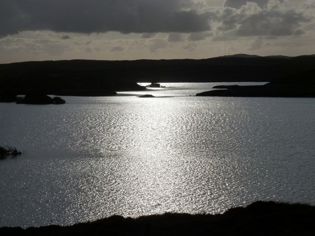
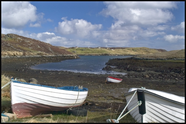
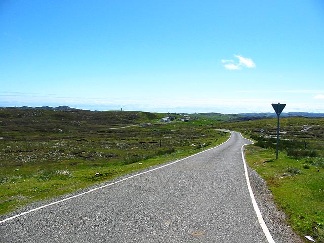
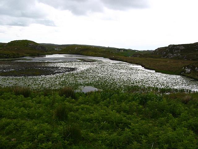
Ceann Hurnavay is a small village located in Ross-shire, Scotland. Situated on the northwest coast of the country, the village is known for its stunning views of the surrounding countryside and the nearby sea. Ceann Hurnavay is a popular destination for tourists looking to experience the beauty of the Scottish Highlands.

The village is home to a small population of residents who enjoy a peaceful and tranquil way of life. The area is known for its rugged landscapes, with rolling hills and cliffs providing a dramatic backdrop to the village. The nearby coastline offers opportunities for outdoor activities such as hiking, fishing, and birdwatching.

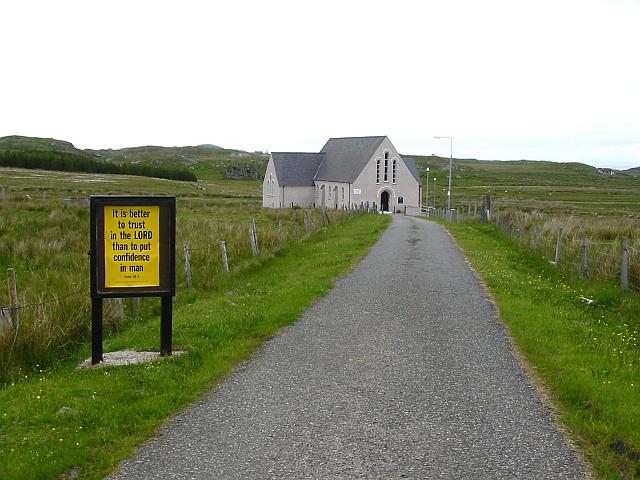
Ceann Hurnavay is also known for its rich history, with several historic sites and landmarks in the area. Visitors can explore ancient ruins, castles, and other historical sites that offer a glimpse into the village's past.

Overall, Ceann Hurnavay is a charming and picturesque village that offers visitors a chance to experience the natural beauty and history of the Scottish Highlands.

If you have any feedback on the listing, please let us know in the comments section below.

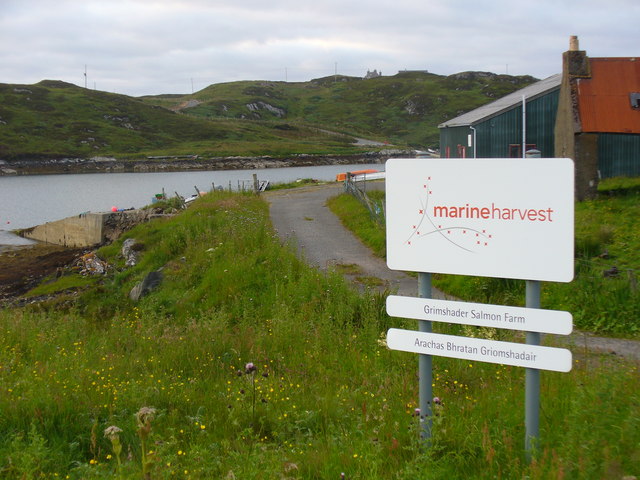
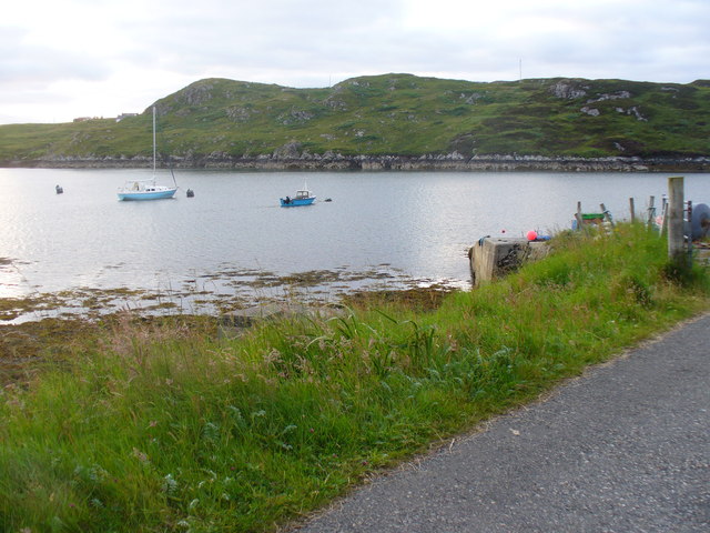
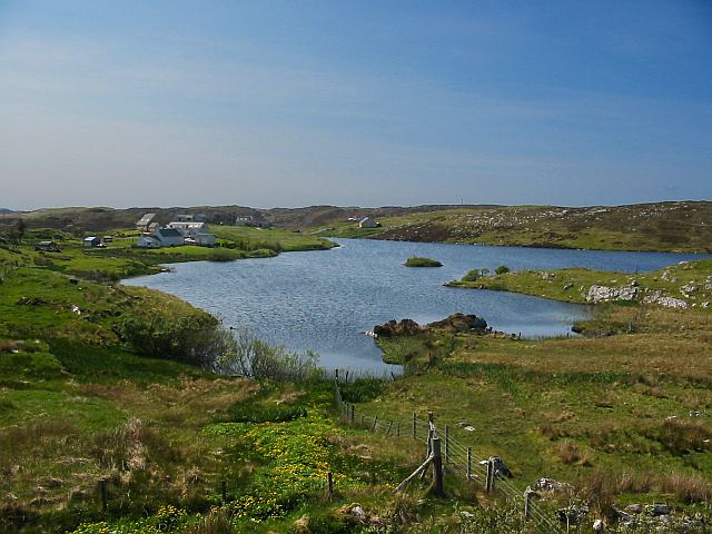
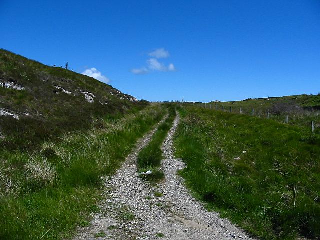
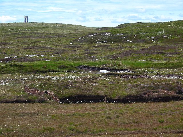
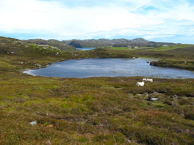
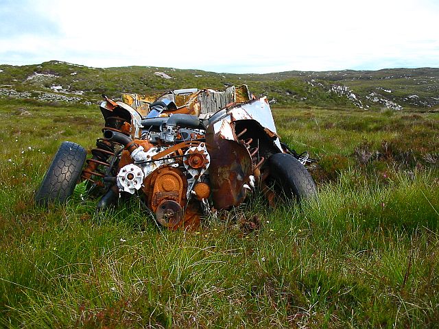
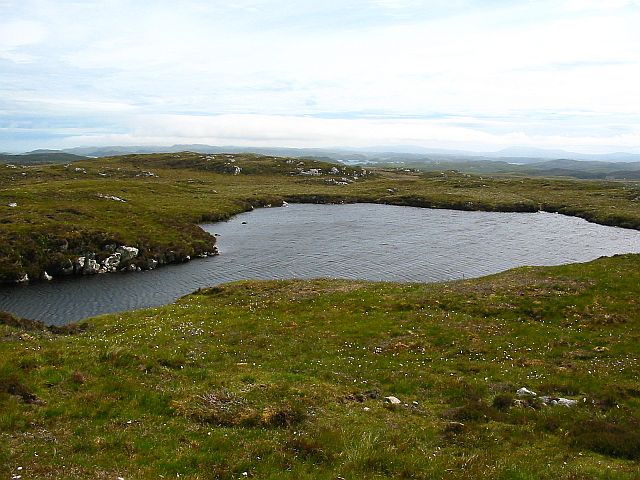
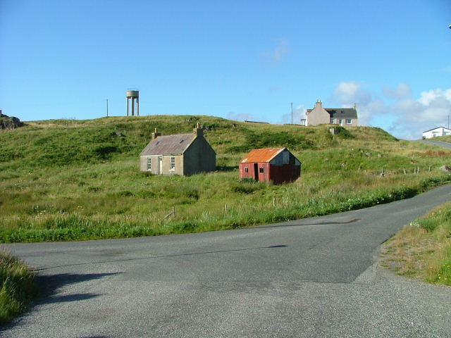
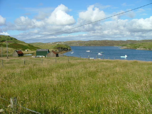
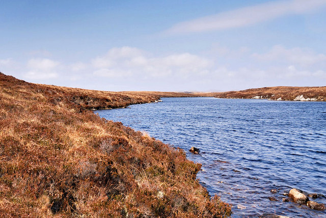
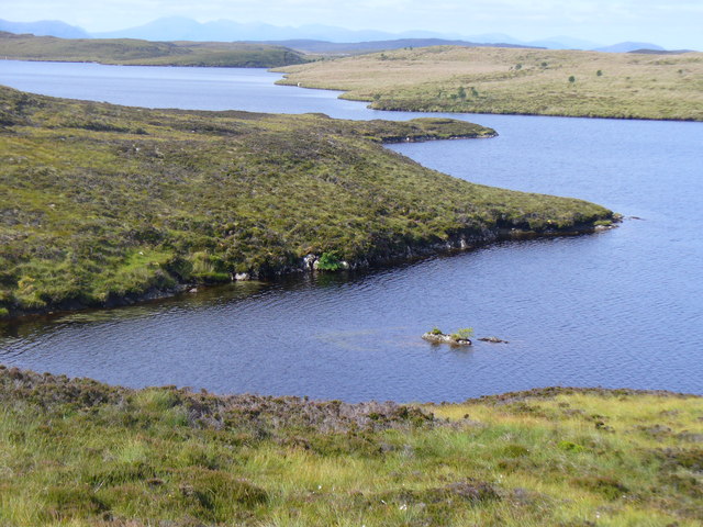
Ceann Hurnavay Images

Images are sourced within 2km of 58.152022/-6.42542 or Grid Reference NB3926. Thanks to Geograph Open Source API. All images are credited.

Grimshader Salmon Farm Marine Harvest - Arachas Bhratan Griomshadair. Sea loch industry on the shores of Loch Griomsiadair.
Grimshader Salmon Farm
Marine Harvest - Arachas Bhratan Griomshadair. Sea loch industry on the shores of Loch Griomsiadair.
Loch Griomsiadair Yacht and lobster boat moored in the sheltered sea loch at Grimshader which is also used for salmon farming.
Loch Griomsiadair
Yacht and lobster boat moored in the sheltered sea loch at Grimshader which is also used for salmon farming.
Loch Grimshader Ordnance survey maps show two Loch Grimshaders! One is the sea loch as shown on  <a href="https://www.geograph.org.uk/gridref/NB3925">NB3925</a>; the second is this small freshwater loch in the village of Grimshader. It seems likely that the ordnance survey got it wrong many years ago when it first named the sea loch as Loch Grimshader. Its name was originally Loch Hurnavay.

This freshwater loch has a small island in it. Although I have found no archaeological reference to it, I suspect that the island is possibly a crannog, as it has a sunken overgrown interior within a ring of large stones and boulders. The loch is good for brown trout and eels.

The village, Grimshader, takes its name from the Norse, and means Grim's summer pasture.
Loch Grimshader
Ordnance survey maps show two Loch Grimshaders! One is the sea loch as shown on NB3925; the second is this small freshwater loch in the village of Grimshader. It seems likely that the ordnance survey got it wrong many years ago when it first named the sea loch as Loch Grimshader. Its name was originally Loch Hurnavay. This freshwater loch has a small island in it. Although I have found no archaeological reference to it, I suspect that the island is possibly a crannog, as it has a sunken overgrown interior within a ring of large stones and boulders. The loch is good for brown trout and eels. The village, Grimshader, takes its name from the Norse, and means Grim's summer pasture.
Grimshader's 'Peat Road' This track is used by local crofters to reach their flocks grazing on the open moorland, and by some villagers who cut peat for fuel.
Grimshader's 'Peat Road'
This track is used by local crofters to reach their flocks grazing on the open moorland, and by some villagers who cut peat for fuel.
Peat Cuttings, Bog Cotton and Water Tower The peat cuttings just right of centre in this photograph were, until recently, worked by Torcuil MacRath (Torquil MacRae), a Gaelic poet and author of some distinction who died late in 2006. A wonderful character and a good neighbour, it was our privilege and pleasure to count him as a friend during the few years my family and I have lived here. I now work these peat cuttings myself.

While much of the UK has suffered a wet spring and summer in 2007, the weather on the Isle of Lewis has been relatively dry. Perhaps this accounts for the fine crop of bog cotton seen on the moorland this year.

On the horizon is a water tower, no longer used.
Peat Cuttings, Bog Cotton and Water Tower
The peat cuttings just right of centre in this photograph were, until recently, worked by Torcuil MacRath (Torquil MacRae), a Gaelic poet and author of some distinction who died late in 2006. A wonderful character and a good neighbour, it was our privilege and pleasure to count him as a friend during the few years my family and I have lived here. I now work these peat cuttings myself. While much of the UK has suffered a wet spring and summer in 2007, the weather on the Isle of Lewis has been relatively dry. Perhaps this accounts for the fine crop of bog cotton seen on the moorland this year. On the horizon is a water tower, no longer used.
Loch nan Capull Loch nan Capull (the loch of the colt). A reasonably good trout loch.
Loch nan Capull
Loch nan Capull (the loch of the colt). A reasonably good trout loch.
Wrecked car at end of the peat road This car graces the far end of Grimshaders peat road. Although the tyres appear in good order, it is probable that the vehicle would fail its MoT on other counts.
Wrecked car at end of the peat road
This car graces the far end of Grimshaders peat road. Although the tyres appear in good order, it is probable that the vehicle would fail its MoT on other counts.
Loch Beinn Bhreac This loch is unusual in that no streams run into it, and no (surface) streams run out of it, as it is drained by an underground stream running through the peat. It is not believed to contain any fish.
Loch Beinn Bhreac
This loch is unusual in that no streams run into it, and no (surface) streams run out of it, as it is drained by an underground stream running through the peat. It is not believed to contain any fish.
Old croft buildings at Ranais
Grazing land at Ranais Overlooking Loch Griomsiadar.
Grazing land at Ranais
Overlooking Loch Griomsiadar.
Loch Tom an Fheidh This is the south western side of Loch Tom an Fheidh. The loch is over half a mile long and the main body runs away to the north east and is situated about a mile south south west of Arnish point.
Loch Tom an Fheidh
This is the south western side of Loch Tom an Fheidh. The loch is over half a mile long and the main body runs away to the north east and is situated about a mile south south west of Arnish point.
Loch Orasaigh Freshwater loch set in rough moorland south of Stornoway. The hills of Harris are on the skyline.
Loch Orasaigh
Freshwater loch set in rough moorland south of Stornoway. The hills of Harris are on the skyline.
Arnish Moor: Loch Orasaigh in silhouette The evening sunlight reflects off the surface of Loch Orasaigh as we look across the northern side of Eilean Mòr, the island in the middle of the loch.
Arnish Moor: Loch Orasaigh in silhouette
The evening sunlight reflects off the surface of Loch Orasaigh as we look across the northern side of Eilean Mòr, the island in the middle of the loch.
Boats at Loch Griomsiadair Fishing boats drawn up behind Buaile Mhor near the crofting settlement of Ranais, Isle of Lewis
Boats at Loch Griomsiadair
Fishing boats drawn up behind Buaile Mhor near the crofting settlement of Ranais, Isle of Lewis
Loch Orasaigh and Eilean Mor Loch Orasaigh and Eilean Mor (Big Island). The mountains of Harris are on the horizon.
Loch Orasaigh and Eilean Mor
Loch Orasaigh and Eilean Mor (Big Island). The mountains of Harris are on the horizon.
Unclassified road to Grimshader At Roisgeil house this unclassified road leading to the village of Grimshader splits from the B897. The houses at the north-westernmost end of Grimshader (marked on the map as Ceann Hurnavay) can be seen in the distance (in NB3926), and to their left, on the skyline, is an obsolete watertower (in NB4026).
Unclassified road to Grimshader
At Roisgeil house this unclassified road leading to the village of Grimshader splits from the B897. The houses at the north-westernmost end of Grimshader (marked on the map as Ceann Hurnavay) can be seen in the distance (in NB3926), and to their left, on the skyline, is an obsolete watertower (in NB4026).
Church at Leurbost This is the Church of Scotland's building in Leurbost.
Church at Leurbost
This is the Church of Scotland's building in Leurbost.
Small Loch beside B897 This small unnamed (as far as I know) Loch beside the B897 has an abundance of waterplants.
Small Loch beside B897
This small unnamed (as far as I know) Loch beside the B897 has an abundance of waterplants.
Show me another place!

Ceann Hurnavay is located at Grid Ref: NB3926 (Lat: 58.152022, Lng: -6.42542)

Unitary Authority: Na h-Eileanan an Iar

Police Authority: Highlands and Islands

What 3 Words

///bibs.toddler.approvals. Near Leurbost, Na h-Eileanan Siar

Related Wikis

Rainish Eilean Mòr

Rainish Eilean Mòr is an uninhabited island in Loch Orasaigh, north of the village of Leurbost in the area of South Lochs on the Isle of Lewis, Lewis and...

North Lochs

North Lochs, (Scottish Gaelic: Ceann a Tuath nan Loch), an area in eastern Lewis, Outer Hebrides, Scotland, is named for the many lochans (small lochs...

Crossbost

Crossbost is a village on the Isle of Lewis in the parish of North Lochs, in the Outer Hebrides, Scotland. It is located approximately ten miles away...

Leurbost

Leurbost (Scottish Gaelic: Liùrbost) is a village on the east coast of the Isle of Lewis in the Outer Hebrides of Scotland. It is approximately 6 miles...

Nearby Amenities

Located within 500m of 58.152022,-6.42542
Barrier: cattle_grid
Lat/Long: 58.1543555/-6.4267827
Passing Place
Lat/Long: 58.1555845/-6.4270194
Bus Stop
Grimshader
Bus: yes
Fixme: position
Naptan AtcoCode: 6010731679
Naptan Bearing: N
Naptan CommonName: Grimshader
Naptan Indicator: Village
Naptan Landmark: Village
Naptan NaptanCode: 94723759
Naptan Street: Village
Naptan Verified: no
Public Transport: platform
Source: naptan_import
Lat/Long: 58.1486574/-6.4198812
Passing Place
Lat/Long: 58.1558883/-6.4274827
Passing Place
Lat/Long: 58.1550886/-6.4267854
Passing Place
Lat/Long: 58.1530461/-6.4260957
Passing Place
Lat/Long: 58.1488975/-6.4201972
Passing Place
Lat/Long: 58.1512875/-6.4245816
Barrier: cattle_grid
Lat/Long: 58.1519128/-6.4257206
Barrier: cattle_grid
Lat/Long: 58.1509927/-6.4238131
Barrier: cattle_grid
Lat/Long: 58.1516066/-6.4230873
Power: pole
Lat/Long: 58.1487769/-6.4195333
Power: pole
Lat/Long: 58.1490052/-6.4203888
Power: pole
Lat/Long: 58.149205/-6.421286
Power: pole
Lat/Long: 58.1490675/-6.4216351
Power: pole
Lat/Long: 58.1508278/-6.4248332
Power: pole
Lat/Long: 58.1504555/-6.4245431
Power: pole
Lat/Long: 58.1500585/-6.4242481
Power: pole
Lat/Long: 58.149733/-6.4234025
Power: pole
Lat/Long: 58.1493931/-6.4224733
Power: pole
Lat/Long: 58.1512273/-6.425138
Power: pole
Lat/Long: 58.1515983/-6.4254157
Power: pole
Lat/Long: 58.1519044/-6.4260155
Power: pole
Lat/Long: 58.1517513/-6.42649
Power: pole
Lat/Long: 58.1515438/-6.4271266
Power: pole
Lat/Long: 58.1524394/-6.4270664
Power: pole
Lat/Long: 58.1528409/-6.4278629
Power: pole
Lat/Long: 58.1535011/-6.4280104
Power: pole
Lat/Long: 58.1542417/-6.4281542
Power: pole
Lat/Long: 58.1549382/-6.4282992
Power: pole
Lat/Long: 58.1554219/-6.4284024
Power: pole
Lat/Long: 58.1557151/-6.4291546
Power: pole
Lat/Long: 58.1548422/-6.4269423
Power: pole
Lat/Long: 58.1542884/-6.4264973
Power: pole
Lat/Long: 58.153409/-6.4258041
Power: pole
Lat/Long: 58.1530108/-6.4254895
Power: pole
Lat/Long: 58.1526256/-6.4251896
Power: pole
Lat/Long: 58.153636/-6.4268317
The data included in this document is from www.openstreetmap.org. The data is made available under ODbL.

Have you been to Ceann Hurnavay?

Leave your review of Ceann Hurnavay below (or comments, questions and feedback).