Cat Tail

Settlement in Somerset South Somerset

England

Cat Tail

Wadeford, Manor House Originally C16 building in village on headwaters of River Isle, in a valley in the Blackdown Hills
Wadeford, Manor House Credit: Derek Harper

Cat Tail is a small village located in the county of Somerset, in the southwest region of England. Situated near the town of Bridgwater, Cat Tail is known for its picturesque surroundings and quaint atmosphere.

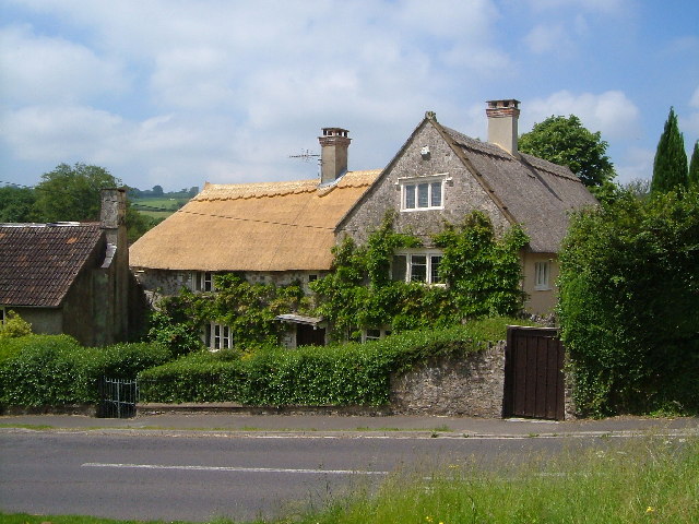
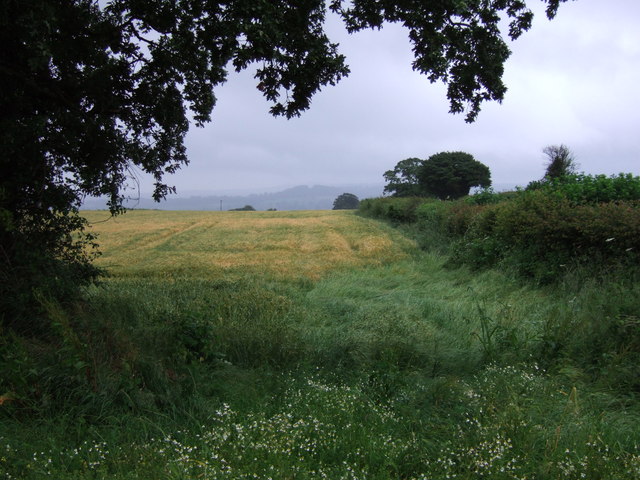
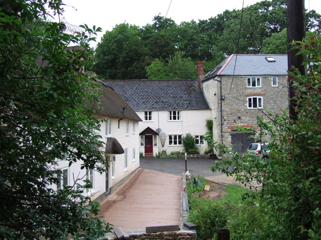
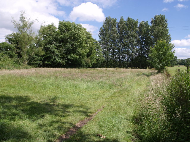
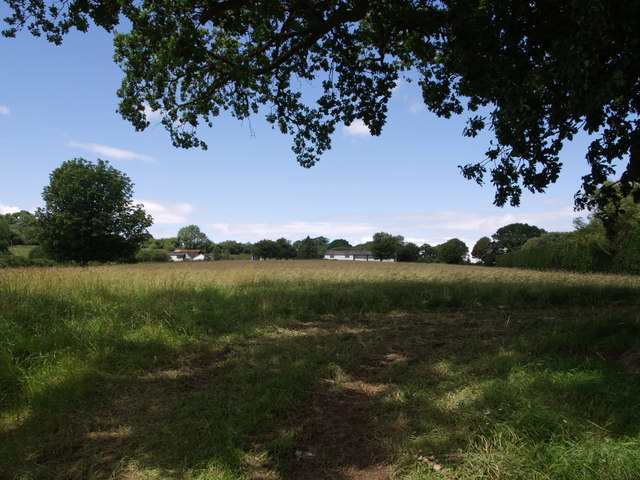
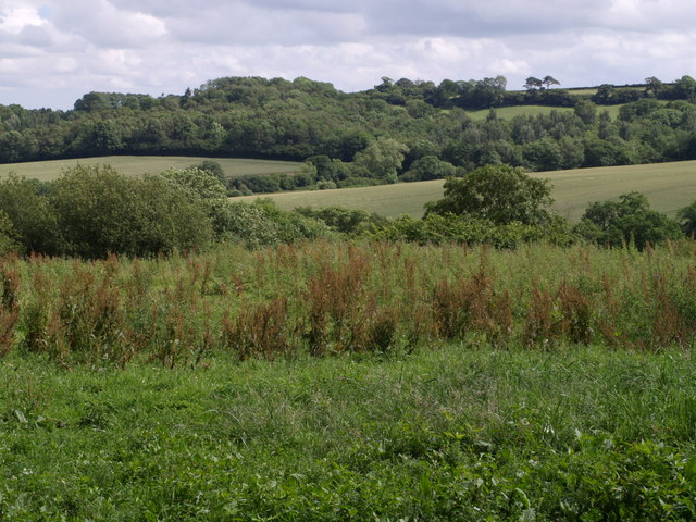
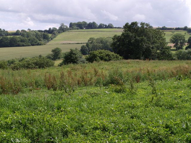
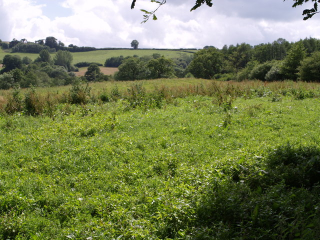
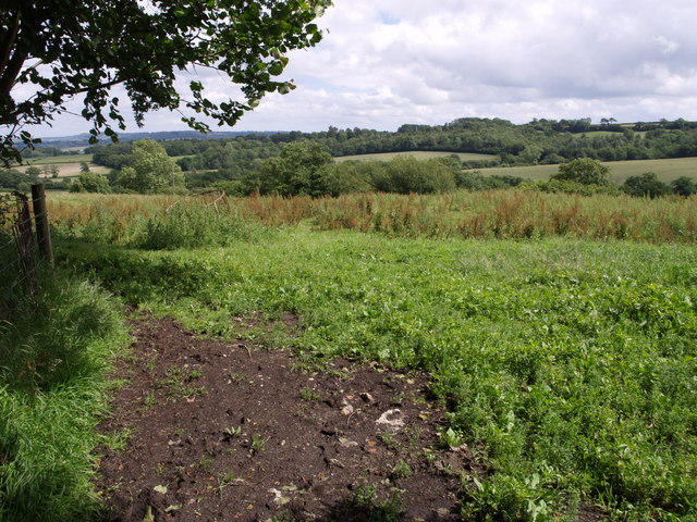
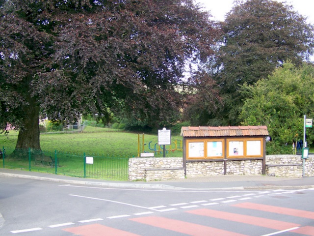
The village is set amidst the beautiful Somerset countryside, with rolling hills and lush green fields forming the backdrop. It is a rural haven, offering a peaceful respite from the hustle and bustle of nearby urban areas. The landscape is dotted with charming cottages and traditional buildings, giving Cat Tail a timeless charm.

Despite its small size, Cat Tail has a strong sense of community, with friendly locals who take pride in their village. The village features a few amenities, including a local pub and a small convenience store, catering to the needs of residents and visitors alike.

Nature enthusiasts will find plenty to explore in the area surrounding Cat Tail. The village is close to the Quantock Hills, an Area of Outstanding Natural Beauty, offering stunning walks and breathtaking views. Additionally, the Somerset Levels, a wetland area of international importance, is within easy reach.

Overall, Cat Tail, Somerset, is a tranquil and idyllic village, perfect for those seeking a peaceful retreat in the heart of the English countryside. Its natural beauty and welcoming community make it a delightful place to visit or call home.

If you have any feedback on the listing, please let us know in the comments section below.
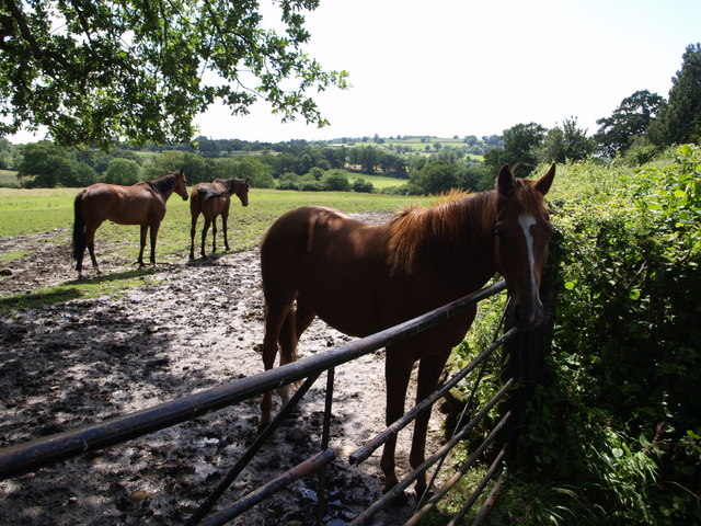
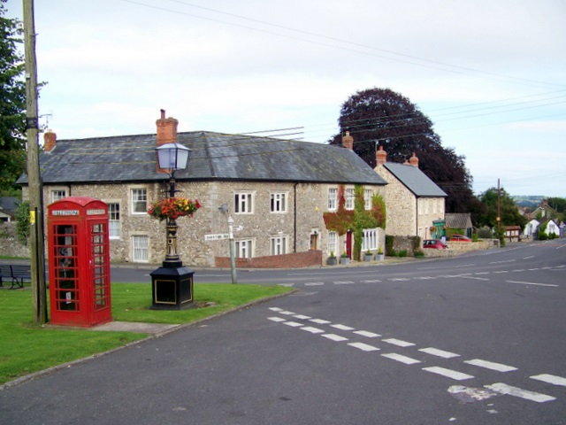
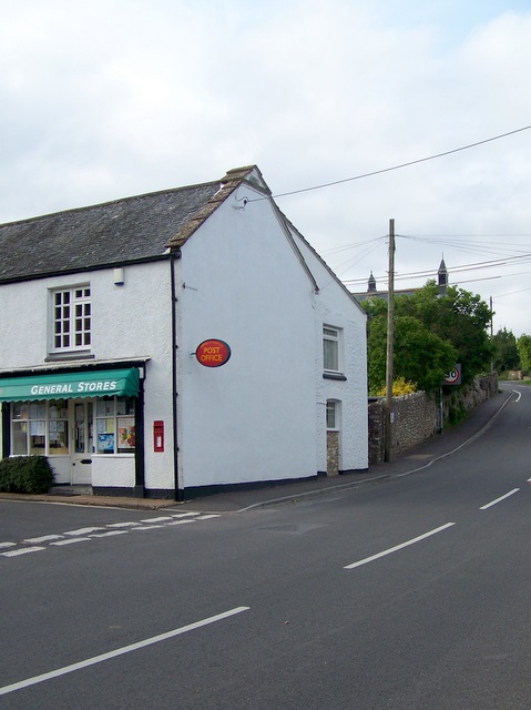
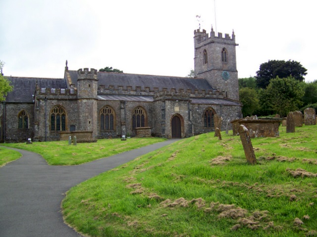
Cat Tail Images

Images are sourced within 2km of 50.892883/-2.9859096 or Grid Reference ST3010. Thanks to Geograph Open Source API. All images are credited.

Wadeford, Manor House Originally C16 building in village on headwaters of River Isle, in a valley in the Blackdown Hills
Wadeford, Manor House
Originally C16 building in village on headwaters of River Isle, in a valley in the Blackdown Hills
Combe St Nicholas: St Nicholas’s church Looking north-north-west, with the centre of the village lying to the north
Combe St Nicholas: St Nicholas’s church
Looking north-north-west, with the centre of the village lying to the north
Combe St Nicholas: the village Looking north-north-west from the churchyard. The village is within easy commuting distance of Taunton – under eleven miles away. On the right the building with the red door is ‘The Old Inn’ and carries a modern datestone indicating that it was built in 1813. Around the bend stands the General Stores and Post Office
Combe St Nicholas: the village
Looking north-north-west from the churchyard. The village is within easy commuting distance of Taunton – under eleven miles away. On the right the building with the red door is ‘The Old Inn’ and carries a modern datestone indicating that it was built in 1813. Around the bend stands the General Stores and Post Office
From Church Path Looking parallel to the lane from Combe Beacon to Slade's Cross. The cottage is also called Slade's Cross. The feature on the left seems to be a disused quarry. Taken from Church Path, which is footpath CH7/20.
From Church Path
Looking parallel to the lane from Combe Beacon to Slade's Cross. The cottage is also called Slade's Cross. The feature on the left seems to be a disused quarry. Taken from Church Path, which is footpath CH7/20.
Field beside Greenway Lane Greenway Lane runs behind the hedge on the right, heading towards Clayhanger.
Field beside Greenway Lane
Greenway Lane runs behind the hedge on the right, heading towards Clayhanger.
Court Mill The early C19 former corn mill on the right, beside the River Isle, is now a dwelling. Beside it are the Mill House and mill cottage.
Court Mill
The early C19 former corn mill on the right, beside the River Isle, is now a dwelling. Beside it are the Mill House and mill cottage.
Trees by the River Isle The row of poplars is at right angles to the river, which flows (away from the camera) among the trees on the left across this little meadow. The old leat for the nearby Nimmer Mill is shown as entering this meadow, which might have been the millpond described in <span class="nowrap"><a title="http://webapp1.somerset.gov.uk/her/details.asp?prn=53163" rel="nofollow ugc noopener" href="http://webapp1.somerset.gov.uk/her/details.asp?prn=53163">Link</a><img style="margin-left:2px;" alt="External link" title="External link - shift click to open in new window" src="https://s1.geograph.org.uk/img/external.png" width="10" height="10"/></span> .
Trees by the River Isle
The row of poplars is at right angles to the river, which flows (away from the camera) among the trees on the left across this little meadow. The old leat for the nearby Nimmer Mill is shown as entering this meadow, which might have been the millpond described in LinkExternal link .
Holemoor Farm Some of the farm buildings seen across a field on the slopes of the Isle valley from the shade of an oak on the lane between Clayhanger and Clayhanger Common.
Holemoor Farm
Some of the farm buildings seen across a field on the slopes of the Isle valley from the shade of an oak on the lane between Clayhanger and Clayhanger Common.
Southeast from Barley Hill A view across a valley on the eastern slopes of the Blackdown Hills, which drains (to the left) into the River Isle. The woods on the far side are Rookery Coppice and Ramshill Copse, and they shelter the estate at Chilworthy House. Seen from the lane between Sticklepath and Crock Street, near Barley Hill Farm. See <a href="https://www.geograph.org.uk/photo/481099">ST3112 : South from Barley Hill</a> for the view a little to the right, and <a href="https://www.geograph.org.uk/photo/481120">ST3112 : Southeast from Barley Hill</a> for a wide angle view including the landscape to the left of this one.
Southeast from Barley Hill
A view across a valley on the eastern slopes of the Blackdown Hills, which drains (to the left) into the River Isle. The woods on the far side are Rookery Coppice and Ramshill Copse, and they shelter the estate at Chilworthy House. Seen from the lane between Sticklepath and Crock Street, near Barley Hill Farm. See ST3112 : South from Barley Hill for the view a little to the right, and ST3112 : Southeast from Barley Hill for a wide angle view including the landscape to the left of this one.
South from Barley Hill Taken from the same spot as <a href="https://www.geograph.org.uk/photo/480906">ST3112 : Southeast from Barley Hill</a>, a view looking further to the right. The straight field boundary climbing the far hill forms the western edge of Ramshill Copse. Durdence Copse, in the valley, is largely hidden by the tree on the far side of the field in the foreground.
South from Barley Hill
Taken from the same spot as ST3112 : Southeast from Barley Hill, a view looking further to the right. The straight field boundary climbing the far hill forms the western edge of Ramshill Copse. Durdence Copse, in the valley, is largely hidden by the tree on the far side of the field in the foreground.
Field near  Barley Hill Farm This is the eastern part of Hobbs' Moor on the slopes of the Blackdown Hills. Taken from the same point as <a href="https://www.geograph.org.uk/photo/481099">ST3112 : South from Barley Hill</a>. The view extends across the upper part of the valley described in <a href="https://www.geograph.org.uk/photo/480906">ST3112 : Southeast from Barley Hill</a> into ST3012.
Field near Barley Hill Farm
This is the eastern part of Hobbs' Moor on the slopes of the Blackdown Hills. Taken from the same point as ST3112 : South from Barley Hill. The view extends across the upper part of the valley described in ST3112 : Southeast from Barley Hill into ST3012.
Southeast from Barley Hill See <a href="https://www.geograph.org.uk/photo/480906">ST3112 : Southeast from Barley Hill</a>, which is a close-up of the right-hand part of this view. Here the view extends further down the valley to the left, and the slopes north of Chilworthy House.
Southeast from Barley Hill
See ST3112 : Southeast from Barley Hill, which is a close-up of the right-hand part of this view. Here the view extends further down the valley to the left, and the slopes north of Chilworthy House.
The friendly one Three horses near Homenoor House by the lane between Clayhanger and Clayhanger Common. In the background is the valley of the River Isle, in <a href="https://www.geograph.org.uk/gridref/ST3210">ST3210</a>.
The friendly one
Three horses near Homenoor House by the lane between Clayhanger and Clayhanger Common. In the background is the valley of the River Isle, in ST3210.
Village scene, Combe St Nicholas A K6 type telephone box stands on the small village green which is over looked by the church.  The cast iron lamp post is dated 1897 and was restored in 1977.
Village scene, Combe St Nicholas
A K6 type telephone box stands on the small village green which is over looked by the church. The cast iron lamp post is dated 1897 and was restored in 1977.
Post Office, Combe St Nicholas Post Office and general store opposite the small village green.
Post Office, Combe St Nicholas
Post Office and general store opposite the small village green.
St Nicholas Church, Combe St Nicholas The church is Norman in origin.  The chancel and lower part of the tower is 13th century.  The church was restored in 1836.
St Nicholas Church, Combe St Nicholas
The church is Norman in origin. The chancel and lower part of the tower is 13th century. The church was restored in 1836.
Notice board, Combe St Nichalas The village notice board is opposite the church.  The green area is known as the Lawns.
Notice board, Combe St Nichalas
The village notice board is opposite the church. The green area is known as the Lawns.
Sign for the Green Dragon, Combe St Nicholas The dragon is one of Britain's oldest heraldic charges.  Before William the Conqueror it was the standard of the West Saxons.  In the Bayeux tapestry a dragon on a pole is shown near King Harold.  It was also a supporter on the arms of Henry VII and other Tudor sovereigns.  There are Green Dragons, White Dragons and Red Dragons and the colour choice may have heraldic connections but equally well may be a traditional choice with the original reason for the colour choice lost in history.
The sign was carved by Trevor, the inns landlord.
Sign for the Green Dragon, Combe St Nicholas
The dragon is one of Britain's oldest heraldic charges. Before William the Conqueror it was the standard of the West Saxons. In the Bayeux tapestry a dragon on a pole is shown near King Harold. It was also a supporter on the arms of Henry VII and other Tudor sovereigns. There are Green Dragons, White Dragons and Red Dragons and the colour choice may have heraldic connections but equally well may be a traditional choice with the original reason for the colour choice lost in history. The sign was carved by Trevor, the inns landlord.
Show me another place!

Cat Tail is located at Grid Ref: ST3010 (Lat: 50.892883, Lng: -2.9859096)

Administrative County: Somerset

District: South Somerset

Police Authority: Avon and Somerset

What 3 Words

///situates.cities.supplier. Near Chard, Somerset

Nearby Locations

Foxdon Hill Cat Tail

Related Wikis

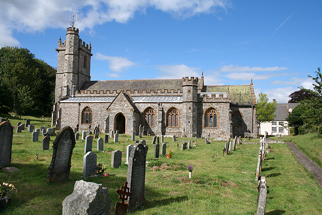
Church of St Nicholas, Combe St Nicholas

The Church of St Nicholas in Combe St Nicholas, Somerset, England is Norman in origin, with the chancel and lower stage of the tower dating from the 13th...
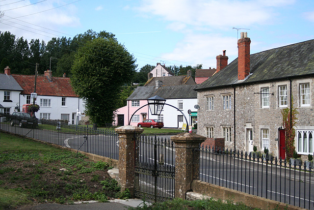
Combe St Nicholas

Combe St Nicholas is a village and parish in Somerset, England, situated 2 miles (3.2 km) northwest of Chard and 10 miles (16 km) from Taunton in the South...

Woolhayes Farm

Woolhayes Farm (grid reference ST315109) is a 13.2 hectare (32.5 acre) biological Site of Special Scientific Interest east of Combe St Nicholas in Somerset...

Snowdon Hill Quarry

Snowdon Hill Quarry (grid reference ST312089) is a 0.6 hectare geological Site of Special Scientific Interest on the western outskirts of Chard in Somerset...

Chard Town F.C.

Chard Town Football Club is a football club based in Chard, Somerset, England. Affiliated to the Somerset County FA, they are currently members of the...

Holyrood Academy

Welcome to Holyrood Academy Wiki page. Holyrood Academy, previously known as Holyrood Community School before September 2010, is a secondary school with...

St Andrew's Church, Whitestaunton

The Church of St Andrew in Whitestaunton, Somerset, England, dates from the 13th century and has been designated as a Grade I listed building.The Perpendicular...

Whitestaunton

Whitestaunton is a village and civil parish in the South Somerset district of Somerset, England. The parish includes the hamlet of Northay. It was known...

Nearby Amenities

Located within 500m of 50.892883,-2.9859096
Wadeford
Is In: Somerset, England, UK
Place: village
Lat/Long: 50.8909478/-2.9831809
Source: OS_OpenData_StreetView
Lat/Long: 50.8889436/-2.9858588
Post Box
Operator: Royal Mail
Post Box Type: lamp
Ref: TA20 560D
Royal Cypher: EIIR
Royal Cypher Wikidata: Q33102113
Lat/Long: 50.8949662/-2.9897082
Post Box
Operator: Royal Mail
Post Box Type: lamp
Ref: TA20 312D
Royal Cypher: EIIR
Royal Cypher Wikidata: Q33102113
Lat/Long: 50.8905649/-2.982493
The data included in this document is from www.openstreetmap.org. The data is made available under ODbL.

Have you been to Cat Tail?

Leave your review of Cat Tail below (or comments, questions and feedback).