Castle Hill

Settlement in Caithness

Scotland

Castle Hill

Castlehill filling station Though it has been many a year that you could get fuel here. Now there are no petrol stations between Brora and Thrumster, the best part of 50 miles.
Castlehill filling station Credit: Peter Moore

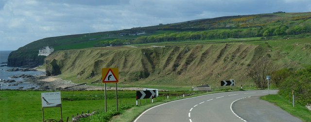
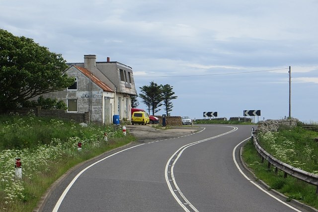
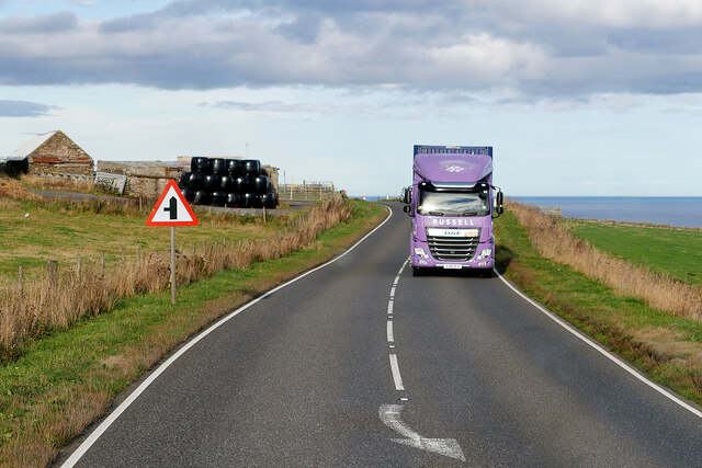
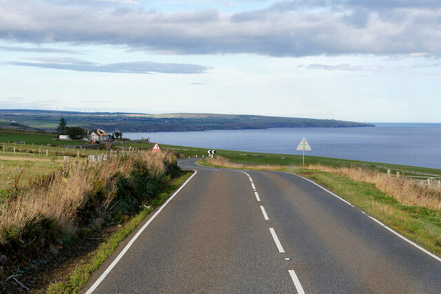
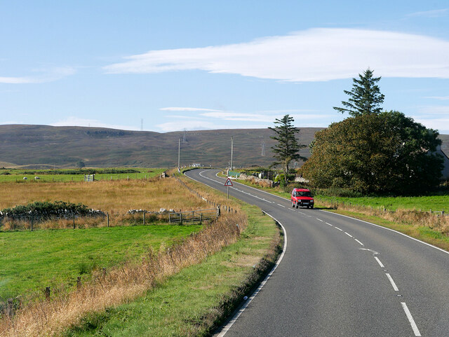
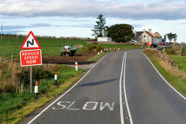
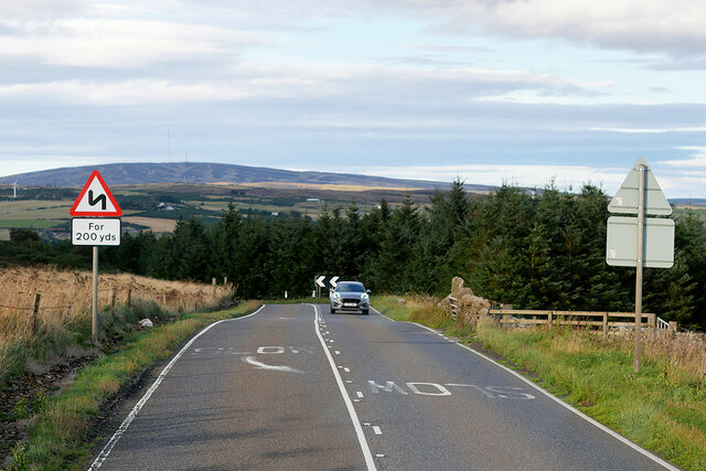
Castle Hill is a small village located in the county of Caithness, on the northern coast of Scotland. Situated approximately 5 miles southwest of Thurso, the village is known for its picturesque setting and historical significance.

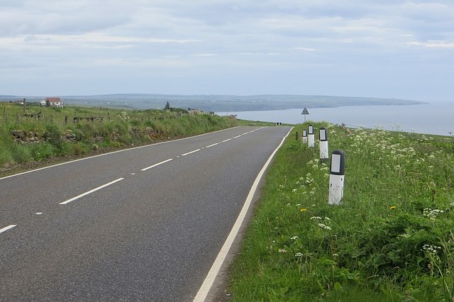
The centerpiece of Castle Hill is the imposing Castlehill Tower, a 16th-century castle that stands on a hill overlooking the surrounding countryside. The tower, which is now a listed building, was once the seat of the Sinclair family, who were prominent landowners in the area. The castle offers stunning views of the rugged coastline and the nearby Orkney Islands.

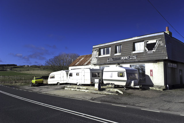
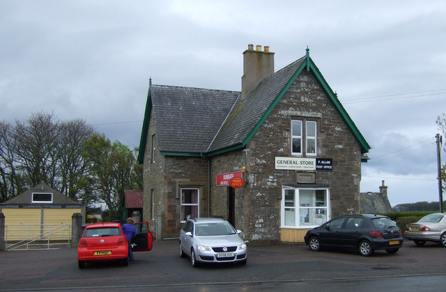
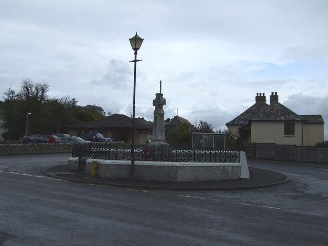
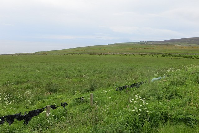
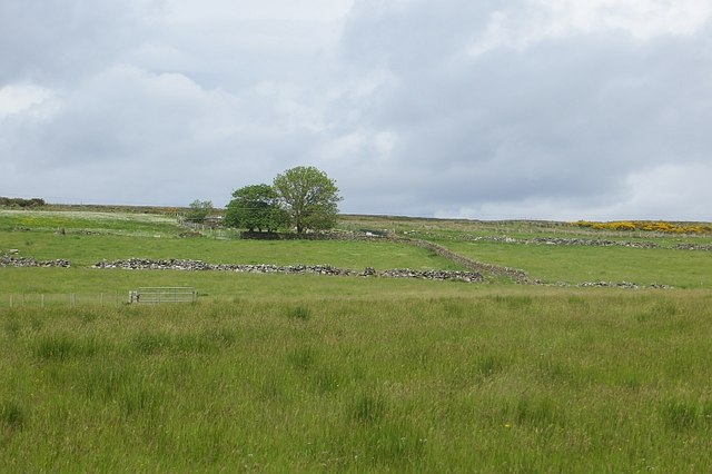
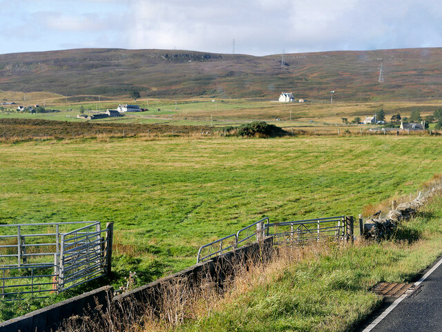
The village itself features a small cluster of houses, with a population of around 200 residents. It exudes a quiet, tranquil atmosphere, making it an ideal destination for those seeking a peaceful getaway. The surrounding countryside is characterized by rolling hills, lush green fields, and scattered farms, creating a picturesque backdrop for visitors.

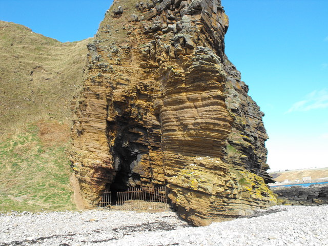
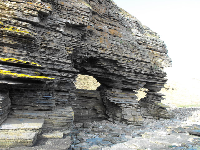
Castle Hill is a popular destination for outdoor enthusiasts, with numerous walking and hiking trails in the area. The nearby Dunnet Forest and Dunnet Bay offer opportunities for exploration and wildlife spotting. The village is also a great base for exploring the wider Caithness region, with its abundance of historical sites, ancient ruins, and stunning natural landscapes.

In summary, Castle Hill in Caithness is a charming village nestled in the Scottish countryside, boasting a rich history, breathtaking scenery, and a warm and welcoming community.

If you have any feedback on the listing, please let us know in the comments section below.

Castle Hill Images

Images are sourced within 2km of 58.231818/-3.4492543 or Grid Reference ND1427. Thanks to Geograph Open Source API. All images are credited.

Castlehill filling station Though it has been many a year that you could get fuel here. Now there are no petrol stations between Brora and Thrumster, the best part of 50 miles.
Castlehill filling station
Though it has been many a year that you could get fuel here. Now there are no petrol stations between Brora and Thrumster, the best part of 50 miles.
Cave Entrance Fenced off entrance to a cave near Dunbeath Castle
Cave Entrance
Fenced off entrance to a cave near Dunbeath Castle
Rockface Window A "Window" in a rockface south of Dunbeath
Rockface Window
A "Window" in a rockface south of Dunbeath
Two Rockface "Windows" Picture of "Windows" showing sedimentary rock layers
Two Rockface "Windows"
Picture of "Windows" showing sedimentary rock layers
Dunbeath Bay The approach on the A9 from the north.
Dunbeath Bay
The approach on the A9 from the north.
Dunbeath Post Office and shop
Dunbeath War Memorial
Leathad na Goibhre Above the "goat coast", fields with bale covering snagged on barbed wire.
Leathad na Goibhre
Above the "goat coast", fields with bale covering snagged on barbed wire.
A9, Ramscraigs A fine view northwards along the Caithness coast.
A9, Ramscraigs
A fine view northwards along the Caithness coast.
Castlehill filling station A derelict petrol station on the A9. Now there is no fuel before Brora going south or Thurso on one of the two northbound routes (probably Wick on the other).
Castlehill filling station
A derelict petrol station on the A9. Now there is no fuel before Brora going south or Thurso on one of the two northbound routes (probably Wick on the other).
Fields, Castlehill Inland of the A9.
Fields, Castlehill
Inland of the A9.
A9, northbound The A9 is a strategic link between the Highlands of Scotland and the Central Belt. It runs 279 miles from junction 5 of the M9 at Polmont to Scrabster. Originally it ran from Edinburgh.
<span class="nowrap"><a title="https://www.sabre-roads.org.uk/wiki/index.php?title=A9" rel="nofollow ugc noopener" href="https://www.sabre-roads.org.uk/wiki/index.php?title=A9">Link</a><img style="margin-left:2px;" alt="External link" title="External link - shift click to open in new window" src="https://s1.geograph.org.uk/img/external.png" width="10" height="10"/></span>
A9, northbound
The A9 is a strategic link between the Highlands of Scotland and the Central Belt. It runs 279 miles from junction 5 of the M9 at Polmont to Scrabster. Originally it ran from Edinburgh. LinkExternal link
Ramscraigs View to the north of the A9.
Ramscraigs
View to the north of the A9.
HGV Heading South on the A9 near Ramscraigs The A9 is a strategic link between the Highlands of Scotland and the Central Belt. Running for 273 miles, it is the longest road in Scotland and the fifth-longest A-road in the United Kingdom. Historically it was the main road between Edinburgh and John o' Groats but its importance has been eclipsed somewhat in the south by the A90 across the Forth Road Bridge and the M90 motorway, which now links Edinburgh more directly with Perth, and the M9, which is now the main road between Edinburgh and Bridge of Allan.
HGV Heading South on the A9 near Ramscraigs
The A9 is a strategic link between the Highlands of Scotland and the Central Belt. Running for 273 miles, it is the longest road in Scotland and the fifth-longest A-road in the United Kingdom. Historically it was the main road between Edinburgh and John o' Groats but its importance has been eclipsed somewhat in the south by the A90 across the Forth Road Bridge and the M90 motorway, which now links Edinburgh more directly with Perth, and the M9, which is now the main road between Edinburgh and Bridge of Allan.
Northbound A9 near Ramscraigs The A9 is a strategic link between the Highlands of Scotland and the Central Belt. Running for 273 miles, it is the longest road in Scotland and the fifth-longest A-road in the United Kingdom. Historically it was the main road between Edinburgh and John o' Groats but its importance has been eclipsed somewhat in the south by the A90 across the Forth Road Bridge and the M90 motorway, which now links Edinburgh more directly with Perth, and the M9, which is now the main road between Edinburgh and Bridge of Allan.
Northbound A9 near Ramscraigs
The A9 is a strategic link between the Highlands of Scotland and the Central Belt. Running for 273 miles, it is the longest road in Scotland and the fifth-longest A-road in the United Kingdom. Historically it was the main road between Edinburgh and John o' Groats but its importance has been eclipsed somewhat in the south by the A90 across the Forth Road Bridge and the M90 motorway, which now links Edinburgh more directly with Perth, and the M9, which is now the main road between Edinburgh and Bridge of Allan.
Southbound A9 near Ramscraigs The A9 is a strategic link between the Highlands of Scotland and the Central Belt. Running for 273 miles, it is the longest road in Scotland and the fifth-longest A-road in the United Kingdom. Historically it was the main road between Edinburgh and John o' Groats but its importance has been eclipsed somewhat in the south by the A90 across the Forth Road Bridge and the M90 motorway, which now links Edinburgh more directly with Perth, and the M9, which is now the main road between Edinburgh and Bridge of Allan.
Southbound A9 near Ramscraigs
The A9 is a strategic link between the Highlands of Scotland and the Central Belt. Running for 273 miles, it is the longest road in Scotland and the fifth-longest A-road in the United Kingdom. Historically it was the main road between Edinburgh and John o' Groats but its importance has been eclipsed somewhat in the south by the A90 across the Forth Road Bridge and the M90 motorway, which now links Edinburgh more directly with Perth, and the M9, which is now the main road between Edinburgh and Bridge of Allan.
A9 near Ramscraigs The A9 is a strategic link between the Highlands of Scotland and the Central Belt. Running for 273 miles, it is the longest road in Scotland and the fifth-longest A-road in the United Kingdom. Historically it was the main road between Edinburgh and John o' Groats but its importance has been eclipsed somewhat in the south by the A90 across the Forth Road Bridge and the M90 motorway, which now links Edinburgh more directly with Perth, and the M9, which is now the main road between Edinburgh and Bridge of Allan.
A9 near Ramscraigs
The A9 is a strategic link between the Highlands of Scotland and the Central Belt. Running for 273 miles, it is the longest road in Scotland and the fifth-longest A-road in the United Kingdom. Historically it was the main road between Edinburgh and John o' Groats but its importance has been eclipsed somewhat in the south by the A90 across the Forth Road Bridge and the M90 motorway, which now links Edinburgh more directly with Perth, and the M9, which is now the main road between Edinburgh and Bridge of Allan.
Northbound A9 near Knockally The A9 is a strategic link between the Highlands of Scotland and the Central Belt. Running for 273 miles, it is the longest road in Scotland and the fifth-longest A-road in the United Kingdom. Historically it was the main road between Edinburgh and John o' Groats but its importance has been eclipsed somewhat in the south by the A90 across the Forth Road Bridge and the M90 motorway, which now links Edinburgh more directly with Perth, and the M9, which is now the main road between Edinburgh and Bridge of Allan.
Northbound A9 near Knockally
The A9 is a strategic link between the Highlands of Scotland and the Central Belt. Running for 273 miles, it is the longest road in Scotland and the fifth-longest A-road in the United Kingdom. Historically it was the main road between Edinburgh and John o' Groats but its importance has been eclipsed somewhat in the south by the A90 across the Forth Road Bridge and the M90 motorway, which now links Edinburgh more directly with Perth, and the M9, which is now the main road between Edinburgh and Bridge of Allan.
Show me another place!

Castle Hill is located at Grid Ref: ND1427 (Lat: 58.231818, Lng: -3.4492543)

Unitary Authority: Highland

Police Authority: Highlands and Islands

What 3 Words

///exit.pasta.resolves. Near Dunbeath, Highland

Nearby Locations

Castle Hill Ramscraigs

Related Wikis

Dunbeath Castle

Dunbeath Castle is located on the east coast of Caithness, 2 kilometres (1.2 mi) south of Dunbeath, in northern Scotland. Although a castle has stood here...

Balnabruich

Balnabruich (from Scottish Gaelic Baile na Bruaich) is a small hamlet on the east coast of Scotland, close to Dunbeath, Caithness, Scottish Highlands...

Ramscraig

Ramscraig is a small scattered crofting hamlet, located 2 miles southwest from Dunbeath, in eastern Caithness, Scottish Highlands and is in the Scottish...

Dunbeath Water

Dunbeath Water is a short river in Caithness in northern Scotland. It rises at Loch Braigh na h-Aibhne in the Flow Country and initially flows northeast...

Related Videos

Hiking John O’ Groats to Land’s End | Daily Vlog | Day 5

Me and Di (my girlfriend) are hiking from John O' Groats to Land's End and wild camping all the way. This is a daily vlog of our ...

Beautiful relaxing day #harbour #ocean #lake #river #scotland #uk #minivlog @PaulaAvilaVlogs

About Dunbeath A small village on the East coast of Caithness, Dunbeath is on the most North-Eastern part of the North Coast ...

Always happy together #couplegoals #harbour #ocean #scotland #uk #minivlog @PaulaAvilaVlogs

About Dunbeath A small village on the East coast of Caithness, Dunbeath is on the most North-Eastern part of the North Coast ...

Nearby Amenities

Located within 500m of 58.231818,-3.4492543
Turning Circle
Lat/Long: 58.2317937/-3.4492437
Power: pole
Lat/Long: 58.228116/-3.4532449
Power: pole
Lat/Long: 58.2286879/-3.4523235
Power: pole
Lat/Long: 58.2294215/-3.4511344
Power: pole
Lat/Long: 58.2300901/-3.4500463
Power: pole
Lat/Long: 58.2307753/-3.4489264
Power: pole
Lat/Long: 58.2314448/-3.4478758
Power: pole
Lat/Long: 58.232204/-3.4466511
Power: pole
Lat/Long: 58.232836/-3.4456398
Power: pole
Lat/Long: 58.23381/-3.4452353
Power: pole
Lat/Long: 58.2347555/-3.4448158
Power: pole
Lat/Long: 58.2351331/-3.4450237
Power: pole
Lat/Long: 58.2359987/-3.4493646
Power: pole
Lat/Long: 58.235416/-3.4490875
Power: pole
Lat/Long: 58.2350601/-3.4488852
The data included in this document is from www.openstreetmap.org. The data is made available under ODbL.

Have you been to Castle Hill?

Leave your review of Castle Hill below (or comments, questions and feedback).