Cae-maes-y-bar

Settlement in Glamorgan

Wales

Cae-maes-y-bar

Benchmark on Railway Bridge This tiny Benchmark can be found on the SW buttress of the railway bridge on Nantong Way.
Benchmark on Railway Bridge Credit: Adrian Dust

Cae-maes-y-bar is a small village located in the county of Glamorgan, Wales. Situated in the southern part of the country, it is nestled in a picturesque rural setting. The village is surrounded by rolling hills, lush green fields, and breathtaking natural landscapes, making it an idyllic spot for nature enthusiasts and those seeking tranquility.

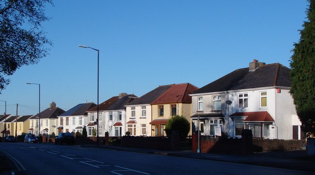
Cae-maes-y-bar is a close-knit community with a population of around 500 residents. It has a rich history that dates back several centuries, and remnants of its past can still be seen in the form of historic buildings and landmarks. The village is known for its traditional architecture, with charming stone cottages and quaint houses lining its streets.

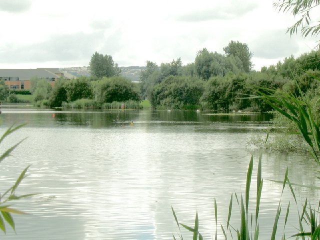
A notable feature of Cae-maes-y-bar is its close proximity to various outdoor recreational areas. The village is a gateway to several scenic walking trails and hiking routes, offering visitors and residents an opportunity to explore the stunning Welsh countryside. Additionally, the nearby rivers and lakes provide ample opportunities for fishing and water activities.

In terms of amenities, Cae-maes-y-bar has a few local shops and services catering to the daily needs of its residents. However, for more extensive shopping and entertainment options, the larger towns of Glamorgan are easily accessible by car or public transport.

Overall, Cae-maes-y-bar offers a peaceful and picturesque lifestyle, making it an ideal place for those seeking a rural retreat with easy access to natural beauty and outdoor activities.

If you have any feedback on the listing, please let us know in the comments section below.

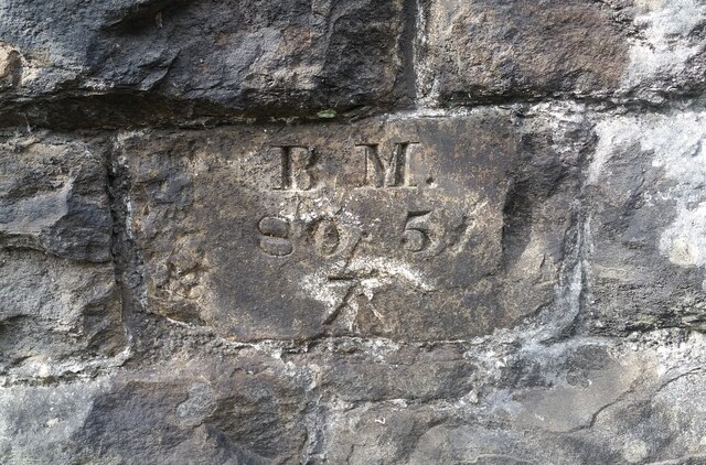
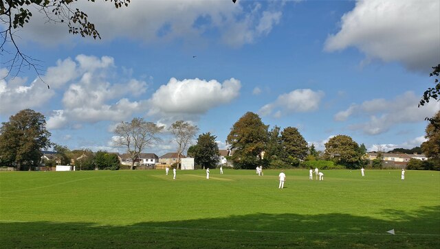
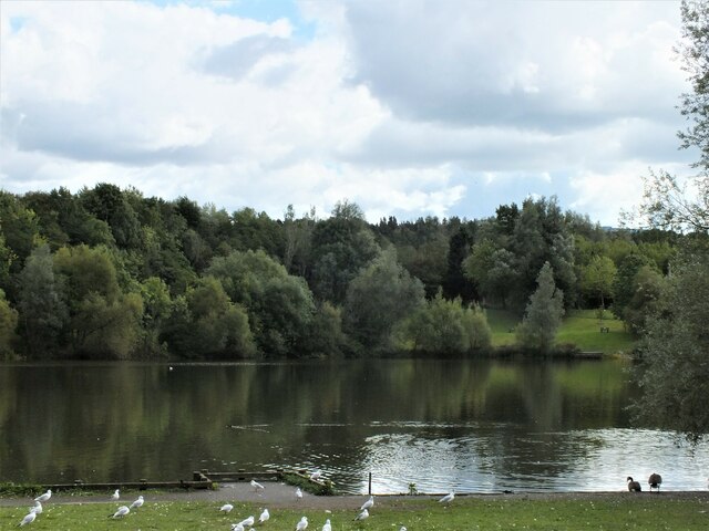
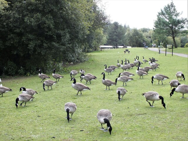
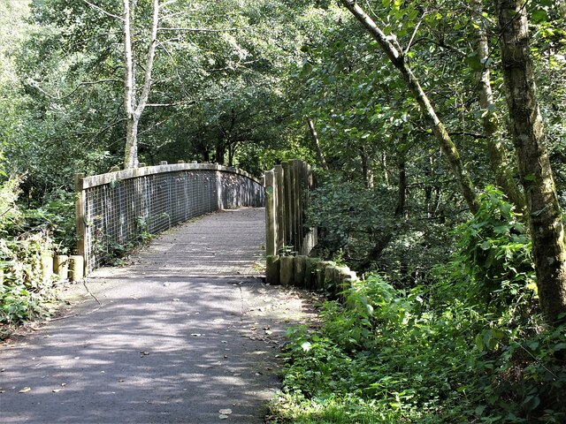
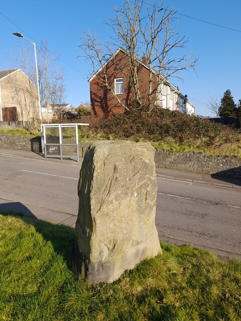
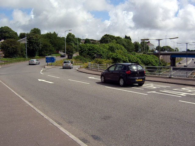
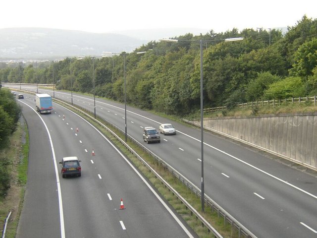
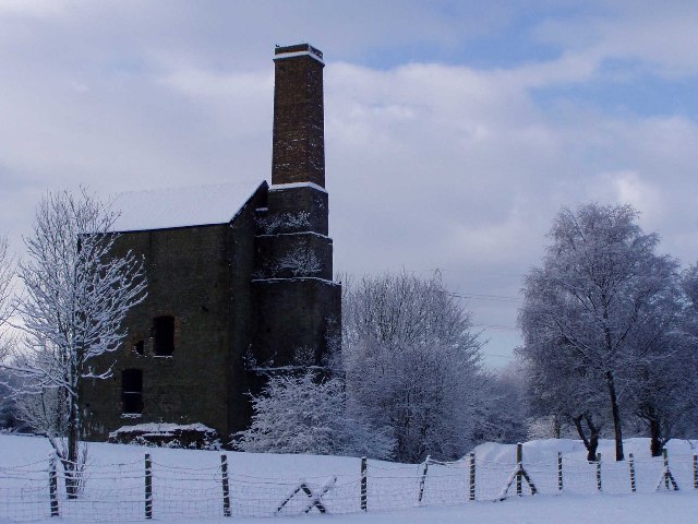
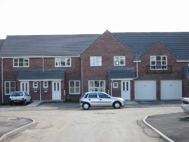
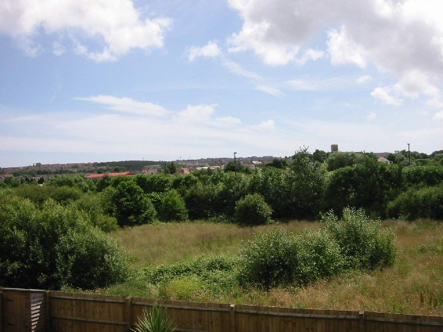
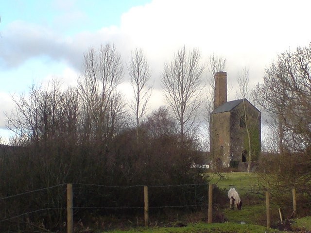
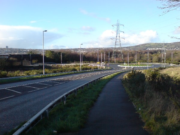
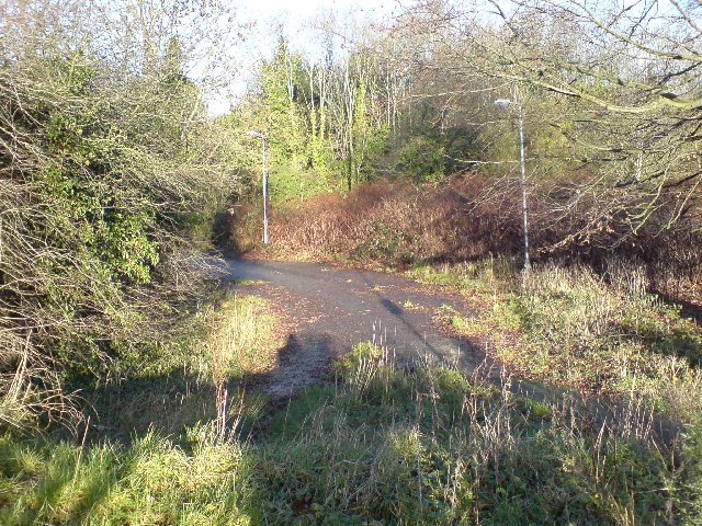
Cae-maes-y-bar Images

Images are sourced within 2km of 51.657429/-3.9035427 or Grid Reference SS6897. Thanks to Geograph Open Source API. All images are credited.

Benchmark on Railway Bridge This tiny Benchmark can be found on the SW buttress of the railway bridge on Nantong Way.
Benchmark on Railway Bridge
This tiny Benchmark can be found on the SW buttress of the railway bridge on Nantong Way.
Heol Las Park, Birchgrove, Swansea
Llyn y Fendrod (The Fendrod Lake), Llansamlet, Swansea
Canada Geese, Llyn y Fendrod, Llansamlet, Swansea
Footbridge over the Fendrod stream, Llansamlet, Swansea Footbridge just north of the point where the stream joins Llyn y Fendrod (The Fendrod Lake).
Footbridge over the Fendrod stream, Llansamlet, Swansea
Footbridge just north of the point where the stream joins Llyn y Fendrod (The Fendrod Lake).
Bronze Age Standing Stone 1.3m high with base 1.2m x 0.5m.
Bronze Age Standing Stone
1.3m high with base 1.2m x 0.5m.
Junction 44 of the M4 The eastbound sliproad from the A48 to the M4 near Birchgrove is unusual in that it peels off the inside of the roundabout that straddles the motorway at this point. Traffic approaching from the B4291 (between the two leftmost lamp posts as seen here) and wishing to join the M4 eastbound has to perform a near 360° circuit of the roundabout.
Junction 44 of the M4
The eastbound sliproad from the A48 to the M4 near Birchgrove is unusual in that it peels off the inside of the roundabout that straddles the motorway at this point. Traffic approaching from the B4291 (between the two leftmost lamp posts as seen here) and wishing to join the M4 eastbound has to perform a near 360° circuit of the roundabout.
M4 motorway (westbound) at Junction 44 Taken from above motorway bridge/junction.   As is so often the case, one lane (westbound) is coned off - but for no apparent reason.
M4 motorway (westbound) at Junction 44
Taken from above motorway bridge/junction. As is so often the case, one lane (westbound) is coned off - but for no apparent reason.
Houses, Peniel Green Winter sun catches these classic semi-detached houses in the suburbs of Swansea.
Houses, Peniel Green
Winter sun catches these classic semi-detached houses in the suburbs of Swansea.
Study in Parallels and Angles Somehow this massive pylon manages to look magnificent in the winter sun.
Study in Parallels and Angles
Somehow this massive pylon manages to look magnificent in the winter sun.
Junction 44 of the M4 - at Peniel Green
Fendrod Lake Swansea has a "Lakeside" retail park too. This is the lake, which is actually part of the River Fendrod.
Fendrod Lake
Swansea has a "Lakeside" retail park too. This is the lake, which is actually part of the River Fendrod.
Scott's Pit, Birchgrove, Swansea
Clos Cadno, Tregof Village, Swansea This is a cul de sac on a new development nearing completion.
Clos Cadno, Tregof Village, Swansea
This is a cul de sac on a new development nearing completion.
Southern side of Llansamlet Taken from just north of Walter Road and looking toward Llansamlet Church
Southern side of Llansamlet
Taken from just north of Walter Road and looking toward Llansamlet Church
Scott's Pit The building in this picture is the remains of a Cornish beam engine house, which housed a pump for the pit. The engine house was one of the first of its type in South Wales.
Scott's Pit
The building in this picture is the remains of a Cornish beam engine house, which housed a pump for the pit. The engine house was one of the first of its type in South Wales.
New road structure near Llansamlet This roundabout was so new, that my GPSr took me along the old road that is now intersected by this road - and which is now a dead end!
New road structure near Llansamlet
This roundabout was so new, that my GPSr took me along the old road that is now intersected by this road - and which is now a dead end!
Abandoned road This is all that remains of a road that used to link Peniel Green with Heol Las in the Llansamlet area.  The road was intersected by a new road development <a href="https://www.geograph.org.uk/photo/307502">SS6997 : New road structure near Llansamlet</a> and this photograph was taken from the same location as that one.
Abandoned road
This is all that remains of a road that used to link Peniel Green with Heol Las in the Llansamlet area. The road was intersected by a new road development SS6997 : New road structure near Llansamlet and this photograph was taken from the same location as that one.
Show me another place!

Cae-maes-y-bar is located at Grid Ref: SS6897 (Lat: 51.657429, Lng: -3.9035427)

Unitary Authority: Swansea

Police Authority: South Wales

What 3 Words

///forgot.libraries.ranks. Near Morriston, Swansea

Related Wikis

Swansea Enterprise Park

The Swansea Enterprise Park (Welsh: Parc Anturiaeth Abertawe) is a combined business park, retail park and industrial estate in Swansea, Wales. In 1981...

Llansamlet

Llansamlet is a suburban district and community of Swansea, Wales, falling into the Llansamlet ward. The area is centred on the A48 road (named Samlet...

Eastside, Swansea

Eastside is an area of Swansea, Wales which is loosely defined as the populated areas to the east of the River Tawe. The Swansea local authority has a...

Llansamlet railway station (MR)

Llansamlet railway station served the suburb of Llansamlet, in the historical county of Glamorganshire, Wales, from 1860 to 1875 on the Swansea Vale Railway...

Llansamlet (electoral ward)

Llansamlet is the name of an electoral ward (coterminous with the Llansamlet community) in the City and County of Swansea, Wales, UK. The electoral ward...

Pentre Dwr

Pentre Dwr (or Pentre-dŵr) is a village in the City and County of Swansea, Wales within the Bon-y-maen ward. The village approximates to the settlement...

Bon-y-maen (electoral ward)

Bon-y-maen (until 2022 Bonymaen) is the name of an electoral ward in the City and County of Swansea, Wales, UK. The ward is bounded by Neath Port Talbot...

Morriston East railway station

Morriston East railway station served the community of Morriston, in the historical county of Glamorganshire, Wales, from 1871 to 1950 on the Swansea Vale...

Nearby Amenities

Located within 500m of 51.657429,-3.9035427
Fuel
Tesco
Brand: Tesco
Brand Wikidata: Q487494
Brand Wikipedia: en:Tesco
Name Cy: Tesco
Website: https://www.tesco.com/store-locator/swansea/nantyffin-road/petrol-filling-station
Lat/Long: 51.6577974/-3.9035668
Traffic Signals
Lat/Long: 51.6604764/-3.9015225
Traffic Signals
Lat/Long: 51.6603691/-3.900851
Crossing
Crossing: unmarked
Kerb: lowered
Lat/Long: 51.6556943/-3.9101138
Screwfix
Brand: Screwfix
Brand Wikidata: Q7439115
Shop: doityourself
Website: https://www.screwfix.com/stores/ET2/swansea-enterprise-park
Lat/Long: 51.6585428/-3.9101326
Traffic Signals
Lat/Long: 51.6592534/-3.902381
Tredz
Created By: Potlatch 0.10f
Shop: bicycle
Url: http://www.tredz.co.uk/
Lat/Long: 51.6568554/-3.9068182
Farmfoods
Brand: Farmfoods
Brand Wikidata: Q5435841
Brand Wikipedia: en:Farmfoods
Contact Website: https://www.farmfoods.co.uk/store-finder.php?branch_code=816
Fixme: location not accurate
Opening Hours Url: https://www.farmfoods.co.uk/store-finder.php?branch_code=816
Shop: frozen_food
Lat/Long: 51.6588361/-3.9091185
Post Office
Llansamlet
Lat/Long: 51.6603254/-3.9015616
Bus Stop
Llansamlet Tesco (NE)
Bus: yes
Naptan AtcoCode: 5810AWC52193
Naptan Bearing: NE
Naptan CommonName: Llansamlet Tesco (NE)
Naptan NaptanCode: swagwga
Naptan PlusbusZoneRef: SWANSEA
Naptan Street: Nantyffin Road
Naptan Verified: yes
Public Transport: platform
Source: naptan_import
Lat/Long: 51.6586947/-3.9030736
Bus Stop
Llansamlet Tesco (SW)
Bus: yes
Naptan AtcoCode: 5810AWC52194
Naptan Bearing: SW
Naptan CommonName: Llansamlet Tesco (SW)
Naptan NaptanCode: swagwgd
Naptan PlusbusZoneRef: SWANSEA
Naptan Street: Nantyffin Road
Naptan Verified: yes
Public Transport: platform
Source: naptan_import
Lat/Long: 51.6588814/-3.902436
Bus Stop
Llansamlet Surgery
Bus: yes
Naptan AtcoCode: 5810AWC52195
Naptan Bearing: NW
Naptan CommonName: Llansamlet Surgery
Naptan Crossing: Nantyffin Road
Naptan Landmark: Llansamlet Road
Naptan NaptanCode: swagwat
Naptan PlusbusZoneRef: SWANSEA
Naptan Street: Samlet Road
Naptan Verified: no
Public Transport: platform
Source: naptan_import
Lat/Long: 51.6607394/-3.902973
Bus Stop
Samlet Social Club (SE)
Bus: yes
Naptan AtcoCode: 5810AWC52196
Naptan Bearing: SE
Naptan CommonName: Samlet Social Club (SE)
Naptan Landmark: Samlet Social Club
Naptan NaptanCode: swagwdg
Naptan PlusbusZoneRef: SWANSEA
Naptan Street: Samlet Road
Naptan Verified: no
Public Transport: platform
Source: naptan_import
Lat/Long: 51.6614568/-3.9058661
Bus Stop
Smiths` Arms (N)
Bus: yes
Naptan AtcoCode: 5810AWC52200
Naptan Bearing: N
Naptan CommonName: Smiths` Arms (N)
Naptan Crossing: Samlet Road
Naptan Landmark: Smiths` Arms PH
Naptan NaptanCode: swagwdm
Naptan PlusbusZoneRef: SWANSEA
Naptan ShortCommonName: Star Inn
Naptan Street: Church Road
Naptan Verified: no
Public Transport: platform
Source: naptan_import
Lat/Long: 51.660854/-3.9008957
Bus Stop
Smiths` Arms (S)
Bus: yes
Naptan AtcoCode: 5810AWC52201
Naptan Bearing: S
Naptan CommonName: Smiths` Arms (S)
Naptan Crossing: Samlet Road
Naptan Landmark: Star Inn PH
Naptan NaptanCode: swagwaj
Naptan PlusbusZoneRef: SWANSEA
Naptan ShortCommonName: Star Inn SE
Naptan Street: Church Road
Naptan Verified: no
Public Transport: platform
Source: naptan_import
Lat/Long: 51.6614563/-3.9009064
Bus Stop
Star Inn
Bus: yes
Naptan AtcoCode: 5810AWC52387
Naptan Bearing: SE
Naptan CommonName: Star Inn
Naptan Crossing: Church Road
Naptan Landmark: Star Inn PH
Naptan NaptanCode: swagwdp
Naptan PlusbusZoneRef: SWANSEA
Naptan Street: Peniel Green Road
Naptan Verified: no
Public Transport: platform
Source: naptan_import
Lat/Long: 51.6603762/-3.900413
Bus Stop
Lion Way (NE)
Bus: yes
Naptan AtcoCode: 5810WDB23896
Naptan Bearing: NE
Naptan CommonName: Lion Way (NE)
Naptan Crossing: Lion Way
Naptan NaptanCode: swapwmj
Naptan PlusbusZoneRef: SWANSEA
Naptan Street: Phoenix Way
Public Transport: platform
Source: naptan_import
Lat/Long: 51.6586183/-3.9078233
Bus Stop
Lion Way (SW)
Bus: yes
Naptan AtcoCode: 5810WDB23897
Naptan Bearing: SW
Naptan CommonName: Lion Way (SW)
Naptan Crossing: Lion Way
Naptan NaptanCode: swapwmp
Naptan PlusbusZoneRef: SWANSEA
Naptan Street: Pehoenix Way
Naptan Verified: no
Public Transport: platform
Source: naptan_import
Lat/Long: 51.6582104/-3.9080866
Post Box
Collection Times: Mo-Fr 17:45; Sa 09:00
Post Box Type: meter
Royal Cypher: no
Lat/Long: 51.6583327/-3.9083232
Post Box
Collection Times: Mo-Fr 17:45; Sa 09:00
Post Box Type: pillar
Ref: SA7 301
Royal Cypher: EIIR
Royal Cypher Wikidata: Q33102113
Lat/Long: 51.6583519/-3.9082859
Post Box
Collection Times: Mo-Fr 17:45; Sa 12:30
Post Box Type: pillar
Ref: SA7 303
Royal Cypher: EIIR
Royal Cypher Wikidata: Q33102113
Lat/Long: 51.6580766/-3.9016234
Cafe
Tesco Café
Addr Postcode: SA7 9RD
Addr Street: Nantyffin Road
Brand: Tesco
Brand Wikidata: Q487494
Cuisine: coffee_shop
Fhrs Id: 61992
Operator: Tesco
Takeaway: yes
Lat/Long: 51.6581324/-3.9014856
Crossing
Lat/Long: 51.6581825/-3.9017179
Crossing
Lat/Long: 51.658747/-3.9023598
Barrier: block
Fixme: check barrier type and access
Motor Vehicle: no
Lat/Long: 51.6572263/-3.9064575
Bus Stop
Bench: no
Bin: no
Bus: yes
Passenger Information Display: no
Public Transport: platform
Shelter: no
Tactile Paving: no
Lat/Long: 51.6594587/-3.9078947
Bus Stop
Bench: no
Bin: no
Bus: yes
Passenger Information Display: no
Public Transport: platform
Shelter: no
Tactile Paving: no
Lat/Long: 51.6593801/-3.9079564
Direction: 125
Generator Method: photovoltaic
Generator Output Electricity: yes
Generator Solar Modules: 15
Generator Source: solar
Generator Type: solar_photovoltaic_panel
Location: roof
Power: generator
Lat/Long: 51.6596145/-3.9008516
Crossing
Crossing: marked
Crossing Markings: yes
Lat/Long: 51.660835/-3.9038531
Entrance: main
Fixme: approx position
Lat/Long: 51.6606437/-3.9040386
Flotek Swansea
Addr City: Swansea
Addr Housename: New Mill Court
Addr Place: Swansea Enterprise Park
Addr Postcode: SA7 9FG
Addr Unit: Unit 2
Email: hello@flotek.io
Office: it
Phone: +44 1792 345 537
Website: https://flotek.io/
Lat/Long: 51.6556297/-3.9083084
Iceland
Addr Housename: Phoenix Retail Park
Addr Postcode: SA7 9EG
Addr Unit: Unit 3
Brand: Iceland
Brand Wikidata: Q721810
Opening Hours: Mo-Sa 09:00-19:00; Su 10:00-16:00
Shop: frozen_food
Website: https://www.iceland.co.uk/store-finder/store?StoreID=1344&StoreName=SWANSEA%20PHOENIX
Lat/Long: 51.6575839/-3.9066106
Euro Car Parts
Addr Postcode: SA7 9AH
Addr Street: Mannesmann Close
Branch: Swansea (Llansamlet)
Brand: Euro Car Parts
Brand Wikidata: Q23782692
Contact Website: https://www.eurocarparts.com/swansea-llansamlet.html
Opening Hours: Mo-Fr 08:00-18:00; Sa 08:00-16:00; PH off
Phone: 01792 762515
Shop: car_parts
Website: https://www.eurocarparts.com
Lat/Long: 51.6588366/-3.9039441
The data included in this document is from www.openstreetmap.org. The data is made available under ODbL.

Have you been to Cae-maes-y-bar?

Leave your review of Cae-maes-y-bar below (or comments, questions and feedback).