Burton Hill

Settlement in Wiltshire

England

Burton Hill

Malmesbury Cemetery Chapel, Wiltshire 2021
Malmesbury Cemetery Chapel, Wiltshire 2021 Credit: Ray Bird

Burton Hill is a small village located in the county of Wiltshire, England. Situated approximately 2 miles southeast of Malmesbury, it is nestled amidst picturesque countryside, offering a tranquil and idyllic setting for its residents. The village is part of the civil parish of Malmesbury, and falls within the North Wiltshire District.

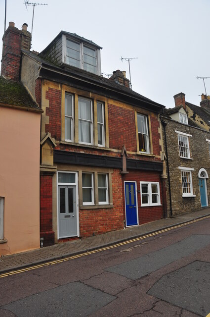
Although small in size, Burton Hill boasts a close-knit community and a rich history. The village is predominantly residential, with a mix of traditional stone cottages and modern houses. The beautiful surrounding countryside provides ample opportunities for outdoor activities, such as walking and cycling, with several footpaths and bridleways accessible from the village.

Residents of Burton Hill benefit from its close proximity to Malmesbury, a historic market town renowned for its medieval architecture and bustling high street. Malmesbury offers a range of amenities including shops, cafes, pubs, and schools, making it a convenient destination for everyday needs.

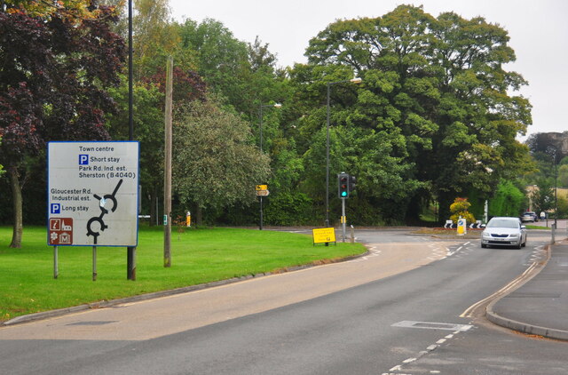
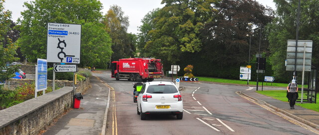
Transport links are well-established in the area, with the nearby A429 providing easy access to surrounding towns and villages, as well as connecting to the M4 motorway. The closest railway station is approximately 4 miles away in Chippenham, offering regular services to major cities such as London, Bristol, and Bath.

Overall, Burton Hill offers a peaceful and picturesque countryside lifestyle, with the added convenience of nearby amenities and transport links. Its close-knit community and proximity to Malmesbury contribute to its appeal as a desirable place to live in Wiltshire.

If you have any feedback on the listing, please let us know in the comments section below.
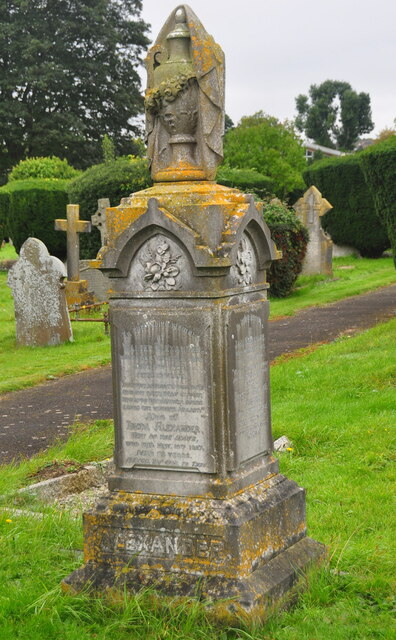
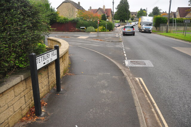
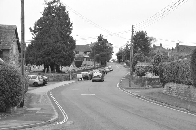
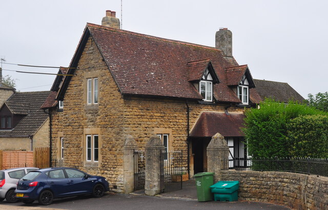
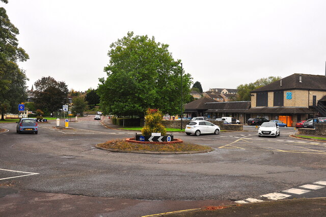
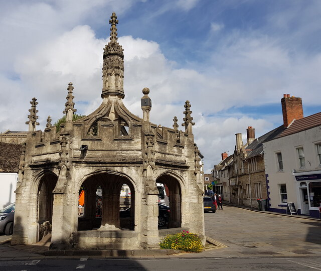
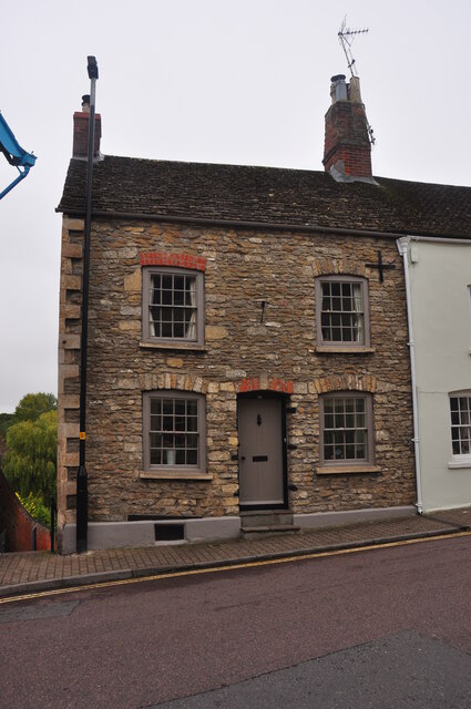
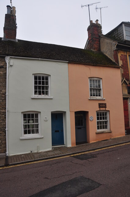
Burton Hill Images

Images are sourced within 2km of 51.577725/-2.0898985 or Grid Reference ST9386. Thanks to Geograph Open Source API. All images are credited.

Malmesbury Cemetery Chapel, Wiltshire 2021
Malmesbury Cemetery, Wiltshire 2021
Tetbury Hill, Malmesbury, Wiltshire 2021
House, Tetbury Hill, Malmesbury, Wiltshire 2021
Roundabout, Malmesbury, Wiltshire 2021
Malmesbury Abbey Malmesbury: "Thought to be the first capital of England, it was home to the first saint of Wessex (St Aldhelm), the first king of England (King Athelstan the Glorious [who was buried somewhere in Malmesbury]), the first man to fly (Brother Eilmer), the father of modern English history (William of Malmesbury) and the father of English philosophy (Thomas Hobbes)." <span class="nowrap"><a title="https://www.malmesburyabbey.com/history/" rel="nofollow ugc noopener" href="https://www.malmesburyabbey.com/history/">Link</a><img style="margin-left:2px;" alt="External link" title="External link - shift click to open in new window" src="https://s1.geograph.org.uk/img/external.png" width="10" height="10"/></span>
Malmesbury Abbey
Malmesbury: "Thought to be the first capital of England, it was home to the first saint of Wessex (St Aldhelm), the first king of England (King Athelstan the Glorious [who was buried somewhere in Malmesbury]), the first man to fly (Brother Eilmer), the father of modern English history (William of Malmesbury) and the father of English philosophy (Thomas Hobbes)." LinkExternal link
Market Cross, Malmesbury Listed Grade I. "Late C15/early C16, renovated c1800 by the Earl of Suffolk, and repaired 1909-12 and 1949-50." <span class="nowrap"><a title="https://historicengland.org.uk/listing/the-list/list-entry/1269291" rel="nofollow ugc noopener" href="https://historicengland.org.uk/listing/the-list/list-entry/1269291">Link</a><img style="margin-left:2px;" alt="External link" title="External link - shift click to open in new window" src="https://s1.geograph.org.uk/img/external.png" width="10" height="10"/></span>
Market Cross, Malmesbury
Listed Grade I. "Late C15/early C16, renovated c1800 by the Earl of Suffolk, and repaired 1909-12 and 1949-50." LinkExternal link
79 Gloucester Road, Malmesbury, Wiltshire 2021 Grade 2 listed
79 Gloucester Road, Malmesbury, Wiltshire 2021
Grade 2 listed
77 (L) & 75 (R) Gloucester Road, Malmesbury, Wiltshire 2021 Both Grade II listed
77 (L) & 75 (R) Gloucester Road, Malmesbury, Wiltshire 2021
Both Grade II listed
73 (L) & 71 (R) Gloucester Road, Malmesbury, Wiltshire 2021
Show me another place!

Burton Hill is located at Grid Ref: ST9386 (Lat: 51.577725, Lng: -2.0898985)

Unitary Authority: Wiltshire

Police Authority: Wiltshire

What 3 Words

///confident.herds.remotest. Near Malmesbury, Wiltshire

Nearby Locations

Burton Hill

Related Wikis

Cowbridge House

Cowbridge House, 3⁄4 mile (1.2 km) southeast of Malmesbury, Wiltshire, England, was an 18th-century country house that was demolished in 2007. During the...

Tetbury Avon

The Tetbury Avon, also known as the River Avon (Tetbury Branch), Little Avon or Ingleburn (Anglo-Saxon – English river), is a tributary of the Bristol...

Woodbridge Brook

The Woodbridge Brook is a tributary of the Bristol Avon. It rises near Lydiard Millicent in Wiltshire in the west of England and flows in a generally...

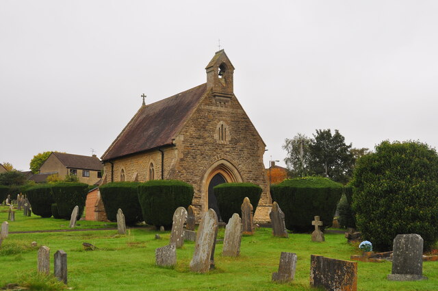
St Aldhelm's Roman Catholic Church, Malmesbury

St Aldhelm's Roman Catholic Church in Malmesbury, Wiltshire, England is a Roman Catholic Church built in 1875. The church is dedicated to St Aldhelm who...

Nearby Amenities

Located within 500m of 51.577725,-2.0898985
Barrier: stile
Lat/Long: 51.5756806/-2.083734
Crossing
Crossing: marked
Crossing Island: no
Tactile Paving: yes
Lat/Long: 51.5786763/-2.0945625
Bus Stop
Burton Hill (Northbound)
Bench: no
Bin: no
Bus: yes
Lit: yes
Naptan AtcoCode: 4600WIA11212
Naptan Bearing: N
Naptan CommonName: Police Station
Naptan Indicator: opp
Naptan NaptanCode: wilapapa
Naptan Street: Burton Hill
Naptan Verified: no
Public Transport: platform
Shelter: no
Source: mapilary;naptan;bing;naptan_compare_tool
Tactile Paving: no
Lat/Long: 51.5784241/-2.0948826
Bus Stop
Burton Hill
Bench: yes
Bin: yes
Bus: yes
Lit: yes
Naptan AtcoCode: 4600WIA11211
Naptan NaptanCode: wilapapd
Public Transport: platform
Ref: wilapapj
Shelter: yes
Tactile Paving: no
Lat/Long: 51.5780969/-2.0949269
Bus Stop
Manor Cottages
Bus: yes
Naptan AtcoCode: 4600WIA11249
Naptan NaptanCode: wilapatj
Public Transport: platform
Lat/Long: 51.5784386/-2.0919872
Bus Stop
Bus: yes
Naptan AtcoCode: 4600WIA11213
Naptan NaptanCode: wilapapj
Public Transport: platform
Lat/Long: 51.5801788/-2.0944575
Waterway: weir
Lat/Long: 51.5808228/-2.0943507
Parking
Lat/Long: 51.5785331/-2.0956274
Crossing
Crossing: zebra
Lat/Long: 51.5804962/-2.0942727
Bus Stop
Bus: yes
Naptan AtcoCode: 4600WIA11215
Naptan NaptanCode: wilapapt
Public Transport: platform
Lat/Long: 51.5802107/-2.0942504
Parking
Lat/Long: 51.5777446/-2.0900924
Burton Hill
Place: suburb
Lat/Long: 51.5778253/-2.0954263
Barrier: stile
Lat/Long: 51.5774516/-2.0887112
Barrier: stile
Lat/Long: 51.5790559/-2.0898707
Post Box
Operator: Royal Mail
Post Box Type: wall
Ref: SN16 197D
Royal Cypher: GVIR
Royal Cypher Wikidata: Q33102169
Lat/Long: 51.5793117/-2.0948141
Barrier: stile
Lat/Long: 51.5761522/-2.0874514
Barrier: stile
Lat/Long: 51.5777188/-2.0875191
Barrier: lift_gate
Lat/Long: 51.5800595/-2.092958
Material: wood
Power: pole
Transformer: distribution
Lat/Long: 51.5798178/-2.0953735
Bus Stop
Cowbridge Mill
Bus: yes
Naptan AtcoCode: 4600WIA11254
Naptan Bearing: NW
Naptan CommonName: Cowbridge Mill
Naptan Indicator: NW-bound
Naptan NaptanCode: wilapdgd
Naptan Street: Malmesbury Road
Naptan Verified: no
Public Transport: platform
Ref: wilapdgd
Lat/Long: 51.5757499/-2.0838186
Bus Stop
Cowbridge Crescent
Bus: yes
Naptan AtcoCode: 4600WIA11252
Naptan Bearing: NW
Naptan CommonName: Cowbridge Crescent
Naptan Indicator: NW-bound
Naptan NaptanCode: wilapdag
Naptan Street: B4042 Swindon Road
Naptan Verified: no
Public Transport: platform
Ref: wilapdag
Source: naptan;bing;naptan_compare_tool
Lat/Long: 51.5769565/-2.087369
Bus Stop
Manor Cottages
Bus: yes
Naptan AtcoCode: 4600WIA11250
Naptan NaptanCode: wilapatg
Public Transport: platform
Ref: wilapatg
Lat/Long: 51.5783703/-2.0921049
Bus Stop
Cowbridge Crescent
Bus: yes
Naptan AtcoCode: 4600WIA11251
Naptan Bearing: SE
Naptan CommonName: Cowbridge Crescent
Naptan Indicator: SE-bound
Naptan NaptanCode: wilapawt
Naptan Street: B4042
Naptan Verified: no
Public Transport: platform
Ref: wilapdag
Source: naptan;bing;naptan_compare_tool
Lat/Long: 51.5769314/-2.0868858
Bus Stop
Cowbridge Mill
Bus: yes
Naptan AtcoCode: 4600WIA11255
Naptan Bearing: SE
Naptan CommonName: Cowbridge Mill
Naptan Indicator: SE-bound
Naptan NaptanCode: wilapdga
Naptan Street: Malmesbury Road
Naptan Verified: no
Public Transport: platform
Ref: wilapdgd
Lat/Long: 51.5757399/-2.0835656
Barrier: cattle_grid
Lat/Long: 51.5821368/-2.0897444
Barrier: height_restrictor
Lat/Long: 51.5821472/-2.0897634
Barrier: kissing_gate
Lat/Long: 51.5821629/-2.089748
The data included in this document is from www.openstreetmap.org. The data is made available under ODbL.

Have you been to Burton Hill?

Leave your review of Burton Hill below (or comments, questions and feedback).