Burnbanks

Settlement in Westmorland Eden

England

Burnbanks

Burnbanks village The telephone box contains a phone...something of a rarity these days
Burnbanks village Credit: David Brown

Burnbanks is a small village located in the county of Westmorland, in the northwestern region of England. Situated within the Lake District National Park, it lies approximately 3 miles northeast of the town of Shap.

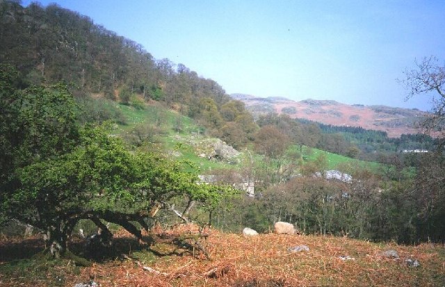
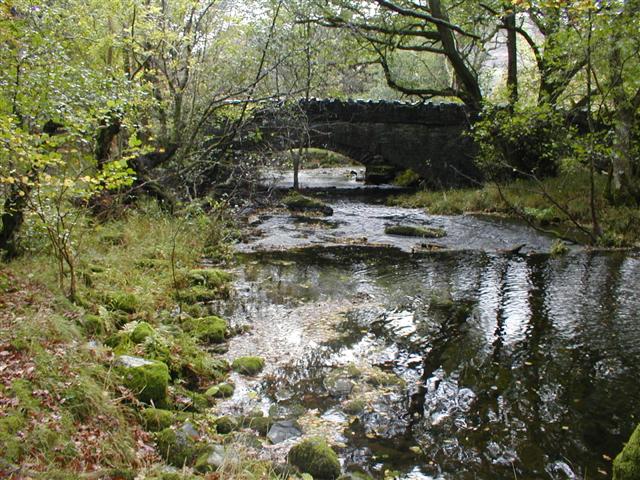
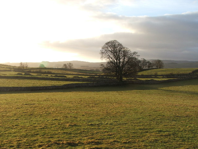
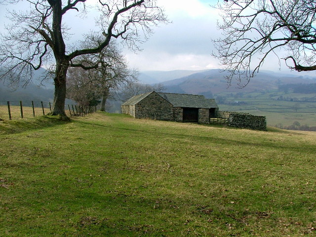
The village is nestled in a picturesque valley surrounded by rolling hills and breathtaking landscapes. It is primarily an agricultural community, with farming being the main occupation of the residents. The fertile land supports livestock farming, particularly sheep rearing.

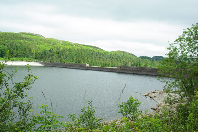
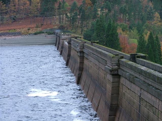
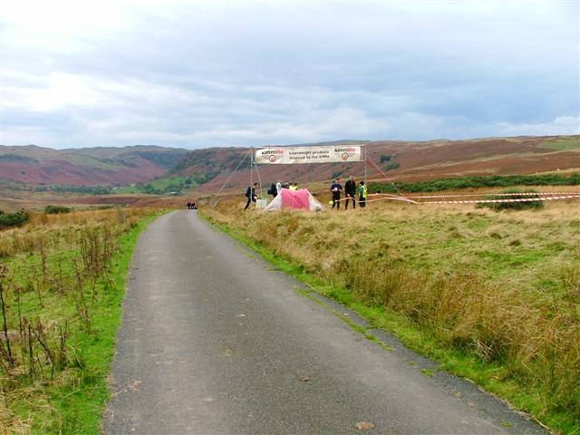
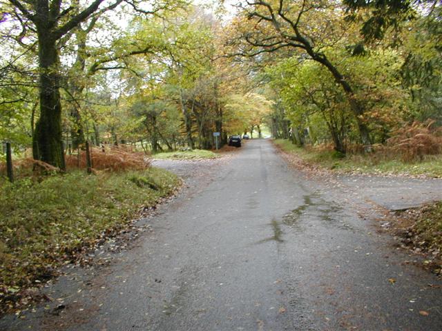
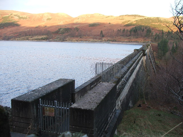
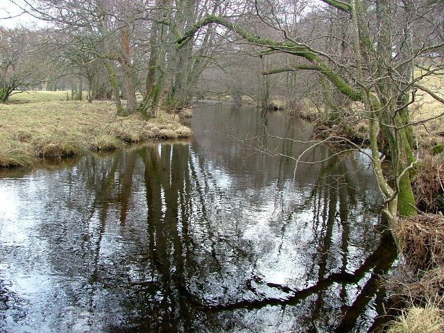
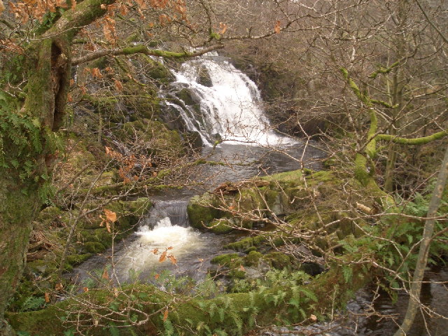
Burnbanks is known for its tranquility and natural beauty, making it a popular destination for tourists seeking a peaceful retreat. The village offers stunning views of the surrounding countryside, with several walking trails and hiking routes that attract outdoor enthusiasts. The nearby Shap Reservoir, a man-made lake, adds to the scenic charm of the area.

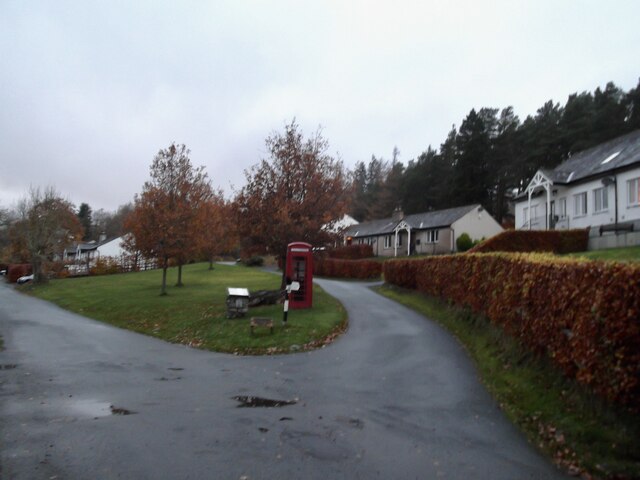
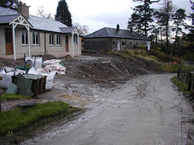
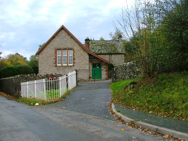
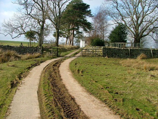
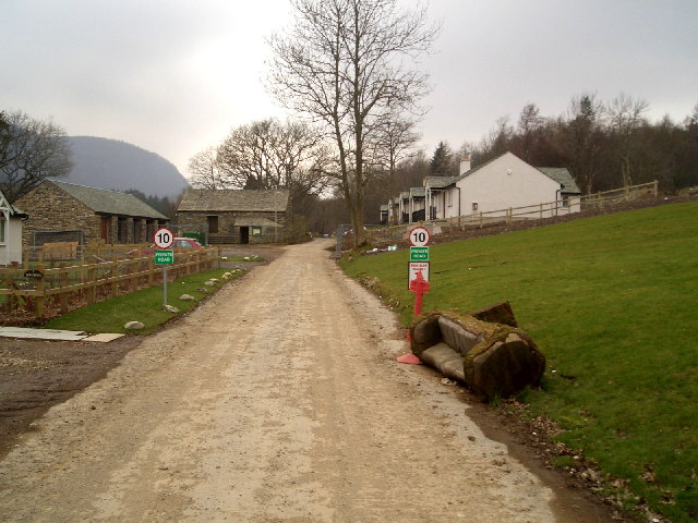
The village itself is small, consisting of a handful of traditional stone houses and cottages. There are no major amenities or facilities in Burnbanks, with residents typically relying on nearby towns for services such as schools, shops, and healthcare.

Despite its secluded location, Burnbanks benefits from good transportation links. The A6 road, which connects Penrith to Kendal, passes close to the village, providing easy access to neighboring towns and cities.

Overall, Burnbanks offers a tranquil and idyllic setting for those seeking solace in the beauty of the Lake District.

If you have any feedback on the listing, please let us know in the comments section below.

Burnbanks Images

Images are sourced within 2km of 54.539028/-2.7580529 or Grid Reference NY5116. Thanks to Geograph Open Source API. All images are credited.

Burnbanks village The telephone box contains a phone...something of a rarity these days
Burnbanks village
The telephone box contains a phone...something of a rarity these days
Haweswater Dam Wall
Haweswater Dam Wall
Burnbanks Ford This ford is found on the track on the north bank of Haweswater Reservoir.
Burnbanks Ford
This ford is found on the track on the north bank of Haweswater Reservoir.
Above Naddle Farm Scrub woodland on the bridleway over to Swindale.
Above Naddle Farm
Scrub woodland on the bridleway over to Swindale.
Haweswater Dam Built by Manchester Corporation between 1929 and 1941. It raised the surface of Haweswater by 96 feet increasing its capacity to 18,660 million gallons. The dam is of hollow concrete buttress construction which was quite innovative in its day. The method was cheaper and lower maintenance. Any movement of the dam is monitored inside by a giant plumb bob which has only deflected one twentieth of an inch since the dam's construction.
Haweswater Dam
Built by Manchester Corporation between 1929 and 1941. It raised the surface of Haweswater by 96 feet increasing its capacity to 18,660 million gallons. The dam is of hollow concrete buttress construction which was quite innovative in its day. The method was cheaper and lower maintenance. Any movement of the dam is monitored inside by a giant plumb bob which has only deflected one twentieth of an inch since the dam's construction.
Burnbanks A village of concrete houses built for the construction workers of the dam. These are now being renovated for sale to local people.
Burnbanks
A village of concrete houses built for the construction workers of the dam. These are now being renovated for sale to local people.
Naddle Bridge Viewed from upstream only the new one can be seen.
Naddle Bridge
Viewed from upstream only the new one can be seen.
Bampton Endowed School In 1999 the school had 21 pupils.
Bampton Endowed School
In 1999 the school had 21 pupils.
Road to Swindale Looking SSW from the crossroads on Rosgill Moor down into Swindale. The area was used for one of the overnight camps in the 2005 Karrimor International Mountain Marathon.
Road to Swindale
Looking SSW from the crossroads on Rosgill Moor down into Swindale. The area was used for one of the overnight camps in the 2005 Karrimor International Mountain Marathon.
Burnbanks Wood View north along the Haweswater road towards Naddle Bridge. The area is well known for its red squirrels. I saw several but none were prepared to pose.
Burnbanks Wood
View north along the Haweswater road towards Naddle Bridge. The area is well known for its red squirrels. I saw several but none were prepared to pose.
Haweswater Dam.
Haweswater Dam.
Bridge over Haweswater Beck at Greengate. Looking NW.
Bridge over Haweswater Beck at Greengate.
Looking NW.
Farmland near Walmgate. Slightly SE of Walmgate.
Farmland near Walmgate.
Slightly SE of Walmgate.
The Coast to Coast Path passing Rawhead A farmhouse overlooking the Lowther Valley.
The Coast to Coast Path passing Rawhead
A farmhouse overlooking the Lowther Valley.
Highpark Buildings Looking westward, the Coast to Coast footpath appears to go to the left of the building contrary to the map.
Highpark Buildings
Looking westward, the Coast to Coast footpath appears to go to the left of the building contrary to the map.
Haweswater Beck Looking downstream. As I was going to take this photo I came across an otter on the bank and then in the beck. Unfortunately it can't be seen in this photo (or any other) as it was too quick for me.
Haweswater Beck
Looking downstream. As I was going to take this photo I came across an otter on the bank and then in the beck. Unfortunately it can't be seen in this photo (or any other) as it was too quick for me.
Thornthwaite Force on Haweswater Beck
Thornthwaite Force
on Haweswater Beck
Burnbanks A village underneath The Haweswater Dam
Burnbanks
A village underneath The Haweswater Dam
Show me another place!

Burnbanks is located at Grid Ref: NY5116 (Lat: 54.539028, Lng: -2.7580529)

Administrative County: Cumbria

District: Eden

Police Authority: Cumbria

What 3 Words

///hubcaps.recital.verdict. Near Shap, Cumbria

Related Wikis

Bomby

Bomby is a village in Cumbria, England. Bomby village consists only of one farm house. The farm is mostly known for its specific potatoes, the Kind Edward...

Naddle Horseshoe

The Naddle Horseshoe is a group of summits in the English Lake District, south of Mardale valley, Cumbria. It is the subject of a chapter of Wainwright...

Bampton Grange

Bampton Grange is a village in Cumbria, England. Haweswater Beck arises as a stream discharge from Haweswater Reservoir and flows eastward, just north...

Bampton, Cumbria

Bampton is a village and civil parish in the Westmorland and Furness unitary authority area of Cumbria, England, on the edge of the Lake District National...

Haweswater Beck

Haweswater Beck flows through Cumbria in England. It arises as a stream discharge from Haweswater Reservoir, at Gill Dubs, just east of the dam, and flows...

Butterwick, Cumbria

Butterwick is a hamlet in Cumbria, England, near the village of Helton. == Location grid ==

West Ward Rural District

West Ward was a rural district of the administrative county of Westmorland. The area was directly based on the former West Ward rural sanitary district...

Swindale Beck

Swindale Beck is a stream in Cumbria, England. It is formed at Swindale Head where Mosedale Beck, from the slopes of Tarn Crag, joins Hobgrumble Beck from...

Nearby Amenities

Located within 500m of 54.539028,-2.7580529
Barrier: stile
Foot: designated
Lat/Long: 54.5369467/-2.7569069
Burnbanks
Is In: Eden, Cumbria, UK
Place: hamlet
Lat/Long: 54.5378465/-2.7622008
Naddle Gate
Local Ref: AT
Naptan AtcoCode: 090074061351
Naptan Bearing: N
Naptan BusStopType: CUS
Naptan CommonName: Naddle Gate
Naptan Indicator: at
Naptan Landmark: junction for Burnbanks
Naptan NaptanCode: cumdadaj
Naptan Street: No name
Naptan Verified: no
Place: hamlet
Source: naptan_import
Lat/Long: 54.5391273/-2.7581475
Barrier: stile
Lat/Long: 54.5380949/-2.757185
Barrier: stile
Lat/Long: 54.5382677/-2.752483
Telephone
Booth: K6
Covered: booth
Operator: BT
Source: survey
Lat/Long: 54.5378717/-2.7620949
Post Box
Post Box Type: wall
Ref: CA10 204
Source: survey
Lat/Long: 54.5378665/-2.761653
Aragon Camping
Tourism: camp_site
Lat/Long: 54.5377732/-2.7572217
Power: pole
Lat/Long: 54.5365839/-2.7577252
The Hobbit Trail
Operator: Aragon Camping
Tourism: attraction
Lat/Long: 54.5370644/-2.7576443
Walmgate Head
Place: locality
Lat/Long: 54.5410058/-2.7565618
Power: pole
Lat/Long: 54.5401443/-2.7507287
Power: pole
Lat/Long: 54.5398704/-2.75163
Power: pole
Lat/Long: 54.5395468/-2.7526707
Power: pole
Lat/Long: 54.538498/-2.756179
Power: pole
Lat/Long: 54.5380452/-2.7576864
Power: pole
Lat/Long: 54.5378841/-2.7584495
Power: pole
Lat/Long: 54.5377316/-2.7591522
Give Way
Direction: backward
Lat/Long: 54.5355523/-2.7590943
Power: pole
Lat/Long: 54.5357023/-2.7587941
Tourism: information
Lat/Long: 54.5378572/-2.7620894
Private Road
Information: sign
Tourism: information
Lat/Long: 54.5355246/-2.7590862
Barrier: stile
Lat/Long: 54.5367897/-2.7584213
Barrier: stile
Lat/Long: 54.5368123/-2.7584789
Information: route_marker
Tourism: information
Lat/Long: 54.5381338/-2.7610093
Power: pole
Lat/Long: 54.5390832/-2.7542215
Power: pole
Lat/Long: 54.5372467/-2.761413
Power: pole
Lat/Long: 54.5369224/-2.7628119
Power: pole
Lat/Long: 54.5367309/-2.7636445
Power: pole
Lat/Long: 54.5375045/-2.760242
Power: pole
Lat/Long: 54.537061/-2.7622088
The data included in this document is from www.openstreetmap.org. The data is made available under ODbL.

Have you been to Burnbanks?

Leave your review of Burnbanks below (or comments, questions and feedback).