Bull Hey

Settlement in Lancashire

England

Bull Hey

Wigan North Western railway station  The entrance to Wigan North Western railway station. The station is currently served by Avanti West Coast (Virgin at the time the picture was taken) and Northern.
Wigan North Western railway station Credit: Daniel Parks

Bull Hey is a small hamlet located in Lancashire, England. It is situated near the town of Ormskirk and is surrounded by picturesque countryside. The hamlet is known for its tranquil and rural setting, making it a popular destination for those looking to escape the hustle and bustle of city life.

Bull Hey is home to a small number of residential properties, with most of the area being made up of farmland and fields. The hamlet is well-connected by road, with the A59 running nearby providing easy access to nearby towns and cities.

The surrounding area offers plenty of opportunities for outdoor activities such as walking, cycling, and horse riding. There are also several historic sites and landmarks in the area, including the nearby Rufford Old Hall.

Overall, Bull Hey is a charming and peaceful hamlet, perfect for those seeking a quiet retreat in the heart of the Lancashire countryside. Its idyllic setting and close proximity to amenities make it a desirable place to live or visit.

If you have any feedback on the listing, please let us know in the comments section below.
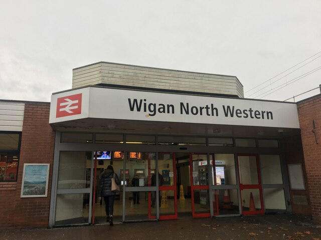
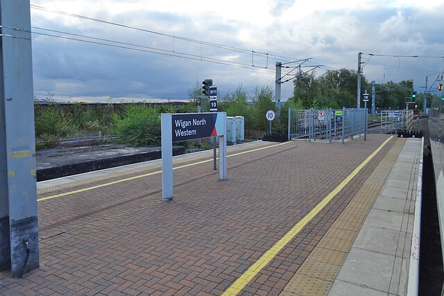
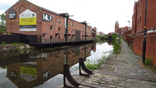
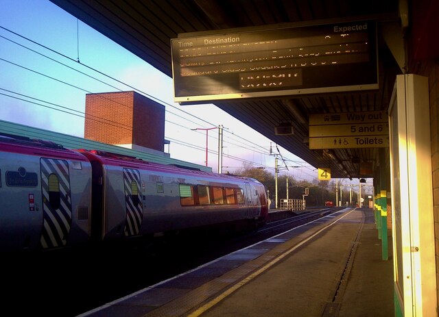
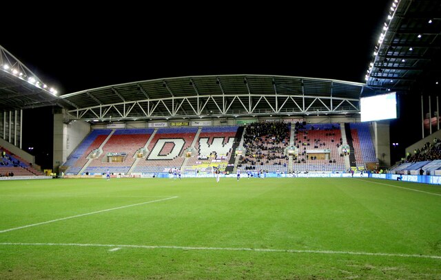
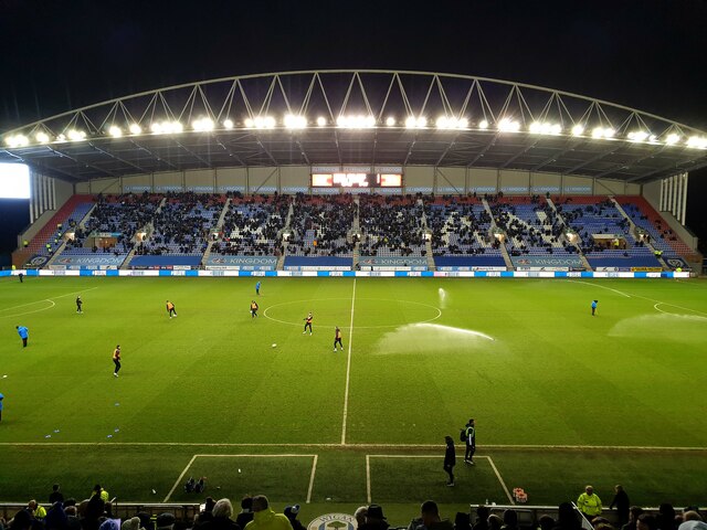
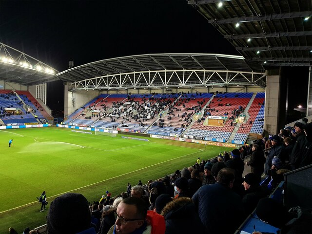
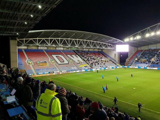
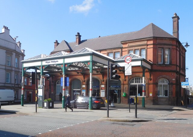
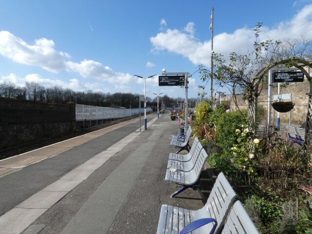
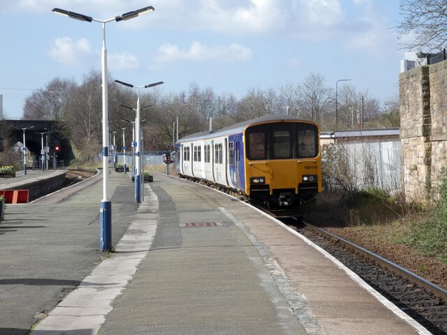
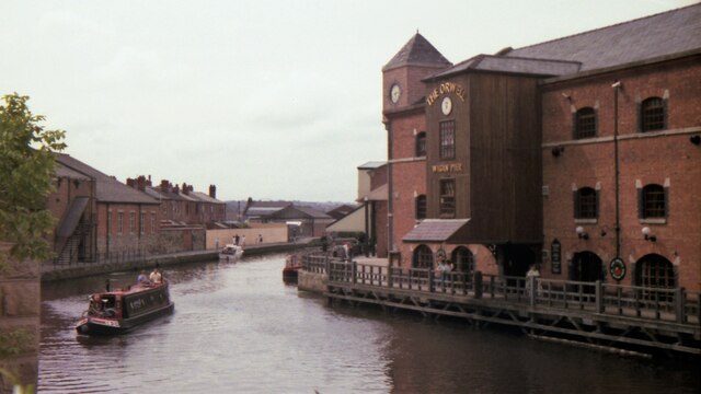
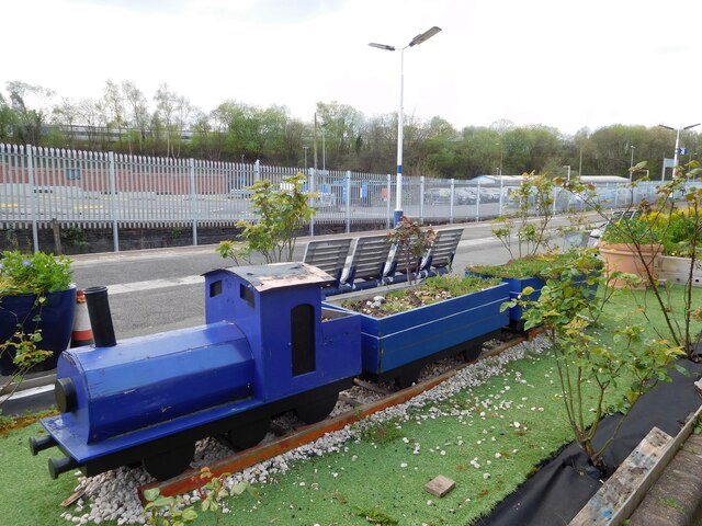
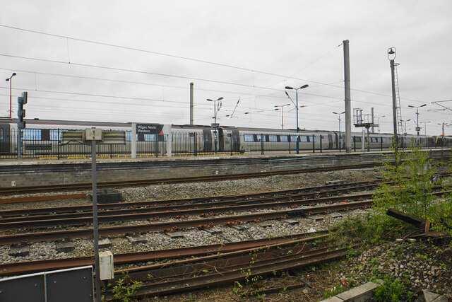
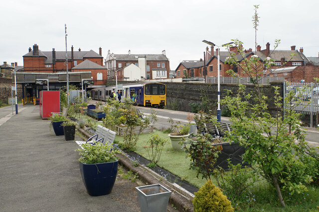
Bull Hey Images

Images are sourced within 2km of 53.548876/-2.637804 or Grid Reference SD5705. Thanks to Geograph Open Source API. All images are credited.

Wigan North Western railway station  The entrance to Wigan North Western railway station. The station is currently served by Avanti West Coast (Virgin at the time the picture was taken) and Northern.
Wigan North Western railway station
The entrance to Wigan North Western railway station. The station is currently served by Avanti West Coast (Virgin at the time the picture was taken) and Northern.
Wigan North Western Station A traveller's view from an Edinburgh-bound train.
Wigan North Western Station
A traveller's view from an Edinburgh-bound train.
Wigan Pier, Leeds & Liverpool Canal
Wigan North Western railway station The station opened as Wigan station in 1838 and was renamed to Wigan North Western in 1924 as it belonged to London and North Western Railway.
Wigan North Western railway station
The station opened as Wigan station in 1838 and was renamed to Wigan North Western in 1924 as it belonged to London and North Western Railway.
The DW Stadium in Wigan The DW Stadium is home to Wigan Athletic F.C. and Wigan Warriors R.L.F.C.
The DW Stadium in Wigan
The DW Stadium is home to Wigan Athletic F.C. and Wigan Warriors R.L.F.C.
The main entrance to the DW Stadium The DW Stadium is home to Wigan Athletic F.C. and Wigan Warriors R.L.F.C.
The main entrance to the DW Stadium
The DW Stadium is home to Wigan Athletic F.C. and Wigan Warriors R.L.F.C.
The Springfield Stand at the DW Stadium The DW Stadium is home to Wigan Athletic F.C. and Wigan Warriors R.L.F.C.
The Springfield Stand at the DW Stadium
The DW Stadium is home to Wigan Athletic F.C. and Wigan Warriors R.L.F.C.
The North Stand at the DW Stadium The DW Stadium is home to Wigan Athletic F.C. and Wigan Warriors R.L.F.C.
The North Stand at the DW Stadium
The DW Stadium is home to Wigan Athletic F.C. and Wigan Warriors R.L.F.C.
The Boston Stand at the DW Stadium
The Leam Richardson Stand at the DW Stadium The DW Stadium is home to Wigan Athletic F.C. and Wigan Warriors R.L.F.C.
The Leam Richardson Stand at the DW Stadium
The DW Stadium is home to Wigan Athletic F.C. and Wigan Warriors R.L.F.C.
The North Stand at the DW Stadium The DW Stadium is home to Wigan Athletic F.C. and Wigan Warriors R.L.F.C.
The North Stand at the DW Stadium
The DW Stadium is home to Wigan Athletic F.C. and Wigan Warriors R.L.F.C.
Wigan Wallgate The first station on this site was opened by the Lancashire and Yorkshire Railway in 1896, It was renamed from "Wigan" to "Wigan Wallgate" in 1924. The outside was all wrapped up 2017 <a href="https://www.geograph.org.uk/photo/5563947">SD5805 : Wigan Wallgate</a>. The booking hall is Grade II listed <span class="nowrap"><a title="https://historicengland.org.uk/listing/the-list/list-entry/1384563?section=official-list-entry" rel="nofollow ugc noopener" href="https://historicengland.org.uk/listing/the-list/list-entry/1384563?section=official-list-entry">Link</a><img style="margin-left:2px;" alt="External link" title="External link - shift click to open in new window" src="https://s1.geograph.org.uk/img/external.png" width="10" height="10"/></span>
Wigan Wallgate
The first station on this site was opened by the Lancashire and Yorkshire Railway in 1896, It was renamed from "Wigan" to "Wigan Wallgate" in 1924. The outside was all wrapped up 2017 SD5805 : Wigan Wallgate. The booking hall is Grade II listed LinkExternal link
Wigan Wallgate 
The platforms here have lovely displays of flowers.
Wigan Wallgate
The platforms here have lovely displays of flowers.
DMU 150114 at Wigan Wallgate 
Class 150 DMU on a service from Southport to Stalybridge.
DMU 150114 at Wigan Wallgate
Class 150 DMU on a service from Southport to Stalybridge.
The Orwell at Wigan Pier in 1990 The pub was apparently developed in 1984 from a warehouse
The Orwell at Wigan Pier in 1990
The pub was apparently developed in 1984 from a warehouse
Little train at Wigan Wallgate 
The flower planter is looking somewhat careworn.
Little train at Wigan Wallgate
The flower planter is looking somewhat careworn.
Wigan North Western station As seen from a train going to Wigan Wallgate station.
Wigan North Western station
As seen from a train going to Wigan Wallgate station.
Wigan Wallgate railway station Most of stations along this line appear to have a maintained garden, though this one relies on artificial grass.
Wigan Wallgate railway station
Most of stations along this line appear to have a maintained garden, though this one relies on artificial grass.
Show me another place!

Bull Hey is located at Grid Ref: SD5705 (Lat: 53.548876, Lng: -2.637804)

Unitary Authority: Wigan

Police Authority: Greater Manchester

What 3 Words

///breed.dull.happy. Near Wigan, Manchester

Nearby Locations

Bull Hey Wallgate

Related Wikis

Deanery High School

The Deanery Church of England High School and Sixth Form College is a coeducational secondary school and sixth form located in Wigan, Greater Manchester...

University Technical College Wigan

University Technical College Wigan (or Wigan UTC) was a university technical college (UTC) sixth form that opened in Wigan, Greater Manchester, England...

Wigan bus station

Wigan bus station is a bus station located in the town of Wigan, in Greater Manchester, England. It is run by Transport for Greater Manchester. == Services... ==

Mesnes Park, Wigan

Mesnes Park (English: (Mains) is a Victorian public park dating from 1878 in Wigan, Greater Manchester, UK. The elongated 12 hectares (30 acres) park lies...

Nearby Amenities

Located within 500m of 53.548876,-2.637804
Traffic Signals
Traffic Signals Direction: backward
Lat/Long: 53.548804/-2.6337349
Traffic Signals
Traffic Signals: signal
Lat/Long: 53.5495359/-2.6325688
Wigan Wallgate
Naptan AtcoCode: 9100WIGANWL
Network: National Rail
Network Website: https://www.nationalrail.co.uk/stations/wgw/
Network Wikidata: Q26334
Operator: Northern Rail
Operator Website: https://www.northernrailway.co.uk/stations/wigan-wallgate
Operator Wikidata: Q85789775
Public Transport: station
Railway: station
Ref Crs: WGW
Source Name: local knowledge
Train: yes
Wikidata: Q7999554
Wikipedia: en:Wigan Wallgate railway station
Lat/Long: 53.5450582/-2.6342351
Traffic Signals
Traffic Signals: crossing
Lat/Long: 53.5495852/-2.6311656
Crossing
Crossing: uncontrolled
Crossing Island: no
Crossing Markings: zebra
Crossing Ref: zebra
Kerb: lowered
Tactile Paving: yes
Lat/Long: 53.5528007/-2.6350319
Traffic Signals
Traffic Signals: signal
Lat/Long: 53.5473428/-2.6372296
Traffic Signals
Traffic Signals: signal
Traffic Signals Direction: forward
Lat/Long: 53.5473516/-2.63716
Traffic Signals
Traffic Signals: signal
Traffic Signals Direction: forward
Lat/Long: 53.548075/-2.6304443
Traffic Signals
Traffic Signals: signal
Lat/Long: 53.5495446/-2.6318555
Crossing
Crossing: unmarked
Crossing Island: yes
Crossing Markings: no
Tactile Paving: yes
Lat/Long: 53.5466041/-2.6341507
World War I & II Memorial
Heritage: 2
Heritage Category: Listed Building
Heritage Name: WAR MEMORIAL SOUTH OF CHURCH OF ALL SAINTS WITH ENCIRCLING RAILINGS
Heritage Operator: Historic England
Historic: heritage
Listed Status: Grade II*
Memorial: war_memorial
Operator: All Saints Parish Church
Ref GB Nhle: 1384562
Start Date: 1925
Website: https://historicengland.org.uk/listing/the-list/list-entry/1384562
Lat/Long: 53.5457574/-2.6325479
Bus Stop
Mesnes Street/New Market Street
Bus: yes
Naptan AtcoCode: 1800WK06201
Naptan Bearing: NW
Naptan CommonName: Mesnes Street/New Market Street
Naptan Indicator: Playing Field
Naptan Landmark: PLAYING FIELD
Naptan NaptanCode: manptmwp
Naptan PlusbusZoneRef: MNCRPIC
Naptan ShortCommonName: New Market Street
Naptan Street: MESNES STREET
Naptan Verified: no
Network: TfGM
Public Transport: platform
Shelter: yes
Source: naptan_import
Lat/Long: 53.5501605/-2.6328423
Bus Stop
King Street West/Wallgate (Stop E)
Bus: yes
Local Ref: E
Naptan AtcoCode: 1800WK02311
Naptan Bearing: SE
Naptan CommonName: King Street West/Wallgate (Stop E)
Naptan Indicator: Stop E
Naptan Landmark: TAKEAWAY
Naptan NaptanCode: manpmtpm
Naptan PlusbusZoneRef: MNCRPIC
Naptan ShortCommonName: Wallgate
Naptan Street: King Street West
Naptan Verified: no
Network: TfGM
Public Transport: platform
Source: naptan_import
Lat/Long: 53.5452112/-2.6337128
Bus Stop
New Market Street/Morrisons
Bus: yes
Naptan AtcoCode: 1800WK02371
Naptan Bearing: SW
Naptan CommonName: New Market Street/Morrisons
Naptan Indicator: Market Hall
Naptan Landmark: MARKET HALL
Naptan NaptanCode: manpmtwd
Naptan PlusbusZoneRef: MNCRPIC
Naptan ShortCommonName: Morrisons
Naptan Street: New Market Street
Naptan Verified: no
Network: TfGM
Public Transport: platform
Source: naptan_import
Lat/Long: 53.5491055/-2.6330792
Bus Stop
Mesnes Street/Market
Bench: no
Bus: yes
Naptan AtcoCode: 1800WK02431
Naptan Bearing: SE
Naptan CommonName: Mesnes Street/Market
Naptan Indicator: Os Bakery
Naptan Landmark: HAIRDRESSERS
Naptan NaptanCode: manpmtwp
Naptan PlusbusZoneRef: MNCRPIC
Naptan ShortCommonName: Market
Naptan Street: MESNES STREET
Naptan Verified: no
Network: TfGM
Public Transport: platform
Shelter: no
Source: naptan_import
Lat/Long: 53.5490452/-2.6315926
Bus Stop
Parsons Walk/Wigan College
Bus: yes
Naptan AtcoCode: 1800WK03671
Naptan Bearing: SE
Naptan CommonName: Parsons Walk/Wigan College
Naptan Indicator: Opp Wigan Tech
Naptan Landmark: OPP WIGAN TECH
Naptan NaptanCode: manptamt
Naptan PlusbusZoneRef: MNCRPIC
Naptan ShortCommonName: Wigan College
Naptan Street: PARSONS WALK
Naptan Verified: no
Network: TfGM
Public Transport: platform
Shelter: no
Source: naptan_import
Lat/Long: 53.5490627/-2.6343881
Bus Stop
Parsons Walk/Wigan College
Bus: yes
Local Ref: F
Naptan AtcoCode: 1800WK03681
Naptan Bearing: NW
Naptan CommonName: Parsons Walk/Wigan College
Naptan Indicator: Wigan Tech
Naptan Landmark: WIGAN COLLEGE
Naptan NaptanCode: manptamw
Naptan PlusbusZoneRef: MNCRPIC
Naptan ShortCommonName: Wigan College
Naptan Street: PARSONS WALK
Naptan Verified: no
Network: TfGM
Public Transport: platform
Shelter: yes
Source: naptan_import
Lat/Long: 53.5494088/-2.6351172
Bus Stop
Frog Lane/Markland Court
Bus: yes
Naptan AtcoCode: 1800WK23551
Naptan Bearing: NW
Naptan CommonName: Frog Lane/Markland Court
Naptan Indicator: Council Yard
Naptan Landmark: COUNCIL YARD
Naptan NaptanCode: manpwtda
Naptan PlusbusZoneRef: MNCRPIC
Naptan ShortCommonName: Markland Court
Naptan Street: FROG LANE
Naptan Verified: no
Network: TfGM
Public Transport: platform
Source: naptan_import
Lat/Long: 53.5485686/-2.6444212
Bus Stop
Frog Lane/Markland Court
Bus: yes
Naptan AtcoCode: 1800WK23561
Naptan Bearing: SE
Naptan CommonName: Frog Lane/Markland Court
Naptan Indicator: Car Park
Naptan Landmark: CAR PARK
Naptan NaptanCode: manpwtdg
Naptan PlusbusZoneRef: MNCRPIC
Naptan ShortCommonName: Markland Court
Naptan Street: FROG LANE
Naptan Verified: no
Network: TfGM
Public Transport: platform
Source: naptan_import
Lat/Long: 53.5485359/-2.643817
Bus Stop
Frog Lane/Gidlow Lane
Bus: yes
Naptan AtcoCode: 1800WK23571
Naptan Bearing: NW
Naptan CommonName: Frog Lane/Gidlow Lane
Naptan Indicator: Guardians Inn
Naptan Landmark: GUARDIANS INN
Naptan NaptanCode: manpwtdj
Naptan PlusbusZoneRef: MNCRPIC
Naptan ShortCommonName: Gidlow Lane
Naptan Street: FROG LANE
Naptan Verified: no
Network: TfGM
Public Transport: platform
Source: naptan_import
Lat/Long: 53.5478462/-2.6416785
Bus Stop
Frog Lane/Prescott Street
Bench: no
Bin: no
Bus: yes
Naptan AtcoCode: 1800WK23581
Naptan Bearing: E
Naptan CommonName: Frog Lane/Prescott Street
Naptan Indicator: Builders Opp
Naptan Landmark: HOUSE 3
Naptan NaptanCode: manpwtdm
Naptan PlusbusZoneRef: MNCRPIC
Naptan ShortCommonName: Prescott Street
Naptan Street: FROG LANE
Naptan Verified: no
Network: TfGM
Public Transport: platform
Shelter: no
Source: naptan_import
Lat/Long: 53.5477103/-2.640244
Bus Stop
Frog Lane/Deanery High School
Bench: yes
Bus: yes
Naptan AtcoCode: 1800WK23591
Naptan Bearing: W
Naptan CommonName: Frog Lane/Deanery High School
Naptan Indicator: Pear Tree Pub
Naptan Landmark: PEAR TREE PUB
Naptan NaptanCode: manpwtdp
Naptan PlusbusZoneRef: MNCRPIC
Naptan ShortCommonName: Deanery HS
Naptan Street: FROG LANE
Naptan Verified: no
Network: TfGM
Public Transport: platform
Shelter: yes
Source: naptan_import
Lat/Long: 53.5474045/-2.6376704
Bus Stop
Frog Lane/Deanery High School
Bus: yes
Departures Board: no
Naptan AtcoCode: 1800WK23601
Naptan Bearing: E
Naptan CommonName: Frog Lane/Deanery High School
Naptan Indicator: Deanery School
Naptan Landmark: DEANERY SCHOOL
Naptan NaptanCode: manpwtdt
Naptan PlusbusZoneRef: MNCRPIC
Naptan ShortCommonName: Deanery HS
Naptan Street: FROG LANE
Naptan Verified: no
Network: TfGM
Public Transport: platform
Shelter: no
Source: naptan_import
Lat/Long: 53.5475698/-2.6368615
Bus Stop
Parsons Walk/Thomas Linacre Centre
Bus: yes
Naptan AtcoCode: 1800WK23921
Naptan Bearing: SE
Naptan CommonName: Parsons Walk/Thomas Linacre Centre
Naptan Indicator: Op House 3
Naptan Landmark: OP HOUSE 3
Naptan NaptanCode: manpwtpm
Naptan PlusbusZoneRef: MNCRPIC
Naptan ShortCommonName: Thomas Linacre
Naptan Street: PARSONS WALK
Naptan Verified: no
Network: TfGM
Public Transport: platform
Source: naptan_import
Lat/Long: 53.5503837/-2.6361322
Bus Stop
Park Road/Park Crescent
Bus: yes
Naptan AtcoCode: 1800WK23931
Naptan Bearing: NW
Naptan CommonName: Park Road/Park Crescent
Naptan Indicator: Op Mesnes Pk
Naptan Landmark: HOUSE 9
Naptan NaptanCode: manpwtpt
Naptan PlusbusZoneRef: MNCRPIC
Naptan ShortCommonName: Park Crescent
Naptan Street: PARK ROAD
Naptan Verified: no
Network: TfGM
Public Transport: platform
Source: naptan_import
Lat/Long: 53.5516613/-2.6392758
Bus Stop
Park Road/Gidlow Lane
Bus: yes
Naptan AtcoCode: 1800WK23941
Naptan Bearing: NW
Naptan CommonName: Park Road/Gidlow Lane
Naptan Indicator: Os House 51
Naptan Landmark: HOUSE 51
Naptan NaptanCode: manpwtpw
Naptan PlusbusZoneRef: MNCRPIC
Naptan ShortCommonName: Gidlow Lane
Naptan Street: PARK ROAD
Naptan Verified: no
Network: TfGM
Public Transport: platform
Source: naptan_import
Lat/Long: 53.5521472/-2.6425435
Bus Stop
Park Road/Gidlow Lane
Bus: yes
Naptan AtcoCode: 1800WK23951
Naptan Bearing: SE
Naptan CommonName: Park Road/Gidlow Lane
Naptan Indicator: Os House 52
Naptan Landmark: HOUSE 52
Naptan NaptanCode: manpwtwa
Naptan PlusbusZoneRef: MNCRPIC
Naptan ShortCommonName: Gidlow Lane
Naptan Street: PARK ROAD
Naptan Verified: no
Network: TfGM
Public Transport: platform
Source: naptan_import
Lat/Long: 53.5522728/-2.6425907
Bus Stop
Bridgeman Terrace/Mesnes Park
Bus: yes
Naptan AtcoCode: 1800WK21681
Naptan Bearing: N
Naptan CommonName: Bridgeman Terrace/Mesnes Park
Naptan Indicator: Nr Park Gates
Naptan Landmark: PARK GATES
Naptan NaptanCode: manpwmad
Naptan PlusbusZoneRef: MNCRPIC
Naptan ShortCommonName: Mesnes Park
Naptan Street: BRIDGEMAN TERR
Naptan Verified: no
Network: TfGM
Public Transport: platform
Source: naptan_import
Lat/Long: 53.5511695/-2.6337289
Bus Stop
Mesnes Street/New Market Street
Bus: yes
Naptan AtcoCode: 1800WK21691
Naptan Bearing: SE
Naptan CommonName: Mesnes Street/New Market Street
Naptan Indicator: Mabs Cross Bldg
Naptan Landmark: SHOPS
Naptan NaptanCode: manpwmag
Naptan PlusbusZoneRef: MNCRPIC
Naptan ShortCommonName: New Market Street
Naptan Street: MESNES STREET
Naptan Verified: no
Network: TfGM
Public Transport: platform
Shelter: no
Source: naptan_import
Lat/Long: 53.5504316/-2.6328972
Railway: switch
Lat/Long: 53.5457474/-2.6387202
Railway: buffer_stop
Lat/Long: 53.5461439/-2.6401745
Railway: switch
Lat/Long: 53.5456174/-2.638295
Railway: switch
Lat/Long: 53.5456424/-2.6383362
Railway: switch
Lat/Long: 53.5462938/-2.6415789
Railway: railway_crossing
Lat/Long: 53.5456337/-2.6386756
Railway: switch
Lat/Long: 53.5456377/-2.6379082
Railway: switch
Lat/Long: 53.5458592/-2.6391847
Railway: switch
Lat/Long: 53.5454914/-2.6404338
Railway: buffer_stop
Lat/Long: 53.5451854/-2.6347589
Barrier: bollard
Bollard: rising
Lat/Long: 53.5465904/-2.6326678
Traffic Signals
Traffic Signals Direction: backward
Lat/Long: 53.5480367/-2.6307287
Powell Statue
HE Ref: 1384493
Alt Name: Powell Monument
Description: Monument to Sir Francis Sharp Powell, many rub his foot for good luck.
Historic: monument
Listed Status: Grade II
Monument: statue
Wikidata: Q26664328
Lat/Long: 53.5516953/-2.6353173
Parking
Lat/Long: 53.5485131/-2.6306638
Cafe
Coffee me
Addr City: Wigan
Addr Housename: Mesnes Terrace Car Park
Addr Postcode: WN1 1QB
Addr Street: Mesnes Terrace
Website: www.wiganboroughshopmobility.org.uk
Lat/Long: 53.5489621/-2.630993
Bus Stop
Bus: yes
Local Ref: Shopmobility
Public Transport: platform
Lat/Long: 53.5489427/-2.6311476
Railway: switch
Lat/Long: 53.5455556/-2.6371433
The IT Way Computer Repairs
Addr City: Wigan
Addr Housenumber: 42B
Addr Postcode: WN1 1HX
Addr Street: Market Street
Phone: +44 1942 825242
Website: https://theitway.com/
Lat/Long: 53.5474173/-2.6332938
Bench
Material: wood
Lat/Long: 53.5462775/-2.6319595
Bench
Material: wood
Lat/Long: 53.5463661/-2.6317804
Bench
Lat/Long: 53.5461729/-2.6320047
Bench
Lat/Long: 53.5461416/-2.6319595
Bench
Lat/Long: 53.5461425/-2.6318782
Bench
Lat/Long: 53.546172/-2.6317969
Traffic Signals
Traffic Signals: signal
Traffic Signals Direction: forward
Lat/Long: 53.5474805/-2.6373828
Traffic Signals
Traffic Signals: signal
Traffic Signals Direction: forward
Lat/Long: 53.5486296/-2.633744
Railway: switch
Lat/Long: 53.5466507/-2.6423452
Railway: switch
Lat/Long: 53.5467492/-2.6426579
Railway: switch
Lat/Long: 53.545555/-2.6396297
Entrance: yes
Wheelchair: yes
Lat/Long: 53.5472661/-2.6335614
Entrance: yes
Wheelchair: yes
Lat/Long: 53.547688/-2.6339718
Traffic Signals
Traffic Signals: signal
Traffic Signals Direction: forward
Lat/Long: 53.5477031/-2.6355194
Pub
Doc's Symposium
Lat/Long: 53.5506012/-2.6328175
Bicycle Parking
Access: customers
Bicycle Parking: lockers
Covered: no
Note: Bicycle lockers available for BLUC members using rail services.
Operator: Railway
Lat/Long: 53.5450817/-2.6342984
Crossing
Button Operated: yes
Crossing: traffic_signals
Crossing Island: no
Crossing Markings: dots
Crossing Ref: toucan
Kerb: lowered
Tactile Paving: yes
Traffic Signals Sound: yes
Lat/Long: 53.5495763/-2.6311008
Crossing
Button Operated: yes
Crossing: traffic_signals
Crossing Island: no
Crossing Markings: dots
Crossing Ref: toucan
Kerb: lowered
Tactile Paving: yes
Traffic Signals Sound: yes
Lat/Long: 53.5494385/-2.6309936
Pub
The Anvil
Addr City: Wigan
Addr Postcode: WN1 1HE
Addr Street: Dorning Street
Phone: +44 1942 239444
Lat/Long: 53.546327/-2.6341455
Pub
Tap 'n Barrel
Addr City: Wigan
Addr Housenumber: 16
Addr Postcode: WN1 1LR
Addr Street: Jaxons Court
Fhrs Id: 869701
Opening Hours: Mo-Th 12:00-22:00; Tu off; Fr,Sa 12:00-23:30; Su 13:00-23:00
Phone: +44 1942 386966
Lat/Long: 53.5467617/-2.633219
Fountain
Lat/Long: 53.5520957/-2.6360668
South African War Memorial
Description: In memory of men from the Wigan area that died in the South African War 1899-1902
Historic: memorial
Memorial: war_memorial
Monument: statue
Lat/Long: 53.5524997/-2.636689
Traffic Signals
Traffic Signals: signal
Traffic Signals Direction: forward
Lat/Long: 53.548456/-2.6343524
Traffic Signals
Traffic Signals: signal
Traffic Signals Direction: backward
Lat/Long: 53.5480032/-2.6350324
Generator Method: photovoltaic
Generator Output Electricity: yes
Generator Source: solar
Generator Type: solar_photovoltaic_panel
Location: roof
Power: generator
Lat/Long: 53.5513678/-2.6320526
Railway: switch
Lat/Long: 53.5449201/-2.6366665
Railway: switch
Lat/Long: 53.5446174/-2.6360003
Railway: switch
Lat/Long: 53.5445644/-2.6358878
Wigan Wallgate Junction
Railway: junction
Lat/Long: 53.5456422/-2.6389161
Railway: buffer_stop
Lat/Long: 53.5461604/-2.6407513
Railway: switch
Lat/Long: 53.5457816/-2.6388624
Railway: buffer_stop
Lat/Long: 53.5461061/-2.6406202
Railway: switch
Lat/Long: 53.5463904/-2.6415512
Southport Up Sidings
Railway: yard
Lat/Long: 53.5459787/-2.6399138
Railway: switch
Lat/Long: 53.5469356/-2.6432066
Railway: buffer_stop
Lat/Long: 53.5466378/-2.6421696
Crossing
Button Operated: yes
Crossing: traffic_signals
Crossing Island: no
Crossing Markings: dots
Crossing Ref: puffin
Kerb: lowered
Tactile Paving: yes
Traffic Signals Sound: yes
Lat/Long: 53.5494403/-2.6320606
Crossing
Button Operated: yes
Crossing: traffic_signals
Crossing Ref: pelican
Kerb: lowered
Tactile Paving: yes
Traffic Signals Sound: yes
Lat/Long: 53.5487638/-2.6314399
Crossing
Button Operated: yes
Crossing: traffic_signals
Crossing Ref: puffin
Kerb: lowered
Tactile Paving: yes
Traffic Signals Sound: yes
Lat/Long: 53.5480052/-2.6306524
Crossing
Button Operated: yes
Crossing: traffic_signals
Crossing Ref: puffin
Kerb: lowered
Tactile Paving: yes
Traffic Signals Sound: yes
Lat/Long: 53.5480466/-2.6304676
Wigan Wallgate
Local Ref: 1
Public Transport: stop_position
Railway: stop
Ref: 1
Train: yes
Lat/Long: 53.5453475/-2.6359058
Walmsley
Addr City: Wigan
Addr Housenumber: 17-21
Addr Postcode: WN1 1RG
Addr Street: Dicconson Street
Office: insurance
Lat/Long: 53.5496934/-2.6309226
Access: private
Entrance: main
Wheelchair: yes
Lat/Long: 53.5496612/-2.6304383
Northwood
Addr City: Wigan
Addr Housenumber: 55-57
Addr Postcode: WN1 1QX
Addr Street: Mesnes Street
Office: estate_agent
Lat/Long: 53.549374/-2.6318544
Chinese Medical & Skiin Centre
Addr City: Wigan
Addr Housenumber: 57
Addr Postcode: WN1 1QX
Addr Street: Mesnes Street
Healthcare: alternative
Healthcare Speciality: traditional_chinese_medicine;acupuncture
Shop: herbalist
Lat/Long: 53.5494151/-2.631791
Access: permissive
Entrance: main
Wheelchair: yes
Lat/Long: 53.5486445/-2.6322151
Access: permissive
Entrance: main
Wheelchair: yes
Lat/Long: 53.5489626/-2.6317995
Access: permissive
Entrance: main
Wheelchair: yes
Lat/Long: 53.5493603/-2.6322793
Give Way
Lat/Long: 53.5496807/-2.6320223
Traffic Signals
Traffic Signals: signal
Lat/Long: 53.5497665/-2.6322772
Traffic Signals
Traffic Signals: signal
Lat/Long: 53.549633/-2.6325377
Crossing
Button Operated: yes
Crossing: traffic_signals
Crossing Island: no
Crossing Markings: dots
Crossing Ref: puffin
Tactile Paving: yes
Lat/Long: 53.5494933/-2.6323493
British Heart Foundation
Addr City: Wigan
Addr Housenumber: 41-43
Addr Postcode: WN1 1QP
Addr Street: Mesnes Street
Brand: British Heart Foundation
Brand Wikidata: Q4970039
Brand Wikipedia: en:British Heart Foundation
Shop: charity
Website: https://www.bhf.org.uk/what-we-do/find-bhf-near-you/wigan-furniture-electrical-store
Lat/Long: 53.5490216/-2.6314886
Salon Rouge
Addr City: Wigan
Addr Housenumber: 47
Addr Postcode: WN1 1QX
Addr Street: Mesnes Street
Shop: beauty
Lat/Long: 53.5490771/-2.6315835
Paul Daniels Magic Party Shop
Addr City: Wigan
Addr Housenumber: 49
Addr Postcode: WN1 1QX
Addr Street: Mesnes Street
Shop: party
Lat/Long: 53.5491682/-2.6316624
Fazackeerley Flooring
Addr City: Wigan
Addr Housenumber: 51
Addr Postcode: WN1 1QX
Addr Street: Mesnes Street
Shop: carpet
Lat/Long: 53.5492281/-2.6317033
Father Browns Barbershop
Addr City: Wigan
Addr Housenumber: 53
Addr Postcode: WN1 1QX
Addr Street: Mesnes Street
Male: yes
Shop: hairdresser
Lat/Long: 53.5492732/-2.6317587
Fast Food
Pizza Rucola
Addr City: Wigan
Addr Housenumber: 53A
Addr Postcode: WN1 1QX
Addr Street: Mesnes Street
Cuisine: burger;kebab;pizza
Delivery: yes
Takeaway: yes
Lat/Long: 53.5493061/-2.6317894
Access: customers
Entrance: yes
Wheelchair: yes
Lat/Long: 53.5482644/-2.6312507
Pharmacy
Hollowood Chemist
Addr City: Wigan
Addr Housenumber: 11
Addr Postcode: WN1 1QP
Addr Street: Mesnes Street
Dispensing: yes
Healthcare: pharmacy
Opening Hours: Mo,Tu,Th,Fr 09:00-18:00; We,Sa 09:00-17:00
Lat/Long: 53.548332/-2.63089
California nails
Addr City: Wigan
Addr Housenumber: 17
Addr Postcode: WN1 1QP
Addr Street: Mesnes Street
Opening Hours: Mo-We 09:00-18:00; Th-Sa 09:00-19:00
Shop: beauty
Lat/Long: 53.548469/-2.6310273
Xenos Wargames
Addr City: Wigan
Addr Housenumber: 25
Addr Postcode: WN1 1QP
Addr Street: Mesnes Street
Opening Hours: Mo-Th,Sa 09:00-17:00; Fr 09:00-12:00
Shop: toys
Lat/Long: 53.5486833/-2.6312229
Boutique X Colette
Addr City: Wigan
Addr Housenumber: 23
Addr Postcode: WN1 1QP
Addr Street: Mesnes Street
Shop: clothes
Lat/Long: 53.5486304/-2.6311718
New Market Hall
Location: indoor
Operator: Electricity North West
Operator Wikidata: Q5357804
Power: substation
Ref: 212227
Substation: minor_distribution
Voltage: 6600
Lat/Long: 53.548757/-2.6319018
Shopmobility
Addr City: Wigan
Addr Housename: Shopmobility
Addr Postcode: WN1 1QB
Addr Street: Mesnes Terrace Car Park, Mesnes Terrace
Phone: +44 1942 776070
Shop: mobility_hire
Website: http://www.wiganboroughshopmobility.org.uk
Wheelchair: yes
Lat/Long: 53.5490303/-2.6310024
Post Box
Brand: Royal Mail
Brand Wikidata: Q638098
Brand Wikipedia: en:Royal Mail
Collection Times: Mo-Fr 09:00; Sa 07:00
Operator: Royal Mail
Operator Wikidata: Q638098
Post Box Type: pillar
Ref: WN1 10
Royal Cypher: GR
Royal Cypher Wikidata: Q33102273
Source: survey
Lat/Long: 53.5488472/-2.6316186
Access: permissive
Entrance: main
Wheelchair: yes
Lat/Long: 53.5491977/-2.6320102
Kings
Addr City: Wigan
Addr Housenumber: 32-36
Addr Postcode: WN1 1UE
Addr Street: Standishgate
Leisure: amusement_arcade
Lat/Long: 53.547916/-2.6307572
Jackson Opticians
Addr City: Wigan
Addr Housenumber: 44
Addr Postcode: WN1 1UW
Addr Street: Standishgate
Opening Hours: Mo-Tu 09:00-17:30; We 09:00-17:00; Th-Fr 09:00-17:30; Sa 09:00-17:00
Phone: +44 1942 242188
Shop: optician
Website: https://www.jacksonopticians.co.uk
Lat/Long: 53.5482131/-2.6304995
Bureau De Change
The Money Shop
Lat/Long: 53.5481763/-2.6305309
Magical Nails & Beauty
Addr City: Wigan
Addr Housenumber: 40
Addr Postcode: WN1 1UW
Addr Street: Standishgate
Beauty: nails
Shop: beauty
Lat/Long: 53.5481455/-2.6305615
Fast Food
Subway
Addr City: Wigan
Addr Housenumber: 38
Addr Postcode: WN1 1UW
Addr Street: Standishgate
Brand: Subway
Brand Wikidata: Q244457
Brand Wikipedia: en:Subway (restaurant)
Contact Website: https://restaurants.subway.com/united-kingdom/en/wigan/38-standishgate
Cuisine: sandwich
Takeaway: yes
Lat/Long: 53.548109/-2.6306214
Phone Drop
Addr City: Wigan
Addr Housenumber: 30
Addr Postcode: WN1 1QH
Addr Street: Royal Arcade
Shop: mobile_phone
Lat/Long: 53.5478323/-2.6307878
Vision Express
Addr City: Wigan
Addr Postcode: WN1 1UE
Addr Street: Standishgate
Brand: Vision Express
Brand Wikidata: Q7936150
Brand Wikipedia: en:Vision Express
Shop: optician
Lat/Long: 53.547553/-2.63089
B&M Bargains
Addr City: Wigan
Addr Housenumber: 22-26
Addr Postcode: WN1 1UE
Addr Street: Standishgate
Brand: B&M Bargains
Brand Wikidata: Q4836931
Brand Wikipedia: en:B&M
Contact Website: https://www.bmstores.co.uk/stores/wigan-standishgate-253
Opening Hours: Mo-Sa 08:00-18:00; Su 10:30-16:30
Shop: variety_store
Website: https://www.bmstores.co.uk
Lat/Long: 53.5476866/-2.6308608
Cafe
bap
Outdoor Seating: yes
Lat/Long: 53.547764/-2.6307564
Traffic Signals
Traffic Signals: signal
Traffic Signals Direction: forward
Lat/Long: 53.5476699/-2.6352746
Crossing
Crossing: marked
Crossing Island: yes
Crossing Ref: zebra
Kerb: lowered
Tactile Paving: yes
Lat/Long: 53.5466063/-2.6340025
Cash Generator
Brand: Cash Generator
Brand Wikidata: Q5048653
Brand Wikipedia: en:Cash Generator
Shop: pawnbroker
Lat/Long: 53.5484189/-2.6303083
Barnardo's
Addr City: Wigan
Addr Housenumber: 52
Addr Postcode: WN1 1UW
Addr Street: Standishgate
Brand: Barnardo's
Brand Wikidata: Q2884670
Brand Wikipedia: en:Barnardo's
Contact Website: https://www.barnardos.org.uk/shops/our-shops/wigan-standishgate
Opening Hours: Mo-Sa 09:00-17:00; Su 10:00-16:00
Phone: +44 1942 244054
Shop: charity
Website: https://www.barnardos.org.uk
Lat/Long: 53.5483735/-2.6303431
Life Style
Male: yes
Shop: hairdresser
Lat/Long: 53.5482643/-2.6304625
Design Clearance
Shop: clothes
Lat/Long: 53.5466404/-2.6314509
Goldsmiths
Brand: Goldsmiths
Brand Wikidata: Q16993095
Brand Wikipedia: en:Goldsmiths (retailer)
Shop: jewelry
Lat/Long: 53.5466961/-2.6313544
Bank
Halifax
Atm: yes
Brand: Halifax
Brand Wikidata: Q3310164
Brand Wikipedia: en:Halifax (bank)
Lat/Long: 53.5469137/-2.6311371
Bank
NatWest
Atm: yes
Brand: NatWest
Brand Wikidata: Q2740021
Brand Wikipedia: en:NatWest
Website: https://www.natwest.com/search-results/locator/branch.html?sortcode=602402&name=Wigan
Lat/Long: 53.5469878/-2.6311089
Warren James
Brand: Warren James
Brand Wikidata: Q19604616
Brand Wikipedia: en:Warren James Jewellers
Shop: jewelry
Lat/Long: 53.5472491/-2.6310244
Fast Food
Greenhalgh's
Brand: Greenhalgh's
Brand Wikidata: Q99939079
Shop: bakery
Takeaway: only
Lat/Long: 53.5471392/-2.6310311
Card Factory
Brand: Card Factory
Brand Wikidata: Q5038192
Brand Wikipedia: en:Card Factory
Shop: gift
Lat/Long: 53.5470531/-2.631066
Bank
Lloyds Bank
Addr City: Wigan
Addr Housenumber: 2-6
Addr Postcode: WN1 1JN
Addr Street: Market Street
Atm: yes
Brand: Lloyds Bank
Brand Wikidata: Q1152847
Brand Wikipedia: en:Lloyds Bank
Contact Website: https://branches.lloydsbank.com/wigan/2-6-market-street
Lat/Long: 53.5463041/-2.6324393
Bank
Barclays
Addr City: Wigan
Addr Housenumber: 6
Addr Postcode: WN1 1QS
Addr Street: Market Place
Atm: yes
Brand: Barclays
Brand Wikidata: Q245343
Brand Wikipedia: en:Barclays
Lat/Long: 53.5461208/-2.6322274
Fast Food
Poundbakery
Addr City: Wigan
Addr Housenumber: 28
Addr Postcode: WN1 1PJ
Addr Street: Market Place
Brand: Poundbakery
Brand Wikidata: Q21061591
Brand Wikipedia: en:Poundbakery
Cuisine: sandwich
Fhrs Id: 1213918
Opening Hours: Mo-Sa 08:00-17:00; Su 11:00-15:00
Phone: +44 1942 246328
Shop: bakery
Takeaway: yes
Website: https://www.poundbakery.co.uk/store/wigan-market-place/
Lat/Long: 53.5463702/-2.6319981
Bank
Nationwide
Addr City: Wigan
Addr Housenumber: 32-34
Addr Postcode: WN1 1NR
Addr Street: Market Place
Atm: yes
Brand: Nationwide
Brand Wikidata: Q846735
Brand Wikipedia: en:Nationwide Building Society
Contact Website: https://locations.nationwidebranches.co.uk/wigan/32/34-market-place
Lat/Long: 53.5464173/-2.6318988
Bank
RBS
Addr City: Wigan
Addr Housenumber: 38
Addr Postcode: WN1 1PJ
Addr Street: Market Place
Atm: yes
Brand: RBS
Brand Wikidata: Q160126
Brand Wikipedia: en:Royal Bank of Scotland
Official Name: Royal Bank of Scotland
Lat/Long: 53.5465001/-2.6317137
TUI
Addr City: Wigan
Addr Housenumber: 4
Addr Postcode: WN1 1QS
Addr Street: Market Place
Branch: Travel
Brand: TUI
Brand Wikidata: Q7795876
Brand Wikipedia: en:Thomson Travel Group
Contact Website: https://www.tui.co.uk/shop-finder/tui-holiday-store-4-market-place-wigan
Shop: travel_agency
Lat/Long: 53.5460069/-2.6321241
Boots Opticians
Brand: Boots Opticians
Brand Wikidata: Q4944037
Brand Wikipedia: en:Boots Opticians
Shop: optician
Short Name: Boots
Lat/Long: 53.5467296/-2.6313034
Cell Fix
Shop: mobile_phone
Lat/Long: 53.5467647/-2.631247
Barrier: bollard
Lat/Long: 53.5453779/-2.6424733
Access: customers
Entrance: main
Wheelchair: yes
Lat/Long: 53.5487049/-2.6344471
Crossing
Bicycle: yes
Button Operated: yes
Crossing: traffic_signals
Crossing Island: no
Crossing Ref: toucan
Kerb: lowered
Tactile Paving: yes
Lat/Long: 53.5476697/-2.635349
Traffic Signals
Traffic Signals: signal
Traffic Signals Direction: forward
Lat/Long: 53.5477058/-2.6352076
Crossing
Button Operated: yes
Crossing: traffic_signals
Crossing Island: no
Crossing Markings: dots
Crossing Ref: puffin
Tactile Paving: yes
Lat/Long: 53.5496743/-2.6324994
Crossing
Button Operated: yes
Crossing: traffic_signals
Crossing Island: no
Crossing Markings: dots
Crossing Ref: puffin
Tactile Paving: yes
Lat/Long: 53.5497201/-2.6321504
Crossing
Button Operated: yes
Crossing: traffic_signals
Crossing Island: no
Crossing Markings: dots
Crossing Ref: puffin
Tactile Paving: yes
Lat/Long: 53.54969/-2.6322909
Traffic Signals
Traffic Signals: signal
Traffic Signals Direction: forward
Lat/Long: 53.5494144/-2.6320382
Crossing
Button Operated: yes
Crossing: traffic_signals
Crossing Island: no
Crossing Markings: dots
Crossing Ref: puffin
Tactile Paving: yes
Lat/Long: 53.5495565/-2.6325102
Traffic Signals
Traffic Signals: crossing
Lat/Long: 53.5494267/-2.6309156
Cycleway: asl
Direction: forward
Lat/Long: 53.5484794/-2.6343124
Traffic Signals
Traffic Signals: signal
Traffic Signals Direction: forward
Lat/Long: 53.5488374/-2.6342016
Cycleway: asl
Direction: forward
Lat/Long: 53.548803/-2.6341609
Cycleway: asl
Direction: forward
Lat/Long: 53.5484402/-2.6338749
Traffic Signals
Traffic Signals: signal
Traffic Signals Direction: forward
Lat/Long: 53.5484062/-2.6338481
Crossing
Crossing: unmarked
Crossing Island: yes
Crossing Markings: no
Tactile Paving: yes
Lat/Long: 53.5499441/-2.6356112
Crossing
Bicycle: yes
Button Operated: yes
Crossing: traffic_signals
Crossing Island: yes
Crossing Ref: pelican
Kerb: lowered
Tactile Paving: yes
Lat/Long: 53.5487824/-2.6337748
Crossing
Crossing: traffic_signals
Crossing Island: yes
Crossing Ref: pelican
Tactile Paving: yes
Lat/Long: 53.5486101/-2.6337816
Crossing
Bicycle: yes
Button Operated: yes
Crossing: traffic_signals
Crossing Island: yes
Crossing Ref: pelican
Kerb: lowered
Tactile Paving: yes
Lat/Long: 53.5487827/-2.634136
Crossing
Bicycle: yes
Button Operated: yes
Crossing: traffic_signals
Crossing Island: no
Crossing Ref: toucan
Kerb: lowered
Tactile Paving: yes
Lat/Long: 53.5477627/-2.6354097
Traffic Signals
Traffic Signals: signal
Traffic Signals Direction: backward
Lat/Long: 53.5475238/-2.6368583
Bus Stop
Hallgate
Bench: no
Bin: no
Bus: yes
Lit: yes
Local Ref: A
Naptan AtcoCode: 1800WK09481
Naptan Bearing: SE
Naptan CommonName: Hallgate
Naptan Indicator: Stop A
Naptan Landmark: WIGAN BUS Station
Naptan NaptanCode: MANTGDMW
Naptan Street: HALLGATE
Naptan Verified: no
Network: TfGM
Public Transport: platform
Shelter: no
Source: naptan;bing;naptan_compare_tool
Tactile Paving: no
Lat/Long: 53.5471005/-2.6346625
Crossing
Crossing: unmarked
Crossing Island: no
Tactile Paving: yes
Lat/Long: 53.5462341/-2.6340904
Cycleway: asl
Direction: forward
Lat/Long: 53.5477329/-2.6354646
Cycleway: asl
Direction: backward
Lat/Long: 53.5479717/-2.6350818
Crossing
Bicycle: yes
Button Operated: yes
Crossing: traffic_signals
Crossing Island: yes
Crossing Ref: toucan
Kerb: lowered
Tactile Paving: yes
Lat/Long: 53.5477776/-2.6351376
Crossing
Bicycle: yes
Button Operated: yes
Crossing: traffic_signals
Crossing Island: yes
Crossing Ref: toucan
Kerb: lowered
Tactile Paving: yes
Lat/Long: 53.5477307/-2.6352469
Crossing
Bicycle: yes
Button Operated: yes
Crossing: traffic_signals
Crossing Island: yes
Crossing Ref: toucan
Kerb: lowered
Tactile Paving: yes
Lat/Long: 53.5479379/-2.6351347
Crossing
Crossing: unmarked
Crossing Island: no
Crossing Markings: no
Tactile Paving: yes
Lat/Long: 53.5478812/-2.6411753
Traffic Calming: cushion
Lat/Long: 53.5485288/-2.6419599
Direction: forward
Traffic Calming: table
Lat/Long: 53.5494769/-2.6428237
Direction: forward
Traffic Calming: table
Lat/Long: 53.549831/-2.6427228
Direction: backward
Traffic Calming: table
Lat/Long: 53.5497768/-2.6428579
Direction: backward
Traffic Calming: table
Lat/Long: 53.5495006/-2.642601
Direction: forward
Traffic Calming: table
Lat/Long: 53.5496671/-2.6425718
Direction: forward
Traffic Calming: table
Lat/Long: 53.550909/-2.642827
Direction: backward
Traffic Calming: table
Lat/Long: 53.5507867/-2.6427
Direction: backward
Traffic Calming: table
Lat/Long: 53.5508299/-2.6429307
Direction: backward
Traffic Calming: table
Lat/Long: 53.5507053/-2.6427783
Traffic Calming: cushion
Lat/Long: 53.5517967/-2.6430242
Artwork Type: installation
Description: Sign reads "Working together as part of The Deal to create a better borough"
Tourism: artwork
Lat/Long: 53.5497522/-2.6317635
Cycleway: asl
Direction: forward
Lat/Long: 53.5497226/-2.6323121
Traffic Signals
Traffic Signals: signal
Traffic Signals Direction: forward
Lat/Long: 53.5497565/-2.6323409
Traffic Signals
Traffic Signals: crossing
Traffic Signals Direction: forward
Lat/Long: 53.5507193/-2.6332248
Traffic Signals
Traffic Signals: crossing
Traffic Signals Direction: backward
Lat/Long: 53.5506643/-2.6331694
Crossing
Button Operated: yes
Crossing: traffic_signals
Crossing Island: no
Crossing Markings: dots
Crossing Ref: pelican
Tactile Paving: yes
Lat/Long: 53.5506953/-2.6331978
Wigan Eye Unit
Healthcare: optometrist
Lat/Long: 53.549947/-2.6443641
Addr City: Wigan
Addr Housenumber: 1
Addr Postcode: WN6 7FY
Addr Street: Colliery Meadow
Lat/Long: 53.5486889/-2.6453362
Addr City: Wigan
Addr Housenumber: 186
Addr Postcode: WN6 7DU
Addr Street: Frog lane
Lat/Long: 53.5484875/-2.6442698
Addr City: Wigan
Addr Housenumber: 188
Addr Postcode: WN6 7DU
Addr Street: Frog lane
Lat/Long: 53.5485003/-2.6443362
Addr City: Wigan
Addr Housenumber: 190
Addr Postcode: WN6 7DU
Addr Street: Frog lane
Lat/Long: 53.5484612/-2.6445796
Addr City: Wigan
Addr Housenumber: 192
Addr Postcode: WN6 7DU
Addr Street: Frog lane
Lat/Long: 53.5485094/-2.6447156
Addr City: Wigan
Addr Housenumber: 194
Addr Postcode: WN6 7DU
Addr Street: Frog lane
Lat/Long: 53.548523/-2.6447816
Addr City: Wigan
Addr Housenumber: 130
Addr Postcode: WN6 7DS
Addr Street: Frog Lane
Lat/Long: 53.5477894/-2.6417915
Addr City: Wigan
Addr Housenumber: 128
Addr Postcode: WN6 7DS
Addr Street: Frog Lane
Lat/Long: 53.547778/-2.6417214
Addr City: Wigan
Addr Housenumber: 136
Addr Postcode: WN6 7DS
Addr Street: Frog Lane
Lat/Long: 53.5477665/-2.6416472
Addr City: Wigan
Addr Housenumber: 124
Addr Postcode: WN6 7DS
Addr Street: Frog Lane
Lat/Long: 53.5477568/-2.641575
Addr City: Wigan
Addr Housenumber: 132
Addr Postcode: WN6 7DS
Addr Street: Frog Lane
Lat/Long: 53.5477973/-2.6418514
Addr City: Wigan
Addr Housenumber: 106
Addr Postcode: WN6 7DB
Addr Street: Prescott Street
Lat/Long: 53.5468455/-2.640532
Addr City: Wigan
Addr Housenumber: 108
Addr Postcode: WN6 7DB
Addr Street: Prescott Street
Lat/Long: 53.5468944/-2.6405108
Addr City: Wigan
Addr Housenumber: 110
Addr Postcode: WN6 7DB
Addr Street: Prescott Street
Lat/Long: 53.5469464/-2.6404895
Addr City: Wigan
Addr Housenumber: 112
Addr Postcode: WN6 7DB
Addr Street: Prescott Street
Lat/Long: 53.5469974/-2.6404612
Addr City: Wigan
Addr Housenumber: 114
Addr Postcode: WN6 7DB
Addr Street: Prescott Street
Lat/Long: 53.5470429/-2.6404365
Addr City: Wigan
Addr Housenumber: 116
Addr Postcode: WN6 7DB
Addr Street: Prescott Street
Lat/Long: 53.54709/-2.6404108
Addr City: Wigan
Addr Housenumber: 118
Addr Postcode: WN6 7DB
Addr Street: Prescott Street
Lat/Long: 53.5471481/-2.6403842
Addr City: Wigan
Addr Housenumber: 120
Addr Postcode: WN6 7DB
Addr Street: Prescott Street
Lat/Long: 53.5471951/-2.6403634
Addr City: Wigan
Addr Housenumber: 122
Addr Postcode: WN6 7DB
Addr Street: Prescott Street
Lat/Long: 53.5472457/-2.6403386
Addr City: Wigan
Addr Housenumber: 124
Addr Postcode: WN6 7DB
Addr Street: Prescott Street
Lat/Long: 53.5472939/-2.6403158
Traffic Signals
Traffic Signals: bridge
Traffic Signals Direction: backward
Lat/Long: 53.5460426/-2.6413363
Traffic Signals
Traffic Signals: bridge
Traffic Signals Direction: forward
Lat/Long: 53.5463575/-2.6410185
Traffic Signals
Traffic Signals: crossing_only
Traffic Signals Direction: forward
Lat/Long: 53.5487316/-2.6314126
Traffic Signals
Traffic Signals: crossing_only
Traffic Signals Direction: backward
Lat/Long: 53.5488005/-2.6314715
Parking
Lat/Long: 53.5488219/-2.6444715
Parking
Lat/Long: 53.5487403/-2.6437754
Entrance: yes
Lat/Long: 53.5451568/-2.6393915
Pier Aquatics
Addr City: Wigan
Addr Postcode: WN3 4DL
Addr Street: Great George Street
Opening Hours: Mo-Sa 10:00-17:30; Su 10:00-16:00
Payment Coins: yes
Payment Credit Cards: yes
Payment Debit Cards: yes
Payment Mastercard: yes
Payment Notes: yes
Payment Visa: yes
Pet: aquatic
Phone: +44 1942236661
Shop: pet
Website: https://www.pieraquatics.com/
Lat/Long: 53.5452334/-2.6395181
Noexit: yes
Lat/Long: 53.5451209/-2.639392
Noexit: yes
Lat/Long: 53.5451265/-2.6392329
Pharmacy
Lloyds Pharmacy
Addr City: Wigan
Addr Housenumber: 91a
Addr Postcode: WN1 1QJ
Addr Street: Mesnes Street
Brand: Lloyds Pharmacy
Brand Wikidata: Q6662870
Brand Wikipedia: en:LloydsPharmacy
Dispensing: yes
Healthcare: pharmacy
Opening Hours: Mo,Tu,Th,Fr 09:00-18:00; We 09:00-13:00
Phone: +44 1942 244666
Lat/Long: 53.5507096/-2.6329456
Addr City: Wigan
Addr Housenumber: 5
Addr Street: Pagefield Street
Lat/Long: 53.5517226/-2.6435786
Bus Stop
Stand S
Bus: yes
Local Ref: S
Naptan AtcoCode: 1800WNBS0S1
Naptan CommonName: Wigan Bus Station
Naptan Indicator: Stand S
Naptan NaptanCode: MANTMPGA
Naptan Verified: yes
Network: TfGM
Public Transport: platform
Lat/Long: 53.5469964/-2.6335192
Bus Stop
Stand P
Bus: yes
Local Ref: P
Naptan AtcoCode: 1800WNBS0P1
Naptan CommonName: Wigan Bus Station
Naptan Indicator: Stand P
Naptan NaptanCode: MANTMPDT
Naptan Verified: no
Network: TfGM
Public Transport: platform
Lat/Long: 53.5471111/-2.6336422
Bus Stop
Stand A
Bus: yes
Local Ref: A
Naptan AtcoCode: 1800WNBS0A1
Naptan CommonName: Wigan Bus Station
Naptan Indicator: Stand A
Naptan NaptanCode: MANTMJWT
Network: TfGM
Public Transport: platform
Survey Date: 2022-05-24
Lat/Long: 53.5476331/-2.634233
Bus Stop
Stand K
Bus: yes
Local Ref: K
Naptan AtcoCode: 1800WNBS0K1
Naptan CommonName: Wigan Bus Station
Naptan Indicator: Stand K
Naptan NaptanCode: MANTMPDG
Naptan Verified: yes
Network: TfGM
Public Transport: platform
Lat/Long: 53.5472721/-2.6337955
Bus Stop
Stand F
Bus: yes
Local Ref: F
Naptan AtcoCode: 1800WNBS0F1
Naptan CommonName: Wigan Bus Station
Naptan Indicator: Stand F
Naptan NaptanCode: MANTMPAP
Naptan Verified: yes
Network: TfGM
Public Transport: platform
Lat/Long: 53.547433/-2.6339639
Bus Stop
Stand D
Bus: yes
Local Ref: D
Naptan AtcoCode: 1800WNBS0D1
Naptan CommonName: Wigan Bus Station
Naptan Indicator: Stand D
Naptan NaptanCode: MANTMPAJ
Naptan Verified: yes
Network: TfGM
Public Transport: platform
Lat/Long: 53.5475134/-2.6340406
Bus Stop
Stand M
Bus: yes
Local Ref: M
Naptan AtcoCode: 1800WNBS0M1
Naptan CommonName: Wigan Bus Station
Naptan Indicator: Stand M
Naptan NaptanCode: MANTMPDM
Naptan Verified: yes
Network: TfGM
Public Transport: platform
Lat/Long: 53.5471916/-2.6337038
Bus Stop
Stand E
Bus: yes
Local Ref: E
Naptan AtcoCode: 1800WNBS0E1
Naptan CommonName: Wigan Bus Station
Naptan Indicator: Stand E
Naptan NaptanCode: MANTMPAM
Naptan Verified: yes
Network: TfGM
Public Transport: platform
Lat/Long: 53.5474777/-2.6340099
Bus Stop
Stand R
Bus: yes
Local Ref: R
Naptan AtcoCode: 1800WNBS0R1
Naptan CommonName: Wigan Bus Station
Naptan Indicator: Stand R
Naptan NaptanCode: MANTMPDW
Naptan Verified: yes
Network: TfGM
Public Transport: platform
Lat/Long: 53.54703/-2.6335487
Bus Stop
Stand B
Bus: yes
Local Ref: B
Naptan AtcoCode: 1800WNBS0B1
Naptan CommonName: Wigan Bus Station
Naptan Indicator: Stand B
Naptan NaptanCode: MANTMPAD
Naptan Verified: yes
Network: TfGM
Public Transport: platform
Lat/Long: 53.5476014/-2.6341894
Bus Stop
Stand T
Bench: yes
Bin: yes
Bus: yes
Local Ref: T
Naptan AtcoCode: 1800WNBS0T1
Naptan CommonName: Wigan Bus Station
Naptan Indicator: Stand T
Naptan NaptanCode: MANTMPGD
Naptan Verified: yes
Network: TfGM
Public Transport: platform
Shelter: yes
Lat/Long: 53.5469412/-2.6334736
Bus Stop
Stand J
Bus: yes
Local Ref: J
Naptan AtcoCode: 1800WNBS0J1
Naptan CommonName: Wigan Bus Station
Naptan Indicator: Stand J
Naptan NaptanCode: MANTMPDA
Naptan Verified: yes
Network: TfGM
Public Transport: platform
Lat/Long: 53.54732/-2.633838
Bus Stop
Stand U
Bus: yes
Local Ref: U
Naptan AtcoCode: 1800WNBS0U1
Naptan CommonName: Wigan Bus Station
Naptan Indicator: Stand U
Naptan NaptanCode: MANTMPGJ
Naptan Verified: yes
Network: TfGM
Public Transport: platform
Lat/Long: 53.5469056/-2.6334127
Bus Stop
Stand L
Bus: yes
Local Ref: L
Naptan AtcoCode: 1800WNBS0L1
Naptan CommonName: Wigan Bus Station
Naptan Indicator: Stand L
Naptan NaptanCode: MANTMPDJ
Naptan Verified: yes
Network: TfGM
Public Transport: platform
Lat/Long: 53.5472363/-2.6337497
Bus Stop
Stand H
Bus: yes
Local Ref: H
Naptan AtcoCode: 1800WNBS0H1
Naptan CommonName: Wigan Bus Station
Naptan Indicator: Stand H
Naptan NaptanCode: MANTMPAW
Naptan Verified: yes
Network: TfGM
Public Transport: platform
Lat/Long: 53.5473525/-2.6338722
Bus Stop
Stand Q
Bus: yes
Local Ref: Q
Naptan AtcoCode: 1800WNBS0Q1
Naptan CommonName: Wigan Bus Station
Naptan Indicator: Stand Q
Naptan NaptanCode: MANWAGWD
Naptan Verified: yes
Network: TfGM
Public Transport: platform
Lat/Long: 53.5470704/-2.633591
Bus Stop
Stand N
Bus: yes
Local Ref: N
Naptan AtcoCode: 1800WNBS0N1
Naptan CommonName: Wigan Bus Station
Naptan Indicator: Stand N
Naptan NaptanCode: MANTMPDP
Naptan Verified: yes
Network: TfGM
Public Transport: platform
Lat/Long: 53.5471559/-2.6336731
Bus Stop
Stand C
Bus: yes
Departures Board: yes
Local Ref: C
Naptan AtcoCode: 1800WNBS0C1
Naptan CommonName: Wigan Bus Station
Naptan Indicator: Stand C
Naptan NaptanCode: MANTMPAG
Naptan Verified: yes
Network: TfGM
Public Transport: platform
Lat/Long: 53.5475624/-2.6341314
Bus Stop
Stand G
Bus: yes
Local Ref: G
Naptan AtcoCode: 1800WNBS0G1
Naptan CommonName: Wigan Bus Station
Naptan Indicator: Stand G
Naptan NaptanCode: MANTMPAT
Naptan Verified: yes
Network: TfGM
Public Transport: platform
Lat/Long: 53.5474062/-2.6339334
Molly's Candles and Gifts
Addr City: Wigan
Addr Housenumber: 12
Addr Postcode: WN1 1LR
Addr Street: Jaxons Court
Opening Hours: Mo-Fr 09:15-15:00; Sa 09:15-16:00
Shop: gift
Lat/Long: 53.5468276/-2.6332976
Restaurant
Pizzico
Addr City: Wigan
Addr Housenumber: 1-3
Addr Postcode: WN1 1LR
Addr Street: Jaxons Court
Cuisine: pizza
Fhrs Id: 1294056
Lat/Long: 53.5467997/-2.6334022
Sirima Thai Massage
Addr City: Wigan
Addr Postcode: WN1 1LR
Addr Street: Jaxons Court
Opening Hours: Mo-Su 10:00-20:00
Shop: massage
Lat/Long: 53.5467344/-2.6331447
The Sach house
Addr City: Wigan
Addr Housenumber: 20
Addr Postcode: WN1 1LR
Addr Street: Jaxon Court
Opening Hours: Tu-Fr 09:00-18:00; Th 09:00-20:00; Sa 09:00-15:00
Shop: hairdresser
Lat/Long: 53.5467033/-2.6331098
Rays Tattoo Body Piercing
Shop: tattoo
Lat/Long: 53.5466212/-2.6332386
Cafe
Courtyard Cafe
Addr City: Wigan
Addr Postcode: WN1 1LR
Addr Street: Jaxons Court
Fhrs Id: 98942
Takeaway: yes
Lat/Long: 53.5467185/-2.633315
Stanbury
Craft: photographer
Lat/Long: 53.5466651/-2.6332439
Renaissance
Shop: hairdresser
Lat/Long: 53.5466459/-2.633201
Phoenix
Shop: hairdresser
Lat/Long: 53.5466324/-2.6331876
Street Lamp
Lamp Mount: straight_mast
Lamp Type: floodlight
Lat/Long: 53.5475591/-2.6347661
Street Lamp
Lamp Mount: straight_mast
Lamp Type: floodlight
Lat/Long: 53.5473217/-2.6345032
Street Lamp
Lamp Mount: straight_mast
Lamp Type: floodlight
Lat/Long: 53.5469918/-2.6342082
Street Lamp
Lamp Mount: straight_mast
Lamp Type: floodlight
Lat/Long: 53.5467862/-2.6340151
Unite the Union
Check Date: 2024-03-09
Office: association
Lat/Long: 53.5474165/-2.6354058
Customer Service Point
Access: customers
Entrance: yes
Opening Hours: Mo 08:00-14:00; Tu-Fr 08:00-19:00; Th 08:00-20:00; Sa 08:00-17:00; Su 11:00-15:00
Lat/Long: 53.5471242/-2.6349272
Post Box
Brand: Royal Mail
Brand Wikidata: Q638098
Brand Wikipedia: en:Royal Mail
Collection Times: Mo-Fr 19:15; Sa 12:30
Operator: Royal Mail
Operator Wikidata: Q638098
Post Box Mounting: wall
Post Box Type: wall
Ref: WN1 1222
Royal Cypher: no
Source: survey
Lat/Long: 53.5470749/-2.6348727
Post Box
Brand: Royal Mail
Brand Wikidata: Q638098
Brand Wikipedia: en:Royal Mail
Collection Times: Mo-Fr 19:15; Sa 12:30
Operator: Royal Mail
Operator Wikidata: Q638098
Post Box Mounting: wall
Post Box Type: wall
Ref: WN1 222
Royal Cypher: EIIR
Royal Cypher Wikidata: Q33102113
Source: survey
Lat/Long: 53.5470635/-2.6348601
Groundwork
Office: company
Lat/Long: 53.5468181/-2.6346307
PIP Consultation Centrre
Office: ngo
Wheelchair: yes
Lat/Long: 53.54662/-2.6343966
Crossing
Bicycle: yes
Button Operated: yes
Crossing: traffic_signals
Crossing Island: yes
Crossing Ref: toucan
Kerb: lowered
Tactile Paving: yes
Lat/Long: 53.5484967/-2.6342828
The Wheel
Artwork Subject: Industrial Pithead Wheel
Artwork Type: installation
Material: metal
Tourism: artwork
Wikidata: Q124327876
Lat/Long: 53.5483424/-2.63486
Sapphire Homes
Addr City: Wigan
Addr Housenumber: 80
Addr Postcode: WN1 1HX
Addr Street: Market Street
Office: estate_agent
Lat/Long: 53.5484563/-2.6340848
Little Cubs
Shop: baby_goods
Lat/Long: 53.5480579/-2.6337656
Symphony Music & Technology Centre
Addr City: Wigan
Addr Housenumber: 66
Addr Postcode: WN1 1HX
Addr Street: Market Street
Opening Hours: Mo-Sa 11:00-17:00
Shop: musical_instrument
Lat/Long: 53.548148/-2.6337858
Creation Weddings
Addr City: Wigan
Addr Housenumber: 70
Addr Postcode: WN1 1HX
Addr Street: Market Street
Shop: clothes
Lat/Long: 53.5482555/-2.633885
Wigan Thai Spa
Addr City: Wigan
Addr Housenumber: 72
Addr Postcode: WN1 1HX
Addr Street: Market Street
Shop: massage
Lat/Long: 53.5483129/-2.6339373
Amplifon
Addr City: Wigan
Addr Housenumber: 74
Addr Postcode: WN1 1HX
Addr Street: Market Street
Brand: Amplifon
Brand Wikidata: Q477222
Brand Wikipedia: en:Amplifon
Shop: hearing_aids
Lat/Long: 53.5483583/-2.6339708
Fast Food
V & V Takeaway
Addr City: Wigan
Addr Housenumber: 76
Addr Postcode: WN1 1HX
Addr Street: Market Street
Fhrs Id: 1294051
Lat/Long: 53.5483982/-2.6340124
Alan Batt
Addr City: Wigan
Addr Housenumber: 78
Addr Postcode: WN1 1HX
Addr Street: Market Street
Office: estate_agent
Lat/Long: 53.5484181/-2.6340151
Place Of Worship
Queens Hall Methodist Mission
Building: church
Denomination: methodist
Religion: christian
Lat/Long: 53.5475089/-2.6333928
Clinic
Footprint Podiatry and Therapy Clinic
Healthcare: clinic
Lat/Long: 53.5476085/-2.6334371
Family Outlet
Shop: confectionery
Lat/Long: 53.5479512/-2.6336584
Phone Pickup
Shop: mobile_phone
Lat/Long: 53.5479041/-2.6336262
Galloways
Addr City: Wigan
Addr Housenumber: 60
Addr Postcode: WN1 1HX
Addr Street: Market Street
Branch: Market Street
Email: office@gallowaysbakers.co.uk
Fhrs Id: 98457
Opening Hours: Mo-Sa 07:30-17:30
Phone: +44 1942 237799
Shop: bakery
Website: https://www.gallowaysbakers.co.uk/locations
Wikidata: Q60769416
Wikipedia: en:Galloways Bakers
Lat/Long: 53.5478523/-2.633594
Greenhalgh's
Addr City: Wigan
Addr Housenumber: 58a
Addr Postcode: WN1 1HX
Addr Street: Market Street
Brand: Greenhalgh's
Brand Wikidata: Q99939079
Fhrs Id: 55100
Shop: bakery
Takeaway: yes
Lat/Long: 53.5477814/-2.6335537
Post Box
Brand: Royal Mail
Brand Wikidata: Q638098
Brand Wikipedia: en:Royal Mail
Collection Times: Mo-Fr 09:00; Sa 07:00
Operator: Royal Mail
Operator Wikidata: Q638098
Post Box Type: pillar
Ref: WN1 9
Royal Cypher: EIIR
Royal Cypher Wikidata: Q33102113
Source: survey
Lat/Long: 53.548001/-2.6335237
Restaurant
La Sentidos Loca
Addr City: Wigan
Addr Housenumber: 14
Addr Postcode: WN1 1JF
Addr Street: Market Street
Alt Name: Crofters Arms
Cuisine: tex-mex
Opening Hours: Mo-Th 17:00-21:00; Fr 16:00-24:00; Sa 12:00-24:00; Su 14:45-21:00
Lat/Long: 53.5467009/-2.632729
Marmaris Turkish Barbers
Addr City: Wigan
Addr Housenumber: 16
Addr Postcode: WN1 1JF
Addr Street: Market Street
Male: yes
Shop: hairdresser
Lat/Long: 53.546826/-2.6327866
Cafe
The New Chippery
Addr City: Wigan
Addr Housenumber: 20
Addr Postcode: WN1 1JF
Addr Street: Market Street
Cuisine: fish
Opening Hours: Mo-Sa 10:15-16:00
Takeaway: yes
Wheelchair: yes
Lat/Long: 53.5468762/-2.6328309
Dentist
Market Street Dental Practice
Addr City: Wigan
Addr Housenumber: 28
Addr Postcode: WN1 1JF
Addr Street: Market Street
Healthcare: dentist
Wheelchair: yes
Lat/Long: 53.5469177/-2.6328604
Wigan Discount Store
Addr City: Wigan
Addr Housenumber: 24-26
Addr Postcode: WN1 1JF
Addr Street: Market Street
Shop: variety_store
Lat/Long: 53.5469814/-2.6329221
Shammy
Addr City: Wigan
Addr Housenumber: 30
Addr Postcode: WN1 1JF
Addr Street: Market Street
Clothes: denim
Shop: clothes
Lat/Long: 53.5470444/-2.6329637
RSPCA
Addr City: Wigan
Addr Postcode: WN1 1JF
Addr Street: Market Street
Brand: RSPCA
Brand Wikidata: Q584819
Brand Wikipedia: en:Royal Society for the Prevention of Cruelty to Animals
Shop: charity
Lat/Long: 53.5470922/-2.6329972
Worldchoice
Addr City: Wigan
Addr Housenumber: 34
Addr Postcode: WN1 1JF
Addr Street: Market Street
Shop: travel_agency
Lat/Long: 53.5471408/-2.6330213
Cafe
ATU
Addr City: Wigan
Addr Housenumber: 42a
Addr Postcode: WN1 1HX
Addr Street: Market Street
Diet Vegetarian: only
Fhrs Id: 1426313
Lat/Long: 53.5474428/-2.6332895
Gillespie's
Addr City: Wigan
Addr Housenumber: 12
Addr Postcode: WN1 1JN
Addr Street: Market Street
Shop: gift
Lat/Long: 53.5465324/-2.6326733
HD Cutz
Addr City: Wigan
Addr Housenumber: 10a
Addr Postcode: WN1 1JN
Addr Street: Market Street
Male: yes
Shop: hairdresser
Lat/Long: 53.5464619/-2.632566
YMCA
Addr City: Wigan
Addr Housenumber: 8
Addr Postcode: WN1 1JN
Addr Street: Market Street
Brand: YMCA
Brand Wikidata: Q157169
Brand Wikipedia: en:YMCA
Shop: charity
Lat/Long: 53.5464208/-2.6325271
Harry Wallwork's
Addr City: Wigan
Addr Postcode: WN1 1LR
Addr Street: Hallgate
Male: yes
Shop: hairdresser
Lat/Long: 53.5463519/-2.6336087
Longy's Sports Nutrition
Addr City: Wigan
Addr Housenumber: 36
Addr Postcode: WN1 1LR
Addr Street: Hallgate
Shop: nutrition_supplements
Lat/Long: 53.5463312/-2.6336919
T & M Rickard Shoe Repairs
Addr City: Wigan
Addr Housenumber: 38
Addr Postcode: WN1 1LR
Addr Street: Hallgate
Check Date: 2024-03-09
Craft: shoemaker
Lat/Long: 53.5463065/-2.6337777
British Telecommunications
Brand: BT
Office: telecommunication
Lat/Long: 53.5460658/-2.6340124
Hair Envy
Addr City: Wigan
Addr Housenumber: 5
Addr Postcode: WN1 1NL
Addr Street: Bishopgate
Shop: hairdresser
Lat/Long: 53.5461101/-2.6336161
Lotus Tattoo Studio
Addr City: Wigan
Addr Housenumber: 4
Addr Postcode: WN1 1NL
Addr Street: Bishopgate
Shop: tattoo
Lat/Long: 53.5460678/-2.6334981
Victoria's Hair & Beauty Academy
Addr City: Wigan
Addr Housenumber: 4
Addr Postcode: WN1 1NL
Addr Street: Bishopgate
Shop: beauty
Lat/Long: 53.5460822/-2.6335122
Waste Basket
Colour: #000000
Material: metal
Lat/Long: 53.5481843/-2.630415
Advertising: poster_box
Lat/Long: 53.5479215/-2.6305901
Bicycle Parking
Bicycle Parking: stands
Capacity: 14
Lat/Long: 53.5478336/-2.6306264
Waste Basket
Colour: #000000
Material: metal
Lat/Long: 53.5477971/-2.6305022
Waste Basket
Colour: #000000
Material: metal
Lat/Long: 53.5478039/-2.6305996
Telephone
Booth: KX100
Covered: booth
Lat/Long: 53.547474/-2.6306524
Waste Basket
Colour: #000000
Material: metal
Lat/Long: 53.547163/-2.6309148
Waste Basket
Colour: #000000
Material: metal
Lat/Long: 53.5469025/-2.6310123
Waste Basket
Colour: #000000
Material: metal
Lat/Long: 53.5461991/-2.6318102
Waste Basket
Colour: #000000
Material: metal
Lat/Long: 53.5462469/-2.6319619
Waste Basket
Colour: #000000
Material: metal
Lat/Long: 53.5462861/-2.6317477
Waste Basket
Colour: #000000
Material: metal
Lat/Long: 53.5463142/-2.6316572
Waste Basket
Colour: #000000
Material: metal
Waste: trash;recycling
Lat/Long: 53.546378/-2.6317238
Waste Basket
Colour: #000000
Material: metal
Waste: trash;recycling
Lat/Long: 53.5463902/-2.631649
Waste Basket
Colour: #000000
Material: metal
Lat/Long: 53.5463693/-2.6317433
Access: permit
Barrier: bollard
Bicycle: yes
Bollard: rising
Foot: yes
Horse: yes
Motor Vehicle: permit
Lat/Long: 53.5478181/-2.6305401
Waste Basket
Colour: #000000
Material: metal
Lat/Long: 53.5460876/-2.6320579
Waste Basket
Colour: #000000
Material: metal
Lat/Long: 53.5461778/-2.6320234
Bicycle Parking
Bicycle Parking: stands
Capacity: 6
Lat/Long: 53.5462347/-2.632104
Waste Basket
Colour: #000000
Material: metal
Lat/Long: 53.5462496/-2.6322283
Waste Basket
Colour: #000000
Material: metal
Lat/Long: 53.5462805/-2.6322984
Waste Basket
Colour: #000000
Material: metal
Lat/Long: 53.546338/-2.6322182
Waste Basket
Colour: #000000
Material: metal
Lat/Long: 53.5464726/-2.632339
Information: guidepost
Tourism: information
Lat/Long: 53.5494215/-2.6322289
Advertising: poster_box
Lat/Long: 53.5494265/-2.6323752
Advertising: poster_box
Lat/Long: 53.5486313/-2.6336634
Bicycle Parking
Bicycle Parking: stands
Capacity: 6
Covered: no
Fee: no
Lat/Long: 53.5487081/-2.6344277
Bicycle Parking
Bicycle Parking: stands
Capacity: 6
Covered: no
Fee: no
Lat/Long: 53.5483045/-2.6337176
Advertising: poster_box
Lat/Long: 53.5479126/-2.6334826
Bench
Backrest: yes
Lat/Long: 53.5478175/-2.6333851
Bench
Backrest: yes
Lat/Long: 53.5477766/-2.6333507
Advertising: poster_box
Lat/Long: 53.5476286/-2.6333381
Bench
Backrest: yes
Lat/Long: 53.5476371/-2.6332075
Bench
Backrest: yes
Lat/Long: 53.5479008/-2.6334442
Bench
Backrest: yes
Lat/Long: 53.5473259/-2.6329735
Bench
Backrest: yes
Lat/Long: 53.5472482/-2.6329125
Advertising: poster_box
Lat/Long: 53.5471486/-2.632836
Bench
Backrest: yes
Lat/Long: 53.5471755/-2.632985
Bench
Backrest: yes
Lat/Long: 53.5472586/-2.6330491
Bicycle Parking
Bicycle Parking: stands
Capacity: 6
Covered: no
Fee: no
Lat/Long: 53.5465099/-2.6325105
Bench
Backrest: yes
Lat/Long: 53.5467029/-2.6326273
Bench
Backrest: yes
Lat/Long: 53.546737/-2.6326538
Bicycle Parking
Bicycle Parking: stands
Capacity: 6
Covered: no
Fee: no
Lat/Long: 53.5472228/-2.6328348
Barrier: bollard
Lat/Long: 53.5480063/-2.6336477
Barrier: bollard
Bollard: rising
Lat/Long: 53.5481087/-2.6336283
Telephone
Booth: KX100
Covered: booth
Lat/Long: 53.5474649/-2.6306548
Information: guidepost
Tourism: information
Lat/Long: 53.549055/-2.6347222
Post Box
Brand: Royal Mail
Brand Wikidata: Q638098
Brand Wikipedia: en:Royal Mail
Operator: Royal Mail
Operator Wikidata: Q638098
Post Box Type: pillar
Ref: WN1 49
Royal Cypher: EVIIR
Lat/Long: 53.5515469/-2.6388228
Direction: 100
Information: board
Tourism: information
Lat/Long: 53.5517934/-2.6387994
Wigan Wallgate
Local Ref: 3
Public Transport: stop_position
Railway: stop
Ref: 3
Train: yes
Lat/Long: 53.5451948/-2.6348025
Bicycle Parking
Bicycle Parking: stands
Capacity: 18
Fee: no
Lat/Long: 53.5493557/-2.6345169
Bus Stop
Parsons Walk
Bus: yes
Naptan AtcoCode: 1800WK13131
Naptan Bearing: SW
Naptan CommonName: Parsons Walk
Naptan Indicator: nr
Naptan Landmark: SUB STATION
Naptan NaptanCode: MANTWJTJ
Naptan Street: MESNES PK TER
Naptan Verified: no
Network: TfGM
Public Transport: platform
Source: naptan;bing;naptan_compare_tool
Lat/Long: 53.5497827/-2.6349499
Addr City: Wigan
Addr Housenumber: 1
Addr Street: Mesnes Park Terrace
Lat/Long: 53.5506187/-2.6334836
Post Box
Brand: Royal Mail
Brand Wikidata: Q638098
Image: https://kartaview.org/details/2058422/150/track-info
Operator: Royal Mail
Operator Wikidata: Q638098
Post Box Design: double_type_g
Post Box Type: pillar
Ref: WN1 16
Royal Cypher: EIIR
Lat/Long: 53.550936/-2.633231
Post Box
Brand: Royal Mail
Brand Wikidata: Q638098
Image: https://kartaview.org/details/2058422/150/track-info
Operator: Royal Mail
Operator Wikidata: Q638098
Post Box Type: meter
Ref: WN1 161
Royal Cypher: yes
Lat/Long: 53.5509641/-2.6331776
Bicycle Parking
Access: yes
Bicycle Parking: stands
Capacity: 10
Fee: no
Lit: yes
Smoothness: good
Surface: paved
Lat/Long: 53.5478388/-2.6343329
Cycleway: asl
Lat/Long: 53.5497433/-2.6322176
Crossing
Crossing: unmarked
Crossing Island: yes
Crossing Markings: no
Tactile Paving: yes
Lat/Long: 53.5476235/-2.6404446
Give Way
Direction: forward
Lat/Long: 53.5479319/-2.6411743
Give Way
Lat/Long: 53.5478464/-2.6411543
Crossing
Crossing: unmarked
Crossing Island: no
Crossing Markings: no
Tactile Paving: yes
Lat/Long: 53.5479084/-2.6413365
Cycleway: asl
Direction: forward
Lat/Long: 53.5473847/-2.6371712
Cycleway: asl
Lat/Long: 53.5473783/-2.6372619
Cycleway: asl
Direction: forward
Lat/Long: 53.547485/-2.6373214
Cycleway: asl
Direction: backward
Lat/Long: 53.5475235/-2.6369256
Give Way
Direction: forward
Lat/Long: 53.5469676/-2.6368037
Give Way
Lat/Long: 53.5468861/-2.6366704
Give Way
Lat/Long: 53.5465687/-2.6340846
Man Made: surveillance
Lat/Long: 53.5478435/-2.6342051
Man Made: surveillance
Lat/Long: 53.5477958/-2.634531
Parcel Locker
Brand: InPost
Operator: InPost
Wheelchair: yes
Lat/Long: 53.5478215/-2.6344319
The data included in this document is from www.openstreetmap.org. The data is made available under ODbL.

Have you been to Bull Hey?

Leave your review of Bull Hey below (or comments, questions and feedback).