Bridgend of Livet

Settlement in Banffshire

Scotland

Bridgend of Livet

Minor road near Glenlivet
Minor road near Glenlivet Credit: Steven Brown

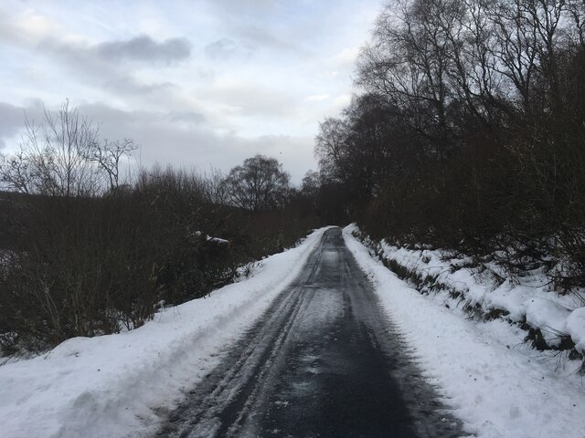
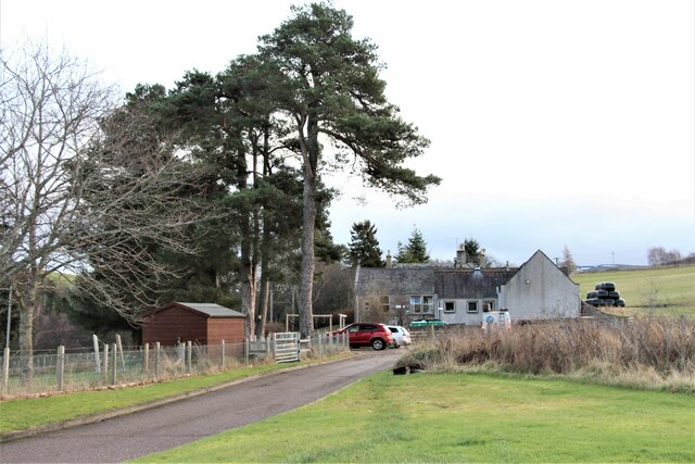
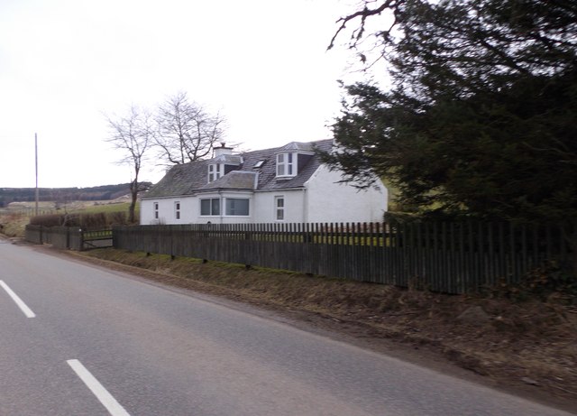
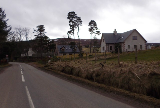
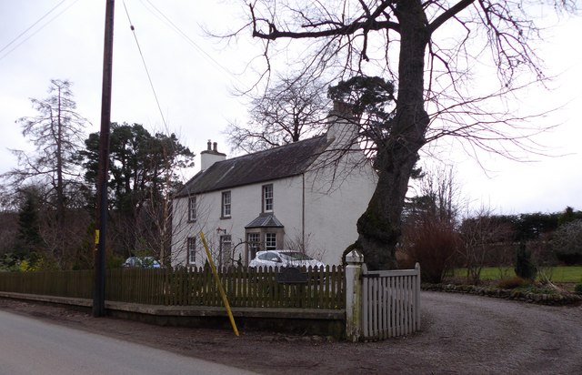
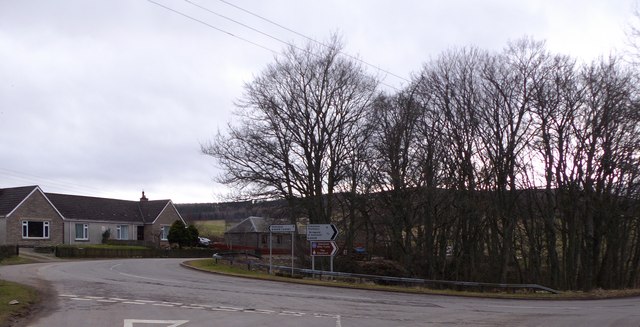
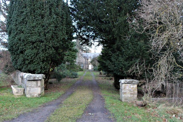
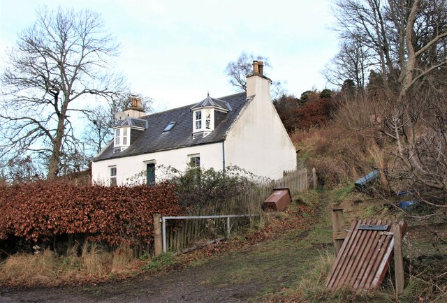
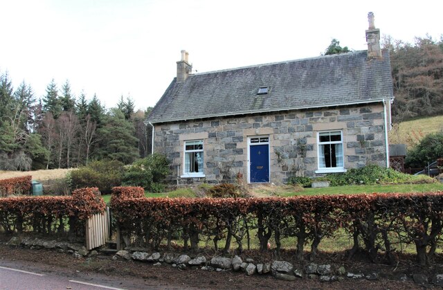
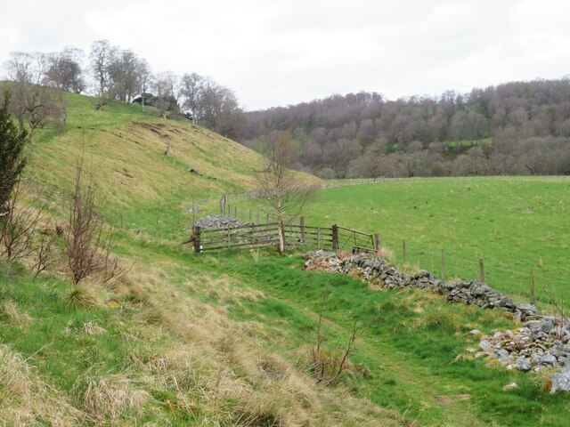
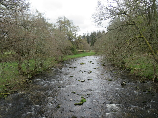
Bridgend of Livet is a small village located in the region of Banffshire, Scotland. Situated in the picturesque Glenlivet Estate, this village offers stunning views of the surrounding hills and countryside. It is positioned on the banks of the River Livet, which adds to the area's natural beauty.

The village is known for its rich history and heritage. It was originally established in the 18th century as a planned settlement to accommodate the workers of the nearby distillery. Today, remnants of the distillery can still be seen, serving as a reminder of the village's industrial past.

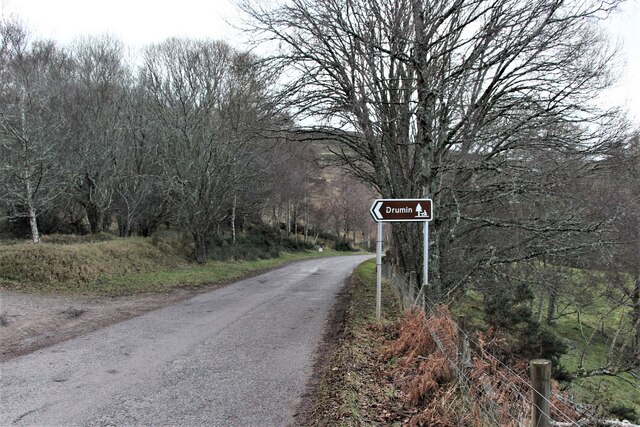
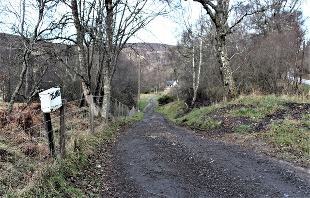
Bridgend of Livet is also home to a charming stone bridge, after which the village is named. This bridge not only provides a crossing over the river but also serves as a focal point for visitors and locals alike. The village is well-connected with surrounding areas, making it a convenient base for exploring nearby attractions.

Nature enthusiasts will find Bridgend of Livet to be a haven for outdoor activities. The Glenlivet Estate offers numerous walking and cycling trails, allowing visitors to immerse themselves in the stunning Scottish countryside. Additionally, the area is known for its abundance of wildlife, including red deer, golden eagles, and otters.

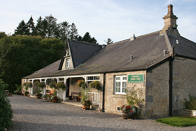
Although small in size, Bridgend of Livet has a strong sense of community. It hosts various events and gatherings throughout the year, including traditional Highland games and local festivals. The village also has a few amenities, including a community hall and a local pub, ensuring that residents and visitors have access to basic facilities.

Overall, Bridgend of Livet is a charming and picturesque village that offers a tranquil and authentic Scottish experience.

If you have any feedback on the listing, please let us know in the comments section below.

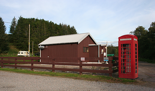
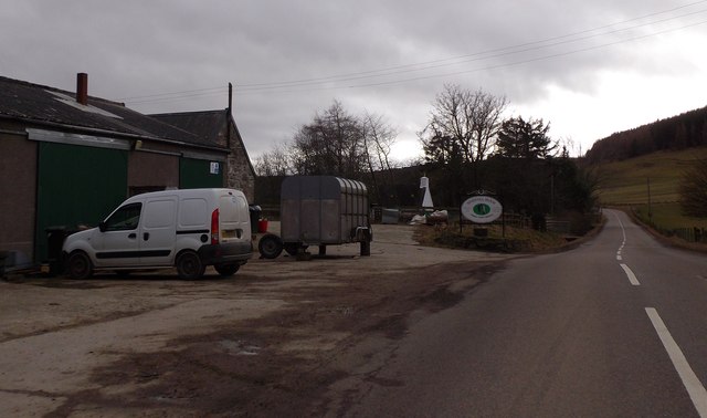
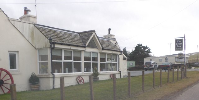
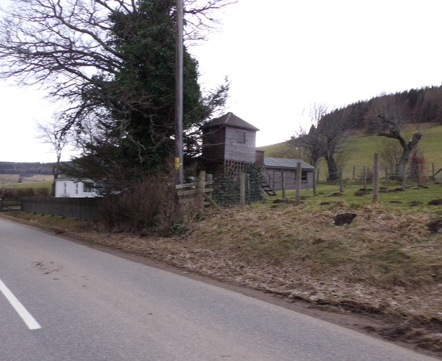
Bridgend of Livet Images

Images are sourced within 2km of 57.353844/-3.3370201 or Grid Reference NJ1930. Thanks to Geograph Open Source API. All images are credited.

Minor road near Glenlivet
Drumin picnic site By the B9136 through Strath Avon.
Drumin picnic site
By the B9136 through Strath Avon.
Glenlivet School
Glenlivet School
Glenlivet Public Hall The hall is displaying a fine array of hanging baskets and other floral decorations.
Glenlivet Public Hall
The hall is displaying a fine array of hanging baskets and other floral decorations.
Telephone Exchange and Kiosk Mobile phone reception is sporadic and unreliable around Glenlivet, so the telephone kiosk may still provide a vital service.
Telephone Exchange and Kiosk
Mobile phone reception is sporadic and unreliable around Glenlivet, so the telephone kiosk may still provide a vital service.
Shenval Farm By B9009 in Glenlivet Estate.
Shenval Farm
By B9009 in Glenlivet Estate.
The Croft Inn, Shenval By the B9009.
The Croft Inn, Shenval
By the B9009.
Moss-side of Shenval Cottage and tree-house by B9009.
Moss-side of Shenval
Cottage and tree-house by B9009.
Moss-side of Shenval (2015) By B9009. Cf. <a href="https://www.geograph.org.uk/photo/1340069">NJ2129 : Moss-side of Shenval</a> of 2009.
Moss-side of Shenval (2015)
By B9009. Cf. NJ2129 : Moss-side of Shenval of 2009.
B9009 approach to Auchbreck From Dufftown.
B9009 approach to Auchbreck
From Dufftown.
Former manse, Auchbreck From B9009.
Former manse, Auchbreck
From B9009.
Junction of B9009 with B9008 At Bridge of Auchbreck.
Junction of B9009 with B9008
At Bridge of Auchbreck.
Gateway to Drumin Farm
Cottage in Glenlivet By the B9008 road to Bridge of Avon.
Cottage in Glenlivet
By the B9008 road to Bridge of Avon.
Downan Cottage and Post Office Post Office services for Glenlivet and Ballindalloch.
Downan Cottage and Post Office
Post Office services for Glenlivet and Ballindalloch.
Access to Delmore, a dwelling
Path below Drumin Castle A circuitous path to the castle avoids a multitude of steps up from the car park, but as the castle was closed for some repair work, the whole exercise was rather pointless. Across the meadow to the right is the River Avon.
Path below Drumin Castle
A circuitous path to the castle avoids a multitude of steps up from the car park, but as the castle was closed for some repair work, the whole exercise was rather pointless. Across the meadow to the right is the River Avon.
River Livet from Drumin Bridge Glen Livet has a strong association with whisky distilleries, so I wonder if the river is around 2% proof from the distillery drainage?
River Livet from Drumin Bridge
Glen Livet has a strong association with whisky distilleries, so I wonder if the river is around 2% proof from the distillery drainage?
Show me another place!

Bridgend of Livet is located at Grid Ref: NJ1930 (Lat: 57.353844, Lng: -3.3370201)

Unitary Authority: Moray

Police Authority: North East

What 3 Words

///calm.resembles.unheated. Near Charlestown of Aberlour, Moray

Related Wikis

Deskie Castle

Deskie Castle was a medieval tower house that is thought to have been near Bridgend of Livet, Moray, Scotland. == History == Little is known of the castle...

Glenlivet

Glenlivet (Scottish Gaelic: Gleann Lìobhait) is the glen in the Scottish Highlands through which the River Livet flows. The river rises high in the Ladder...

The Glenlivet distillery

The Glenlivet distillery is a distillery near Ballindalloch in Moray, Scotland, that produces single malt Scotch whisky. It is the oldest legal distillery...

Drumin Castle

Drumin Castle is a ruined tower house near Glenlivet, Moray, Scotland. The castle is situated on a ridge above the junction of the Livet and Avon Rivers...

Blairfindy Castle

Blairfindy Castle is an L-plan tower house, dating from the 16th century, around 6.5 miles (10.5 km) north of Tomintoul, and west of the River Livet....

Auchbreck

Auchbreck (Scottish Gaelic: An t-Achadh Breac, meaning the speckled field) is a village in Moray, Scotland.

Tamnavulin distillery

Tamnavulin distillery is a producer of single malt Scotch whisky that was founded in 1966. The distillery is operated by Whyte & Mackay, which Philippines...

Church of The Incarnation, Tombae

The Church of The Incarnation was built between 1827 and 1829 as a Roman Catholic church, under the patronage of the Gordon family, in Banffshire, Scotland...

Nearby Amenities

Located within 500m of 57.353844,-3.3370201
Passing Place
Lat/Long: 57.3523869/-3.3332956
Glenlivet
Name Ga: Gleann Líobhait
Name Gd: Gleann Lìobhait
Place: village
Wikidata: Q5568584
Wikipedia: en:Glenlivet
Lat/Long: 57.3519586/-3.3380839
Archaeological Site: megalith
Ele: 1
Historic: archaeological_site
Historic Civilization: neolithic
Lat/Long: 57.3500478/-3.3355647
Power: pole
Lat/Long: 57.3537705/-3.3331012
Power: pole
Lat/Long: 57.3532303/-3.3329656
Power: pole
Lat/Long: 57.3519854/-3.3337113
Power: pole
Lat/Long: 57.3515781/-3.3339485
Power: pole
Lat/Long: 57.3508484/-3.3339916
Power: pole
Lat/Long: 57.3500938/-3.3340378
Power: pole
Lat/Long: 57.35434/-3.3332213
Power: pole
Lat/Long: 57.354925/-3.3338283
Power: pole
Lat/Long: 57.3553256/-3.3342381
Power: pole
Lat/Long: 57.3557427/-3.3365396
Power: pole
Lat/Long: 57.3524064/-3.3334328
Power: pole
Lat/Long: 57.350089/-3.3380238
Power: pole
Lat/Long: 57.3508337/-3.3376756
Power: pole
Lat/Long: 57.3512925/-3.3374661
Power: pole
Lat/Long: 57.3517375/-3.3376936
Power: pole
Lat/Long: 57.3516508/-3.3408314
Power: pole
Lat/Long: 57.3516976/-3.3397927
Power: pole
Lat/Long: 57.3517444/-3.3386708
Power: pole
Lat/Long: 57.3519057/-3.3365216
Power: pole
Lat/Long: 57.3519924/-3.3358142
Power: pole
Lat/Long: 57.3521558/-3.3344746
Power: pole
Lat/Long: 57.3567116/-3.3412981
Power: pole
Lat/Long: 57.3522141/-3.3330521
Power: pole
Lat/Long: 57.3522551/-3.3316789
Power: pole
Lat/Long: 57.3523554/-3.3293466
Power: pole
Lat/Long: 57.3528587/-3.3291559
Power: pole
Lat/Long: 57.353327/-3.3290889
Power: pole
Lat/Long: 57.3544095/-3.3452073
Power: pole
Lat/Long: 57.3554087/-3.3445985
Power: pole
Lat/Long: 57.3558251/-3.3435599
Power: pole
Lat/Long: 57.3562641/-3.3424218
Power: pole
Lat/Long: 57.356483/-3.3418647
Recycling
Recycling Type: centre
Lat/Long: 57.3511925/-3.3306243
Information: board
Tourism: information
Lat/Long: 57.3512736/-3.3307752
The data included in this document is from www.openstreetmap.org. The data is made available under ODbL.

Have you been to Bridgend of Livet?

Leave your review of Bridgend of Livet below (or comments, questions and feedback).