Breckend

Settlement in Derbyshire High Peak

England

Breckend

War memorial in Chapel-en-le-Frith Situated in the Market Place.
War memorial in Chapel-en-le-Frith Credit: Bill Boaden

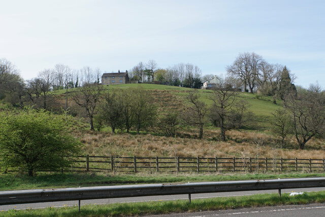
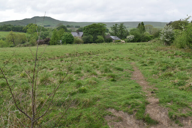
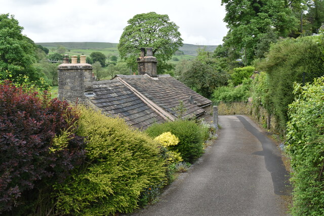
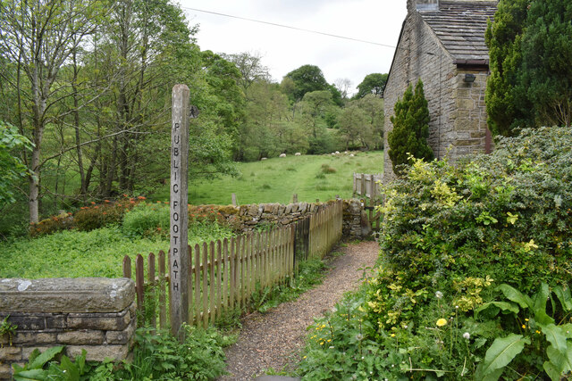
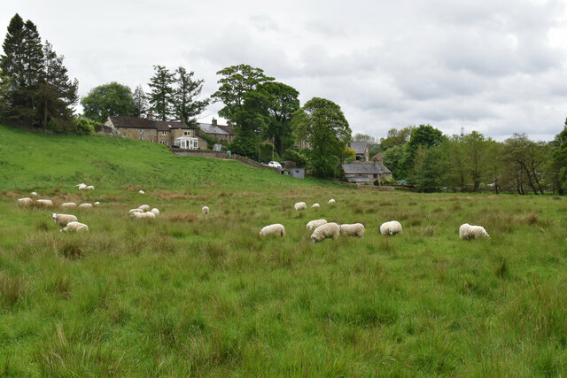
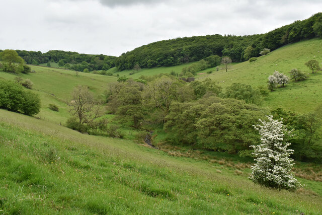
Brecken, located in Derbyshire, England, is a small village nestled in the picturesque Peak District National Park. Situated approximately 10 miles north of the city of Derby, Brecken offers a charming rural setting with stunning natural beauty.

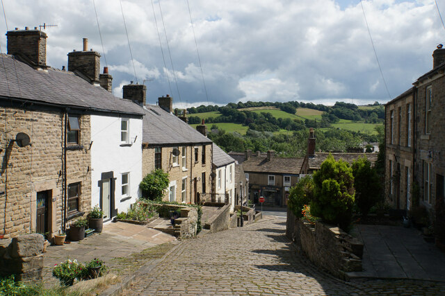
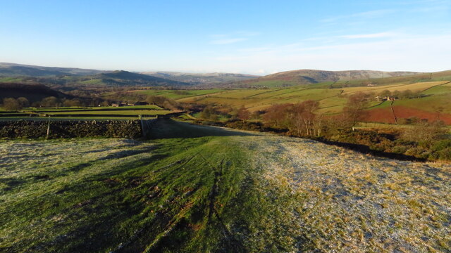
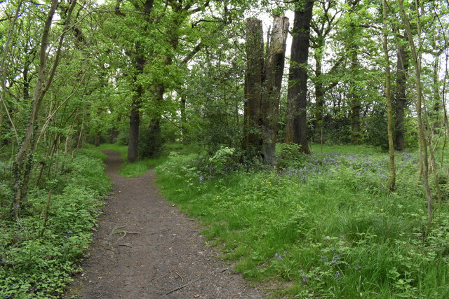
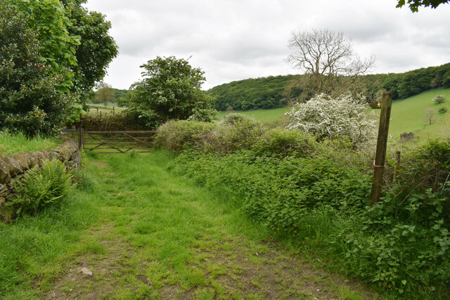
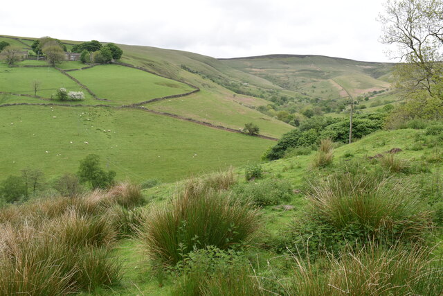
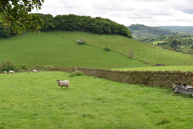
The village is renowned for its idyllic landscapes, featuring rolling hills, lush green meadows, and dense woodlands, making it a popular destination for nature enthusiasts and hikers. The nearby River Derwent adds to the scenic allure, providing opportunities for fishing and leisurely walks along its banks.

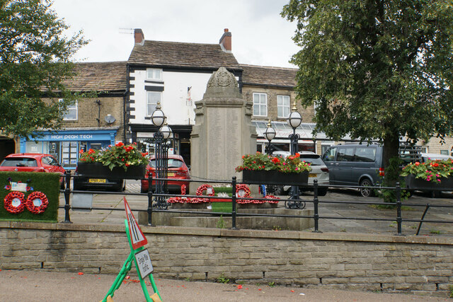
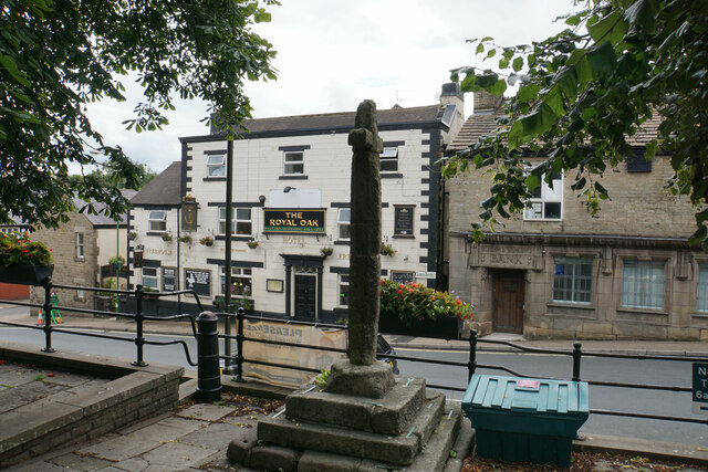
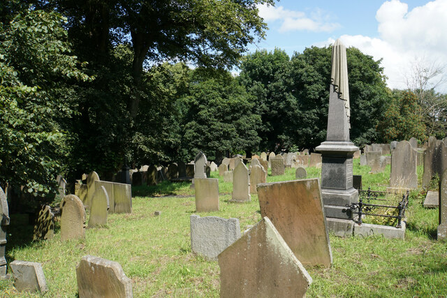
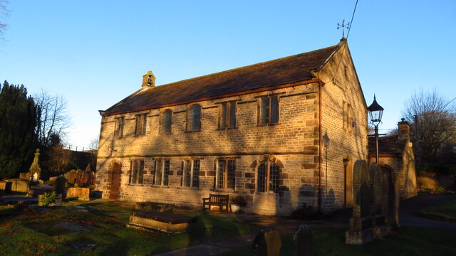
Brecken boasts a rich historical heritage. The village is home to several well-preserved historic buildings, including the St. John the Baptist Church, which dates back to the 13th century. The church's architecture showcases a blend of Norman and Gothic styles, offering visitors a glimpse into the area's past.

Despite its small size, Brecken offers a range of amenities to cater to both residents and visitors. The village has a local pub, The Brecken Arms, serving traditional British cuisine and offering a warm and welcoming atmosphere. Additionally, there are a few local shops and a primary school, making it an ideal place for families.

The surrounding area provides ample opportunities for outdoor activities, such as hiking, cycling, and horse riding, with numerous trails and pathways crisscrossing the countryside. The nearby Peak District National Park offers breathtaking vistas, with attractions like the Heights of Abraham and Chatsworth House within easy reach.

Overall, Brecken, Derbyshire, is a charming village that combines natural beauty, historical significance, and a peaceful atmosphere, making it an appealing destination for those seeking a tranquil retreat in the heart of the English countryside.

If you have any feedback on the listing, please let us know in the comments section below.
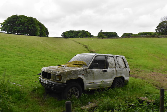
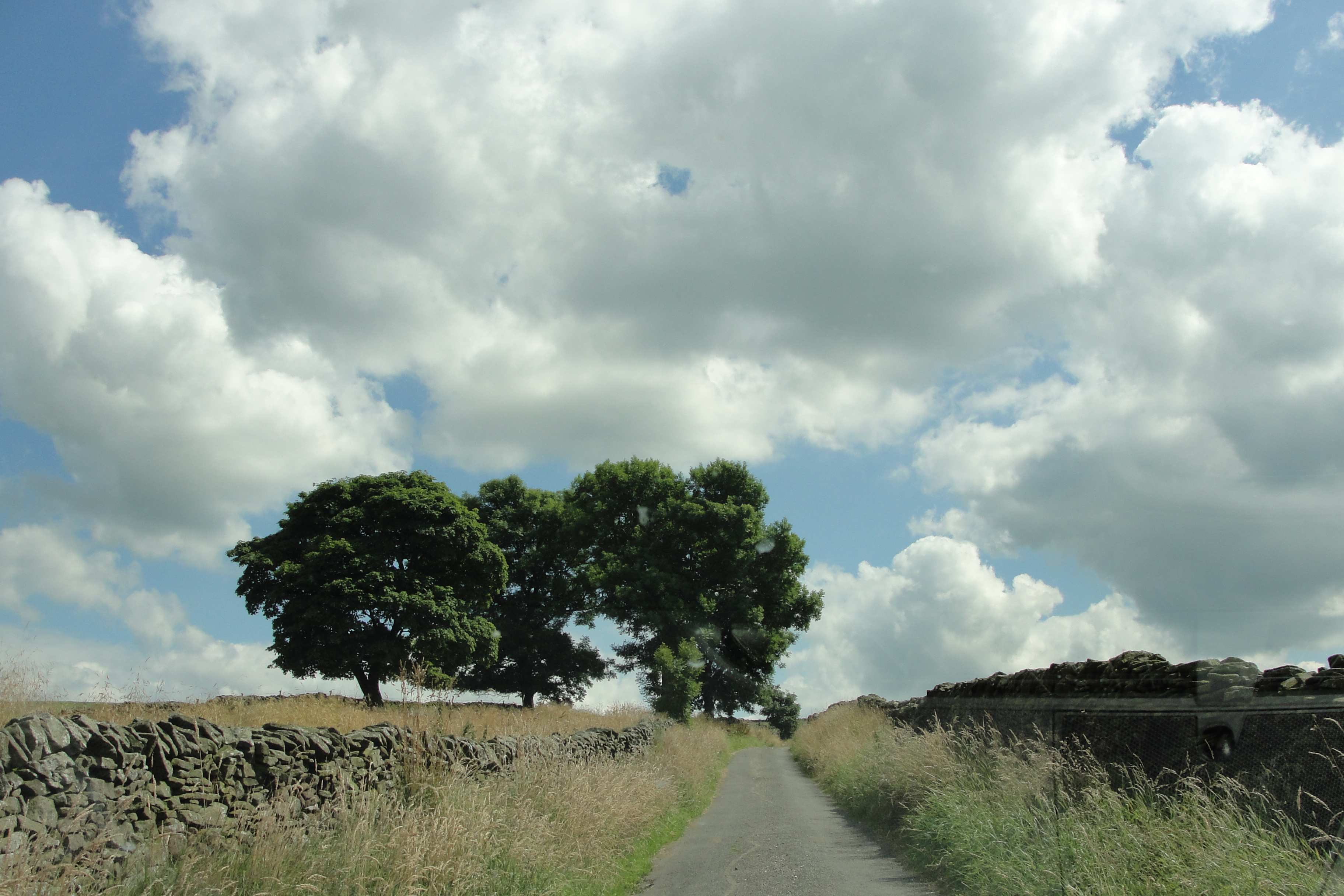
Breckend Images

Images are sourced within 2km of 53.335675/-1.9110292 or Grid Reference SK0682. Thanks to Geograph Open Source API. All images are credited.

War memorial in Chapel-en-le-Frith Situated in the Market Place.
War memorial in Chapel-en-le-Frith
Situated in the Market Place.
Market Cross, Chapel-en-le-Frith Grade II listed and said to date from 1643. It is situated in Market Place overlooking Market Street which runs below.
Market Cross, Chapel-en-le-Frith
Grade II listed and said to date from 1643. It is situated in Market Place overlooking Market Street which runs below.
Churchyard of St Thomas Becket, Chapel-en-le-Frith Quite a large churchyard which extends down the hill to the left.
Churchyard of St Thomas Becket, Chapel-en-le-Frith
Quite a large churchyard which extends down the hill to the left.
Church Brow A largely unspoilt road in Chapel-en-le-Frith though there are a lot of telegraph wires.
Church Brow
A largely unspoilt road in Chapel-en-le-Frith though there are a lot of telegraph wires.
Chinley Chapel at Chapel Milton Chinley Independent Chapel was founded in 1662 by Rev. William Bagshawe who one of about 2,000 ministers and teachers of the church who failed to conform to the Uniformity Act of 1662. On St Bartholomew's Day, 24th August, 1662, Rev. Bagshawe who was then vicar of Glossop and others who rebelled against the Uniformity Act of 1662 were deprived of their living and ministries.

Rev. Bagshawe (who was also known as the 'Apostle of the Peak') then moved to Malcoffe Farm occupied by his brother-in-law who willingly consented for a barn on his farm to be converted into a Chapel. This became the place of worship for him and about 120 members who attended Sacramental Services there. He preached regularly to this gathering until 22nd March, 1702 -the day he preached his last sermon.

After Rev Bagshawe's death in 1702, the members of the church led by the Rev. James Clegg started the work on finding a suitable place for building of a new Chapel. In 1711, Chinley Independent Chapel was built. source <span class="nowrap"><a title="www.chinleyindependentchapel.org.uk" rel="nofollow ugc noopener" href="http://www.chinleyindependentchapel.org.uk">Link</a><img style="margin-left:2px;" alt="External link" title="External link - shift click to open in new window" src="https://s1.geograph.org.uk/img/external.png" width="10" height="10"/></span>
Chinley Chapel at Chapel Milton
Chinley Independent Chapel was founded in 1662 by Rev. William Bagshawe who one of about 2,000 ministers and teachers of the church who failed to conform to the Uniformity Act of 1662. On St Bartholomew's Day, 24th August, 1662, Rev. Bagshawe who was then vicar of Glossop and others who rebelled against the Uniformity Act of 1662 were deprived of their living and ministries. Rev. Bagshawe (who was also known as the 'Apostle of the Peak') then moved to Malcoffe Farm occupied by his brother-in-law who willingly consented for a barn on his farm to be converted into a Chapel. This became the place of worship for him and about 120 members who attended Sacramental Services there. He preached regularly to this gathering until 22nd March, 1702 -the day he preached his last sermon. After Rev Bagshawe's death in 1702, the members of the church led by the Rev. James Clegg started the work on finding a suitable place for building of a new Chapel. In 1711, Chinley Independent Chapel was built. source LinkExternal link
Track above Malcoff
Track above Malcoff
Grazing land near Chinley Chinley is seen ahead with Chinley Churn rising behind it.
Grazing land near Chinley
Chinley is seen ahead with Chinley Churn rising behind it.
Whitehough Head As viewed from the A6 which runs below.
Whitehough Head
As viewed from the A6 which runs below.
Woodland path off Bowden Lane The surface of the path is nice and dry but I am sure it isn't always. The path leads to Wash.
Woodland path off Bowden Lane
The surface of the path is nice and dry but I am sure it isn't always. The path leads to Wash.
Footpath to Wash Passing through a field of sheep. Some of the houses of the small village of Wash are seen ahead. South Head is seen on the skyline.
Footpath to Wash
Passing through a field of sheep. Some of the houses of the small village of Wash are seen ahead. South Head is seen on the skyline.
Small road in Wash Wash is a very small village with traditional cottages.
Small road in Wash
Wash is a very small village with traditional cottages.
Footpath leaving Wash The path goes up the valley of Hockham Brook.
Footpath leaving Wash
The path goes up the valley of Hockham Brook.
Sheep near Wash The sheep are grazing in the valley of Hockham Brook. Some of the houses of Wash are behind.
Sheep near Wash
The sheep are grazing in the valley of Hockham Brook. Some of the houses of Wash are behind.
The valley of Hockham Brook Looking up the valley from the land below Malcoff.
The valley of Hockham Brook
Looking up the valley from the land below Malcoff.
Farm track and footpath near Malcoff The path crosses the valley of Hockham Brook to Bowden Head.
Farm track and footpath near Malcoff
The path crosses the valley of Hockham Brook to Bowden Head.
Roych Clough Looking up the clough from Malcoff. Brown Knoll is in the background, one of the heights at the head of Edale.
Roych Clough
Looking up the clough from Malcoff. Brown Knoll is in the background, one of the heights at the head of Edale.
Sheep near Malcoff Looking into the valley of Hockham Brook. Eccles Pike shows up round the corner.
Sheep near Malcoff
Looking into the valley of Hockham Brook. Eccles Pike shows up round the corner.
Going nowhere An abandoned vehicle that has been there some time.
Going nowhere
An abandoned vehicle that has been there some time.
Show me another place!

Breckend is located at Grid Ref: SK0682 (Lat: 53.335675, Lng: -1.9110292)

Administrative County: Derbyshire

District: High Peak

Police Authority: Derbyshire

What 3 Words

///responds.atlas.salmon. Near Chapel en le Frith, Derbyshire

Nearby Locations

Breckend Wash Bowden Head

Related Wikis

Wash, Derbyshire

Wash, or The Wash is a hamlet in Derbyshire, England. The hamlet falls within the civil parish of Chapel-en-le-Frith. It is about 1.2 km (or 0.75 miles...

Chapel Milton

Chapel Milton is a hamlet on the outskirts of Chapel-en-le-Frith on the road leading from there to Chinley and to Glossop. Within the parish of Chinley...

Chapel Milton Viaduct

Chapel Milton Viaduct is a Grade II listed bifurcated railway viaduct on the Great Rocks Line at its junction with the Hope Valley Line, straddling the...

Stodhart Tunnel

Stodhart Tunnel is a 100-yard (91 m) tunnel on the Peak Forest Tramway at Chapel Milton, Derbyshire. The tunnel stretches under the Chapel-en-le-Firth...

New Smithy

New Smithy is a hamlet in the civil parish of Chinley, Buxworth and Brownside, Derbyshire, England, near the village of Chinley. It sits on the A624 trunk...

High Peak Radio

High Peak Radio was an Independent Local Radio station broadcasting to the Peak District, Derbyshire, from studios in Chapel-en-le-Frith. It broadcast...

Chapel-en-le-Frith Town Hall

Chapel-en-le-Frith Town Hall is a municipal building in Market Street, Chapel-en-le-Frith, Derbyshire, England. The structure operates as a community events...

Chapel-en-le-Frith Central railway station

Chapel-en-le-Frith Central railway station was an intermediate stop on the Derby–Manchester line of the Midland Railway. It served the Derbyshire town...

Nearby Amenities

Located within 500m of 53.335675,-1.9110292
Railway: switch
Lat/Long: 53.3359809/-1.9140804
Cross Keys Inn
Disused Amenity: pub
Lat/Long: 53.3334931/-1.9169727
Chapel Milton
Is In: High Peak,Derbyshire
Place: hamlet
Source Name: local knowledge
Wikidata: Q5073036
Lat/Long: 53.3331397/-1.9164446
Post Box
Lat/Long: 53.3357278/-1.9110974
Wash
Is In: High Peak,Derbyshire
Place: village
Source Name: local knowledge
Lat/Long: 53.3360341/-1.9089292
Created By: Merkaartor 0.13
Lat/Long: 53.3356976/-1.9038616
Post Box
Postal Code: SK23
Ref: SK23 83
Source: GPS Survey
Lat/Long: 53.3356645/-1.9128544
Power: tower
Lat/Long: 53.3318022/-1.9115151
First Aid
Defibrillator
Booth: K6
Covered: booth
Defibrillator Location: inside old red phone box, Chapel Milton
Disused Amenity: telephone
Disused Operator: BT
Emergency: defibrillator
Man Made: telephone_box
Old Phone: +44 1298 812331
Operator: Chinley, Buxworth & Brownside Community Association
Postal Code: SK23 0QQ
Lat/Long: 53.332769/-1.9162807
Ford: stepping_stones
Source: OS_OpenData_StreetView
Lat/Long: 53.3340014/-1.9075358
Railway: catch_point
Lat/Long: 53.3358496/-1.91471
Information: guidepost
Operator: Peak & Northern Footpaths Society
Ref: 231
Source: survey;gps
Tourism: information
Lat/Long: 53.3383518/-1.9127811
Barrier: stile
Material: wood
Source: survey;gps
Stile: stepover
Lat/Long: 53.3388522/-1.9129265
Barrier: stile
Material: stone
Source: survey;gps
Stile: stepover
Lat/Long: 53.3392017/-1.9124558
Barrier: stile
Material: stone
Source: survey;gps
Stile: squeezer
Lat/Long: 53.3343453/-1.9151708
Barrier: stile
Material: stone
Source: survey;gps
Stile: squeezer
Lat/Long: 53.335352/-1.9146673
First Aid
Defibrillator
Booth: K6
Covered: booth
Defibrillator Location: inside old red phone box, Wash
Disused Amenity: telephone
Disused Operator: BT
Emergency: defibrillator
Man Made: telephone_box
Old Phone: +44 1663 750254
Operator: Chinley, Buxworth & Brownside Community Association
Lat/Long: 53.3356409/-1.9077583
Ford: stepping_stones
Source: survey 10 February 2016
Lat/Long: 53.3341359/-1.9074331
Railway: switch
Lat/Long: 53.3361014/-1.9133551
Railway: switch
Lat/Long: 53.3362495/-1.9128375
Chinley East Junction
Railway: junction
Lat/Long: 53.3359932/-1.9140995
The data included in this document is from www.openstreetmap.org. The data is made available under ODbL.

Have you been to Breckend?

Leave your review of Breckend below (or comments, questions and feedback).