Blazefield
Settlement in Yorkshire Harrogate
England
Blazefield
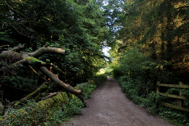
Blazefield is a picturesque village located in Yorkshire, England. Situated amidst the stunning Yorkshire Dales National Park, this charming settlement offers a serene and idyllic countryside experience. The village is positioned on the banks of the River Wharfe, providing breathtaking views of rolling hills, lush meadows, and scenic landscapes.
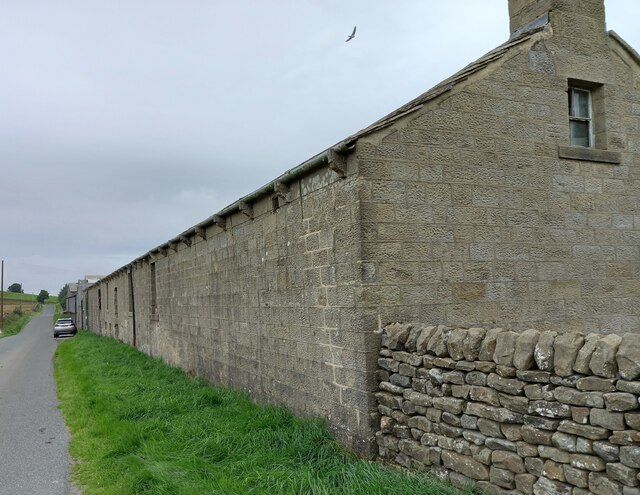
Blazefield is a small village with a tight-knit community, comprising mainly of traditional stone houses and cottages. The architecture reflects the village's rich history, with some buildings dating back several centuries. The village is characterized by its peaceful atmosphere and a slower pace of life, making it an ideal retreat for those seeking solace from the bustling city life.
The surrounding area is abundant with natural beauty, making it a haven for outdoor enthusiasts. Blazefield offers numerous walking trails and hiking routes, allowing visitors to explore the stunning countryside and discover hidden gems along the way. The River Wharfe is also a popular spot for fishing and boating, providing a tranquil setting for leisure activities.
Although small in size, Blazefield is home to a few amenities, including a local pub, a village hall, and a small convenience store. For a wider range of services and facilities, the nearby town of Skipton is easily accessible.
Overall, Blazefield is a delightful village that offers a peaceful and picturesque retreat in the heart of the Yorkshire Dales. Its natural beauty, friendly community, and historic charm make it a hidden gem for those seeking a tranquil countryside getaway.
If you have any feedback on the listing, please let us know in the comments section below.
Blazefield Images
Images are sourced within 2km of 54.082336/-1.7308655 or Grid Reference SE1765. Thanks to Geograph Open Source API. All images are credited.
![Pateley Bridge buildings [1] Numbers 9 and 11 High Street are two shops with flats above. Built in the mid 18th century of squared, coursed stone under a stone slate roof. The left shopfront is late 19th century, the right shopfront is 20th century. Listed, grade II, with details at: <span class="nowrap"><a title="https://historicengland.org.uk/listing/the-list/list-entry/1173791" rel="nofollow ugc noopener" href="https://historicengland.org.uk/listing/the-list/list-entry/1173791">Link</a><img style="margin-left:2px;" alt="External link" title="External link - shift click to open in new window" src="https://s1.geograph.org.uk/img/external.png" width="10" height="10"/></span>
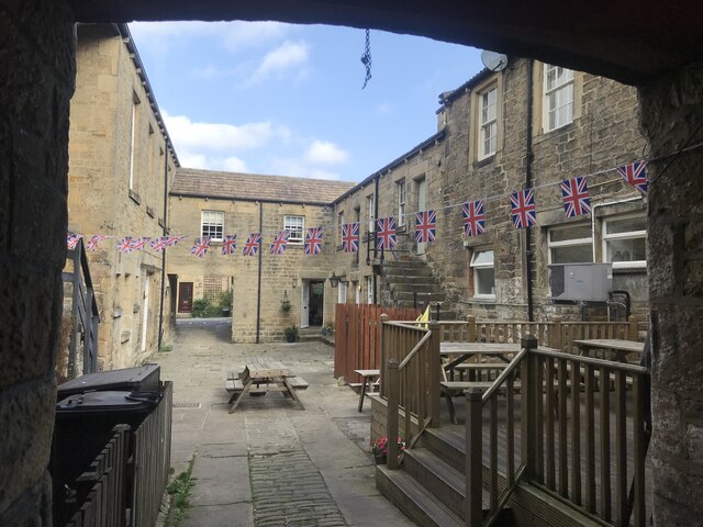
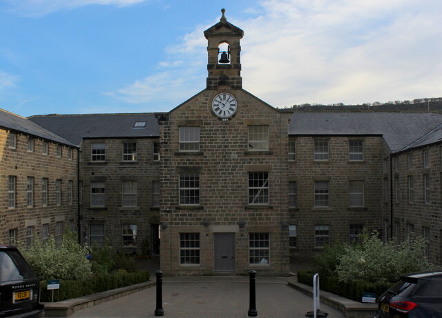
Pateley Bridge is a small market town, the market charter being granted in 1320. Located on the banks of the River Nidd, the town is some 11 miles northwest of Harrogate, some 10 miles southwest of Ripon and is within the Nidderdale Area of Outstanding Natural Beauty. The town is popular with tourists exploring the Yorkshire Dales.](https://s3.geograph.org.uk/geophotos/07/03/08/7030879_515f579a.jpg)
![Pateley Bridge buildings [2] The Crown Hotel, number 19 High Street, was built in the early 19th century. Constructed of squared, coursed stone with ashlar dressings under a tile roof. Listed, grade II, with details at: <span class="nowrap"><a title="https://historicengland.org.uk/listing/the-list/list-entry/1296065" rel="nofollow ugc noopener" href="https://historicengland.org.uk/listing/the-list/list-entry/1296065">Link</a><img style="margin-left:2px;" alt="External link" title="External link - shift click to open in new window" src="https://s1.geograph.org.uk/img/external.png" width="10" height="10"/></span>
Pateley Bridge is a small market town, the market charter being granted in 1320. Located on the banks of the River Nidd, the town is some 11 miles northwest of Harrogate, some 10 miles southwest of Ripon and is within the Nidderdale Area of Outstanding Natural Beauty. The town is popular with tourists exploring the Yorkshire Dales.](https://s1.geograph.org.uk/geophotos/07/03/08/7030881_f8067ef2.jpg)
![Pateley Bridge buildings [3] Formerly a coaching inn with stabling for 15 horses, Talbot House now offers tearooms and bed and breakfast accommodation. Built in the early 18th century of squared, coursed stone with freestone dressings, all under a stone slate roof. Listed, grade II, with details at: <span class="nowrap"><a title="https://historicengland.org.uk/listing/the-list/list-entry/1150504" rel="nofollow ugc noopener" href="https://historicengland.org.uk/listing/the-list/list-entry/1150504">Link</a><img style="margin-left:2px;" alt="External link" title="External link - shift click to open in new window" src="https://s1.geograph.org.uk/img/external.png" width="10" height="10"/></span>
Pateley Bridge is a small market town, the market charter being granted in 1320. Located on the banks of the River Nidd, the town is some 11 miles northwest of Harrogate, some 10 miles southwest of Ripon and is within the Nidderdale Area of Outstanding Natural Beauty. The town is popular with tourists exploring the Yorkshire Dales.](https://s0.geograph.org.uk/geophotos/07/03/08/7030884_c80db19b.jpg)
![Pateley Bridge buildings [4] Originally one house, this is now three shops, numbers 35, 37 and 39 High Street.
Built in the 17th century with alterations in the 18th century and later. Constructed of squared, coursed stone with freestone dressings, under a stone slate roof. The bay window on the left is 20th century, as is the shopfront on the right. Listed, grade II, with details at: <span class="nowrap"><a title="https://historicengland.org.uk/listing/the-list/list-entry/1173812" rel="nofollow ugc noopener" href="https://historicengland.org.uk/listing/the-list/list-entry/1173812">Link</a><img style="margin-left:2px;" alt="External link" title="External link - shift click to open in new window" src="https://s1.geograph.org.uk/img/external.png" width="10" height="10"/></span>
Pateley Bridge is a small market town, the market charter being granted in 1320. Located on the banks of the River Nidd, the town is some 11 miles northwest of Harrogate, some 10 miles southwest of Ripon and is within the Nidderdale Area of Outstanding Natural Beauty. The town is popular with tourists exploring the Yorkshire Dales.](https://s2.geograph.org.uk/geophotos/07/03/08/7030886_6e99aeba.jpg)
![Pateley Bridge buildings [5] Numbers 45 and 47 High Street are a shop and house, now in separate occupations. Built in the mid 18th century with 20th century alterations. Constructed of squared, coursed stone with ashlar dressings, under a stone slate roof. The shopfront is early 20th century. Listed, grade II, with details at: <span class="nowrap"><a title="https://historicengland.org.uk/listing/the-list/list-entry/1173825" rel="nofollow ugc noopener" href="https://historicengland.org.uk/listing/the-list/list-entry/1173825">Link</a><img style="margin-left:2px;" alt="External link" title="External link - shift click to open in new window" src="https://s1.geograph.org.uk/img/external.png" width="10" height="10"/></span>
Pateley Bridge is a small market town, the market charter being granted in 1320. Located on the banks of the River Nidd, the town is some 11 miles northwest of Harrogate, some 10 miles southwest of Ripon and is within the Nidderdale Area of Outstanding Natural Beauty. The town is popular with tourists exploring the Yorkshire Dales.](https://s3.geograph.org.uk/geophotos/07/03/08/7030891_9e040dfd.jpg)
![Pateley Bridge buildings [6] The Pateley Club, number 42 High Street, was built as the George and Dragon public house and is dated 1664 with 18th and 19th century alterations. Ale was brewed on the site in 1777 the building became the brewery manager&#039;s house. After a time as the Conservative Club, it is now the Pateley Club. Constructed of squared, coursed stone with freestone dressings under a stone slate roof. The canted bay windows are 19th century. Listed, grade II, with details at: <span class="nowrap"><a title="https://historicengland.org.uk/listing/the-list/list-entry/1150507" rel="nofollow ugc noopener" href="https://historicengland.org.uk/listing/the-list/list-entry/1150507">Link</a><img style="margin-left:2px;" alt="External link" title="External link - shift click to open in new window" src="https://s1.geograph.org.uk/img/external.png" width="10" height="10"/></span>
Pateley Bridge is a small market town, the market charter being granted in 1320. Located on the banks of the River Nidd, the town is some 11 miles northwest of Harrogate, some 10 miles southwest of Ripon and is within the Nidderdale Area of Outstanding Natural Beauty. The town is popular with tourists exploring the Yorkshire Dales.](https://s3.geograph.org.uk/geophotos/07/03/09/7030907_f5ca343e.jpg)
![Pateley Bridge buildings [7] This house and shop at number 8 High Street was built in the early 19th century. Constructed of ashlar under a Welsh slate roof. Listed, grade II, with details at: <span class="nowrap"><a title="https://historicengland.org.uk/listing/the-list/list-entry/1173881" rel="nofollow ugc noopener" href="https://historicengland.org.uk/listing/the-list/list-entry/1173881">Link</a><img style="margin-left:2px;" alt="External link" title="External link - shift click to open in new window" src="https://s1.geograph.org.uk/img/external.png" width="10" height="10"/></span>
Pateley Bridge is a small market town, the market charter being granted in 1320. Located on the banks of the River Nidd, the town is some 11 miles northwest of Harrogate, some 10 miles southwest of Ripon and is within the Nidderdale Area of Outstanding Natural Beauty. The town is popular with tourists exploring the Yorkshire Dales.](https://s0.geograph.org.uk/geophotos/07/03/09/7030936_f8852da6.jpg)
![Pateley Bridge features [1] This well was originally erected in 1852 on Ripon Road and was known as Souter Well. Moved to its present position in the 1970s and now known as Fox&#039;s Head Well.
Built of stone with a stone trough with cast-iron fox&#039;s head spout above. Listed, grade II, with details at: <span class="nowrap"><a title="https://historicengland.org.uk/listing/the-list/list-entry/1150506" rel="nofollow ugc noopener" href="https://historicengland.org.uk/listing/the-list/list-entry/1150506">Link</a><img style="margin-left:2px;" alt="External link" title="External link - shift click to open in new window" src="https://s1.geograph.org.uk/img/external.png" width="10" height="10"/></span>
Pateley Bridge is a small market town, the market charter being granted in 1320. Located on the banks of the River Nidd, the town is some 11 miles northwest of Harrogate, some 10 miles southwest of Ripon and is within the Nidderdale Area of Outstanding Natural Beauty. The town is popular with tourists exploring the Yorkshire Dales.](https://s2.geograph.org.uk/geophotos/07/03/09/7030942_6b139019.jpg)
![Pateley Bridge buildings [8] This building which is now the Playhouse began life as a Primitive Methodist Chapel in 1859. When the Methodists united in the mid 1930s the Salvation Army bought the building and used it as their citadel until the late 1950s. Purchased by the Pateley Bridge Dramatic Society it has since been converted into a 73 seat theatre.
Pateley Bridge is a small market town, the market charter being granted in 1320. Located on the banks of the River Nidd, the town is some 11 miles northwest of Harrogate, some 10 miles southwest of Ripon and is within the Nidderdale Area of Outstanding Natural Beauty. The town is popular with tourists exploring the Yorkshire Dales.](https://s2.geograph.org.uk/geophotos/07/03/09/7030950_2eb93448.jpg)
![Pateley Bridge buildings [9] A plaque on the front of The Playhouse, seen at <a href="https://www.geograph.org.uk/photo/7030950">SE1565 : Pateley Bridge buildings [8]</a>.
Pateley Bridge is a small market town, the market charter being granted in 1320. Located on the banks of the River Nidd, the town is some 11 miles northwest of Harrogate, some 10 miles southwest of Ripon and is within the Nidderdale Area of Outstanding Natural Beauty. The town is popular with tourists exploring the Yorkshire Dales.](https://s0.geograph.org.uk/geophotos/07/03/09/7030952_5992e5cf.jpg)
![Pateley Bridge buildings [10] This delightful building in Church Street, now a private residence, was Oddfellows Hall. Built in 1859 for the Friendly Society who provided insurances.
Pateley Bridge is a small market town, the market charter being granted in 1320. Located on the banks of the River Nidd, the town is some 11 miles northwest of Harrogate, some 10 miles southwest of Ripon and is within the Nidderdale Area of Outstanding Natural Beauty. The town is popular with tourists exploring the Yorkshire Dales.](https://s0.geograph.org.uk/geophotos/07/03/09/7030968_b4a0b5a3.jpg)
Blazefield is located at Grid Ref: SE1765 (Lat: 54.082336, Lng: -1.7308655)
Division: West Riding
Administrative County: North Yorkshire
District: Harrogate
Police Authority: North Yorkshire
What 3 Words
///amplified.evidence.vegans. Near Pateley Bridge, North Yorkshire
Nearby Locations
Related Wikis

Glasshouses, North Yorkshire
Glasshouses is a small village in Nidderdale, North Yorkshire, England. It lies 1 mile (1.6 km) south-east of Pateley Bridge on the east side of Nidderdale...
Wilsill
Wilsill is a village in Nidderdale in the Harrogate district of North Yorkshire, England. It is about 2 miles (3 km) east of Pateley Bridge on the B6165...

Smelthouses
Smelthouses is a hamlet in Nidderdale in North Yorkshire, England. It lies about 2.3 miles (4 km) south-east of Pateley Bridge, on either side of Fell...

Nidderdale AONB
The Nidderdale AONB is an Area of Outstanding Natural Beauty in North Yorkshire, England, bordering the Yorkshire Dales National Park to the east and south...

Nidderdale
Nidderdale, historically also known as Netherdale, is one of the Yorkshire Dales (although outside the Yorkshire Dales National Park) in North Yorkshire...

Pateley Playhouse
The Pateley Playhouse is a small amateur-run theatre in the town of Pateley Bridge in Nidderdale, North Yorkshire, England. The building was initially...

Pateley Bridge railway station
Pateley Bridge railway station is a disused railway station in North Yorkshire, England. The station was the terminating station on the North Eastern Railway...

Nidderdale Museum
Nidderdale Museum is a local and social history museum in the market town of Pateley Bridge in Nidderdale, one of the Yorkshire Dales, in North Yorkshire...
Related Videos

Brimham Rocks | Amazing National Trust Site in Yorkshire for Walking, Climbing & Photography!
If you're looking for an outdoors activity in Yorkshire then visit National Trust's Brimham Rocks. Brimham is home to amazing giant ...
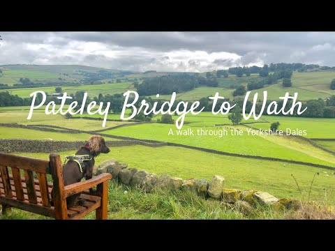
Walk with Me: Pateley Bridge to Wath | Yorkshire Walking Girl | English Countryside
Thank you for taking the time to watch my video. I hope you enjoyed the walk as much as I did. Today I walked from the ...

Brimham Rocks | Amazing National Trust Site in Yorkshire for Walking, Climbing & Photography!
National Trust - Brimham Rocks walking around Brimham Rocks wityh the kids such a stunning and relaxing place , i would ...

Walking hilly woods, down a green field, along a stream bank and finally a lake, slow tv style
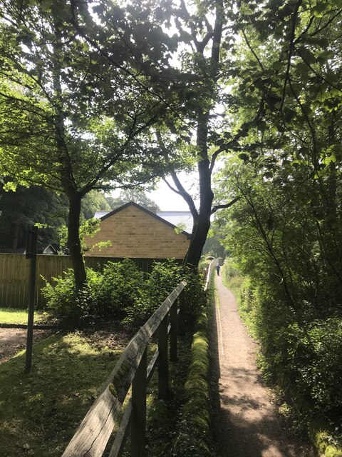
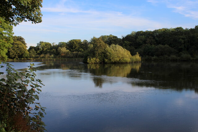
Spring time walk in woods near Pateley Bridge, North Yorkshire. The route features a small lake, a gentle stream, a meandering ...
Nearby Amenities
Located within 500m of 54.082336,-1.7308655Have you been to Blazefield?
Leave your review of Blazefield below (or comments, questions and feedback).