Blackbank

Settlement in Cumberland Carlisle

England

Blackbank

Sheep in a field near Gretna Sheep grazing on the English side of the border.
Sheep in a field near Gretna Credit: David Dixon

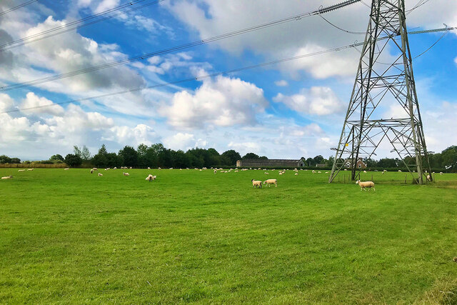
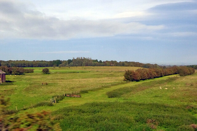
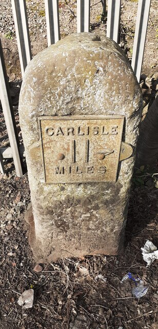
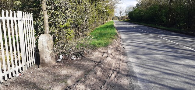
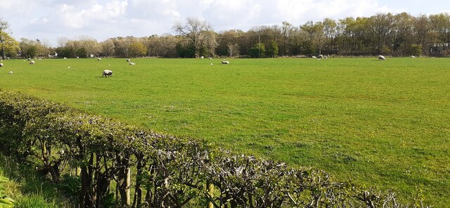
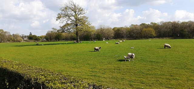
Blackbank is a small village located in the county of Cumberland, England. Situated in the picturesque countryside, it lies approximately 10 miles southwest of the city of Carlisle. The village is nestled in a valley surrounded by lush green hills, providing a picturesque and serene setting for its inhabitants.

Blackbank has a rich history that dates back centuries. It was originally a farming community, with agriculture being the main source of livelihood for its residents. Over the years, the village has expanded and developed, but it has managed to retain its rural charm and character.

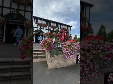
The heart of Blackbank is its village square, which is lined with a few local shops, a traditional pub, and a village hall. The pub, known as The Black Swan, is a popular meeting place for locals and visitors alike, offering a warm and friendly atmosphere and serving traditional English food and ales.

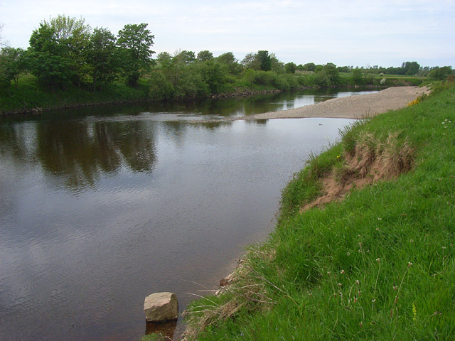
The surrounding countryside offers numerous opportunities for outdoor activities, making Blackbank an attractive destination for nature enthusiasts. There are several walking and cycling trails that wind through the rolling hills, providing breathtaking views of the landscape. Additionally, the nearby River Eden offers opportunities for fishing and boating.

Despite its small size, Blackbank has a strong sense of community, hosting various events and festivals throughout the year. The villagers take great pride in their close-knit community and work together to maintain the village's unique charm.

Overall, Blackbank, Cumberland is a delightful village that offers a peaceful and idyllic lifestyle, surrounded by natural beauty and a strong sense of community.

If you have any feedback on the listing, please let us know in the comments section below.
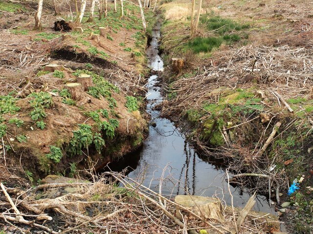
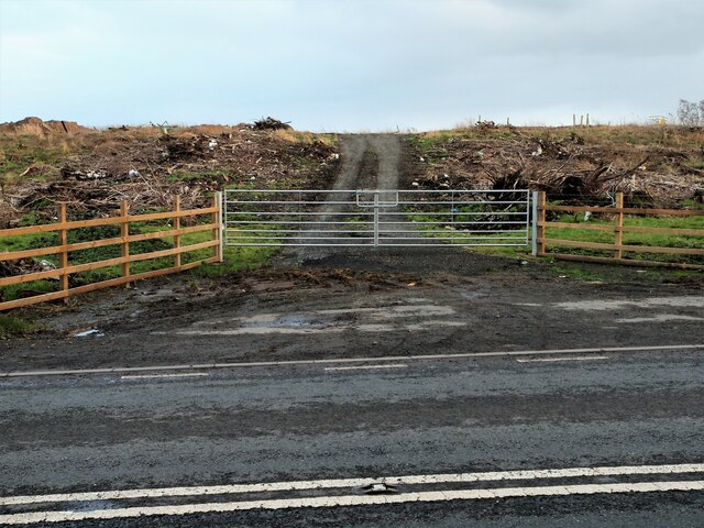
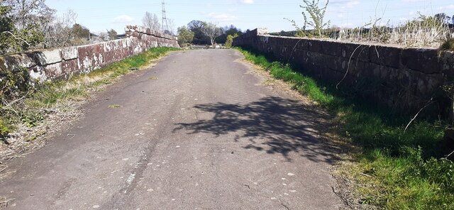
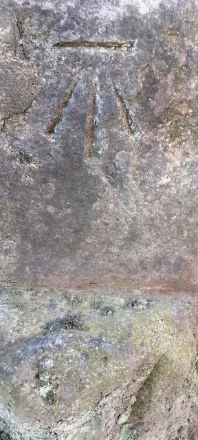
Blackbank Images

Images are sourced within 2km of 54.99763/-3.0201962 or Grid Reference NY3467. Thanks to Geograph Open Source API. All images are credited.

Sheep in a field near Gretna Sheep grazing on the English side of the border.
Sheep in a field near Gretna
Sheep grazing on the English side of the border.
M6 approaching Guards Mill Bridge
Almost in Scotland Having left the M6 at Junction 45 and turned onto the B7076, we are now only about 350 yards away from the England/Scotland border at Gretna. The Solway Firth is just visible above the hedge.
Almost in Scotland
Having left the M6 at Junction 45 and turned onto the B7076, we are now only about 350 yards away from the England/Scotland border at Gretna. The Solway Firth is just visible above the hedge.
Green Mill Road Entrance to Green Mill Road off the A6071 Longtown.
Green Mill Road
Entrance to Green Mill Road off the A6071 Longtown.
Drainage ditch Situated off the A6071 on the left just past Green Mill Road as you head towards Gretna Green.
Drainage ditch
Situated off the A6071 on the left just past Green Mill Road as you head towards Gretna Green.
Gateway A6071 What looks like a gateway to a logging track situated off the A6071. Woodland has recently been cleared from this site.
Gateway A6071
What looks like a gateway to a logging track situated off the A6071. Woodland has recently been cleared from this site.
Course of old railway south of Gretna This appears on hardly any maps, but a 1" OS map of 1925 shows a single track railway leaving the Gretna branch at about the right-hand edge of this view. It passes under the West Coast main line and south of Gretna village, where a couple of establishments of some sort are served. It then eventually joins up with the Glasgow and South Western line west of Eastriggs, about where the current military junction is. This was a military railway serving the widely spread areas of the WWI Gretna ordnance factory.
Course of old railway south of Gretna
This appears on hardly any maps, but a 1" OS map of 1925 shows a single track railway leaving the Gretna branch at about the right-hand edge of this view. It passes under the West Coast main line and south of Gretna village, where a couple of establishments of some sort are served. It then eventually joins up with the Glasgow and South Western line west of Eastriggs, about where the current military junction is. This was a military railway serving the widely spread areas of the WWI Gretna ordnance factory.
Bus shelter at junction to Blackbank from A6071
Benchmark on Plump Bridge Ordnance Survey cut mark benchmark levelled at 13.748m above Newlyn Datum verified 1974
Benchmark on Plump Bridge
Ordnance Survey cut mark benchmark levelled at 13.748m above Newlyn Datum verified 1974
Northern parapet of Plump Bridge beside old road at approach to Plumpe Farm There is an Ordnance Survey benchmark <a href="https://www.geograph.org.uk/photo/7155992">NY3368 : Benchmark on Plump Bridge</a> on the road face of the parapet at its far end
Northern parapet of Plump Bridge beside old road at approach to Plumpe Farm
There is an Ordnance Survey benchmark NY3368 : Benchmark on Plump Bridge on the road face of the parapet at its far end
Royal Bank of Scotland milepost on north side of road west of Plumpe Farm The post indicates Gretna Green 1, Gretna 1½, Carlisle 11, on National Cycle Network Route 7
Royal Bank of Scotland milepost on north side of road west of Plumpe Farm
The post indicates Gretna Green 1, Gretna 1½, Carlisle 11, on National Cycle Network Route 7
Benchmark on top of milestone indicating 11 miles to Carlisle Ordnance Survey pivot benchmark levelled at 26.651m above Newlyn Datum verified 1974.
Benchmark on top of milestone indicating 11 miles to Carlisle
Ordnance Survey pivot benchmark levelled at 26.651m above Newlyn Datum verified 1974.
Carlisle 11 milestone on north side of road west of Mill Hill There is an Ordnance Survey benchmark <a href="https://www.geograph.org.uk/photo/7158173">NY3367 : Benchmark on top of milestone indicating 11 miles to Carlisle</a> on top of the milestone
Carlisle 11 milestone on north side of road west of Mill Hill
There is an Ordnance Survey benchmark NY3367 : Benchmark on top of milestone indicating 11 miles to Carlisle on top of the milestone
Gretna Loaning heading towards Longtown at Mill Hill There is an old milestone <a href="https://www.geograph.org.uk/photo/7158533">NY3367 : Carlisle 11 milestone on north side of road west of Mill Hill</a> on the verge at the left hand side of the image
Gretna Loaning heading towards Longtown at Mill Hill
There is an old milestone NY3367 : Carlisle 11 milestone on north side of road west of Mill Hill on the verge at the left hand side of the image
Sheep in field between minor road east of Mill Hill and A6071
Sheep and tree in field between Gretna Loaning and Borders east of Mill Hill
Sark Bridge taking old road over River Sark at Scotland / England border Ordnance Survey documents indicate that a benchmark was levelled at 51.106 feet above Liverpool Datum during the 1GL Carlisle to Sark Bridge, through Longtown Survey of 1844-1845 on the left hand parapet of the bridge. The surveyor's description was 'No. 32 Bolt in North pier of Sark Bridge, at boundary of England and Scotland ; 2.18 ft. below mark on top of battlement'
Sark Bridge taking old road over River Sark at Scotland / England border
Ordnance Survey documents indicate that a benchmark was levelled at 51.106 feet above Liverpool Datum during the 1GL Carlisle to Sark Bridge, through Longtown Survey of 1844-1845 on the left hand parapet of the bridge. The surveyor's description was 'No. 32 Bolt in North pier of Sark Bridge, at boundary of England and Scotland ; 2.18 ft. below mark on top of battlement'
Benchmark on buttress of Longtown Road railway bridge Ordnance Survey cut mark benchmark levelled at 17.915m above Newlyn Datum verified  1974
Benchmark on buttress of Longtown Road railway bridge
Ordnance Survey cut mark benchmark levelled at 17.915m above Newlyn Datum verified 1974
Show me another place!

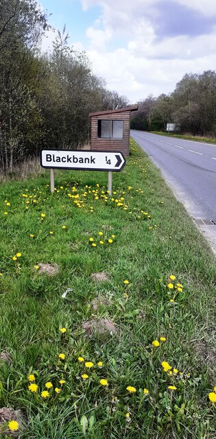
Blackbank is located at Grid Ref: NY3467 (Lat: 54.99763, Lng: -3.0201962)

Administrative County: Cumbria

District: Carlisle

Police Authority: Cumbria

What 3 Words

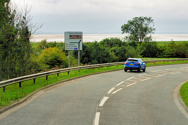
///glorified.meanwhile.birdcage. Near Gretna, Dumfries & Galloway

Nearby Locations

Mill Hill Wood Blackbank

Related Wikis

2020s in United Kingdom political history

2020s political history refers to significant political and societal historical events in the United Kingdom in the 2020s, presented as a historical overview...

United Kingdom

The United Kingdom of Great Britain and Northern Ireland, commonly known as the United Kingdom (UK) or Britain, is a country in Northwestern Europe, off...

Gretna railway station (Border Union Railway)

Gretna railway station was a railway station close to Gretna Green in Scotland although the station was on the English side of the border. However the...

Gretna railway station (Caledonian Railway)

Gretna railway station was a railway station close to Gretna Green in Scotland. The Caledonian Railway, however, built the station just south of Gretna...

Battle of Solway Moss

The Battle of Solway Moss took place on Solway Moss near the River Esk on the English side of the Anglo-Scottish border in November 1542 between English...

Solway Moss

Solway Moss, also known as Solway Flow, is a moss (lowland peat bog), in the City of Carlisle in Cumbria, England near the Scottish border and less than...

River Esk, Dumfries and Galloway

The River Esk (Scottish Gaelic: Easg), also known as the Border Esk, is a river in Dumfries and Galloway, Scotland, that enters the English county of Cumbria...

River Lyne

The River Lyne is a river of Cumbria in England. The river is formed near the hamlet of Stapleton, five miles west of Bewcastle, by the confluence of the...

Related Videos

Scotland AND chasing waterfalls in the Lake District in ONE day

On my final day glamping solo (with the doggos) we made a quick stop over in Scotland to visit the famous wedding site, Gretna ...

Nearby Amenities

Located within 500m of 54.99763,-3.0201962
Bus Stop
Blackbank West
Naptan AtcoCode: 090033014196
Naptan Bearing: W
Naptan CommonName: Blackbank West
Naptan Indicator: Near
Naptan Landmark: Springfield turn off
Naptan NaptanCode: cumdptwd
Naptan Street: A6071
Naptan Verified: no
Source: naptan_import
Lat/Long: 55.0002053/-3.0210869
Blackbank East
Naptan AtcoCode: 090033014197
Naptan Bearing: E
Naptan BusStopType: CUS
Naptan CommonName: Blackbank East
Naptan Indicator: near
Naptan Landmark: Springfield turnoff
Naptan NaptanCode: cumdptwg
Naptan Street: A6071
Naptan Verified: no
Source: naptan_import
Lat/Long: 55.0002363/-3.0216818
Railway: switch
Lat/Long: 54.9940224/-3.016586
Railway: level_crossing
Lat/Long: 54.9941813/-3.0209684
Railway: level_crossing
Lat/Long: 54.9970634/-3.0164042
Railway: switch
Lat/Long: 54.9936775/-3.0173853
Railway: level_crossing
Supervised: no
Lat/Long: 54.9944699/-3.0155396
The data included in this document is from www.openstreetmap.org. The data is made available under ODbL.

Have you been to Blackbank?

Leave your review of Blackbank below (or comments, questions and feedback).