Sarn Gynfelyn

Coastal Marsh, Saltings in Cardiganshire

Wales

Sarn Gynfelyn

Ordnance Survey Rivet This OS rivet can be found on the boulder west side of the road. It marks a point 71.610m above mean sea level.
Ordnance Survey Rivet Credit: Adrian Dust

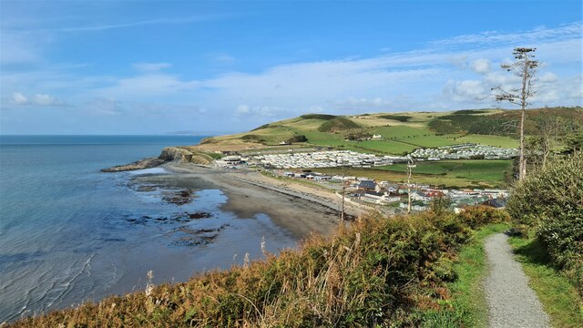
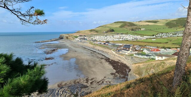
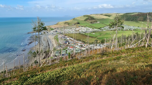
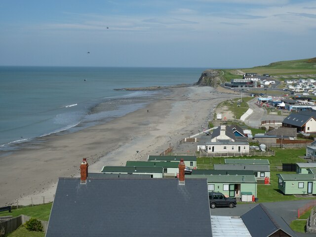
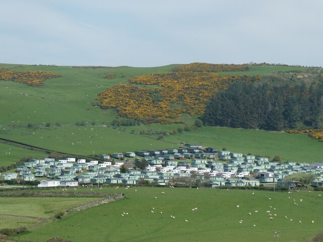
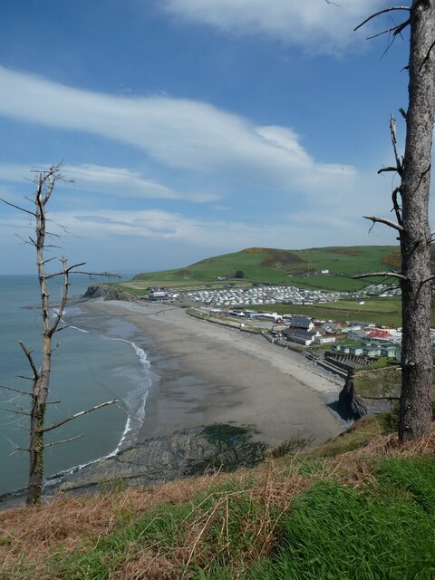
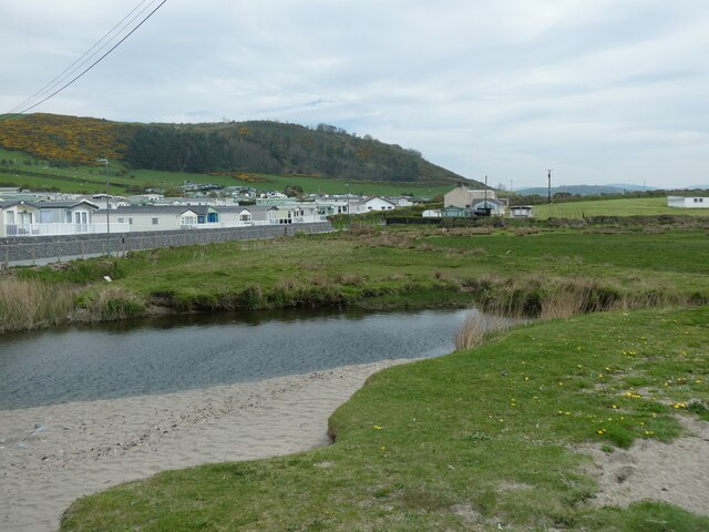
Sarn Gynfelyn is a coastal marsh and saltings area located in Cardiganshire, Wales. It is situated near the village of Borth and stretches out into the Cardigan Bay. The area is characterized by its unique and diverse ecosystem, which includes a variety of salt marsh plants, birds, and marine life.

The salt marsh at Sarn Gynfelyn is an important habitat for many species of birds, including wading birds such as curlews, redshanks, and oystercatchers. The area is also home to a number of rare plants and insects that thrive in the salty, marshy environment.

Sarn Gynfelyn is a popular destination for birdwatchers and nature enthusiasts, who come to observe the rich biodiversity of the area. The marsh and saltings are also important for their role in protecting the coastline from erosion and providing a buffer against storm surges.

Overall, Sarn Gynfelyn is a valuable and ecologically significant area that plays an important role in supporting wildlife and protecting the coastal environment in Cardiganshire.

If you have any feedback on the listing, please let us know in the comments section below.

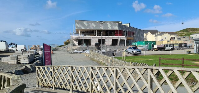
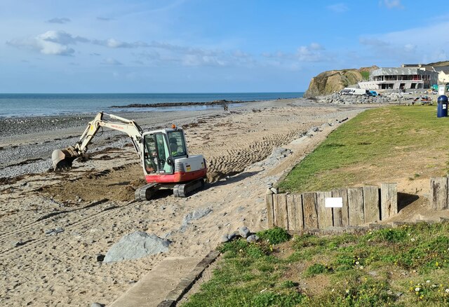
Sarn Gynfelyn Images

Images are sourced within 2km of 52.451339/-4.0788843 or Grid Reference SN5885. Thanks to Geograph Open Source API. All images are credited.

Ordnance Survey Rivet This OS rivet can be found on the boulder west side of the road. It marks a point 71.610m above mean sea level.
Ordnance Survey Rivet
This OS rivet can be found on the boulder west side of the road. It marks a point 71.610m above mean sea level.
Clarach Bay
Clarach Bay
Clarach Bay
Clarach Bay
Road from the Bay to Clarach
Work in progress at Clarach Bay When finished this building may resemble the bow of a yacht.
Work in progress at Clarach Bay
When finished this building may resemble the bow of a yacht.
Clarach Bay The woodland has seen better days
Clarach Bay
The woodland has seen better days
Playing on the beach?
Ordnance Survey Cut Mark This OS cut mark can be found on the gatepost east side of the road. It marks a point 66.017m above mean sea level.
Ordnance Survey Cut Mark
This OS cut mark can be found on the gatepost east side of the road. It marks a point 66.017m above mean sea level.
Ordnance Survey Cut Mark This OS cut mark can be found on the gatepost east side of the road. It marks a point 65.392m above mean sea level.
Ordnance Survey Cut Mark
This OS cut mark can be found on the gatepost east side of the road. It marks a point 65.392m above mean sea level.
Holiday complex at Glan-y-mor
Glan-y-mor caravan park
Ice cream cafe, Clarach Bay The cafe offers "over 18 flavours of scooped ice cream"; does that mean 19?
Ice cream cafe, Clarach Bay
The cafe offers "over 18 flavours of scooped ice cream"; does that mean 19?
Clarach Bay
Clarach Bay
Caravan park at Glangors
Beach and caravan parks, Clarach Bay
Snack bar, Clarach Bay, by the caravan parks
Afon Clarach at Clarach Bay
Footbridge over Afon Clarach at Clarach Bay
Show me another place!

Sarn Gynfelyn is located at Grid Ref: SN5885 (Lat: 52.451339, Lng: -4.0788843)

Unitary Authority: Ceredigion

Police Authority: Dyfed Powys

What 3 Words

///began.revisit.forge. Near Bow Street, Ceredigion

Nearby Locations

Sarn Gynfelyn

Related Wikis

Sarn Gynfelyn

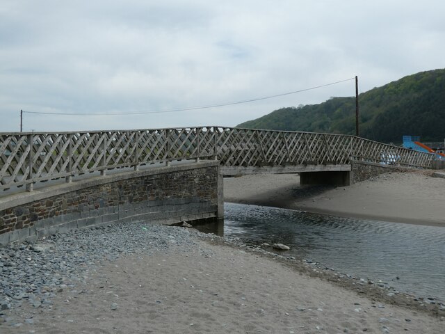
Sarn Gynfelyn (or Sarn Cynfelyn) is a shingle spit on the coast of Cardigan Bay, in the county of Ceredigion, Mid-Wales, in the United Kingdom. It is located...

Llangorwen

Llangorwen is a village located in the county of Ceredigion, Mid-Wales. Close to Clarach Bay and a mile north of Aberystwyth. The Church of All Saints...

Wallog

Wallog is a beach on the coast of Cardigan Bay north of Aberystwyth between Clarach Bay and Borth in the county of Ceredigion, Mid-Wales. A shingle spit...

Rhyd-Meirionnydd

Rhyd Meirionnydd (wrongly spelt: Rhyd-meirionydd) is a small village in the community of Genau'r-glyn, Ceredigion, Wales, which is 77.3 miles (124.3 km...

Nearby Amenities

Located within 500m of 52.451339,-4.0788843
Source: PGS
Lat/Long: 52.4547063/-4.0747583
Source: PGS
Lat/Long: 52.4541432/-4.0748707
Source: PGS
Lat/Long: 52.4535479/-4.0751024
Source: PGS
Lat/Long: 52.4531639/-4.0753162
Source: PGS
Lat/Long: 52.451971/-4.0758577
Source: PGS
Lat/Long: 52.4517783/-4.0759865
Source: PGS
Lat/Long: 52.4514381/-4.0769398
Source: PGS
Lat/Long: 52.4507257/-4.0774499
Source: PGS
Lat/Long: 52.4492419/-4.0779101
Source: PGS
Lat/Long: 52.4484043/-4.078405
Source: PGS
Lat/Long: 52.4479206/-4.0786881
Barrier: kissing_gate
Lat/Long: 52.451969/-4.0754095
Crossing
Lat/Long: 52.4511411/-4.074297
Sarn Gynfelyn
Natural: peninsula
Lat/Long: 52.4512476/-4.0784983
The data included in this document is from www.openstreetmap.org. The data is made available under ODbL.

Have you been to Sarn Gynfelyn?

Leave your review of Sarn Gynfelyn below (or comments, questions and feedback).