Aird Fhinn

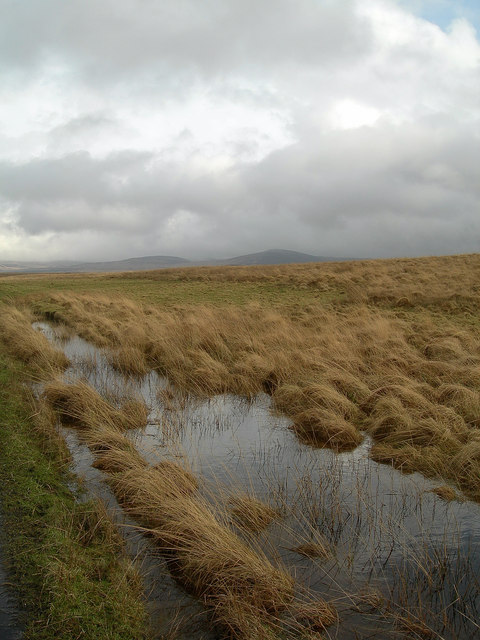
Coastal Marsh, Saltings in Argyllshire

Scotland

Aird Fhinn

End of the public road at Cnuic na Croise Glad the dogs are left at home
End of the public road at Cnuic na Croise Credit: thejackrustles

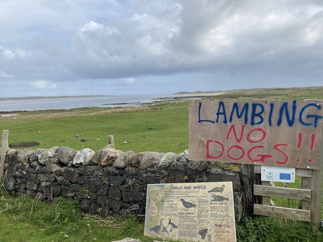
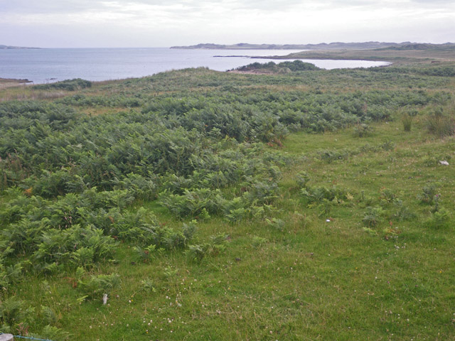
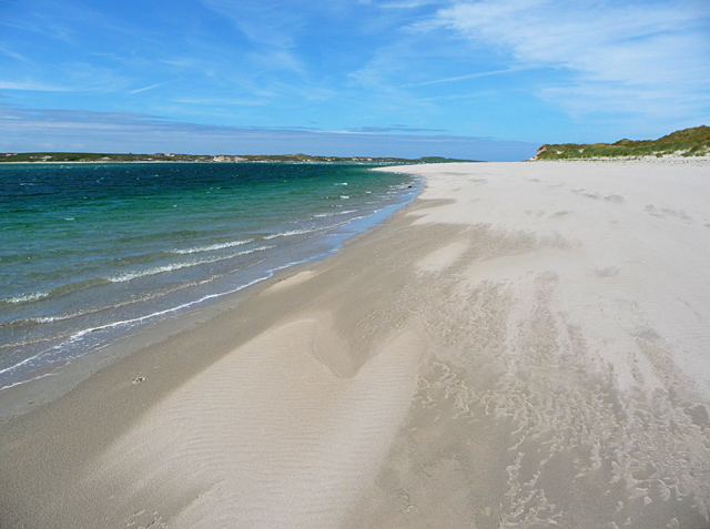
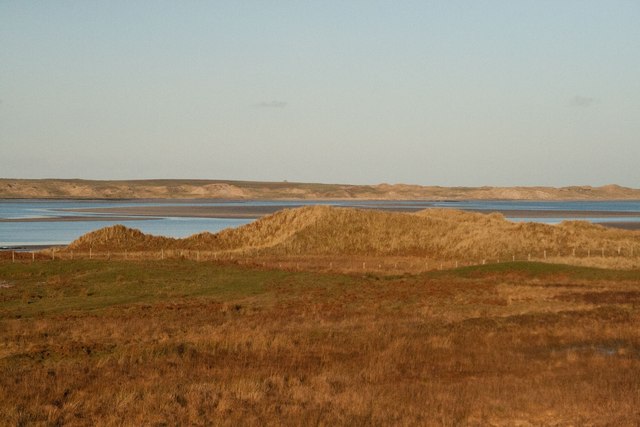
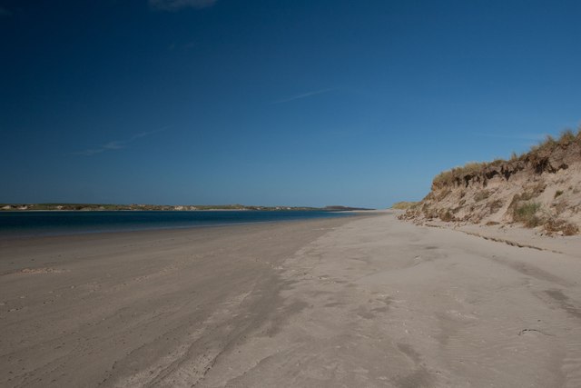
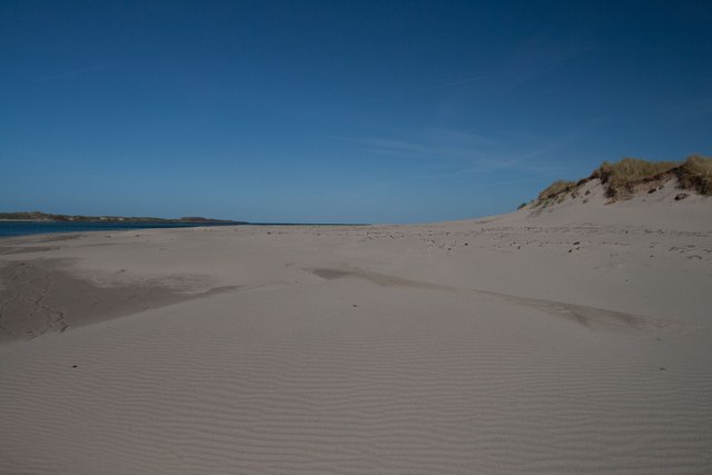
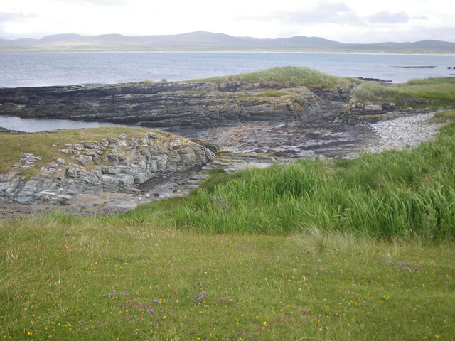
Aird Fhinn is a coastal marsh located in Argyllshire, Scotland. It is nestled along the western coast of the county, offering a picturesque landscape of marshes and saltings. The area is known for its rich biodiversity and stunning natural beauty.

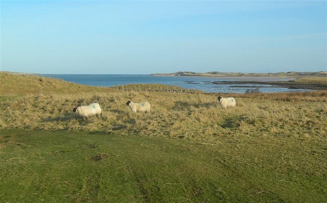
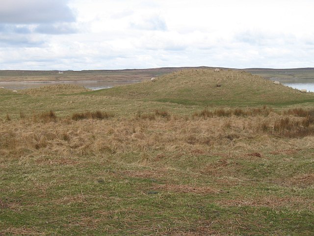
Covering a considerable expanse, Aird Fhinn is characterized by its wetland ecosystem. It is home to a variety of plant and animal species, making it an important habitat for wildlife conservation. The marshes provide a haven for numerous bird species, including waders, waterfowl, and seabirds. Visitors can often spot herons, curlews, oystercatchers, and sandpipers, among others.

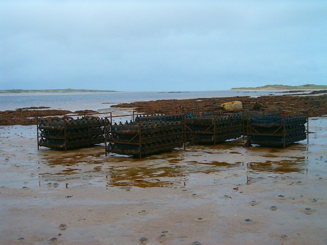
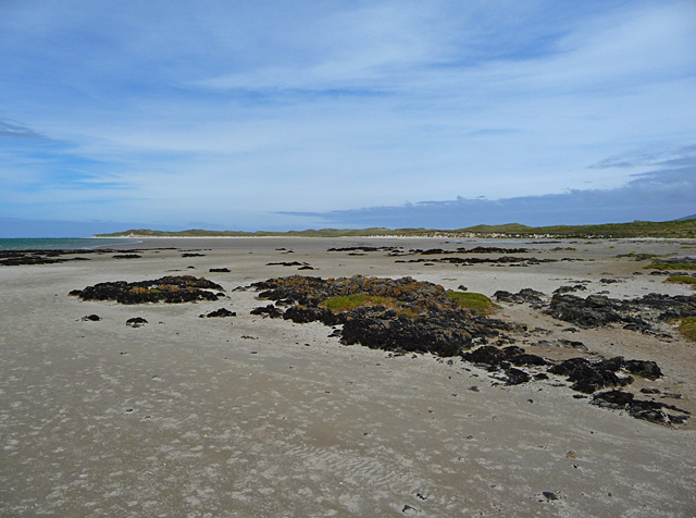
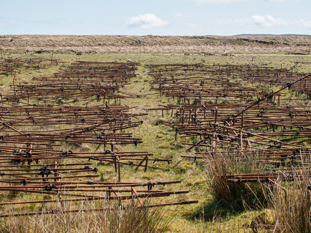
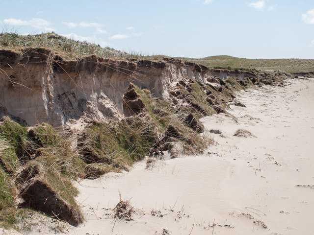
The saltings, which are areas of coastal salt marshes, add to the unique charm of Aird Fhinn. These tidal flats are formed by the deposition of saltwater and are an important part of the local ecosystem. They support a diverse range of plants and provide nesting grounds for birds.

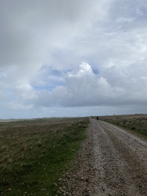
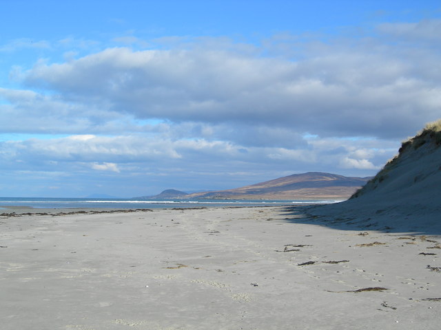
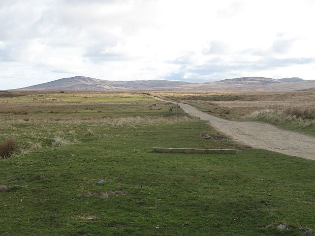
In addition to its ecological significance, Aird Fhinn offers visitors a tranquil and scenic experience. The marshes and saltings provide stunning views of the surrounding coastline, with its jagged cliffs and rugged terrain. The area is a popular spot for nature enthusiasts, birdwatchers, and photographers.

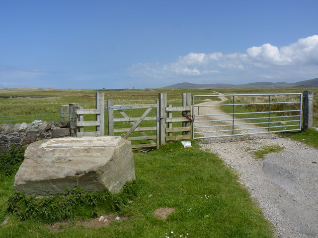
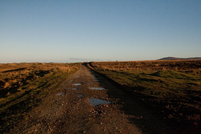
Access to Aird Fhinn is easy, with well-maintained footpaths and trails allowing visitors to explore the area. Interpretive signs are placed along the paths, providing information about the local flora and fauna. The marshes can be visited year-round, with each season offering a different experience, from the vibrant blooms of wildflowers in spring to the striking colors of autumn.

Overall, Aird Fhinn is a must-visit destination for those seeking to immerse themselves in the natural beauty and biodiversity of Argyllshire's coastal marshes and saltings.

If you have any feedback on the listing, please let us know in the comments section below.

Aird Fhinn Images

Images are sourced within 2km of 55.862366/-6.335779 or Grid Reference NR2871. Thanks to Geograph Open Source API. All images are credited.

End of the public road at Cnuic na Croise Glad the dogs are left at home
End of the public road at Cnuic na Croise
Glad the dogs are left at home
Track near Killinallan
Oyster farming on Loch Gruinart Pacific oysters growing in baskets on a remote Islay beach.
Oyster farming on Loch Gruinart
Pacific oysters growing in baskets on a remote Islay beach.
Killinallan Point The end of the dune system and the beach, viewed at low tide.
Killinallan Point
The end of the dune system and the beach, viewed at low tide.
Wet Walking Conditions The side of the track to Killinallan after much wet weather.
Wet Walking Conditions
The side of the track to Killinallan after much wet weather.
Grazing Land Sheep on coastal grazing land by Loch Gruinart.  Killinallan Point is visible in the far distance.
Grazing Land
Sheep on coastal grazing land by Loch Gruinart. Killinallan Point is visible in the far distance.
Road to Killinallan View along the road from the public road end. A good starting point for trips into the wild lands of north Islay.
Road to Killinallan
View along the road from the public road end. A good starting point for trips into the wild lands of north Islay.
Cnuic na Croise Sand dunes beside Loch Gruinart
Cnuic na Croise
Sand dunes beside Loch Gruinart
Bracken covered shoreline on the east of Loch Gruinart
End of the Killinallan Road, Islay The gate is padlocked, but there is pedestrian access to Gortantoid about two miles further north-east. There used to be an information board on the big boulder, but it was removed when I arrived to take the photo.
End of the Killinallan Road, Islay
The gate is padlocked, but there is pedestrian access to Gortantoid about two miles further north-east. There used to be an information board on the big boulder, but it was removed when I arrived to take the photo.
Killinallan Point The western side of the mouth of Loch Gruinart.
Killinallan Point
The western side of the mouth of Loch Gruinart.
The beach at Killinallan Seemingly endless reaches of sand on the east of Loch Gruinart.
The beach at Killinallan
Seemingly endless reaches of sand on the east of Loch Gruinart.
Rusting frames This is just part of a large collection of metal frames on the shore. They hold large hooks and show signs of standing in the sea. Presumably they were once used for <a href="https://www.geograph.org.uk/photo/254647">NR3071 : Oyster farming on Loch Gruinart</a>.
Rusting frames
This is just part of a large collection of metal frames on the shore. They hold large hooks and show signs of standing in the sea. Presumably they were once used for NR3071 : Oyster farming on Loch Gruinart.
Erosion on progress The high tide has undermined the dune, causing the turf to fall on to the beach. The thin layer of topsoil is clearly visible. Note that the photographer's position (by GPS) is about 50m inland of the coastline shown on the OS map.
Erosion on progress
The high tide has undermined the dune, causing the turf to fall on to the beach. The thin layer of topsoil is clearly visible. Note that the photographer's position (by GPS) is about 50m inland of the coastline shown on the OS map.
Cnoc Gormadail, Islay Dunes by the east shores of Loch Gruinart.
Cnoc Gormadail, Islay
Dunes by the east shores of Loch Gruinart.
Track to Killinallan, Islay
Walking towards Killinallan Point, Islay This beach stretches in total for about 3 miles from the 'car park' at the Killinallan locked gate to the Gortantoid River. It is an easy and beautiful walk covering several gridsquares.
Walking towards Killinallan Point, Islay
This beach stretches in total for about 3 miles from the 'car park' at the Killinallan locked gate to the Gortantoid River. It is an easy and beautiful walk covering several gridsquares.
Corran Bàn, Killinallan Point, Islay It can be hard work walking through this dry sand! For 3 miles!
Corran Bàn, Killinallan Point, Islay
It can be hard work walking through this dry sand! For 3 miles!
Show me another place!

Aird Fhinn is located at Grid Ref: NR2871 (Lat: 55.862366, Lng: -6.335779)

Unitary Authority: Argyll and Bute

Police Authority: Argyll and West Dunbartonshire

What 3 Words

///ambitions.umbrella.lanes. Near Bridgend, Argyll & Bute

Related Wikis

Loch Gruinart

Loch Gruinart (Scottish Gaelic: Loch Gruinneard from the Old Norse, meaning "shallow fjord") is a sea loch on the northern coast of isle of Islay in Scotland...

Ardnave Point

Ardnave Point (Scottish Gaelic, Àird an Naoimh) is a coastal promontory on the northwest of Islay, a Scottish island. This landform has a rocky northern...

Nave Island

Nave Island lies to the north of Islay in the Inner Hebrides near the mouth of Loch Gruinart. It is uninhabited. == Geography == The island is all but...

Battle of Traigh Ghruinneart

The Battle of Traigh Ghruinneart or in Scottish Gaelic Blàr Tràigh Ghruineart or sometimes called the Battle of Gruinart Strand was a Scottish clan battle...

Nearby Amenities

Located within 500m of 55.862366,-6.335779
Source: PGS
Lat/Long: 55.8585313/-6.3376464
Source: PGS
Lat/Long: 55.8601646/-6.3379187
Source: PGS
Lat/Long: 55.8618282/-6.3374614
Kilnave
Name Gd: Cill Naiomh
Place: isolated_dwelling
Source: local_knowledge
Lat/Long: 55.8597074/-6.3416033
Kilnave Cross
Historic: wayside_cross
Wikidata: Q1741411
Lat/Long: 55.8601517/-6.3402808
Port na Feannaige
Description: Translates into English as "Port of the royston"
Name Gd: Port na Feannaige
Natural: bay
Lat/Long: 55.8662161/-6.3374022
Tobar Nèill Neònaich
Description: Translates into English as "Eccentic Neill's Well"
Name Gd: Tobar Nèill Neònaich
Natural: spring
Lat/Long: 55.8652696/-6.3385659
Àird Fhìnn
Description: Translates into English as "Fingal's head"
Name Gd: Àird Fhìnn
Natural: bare_rock
Lat/Long: 55.8624166/-6.3369181
Power: pole
Lat/Long: 55.8626991/-6.3424999
Power: pole
Lat/Long: 55.8611599/-6.3429856
Power: pole
Lat/Long: 55.8619713/-6.3427296
Power: pole
Lat/Long: 55.8633702/-6.342288
Power: pole
Lat/Long: 55.8640009/-6.3420889
Power: pole
Lat/Long: 55.8648504/-6.3418208
The data included in this document is from www.openstreetmap.org. The data is made available under ODbL.

Have you been to Aird Fhinn?

Leave your review of Aird Fhinn below (or comments, questions and feedback).