Ness Point

Coastal Feature, Headland, Point in Yorkshire Scarborough

England

Ness Point

Thorpe Lane, Robin Hood's Bay The bus route through the village.
Thorpe Lane, Robin Hood's Bay Credit: Gerald England

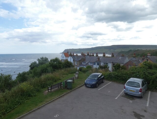
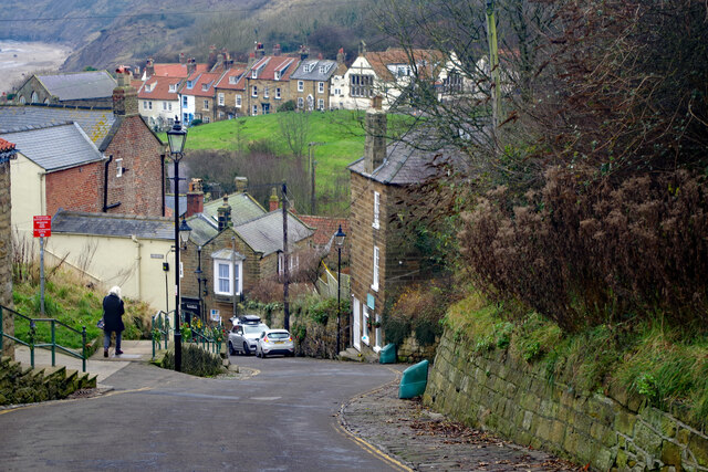
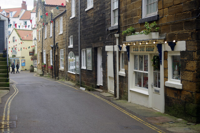
Ness Point, located in the county of Yorkshire, England, is a prominent coastal feature known for its picturesque headland and point. Situated on the eastern coast of the country, it marks the most easterly point in the entirety of England and is often referred to as the "Land's End of the East."

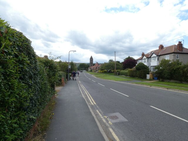
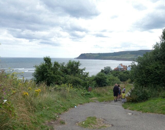
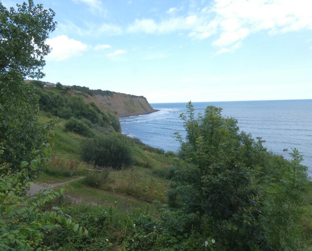
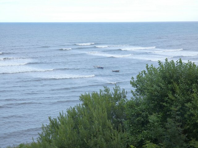
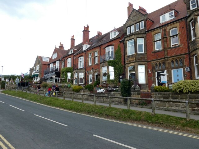
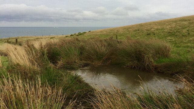
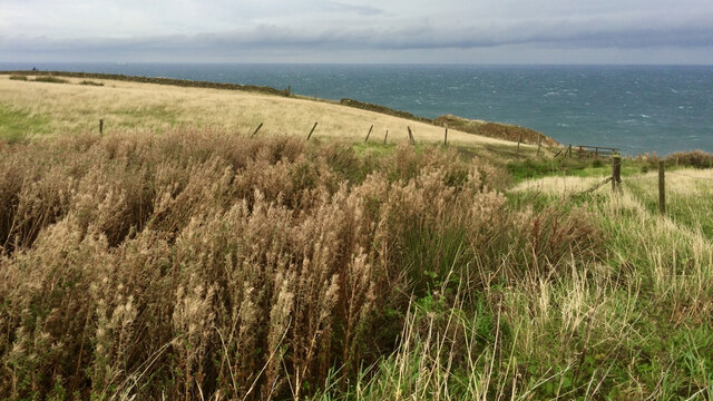
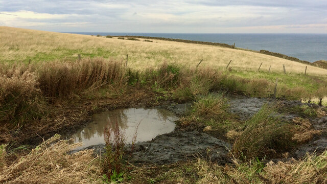
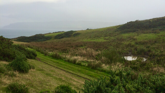
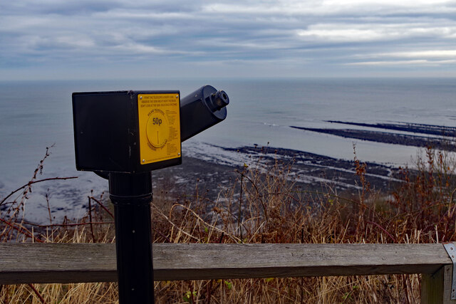
The headland at Ness Point offers breathtaking views of the North Sea, making it a popular destination for tourists and locals alike. Its dramatic cliffs and rugged coastline create a striking contrast against the vast expanse of the ocean. Visitors can enjoy panoramic vistas of the surrounding area, taking in the beauty of the coastal landscape.

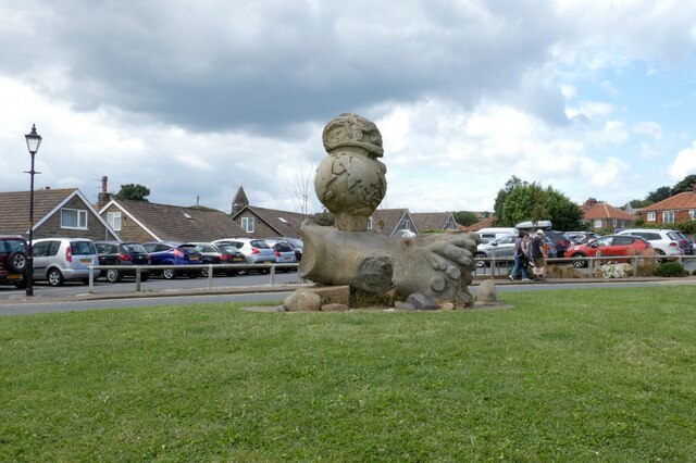
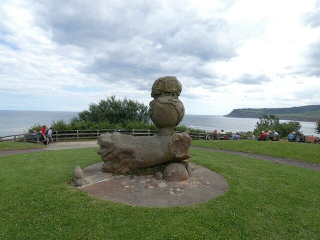
The point itself is easily identifiable by the presence of a large concrete sculpture known as the "Ness Point Compass." Designed by renowned artist Fiona Heron, this unique installation serves as a navigational landmark and symbolizes the significance of the location as the easternmost point of England. The compass is engraved with directional markers indicating distances to various global destinations, highlighting the connection between Ness Point and the wider world.

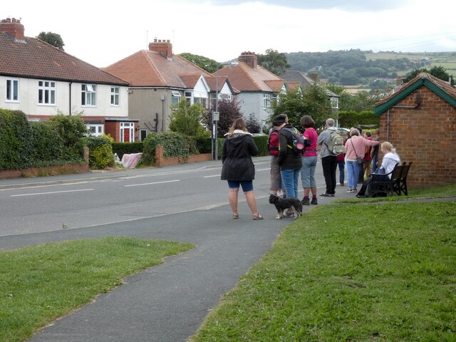
In addition to its natural beauty and artistic features, Ness Point offers various recreational activities for visitors to enjoy. The headland is a popular spot for birdwatching, with a wide range of seabirds and migratory species frequenting the area. The nearby Ness Point Country Park provides opportunities for leisurely walks and picnics, allowing visitors to immerse themselves in the tranquil surroundings.

Overall, Ness Point is a captivating coastal feature that combines stunning natural scenery, artistic installations, and recreational opportunities. Its status as the easternmost point of England adds to its allure, making it a must-visit destination for those exploring the Yorkshire coastline.

If you have any feedback on the listing, please let us know in the comments section below.

Ness Point Images

Images are sourced within 2km of 54.441606/-0.52096977 or Grid Reference NZ9606. Thanks to Geograph Open Source API. All images are credited.

Thorpe Lane, Robin Hood's Bay The bus route through the village.
Thorpe Lane, Robin Hood's Bay
The bus route through the village.
Victoria Hotel Built in 1897, some twelve years after the opening of the railway.
Victoria Hotel
Built in 1897, some twelve years after the opening of the railway.
Path at Robin Hood's Bay 
A cliffside path leads down from Upper Bay to Lower Bay.
Path at Robin Hood's Bay
A cliffside path leads down from Upper Bay to Lower Bay.
Millennium Sculpture, Robin Hood's Bay This stone sculpture consists of a fallen trunk on which a globe is mounted. Atop the globe is a 'structure' with the year MM and some reliefs - an owl, a boat, portrait of Robin Hood and E.T. It is the work of David Duncalfe (b.1953), a local farm worker who began making sculptures for his own pleasure. The sculpture was never given a formal name but was intended to be a celebration of the Millennium and was funded by the local council. The original idea was to have a globe in the centre of a large table; but despite searching far-and-wide, David couldn't find a large disc of stone. This delay contributed to the fact that the sculpture was not completed until 2004. The finished work is made of two large pieces of stone that David brought down from the North Yorkshire Moors. The base is modelled on a fallen tree that David had seen locally. The concept is themed around the "Tree of Knowledge" and the detailing around the globe reflects the things that were happening around the Millennium. These   range  from  DNA (Watson & Crick's 'Double Helix') to ET (Stephen Spielberg) and include Robin Hood. Information from Statues Hither & Thither: <span class="nowrap"><a title="https://statues.vanderkrogt.net/object.php?webpage=ST&record=gbyh207" rel="nofollow ugc noopener" href="https://statues.vanderkrogt.net/object.php?webpage=ST&record=gbyh207">Link</a><img style="margin-left:2px;" alt="External link" title="External link - shift click to open in new window" src="https://s1.geograph.org.uk/img/external.png" width="10" height="10"/></span>
Millennium Sculpture, Robin Hood's Bay
This stone sculpture consists of a fallen trunk on which a globe is mounted. Atop the globe is a 'structure' with the year MM and some reliefs - an owl, a boat, portrait of Robin Hood and E.T. It is the work of David Duncalfe (b.1953), a local farm worker who began making sculptures for his own pleasure. The sculpture was never given a formal name but was intended to be a celebration of the Millennium and was funded by the local council. The original idea was to have a globe in the centre of a large table; but despite searching far-and-wide, David couldn't find a large disc of stone. This delay contributed to the fact that the sculpture was not completed until 2004. The finished work is made of two large pieces of stone that David brought down from the North Yorkshire Moors. The base is modelled on a fallen tree that David had seen locally. The concept is themed around the "Tree of Knowledge" and the detailing around the globe reflects the things that were happening around the Millennium. These range from DNA (Watson & Crick's 'Double Helix') to ET (Stephen Spielberg) and include Robin Hood. Information from Statues Hither & Thither: LinkExternal link
Toilets at Robin Hood's Bay 
The toilets have been much improved since 2008 <a href="https://www.geograph.org.uk/photo/818318">NZ9505 : Robin Hood's Bay - public toilets</a>. However it does now cost 40p to "spend a penny". The doors carry a warning that they may lock if you try to hold them open for the next person. There is a defibrillator of the wall outside. Behind the block is a children's play area.
Toilets at Robin Hood's Bay
The toilets have been much improved since 2008 NZ9505 : Robin Hood's Bay - public toilets. However it does now cost 40p to "spend a penny". The doors carry a warning that they may lock if you try to hold them open for the next person. There is a defibrillator of the wall outside. Behind the block is a children's play area.
Robin Hood's Bay View from the terrace of the Fish Box.
Robin Hood's Bay
View from the terrace of the Fish Box.
Robin Hood's Bay Boats offshore.
Robin Hood's Bay
Boats offshore.
Robin Hood's Bay From the terrace at the Fish Box.
Robin Hood's Bay
From the terrace at the Fish Box.
Station Road 
The B1447 into Robin Hood's Bay. Several of these grand Victorian terraced houses have been converted into B&B accommodation.
Station Road
The B1447 into Robin Hood's Bay. Several of these grand Victorian terraced houses have been converted into B&B accommodation.
Bus stop on Thorpe Road 
Robin Hood's Bay is served by the Arriva X93/94 route from Scarborough to Middlesbrough via Whitby and Guisborough. Buses are roughly every half hourly during summer weekdays. On this occasion the bus was running some ten minutes late. Most of the delay seemed to be due to the fact that many of the passengers were not regular ones with a pass or prebrought day ticket but visitors who needed to buy their ticket when boarding the bus. With the driver often having to explain what types of ticket were available it took several minutes to board an already full bus.
Bus stop on Thorpe Road
Robin Hood's Bay is served by the Arriva X93/94 route from Scarborough to Middlesbrough via Whitby and Guisborough. Buses are roughly every half hourly during summer weekdays. On this occasion the bus was running some ten minutes late. Most of the delay seemed to be due to the fact that many of the passengers were not regular ones with a pass or prebrought day ticket but visitors who needed to buy their ticket when boarding the bus. With the driver often having to explain what types of ticket were available it took several minutes to board an already full bus.
Wildlife Pond — Bay Ness National Trust property
Pond near Craze Naze - before cleaning
Pond near Craze Naze - after cleaning
Pond, Bay Ness National Trust property
Telescope at Robin Hood's Bay 50p buys a look through the telescope strategically located at the top of the hill down to the harbour.
Telescope at Robin Hood's Bay
50p buys a look through the telescope strategically located at the top of the hill down to the harbour.
New Road, Robin Hood's Bay The road down to the sea is both steep and narrow; visitors must park at the top and walk down. This is the view from near the top.
New Road, Robin Hood's Bay
The road down to the sea is both steep and narrow; visitors must park at the top and walk down. This is the view from near the top.
New Road, Robin Hood's Bay Two days before Christmas and Robin's Hood Bay is relatively deserted with few of the businesses open. Those that are here, however, can move around relatively easily.
New Road, Robin Hood's Bay
Two days before Christmas and Robin's Hood Bay is relatively deserted with few of the businesses open. Those that are here, however, can move around relatively easily.
Show me another place!

Ness Point is located at Grid Ref: NZ9606 (Lat: 54.441606, Lng: -0.52096977)

Division: North Riding

Administrative County: North Yorkshire

District: Scarborough

Police Authority: North Yorkshire

Also known as: North Cheek

What 3 Words

///radiating.destined.horizons. Near Whitby, North Yorkshire

Related Wikis

Robin Hood's Bay

Robin Hood's Bay is a village in North Yorkshire, England. It is 6 miles (10 km) south of Whitby and 15 miles (24 km) north of Scarborough on the Yorkshire...

Robin Hood's Bay railway station

Robin Hood's Bay railway station was a railway station on the Scarborough & Whitby Railway situated 15 miles (24 km) from Scarborough and 6 miles (9.7...

The Old Chapel, Robin Hood's Bay

The former Wesleyan Chapel on Chapel Street, Robin Hood's Bay, North Yorkshire, England, was built in 1779. John Wesley is recorded as preaching there...

Robin Hood's Bay Marine Laboratory

The Robin Hood's Bay Marine Laboratory was a marine scientific research and education unit in North Yorkshire, England, from 1912 to 1982. Purchased in...

Old St Stephen's Church, Fylingdales

Old St Stephen's Church is a redundant Anglican church standing on a hillside in Fylingdales, overlooking Robin Hood's Bay, North Yorkshire, England....

Fylingthorpe

Fylingthorpe is a village in the civil parish of Fylingdales in North Yorkshire, England. == Geography == Fylingthorpe is located about 1.1 mi (1.8 km...

Ramsdale Beck

Ramsdale Beck is a small river that feeds directly into the North Sea between Robin Hood's Bay and Ravenscar on the North Yorkshire coast in England. The...

Raw, North Yorkshire

Raw is a hamlet in the Borough of Scarborough of North Yorkshire, England, near to the villages of Fylingthorpe, Robin Hood's Bay, and Hawsker. The hamlet...

Nearby Amenities

Located within 500m of 54.441606,-0.52096977
Source: PGS
Lat/Long: 54.4384506/-0.5262982
Source: PGS
Lat/Long: 54.438559/-0.5261205
Source: PGS
Lat/Long: 54.4387303/-0.5258335
Source: PGS
Lat/Long: 54.4390323/-0.5252399
Source: PGS
Lat/Long: 54.4392202/-0.5247912
Source: PGS
Lat/Long: 54.4392793/-0.5247349
Source: PGS
Lat/Long: 54.4394626/-0.5245133
Source: PGS
Lat/Long: 54.4395972/-0.5242631
Source: PGS
Lat/Long: 54.4397015/-0.5240244
Source: PGS
Lat/Long: 54.4398062/-0.523814
Source: PGS
Lat/Long: 54.4402336/-0.523189
Source: PGS
Lat/Long: 54.4404941/-0.523192
Source: PGS
Lat/Long: 54.4404613/-0.5229744
Source: PGS
Lat/Long: 54.441126/-0.522099
Source: PGS
Lat/Long: 54.441629/-0.52163
Source: PGS
Lat/Long: 54.441752/-0.521402
Source: PGS
Lat/Long: 54.441876/-0.521175
Source: PGS
Lat/Long: 54.442132/-0.52116
Source: PGS
Lat/Long: 54.442899/-0.521113
Source: PGS
Lat/Long: 54.4435103/-0.5209328
Source: PGS
Lat/Long: 54.4438351/-0.5209508
Source: PGS
Lat/Long: 54.444055/-0.521262
Source: PGS
Lat/Long: 54.4442215/-0.5212622
Source: PGS
Lat/Long: 54.444444/-0.52146
Source: PGS
Lat/Long: 54.444567/-0.521232
Source: PGS
Lat/Long: 54.444691/-0.521005
Source: PGS
Lat/Long: 54.445202/-0.520974
Source: PGS
Lat/Long: 54.4454432/-0.5211876
Source: PGS
Lat/Long: 54.445714/-0.5212478
Source: PGS
Lat/Long: 54.4459995/-0.5211566
Bulmer Steel
Place: locality
Lat/Long: 54.4448875/-0.5212668
Ness Point
Place: locality
Lat/Long: 54.4420217/-0.5214432
Information: route_marker
Tourism: information
Lat/Long: 54.4390849/-0.5268408
Bench
Lat/Long: 54.4416754/-0.5227132
Barrier: kissing_gate
Lat/Long: 54.4416411/-0.522758
Barrier: kissing_gate
Lat/Long: 54.4437006/-0.5219414
Information: route_marker
Tourism: information
Lat/Long: 54.4437089/-0.5219099
Bench
Lat/Long: 54.4408004/-0.5268814
Bench
Lat/Long: 54.4405508/-0.5271093
Bench
Lat/Long: 54.4399953/-0.5276822
Bay Ness
Information: board
Operator: National Trust
Tourism: information
Lat/Long: 54.4398675/-0.5277558
Barrier: kissing_gate
Source: survey;gps
Lat/Long: 54.4437256/-0.5219375
Barrier: stile
Material: wood
Source: survey;gps
Stile: stepover
Lat/Long: 54.4403662/-0.5245734
Barrier: stile
Material: wood
Source: survey;gps
Stile: stepover
Lat/Long: 54.4410871/-0.5233348
Bay Ness
Description: National Trust
Tourism: information
Lat/Long: 54.4392817/-0.5263808
The data included in this document is from www.openstreetmap.org. The data is made available under ODbL.

Have you been to Ness Point?

Leave your review of Ness Point below (or comments, questions and feedback).