Swarta Taing

Coastal Feature, Headland, Point in Shetland

Scotland

Swarta Taing

Aesha Head One of the many fine stretches of coast on Papa Stours, Aesha Head is the furthest west point of the main island, though there are various smaller islands and skerries beyond.
Aesha Head Credit: Anne Burgess

Swartha Taing is a prominent coastal feature located in the Shetland Islands, which are part of Scotland, United Kingdom. This rugged headland is situated in the northeastern part of the main island of Shetland, known as Mainland.

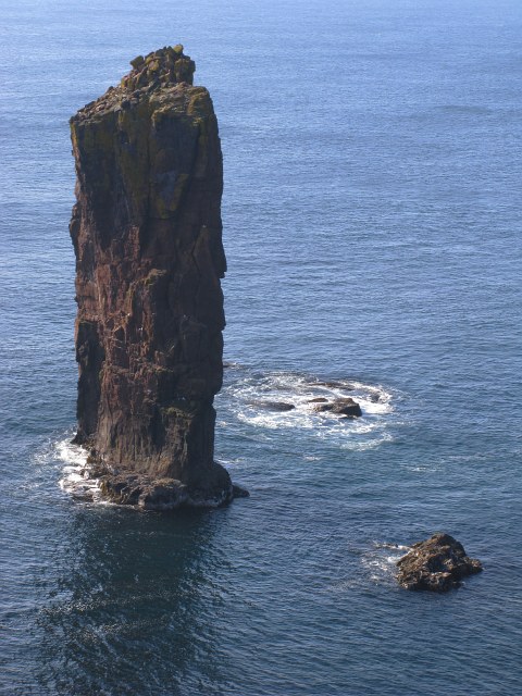
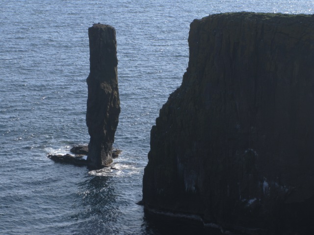
Swartha Taing juts out into the North Sea, offering stunning panoramic views of the surrounding coastline and the vast ocean beyond. The name "Swartha Taing" is derived from Old Norse and translates to "dark promontory," which accurately describes the dark and imposing appearance of this headland.

The geography of Swartha Taing is characterized by steep cliffs that rise sharply from the sea, reaching heights of up to 200 feet (60 meters). These cliffs are composed of layers of sedimentary rock, showcasing the geological history of the area. The headland is also known for its rocky shoreline, with large boulders and rock formations scattered along the water's edge.

The area surrounding Swartha Taing is rich in wildlife, attracting birdwatchers and nature enthusiasts. The cliffs provide nesting sites for various seabirds, including puffins, guillemots, and razorbills. Visitors may also spot seals basking on the rocks or swimming in the nearby waters.

Access to Swartha Taing is limited to footpaths and hiking trails, ensuring the preservation of the natural environment. It is a popular destination for hikers and photographers, offering breathtaking vistas and an opportunity to connect with the rugged beauty of the Shetland Islands.

If you have any feedback on the listing, please let us know in the comments section below.
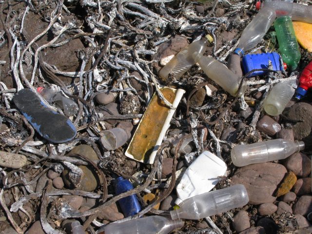
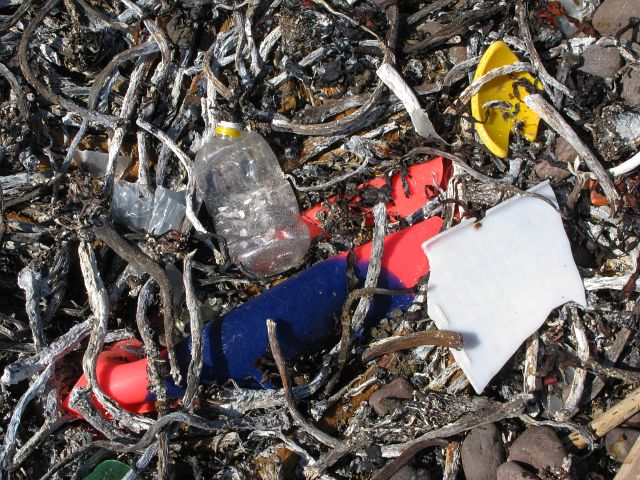
Swarta Taing Images

Images are sourced within 2km of 60.342405/-1.7097438 or Grid Reference HU1662. Thanks to Geograph Open Source API. All images are credited.

Aesha Head One of the many fine stretches of coast on Papa Stours, Aesha Head is the furthest west point of the main island, though there are various smaller islands and skerries beyond.
Aesha Head
One of the many fine stretches of coast on Papa Stours, Aesha Head is the furthest west point of the main island, though there are various smaller islands and skerries beyond.
Natural Arch, Aesha Head This is a closer view of the fine arch in Aesha Head, with a glimpse of Lyra Skerry beyond.
Natural Arch, Aesha Head
This is a closer view of the fine arch in Aesha Head, with a glimpse of Lyra Skerry beyond.
Kirstan's Hole Actually, it isn't the Kirstan's Hole (or Christie's Hole) shown on the maps, but a second hole which opened suddenly a few years ago, where previously there had been a depression in the ground, into the same sea-cave system as the original Kirstan's Hole.
Kirstan's Hole
Actually, it isn't the Kirstan's Hole (or Christie's Hole) shown on the maps, but a second hole which opened suddenly a few years ago, where previously there had been a depression in the ground, into the same sea-cave system as the original Kirstan's Hole.
Storm Beach These boulders, thrown up by the waves to form a storm beach 30 metres above the sea, demonstrate the power of the seas which pound the exposed north side of Papa Stour
Storm Beach
These boulders, thrown up by the waves to form a storm beach 30 metres above the sea, demonstrate the power of the seas which pound the exposed north side of Papa Stour
Ruined Meal Mills Several traditional mills straddle this little burn. Inside the building was a fixed lower millstone, and a rotating upper millstone driven by the water falling on to the paddles below, which were mounted at 45º to the vertical drive shaft.
Ruined Meal Mills
Several traditional mills straddle this little burn. Inside the building was a fixed lower millstone, and a rotating upper millstone driven by the water falling on to the paddles below, which were mounted at 45º to the vertical drive shaft.
The Loch that Ebbs and Flows The interior of Papa Stour is mainly moorland, though there are several lochans in the central part. This one's curious name reflects its closeness to the sea, from which it is cut off only by an ayre or shingle spit.
The Loch that Ebbs and Flows
The interior of Papa Stour is mainly moorland, though there are several lochans in the central part. This one's curious name reflects its closeness to the sea, from which it is cut off only by an ayre or shingle spit.
Lang Geo One of the many inlets typical of the north coast of Papa Stour.
Lang Geo
One of the many inlets typical of the north coast of Papa Stour.
The Wall This is the wall which cuts across the whole island. The west side (left) has a steep face to prevent animals climbing over it. The east (right) side has a sloping face so that any animals which have managed to cross it can easily be driven back on to the pasture land.
The Wall
This is the wall which cuts across the whole island. The west side (left) has a steep face to prevent animals climbing over it. The east (right) side has a sloping face so that any animals which have managed to cross it can easily be driven back on to the pasture land.
Robie's Noust This is a very dull shot of a square which would certainly have yielded a more interesting image if we had had time to explore it before the ferry left.
Robie's Noust
This is a very dull shot of a square which would certainly have yielded a more interesting image if we had had time to explore it before the ferry left.
Remains of Observation Post The concrete and iron are the only remains of a World War Two observation post that used to stand here.  As can be seen from the image, in good visibility this location provides an excellent view of the surrounding area.
Remains of Observation Post
The concrete and iron are the only remains of a World War Two observation post that used to stand here. As can be seen from the image, in good visibility this location provides an excellent view of the surrounding area.
Oystercatcher nest with eggs This nest was located in the pebbles at the high-point of the beach.  The eggs are camouflaged to be hard to see amongst the pebbles - although thankfully these were just noticeable enough to escape being trodden on.

The oystercatchers seem to be surviving relatively well on the island, whilst the previously abundant tern population has been largely destroyed by the skuas.
Oystercatcher nest with eggs
This nest was located in the pebbles at the high-point of the beach. The eggs are camouflaged to be hard to see amongst the pebbles - although thankfully these were just noticeable enough to escape being trodden on. The oystercatchers seem to be surviving relatively well on the island, whilst the previously abundant tern population has been largely destroyed by the skuas.
Natural Arch by Sholma Wick The map marks this as a Natural Arch - one of many arches, subterranean passages or caves to be found on the island.
Natural Arch by Sholma Wick
The map marks this as a Natural Arch - one of many arches, subterranean passages or caves to be found on the island.
Plastic beach The beach had a depressingly large amount of plastic waste which had been washed up onto it.  This largely comprised plastic bottles , footwear, floats/buoys etc.

Most identifyable items originated in the UK, but a large subset were from Spain, Norway and Iceland.  This latter set probably represents the boats fishing in these waters and the manufacturers supplying those boats.
Plastic beach
The beach had a depressingly large amount of plastic waste which had been washed up onto it. This largely comprised plastic bottles , footwear, floats/buoys etc. Most identifyable items originated in the UK, but a large subset were from Spain, Norway and Iceland. This latter set probably represents the boats fishing in these waters and the manufacturers supplying those boats.
Plastic Beach A further selection of the plastic contamination in this area.
Plastic Beach
A further selection of the plastic contamination in this area.
Snolda Sea Stack
Snolda Sea Stack
Lyra Stack Lyra Stack lies just to the south of Lyra Skerry which is the land in the right half of this image.
Lyra Stack
Lyra Stack lies just to the south of Lyra Skerry which is the land in the right half of this image.
Ruined meal mill The image shows the rear of one of the two mills at this location.  The image was taken from channel, now waterless, which fed water into the mill.
Ruined meal mill
The image shows the rear of one of the two mills at this location. The image was taken from channel, now waterless, which fed water into the mill.
Ruined mill The image shows a view of the front of the mill shown in <a href="https://www.geograph.org.uk/photo/799075">HU1660 : Ruined meal mill</a>.
Ruined mill
The image shows a view of the front of the mill shown in HU1660 : Ruined meal mill.
Show me another place!

Swarta Taing is located at Grid Ref: HU1662 (Lat: 60.342405, Lng: -1.7097438)

Unitary Authority: Shetland Islands

Police Authority: Highlands and Islands

What 3 Words

///riddle.arena.transcribes. Near Walls, Shetland Islands

Related Wikis

Papa Stour

Papa Stour (Scots: Papa Stour) is one of the Shetland Islands in Scotland, with a population of under fifteen people, some of whom immigrated after an...

Biggings

Biggings is a village on the island of Papa Stour, in Shetland, Scotland. Papa Stour's church is situated at the south of Biggings. A homestead of Duke...

Papa Stour Airstrip

Papa Stour Airstrip is a small airstrip in the village of Biggings on the island of Papa Stour. Shetland, Scotland. == History == Papa Stour Airstrip opened...

Maiden Stack

The Maiden Stack or Frau Stack is a tiny stack in the western Shetland Islands to the north of Brei Holm and east of Housa Voe in Papa Stour. It is so...

Have you been to Swarta Taing?

Leave your review of Swarta Taing below (or comments, questions and feedback).