Broad Hive

Coastal Feature, Headland, Point in Aberdeenshire

Scotland

Broad Hive

Cairnbulg Harbour Looking back into the harbour from the end of the harbour arm. 

Built in the 1920s, the harbour is privately owned, by Cairnbulg Boat Haven Ltd. There are plans to deepen and further improve the harbour, which has recently installed pontoons for leisure craft.
Cairnbulg Harbour Credit: Bob Jones

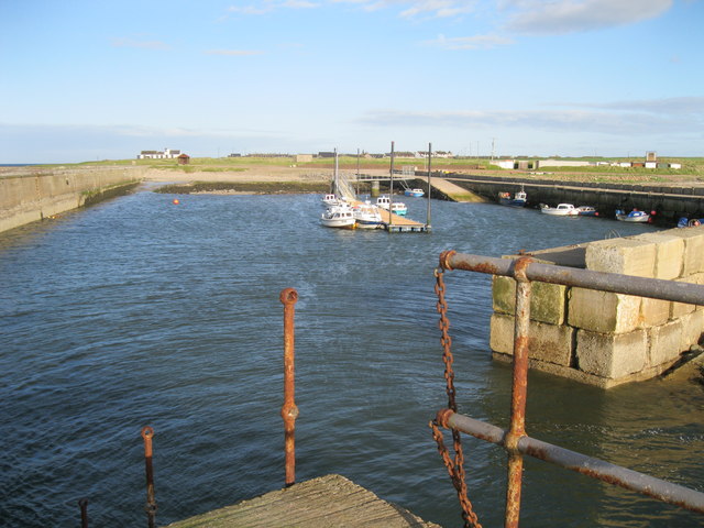
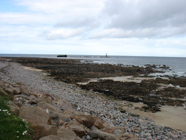
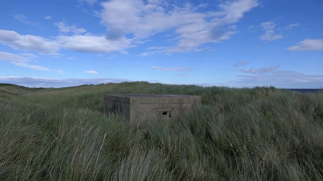
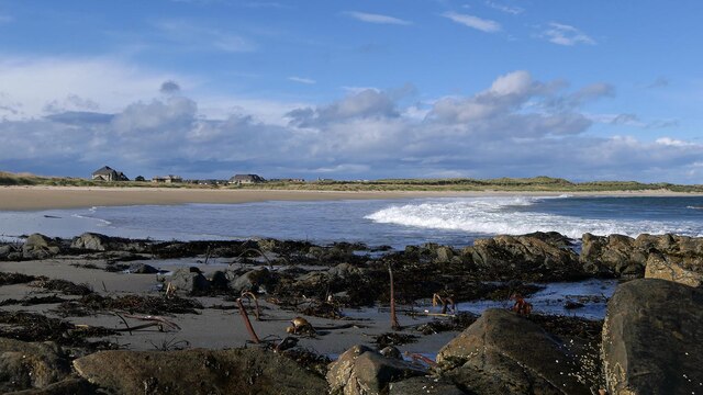
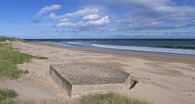
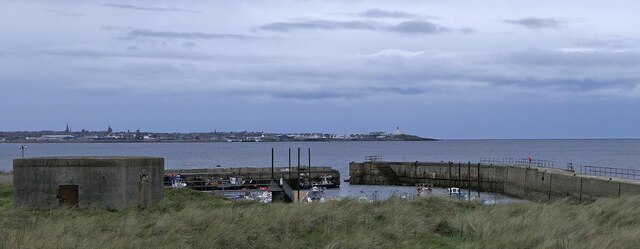
Broad Hive is a prominent coastal feature located in Aberdeenshire, Scotland. Situated on the eastern coast of the country, it is specifically categorized as a headland or point due to its geographical characteristics and position. The headland extends outward into the North Sea, forming a distinctive shape that juts out into the water.

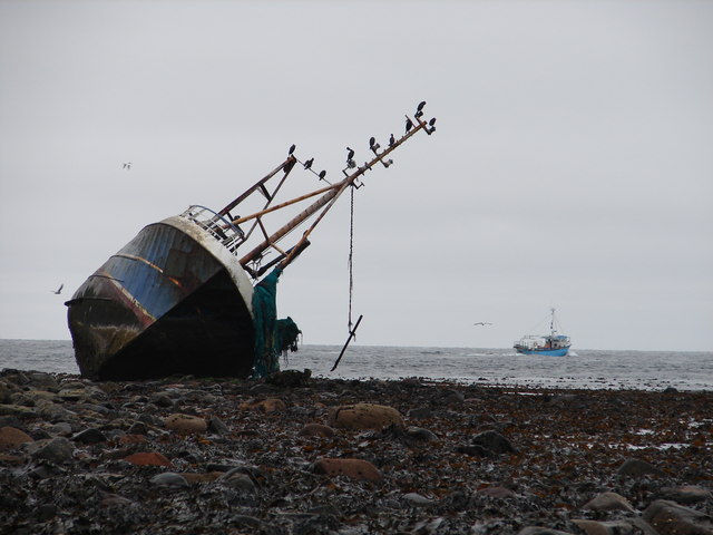
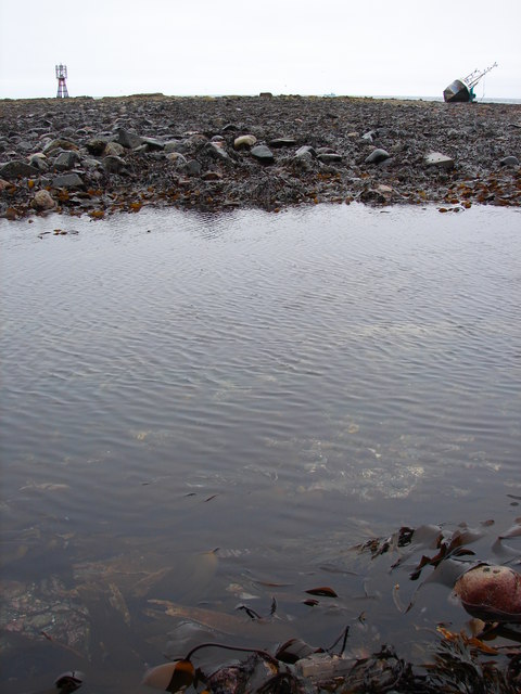
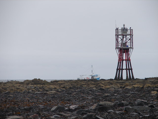
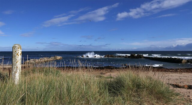
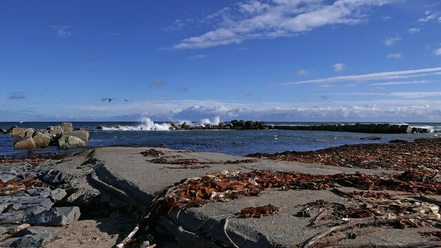
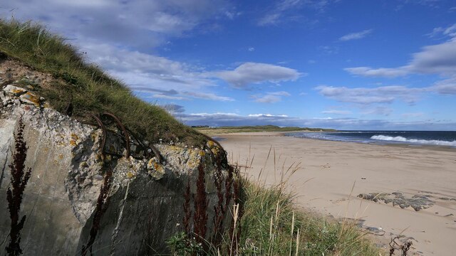
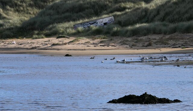
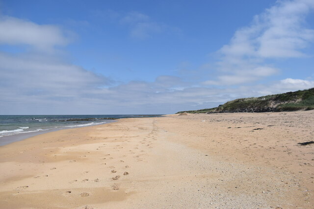
At Broad Hive, visitors are treated to breathtaking views of the surrounding coastline and the vast expanse of the North Sea. The headland is composed of rugged cliffs, which are eroded by the constant force of the crashing waves. The cliffs showcase various layers of sedimentary rock, offering a glimpse into the area's geological history.

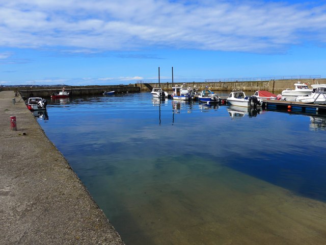
This coastal feature also boasts diverse flora and fauna, making it an important ecosystem for both land and marine life. Seabirds, such as gulls and cormorants, can be observed nesting and foraging along the cliffs. The surrounding waters are home to a variety of fish, seals, and occasionally dolphins, providing ample opportunities for wildlife enthusiasts and photographers.

Broad Hive is a popular destination for outdoor activities, including hiking and birdwatching. There are well-maintained trails that allow visitors to explore the headland and take in its natural beauty. The area also offers picnic spots, allowing visitors to enjoy a scenic meal while admiring the panoramic views.

Overall, Broad Hive in Aberdeenshire is a captivating coastal feature that showcases the rugged beauty of Scotland's eastern coastline. With its stunning cliffs, diverse wildlife, and recreational opportunities, it is a must-visit destination for nature lovers and outdoor enthusiasts alike.

If you have any feedback on the listing, please let us know in the comments section below.
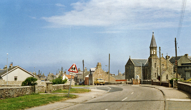
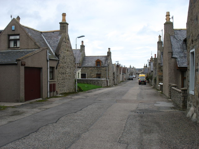
Broad Hive Images

Images are sourced within 2km of 57.675444/-1.9212369 or Grid Reference NK0465. Thanks to Geograph Open Source API. All images are credited.

Cairnbulg Harbour Looking back into the harbour from the end of the harbour arm. 

Built in the 1920s, the harbour is privately owned, by Cairnbulg Boat Haven Ltd. There are plans to deepen and further improve the harbour, which has recently installed pontoons for leisure craft.
Cairnbulg Harbour
Looking back into the harbour from the end of the harbour arm. Built in the 1920s, the harbour is privately owned, by Cairnbulg Boat Haven Ltd. There are plans to deepen and further improve the harbour, which has recently installed pontoons for leisure craft.
Sovereign on the rocks Forlorn and lonesome, the wreck of the Sovereign lies high and dry at low tide atop Cairnbulg Briggs as shiny FR6 Remembrance <span class="nowrap"><a title="http://www.trawlerphotos.co.uk/gallery/showphoto.php?photo=131052&title=remembrance-fr6&cat=685" rel="nofollow ugc noopener" href="http://www.trawlerphotos.co.uk/gallery/showphoto.php?photo=131052&title=remembrance-fr6&cat=685">Link</a><img style="margin-left:2px;" alt="External link" title="External link - shift click to open in new window" src="https://s1.geograph.org.uk/img/external.png" width="10" height="10"/></span> sails past at a safe distance.  
See <span class="nowrap"><a title="http://www.trawlerphotos.co.uk/gallery/showphoto.php?photo=72822&title=27r-sovereign-bf380&cat=1029" rel="nofollow ugc noopener" href="http://www.trawlerphotos.co.uk/gallery/showphoto.php?photo=72822&title=27r-sovereign-bf380&cat=1029">Link</a><img style="margin-left:2px;" alt="External link" title="External link - shift click to open in new window" src="https://s1.geograph.org.uk/img/external.png" width="10" height="10"/></span> for more information on Sovereigh in better days.
Sovereign on the rocks
Forlorn and lonesome, the wreck of the Sovereign lies high and dry at low tide atop Cairnbulg Briggs as shiny FR6 Remembrance LinkExternal link sails past at a safe distance. See LinkExternal link for more information on Sovereigh in better days.
Roll on spring tide After what seemed like a sure geograph for the adjacent square to the north, the route was blocked by just a few feet of water - "and me withoot ma wellies!"*.  
Low tide was 1.1 m above chart datum at this point, so next time there's a low spring tide, the slippery walk across the bladder wrack might prove more fruitful for someone.

The wrecked Sovereigh <a href="https://www.geograph.org.uk/photo/2635691">NK0365 : Sovereign on the rocks</a> lies to the right of the photograph.

(* Thanks to the Big Yin <span class="nowrap"><a title="http://en.wikipedia.org/wiki/Billy_Connolly" rel="nofollow ugc noopener" href="http://en.wikipedia.org/wiki/Billy_Connolly">Link</a><img style="margin-left:2px;" alt="External link" title="External link - shift click to open in new window" src="https://s1.geograph.org.uk/img/external.png" width="10" height="10"/></span> .)
Roll on spring tide
After what seemed like a sure geograph for the adjacent square to the north, the route was blocked by just a few feet of water - "and me withoot ma wellies!"*. Low tide was 1.1 m above chart datum at this point, so next time there's a low spring tide, the slippery walk across the bladder wrack might prove more fruitful for someone. The wrecked Sovereigh NK0365 : Sovereign on the rocks lies to the right of the photograph. (* Thanks to the Big Yin LinkExternal link .)
Beacon on Cairnbulg Briggs These rocks have seen wrecks old <span class="nowrap"><a title="http://canmore.rcahms.gov.uk/en/search/?keyword=cairnbulg+point" rel="nofollow ugc noopener" href="http://canmore.rcahms.gov.uk/en/search/?keyword=cairnbulg+point">Link</a><img style="margin-left:2px;" alt="External link" title="External link - shift click to open in new window" src="https://s1.geograph.org.uk/img/external.png" width="10" height="10"/></span> and new <a href="https://www.geograph.org.uk/photo/2635691">NK0365 : Sovereign on the rocks</a>.  Modern vessel Remembrance sails past at a safe distance after leaving Fraserburgh earlier.

The beacon flashes white once every ten seconds if it's dark.
Beacon on Cairnbulg Briggs
These rocks have seen wrecks old LinkExternal link and new NK0365 : Sovereign on the rocks. Modern vessel Remembrance sails past at a safe distance after leaving Fraserburgh earlier. The beacon flashes white once every ten seconds if it's dark.
Cairnbulg: site of station, 1988 View NE on B9107 to Inverallochy where the ex-GNS Fraserburgh (left) - St Combs (right) light railway crossed. The station and line were closed from 3/5/65.
Cairnbulg: site of station, 1988
View NE on B9107 to Inverallochy where the ex-GNS Fraserburgh (left) - St Combs (right) light railway crossed. The station and line were closed from 3/5/65.
Inverallochy village
The shoreline at Cairnbulg Point
Cairnbulg Harbour Deepened and with extra pontoons added in 2012/13.
Cairnbulg Harbour
Deepened and with extra pontoons added in 2012/13.
Pillbox, Charlestown, Aberdeenshire The pillbox is a Scottish variant of the Type 24 design and is one of three which overlooked Whitelinks Bay.
Pillbox, Charlestown, Aberdeenshire
The pillbox is a Scottish variant of the Type 24 design and is one of three which overlooked Whitelinks Bay.
Harbour, Kittyloch Shore, Aberdeenshire The harbour has been built using WWII anti-tank blocks gathered from nearby beaches and so is not particularly old.
Harbour, Kittyloch Shore, Aberdeenshire
The harbour has been built using WWII anti-tank blocks gathered from nearby beaches and so is not particularly old.
Pillbox, Whitelinks Bay, Aberdeenshire The pillbox is one of three which overlooked Whitelinks Bay.
Pillbox, Whitelinks Bay, Aberdeenshire
The pillbox is one of three which overlooked Whitelinks Bay.
Whitelinks Bay, Aberdeenshire On the horizon can be seen large houses which have been built behind Inverallochy Golf Course.  The one on the left is shown at <a href="https://www.geograph.org.uk/photo/6596480">NK0464 : Jeca House</a>.
Whitelinks Bay, Aberdeenshire
On the horizon can be seen large houses which have been built behind Inverallochy Golf Course. The one on the left is shown at NK0464 : Jeca House.
Buried pillbox, Whitelinks Bay, Aberdeenshire The pillbox is one of three which overlooked Whitelinks Bay.
Buried pillbox, Whitelinks Bay, Aberdeenshire
The pillbox is one of three which overlooked Whitelinks Bay.
Minor road near Hallmoss, Aberdeenshire Although the road is open to all traffic, it has not been adopted by the local authority and is privately maintained.

The figure advertises a protective coatings company which operates from buildings at the farm at Hallmoss.
Minor road near Hallmoss, Aberdeenshire
Although the road is open to all traffic, it has not been adopted by the local authority and is privately maintained. The figure advertises a protective coatings company which operates from buildings at the farm at Hallmoss.
Pillbox, Cairnbulg Harbour, Aberdeenshire Looking across Fraserburgh Bay towards Fraserburgh.

The pillbox is a Scottish variant of the Type 24 design.  A 1941 aerial photograph suggests that it was disguised as a fisherman's hut during the war.  After the war it was bought by a local fisherman and used to store creels.

The harbour breakwaters were extended in the 1980s using anti-tank blocks.
Pillbox, Cairnbulg Harbour, Aberdeenshire
Looking across Fraserburgh Bay towards Fraserburgh. The pillbox is a Scottish variant of the Type 24 design. A 1941 aerial photograph suggests that it was disguised as a fisherman's hut during the war. After the war it was bought by a local fisherman and used to store creels. The harbour breakwaters were extended in the 1980s using anti-tank blocks.
Pillbox by the Water of Philorth, Aberdeenshire Unfortunately the pillbox has slipped further and acquired a paint job since it was last Geographed: <a href="https://www.geograph.org.uk/photo/1610192">NK0264 : Pillbox by the Water of Philorth</a>.  This is one of three pillboxes which overlooked the eastern half of Fraserburgh Bay.  It is a CEScC 2893 which is a Scottish variant of the Type 24 design.
Pillbox by the Water of Philorth, Aberdeenshire
Unfortunately the pillbox has slipped further and acquired a paint job since it was last Geographed: NK0264 : Pillbox by the Water of Philorth. This is one of three pillboxes which overlooked the eastern half of Fraserburgh Bay. It is a CEScC 2893 which is a Scottish variant of the Type 24 design.
On the beach (St Combs) Like many sandy beaches north of Aberdeen, it is deserted.
On the beach (St Combs)
Like many sandy beaches north of Aberdeen, it is deserted.
Show me another place!

Broad Hive is located at Grid Ref: NK0465 (Lat: 57.675444, Lng: -1.9212369)

Unitary Authority: Aberdeenshire

Police Authority: North East

What 3 Words

///escorting.projects.develop. Near Fraserburgh, Aberdeenshire

Related Wikis

Inverallochy and Cairnbulg

The villages of Inverallochy (Scottish Gaelic: Inbhir Aileachaidh) and Cairnbulg (from the Gaelic càrn builg meaning 'gap cairn') lie some 4 miles (6.4...

Cairnbulg railway station

Cairnbulg railway station was a station on the Fraserburgh and St Combs Light Railway, Aberdeenshire. It was opened in 1903 as Inverallochy and was renamed...

RAF Fraserburgh

Royal Air Force Fraserburgh, or more simply RAF Fraserburgh, is a former Royal Air Force satellite station located in Aberdeenshire, Scotland, 3.2 miles...

St Combs railway station

St. Combs railway station was a station on the Fraserburgh and St Combs Light Railway, Aberdeenshire. It was opened on 1 July 1903 and stood 5 1⁄8 miles...

St Combs

St Combs is a small fishing village in Aberdeenshire, Scotland, immediately southeast of Inverallochy. It has existed since at least the 17th century,...

Inverallochy Castle

Inverallochy Castle is a ruined courtyard castle, near the village of Inverallochy in the Buchan area of North-East Scotland, dating to 1504. It lies 0...

Philorth Bridge Halt railway station

Philorth Bridge Halt railway station, not to be confused with Philorth railway station on the old Formartine and Buchan Railway, was a request stop on...
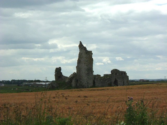
Cairnbulg Castle

Cairnbulg Castle is a z-plan castle situated in Cairnbulg, Aberdeenshire, Scotland. It was described by W. Douglas Simpson as one of the nine castles of...

Nearby Amenities

Located within 500m of 57.675444,-1.9212369
Source: Old Landsat image trace
Lat/Long: 57.6750748/-1.9231156
Source: Old Landsat image trace
Lat/Long: 57.6749595/-1.9241467
Source: Old Landsat image trace
Lat/Long: 57.6742694/-1.9191889
Source: Old Landsat image trace
Lat/Long: 57.6742545/-1.920913
Source: Old Landsat image trace
Lat/Long: 57.6758987/-1.9264426
Source: Old Landsat image trace
Lat/Long: 57.6759973/-1.9271937
Source: Old Landsat image trace
Lat/Long: 57.672379/-1.9186095
Source: Old Landsat image trace
Lat/Long: 57.6729997/-1.9188455
Source: Old Landsat image trace
Lat/Long: 57.6771034/-1.9287912
Source: Old Landsat image trace
Lat/Long: 57.6750163/-1.9236092
Source: Old Landsat image trace
Lat/Long: 57.6746503/-1.9222144
Source: Old Landsat image trace
Lat/Long: 57.6761321/-1.9266572
Source: Old Landsat image trace
Lat/Long: 57.6740433/-1.9189314
Source: Old Landsat image trace
Lat/Long: 57.6761058/-1.9254985
Source: Old Landsat image trace
Lat/Long: 57.6711833/-1.9191674
Source: Old Landsat image trace
Lat/Long: 57.6737662/-1.9197253
Source: Old Landsat image trace
Lat/Long: 57.6725017/-1.9182018
Inverallochy
Loc Name: Cotton
Name Gd: Inbhir Aileachaidh
Place: village
Population: 1290
Wikidata: Q6059983
Wikipedia: en:Inverallochy and Cairnbulg
Lat/Long: 57.6748247/-1.9293597
Point of Whitelinks
Natural: locality
Lat/Long: 57.6724525/-1.9156471
Power: pole
Lat/Long: 57.6719687/-1.9259181
The data included in this document is from www.openstreetmap.org. The data is made available under ODbL.

Have you been to Broad Hive?

Leave your review of Broad Hive below (or comments, questions and feedback).